
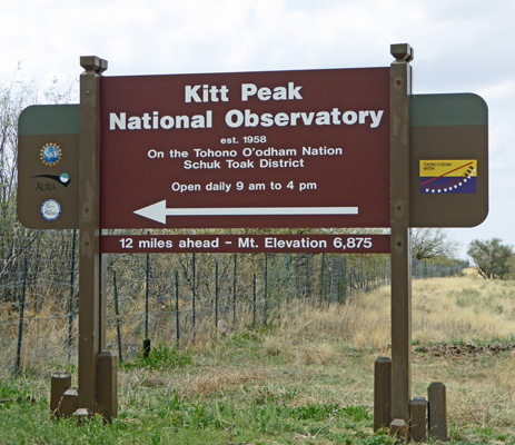
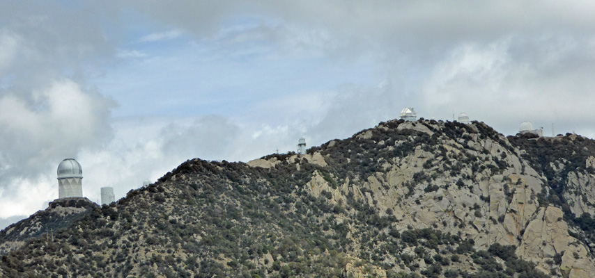
Then we drove the 12 miles out and UP to the observatory. You start at about 2,600 feet and end up at 6,875 feet so part of the road is pretty steep and winding. You go around the back side of the peak and as you wind up the back side you get a view of a few of the 25 optical observatories on the peak.
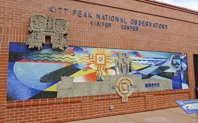
We parked and then took a walk over to the Visitors Center. There’s a nifty mural on the south facing wall.
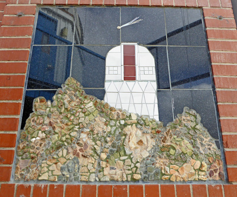
And another small mosaic of their most photogenic (and iconic) observatory next to the entry.
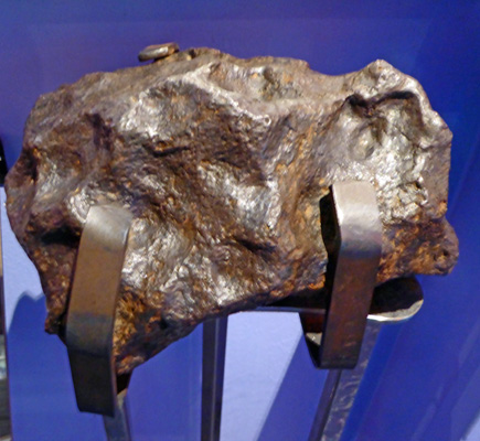
Inside there are displays on black holes and plasma and meteorites!
They give three different tours here of three of the observatories (a different tour at 9, 11 and 1:30)—or you can do the self guided tour. We opted for the self guided tour and hiked up the road to the 2.1 meter observatory.
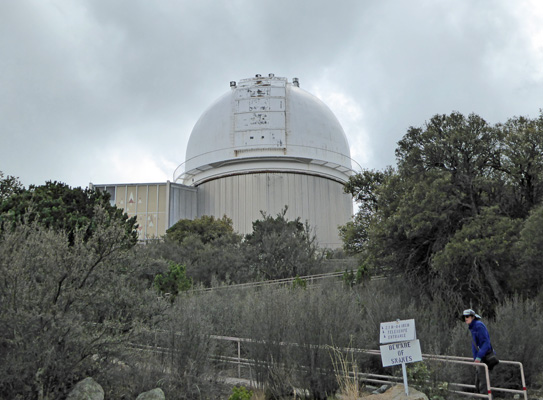
It was windy and I almost lost my hat at the top of this ramp. Construction on this observatory began in 1959 and the first light was offered to astronomers in 1964. It is now equipped with the only Robo-AO (robotically controlled adaptive optics) in the world. The Robo-AO removes the blurring caused by the atmosphere to produce more efficient observations than any other observatory in the world. They are working on looking at the exo-planets that the Kepler project identifies. So when they make reports on new planets in other solar systems some of those observations come from here!
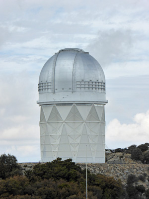
You get a great view of 4-meter Mayall Observatory (which you can see for miles from down in the valley).
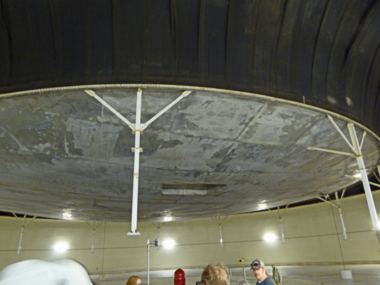
And the Solar Observatory which goes deep into the ground in addition to having this huge tower.
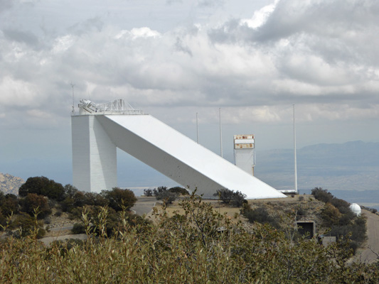
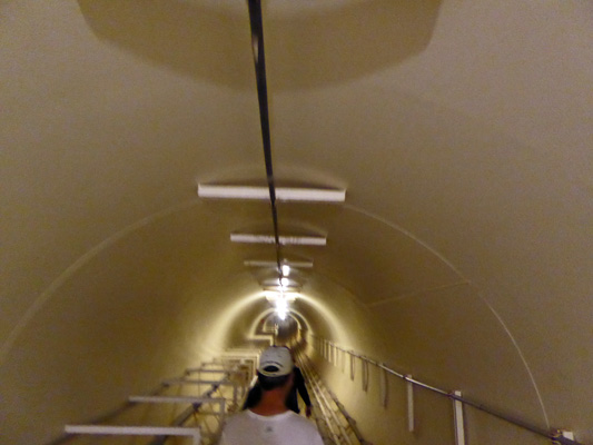
We walked on down to the viewing gallery at the Solar Telescope. It’s a really complex set of tunnels and mirrors and spectrographs that allows them to make observations of sun spots and solar flares and to study activity deep within the sun. This is the largest solar observatory in the world.
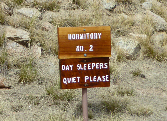
Kitt Peak was developed as the first National Observatory in the early 1950’s. It has grown to contain not only the National Observatory but it also now houses several large university observatories too. There are 25 optical observatories and 2 radio telescopes here. With so many astronomers wanting to use the instruments there are dorms here to house them. They have these great signs along the road to make sure you understand that these folks mostly work at night.
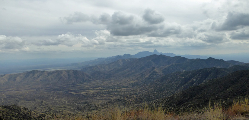
We had a great time even if we almost blew away a few times. It was only about 52 degrees up on the peak and after we’d explored for an hour or so in the wind we were ready to climb back in the truck and warm back up. We had lunch in a turnout with a hazy view northward across the valley. But the view to the south was fairly clear as we began the drive back down.
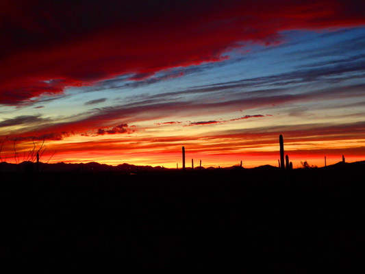
The clouds began to clear out a bit in the early evening and we had just the right conditions for yet another gorgeous Arizona sunset at Gilbert Ray. Orange to start.
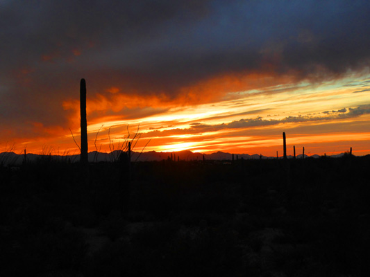
Then pink
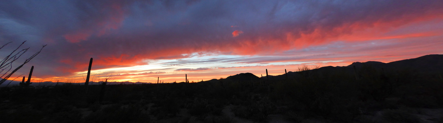
And then red
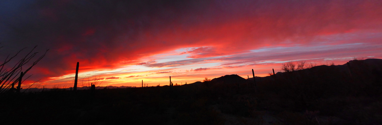
It went on and on and on and just kept getting prettier
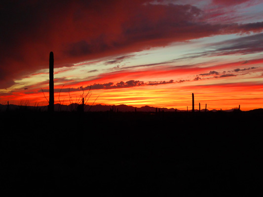
And prettier
Monday morning we got up early, packed up enough stuff for a 3 or 4 day hotel stay and took Genevieve into Oasis RV Center in Tucson so they could fix the damage from her being rear ended. They were waiting for us when we rolled in at about 9:15 so we unhitched and let them get to it.
We drove north back up toward Catalina State Park to the Best Western InnSuites in the Tucson Foothills. We’d managed to get a reservation there for a 2 room suite with a kitchen for only $99 a night. We knew we were early but we took the chance that they might let us check in. They had a room for us so we paid a $10 early fee and checked in. We got settled in and then decided we’d make the trip about 20 miles north to Biosphere 2 in Oracle, AZ.
Biosphere 2 (Biosphere 1 is planet earth) was built in the 1980’s and early 1990’s as a commercial venture to explore whether they could develop a fully self-contained sustainable environment as a model for colonies in space and on the moon. A group of 8 folks (4 men and 4 women) spent 2 years sealed up in the the structure, growing all their own food and tending the ecosystems that it contained and keeping all the equipment running. While it was not a complete success in terms of sustainability it was a HUGE success in terms of the scientific information that they obtained and the engineering that went into the development of the structure.
It is no longer a sealed terrarium but it is the worlds largest living research center dedicated to exploring the environment. We took the tour ($18 for seniors $20 for adults) and it was well worth it. It took over 1 1/2 hours not counting the walk down and back from the Visitors Center to Biosphere 2 itself.
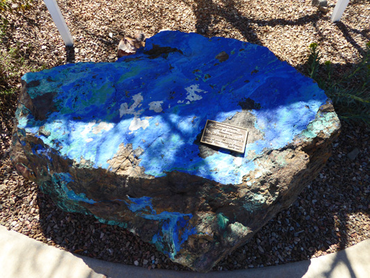
Along the path to the Visitors Center (and then within the grounds) there are large mineral specimens donated by Allen and Ruthie Preston. This is a 2,015 pound hunk of azurite and malachite.
There’s a nice little village of living quarters for students and conference attendees that we wandered through on our way down to the Biosphere. You get a great view of the whole complex from the edge of the living quarters area.
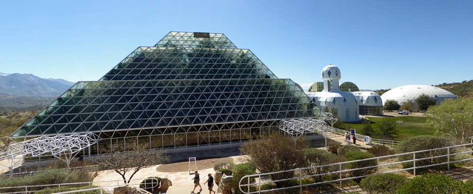
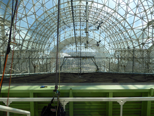
The big dome on the right is one of the two ‘lungs’ that they used to maintain the pressure in the closed system so that it wouldn’t collapse or explode as atmospheric pressure changed (and temperature changes inside the system caused the gasses to expand and contract). The fun little cluster of domes next to the lung are where the living quarters were. And the big pyramid-shaped greenhouse is where they had 6 mini-ecosystems running to produce the oxygen and water for the system. Behind the living quarters there is yet another large glass structure where the 8 residents grew all their food.
The tour starts over in the living quarters area with a video and then they take you into the big structure to the rain forest.
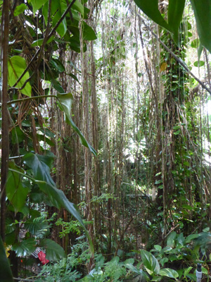
It was hot and steamy and wonderful. It’s not large and many of the species they started with didn’t make it but they sure have some great bamboo and vines.
Then you visit the ocean.
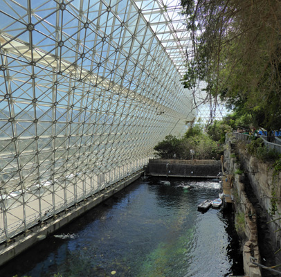
This is a saltwater lagoon that is about 25 feet deep. It had a coral reef and fish in it originally. At this point they’re working to redesign it as a model of the Sea of Cortez in Baja California. The University of Arizona now owns the facility and they are using it as both a research and an education facility. The tour fees help to support the complex.
Originally, there was a grassland next to the ocean but it’s been removed to create walkways for visitors. There’s a large mangrove swamp that helps to filter the water in the system and the mangroves are still doing marvelously. Down below the mangroves is a fog desert like that found in Baja California—complete with Boojum trees!
After wandering through the desert we made our way through a long tunnel down into what they call the technosphere—all the equipment that keeps the biosphere climate-controlled year round.
There are miles of pipes and heat exchangers down here.
And tunnels going all over the place beneath the spheres. We took one tunnel over to inside the south ‘lung’.
This is held up with a vacuum above it and when you open the doors (and there’s a huge whoosh of wind) the big black rubber ceiling causes the silver disc to move down to adjust the pressure. They do this just as a demonstration for visitors since the system is no longer sealed. But it was way fun to see. And the place is an incredible echo chamber.
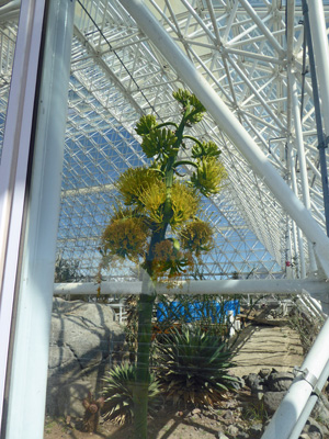
We walked around the outside of the main ‘greenhouse’ and saw a lovely century plant in bloom up against the glass.
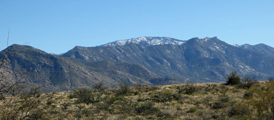
You get a great view of Mount Lemon (over 9,100 feet) from the far end of the project.
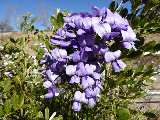
There were more of these purple flowers (that we saw the week before at Tohono Chul) in bloom and I finally found out that they are Mescal Bean (Calia secundiflora).
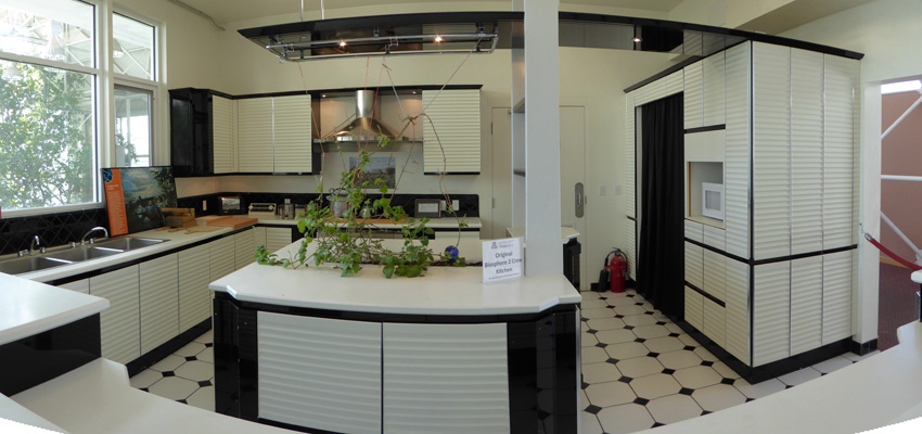
After the tour, we took the self guided tour of the living quarters. They had a state of the art kitchen in 1991. Each team member cooked for a day (3 meals) every 8 days. They ate a vegetarian (they did have chickens for eggs and goats for a bit of milk) high nutrient, low calorie diet. The first year they only managed to produce 80% of their food but the second year they did manage to produce 100% of their food.
We got a view of the area they used for their main food production (they had a small orchard with citrus and tropical fruit too). This area is now being used for a research project into the way precipitation flows through soil based on different rain and snow rates. They’re starting with raw ground lava rock and then will add grasses and cacti to study the way water percolates in the desert and if it ever actually recharges the aquifers here.
It took the 4 years to removed the biomass that had accumulated in this area so they could do these studies! Amazing.
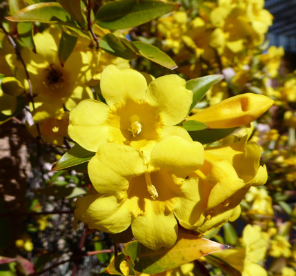
We hiked back up the hill and I noticed this incredibly fragrant vine growing on a covered walkway. It’s Carolina Jasmine (Gelsemium sempervirens) and it was really yummy smelling.
We headed back to town and stopped at the market to pick up paper plates and plastic silverware since the kitchen in our hotel room (which was supposed to be fully equipped) didn’t have a thing in it and then we stopped at Trader Joes for the makings of a simple but yummy dinner that we could make in the microwave—Chicken Marsala with mashed potatoes and a fancy Spinach Salad.
The free Wi-Fi at the hotel was a little sporadic but when it worked it was pretty fast. We had two large flat-screen TV’s with cable TV (one in the sitting room area where the kitchen was and one in the bedroom) so Walter had plenty of entertainment. I on the other hand, retreated to the bathroom where I soaked in the bathtub—my first such soak since we moved out of our house in May 2014. Heaven!
The hotel provided free hot breakfast, so the next morning we got up and went over to the little café by the pool to try it out. It turned out to be pretty decent so we didn’t need the breakfast makings we’d brought with us for the rest of our stay. After breakfast, I called the folks at Oasis to see whether the appraiser was going to make another visit since it said on his last appraisal he wanted to see the trailer once they had it ‘torn down’. It turned out he had just left. When they got the bumper and the pan and the two rear side panels off they could tell that the bumper frame (which is welded to the main frame of the trailer) was bent. One side was so torqued they had cut off the old one and put a new one on while the other side just needed to be straightened. This of course meant that the appraiser had to do yet ANOTHER supplemental appraisal and the repair was not going to be done Wednesday afternoon as promised. Oh goodie.
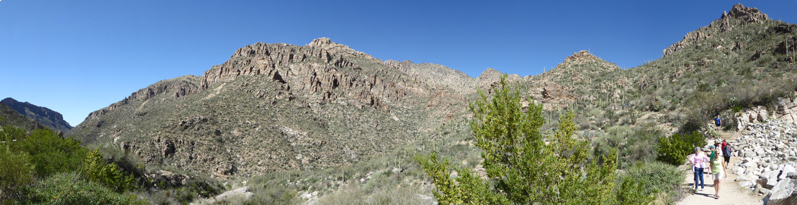
The forecast was for temps in the low 80’s on Tuesday so we drove a few miles east to Sabino Canyon, part of the Catalina Mountains National Forest, where they have a tram system that will take you up canyon about 3.7 miles and 500 feet in elevation. From there you can either hike higher or you can hike back down. Our Golden Geezer Pass paid for our parking and we happily paid $10 a piece to ride the tram to the top.
Lot of folks choose to hike up the switchbacks a ways and them come back and catch the tram back. We didn’t need to do the switchbacks but I was ready for a bit of exercise so we opted to follow the road back down again for a couple of miles.
The top of the canyon is rocky and has oaks and junipers.
There were wild flowers scattered along the road for the first few miles.
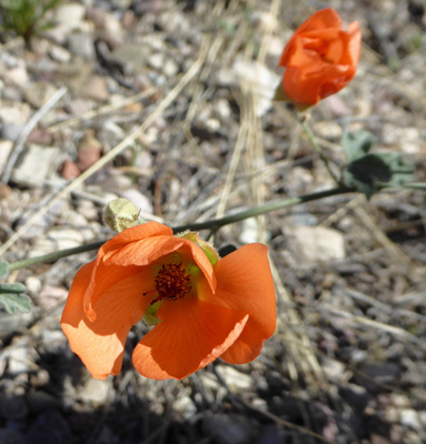
We saw Small Flowered Globe Mallow (Sphaeralcea parvifolia)
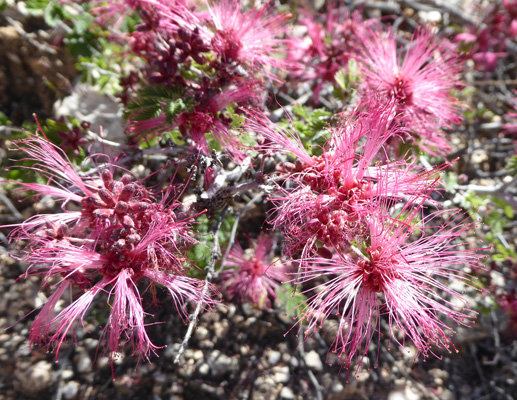
Fairy Dusters (Calliandra eriophylla)
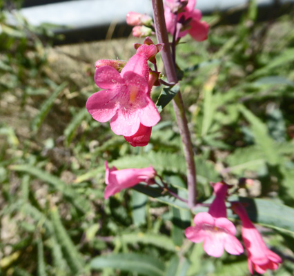
Parry Penstemon (Penstemon parryi)
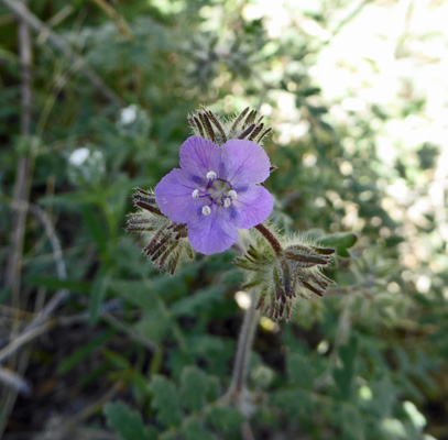
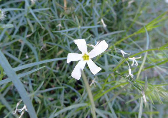
Distant Phacelia (Phacelia distans)
And tons and tons of Rose Bladder-pod (Physaria purpurea) which attracted lots of happy bees
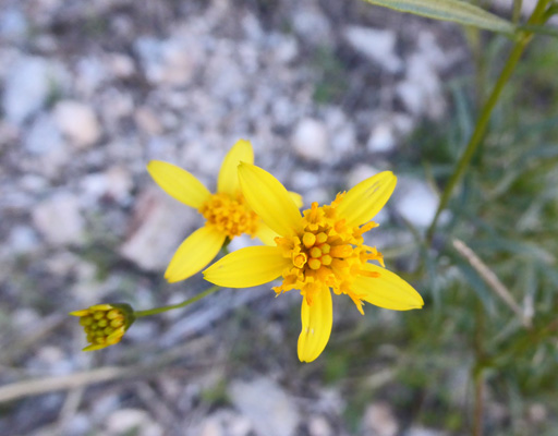
A bit further down we began to see this little yellow daisy whose name I haven’t been able to determine
And here and there we saw Ragged Rockflower (Crossosoma bigelovii) which is a pretty good-sized shrub.
I also got a few photos of Santa Catalina Mountain Phlox (Phlox tenuifolia)
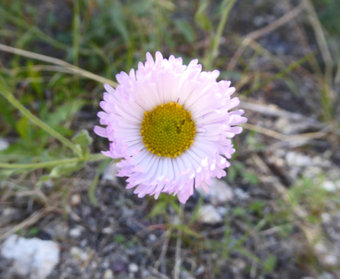
And there were bunches of Running Fleabane (Erigeron tracyi) which looks a lot like one of the dried flowers I used to grown that was called Xeranthemum.
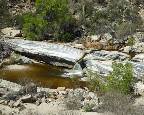
Sabino Creek is a seasonal stream that had plenty of water in it this year fed by melting snow up on Mt Lemon. The first time we visited Sabino in February 2006, there wasn’t a drop of water in the canyon. So it was a real treat to have waterfalls and ponds and folks out playing in the water.
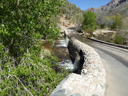
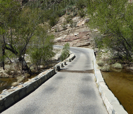
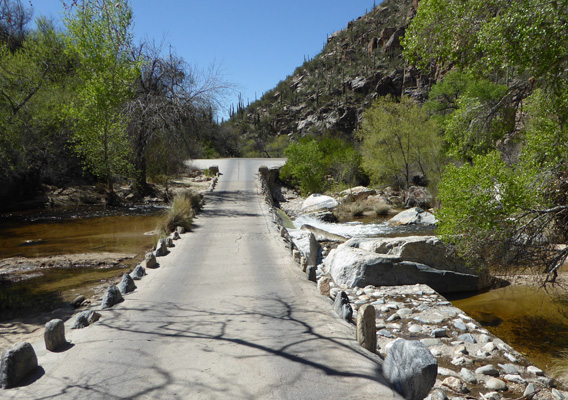
Back in the 1930’s the CCC built the roadway into the canyon and a series of wonderful bridges over the creek. We’d crossed a number of these on our way down that were dry but this one had the creek running over it. It wasn’t very deep so Walter just forged ahead.
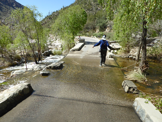
I tried rock hopping and managed to only get one of my feet wet on my last leap.
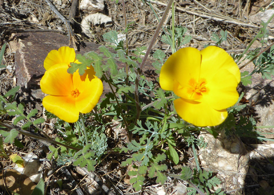
At this point, we began to see California poppies!
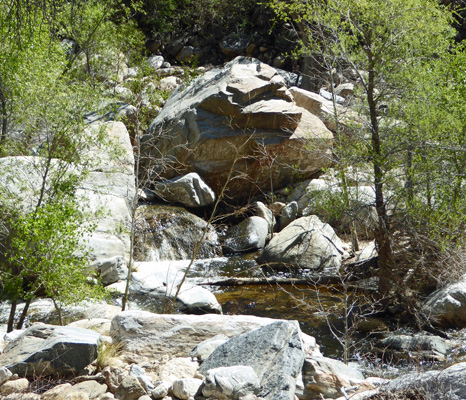
With each bridge there was a new view of sparkling water and little waterfalls.
I cannot tell you how wonderful all that water was after all this time in the desert.
Several bridges later we came to yet another fully flooded one.
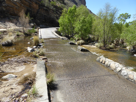
And while we were trying to decide if rock hopping would help, the tram came splashing through.
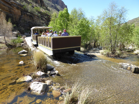
So we just waded across. It was warm enough that neither of us got cold feet in the process, so what the heck, go for it.
Once we made it across the bridge I stopped to get a shot of the water as it cascaded over the top. It really must be something in monsoon season when it pours here.
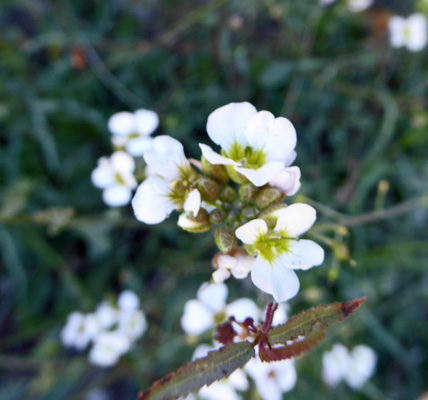
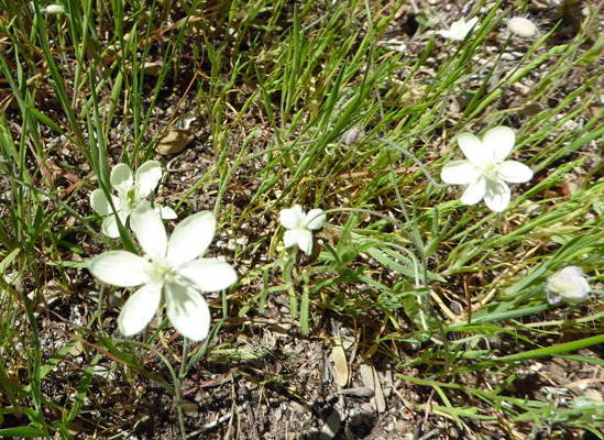
Along about here we began to see these little white flowers that I think are Creamcups (Platystemon californicus).
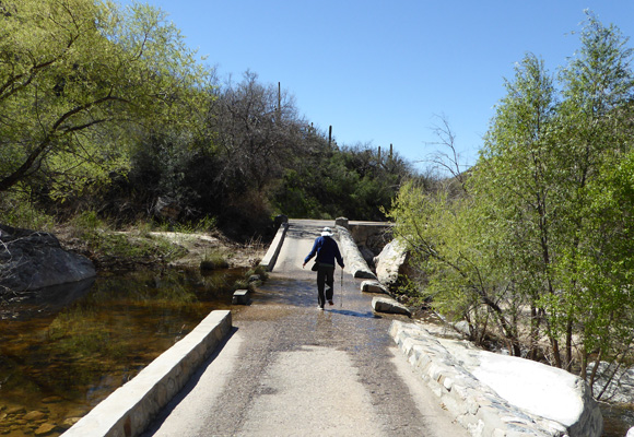
And then we had another wet bridge to cross.
They’re really lovely bridges and because they’ve been declared historic landmarks they have to keep them up in the original stone. This one was just a little damp.
As we got deeper down into the canyon, pools began to appear next to the bridges—sometimes with little sandy beaches and kids playing in the water.
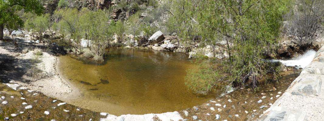
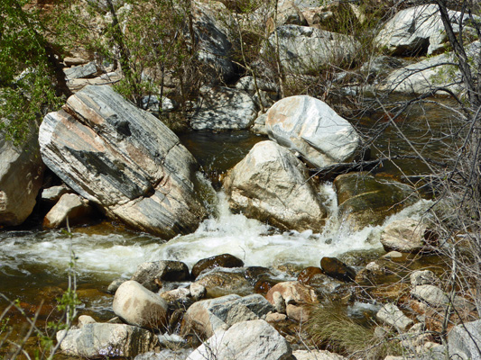
And sometimes fed by nice cascades of crashing water.
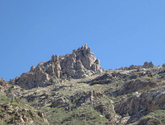
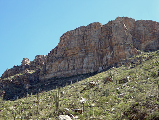
Up above us the canyon walls rise to a high point with this big rock face. It’s crumbly rock so folks don’t do rock climbing on it but you can take the trail over the top of it on the ridge.
We crossed one more bridge
And came to tram stop #3 (we’d started at #9) and here came a pair of trams. We talked about it for a minute and looked at the map and realized we’d come 2 miles down hill and the next stop was only a short distance with another wet bridge so we packed it in and caught the tram (your ticket is good anywhere in the canyon but becomes void once you return to the starting point).
We rode back down to the parking lot, got our lunch and even found a spot at a picnic table to have lunch. Most of the picnic tables are up in the canyon but we hadn’t carried our lunch with us so they weren’t an option for us.
We stopped at Trader Joes again on the way home—this time for Chicken Tikka with rice and some nifty Indian fried rice with vegetarian dumplings. I’ve never shopped to cook in a microwave before so it was kind of a trip to have to rule things out because they belonged in an oven. Trader Joes was great because they had a lot of non-frozen options in addition to the interesting things in the freezer section.
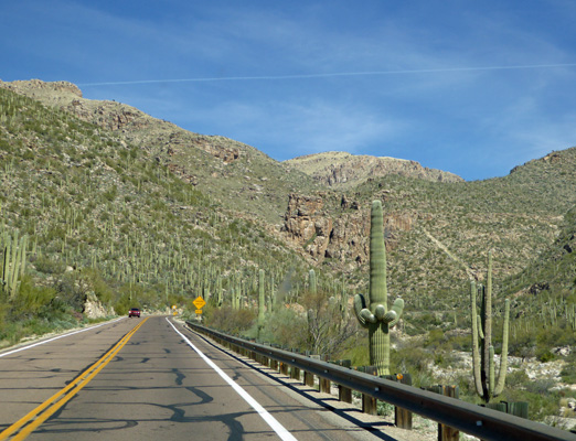
Wednesday morning, the big question was whether the trailer would be ready for us by Thursday afternoon or whether we were going to have to extend our hotel stay. We tried calling Oasis but no one could tell us anything. The forecast was for a high 88 degrees (HOT for March). So we decided to get above it all by taking the Catalina Mountain Highway up Mount Lemon to 9, 100 feet.
The highway starts on the southeast side of Tucson where you’re down in the desert at about 2600 feet.
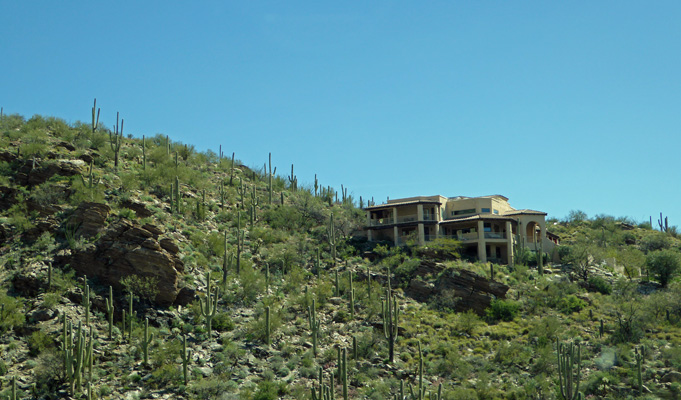
There are a number of large fancy homes along the edge of the canyon just before you enter the National Forest.
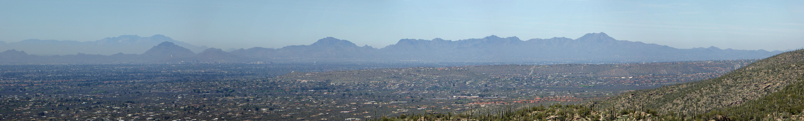
The road gains elevation until you come to the first vista point, Badad Do'ag Vista, with a great view westward
When we were camping at Gilbert Ray Campground we were on the western side of the near field mountains.
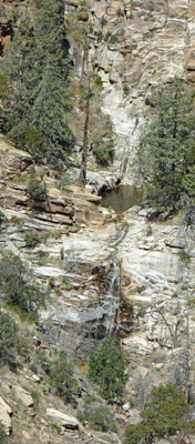
The road winds up the mountains to the Seven Cataracts Viewpoint where if you stand in just the right spot and look really carefully you can count 7 waterfalls cascading down the mountainside. Several of them start in pools like this.
The view up the mountain to the east is pretty nice too. At this point you’re high enough in elevation that there are junipers and pines.
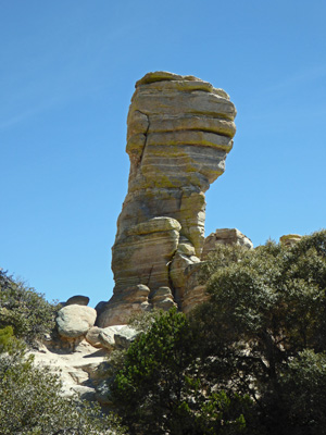
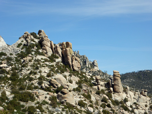
Up another couple switchbacks you come to the Windy Point Vista. Here you begin to see hoodoos.
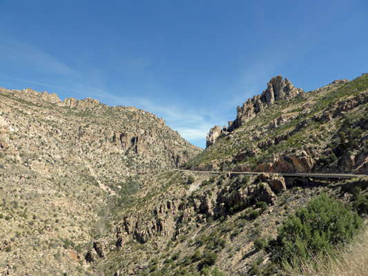
This is a really popular vista point and there’s lots of parking and there were lots of folks climbing on the rocks. The view westward was really nice too. You can see a ribbon of pavement down in the canyon—that’s part of the highway as it heads up the mountains.
Shortly after Windy Point you come to Hoodoo Vista where you can get a great view of a big selection of hoodoos.
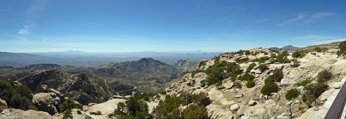
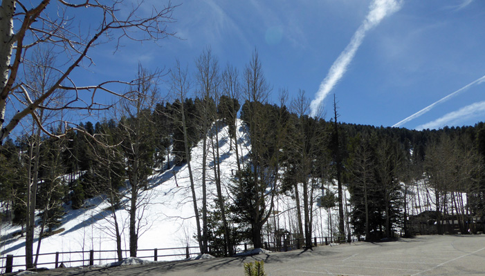
The road continues on past a number of campgrounds and lots of trailheads. There were tons of bicyclist riding on this road. It’s 25 miles from the bottom up to the ski area at the top of Mount Lemon and there were a remarkable number of folks of all ages pedaling their way up the mountain. We stopped in the little settlement of Summerhaven near the top and there were bikers sitting out on patios eating pizza before they began the race back down to the bottom. From there we drove on to the end of the road and the snow fields of Mount Lemon. This is looking northward–back towards Biosphere 2 where we had views of the mountain earlier in the week.
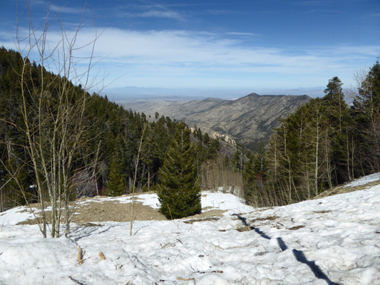
And this is the view to the south and the ski area—which is the southernmost ski area in the US.
We slowly made our way back down the mountain in no rush to leave the nice 55 degree weather for the 88 degrees down below. We stopped for lunch at a picnic ground part-way down and had lunch sitting outside with temps in the 60’s.
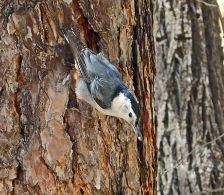
There were lots of birds including a flock of white breasted nuthatches who go up
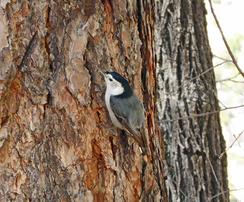
And down the trees
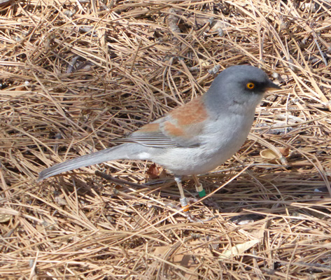
And the yellow-eyed junco who is only found at high elevations in SE Arizona and New Mexico
There were scrub jays too but they insisted on hiding up in the trees where I couldn’t get a good shot.
After lunch we headed on down the hill with the bicycles whizzing by. At one point I was going 40 mph and not gaining on the bike in front of me! Personally all that bare skin and Lycra going that fast gives me the willies.
When we got back into cell phone range Walter had a call from Oasis. They assured us that they were going to work as hard as possible to get the trailer done by the end of the day on Thursday. And if it wasn’t all done, it would be in a place where we could stay the night in it and they could finish off the last couple of things in the morning. Okay!
So Thursday morning, we packed up and checked out and went and hung out at the local library for a few hours. It was nice to have Wi-Fi that actually worked well for a while. After lunch we went and did our grocery shopping for the next 10 days and then drove down to Oasis. We arrived just after 4 pm and they had JUST finished the last of the work on the trailer. We settled up (just over $6,500 and yes they have to do one more supplemental appraisal to cover the shipping costs), loaded the groceries into the trailer and pulled out at 5 pm. Whoo Hoo!
We drove east on I-10 for about 50 miles to Benson AZ and the SKP Saguaro Co-op that’s just south of town. We stayed here back in November 2015 and we knew that they had decent dry camping for folks who arrived late since we knew that their office closed at 4 pm. We pulled in a little after 6 and found a spot that was just long enough for us even if it was a bit down hill. It was so nice to be back in our own space again.
Oasis did a great job on the repair. She looks as good as new now. They even rescued the most important tools that we’d stowed in the bumper and unbent them so we have what we need for our travels. Staying in Tucson for all that time might not have been what we would have chosen but it all worked out in the end. The insurance company wasn’t real easy to work with but in the end they are reimbursing us for our hotel stay and for the full cost of the repair so it’s all come out okay.
Friday morning, March 10th, we hit the road east on I-10 and drove just under 200 miles to Deming, NM and the Dreamcatcher RV Park that is one of the Escapee Rainbow parks. It only costs $18 a night (plus tax) for a full hook up so why not? We rolled in a little after 1 pm and got a nice long pull through spot. It was just over 80 and a bit breezy.
Our hot spot didn’t work too well here to start with but with some fiddling we got it to work better. Sometimes when we change locations it gets finicky. Late in the afternoon we went and found the local True Value Hardware so we could replace the locks that had gotten ripped off of the bumper storage compartment in the accident. So now we’re truly back to where we were before the accident.
Saturday we did laundry and then in the afternoon I tackled the taxes (everyone’s favorite thing). Sunday morning, March 12th we headed east on I-10, around El Paso and over to Guadalupe Mountain National Park. We arrived a little before 3 to find that not only was the campground full but all their hiker parking spots were full too. What the heck was going on, we asked? Spring Break was the reply. Oh wonderful. We motored north towards Carlsbad and Whites RV Park. It’s a first come first served park and all their hook up spots were full but we got one of the last dry camping spots for half price ($20 a night).
We set up camp and the decided that maybe we should check about availability for the next night. We walked back to the office and ended up signing up for nother nigth in the dry camping area since the recommendation was to get to the Carlsbad Caverns Visitor Center before 8 am to get a ticket for the elevator down into the cave. Folks had waited 2 1/2 hours for the elevator (both down and up) during the day on Sunday! So our plan is to get up EARLY and see if we can’t get down into the cave before the Spring Break Hordes arrive mid-morning.