
It was cloudy and misting lightly when we set up in a nice electricity and water site overlooking a wide open field. The Maine State Parks even provided WiFi which worked most of the time. Of course the park wasn’t very full which always helps.
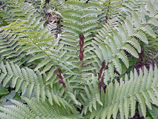
The site itself was full of ferns I’m not familiar with. There were these Lady fern-like ones that looked like they’d been crossed with a cinnamon fern since they had reproductive structures on the fronds.
We set up camp and had lunch and then drove back to town to do our grocery shopping. On the way back there were lots of people lining Main Street, many of them high school kids who were all dressed up—girls in black formals and boys in tuxes. Clearly something was happening. That evening I checked on-line and discovered that the town of Camden has a tradition that the seniors march from the Middle School through town and then down Main Street (which is Hwy 1) to one of the churches for a non-denominational service to begin graduation week. Most of the town comes out to watch them march. I found a video of the march. It was led by a bagpiper and the pastors and rabbi from town and then all the kids in caps and gowns.
After dinner we decided we’d take a drive up the Mt Battie Road in the park. But it turned out that it closed at 7 pm so we took a tour of the campground instead. There were maybe 5 tents in the tent loop and the hook-up loop was maybe 1/3 full. Clearly early June is not high season.
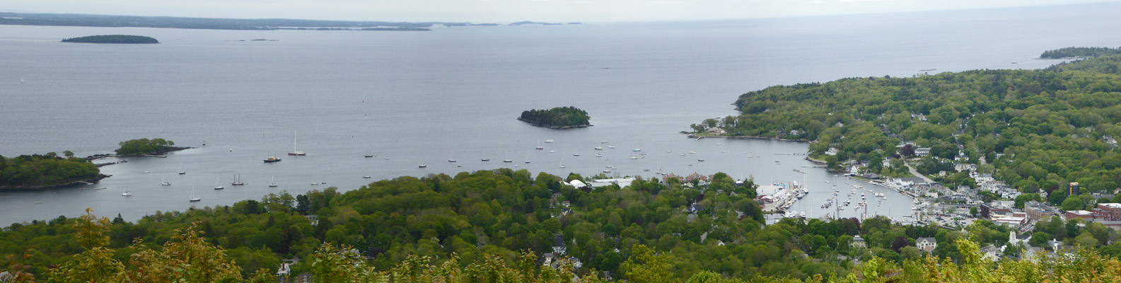
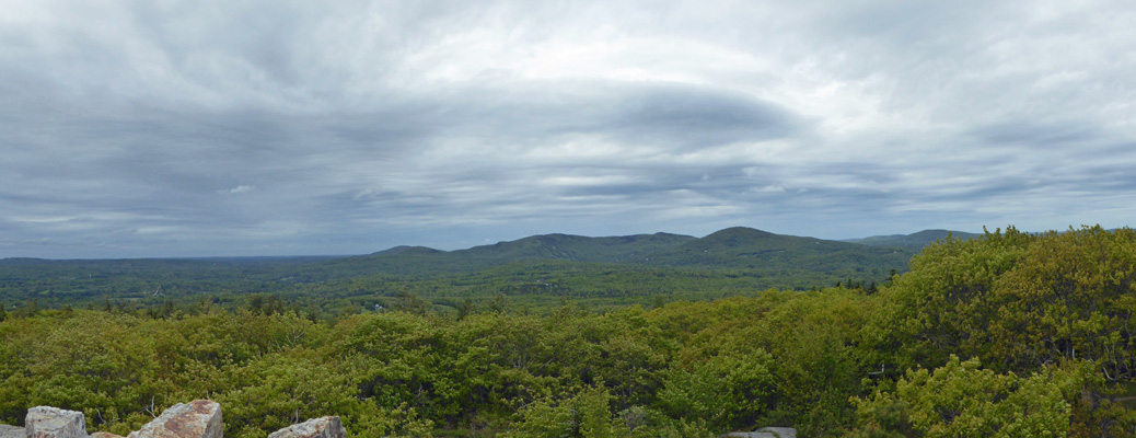
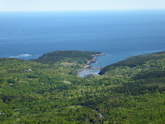
The next morning it was still cloudy but the rain/mist had stopped. We loaded up the laundry (and a lunch) and then headed up the Mt. Battie Road to the top. There’s a little stone observation tower here and a great viewpoint looking out across Penobscot Bay and the nearly 100 islands in the area.
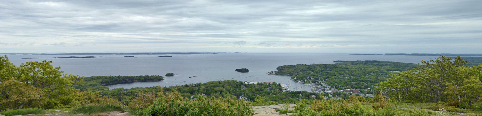
You get a great view of Camden Harbor too.
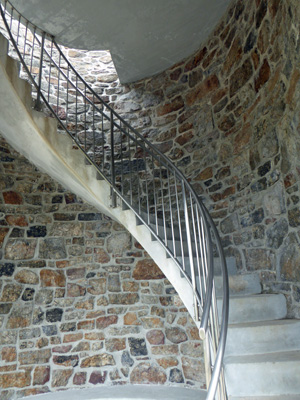
I climbed the spiral staircase up the tower.
The view of the bay wasn’t any better really but the view eastward into the ‘mountains’ was great. Mt. Battie is 780 feet but there are several other mountains that are in the 1300 foot range nearby which are popular hikes in the park.
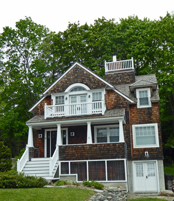
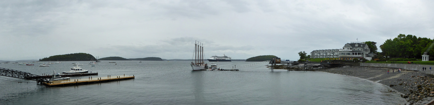
We went on into town to a very nice Laundromat (free wifi though we didn’t need it since we had it at the campground) which was next door to a very nice music store. Once we were done with the laundry we headed south to the town of Rockland and had the oil changed in the truck and then drove back to Camden to the harbor area for lunch. Thank goodness it wasn’t high season since parking seems to be at a premium in Camden. We found a nice spot near the harbor and the little pocket park that overlooks it. This lovely house was across the street from the entrance of the park—complete with Widow’s Walk.
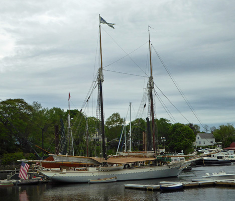
Camden is a favorite place for Windjammer cruises and one of them was in port having some work done.
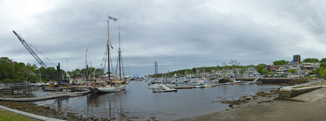
She was the Mary Day—or so said her flag at the top of her mast and the name on her stern.
There’s a waterfall that brings a creek from the town level down to the harbor. You can’t get in front of it but I got a decent photo of it by standing out on the edge of the rock walkway nearby.
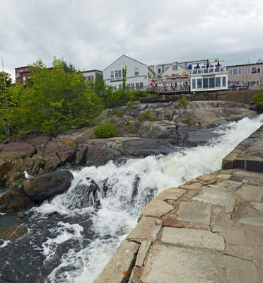
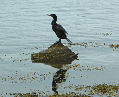
We sat and talked to some folks from Massachusetts who were up for a visit and watched the cormorants dive for food at the base of the falls. Just as we were leaving one of them stopped for a rest on the top of a rock.
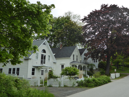
We had our lunch in the truck overlooking the harbor. And I grabbed a shot of the houses that were across the road from us. Camden is a very picturesque town full of very nice houses—many of them 2 or 3 times as big as these.
The next morning the sun was out! I took a photo of our view from our dining room windows before we packed up to head up to Bar Harbor and Acadia National Park.
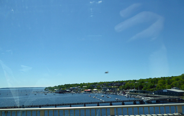
The forecast said that it would be sunny for 2 days and then we were due for rain again. So we set out to enjoy the sun (and temps in the high 60’s and low 70’s) while we could. We drove north on Highway 1 going through one quaint town after another getting only brief glimpses of the water as we went. We crossed a bridge (in Belfast I think) and I grabbed a photo of their harbor as we sped by.
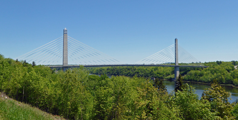
There was a nice turnout at the Penobscot Narrows so we stopped to switch drivers and look at the view of the spiffy new bridge there. The tower on the left has observation windows in it so that you can ride an elevator up and have a look.
We continued on up Hwy 1 until we reached to the turnoff to Hwy 3 and Mount Desert Island. Part of Hwy 3 was under construction so it was a bumpy ride into Bar Harbor but once we got in all was good. We made our way across the island to the Blackwoods Campground on the southeast side of the island and checked in for the campsite I had reserved back in March. It was a pull through site (plenty long) with no hook ups (this is a National Park after all) that we were only paying $15 a night for with our Senior Pass. We set up camp, put out the solar panel (we had sun in this site for about 4 hours each afternoon) and had lunch. There is no WiFi here. And no data signal for the hot spot and our phones didn’t work either. And there was no over the air TV. Welcome to the back of beyond in a National Park. YES!
After lunch, we headed out to drive to Cadillac Mountain—the highest point on the Eastern Seaboard of the US at 1530 feet. However to get there from Blackwoods required a bit of a backtrack so we could get onto the Park Loop Road and that took us along the coast and well, it was a beautiful sunny afternoon and there were parking spots available so why not stop and have a look?
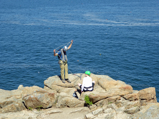
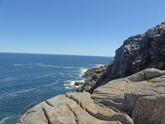
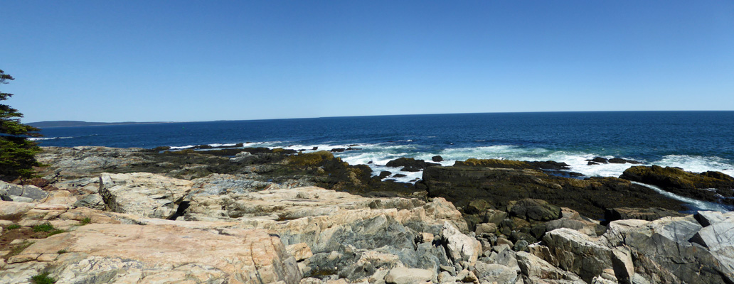
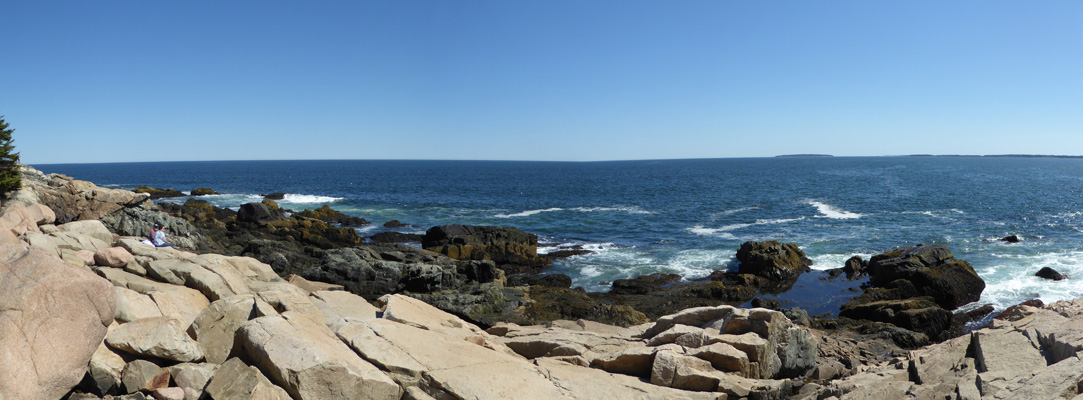
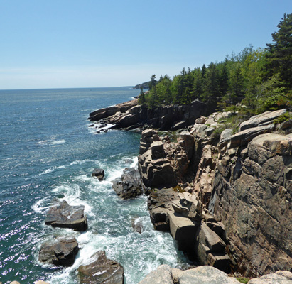
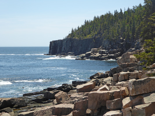
The first stop was an area called Otter Cliffs. No otters and in fact you are on TOP of the cliffs at this point but hey, there’s still a great view. And there were rock climbers just winding up their ropes from having been climbing on said cliffs.
The view northward gives you a glimpse of Sand Beach—one of the few sandy beaches on the island and lots of rocks because this is after all the Maine coast.
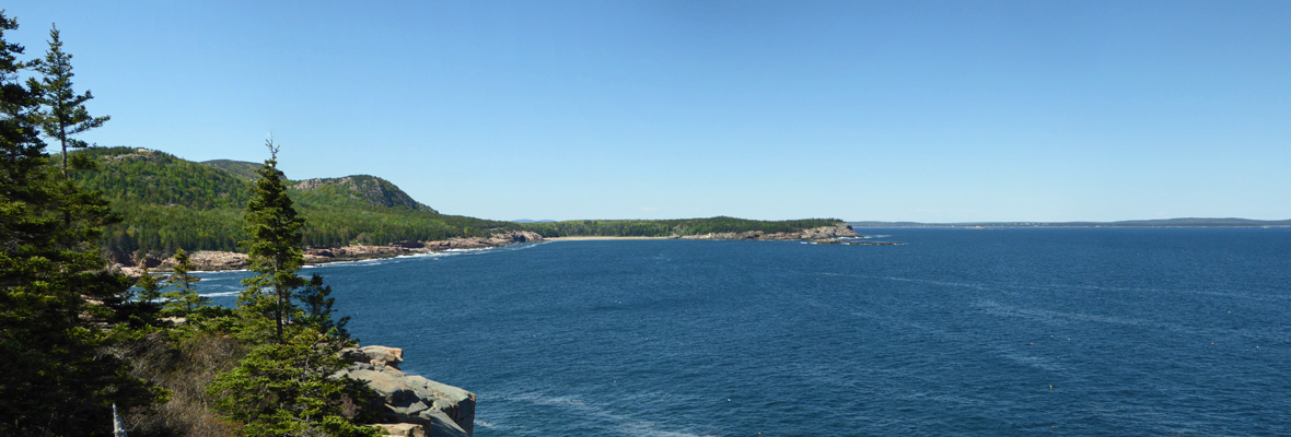
Southward you get a bit of a look at part of the Otter Cliffs and lots of the pink granite that the island is known for.
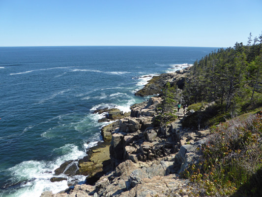
I clambered back up the rocks and walked along the walkway next to the road and got a view of the Ocean Path which is a trail that goes from Sand Beach to Otter Point around the corner.
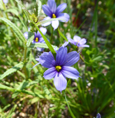
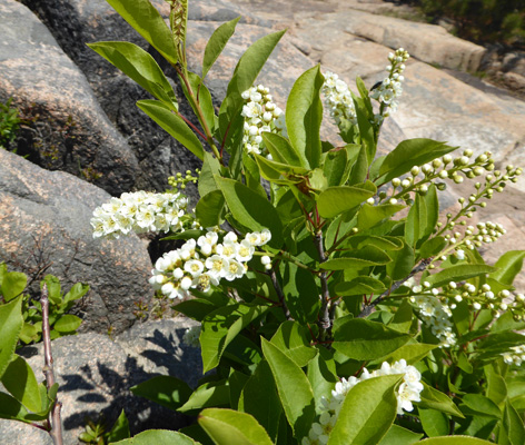
We carried on and came to a nice big parking lot at Otter Point. There was Stout Blue-eyed Grass (Sisyrinchium angustifolium) in bloom in the parking lot area.
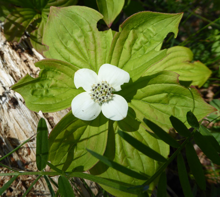
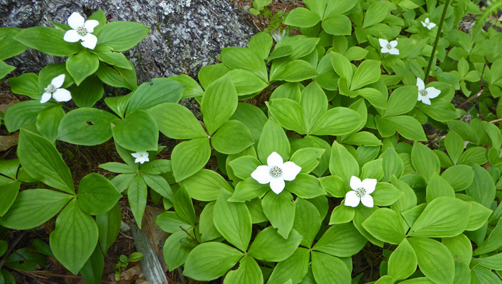
And more bunchberry. My references say that both Canadian and Alaskan Bunchberry grow here and darned if I can tell the difference. They also say that the bunchberry we have in Washington is actually Alaskan (Cornus unalaschkensis) not Canadian (Cornus canadesis) so I’m totally at a loss. So I’ll just call this bunchberry to play it safe.
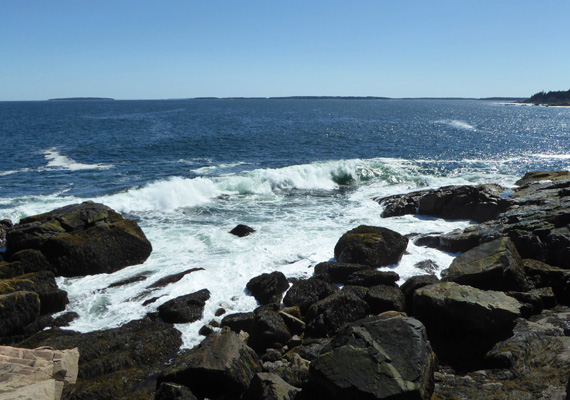
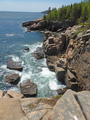
Otter Point is a narrow little peninsula with gorgeous rocks all along it. The northern portion looks like this.
And provided me with lots of happy moments capturing crashing surf.
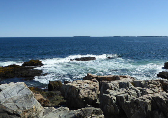
As you go around the point the rocks and the surf just get better.
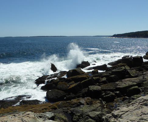
What’s not to like about this place? Sun, blue water, rocks and surf.
Add to it the pink granite with the darker brown rocks with mustard alga and wow.
It was nearing low tide and the surf was still this good, amazing.
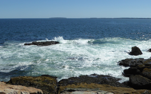
The view southward wasn’t too shabby either.
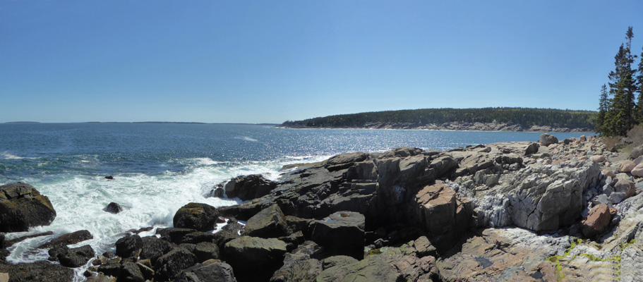
Having taken way too many pictures we got back in the truck and went on only to be grabbed by the view of the coastline where private property starts up and big houses appear. How’s that for a view from your summer ‘cottage’?
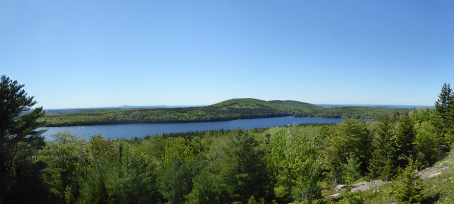
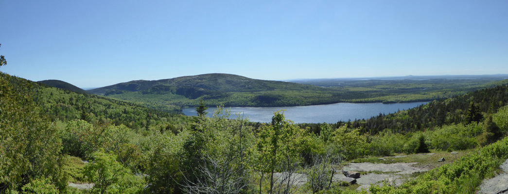
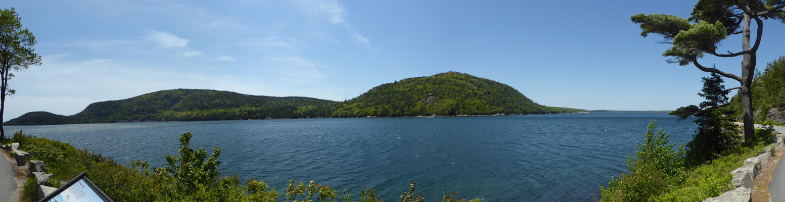
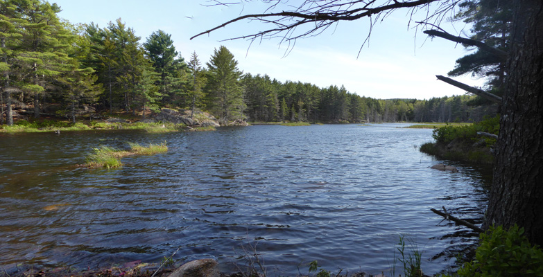
The Park Loop Road then goes inland past Jordan Pond (where there’s a concessionaire-run restaurant) and past Eagle Lake, a long finger of a lake dug by the glaciers of the last ice age.
There were bluets along the roadway but when I stopped for this photo there were lots of Three-toothed Cinquefoil (Sibbaldiopsis tridentata) in bloom on the verge.
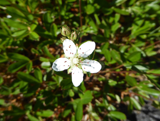
And Sand cherry (Prunus pumila), a small shrub, blooming in the ditch across the road.
We took the turn-off for Cadillac Mountain at last and wound our way up what we would consider a nice round foothill but which in these parts is a mountain. We stopped along the way for a view of Eagle Lake and the islands off the coast (off in the distance).
The road winds its way up the 1500 feet of elevation gain and brings you to a large parking area. We grabbed the first spot we saw but there turned out to be lots of empty spots in the main lot—a bit of surprise on such a beautiful clear day.
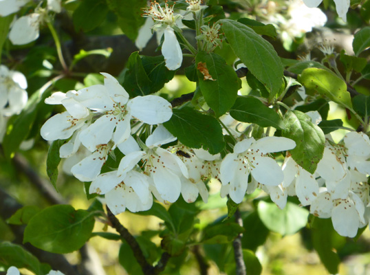
There was what I think was a domestic apple tree in bloom next to the parking lot. The flowers sure smelled like apple blossoms.
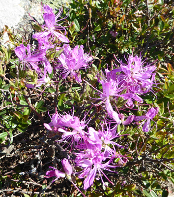
The glaciers tore all the topsoil off of the mountains when they retreated so there are few trees up at the top. It’s like being in an alpine setting except you’re only at 1500 feet. There were Rhodra (Rhododendron canadens) growing in cracks in the pink granite.
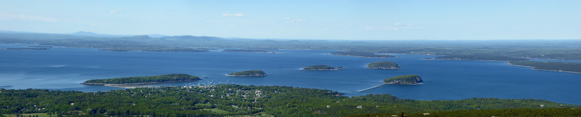
And out to the south you could see all the way to the Cranberry Islands.
And Seal Harbor on Mount Desert Island itself just opposite the islands.
Westward you could see Otter Point.
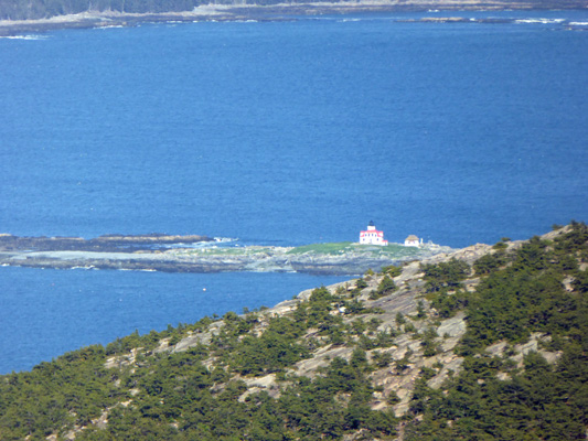
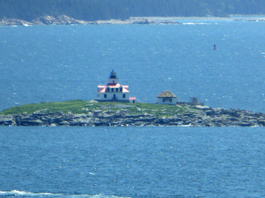
To the north, you could see the little lighthouse on Egg Island.
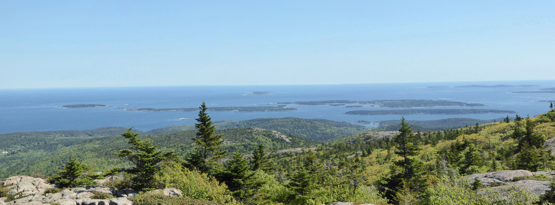
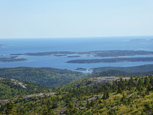
And all of Frenchman Bay spread out before you.
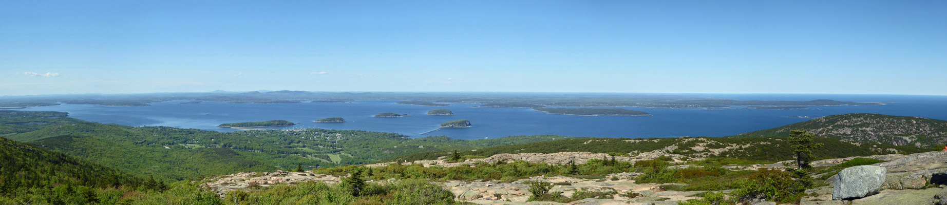
Here’s a closer shot of the Porcupine Islands and Bar Harbor. Bar Island is the island closest to town. When the tide is out (as it was at this point) you can walk to the island on the sand bar. But be sure you head back before the tide comes in or you’ll have to swim back.
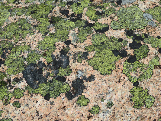
Originally Cadillac Mountain was called Green Mountain. I guess it was because of all the very bright green lichen on the rocks because it wasn’t because of the trees.
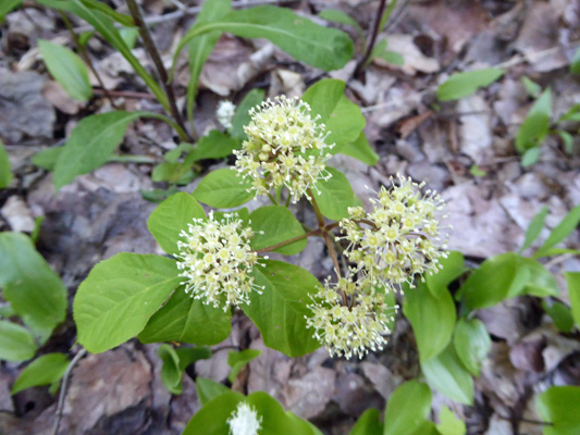
Having hiked all over the top of Cadillac Mountain we drove on back to the campground. I found some more Wild Sarsparilla in bloom in our campsite.
Our solar panels had charged the batteries up enough that we didn’t feel we needed to run the generator that night and we just settled in to enjoy the evening.
On Thursday June 8th, we had another gorgeous sunny day. We ran the generator first thing to charge the battery up since 4 hours isn’t enough on a day to day basis. And then we headed north towards Bar Harbor and picked up the Park Loop Road to finish the part we hadn’t driven the day before. Along the way the little bit of traffic there was slowed to a stop and what should appear but a mamma river otter and her pup.
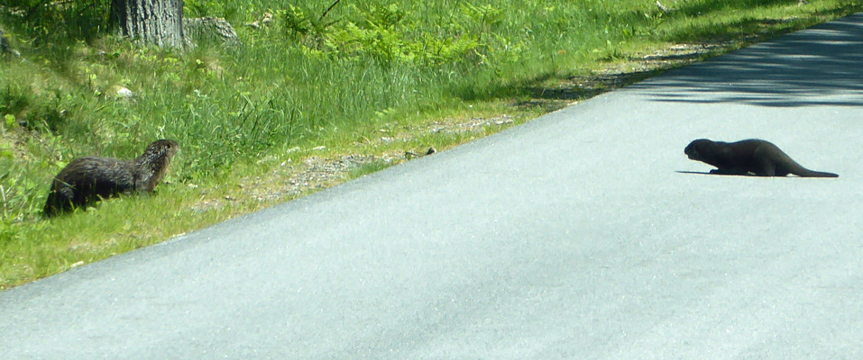
Mamma clearly wanted to cross but was concerned about the cars. She’d run out into the road and then back again with the pup following her or hiding in the ditch.
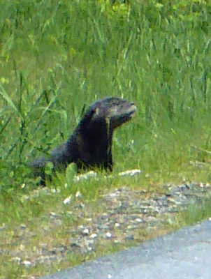
This amusement ended when they both finally scampered across the road and into the grasses.
The road then turned and took us along the coastline of Frenchman Bay and a great view of the little lighthouse on Egg Island.
We drove on and finally came to a mass of cars trying to park along the road. This was merely a prelude to the completely full parking lots at Sand Beach. It was a beautiful day and everyone wanted to go sit on the sand I guess. We drove around both lots a couple of times and both decided that we could easily skip the sand. So we drove on until we found a nice parking spot in a lot near a view point.
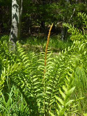
There were cinnamon ferns doing their thing in the parking area.
And a great view up the coast to Sand Beach.
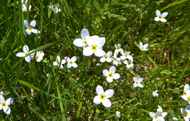
There were masses of Bluets (Houstonia caerulea) in bloom in the verge.
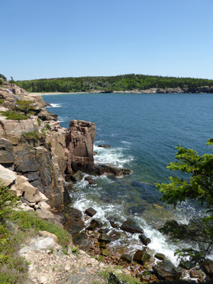
And the view to the south gave you a taste of what the Maine Coast is all about—rocks and cliffs.
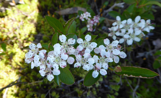
There were Chokecherries (Prunus virginiana) in bloom along the cliffs.
I clambered down on the rocks a ways and got a heart stopping view DOWN the cliffs into the surf below.
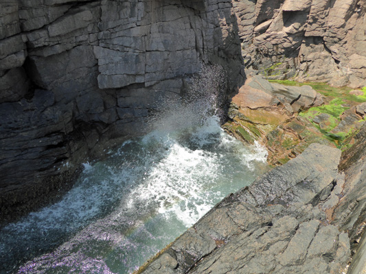
Remarkably there were plenty of parking spaces at Thunder Hole, a spot where the water crashes up a cleft in the rocks and makes lots of noise (and splash) when the tide is about 3/4 of the way in. There are stairs that take you down to get up close and personal with the crashing surf.
The water in the hole rises and falls like a monster breathing. Here it is at it’s low point with water draining away.
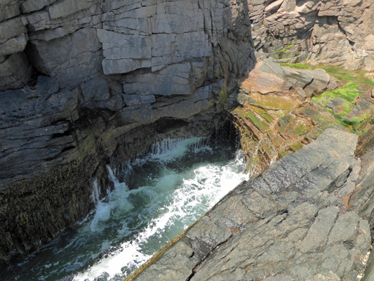
And here it is with the water spurting up out of it.
As the tide came in more and more of these surges got more and more of the folks watching very wet.
Meanwhile if you turned northward the surf was crashing on the rocks just a few yards away.
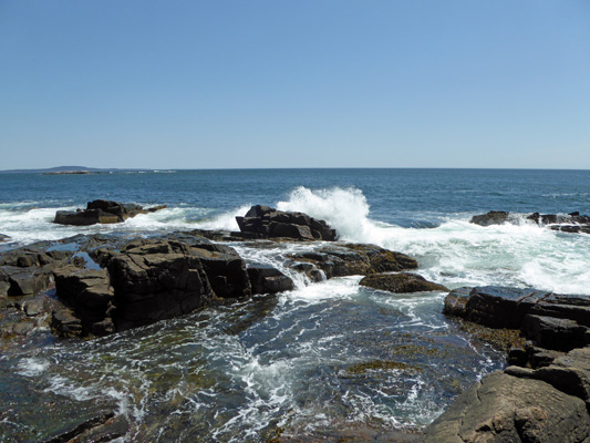
Personally, I like this kind of crashing surf better than the stuff that comes up out of the hole but I get it that folks like the excitement and the risk of getting wet.
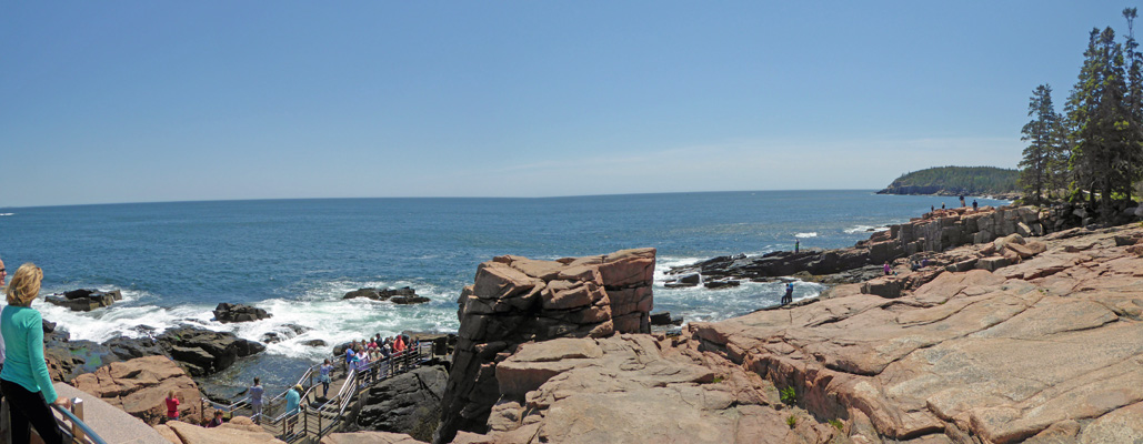
We climbed back up the stairs and I took a panorama shot of the area with folks swarming over all the rocks.
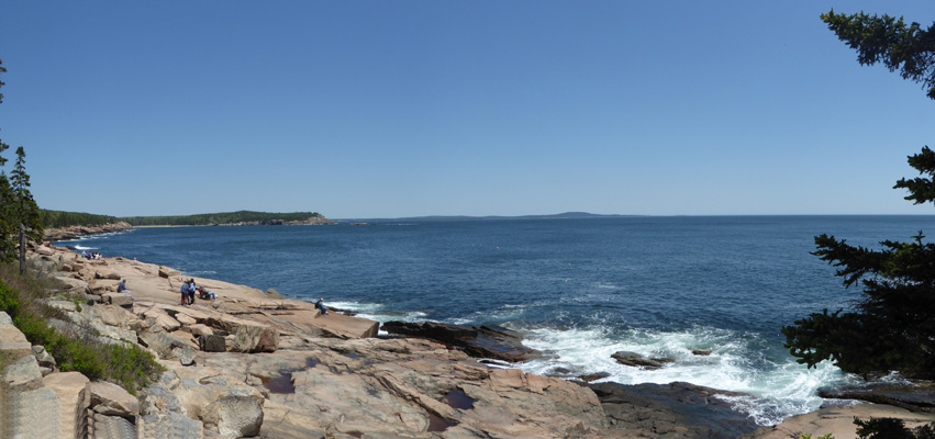
And another view northward towards Sand Beach.
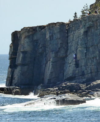
A ways further down the road you come to another parking area where they painted the lines wrong so that you can’t get into half of the parking spots. We drove through, shook our heads and drove on--you can’t loop back through a second time because this portion of the Park Loop Road is one way. But there was a spot on the verge for me so I could get out and hike back and get a good shot of Otter Cliffs.
And yet another rock climber doing his thing on the cliffs.
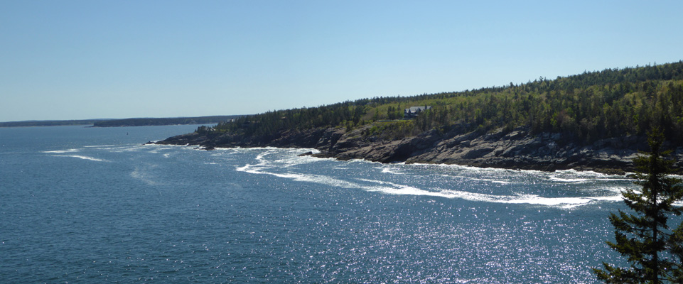
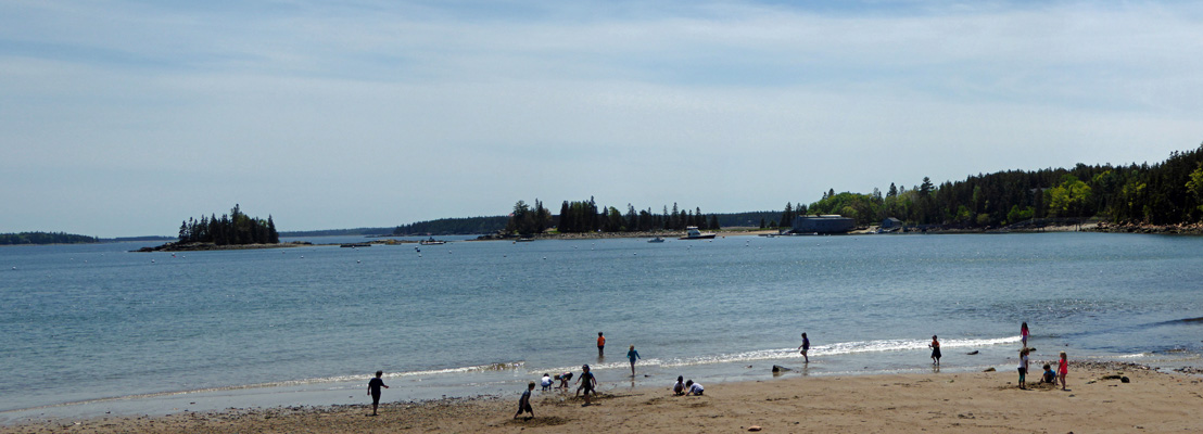
We took a shortcut off the Park Loop Road and back to our campground so we could make a picnic lunch and then drove on down to Seal Harbor where there is a nice little sandy beach with a great view of some little islands—and a parking lot that had plenty of open spots.
We followed the road that winds along Somes Sound, the only fjord in the eastern part of the US, until there was a spot to stop and take a photo.
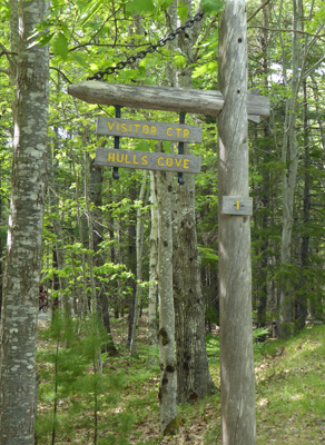
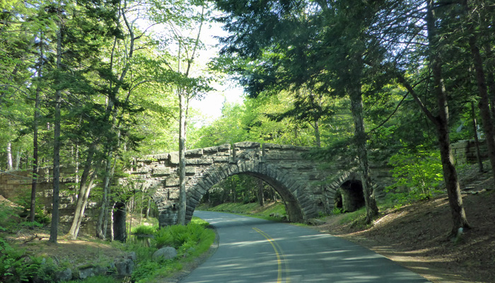
Then we took a connector road back to the Park Loop Road which took us northwestward to Hulls Cove Visitor Center. We stopped in the Visitors Center and watched the movie (it was no great shakes) and got a map of the Carriage Roads on Mount Desert Island. John D Rockefeller Jr. built over 50 miles of Carriage Roads on the island to preserve the leisurely pace of life with a horse-drawn vehicle since he just hated automobiles. All these roads are crushed gravel and 16 feet wide. There are 17 stone bridges that either provide a place for the Park Loop Road to pass over a carriage road or vice versa. Then he donated most of them and their land to the park. There are a few outside of the park boundary and they are only open to horses and pedestrians. Most of the rest of them inside of the park are open to bicycles too.
Acadia, like Shenandoah and Great Smokey Mountain National Parks, is made up almost entirely of donated land. In this case, it was the robber barons of the early 1900’s who decided they wanted to preserve this beautiful place that had become one of their summer playgrounds. First they bought up the mountain tops, and then slowly added more and more of the rest of the park.
After lunch we set out to take a walk on the Witch’s Hole Pond Carriage Road that is near the Visitor’s Center.
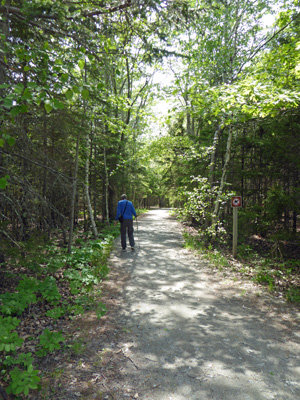
The first part is a 1/2 mile connector trail that goes UP a steep hill (warning to bicycles it’s got a curve in it too) until it joins the main carriage road which was basically flat.
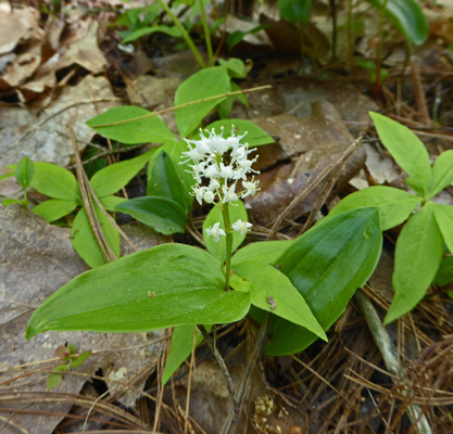
There was lots of Canadian Mayflower (Maianthemum canadense) which I’d seen all over (even in our campsite) but didn’t know what it was.
And lots of Northern Starflowers too.
In time the trail flattened out and we came to an intersection that was well marked with signs telling you which part of the road went where.
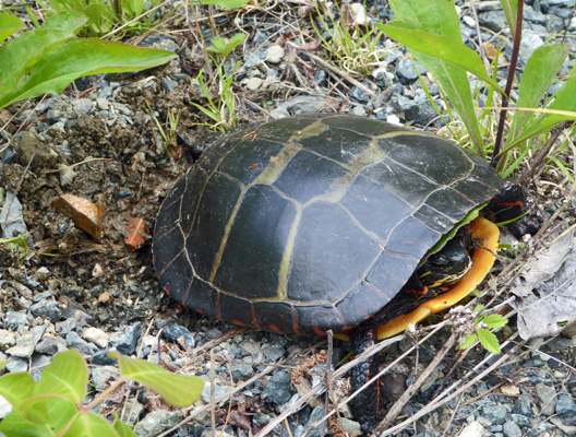
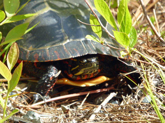
We continued on towards the pond and another walker pointed out a nifty turtle nestled in the grass and gravel next to the road.
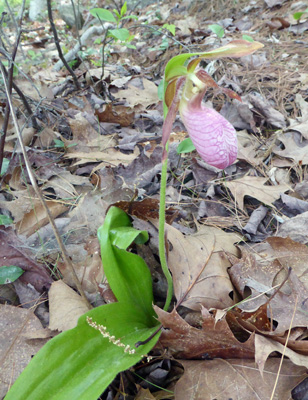
Walter spied a Pink Lady’s Slipper (Cypripedium acaule), the only one we’d seen in Acadia.
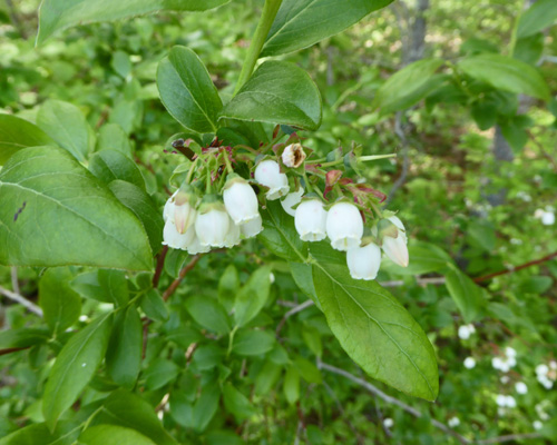
There were lots of Highbush Blueberries (Vaccinium corymbosum) with tons of flowers on them.
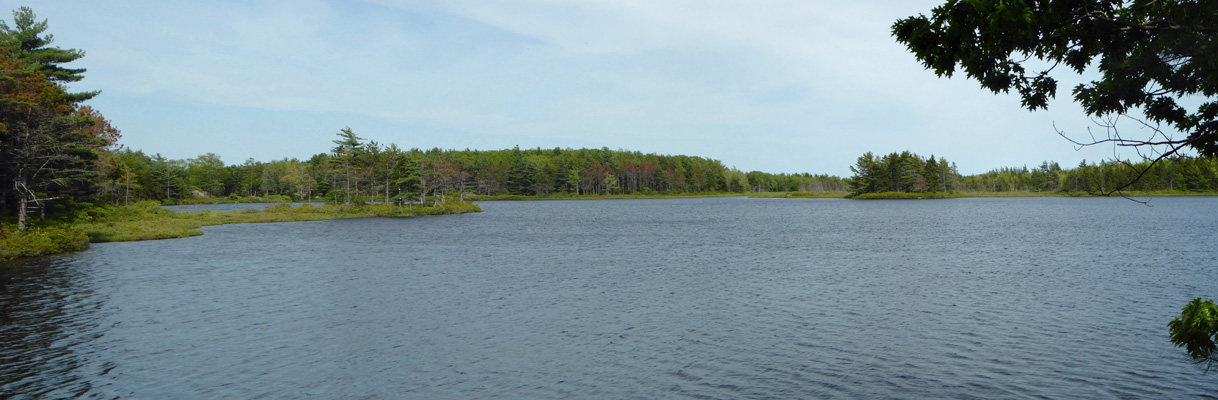
And in time we got a nice view of Witch’s Hole Pond (originally known as Witch’s Hollow Pond but later shortened to Witch’s Hole Pond).
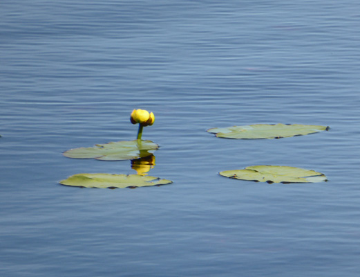
There were yellow pond lilies (Nuphar variegata) in bloom on the shallow end of the pond.
And yet another turtle who I managed to get up close and personal with.
Some folks we had stopped to talk with along the way said that the next little pond was a beaver pond so I went on while Walter rested. There was a nice big patch of bunchberries in bloom in the woods.
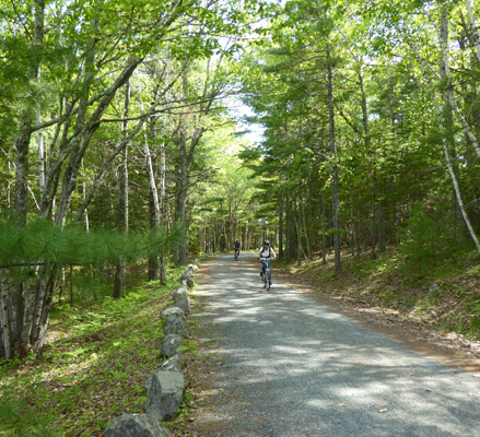
And I got a fun shot of some bicyclists enjoying the Carriage Road.
Then I spied the next pond and crashed through bushes and sure enough there was a beaver dam right at the foot of it.
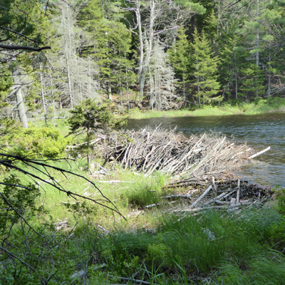
I waded in through the wetland (I had on my GoreTex hiking boots so no wet feet here) and took a photo of the whole pond. It’s amazing what a few beaver can do.
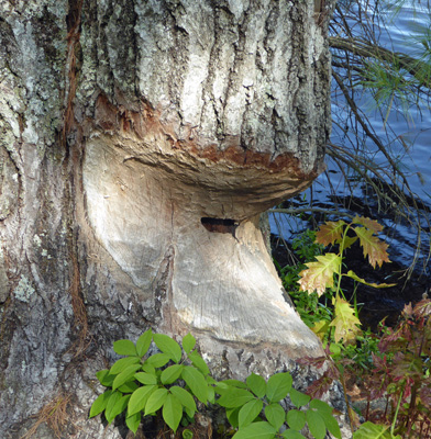
On the way back I spied a tree that the beaver had managed to eat their way through enough to kill it but never finished felling it.
It was a nice walk but it reminded both of us of doing hikes on old logging roads since it was gravel and so wide. I’m sure in the summer all the Carriage Roads are full of folks on bikes and everyone is glad that they are wide.
On our drive back to the campground I stopped and took a shot of one of the stone bridges. In this case, the Park Loop Road is going under a Carriage Road.
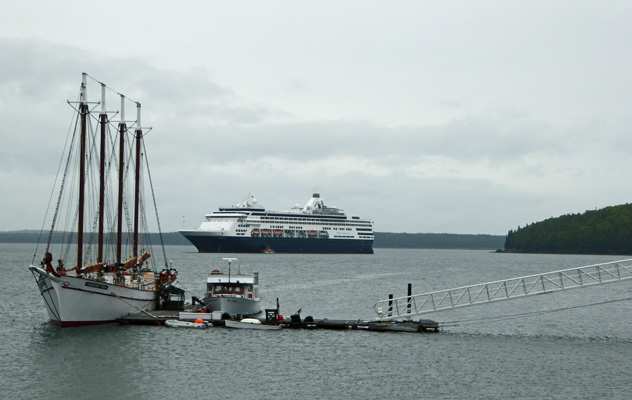
Friday morning June 9th we had rain as expected. It was in the low 50’s outside and in the high 50’s inside so we just turned over and went back to sleep. We ran the generator using our little generator tent to keep it dry—we’ve almost gotten all the kinks worked out of the design at this point. And then drove into Bar Harbor to the library to use their Wifi. It’s a lovely old library with wooden shelves and a balcony around the main reading room with spiral staircases leading up to more shelves up there. We waded through 3 days of email and news and then drove to the local grocery store and picked up a picnic lunch. Studying the map we decided that a great place for a rainy picnic would be the wharf where there is free parking and a view of the little harbor. There was a small cruise ship in town (they arrived at 8 am and were scheduled to leave at 5 pm). There’s no dock big enough for the cruise ships so they use tenders to bring the passengers in like they do in Sitka, Alaska.
We sat and watched the tenders go back and forth and enjoyed our lunch and I got out when it wasn’t raining too hard and took a shot of the harbor looking east.
It was late afternoon when we got back to the cold trailer—just in time to snuggle into the warm bed and read (and have a nap as needed). We had a few thunder boombers that evening. But mostly the showers were sporadic much of the day. Of course it rained a bit when we set up and took down the generator but hey, that’s life on the road.
Saturday June 10th, we awoke to clear skies. We broke camp early since check out time was 10 am—way earlier than most places. And headed out Hwy 3 to Hwy 198 to get off Mount Desert Island and join Hwy 1 north. We took Hwy 1 north along the edge of Frenchman Bay and then turned onto Hwy 186 where it takes off onto the Schoodic Peninsula. We had a 3-day reservation at the Schoodic Woods Campground. The far end of the Schoodic (pronounced Skoodic—like school or schooner) Peninsula is part of Acadia National Park. The campground here is only 2 years old. Someone bought the land, had a gorgeous campground with water and electric hook ups (all pull throughs) installed, put in trails and some Carriage Roads and then anonymously donated it all to the National Park. The spots are all really widely space and the roads are all paved. The spots are level gravel. There’s a nice tents only section too. The only thing missing is that they didn’t put in showers in the bathrooms. They even put in a great welcome center where you check in. It’s great. And with our Senior Pass we only paid $25 a night. For arcane reasons you only get $15 off the $40 a night price but hey, $25 for electricity and water in these parts is a super good deal.
We checked in and talked for a little while with the camp hosts who helped us. They were hosts at Honeyman State Park in Florence, OR the same year we were at Heceta Head Light House. Then we set up camp. This place even had free WiFi. The signal was a little weak at our spot but it was fast enough to overcome that. Amazing really. (It did get overloaded in the evening and not work at all but hey that’s life with free WiFi). It was breezy and the temperature was in the mid-60’s. We hung out for a while enjoying our sunny spot and the Wifi (and the over the air TV that Walter had found).
After lunch we drove the one-way road around the Schoodic Peninsula. It is fantastically gorgeous and there was wonderful surf crashing on the rocks. This missive is already too long (with too many photos) so I will leave our adventures at Schoodic for my next missive.