
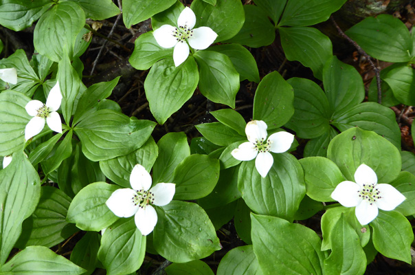
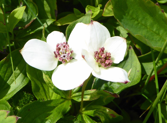
On Friday July 21st, it was partly cloudy when we set out to drive north to Broom Point about 2/3s of the way up the coast of Gros Morne. The Long Range Mountains (the northernmost reaches of the Appalachians) were just visible through the haze. But it wasn’t raining so we set out on Steve’s Trail, named for the fisherman who once lived here. There were Bunchberries (Cornus canadensis) in bloom along the trail (still).
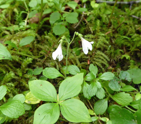
And Twinflowers (Linnaea borealis) too.
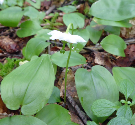
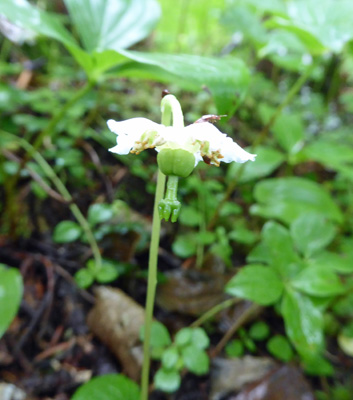
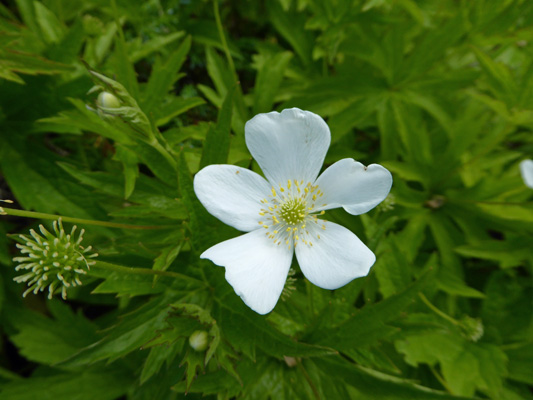
Here and there I saw One-flowered Shinleaf (Moneses uniflora).
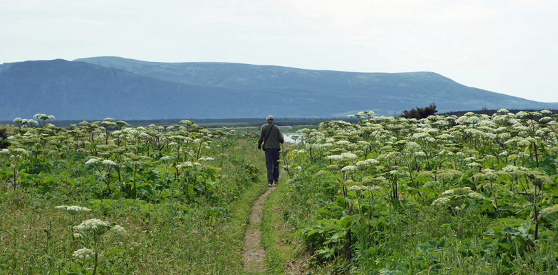
The trail comes out of the woods into an open meadow full of Cow Parsnip nearly as tall as Walter.
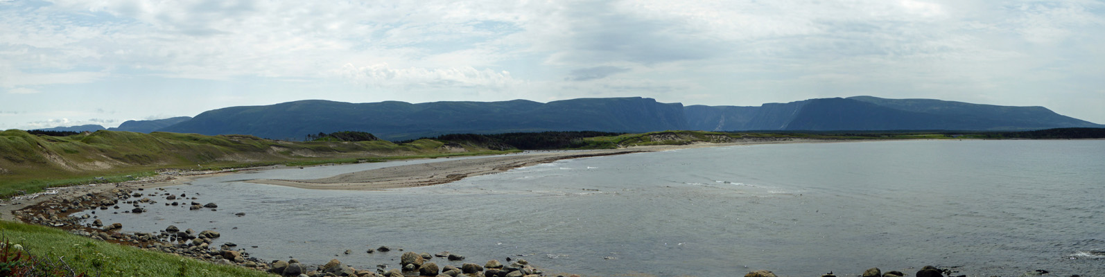
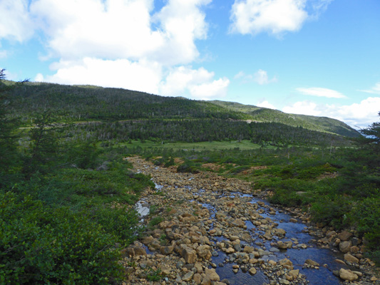
And out onto a little bay where Western Brook flows into the sea.
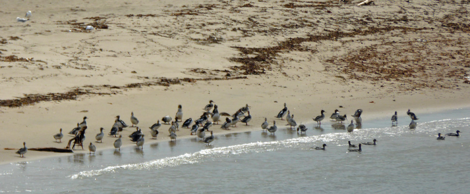
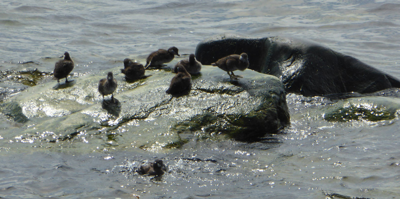
There were sea birds out on the sand spit. We had seen very few birds anywhere in Newfoundland so we were excited to see them.
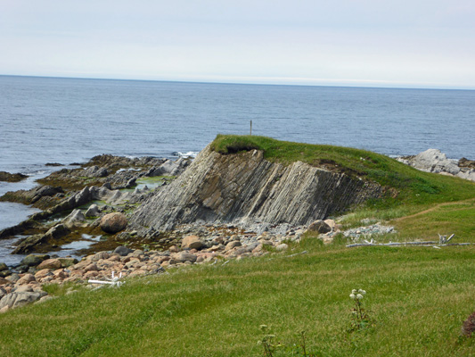
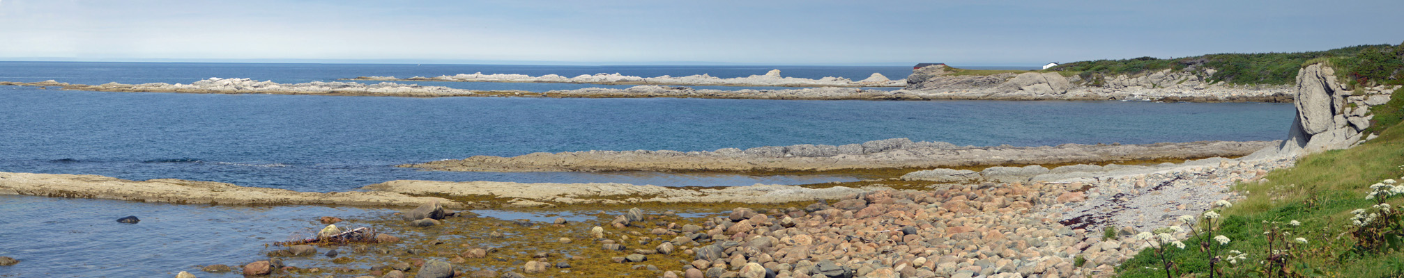
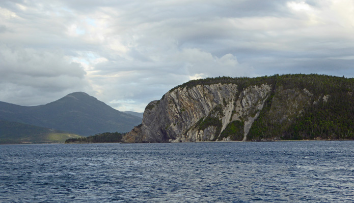
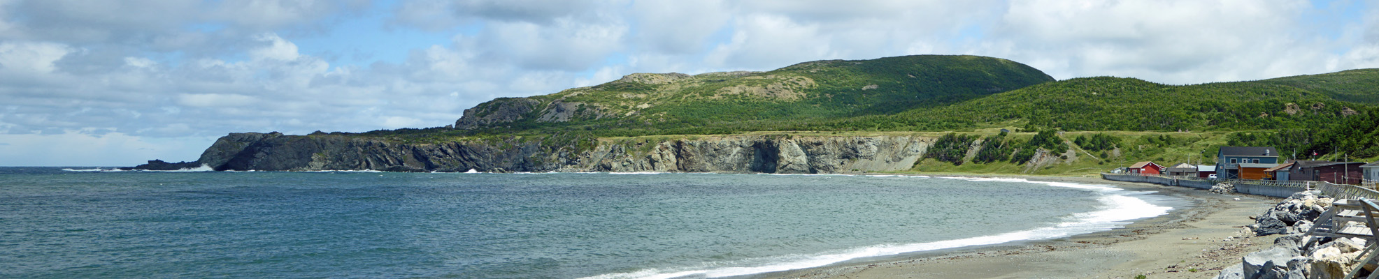
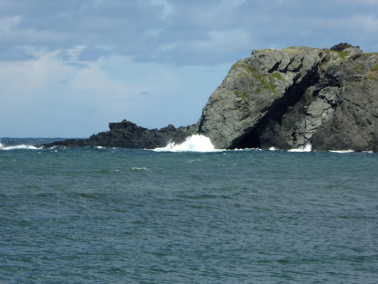
As the trail turned towards the ocean we got a nice view of Green Head.
There were a different variety of bunchberries out here in the sun. They have purple centers and are called Dwarf Cornel (Cornus suecica).
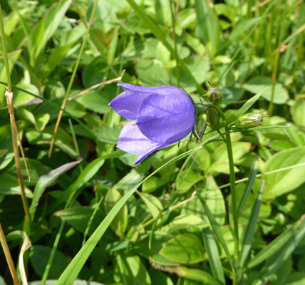
And there were lots of single harebells (Campanula rotundifolia) in the grass.
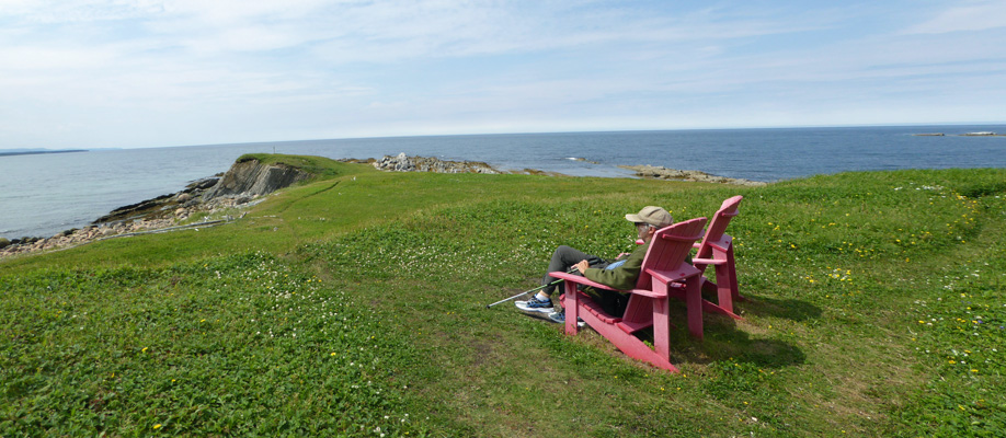
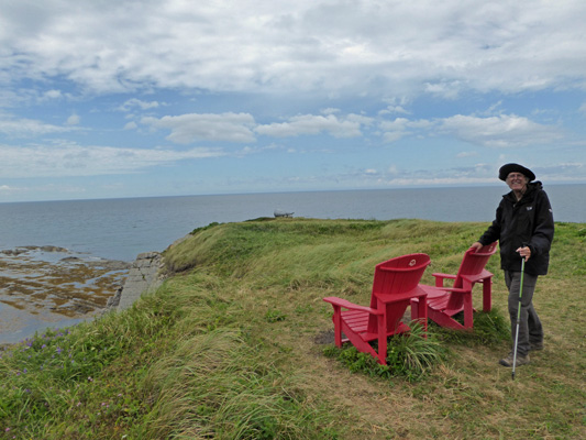
Out along the head there were two red chairs which clearly had been here a while since they were starting to turn pink.
I followed the trail northward and got a nice view of Graveyard Cove, so named because there’s a graveyard there—duh.
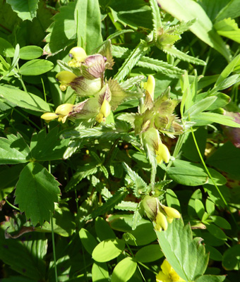
There were these weird yellow flowers in bloom along the head. They turned out to be Yellow Rattle (Rhinanthus minor).
We spied some ducklings playing out in among the rocks and just as we got ready to head back they climbed up on one of the boulders. Love that fuzzy look.
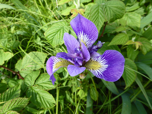
Out in the meadows there were Blue Flags (Iris versicolor).
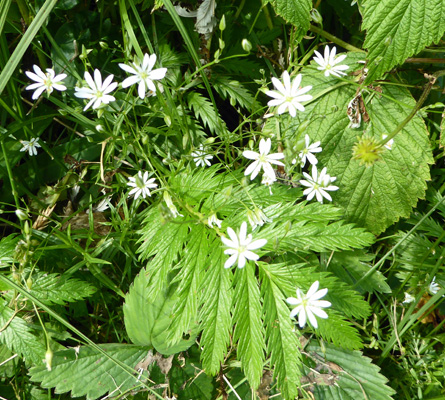
And Lesser Stitchwort (Stellaria graminea).
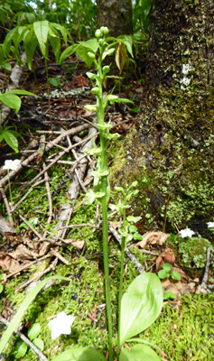
Back in the woods I spied a strange green-looking orchid. I think that it was a Roundleaf Orchid (Platnthera orbiculata) just coming into bloom.
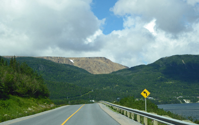
Having completed this highly satisfactory hike we drove south a ways to the nearly full parking lot at the trailhead to Western Brook Pond. This is a nearly 4-mile round trip hike that takes you out to Western Brook Pond where you can take a 2 hour boat ride up this landlocked fjord. We had decided that the hike plus boat ride was more than we wanted to tackle even though it is no doubt a wonderful experience. Instead, we just set out to hike a ways to see the bogs and get what views we could.
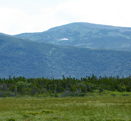
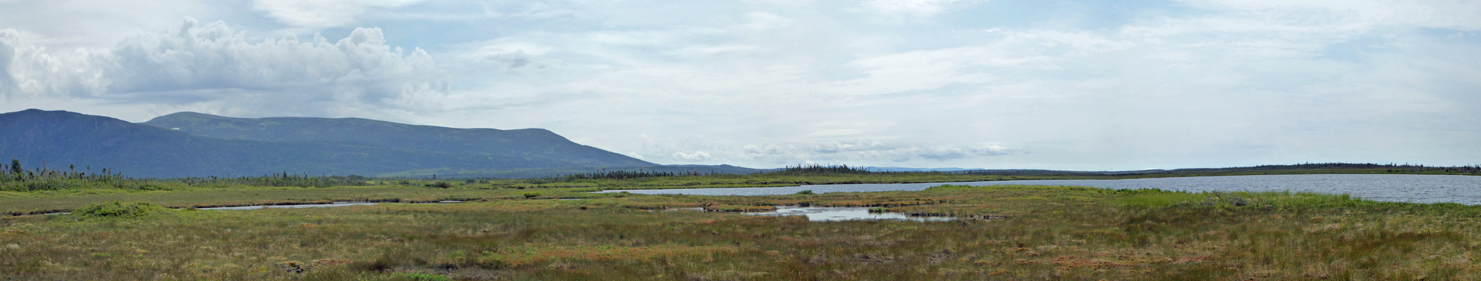
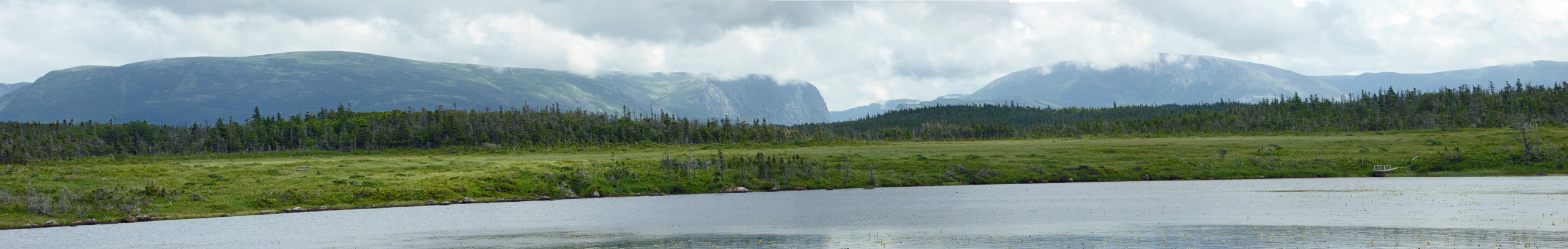
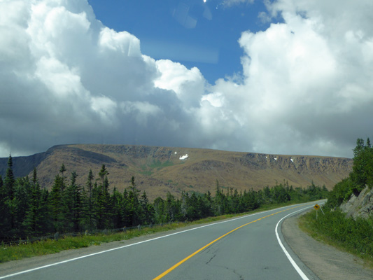
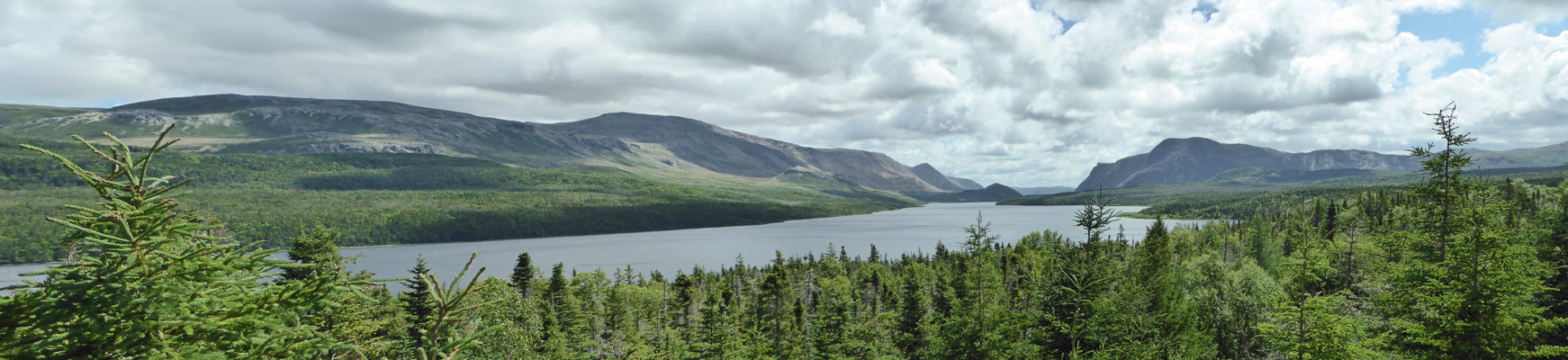
The trail starts out in the woods and then opens out into a meadow/bog. You can see out across it to the Long Range Mountains and the mouth of Western Brook Pond.
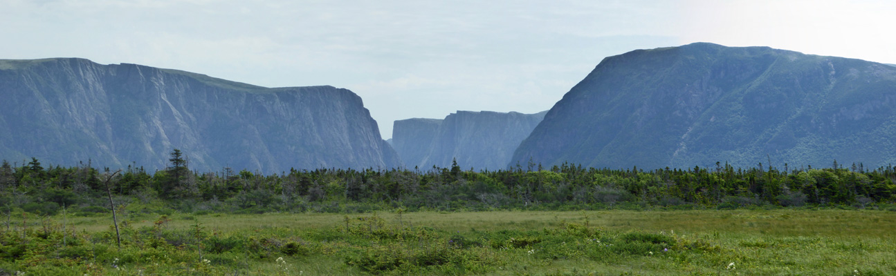
There was still snow here and there in patches on the upper reaches. The highest of these mountains are just around 2,000 feet so that snow isn’t all that high in elevation.
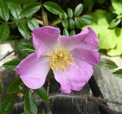
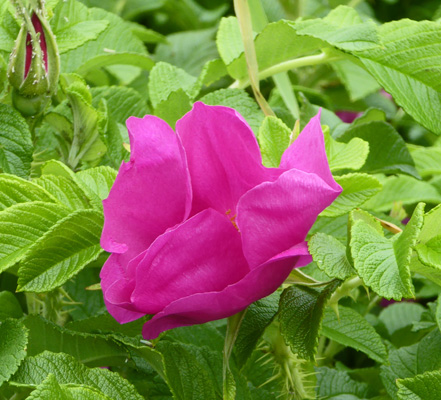
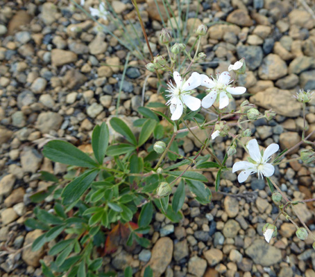
There were wild roses (Rosa virginiana) in bloom along the trail.
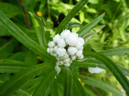
And I spied the first of the Pearly Everlasting (Anaphalis margaritacea) for the season in bloom. I don’t think there is anywhere we have visited that I haven’t found Pearly Everlasting in bloom in July.
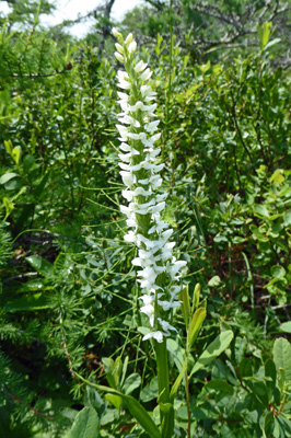
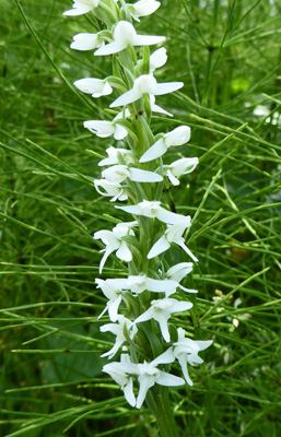
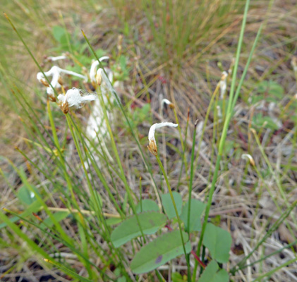
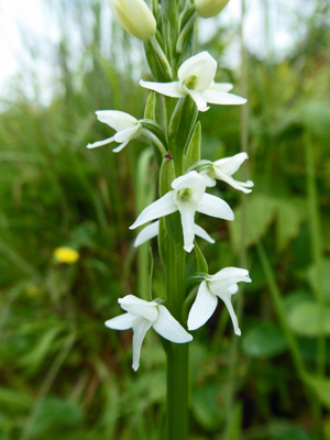
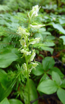
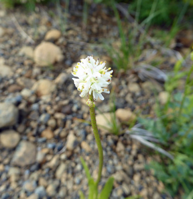
Way more exciting was to find White Bog Orchids (Platanthera dilatata) in bloom in great numbers all along the trail.
Here’s a close-up of the flowers.
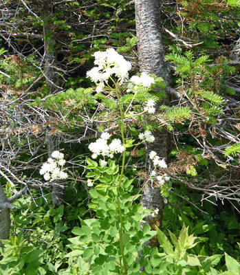
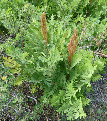
There was lots of Tall Meadow Rue (Thalictrum pubescens) in bloom too.
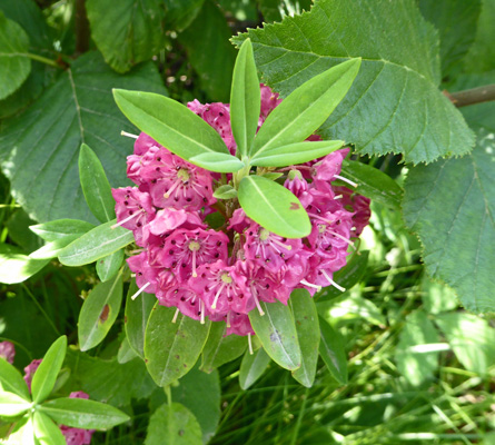
And to provide a splash of color now and then there was of course plenty of Sheep Laurel (Kalmia angustifolia) too.
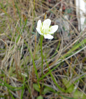
We came to a very flat open area in the bog and right along the boardwalk I spied my first Sundews (Drosera anglica). And they were in bloom too!
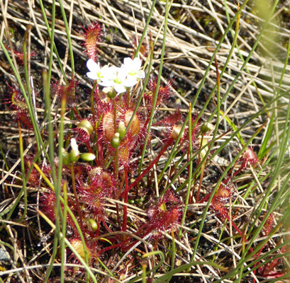
Sundews are insectivores like pitcher plants. In their case, they have little red hairs along the edges of their leaves. Each hair has a drop of sticky dew that catches bugs. The bugs are dissolved by the dew and the plant absorbs the nutrients.
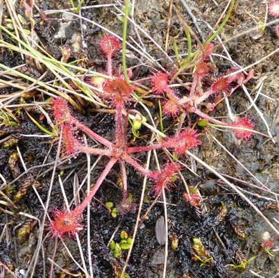
These weren’t big plants. The one above might have been 2 inches across at most. Non-plant folks would walk by me and wonder why I was so excited by these little pink plants. But I’ve waited a long time now to see some and to see so many and to have some of them in bloom was really a wonder for me.
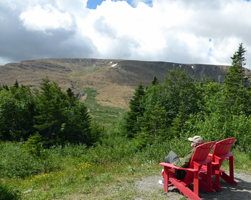
Eventually we came to a rather large pond about a mile out along the trail. It had a bench and Walter sat and enjoyed the view while I walked around the next bend to make sure I wasn’t missing anything. I wasn’t. The trail heads downhill a bit and into short scrubby trees so I turned back.
Here’s a view of the pond were we turned back.
By this point it was actually pretty warm and folks coming back from the boat tour werre flushed and sweaty and asking how much farther it was to get back. People said it had been a nice boat ride but no one had seen any wildlife. Someone asked me if we were going up to the Great Northern Peninsula and she said that the icebergs up there were much better than the boat ride—good to know since indeed we were headed that way after Gros Morne.
The cotton grass in these bogs wasn’t the lush fluffy stuff we’d seen before. Instead it all looked like droopy watercolor brushes.
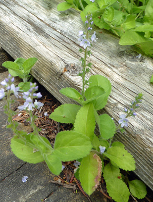
Just before we got back to the trailhead I spied some Heath Speedwell (Veronica officinalis).
It was near lunchtime at this point so we drove south to Lobster Cove Head to have lunch. This was our view looking eastward across Bonne Bay towards Rocky Harbour.
After lunch we strolled over to the Lobster Cove Head Lighthouse.
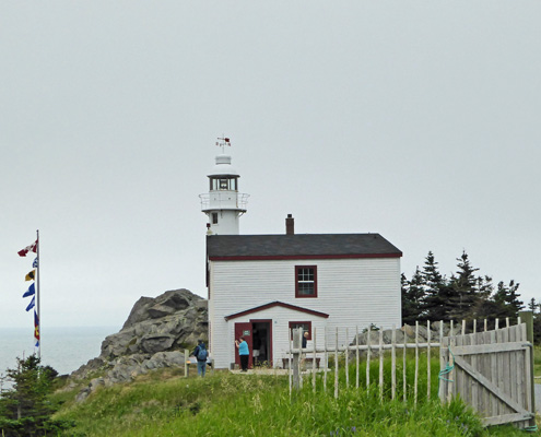
It’s not very big but it’s made of cast iron and is still run by the Coast Guard. They have a nice little interpretation center/museum there and we enjoyed talking with the rangers about lighthouses. They had a bit of a display on local music (including 2 out-of tune-guitars that Walter tried and put back down) so Walter took a seat and played his harmonica for a while.
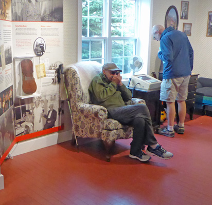
The interpretation ranger pulled out an interesting rhythm instrument to play along.

That’s a single galosh on the bottom and the round things on the sides of the stick are bottle caps nailed loosely with a little cymbal at the nailhead. The stick he’s running across the top has notches on it so it makes the whole thing rattle—including the Carnation milk can on the top.
I played along with Walter for a while—it’s a bit like rubbing your belly and patting your head at the same time—and we had a great time.
There were more wild roses along the trail back to the parking lot.
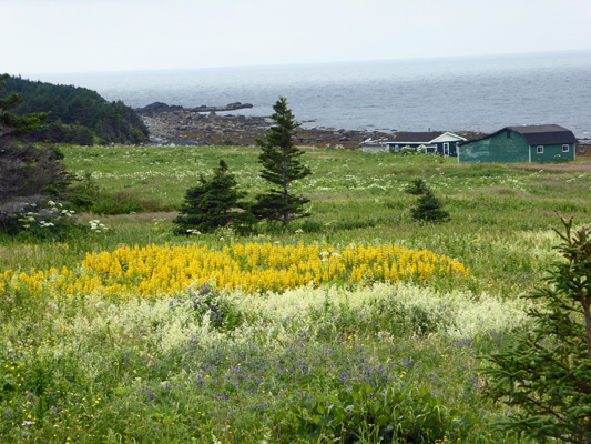
On the way back to Rocky Harbour we passed this lovely field of what appear to be yellow lupine. They’re not a native plant (they don’t show up in the books or plant lists for the park) but they surely do well here since we saw them in many of the yards in town. I know I’ve seen them out west and that they aren’t really lupine but I can’t remember their name and my west coast books are stored away in the truck...
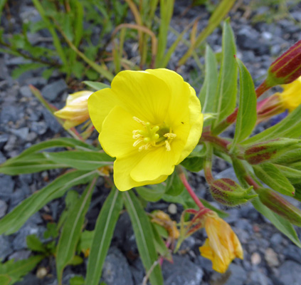
There was also Evening Primrose (Oenothera sp.) growing in the ditch across the road.
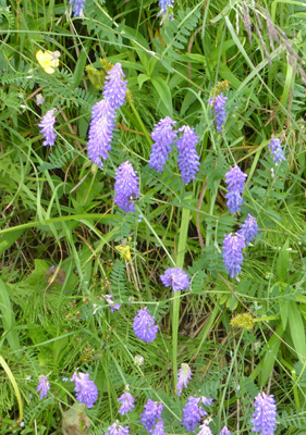
And as always Vetch (Vicia sp.) everywhere.
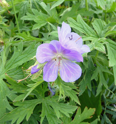
We drove through Rocky Harbour to see the sights and when we came to the end of the road there was an entire field of Meadow Cranesbill (Geranium pratense).
We went home and I spent the rest of the afternoon processing pictures and doing flower I.D.
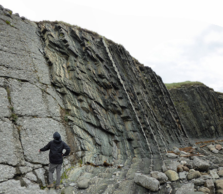
On Saturday July 22nd, we awoke to rain. But by noon it had let up and we decided we would drive north to Green Point to visit the important geological site there. Newfoundland sits on the edge of the Atlantic Plate. The rocks here have played an important role in confirming the theory of plate tectonics since so much of the geology is out in plain sight at the edges of the ocean and in the mountains scoured clean by the glaciers in the last ice age. Besides that, there are some really unusual and important things here that can’t be found just about anywhere else on earth.
At Green Point the geologic layers and fossils therein are so visible (and so complete) that it has been named the stratotype for the boundary between the Cambrian and Ordovician systems. Folks can compare the fossils in any rock for that period and correlate it to the rocks here at Green Point. It’s like the Greenwich Mean Time for the Cambrian and Ordovician systems complete with a pictorial ruler!
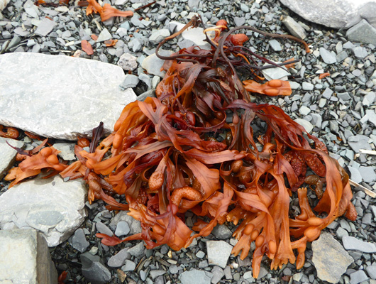
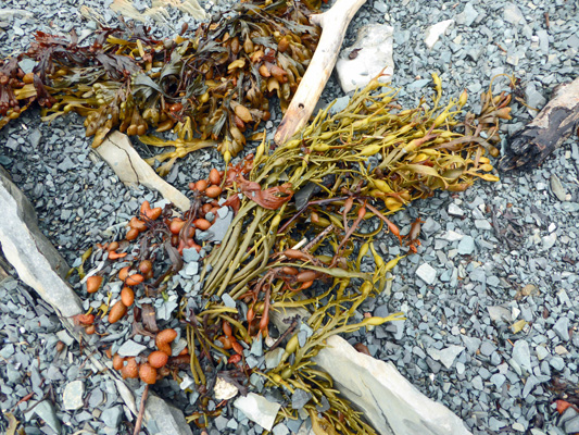
There’s a short trail out to the point and then a series of stairs that take you down onto the beach. They have orange/red seaweed here!
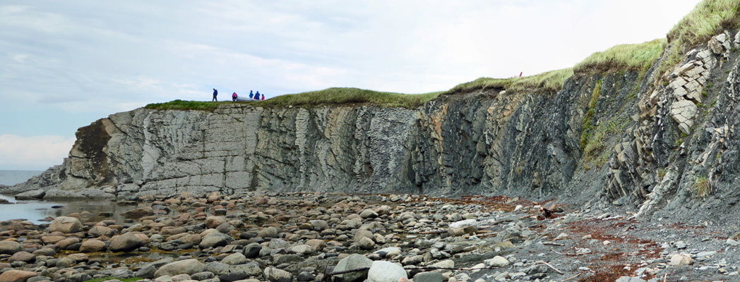
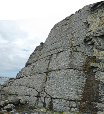
As you come around the curve of the beach you get a view of the uplifted (and folded) layers.
We picked our way through the rocks on the beach where not only was there red seaweed but yellow too.We picked our way through the rocks on the beach where not only was there red seaweed but yellow too.
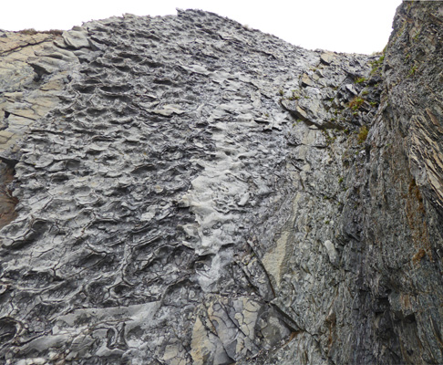
Up close some of the rock faces are pretty strange. Clearly this was a muddy pocked ocean layer.
At the end of the head the rock turns from shale to a conglomerate that looks like cement.
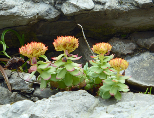
There were little Roseroot (Rhodiola rosea) growing in the ledges here.
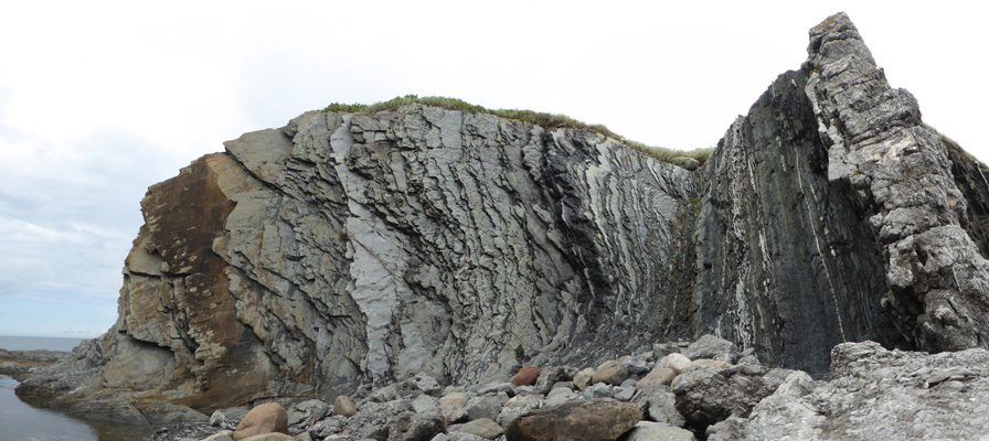
We climbed out on the point and I took this shot looking back. I love how the layers look like they turn the corner as they go up the cliff where the ocean has simply worn them away.
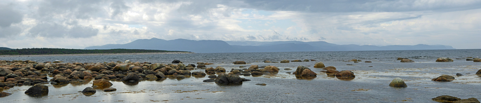
Here’s the view out to sea looking southward.
Walter talked me into scrambling up onto the rocky head and around the corner. Back behind the point, things look even more interesting.
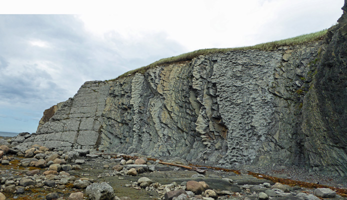
These rocks are supposed to be full of fossils but we didn’t see any. But the layers are so fantastic and the setting is so wonderful, who cares?
A father and his two teenage daughters scrambled right on up these to the grassy top but we turned back and made our way along the beach again. I turned back and took one more shot of the formation. You can almost see how the eons could be labeled precisely with these clearly marked layers exposed the way they are—it’s all done with the fossils.
I can well imagine some kid deciding to become a geologist after seeing this place.
We climbed the stairs and made our way out onto the top of the point where there was a pair of very wet red chairs—and lots of wind.
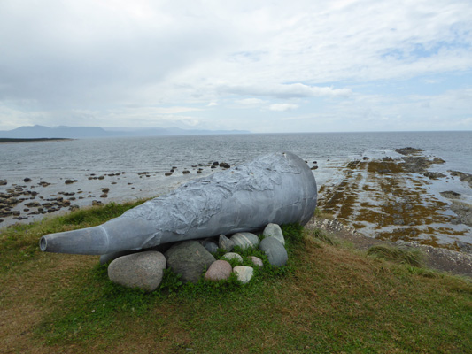
Out on the end of the point was a sculpture designed to help you listen to the land. It was a huge stone horn pointed out to sea. If you knelt down and put your ear to the hole you could hear the birds and the ocean (or your teenage sister talking in the other end in one case).
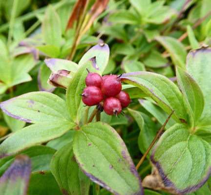
The Dwarf Cornel (Cornus suecica) out on the point had berries. They look a little different than regular bunchberries.
It was clearing out to the west and we decided that the rain was over for the day. So we drove south just a ways to the Berry Head Pond Trailhead to take a little hike. The trail is wheelchair accessible (paved) out to the pond.
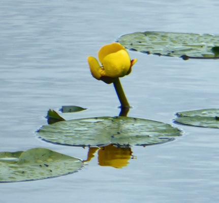
There were lots Yellow Pond Lilies (Nuphar-variegatum) in bloom.
The trail continues on boardwalk for a while and you get nice views out onto the pond. Then it turns to gravel and we saw more One-flowered Shinleaf (Moneses uniflora) in bloom.
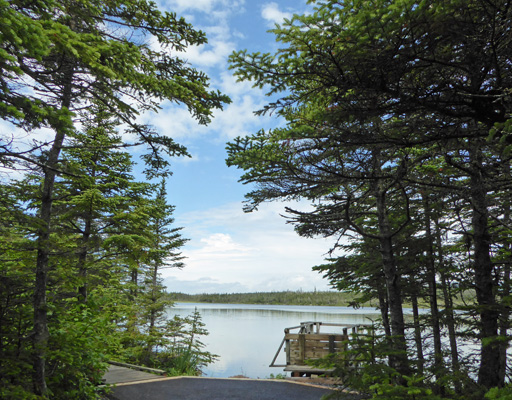
There are viewing platforms from time to time that give you a nice view of the pond and the Long Range Mountains.
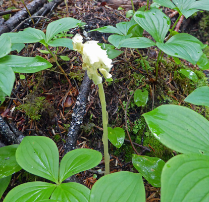
In the woods I saw one instance of Pinesap (Monotropa hypopithys). It is similar to Indian Pipe but it has multiple flowers at the top while the Indian Pipes only have one. Both are parasitic plants with no chlorophyll.
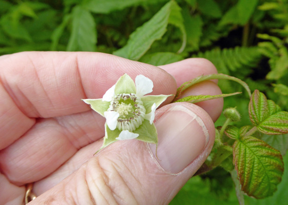
There was a large patch of Grayleaf Red Raspberry (Rubus idaeus strigosus) in bloom with a few very green berries just set.
And more White Bog Orchids (Platanthera-dilatata) along about half of the middle portion of the trail.
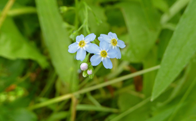
Here and there I found a few Bay Forget-me-not (Myosotis laxa).
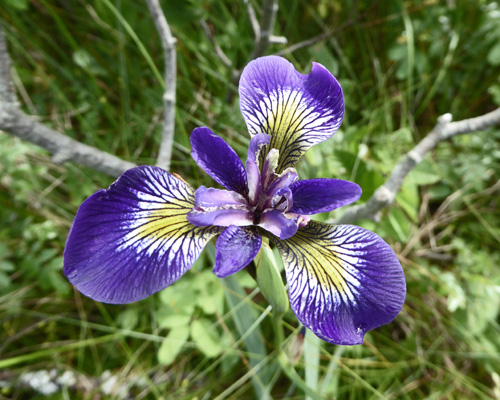
And we found a Blue Flag that was nearly purple.
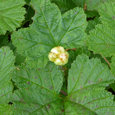
Here in Newfoundland you hear a lot of a berry called Bakeapple (Rubus chamaemorusa). Elsewhere it’s called a Cloudberry. I’d been looking for either the flowers or the berries since we got here and at last I found one—nearly ripe.
I also found another patch of Roundleaf Orchid (Platnthera orbiculata) this time a bit further along in flowering.
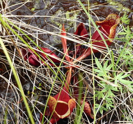
There were tons of pitcher plants (Sarracenia purpurea) in bloom on the south side of the pond.
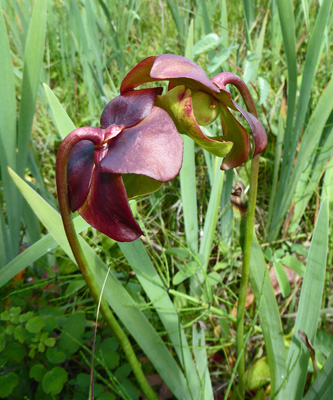
Many of them had lots of pitchers visible. Have I mentioned that the Pitcher Plant is the Provincial Flower of Newfoundland? Given how boggy it is here, it sure makes sense. They are very happy here.
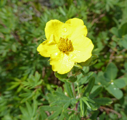
There was Shrubby Cinquefoil (Dasiphora fruticosa ssp. floribunda) in bloom here too.
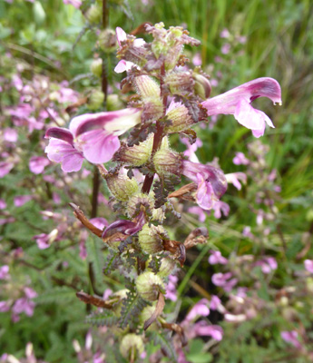
And there was a huge patch of Marsh Lousewort (Pedicularis palustris) along a boardwalk near the end of the trail.
Having finished this nice hike we headed home and I once again spent the rest of the afternoon labeling and processing photos.
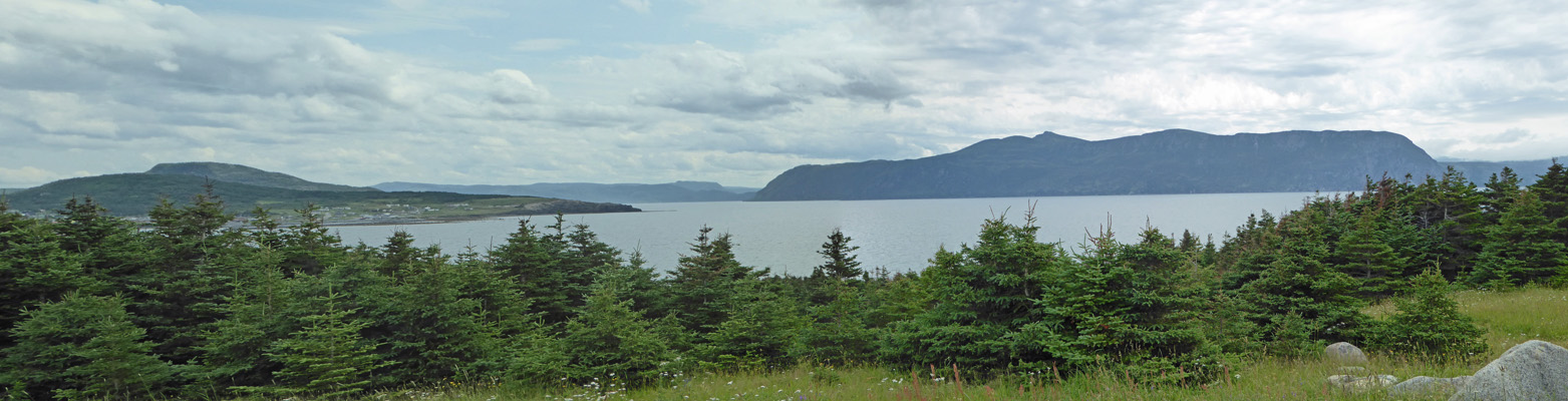
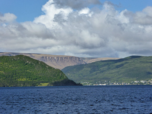
And then we drove back up the hill to the Photographers Look-off, where the view is pretty spectacular (it’s even better first thing in the morning when the sun hits the Tablelands which are in the center of this photo across Bonne Bay).
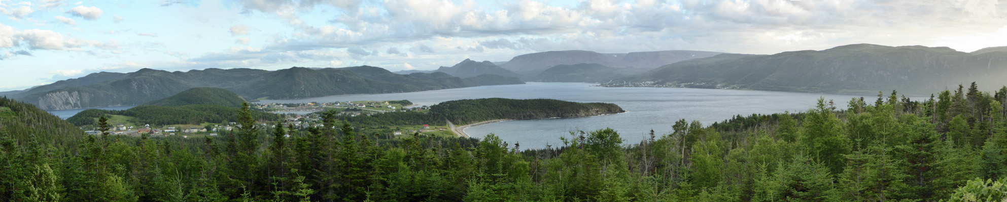
That’s Norris Point down below us and Woody Point across the bay.
There was a wonderful windjack as they’re called here called Gros Morne Whirl near the parking lot.
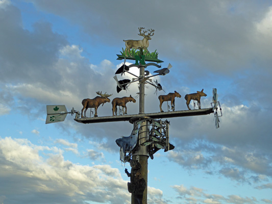
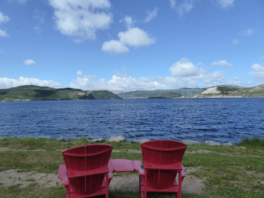
There were whales on the sides and a beaver on the pole in addition to the moose and the caribou and some giant mosquitoes. Sunday July 23rd, the weather forecast had predicted rain late morning and afternoon. So we got going earlier than usual and headed southeast towards the Tablelands. You have to drive along the East Arm of Bonne Bay to get there so we stopped at one of the primo look-offs while we were at it. This is the Gull Rock Look-off complete with red chairs.
You can see Woody Point across the way with the brown/orange of the Tablelands lit by the morning sun behind it.
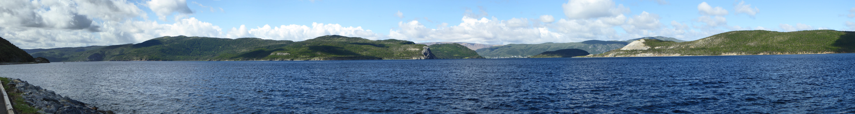
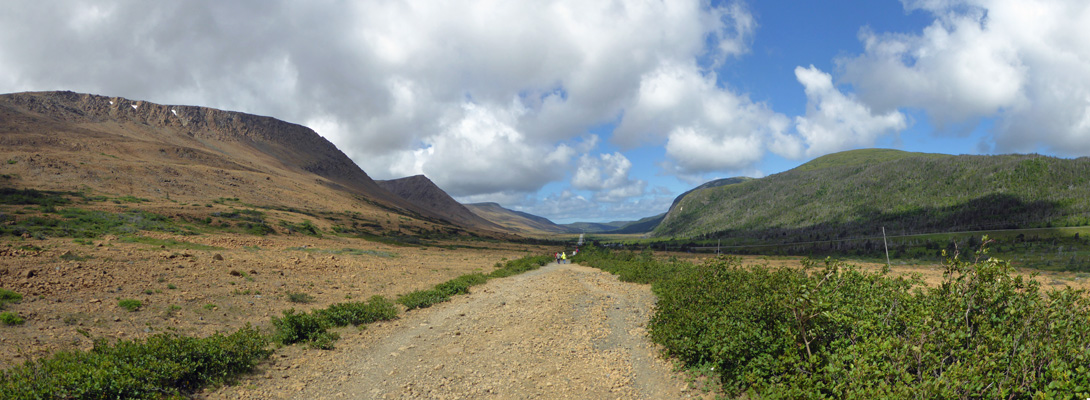
Here’s the panorama shot from the look-off.
We drove on up over the Southeast Hills and down to the South Arm of Bonne Bay where you get a closer view of the Tablelands.
The road turns just before you reach Woody Point and you come around a curve to be confronted by the Tablelands in full view—complete with little patches of snow (the highest point in the Tablelands is around 2200 feet).
We stopped at the next look-off which came complete with red chairs.
The Tablelands may look like desert because they are brown and have very little vegetation but they are actually just as wet as the rest of the mountains around here. They don’t support plant life not because they are dry but because they have too much nickel in the rocks (and thus the soil). Most plants can’t tolerate any nickel at all so there’s only a bit of growth on the lower slopes where the nickel has leached out over the last 500 million years.
Yes, you read that number right. The Tablelands were formed when tectonic plates clashed together and a bit of seafloor was pushed upwards. That sea floor has eroded away baring the earth’s mantle. This is one of the few places on earth where you can actually see and walk on the earth’s mantle which usually is located deep within the earth (as in 30,000 feet or more deep). Put together the existence of the Tablelands here and the layers of rock formed at the bottom of ancient seas and forced up and folded that you see at Green Point plus the granite in the Long Range Mountains (and a bit of volcanic rock along the coast) and you have the pieces that allowed geologists to confirm the theory of plate tectonics.
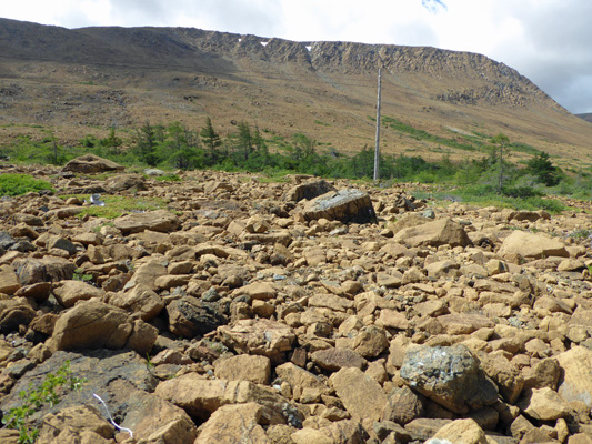
We drove on and stopped at the Tablelands Trailhead parking lot—which was full since there had been a ranger-led walk that morning. We found a place to put the truck and set out to walk with a very brisk wind behind us (and a temperature of about 55). Along the trail we found these rocks with this odd crackled snakeskin surface.
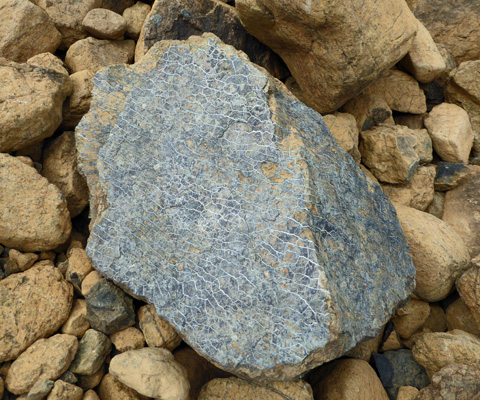
This is called Serpentinite. It’s formed when water flows through cracks in the mantle rock which is under lots of pressure (it’s super dense) to form this weird surface. The mantle rock is mainly peridotite and has lots of iron, magnesium, chrome and nickel. The iron causes the rock to weather to the orange color. When it is freshly broken open it is a dark greenish-brown.
Even though nothing much grows up on the Tablelands there were a remarkable number of plants growing along the trail including three-toothed cinquefoil (Sibbaldiopsis tridentata).
Three-leafed Solomon’s Seal (Maianthemum trifolium)
And junipers and even pitcher plants!
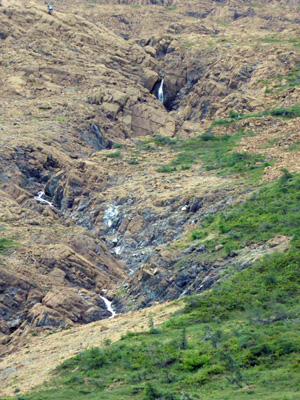
We hiked out to this odd waterfall
And from the little bridge over it’s stream, I took a photo looking up into the Tablelands
And then I turned 180 degrees and took a photo of the Lookout Hills.
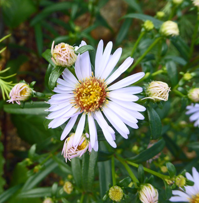
The trail continues on but we were both getting cold so we turned around here and made our way straight into the wind where we got even colder. There were New York Asters (Symphyotrichum novi belgii) blooming in the shelter of a juniper.
As I walked along I decided that the view back up the trail gave you a stark view of the difference between the Tablelands and the rest of the terrain—red/brown in the Tablelands and lush green in the rest of the park.
Pretty weird, huh?
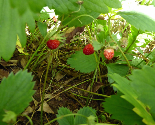
We took the Serpentine Trail back and spied some wild strawberries nestled in at the base of some shrubs.
The rocks along this trail were the real deal—the main trail is an old road—with lots of serpentinite.
There were lots of lush Royal ferns (Osmunda regalis) growing in the boggy spots.
As we were finishing up our hike a big tour bus backed up the long driveway of the parking lot! And then parked to let his passengers out to take photos. We were very glad to be parked down on the access road rather than pinned in by the big bus.
We drove on westward to Trout River, a nice little fishing village on the coast. We found a place to park along their boardwalk and I shot this photo looking north.
And this one looking south.
Newfoundlanders like to paint their fishing shacks bright colors which makes for great photos.
The surf was up with the wind from the west.
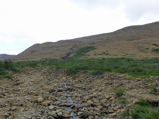
We drove on out of town and out the gravel road towards the Trout River Campground. I had read that there was a great look-off on this road. Well the view is great, but there is no look-off parking. So we just stopped along the side of the road and I took a photo of the Trout River Pond.
We stopped at the Discovery Center just outside of Woody Point to learn about the geology of the area and have a picnic lunch. There were Meadow Anemones (Anemone canadensis) in bloom near the entry of the Discovery Center.
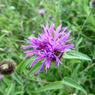
And Black Knapweed (Centaurea nigra) next to our picnic table.
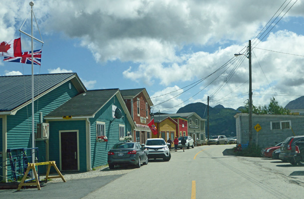
We drove on down through Woody Point and I grabbed a photo on the main drag.
Then we headed back up over the Southeast Hills and stopped to do the short hike to Southeast Brook Falls.
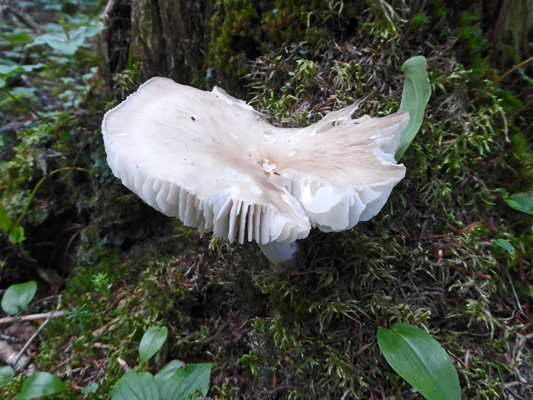
The trail takes you through the woods where I saw my first fungus in Gros Morne.
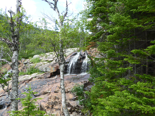
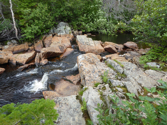
The falls drop a long way down but you can only see part of the drop from the trail. And even then, the trees are a bit of an obstruction. Here’s one section
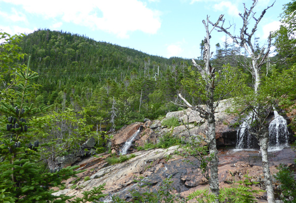
And the other section further over.
I climbed one more set of stairs to the top of the falls and looked over the edge to see how far the drop really is.
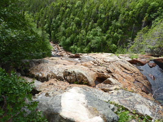
There’s a nice little cascade here at the top before the brook heads over the cliff.
Gros Morne is a great place. We had a very full 3 days and could easily have spent several more days exploring other hikes and just hanging out. But we had a reservation for the ferry in 6 days so we had to move on.