The east side of the peninsula faces onto Georgian Bay, on the east end of Lake Huron. If the Niagara Escarpment were a little higher Georgian Bay would be a separate lake (another Great Lake, it’s so big) but the escarpment dips down and only shows as the tops of all the islands (30,000 of them in the bay). The Niagara Escarpment runs from the upper peninsula of Michigan over to Ontario; all the way down the peninsula to Toronto; to Niagara Falls which plunge over the escarpment; and then along Lake Ontario in upstate NY. The Bruce Peninsula portion of the escarpment has been named a UNESCO World Biosphere Reserve—another effort to set aside an important ecosystem after it has been logged but before it is totally filled with houses. The stretch of the peninsula in the National Park is the only portion of the lakeshore that has been saved from development.
After exploring the Visitors Centre we took a stroll over to the 100 foot high observation tower.
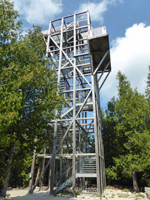
The view from the top was worth the climb.
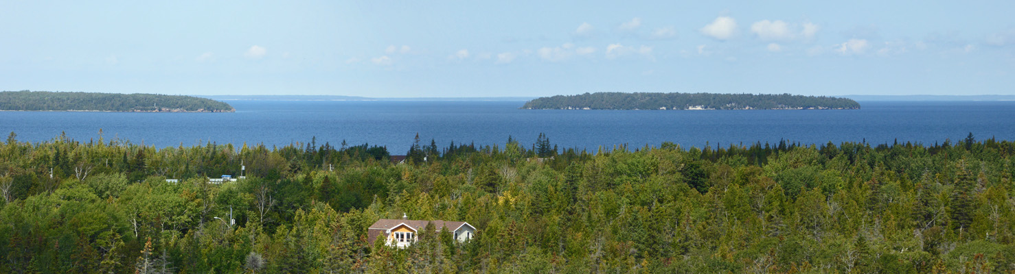
That’s the Bear’s Rump Island on the right and Flowerpot Island on the left, both part of the Fathom Five National Marine Park.
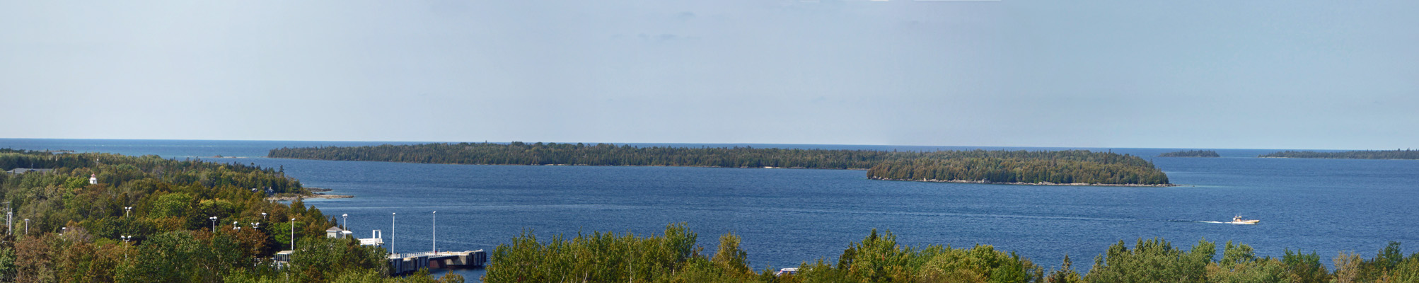
Taking panorama shots was a challenge up on the tower because you couldn’t brace yourself on the railing because the whole tower was swaying. Here’s a shot that includes Flowerpot Island over towards the town of Tobermory.
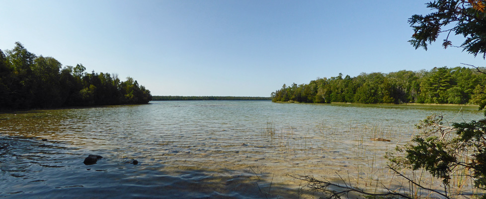
We climbed back down the tower and then took the Bruce Trail (which starts here and goes out of the park and all the way down the peninsula for 782 km southwest of Toronto) out to Dunks Bay. This was a nice stroll through the woods which ended in an observation platform overlooking the water.
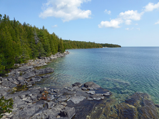
The water is incredibly clear here—partially because of the invasion of zebra muscles into the lake and partially because it’s such cold water. In any case, it’s crystal clear and has lovely colors.
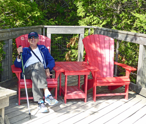
There was a pair of Red Chairs on the observation deck so I had to have a photo of Walter in one of them. This was our 8th Canadian National Park this summer. And I think we found a red chair in each of them.
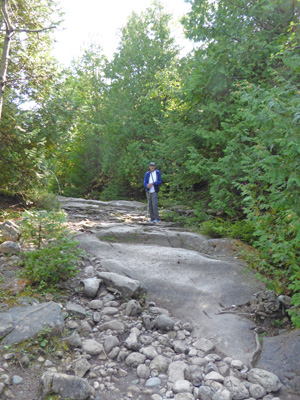
We walked the .8 km back to the truck and then drove south on Hwy 6 about 20 km to Emmett Lake Road, a gravel/dirt road that takes you out to the trailhead for Halfway Log Dump, a side trail of the Bruce Trail. The name of this place may not be too lovely but it is descriptive. Back at the height of the logging days this was where they stored logs over the winter because it was halfway between Cabot Head and Tobermory. We had our picnic lunch sitting out in the sun at about 66 degrees—just lovely. And then hiked the gentle trail out to the Bruce Trail (about 1 km) and the DOWN a rocky slope to the beach.
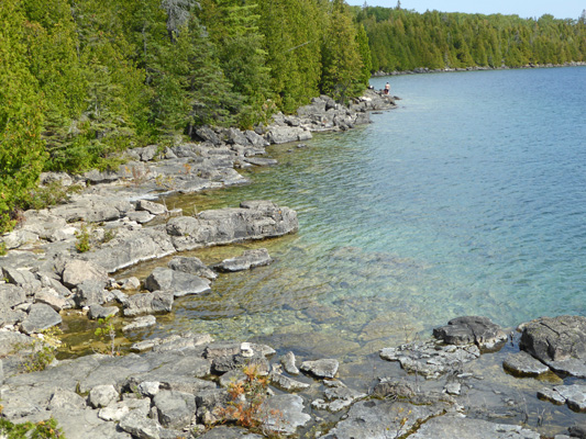
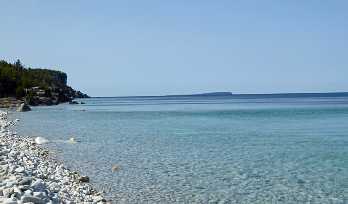
The beach was covered entirely in white cobbles—as is the lake bottom here. Looking northward there are bits of the escarpment visible and folks like to go bouldering in the debris field.
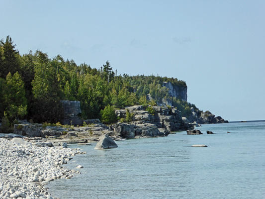
With the white rocks the water was a gorgeous aqua color and then would have greenish riffles on the surface. Farther out it’s darker blue as it gets deeper. To the south you could see all the way to Cabot Head some 15 km away.
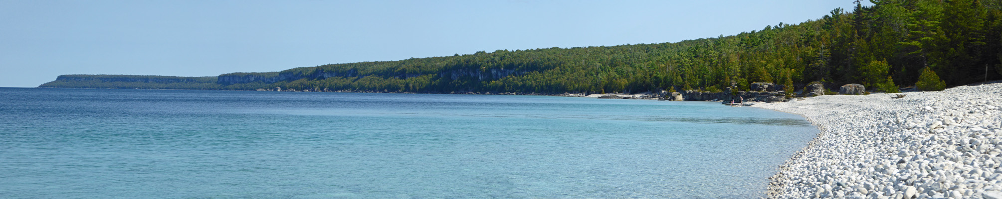
I took a lot of photos trying to capture the water colors. Here’s my best try with Bear’s Rump island off in the distance.
We clamored our way back up the beach, which was far easier then coming down had been, and made our way back up the trail. It’s a fairly easy trail except for the last rocky bit near the shore.
This was a lovely day. We had blue skies with just a few clouds now and then. The temperatures were in the high 60’s and the trailer warmed up nicely in the afternoon so we had the windows open. It sure has been nice to have some decent weather after a few cold grey rainy days.
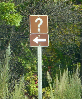
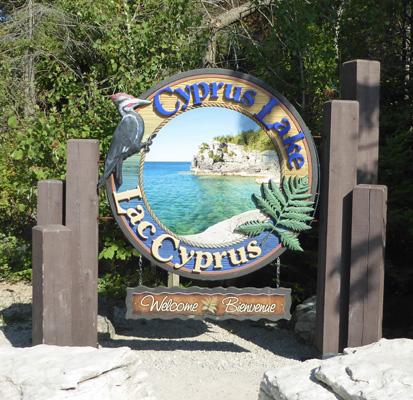
On Tuesday September 12th, we drove south just a ways (not as far as Emmett Lake Road) and turned east on the Lake Cyprus Road for the hike to The Grotto. This is the Bruce Peninsula’s most popular place and in the summer and on the weekends in the fall and spring you have to get a parking pass that gives you a 4 hour window when you can park there. When we arrived a little after 11 the first lot was full but the second lot was only about 1/2 full and the third biggest lot was empty. So it definitely pays to visit after Labor Day and during the week. By the time we returned from our walk the third lot was pretty full too.
There was a big shade structure at the beginning of the trail and the fanciest trailhead sign I’ve ever seen.
We took the Georgian Bay Trail out through the woods. It passes Cyprus Lake along the way.
And in about 1 km you come to Indian Head and a view of Indian Head Cove—if you can scramble out on the rocks and don’t get too giddy from the height.
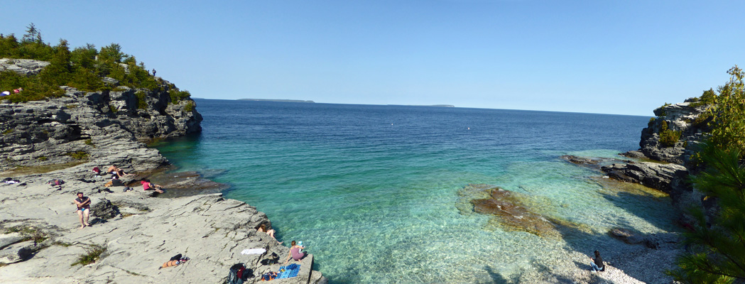
The trail winds northward and you come out on the shelf of rocks over on the left in this photo and get a full view of the cove.
There were people everywhere though very few stayed in the water more than a moment. It was in the low 70’s and the water is COLD so mostly people waded in and back out real quick. There were folks sitting everywhere on the rocks. Here’s a panorama shot of the cove and the islands off in the distance.
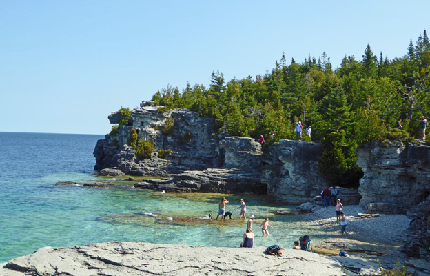
There were people all over the rocks—I managed to only get some of them in this photo. But from this height you can really see the color of the water. Yum. The trail description (and map) said you could continue north and while we looked for the trail we never found it. So we were content to turn back and retrace our steps. I cannot imagine what this place is like in the summer. Clearly it’s being loved to death—though there was no trash anywhere since they don’t provide trash bins and there are rangers who patrol to pick up after everyone.
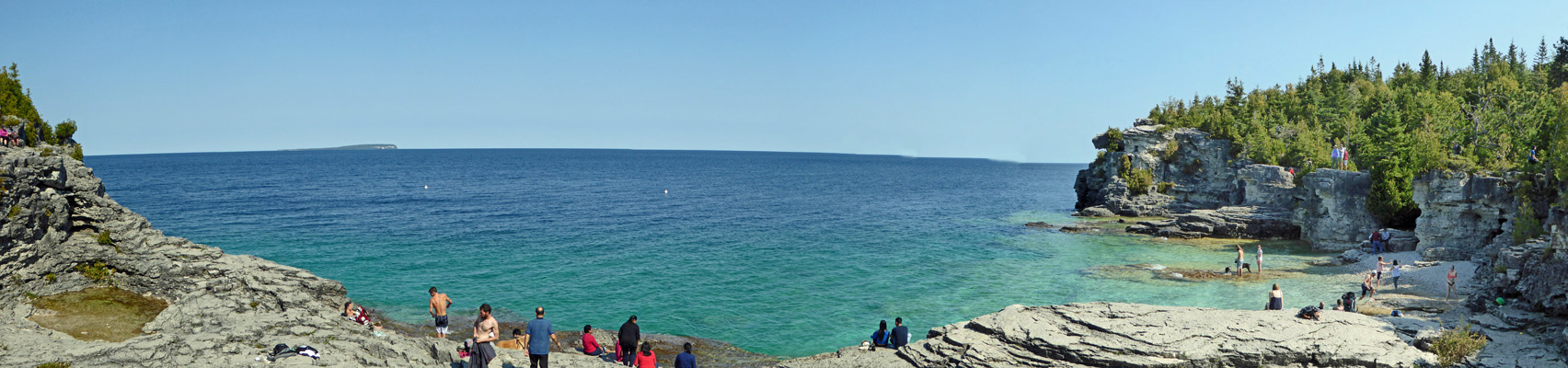
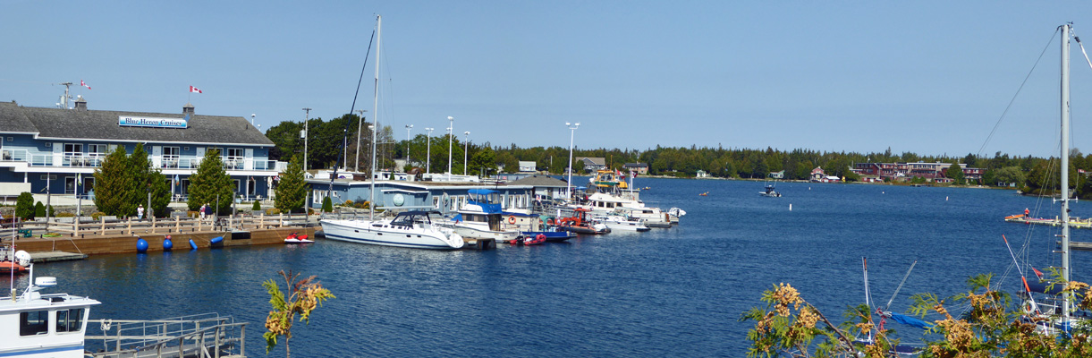
Folks on the trail back assured us that the cove was the grotto that we’d hiked out to see and so we were happy even if I thought there might have been something more out there. From here we drove north to the town of Tobermory in search of gas. There is no gas station in the town itself we discovered. There is however a ferry dock for the ferry north through the islands and lots of tour boats and a nice marina.
Just south of town we found a small gas station (up for sale if you want to move to Tobermory) where we got gas.
That afternoon we sketched out a plan for the next week or so and did some research on places to camp in Michigan north of Detroit—lots of nice state parks on the western shores of Lake Huron.
On Wednesday September 13th, we broke camp and headed south along Highway 6 until we hit Red Bay Rd where we turned west until we hit Hwy 21 which took us down the west coast of the Bruce Peninsula. This is a nice drive through beach towns and farm country—lots of corn and bean fields. After about 3 hours we made our way to Auburn Riverside Retreat, a nice RV Park just outside of Goderich, Ontario. We got a back-in water and electric site near the river for $49.72 a night (tax included) for 2 nights. Have I mentioned that camping in Ontario isn’t cheap? Walter managed to get an appointment to have his teeth cleaned with a dental hygienist on the west side of Toronto on Saturday afternoon (they’re open Tuesday through Saturday) so we opted to only stay 2 nights here and move on to the Toronto area on Friday and thus not have to rush on Saturday.
It made it up to 78 and was a bit sticky but not too bad. There were big thunderheads but we only got a sprinkle or two during our drive and not a drop once we were set up. Our phone worked fine here (as it had up in Tobermory area) but the free WiFi only worked near the office (where it was just fine). After dinner we drove over and sat in the truck to check email etc. There was no over-the-air TV at all.
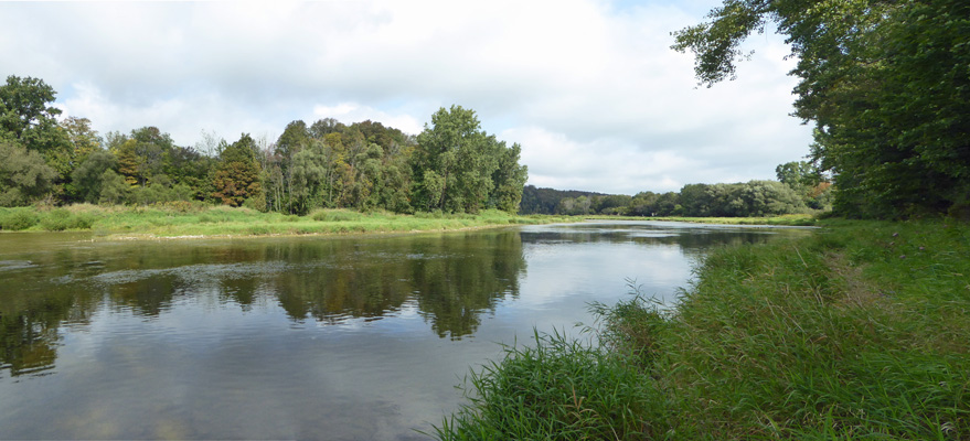
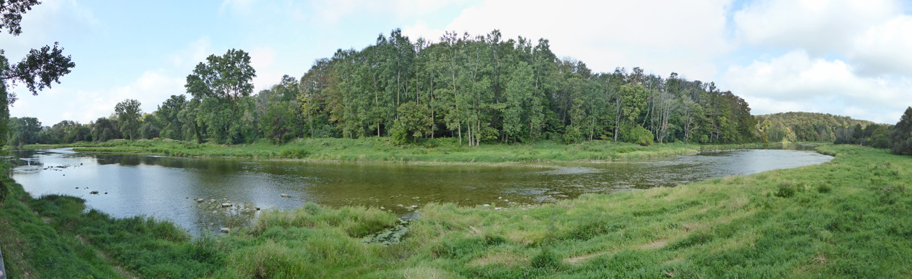
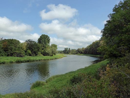
There were large numbers of Canada geese out on the river and at dusk they made a real racket as they headed off to wherever it is they spend the night—up river apparently. Then again in the early morning hours they honked there way back. It didn’t cool off that much over night and was in the low 70’s when we set out to explore the trails in the park. Over half of this park is seasonal—folks rent a spot for the whole summer and come out for the weekends mostly. We were the only folks in the non-seasonal spots on Thursday so we had the place to ourselves. We strolled the woods behind our rig and found a trail out to the Maitland River. Here’s the view looking up river (north).
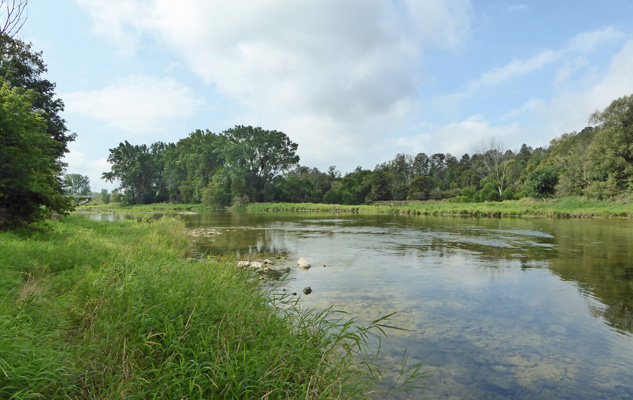
And looking down river (south).
Floating the river in inner tubes is popular here. There were folks who came out just north of our campsite the day before carrying red inflatable donuts.
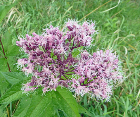
We walked up the river, took the stairs up the bank and then strolled past a bunch of seasonal trailers with decks and screen tents and flowers. And then out to the Viewing Dock. Along the way we saw lots of Joe-Pye Weed (Eupatorium maculatum).
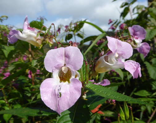
And near the Viewing Dock there was this purple stuff which looks like a relative of Spotted Touch-me-not or Jewelweed. I’m pretty sure it’s Policeman’s Hat (Impatiens gladulifera), an introduced species that’s considered invasive in some parts of the country.
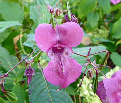
It also came in lavender.
The view was lovely too.
We followed the trail back across the campground and northward past the Elk Viewing paddock. There are supposed to be elk but we didn’t see any. There’s lots of trees and brush in the enclosure and it was warm and humid—a perfect time for a nap if you were an elk.
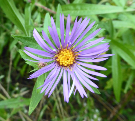
There were New York Asters (Symphyotrichum novi-belgii) in bloom along the way here and there.
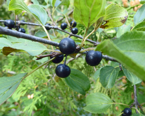
There were also apples on the ground from trees that are either left over from when this was a farm or have naturalized. Along the lakeshore there were lots of shrubs with black berries. I think that this is Aronia. They were just starting to fall on the ground.
The main trail ends when the river takes a bend off to the west.
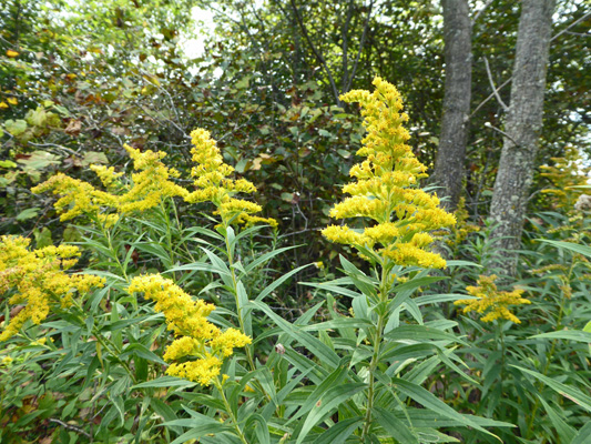
There were kid trail off into the dense woods but we opted to stay on the main trail that winds back into the campground. There were huge swathes of goldenrod in bloom still.
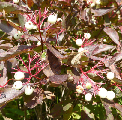
And shrubs with white berries and maroon leaves—though down in the protected shade the leaves were still green. I’m pretty sure this is red osier dogwood (Cornus stolonifera).
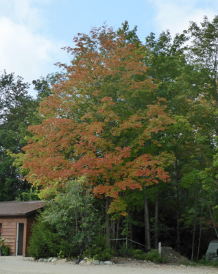
Back in the main portion of the campground (near the pool which looked closed up for the season) there were several trees that had started to turn orange.
We stopped and inspected the showers (the water was hot) and then made our way back to the trailer. With the mix of sun and clouds it didn’t get too hot but it was well into the upper 70’s by afternoon.
On Friday September 15th, we drove southwest across farm country for many miles until we hit Hwy 401, the main freeway across Ontario. Along the way we passed signs for the International Plowing Match in Walton. This turns out to be a BIG DEAL that happens September 19-23rd with big agricultural displays etc. The fields were already marked out for the Plowing Match. Who would guess?
We went east on Hwy 401 to the town of Milton and the Toronto West KOA. Even though you get to drive through some nice country lanes to get to this place it turns out to be RIGHT next to busy Hwy 401. All the other places on this side of Toronto were also next to the freeway (or were full for the weekend) so we’d made a reservation here for Friday through Sunday and gotten the last spot when we’d called on Thursday!
We’d racked up enough nights staying at KOAs in Canada that we got one night free here! Yahoo. In any case our pull through water and electric site (we’d reserved a back in but they gave us the pull through on the end next to some seasonal folks) was $42.72 a night (taxes included) with our KOA discount card. KOA is not our favorite but sometimes they’re the only choice that makes sense. This one had tons of cabins and quite a few tenting spots in addition to the RV spots. It was in the low 80’s by the time we got set up so we opened the windows and spent the next 3 days listening to the roar of the freeway. How anyone could think that they were having a get-away from the city while they camped next to the freeway is beyond me, but there sure were lots of families who filled the place up for Friday and Saturday night.
Our phone worked great, the WiFi here never got bogged down even with all the folks who filled the park and Walter found not only a bunch of Canadian TV but also got the Buffalo station so he had both College and NFL football to watch over the weekend!
I did the laundry that afternoon and the on Saturday we drove about 30 miles north to the town of Brampton for Walter’s dentist appointment. Main Street in downtown Brampton (population 600,000) was closed for a street fair and the traffic was amazing. We’d left we plenty of time and that was a good thing because the drive took us a lot longer than we’d expected. The appointment was successful (only $130 Canadian to have his teeth cleaned) and then we drove west to the nearest Sobey’s to do grocery shopping.
That evening we planned out our route for the next two weeks taking us up the western coast of Lake Huron in Michigan and then down to Jackson Center, Ohio and the Airstream Factory Service on October 1st for our repair appointment.
On Sunday we set out to do a hike along the Bruce Trail to see one of the 100 waterfalls in the Hamilton, ON area. It was in the mid-70’s and humid when we left at about 11 am. The drive south was pretty—more farm country with interesting high density housing distributed here and there. We we arrived in Waterdown the parking area for the hike was full. There was no street parking and no sidewalks so parking in town and walking back wasn’t particularly safe. We didn’t have info on how to get to any of the other waterfalls and it was now in the low 80’s so we bagged it and went shopping instead. First we went to Canadian Tire which to get the desiccant packets for our closets that we’d found while we were in Nova Scotia and had really liked. These are really big stores (on the scale of a Super Walmart) so we decided we’d get a walk by exploring the place. I had no idea how many aisles of the sporting goods section that hockey could take up! In the process we decided we needed to make a trip to Walmart since Canadian Tire didn’t have the headphone extension cord we needed. So then we did a hike through that Super Walmart. It wasn’t as scenic or as pleasurable as doing a waterfall hike but it was air conditioned!
Watching aftermath of Hurricane Irma we’ve decided that this is really not the year to explore the Everglades, Biscayne Bay and the Keys. We’re both pretty worn out from our six months of touring and so we’ve decided to head west for the winter and start looking for a place to call our winter home. After nearly 3 1/2 years of wandering we are actually thinking that it is time to settle down. At the moment we’re leaning towards getting two small places—one north and one south. So our goal for the winter is to spend a month at a time in a number of places so we can try them out and hopefully get clear on that.