
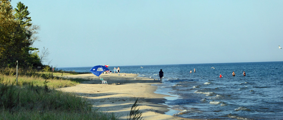
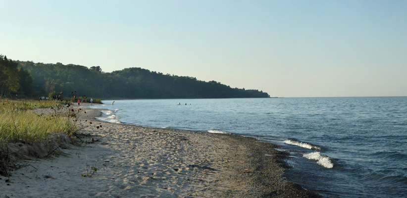
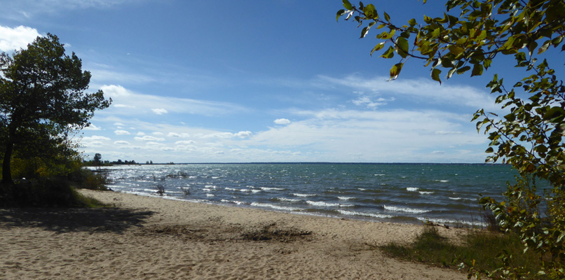
Late in the afternoon as it began to cool off we strolled down to the beach to have a look. There were still people out in the water.
Looking southward the sun was nearly gone which made for nifty lighting
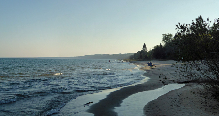
We stopped and talked to the folks in the beach chairs –they want to visit all the National Parks when they retire—and then wandered on home.
Monday September 25th, we broke camp and drove north on Hwy 23 to Hoeft State Park about 50 miles south of the northern tip of Michigan’s lower peninsula. The park was nearly empty and they had posted a list of all the available spots—pages of them--(rather than just a list of the few reservations) so we drove around and picked 3 possible spots and drove back and used the “yellow phone” that lets you register with a live person. Of course our first choice was one of the few spots anyone had a reservation for. Duh. So we went with our second choice, a odd little pull through spot at the end of one of the side roads. We got this spot for $23 a night—such a deal for a pull through with electricity. Walter’s phone had 1X again but the hot spot worked with the booster and only got slow now and then. And he found a few decent TV stations over the air.
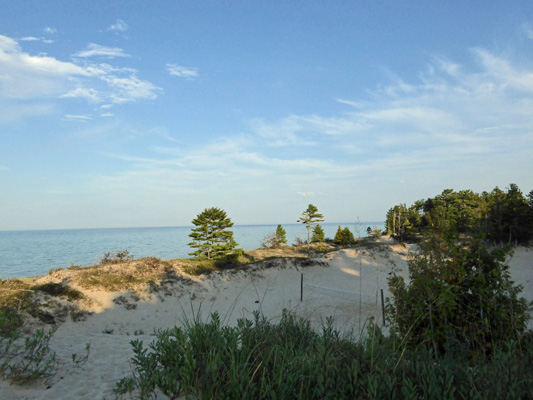
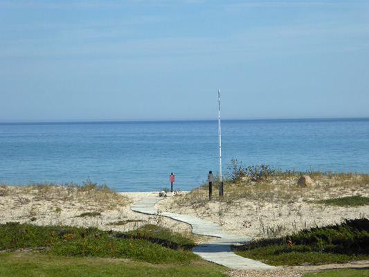
It was hot again with highs in the upper 80’s and with enough humidity to make things feel sticky. Late in the afternoon we wandered down through the campground and out towards the beach. There was a pretty decent-sized set of dunes here with a wooden pathway snaking across them. This view was taken from near the beach back towards the campground.
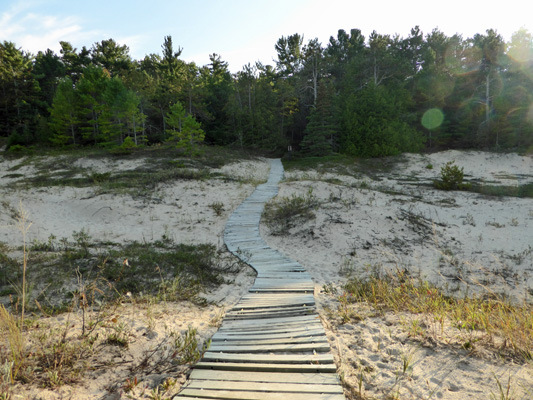
And here’s the rest of the boardwalk out to the beach.
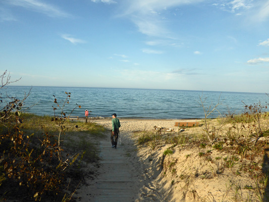
There was a group of kids out in the water to the north (private property).
And I tested the water. It wasn’t as warm as the other day at Sleeper State Beach. We sat on a nice bench and watched the water. The surf here was really strange. It came at very set intervals and always broke in the exact same spot so it was piling up a band of gravel with each wave.
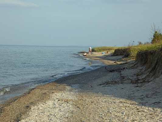
There was a family out on the beach just to the south of us.
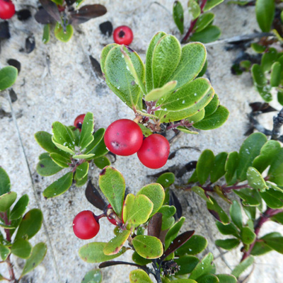
They left and we wandered down that way and then up over the dunes where there was tons of Kinnikinnick (Arctostaphylos uva-ursi) growing all over the dunes.
From the top of the dunes you get a nice view of the sand volleyball pits that are nestled down in the swales.
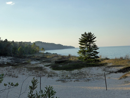
And a generally nice view to the south with the other volleyball pit. I love these pines growing so near the shore.
Tuesday September 26th, we awakened to yet anther warm day. We’d now had a full week of days near to or over 80, many of them breaking local temperature records. But the TV weatherman promised that this would be the last one. In the morning while it was still only in the mid-70’s we walked the length of the campground to pick up the park’s trail system. We followed the signs (the same complicated system we’d had at Sleeper State Park) to explore both the Pavilion and Beach Trails.
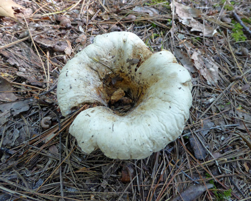
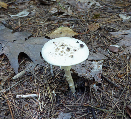
Along the way we saw these wonderful concave mushrooms.
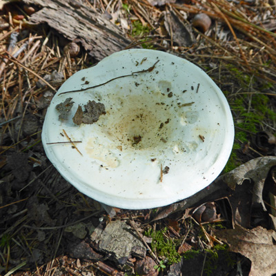
As they age they get more concave and curly.
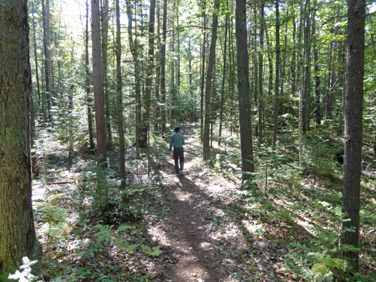
The western portion of the trail was all trees and mostly flat though it did go through some low rolling dunes.
There was more interesting fungus along the way.
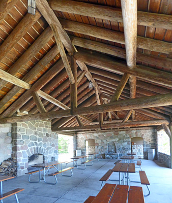
The trail loops back to the Pavilion—a CCC project completed in 1938.
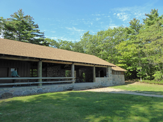
The stonework and wood beams are classic CCC.
You can rent the place for events. It has a nice view and access to the water.
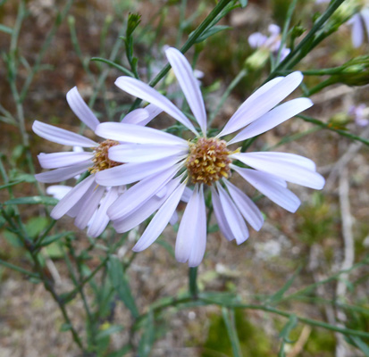
There were very few flowers—it’s pretty late I guess. But I did see a few New York Asters (Symphyotrichum novi-belgii) growing along the trail through the dunes on the way back.
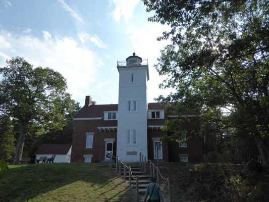
We were out for about an hour and a half and it was a nice, not very challenging walk. We hung out for a while and had lunch and then drove north 2 miles to the 40 Mile Point Lighthouse. This lighthouse was built in 1898 (the same period as Heceta Head Light in Oregon where we volunteered back in 2015). The Lighthouse Society runs the place and has acquired the pilot house of the 1912 Calcite, a self-unloading ore ship that carried limestone (calcite) throughout the Great Lakes area. It was scrapped in 1961 and the Pilot House sat in Rogers City to the south for many years before being moved here.
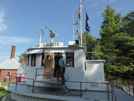
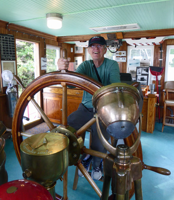
It’s still fully equipped inside and had a very nice docent who was there to answer our questions. Walter took the wheel and we headed out in our imaginations over Lake Huron.
The docents, called Guest Keepers, are like camp hosts. They get free camping spots just south of the lighthouse and in return man the boat, the gift shop, the keepers quarters and the lighthouse. There were at least 4 folks on duty when we were there but there’s hook ups for 4 rigs so I suspect they have 8 keepers in the summer while now at the end of the season there were only 3 rigs in the host area.
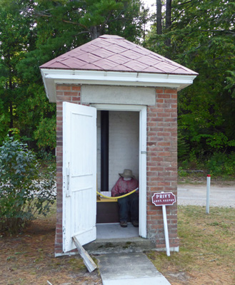
They still have most of the outbuildings including the Assistant Keeper’s Privy.
The gift shop is in the barracks that they built for the workers to live in as they built the lighthouse. It became a barn and then was restored to become the gift shop. The keeper’s duplex is literally built right up against the lighthouse so the keepers didn’t have to go outside to tend the light!
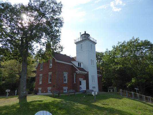
Given the amount of snow and wind and weather they get here that was a really good idea. They’ve restored the inside of one side of the duplex and furnished it very nicely both upstairs and down.
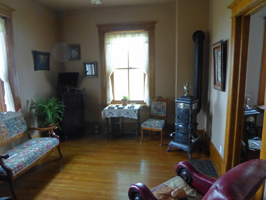
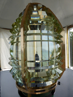
Even though they’re open until 4 they were already talking about starting to close when we arrived at 3:20 so we made a quick tour of the house and then went up the iron spiral staircase to explore the light. The keeper’s work area was on the level right below the light so he didn’t have to climb all that many stairs to top up the kerosene and trim the wicks. This lighthouse is powered by a 4th order Fresnel lens that was very pretty. It dates back into the 1850’s and since this lighthouse wasn’t built until 1898 clearly it came from another lighthouse.
The view southward from the top was pretty nice.
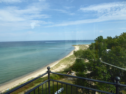
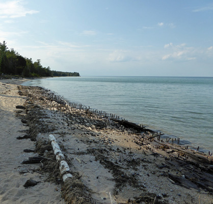
The last set of stairs to the top were really narrow and you had to go down them backwards like a ladder so this lighthouse isn’t for the faint of heart or the wobbly of foot. Just to the north along the beach are the remains of the wreck of the Fay. On Oct. 19, 1905, the SS Joseph S. Fay was heading south towing the schooner barge DP Rhodes. A storm came up. The Rhodes was blown free and survived but the Fay broke up on a sandbar. All but one of her crew survived. About 130 feet of the starboard side of the Fay still remains on the beach held steady by her spikes and rods.
On the way back up from the beach I got a different view of the lighthouse.
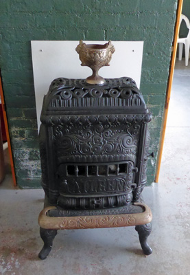
The fog horn building still stands too. It’s set up as a museum and has this great wood stove. I’ve never seen stoves with built in chalices until the ones in the keepers house and here.
It was still hot so we thought we might as well enjoy the truck’s air conditioning for a while longer so we drove south to Rogers City and out to the Calcite Harbor where you can get a view of the huge Calcite processing plant next to the big limestone (calcite) quarry there.
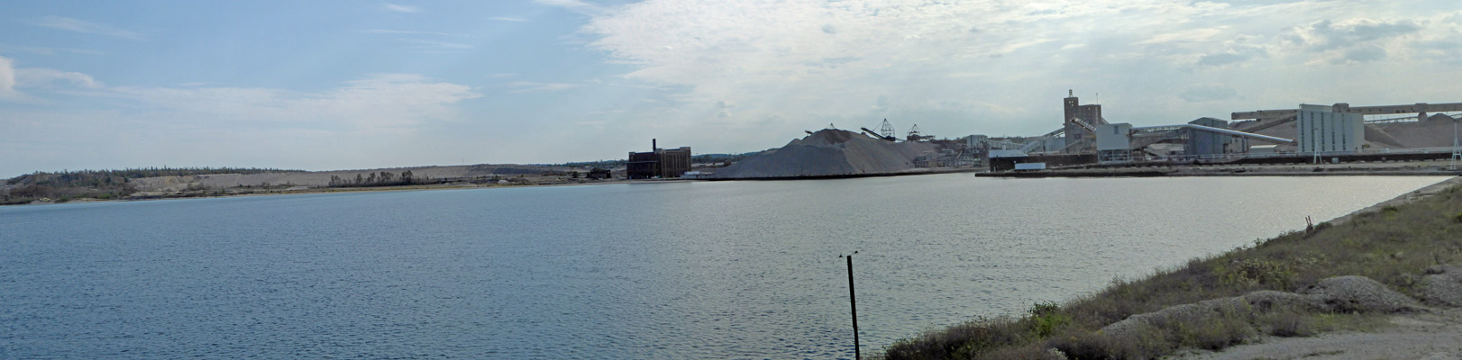
They use calcite in making steel so US Steel bought this entire operation (including 6 self-loading ships) in 1920. Rogers City was the home port for these ships for years but they are now based in Duluth, MN.
One of the advantages of wandering around the way we have been here in Michigan is that we learn all sorts of interesting things about nature, farming and industry that we otherwise would never learn.
The weather finally shifted in the night on Tuesday night when the wind came up and we had a few showers. It was in the low 60’s (instead of the mid 70’s) when we went to break camp the next morning and discovered we had a flat tire on the trailer. Oh joy! This is our third flat on the trailer (all due to nails and screws we’ve picked up along the way) and we’re now pretty good at going through the procedure to change a tire. It’s not a lot of fun but we got it done without much of a problem—just a bit of dirt and grease on our clothes which can be remedied.
We drove south on Hwy 23 and then turned onto Hwy 65 which took us due south rather than following the coastline. This took us through some lovely National Forest areas full of pines and lakes. Then at Hwy 55 we turned east towards the coast and the town of Tawas City to Tawas Point State Park. Their office was open and they helped us select a nice spot that gave us a peekaboo view of the lake! This back-in electricity hook up site cost $29 a night. Both of our phones worked!!!! And the hot spot had a green signal (though it could still be slow at times). Walter found 10 TV stations (the most so far here in Michigan).
It was WINDY and about 68 with scattered clouds when we arrived. Our spot was right next to the path to the Campers Beach where the view was lovely.
It clouded up more as the afternoon wore on but the wind didn’t die down until late in the evening.
After lunch, Walter headed back into town to get the tire repaired. He couldn’t find the first place he was looking for so he ended up at Walmart where they did the repair for $10—we’d picked up a big brad that had gotten worked in between the tread.
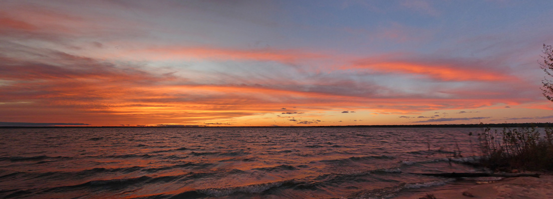
Since Tawas Point sticks out into Lake Huron and the campground faces west we had a view of the sunset!! And those clouds that had come in made for a great sunset.
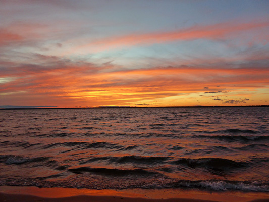
I had to take another shot so that you could see how even the sand was painted orange. Yum.
It cooled off into the low 50’s overnight—greatly improved sleeping weather! The trailer was in the high 50’s in the morning so we even got the heater out to warm things up for breakfast.
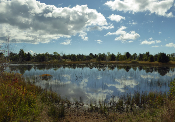
Near noon we wandered out to take the walk out the trail to the Tawas Point Lighthouse. The trail takes you past a little pond that has a couple of mini-cabins and a yurt facing onto it.
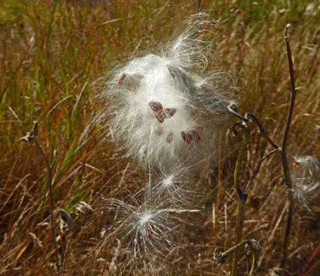
The milkweed pods were just starting to open.
And one of the many ground squirrels (we’ve had them at all the parks here in Michigan) actually stayed still long enough for me to grab a quick photo of it.

They had been really busy at Hoeft eating acorns and chasing each other up and down the road.
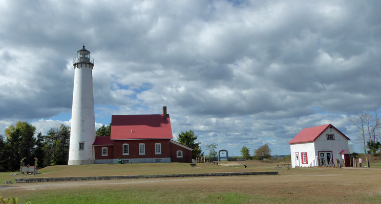
The lighthouse is another one with the keeper’s quarters built right up next to it. The building on the right is now a gift shop. The little arch to the right of the keeper’s house is the entry to a cemetery. The lighthouse is open for tours in the summer time but it closed for the season back at Labor Day.
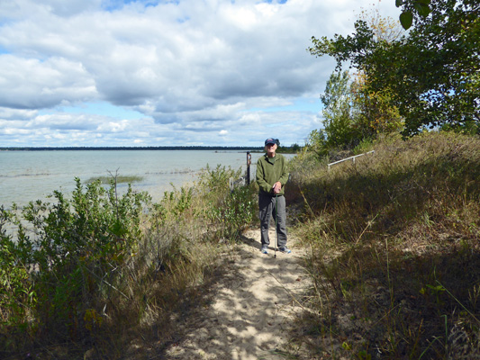
We took the Nature Trail out along the point. It wanders along the shore over the tops of low dunes until it comes to a little inlet where the water feeds a small wetland. There was no crossing here and no rocks to hop on so we turned back. I shot this photo of Walter along the very sandy trail with a bit of the view of Tawas Bay which is pretty darned shallow through here.
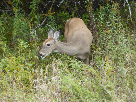
We came back over the top of the the dune and Walter froze—deer! She was hiding in among the bushes but stayed still and watched us. After feeding for a little while she turned tail and disappeared in the underbrush.
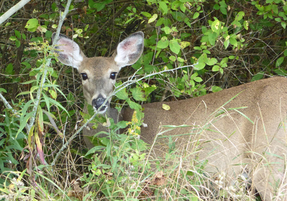
A short ways ahead he spotted another one farther out into the clearing. She too was feeding and I managed to get a photo of her between bites.
We rejoined the road that goes all the way out to the point and decided we’d been out walking long enough and turned back to towards the lighthouse. We met some folks who were out for a walk and they said that the part of the trail that is under water has been like that for years. So the only way to actually get all the way out to the point is to follow the road which belongs to the Coast Guard Fog Horn Station.
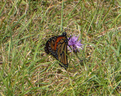
There were tons of Monarch butterflies in the campground and along the trail. They were all headed south in the wind. I don’t know if they were headed that way because it’s time to migrate or because that’s the way the wind was blowing. Most just kept on flitting. But when we got back into the open grassy area by the lighthouse one settled in on a knapweed flower (a noxious weed but hey nectar is nectar) and I managed to get a quick photo.
I also stopped and took a photo of the old pirate up on the crows nest/flag pole not far from the lighthouse.
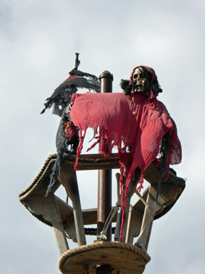
I don’t know if he’s an early Halloween decoration or if he’s up there all the time.
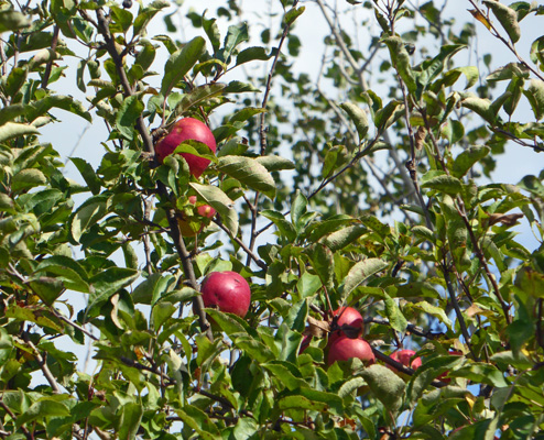
There was an old apple tree along the trail back towards the campground with some pretty red apples.
We followed the signs down to the Pet Friendly beach area only to discover it was all under water. Don’t you want to sit on this bench and watch your dog swim?
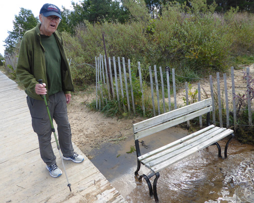
There was a picnic table that was also sitting out in the water.
More clouds rolled in that afternoon and we had one of those flash in the pan sunsets where it’s pretty for a few minutes before the sun gets to the horizon and then poof it’s gone. We had a bit of rain overnight—just enough to make everything damp in the morning. We broke camp and headed south on Hwy 23 to I-75 and then jigged and jogged back to Hwy 23 to I-275 and finally I-94 to the Ypsilanti area between Detroit and Ann Arbor. We ended up at the Wayne Country Fairgrounds RV Park just off of I-94 in Belleville, MI. We got a nice pull through site with water and electric for only $24.30 a night with our Good Sam Discount card. There are not a lot of places to camp in the area so this place is a real find and a great deal. It wasn’t palatial but it also wasn’t very full so it was fairly quiet even though it wasn’t that far from the freeway.
They had great free WiFi, both of our phones worked and Walter found a TON of TV stations over the air—from Detroit, Toledo and Ann Arbor. Being in metropolitan areas isn’t our favorite thing but every once and a while we need to shop and Ann Arbor has both a Trader Joe’s and a Whole Foods so that’s why we ended up here. Besides it’s under 200 miles from here to Jackson Center, Ohio and the Airstream Factory Repair Center which is our next stop.
Saturday September 30th, we spent the heart of the day shopping in Ann Arbor. It’s a great town—we both do so love University and College towns. We found everything we needed and then went home and struggled with finding a place for all the food we’d bought. Thank goodness for the backseat of the truck where I stow extra cereal! Walter watched some football and I had a chat with one of our neighbors.