It was in the mid 50’s when we arrived and the clouds from the rain the night before were blowing away. The wind made it feel cold but we hadn’t seen anything yet. Over night it cooled down some more and we had a high of 44 with heavy rain for much of the day on Saturday. Walter watched college football (Go Huskies! they managed to win once again) and we took a short break mid-day to drive into town and stop at the grocery store for a few things and to get gas.
I spent much of the day surfing the web. At one point, I thought to check the road status for the road to Wheeler Peak at Great Basin. Our original plan for Saturday had been to drive up to the top of Wheeler Peak but we had changed our minds. Good thing we did. The road was closed less than half way up due to ice and snow! I couldn’t have hiked the trail to see the Bristlecone Pines if I’d wanted to.
The weather forecast for the next few days wasn’t very good either. In fact, it was supposed to be rainy with highs only in the low 40’s and lows in the low 20’s at Bryce Canyon where we were headed next. I was worried that the weather might not allow me to hike the Bristlecone Trail there either. So I checked the Bryce Canyon National Park website only to discover that the Bristlecone Trail (and most of the other trails in the southern portion of the park) was closed due to firefighting activity. Okay... So it was going to be really cold AND I couldn’t do the hike we were going there to hike. Time to change plans again. We had a reservation at the Bryce Canyon Pines RV Park so I tried calling them and got no answer. In the end I just sent them an email asking to cancel our reservation. I’d now canceled two reservations in the last 2 weeks. To put this in perspective before these two I’d never canceled a camping reservation ever before!
It got down into the high 30’s that night and on Sunday October 7th when we broke camp it was windy and only 41. Boy were our hands cold by the time we’d finished dumping tanks and playing with the hoses! We drove south on I-15 to Hwy 20 and headed east over the 7,910 foot pass where the road was bare and wet but the sagebrush was covered in snow. Given that most of Bryce is over 8,000 feet that snow only confirmed the wisdom of our decision. It rained/slushed most of the way over the pass and then south on Highway 89 through Panguitch and on to Kanab, Utah just north of the Arizona border. Kanab is only at 4970 feet so it was way warmer than up by Bryce.
Kanab has grown from a sleepy little town to a new tourist hub. The RV park we’d planned to camp in was full as was our second choice. But we lucked out, the first place told us about a brand new park that had only been open for 2 weeks. And they had plenty of spots. We signed up for 3 nights of a back-in full hook up and set up camp between the rain showers. Their new gravel hadn’t settled entirely so we had to be careful where we parked and both of us got a little muddy walking around the rear of the trailer close to the drainage ditch but otherwise all was good. J & J RV Park had a decent WiFi signal most of the time—it did get overwhelmed in the evening but hey that’s normal. And our cell phones worked great since we were right in town. Walter found lots of TV over the air and spent much of the rest of the day watching pro football since it was Sunday.
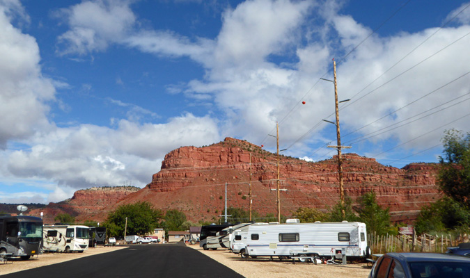
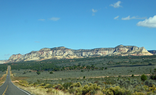
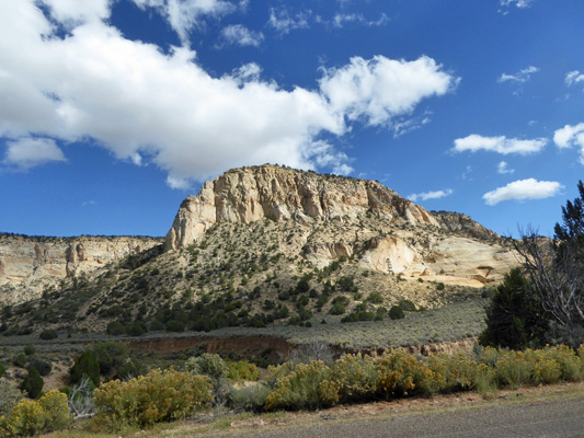
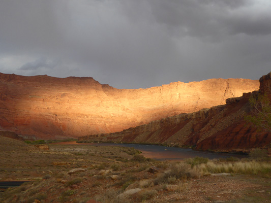
We saw the sun briefly in the afternoon but showers continued to come through until the next morning. The sun was out as we got ready to head out to do laundry and I shot this photo of the view from the campground looking north.
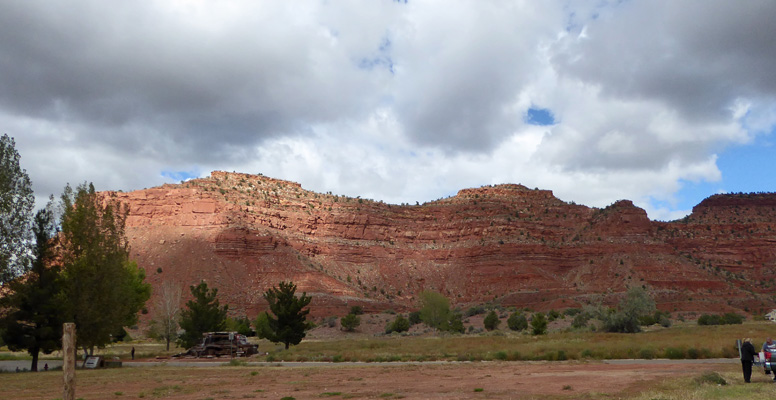
We managed to get the laundry done without a hitch and then drove over to visit the Grand Staircase National Monument Visitors Center. The view from the parking lot was pretty nice with a brief sun break.
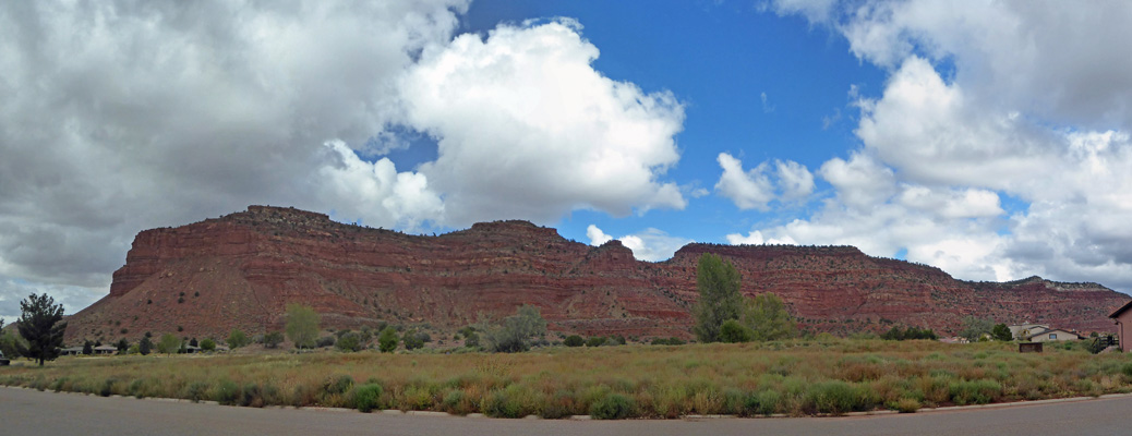
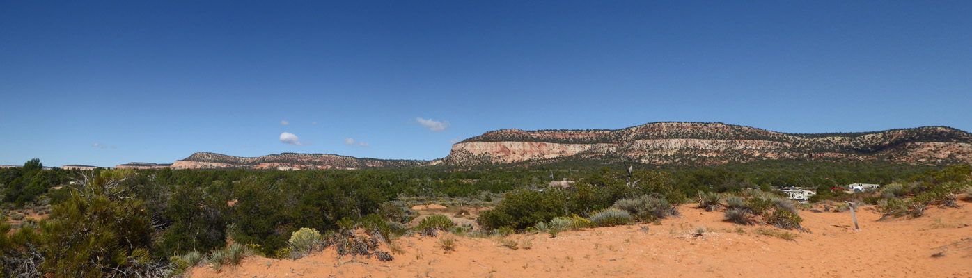
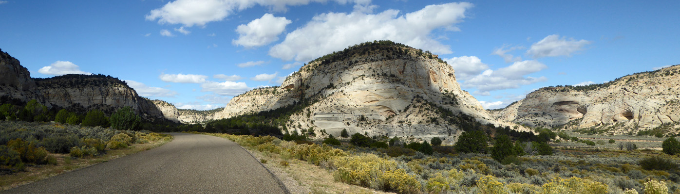
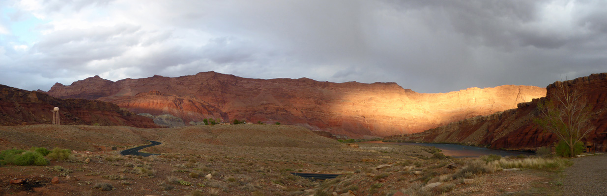
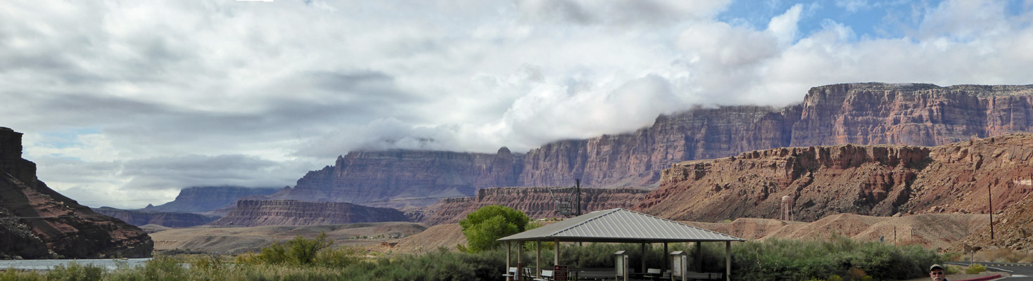
When we came back out the sun was gone but I still took the time to walk a ways north to get a full panorama shot.
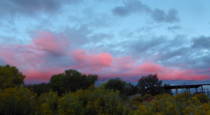
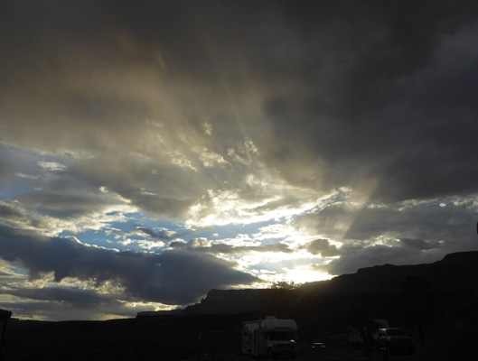
We got up into the high 50’s-low 60’s and the trailer actually was warm enough to open the vents for the first time in days. But late in the afternoon cold rain returned and the temperature dropped back down into the 40’s. The clouds broke up just enough to give us a brief 360 degree sunset. It turned lovely and pink to the east.
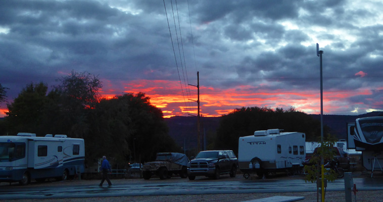
And fiery red to the west.
It was cold again that night and with the clearing skies got down to 33 in the early morning hours. We stayed in bed late waiting for it to warm up. It was sunny and clear and stayed that way for most of the day. And in town it got up to about 62.
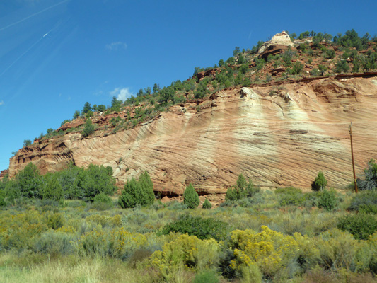
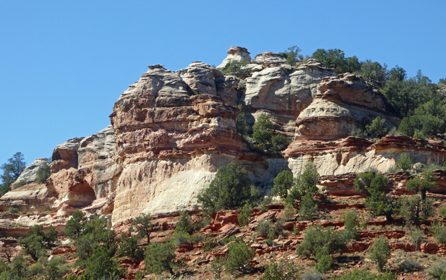
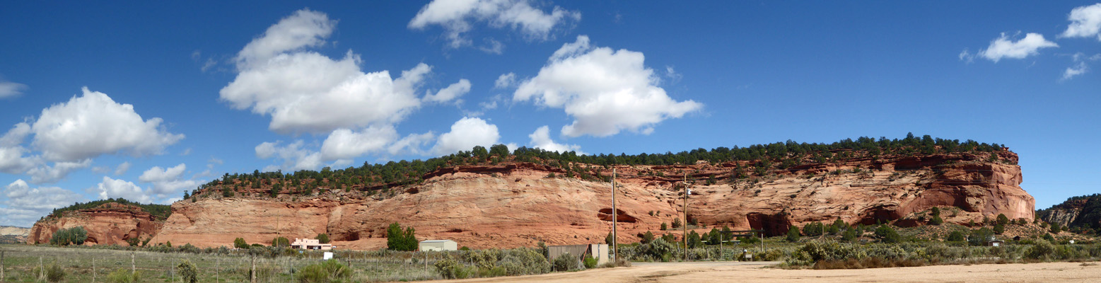
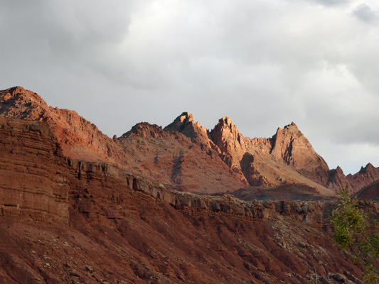
We set out for our outing for the day by first stopping by the Post Office to pick up our mail. Then we headed north on Hwy 89 back through the lovely red rock canyons that are just north of town.
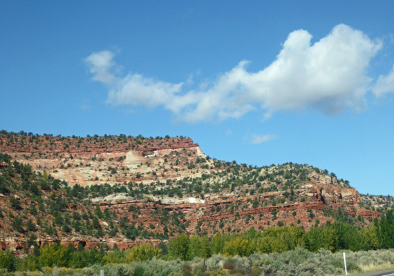
The sunshine sure lights up the red rocks nicely.
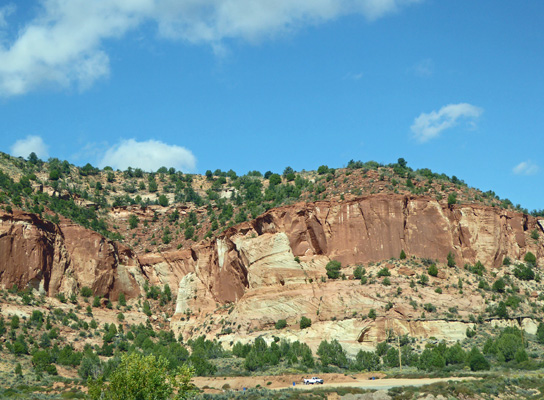
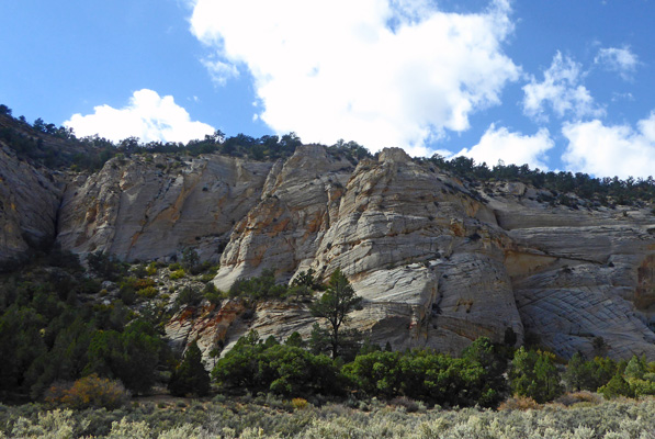
There are nifty caves/alcoves along the way.
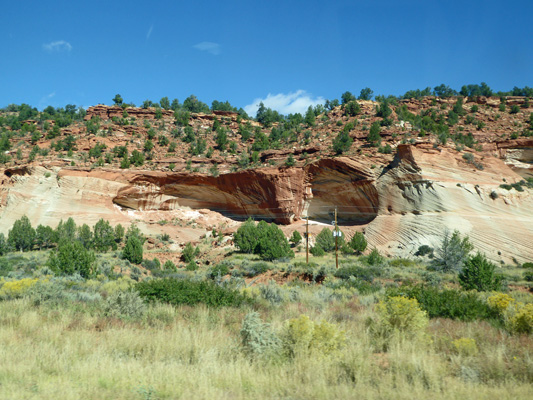
And the rocks in this section have these really cool striations too.
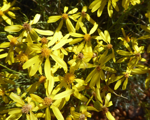
The rabbitbush was past peak but still adding color along the road and here and there we’d see the yellow daisies of Broom-like Ragwort (Senecio spartioides).
We turned east on Handcock Road and drove about 10 miles to Coral Pink Sand Dunes State Park. This is mostly an ATV park but there’s a short trail and viewing platform so that non-riders can get a view of the dunes.
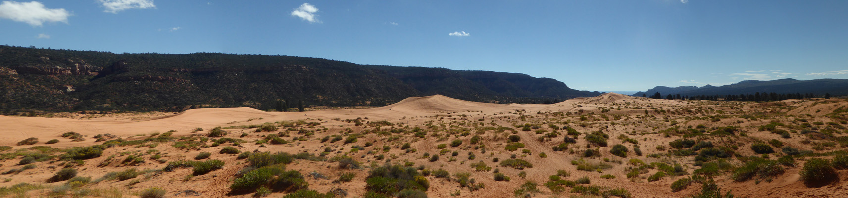
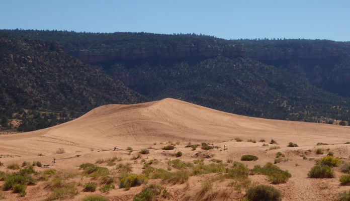
The sand comes from the erosion of Navaho sandstone which is just this color. The prevailing winds carry it from the south through the notch in the hills on the right. The notch funnels the winds increasing the velocity to the point where it can easily carry grains of sand—a Venturi Effect. After the wind passes through the notch and out into the valley the wind velocity drops and the sand is deposited in the 7 mile long dune field.
The view to the north is pretty nice too.
There were a couple of ATV’s out playing in the dunes and I managed to get a photo of one of them making a jump.
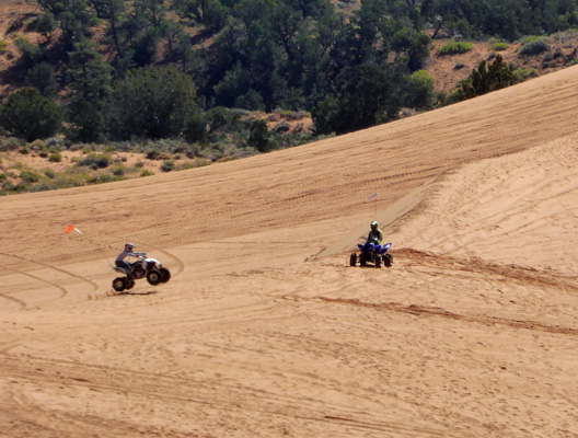
They were on the left side of the big dune.
There were a few people out hiking on the dunes too. I went out and walked around a bit to see how firm the sand was. It wasn’t super dry so I managed to walk down a hill and back up without getting any sand in my shoes!
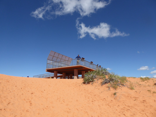
Here’s a shot of Walter up on the viewing platform.
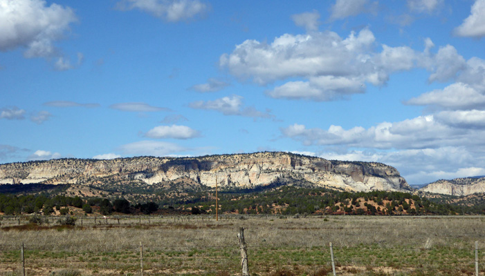
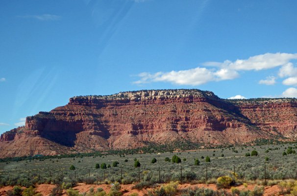
Since we had no need to hike in this stuff or to go sand boarding we turned back and took the Yellow Jacket Road (the long way) back to Hwy 89. In the process we got a nice view of a section of the White Mountains.
We’d read about a trail to a slot canyon called the Peakaboo Trail and thought it might be a fun hike so we went looking for the road to it. It turned out to be a very sandy ATV 4-Wheel Drive road and after reading the cautions about it we decided we’d take a pass since there was a high probability of getting stuck in the sand with a big rig like ours.
So we drove back into Kanab and stopped at the Visitors Center to get instructions (and a Driving Tour Guide) to Johnson Canyon which is just east of Kanab on Hwy 89.
The first stop along Johnson Canyon Road was a formation called the Lions Head.
Comparing the photo in the driving guide to reality we both agreed that there had been some major erosion since the top-most nob was supposed to have a small window in it. Then again maybe we didn’t find the right formation... It took some serious looking to find the Eagle Gate Arch. Can you see it?
How about now?
No? How about now?
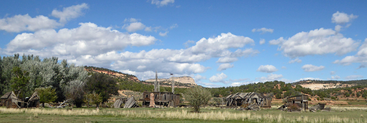
There’s a cluster of buildings that are rapidly falling apart that we think must be the movie set for Gunsmoke which was used from 1955 to 1975. The photo in the brochure shows these buildings still in pretty good shape but 43 years can take a toll on things like this.
As you drive north you get a nice view of the White Mountains.
We stopped for lunch at the Crocodile/Hog Canyon Trailhead. Not a bad view, don’t you think?
The buildings are part of a ranch nestled in among the red cliffs.
We had thought we’d take the hike to Inchworm Arch which is somewhere out this way. But we never found the turn off. My suspicion is that you have to take another long 4-wheel drive road to get to the trailhead. There were several and they all looked wet, muddy and challenging.
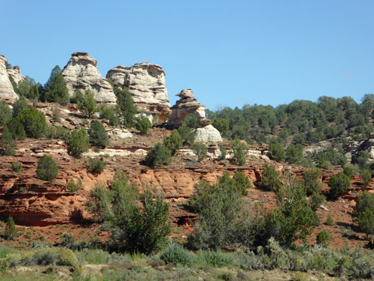
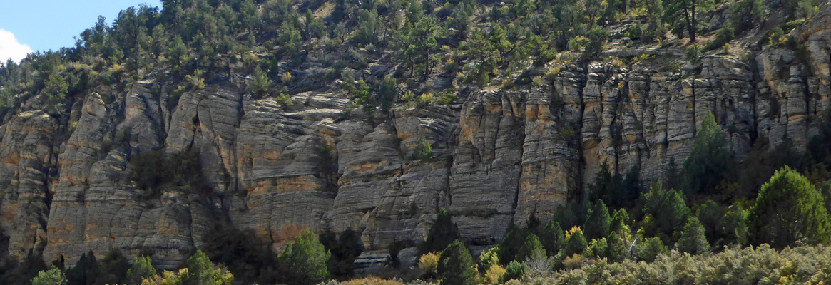
As you near the end of the road you come through some wonderful white rocks.
They have caves and alcoves and fun striations too.
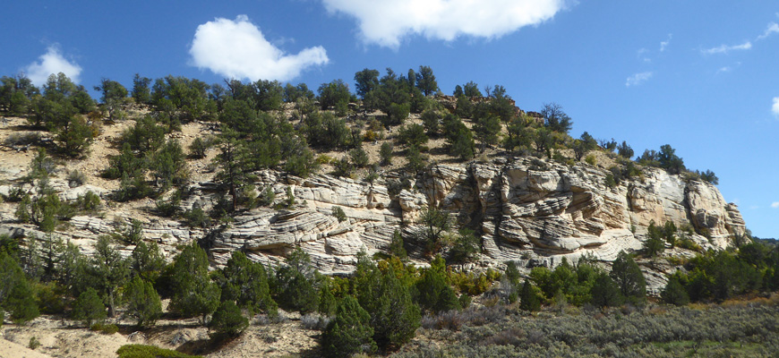
Here’s a close up shot of some of the striations.
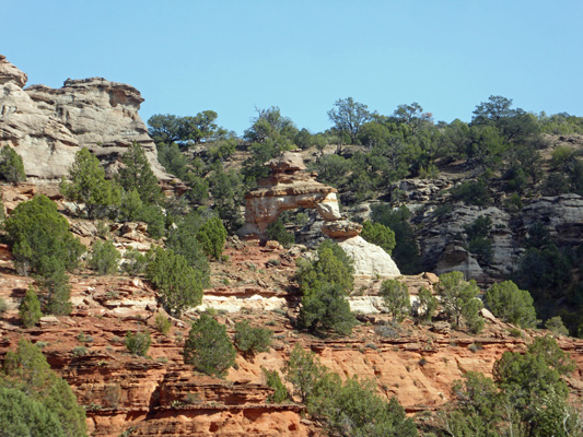
On the west facing cliffs the light made the striated rock looked really different.
The pavement ends at a T where two dirt roads take off—one into the Grand Staircase potion of the National Monument, the other into ranch land.
We turned around, and as we drove back the late afternoon light lit up the white formations really nicely.
On our way back to town on Hwy 89, I couldn’t resist taking one more set of photos of the red cliffs north of town.
The red cliffs surround the town on the north and west and create a gorgeous setting.
Wednesday October 10th, we loaded up one more time and headed south on Hwy 89A following it up onto the plateau (nearly 8,000 feet--where you can turn south to the North Rim of the Grand Canyon--and then on past the Vermillion Cliffs to Marble Canyon and the Lees ferry Campground on the Colorado River just west of Page, AZ. We picked up an hour because of a time change—Arizona doesn’t do Daylight Savings Time—so we arrived there pretty early.
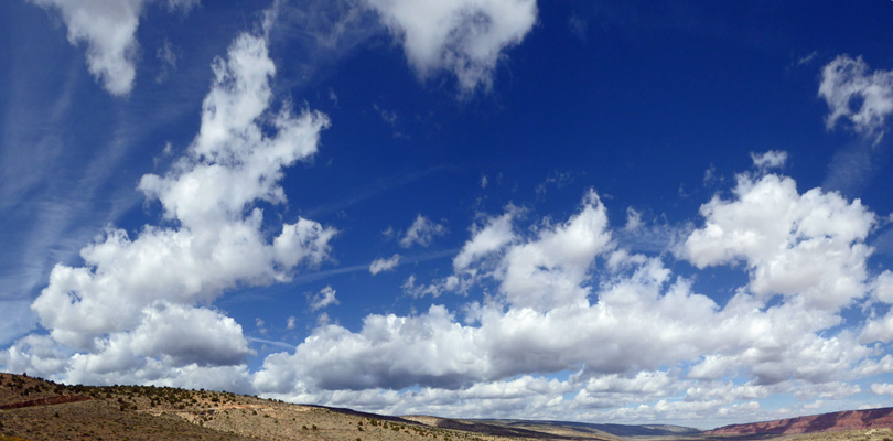
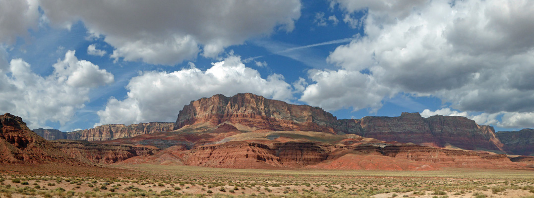
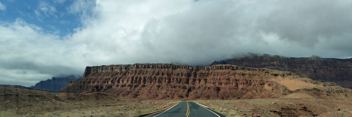
We had partly cloudy skies but the sun was out when we reached the viewpoint for the Vermilion Cliffs.
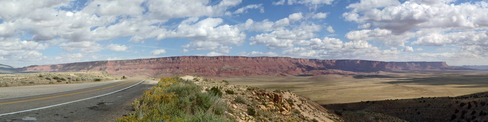
I can’t tell you the number of times we’ve driven through here and had cloudy skies so you couldn’t see the wonderful colors.
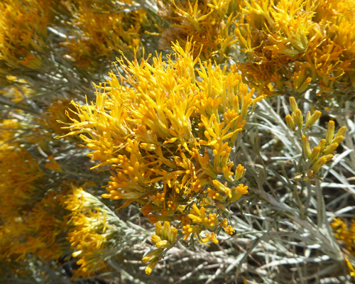
The rabbitbush was in full bloom here.
And the clouds against the deep blue sky were marvelous.
We drove on and I pulled out at the Vermilion Cliffs viewpoint down in the valley. Aren’t they gorgeous?
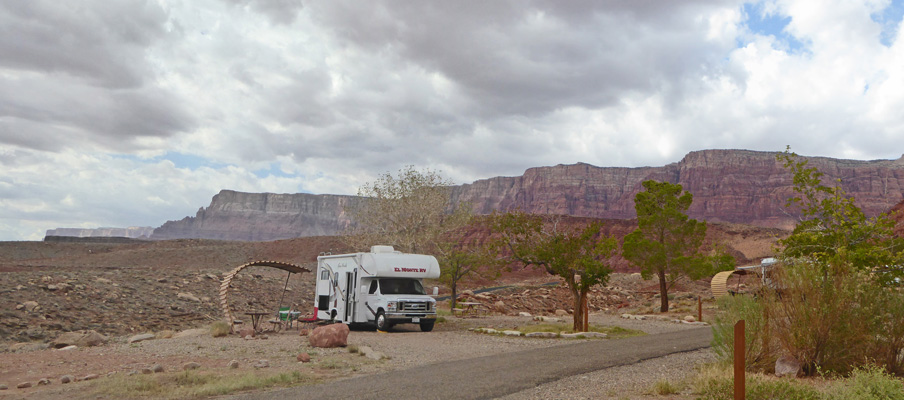
We continued on to the turn off for Lees Ferry. As we approached the campground it looked kind of full and we had a few moments of concern. But we had no problem finding a spot—it was just the spots right at the edge of the cliff overlooking the river that were full. We got a nice pull through spot and easily set up camp.
The sun was playing peekaboo at this point and I didn’t know how long it would be before we got rain. So I set out to take a few photos of the marvelous setting here.
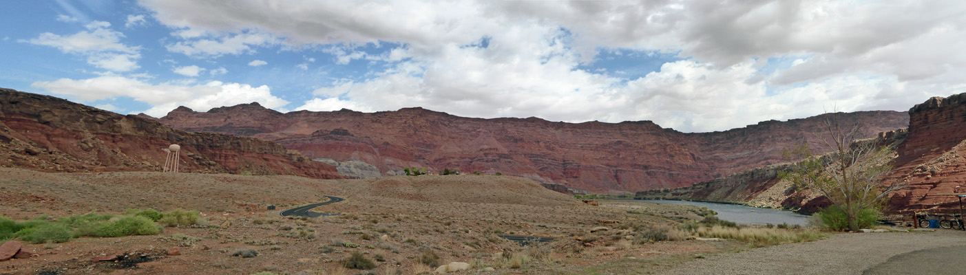
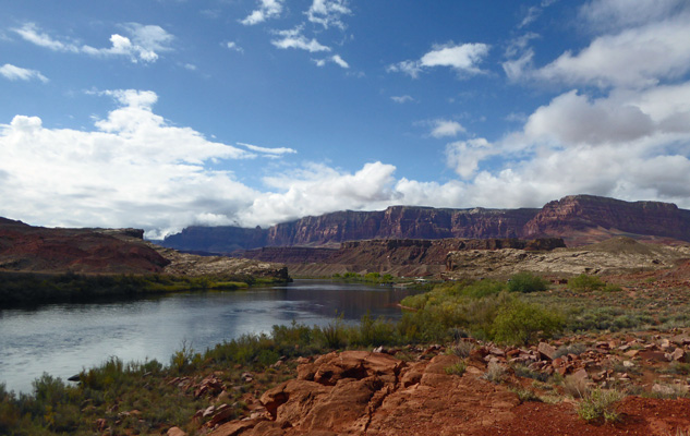
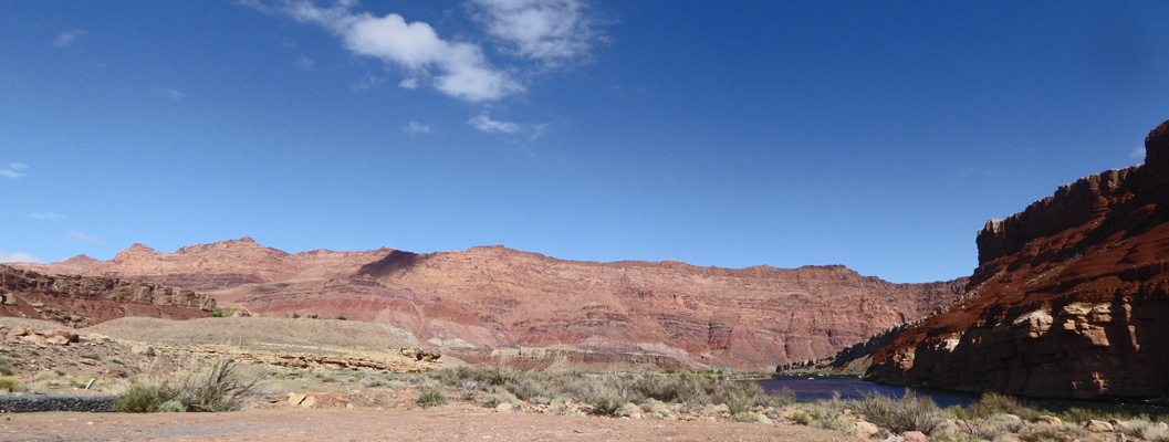
Looking east from the front of our campsite you see the Vermillion Cliffs and the river.
The view from out back windows wasn’t too bad either.
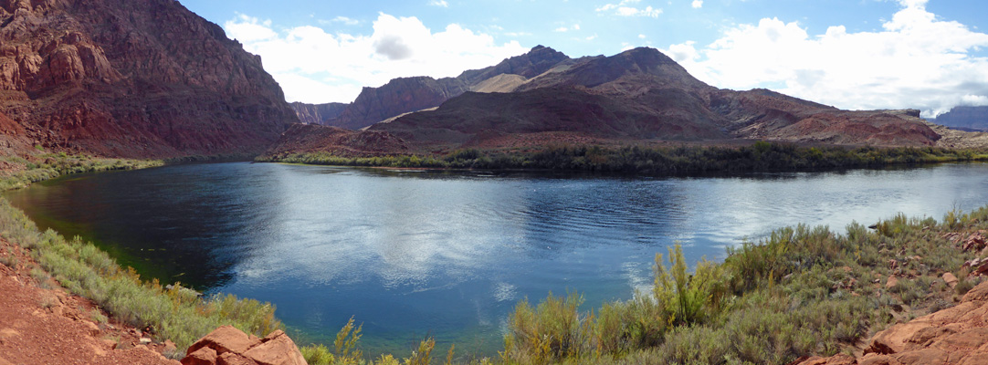
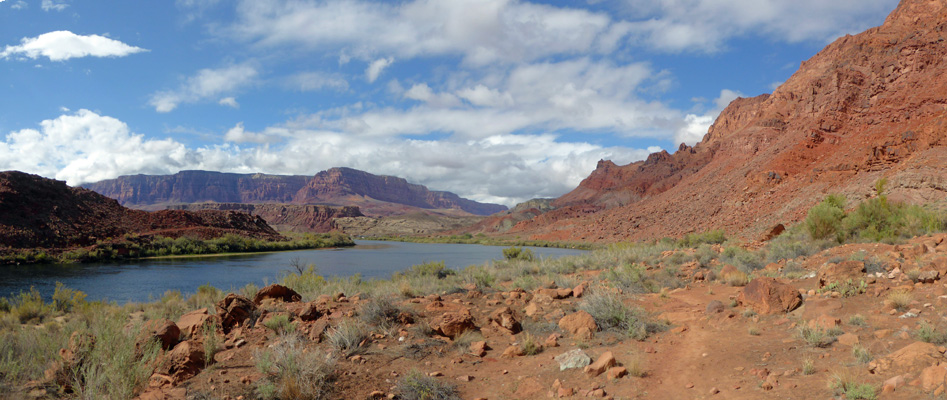
But when you walked south to edge of the campground is where you get the best view of all. Red cliffs, mountains and the Colorado River making a turn as it heads towards the Grand Canyon.
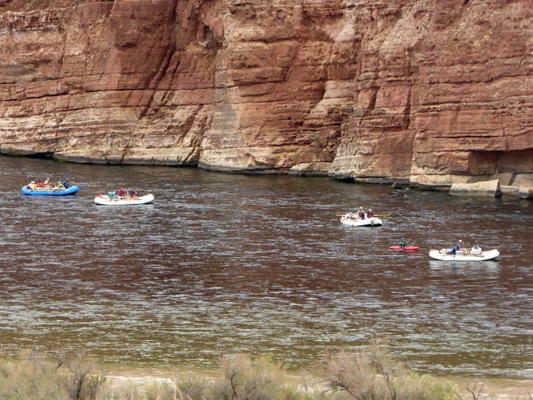
A few minutes after I took this photo we walked by on our way to pay for our campsite and a group of 4 rafts and 4 kayaks came by starting their journey down the Colorado through the Grand Canyon. Lees Ferry is the only put in for the run through the Grand Canyon so there is a steady parade of boats to watch here—and folks camping in the campground getting ready to head out the next morning.
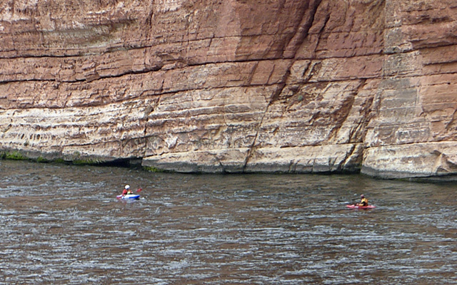
Here are two of the kayaks.
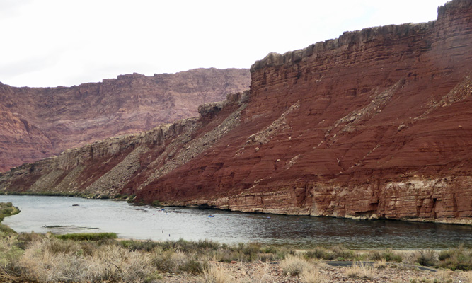
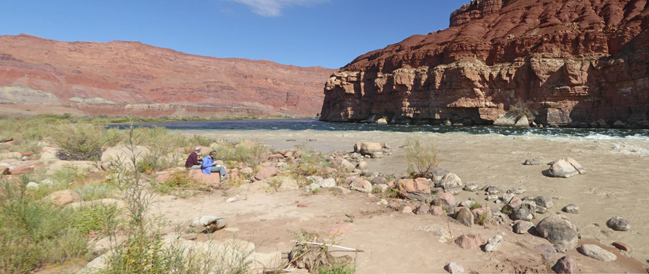
The view up river is really lovely. There are two little specks left of center in the river. They are two fisherman out standing in the water. People fish for trout here.
In the late afternoon the sun began to sink behind the Vermillion Cliffs to the west. And it lit up a small portion of the mountains to the south.
And put a spotlight on the cliffs to the east.
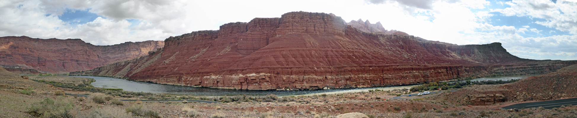
Here’s a panorama shot of the whole east side. You can see a streak of sunlight over on the left too.
And just as the sun sank behind the cliffs to the west we got rays of sunshine on the clouds.
About an hour later there was a tiny bit of pink on the tops of the clouds but that was it for sunset.
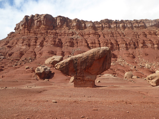
We had partly sunny skies the next morning so we set out to do an outing while the going was good. We headed back west to the little town of Marble Canyon and got gas for the generator. On the way I caught the Vermilion Cliffs in the sunshine again.
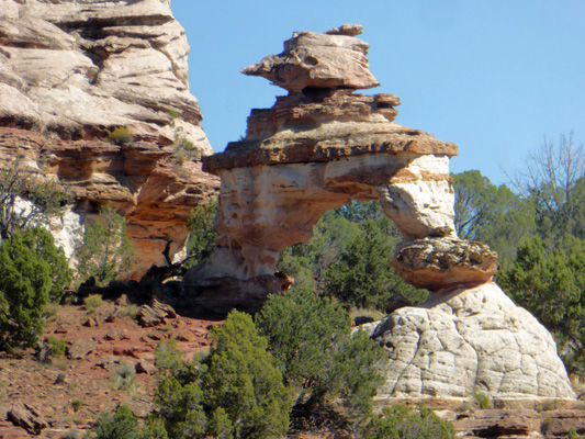
I’ve taken photos of the balancing rocks before but who could resist taking another?
Having gotten our gas wen drove on the short way to the Navajo Bridge. This bridge was build in 1927 to replace the very dangerous ferry crossing at Lees Ferry. The ferry sank in the early 20’s and there was no way to cross the Colorado for hundreds of miles because of it. So this bridge was super important in once again making access from Arizona to Utah possible.
There’s a nice pedestrian bridge you can walk out on to look at the view.
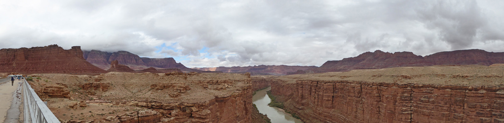
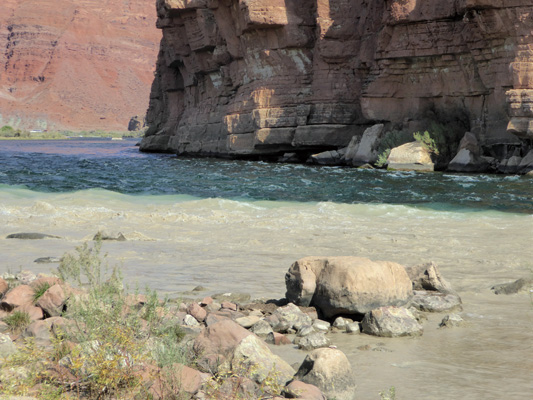
And of course get a nice look at the Colorado. It’s grey here from the mud added by the Paria River which joins the Colorado right by the campground where we were camped.
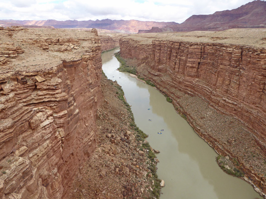
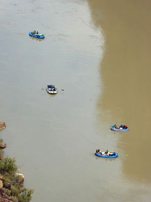
There were 6 rafts coming down river and I managed to get 4 of them all in the same shot.
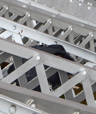
While we were watching the rafts, a California Condor flew in and perched on the bridge struts just below us! Each year they release more condors just up river from here. And it turns out they love perching under the bridge. You can tell it’s a condor (even if you can’t see much of him) because you can see a number on his wings. All the condors have these huge number on their wings so they can be tracked.
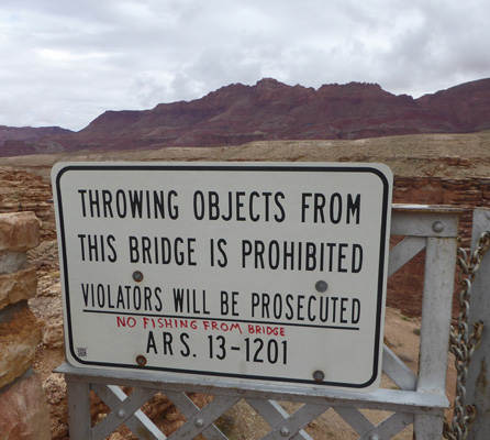
Some local wag had added a joke to the caution sign at the bridge entry. I dare you to find a line long enough to fish from this bridge—it’s over 450 feet above the river.
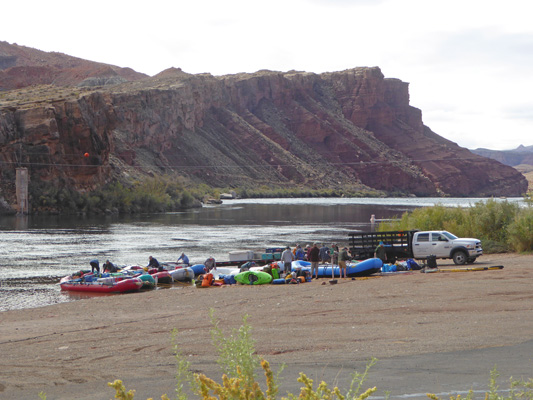
We drove back up Marble Canyon to the end of the road at Lees Ferry where the rafting trips launch to go through the Grand Canyon. There was a group of folks with 7 rafts busy packing to get ready to set out the next morning.
The view from the boat launch is pretty nice looking west.
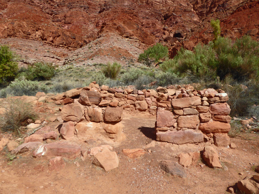
We turned east and followed the River Trail which takes you through the history of the area. First off are a couple of buildings from the early 1900’s which housed the offices of the American Placer Corporation in 1911.
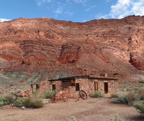
This is also the site of the original pioneer ferry in 1872.
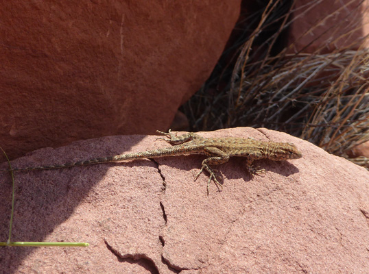
Charles H Spencer tried to mine gold here in the early 1900’s. He brought in a placer mining set up including this big boiler used to try to separate the fine gold from the sand. They had no luck and the operation was abandoned.
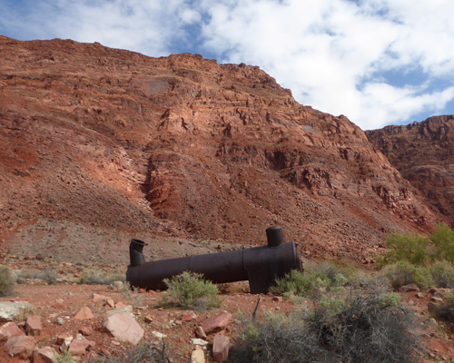
And the lizards took over!
The trail follows the Colorado and gives you some lovely views east...
And west.
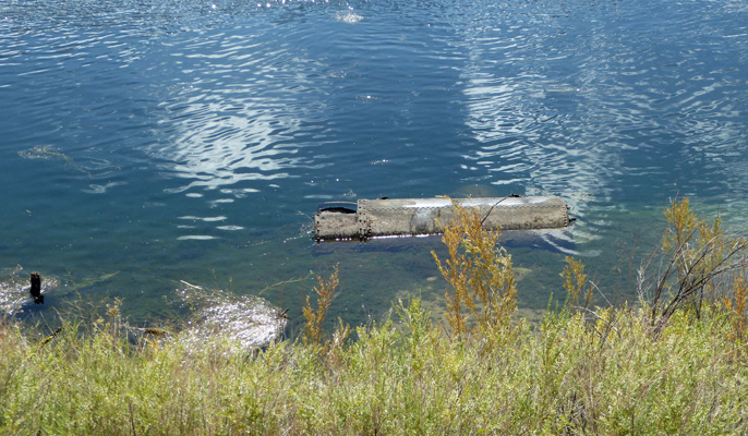
Spencer also had a steamboat that he used to bring coal down the Colorado to this site for his operation. It sank and you can still see bits of it submerged along the shore.
Walter found a likely rock to sit on a little past here and I walked on to see the remains of the Fort built here in the 1800’s.
There wasn’t a lot out there but I did like the view back down river that I got.
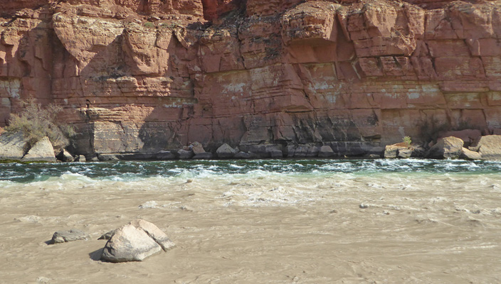
We hiked back and picked up the truck and drove the River Road back towards the campground and stopped at Paria Beach. Here you can see the confluence of the Paria and Colorado Rivers AND the Paria Riffle, the first rapid that rafters hit on their journey towards the Grand Canyon.
Here’s the view up river.
Down on the beach you can see the confluence at work. The Paria is mud colored while the Colorado is clear because all the mud has settled out back behind Glen Canyon Dam over by Page.
Here’s a close up of the rivers joining.
To add to the fun there’s a riffle here too. It’s not big enough to be considered a real rapid but it gives folks their first thrill as they set out to run the Colorado for many days.
We had enough sun that we put out the solar panel for a couple of hours but then dark clouds came in again. We didn’t get much rain but it certainly ended our solar gain.
Friday October 12th, we packed up and headed south on Hwy 89A to Hwy 89 and continued on to Flagstaff AZ up in the mountains. It was mostly sunny and pleasant when we arrived at the Flagstaff KOA where we had a reservation for a pull through water and electric site for 2 nights. We set up camp and settled in. Their WiFi worked to start with but as the campground filled up of course the WiFi degraded. Walter got plenty of TV over the air so all was good.