
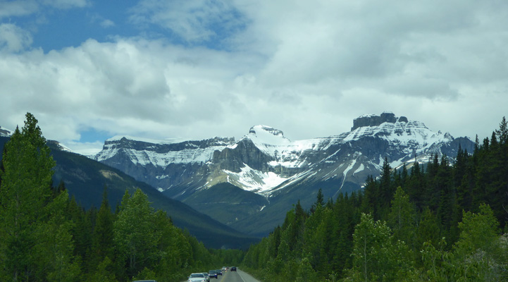
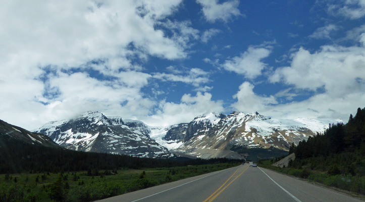
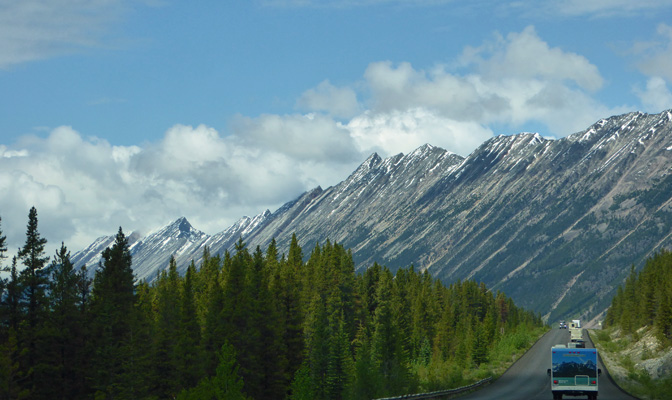
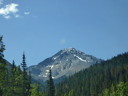
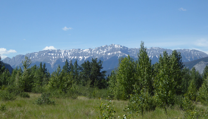
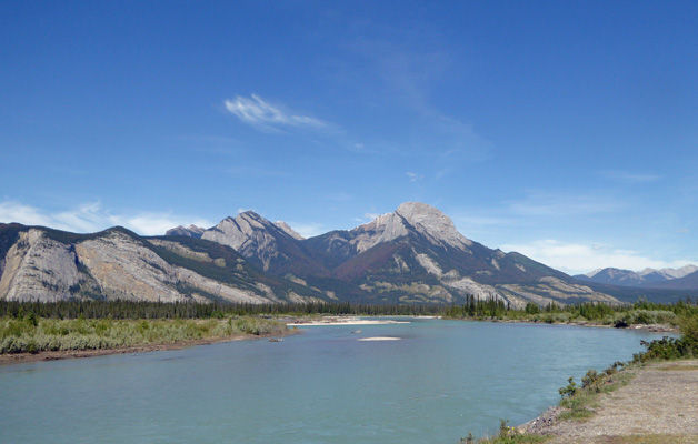
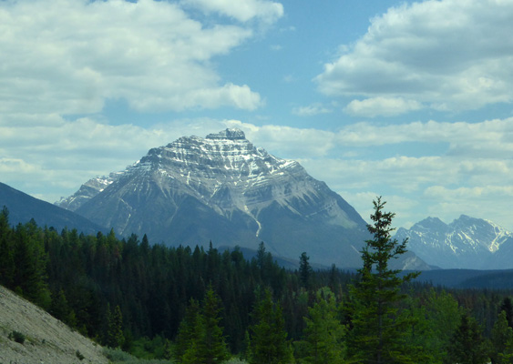
We headed north/west on Hwy 1 up past Lake Louise and then took Hwy 93, also known as the Icefields Parkway, north up towards Jasper. The parkway is gorgeous and over 144 miles long. That’s a lot of fantastic mountain views, rivers, glaciers, and waterfalls.
I took this photo just as we joined the parkway.
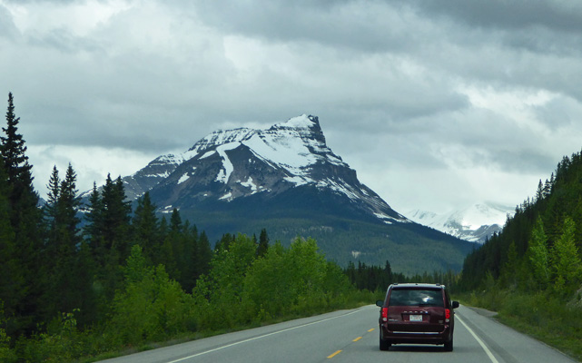
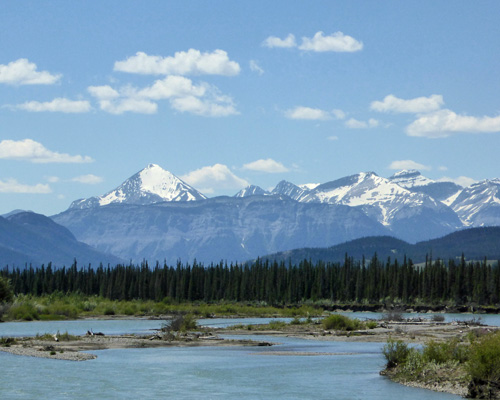
It had been sprinkling and 42 degrees when we left Banff and you could barely see that there were any mountains at all so I was thrilled that as we went north the ceiling lifted so we could see most of the mountains.
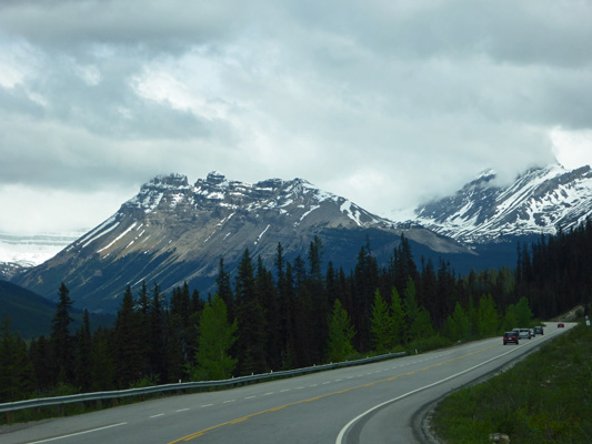
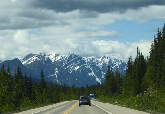
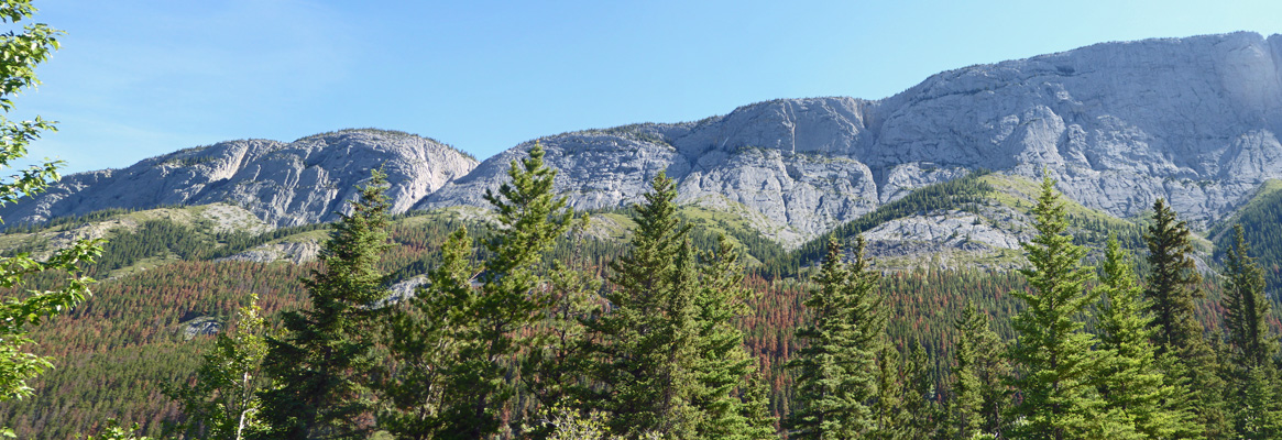
The highway climbs to over 6000 feet going over two high passes.
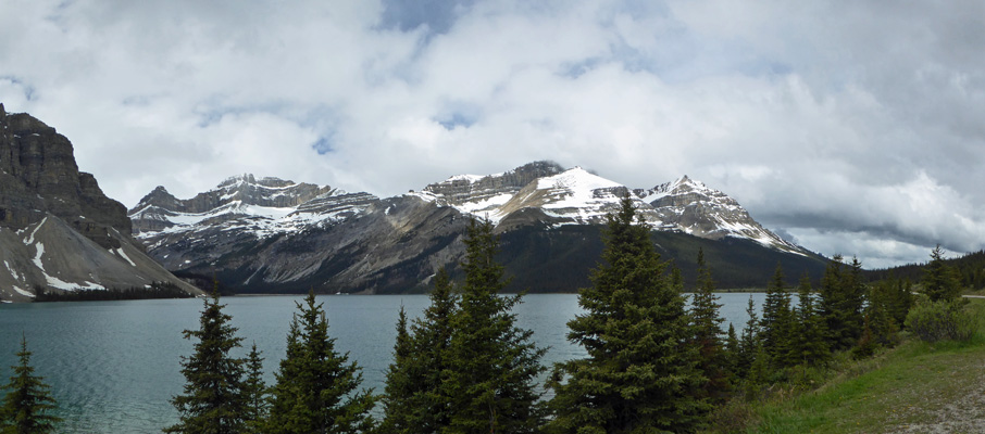
But before that you come to Bow Lake and a view of Crowfoot Glacier.
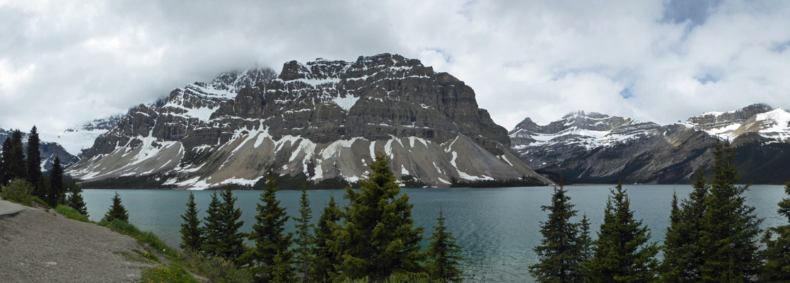
Here’s a close up of Crowfoot Glacier.
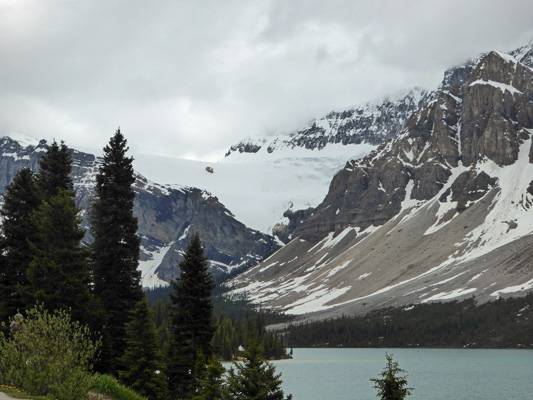
And a view looking northward across the lake.
It was Saturday and many of the pull outs were full so we weren’t surprised when we pulled into the Bow Pass parking lot that it was totally full of cars. So we drove on rather than stopping to get the photo of Peyto Lake that the all tour books talk about.
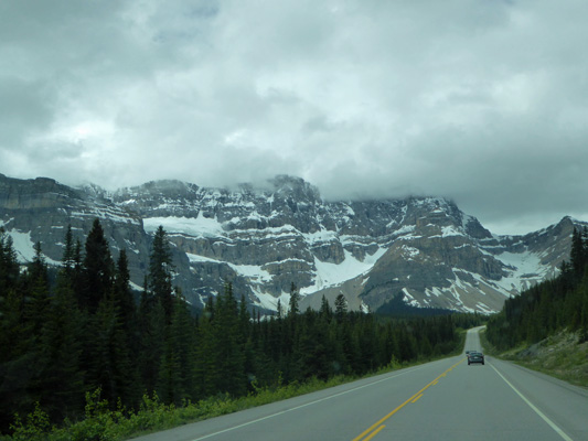
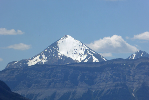
Instead, we got more lovely mountains.
We changed drivers while sitting in a construction back up. We even had time for both of us to use the bathroom before the cars started to move again.
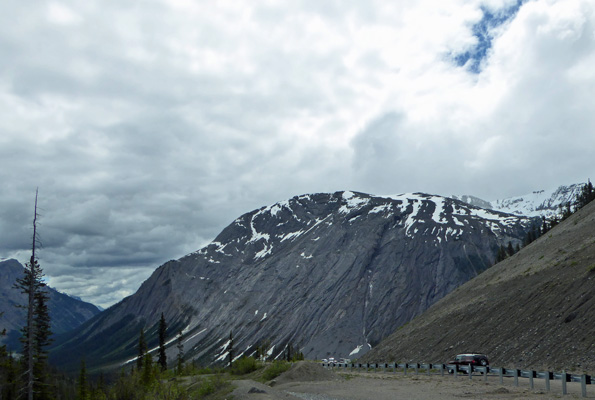
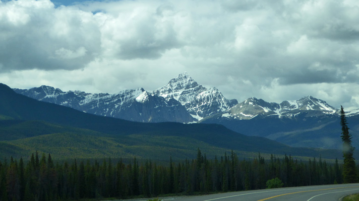
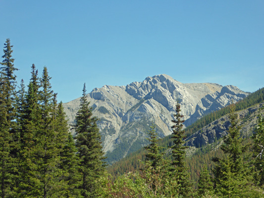
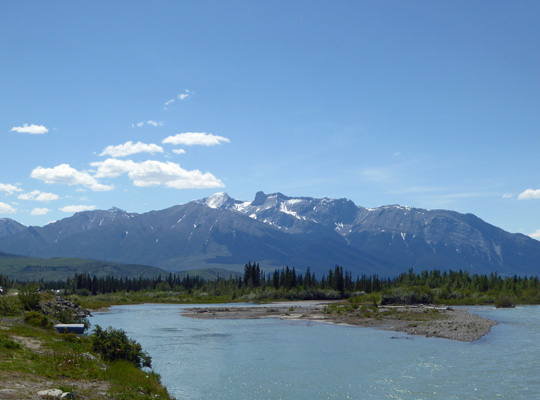
Just past Parker Ridge (another full parking lot since it’s a trailhead for a very scenic hike) we pulled over and I shot this photo of one of the gray ramparts. It amazes me how different from one another the mountains are here.
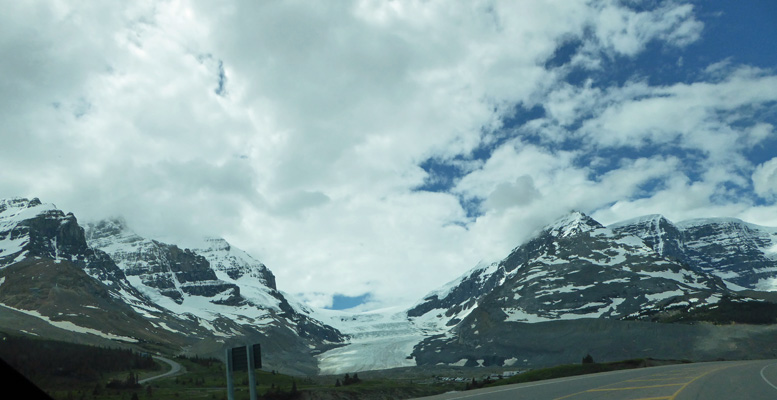
Just south of the Icefields Interpretive Center we began to see bits of the Athabasca Glacier. It’s a portion of the Columbia Icefield and it’s the only glacier that’s accessible from the road. The Columbia Icefield is one of the largest masses of ice in North America south of the polar regions.
You come around a bend and there is the toe of the Athabasca Glacier.
And signs telling us that the parking lots at the Icefields Interpretive Center were full. Ah well, we hadn’t planned to stop since we actually visited this glacier (when it was much closer to the road) 30 years ago and even walked on it. Instead, I turned off the highway and headed towards the parking lot at the toe of the glacier and stopped and took a photo.
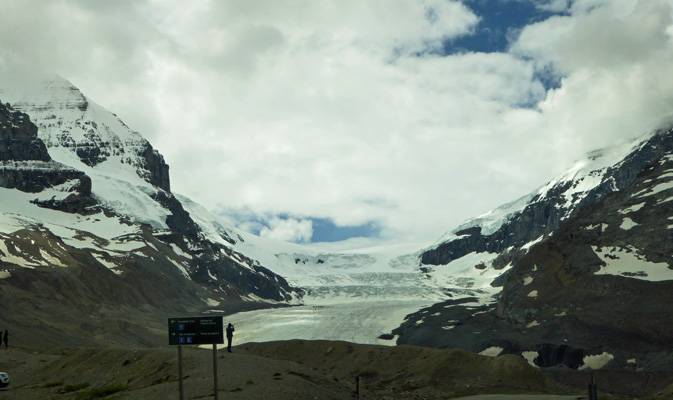
And then got back on the highway. This is a HUGE tourist attraction. You can take sno-coaches up onto the glacier (for a hefty price) and the Interpretive Center is brand new and had gift shops and eateries and it was crawling with people everywhere. So we were happy to drive on.
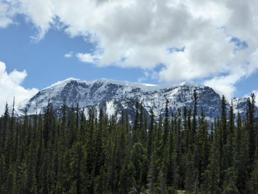
We stopped for construction again (they are repaving the highway and it’s construction season so they were working Saturday) and I took this photo of either a hanging glacier or a whole lot of un-melted snow.
We stopped again and I got this shot of what is called Endless Chain Ridge.
It’s amazing to me how different mountains like this are from the Endless Ridge and they’re just a few miles apart.
I love how the snow highlights the angle of uplift of this part of the Rockies.
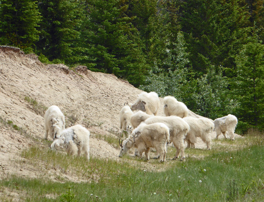
Just past a sign announcing an exhibit area called Goats and Glaciers, there were cars parked on the verge and sure enough there were goats. And blessed be there was a spot big enough for us to pull over too. I got out and joined the crowd taking photos.
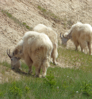
Someone started up their engine and this big guy turned his head.
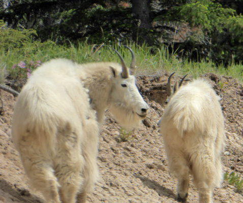
And took off up to the top of the incline and posed.
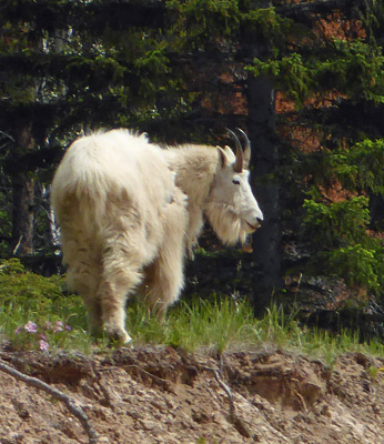
I’ve seen a lot of bighorn sheep in my time but I don’t think I’d ever seen mountain goats in the wild before. It turns out that this is a natural salt lick and the goats come here often.
We drove on up to the town of Jasper and then went another 25 miles east to the Pocahontas Campground on the east side of the park. We had a reservation for a no hook-up site which was a good thing because the campground was full when we arrived. This is a great wooded campground with back in sites. Ours was plenty long and we got in first try which is always a pleasure. When I’d made reservations back in mid-April all the electrical and full hook up sites in the park were already taken. So we picked this campground because it was smaller and a bit more remote just for the quiet. That paid off come Sunday afternoon after the weekend crowd left. It was nearly empty for the rest of our stay. We had to drive a bit farther to most of the park but ah well.
We had clouds and sun (and a temp in the low 60s) so we put the solar panel out and spent what time we had left before dinner moving it around as the sun came in and out from behind the trees. This was not a primo spot for solar and we knew we’d have to run the generator but it’s always good to get what solar we can.
Along about 8:45 that evening, Walter announced the arrival of a big black bear. He was trotting along the campground road. I ran into the bedroom and watched him go by. So we had a great wildlife day—goats and a bear!
The trailer had warmed up into the low 70’s but it got cold enough in the night to be only 48 in the dining room come morning. Generator hours here are limited to 8 to 9:30 am and 5 to 7 pm here. We need 3 hours of generator time to keep the batteries charged up so Walter was out setting up the generator up at 8:30 when it was only 40 degrees outside.
We took our time and after breakfast we headed up the Miette Road (just up the road from the campground) to take the Source of the Springs hike at the end of the road where the Miette Hot Springs are located.
Along the way we stopped at a view point where I got a shot of the Ashlar Ridge. This ridge was heaved up at an 80 degree angle as the Rockies were formed. The rock layers at the top have been eroded away so that even though they are much higher than the overlook, they are 220 million years older than the rocks we were standing on. Isn’t geology wonderful?
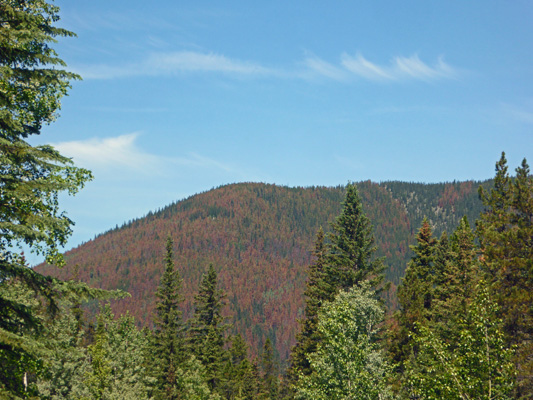
Most of Jasper has been hit with a heavy infestation of Pine Bark Beetle and the level of die off in their forest is high. Everywhere you look you can see orange trees. The fire danger is so high they’ve banned camp fires in the campground even though it’s been raining for at least the last 2 weeks here.
The river at the bottom of this canyon is called the Fiddle River (no ones knows why) and so they called the whole area the Fiddle Valley. The views to the southwest were so different than Ashlar Ridge.
Silly us. It was Father’s Day and it was a glorious sunny day. We got the 2nd to last parking spot in the very large lot at the end of the road. Everyone else was putting on sun screen and heading the to Hot Springs to play in the water. I’m afraid that at this point neither of us are attracted to hot springs FULL of hundreds of people. So we passed that up and wandered off down the trail.
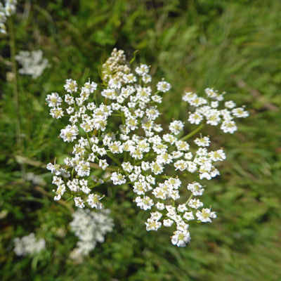
There was Queen Anne’s Lace in bloom in profusion along the beginning of the trail.
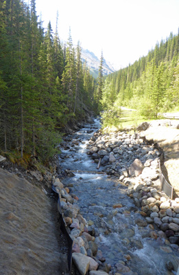
The trail follows along the side of the Sulfur Creek which happily chatters its way down the hill.
To the north you could see this big fellow from time to time.
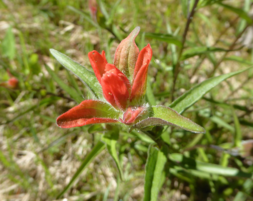
And there were patches of Harsh Indian Paintbrush (Castilleja hispida) here and there. There had been big swathes of it along the road on our drive the day before.
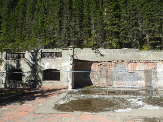
The trail takes you to the ruins of the Miette Aquacourt which was built in 1938 to replace the log tubs folks had used here to enjoy the hot springs before that. It was closed in 1984 because of the unstable rock slopes above it, weakening concrete in it’s construction, antiquated equipment, poor access and overcrowding.
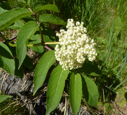
There were a few red elderberries (Sambucus racemosa) in bloom along the way.
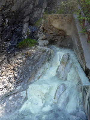
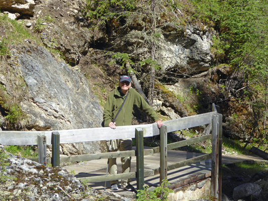
And then at last we came to a little bridge across the creek and the opening where the 129 degree water comes out of the hillside. There are a series of these springs along the creek and this is the one with the highest flow. It has that wonderful hot spring sulfur smell and has laid down a coating of yellow/white deposit as it flows down to the river.
The creek makes a much prettier picture. This is the view up stream.
And here it is down stream.
Along with Walter to add to the beauty.
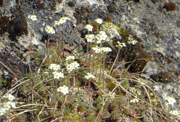
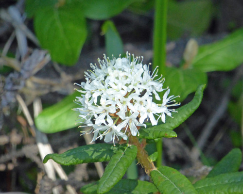
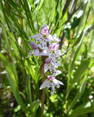
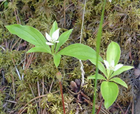
There were more of those little white flowers that I’d seen at Marble Canyon Falls. These were growing on a rock.
And more Labrador Tea (Rhododendron groenlandicum) too.
This was a nice little hike and while we had it to ourselves on the way out there were lots of folks hiking it as we returned. And the parking lot was now totally full and folks were parked way down the road. Happy Father’s Day.
As we drove back down the road, Walter urged me to get a shot of the Bark Beetle die off. So sad.
We stopped at the turn off for Punchbowl Falls which turns out to be a little water fall with the only view being from the top. I walked out along the trail but it ended before I could see the falls. Phooey.
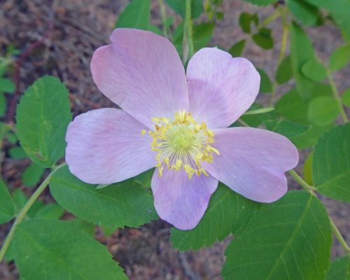
But I did get a nice shot of a wild rose.
We continued down the road almost to the highway and stopped at the site of the old Pocahontas Mine. This was a coal mine that they mined from 1910 until 1921. It didn’t produce much coal and the quality was poor so it didn’t last long. They named their company town after the very successful Pocahontas Mine in Virginia. This of course explains why in the world there is a campground named Pocahontas all they way out in the Canadian Rockies.
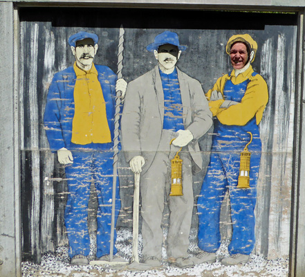
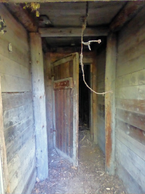
There’s not much left here but we took the lower trail around the historical area and stopped and talked to some colliers.
We think this was the entry to the old mine but who knows, it may have just been a sod house. It’s closed off and marked as unsafe.
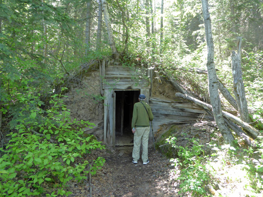
But it’s the only building remaining.
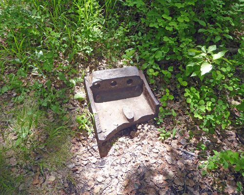
There are a few foundations and a concrete abutment here and there but that’s about it. All the houses in the company town were moved to Jasper or elsewhere. We found this big hunk of metal in the woods. Exciting, no?
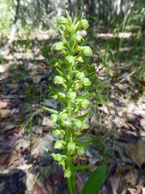
And I found three of these fun green bluntleaved orchids (Platanthera obtusata) in bloom.
The mosquitos were thick in the woods but when we came out into an open area (we figure this was the old town site) they weren’t so bad so we sat on a bench and enjoyed the view.
From here we decided to drive on over to the Jasper House Historic Site—site of the first trading post in the area.
And along the way there were cars pulled over and we won the jack pot! A bighorn sheep ram.
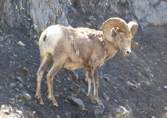
He, like the goats, was still losing his winter coat but he sure is majestic looking.
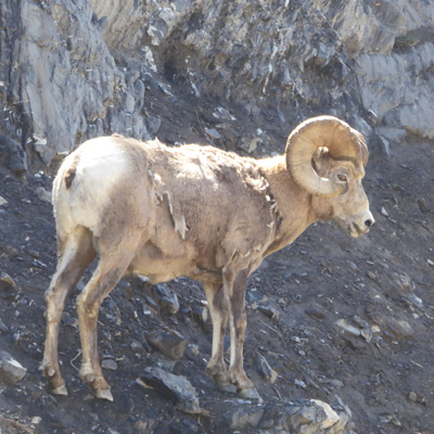
He turned around and then settled down to sit and watch the traffic down below.
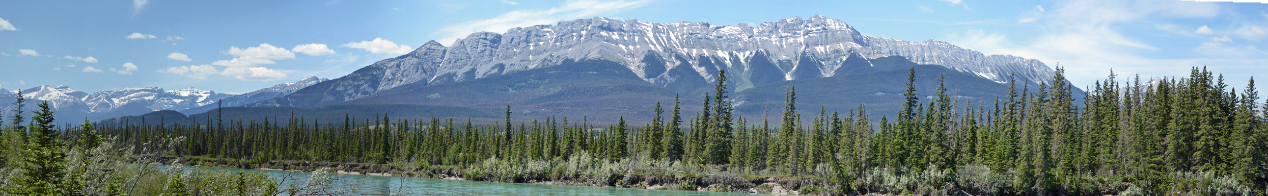
Around the next bend there was a nice pull out with great views of the mountains and the Athabasca River. Here’s the view to the east.
And the west.
That’s Pyramid Mountain on the left. It doesn’t take much imagination to figure out why they named it that.
The view to the southwest is lovely too.
Walter decided to take a pass on the short (300 meters) trail to the overlook at Jasper House. So I hiked out and discovered a premium wildflower walk!
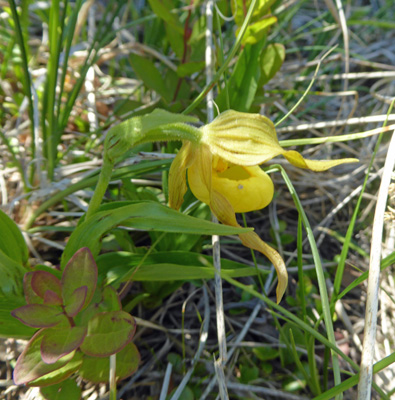
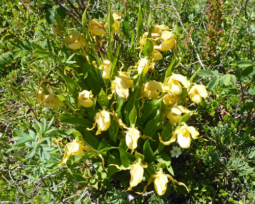
There were tons of these Greater Yellow Ladyslippers (Cypripedium parviflorum var. pubescens). We saw the standard Yellow Ladyslippers later in the week and they are smaller and have brownish upper petals.
They came in singles to start with but by halfway out there were bouquets of them.
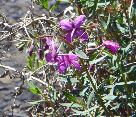
The trail crossed several small creeks and down below was what looks like the dwarf fireweed (Chamerion latifolium) that we saw in Alaska along the braided rivers.
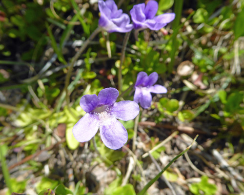
There were more of those lovely little purple vase-like flowers we’d seen on the trail to the Paint Pots which turn out to be Common Butterwort (Pinguicula vulgaris).
Plus these lovely tiny Roundleaf orchids (Galearis rotundifolia).
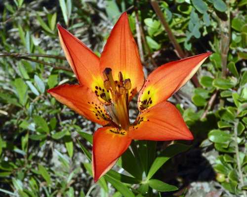
And one Wood Lily (Lilium philadelphicum) in full bloom on a creek bank.
The overlook gave you a full view of the mountains from east to west.
Jasper House was a trading post for fur traders from 1829 to 1884. It was in a meadow on the other side of the river.
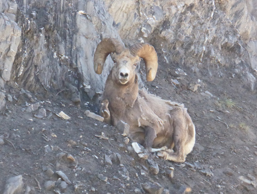
We drove on back home, past the bighorn sheep who had moved down to the highway verge. We think that there may be another salt lick here since the bighorn sheep hang out in this area a lot and he too was licking the dirt near the road. Then again, he might be after road salt from the winter.
At about 1:45 as we were sitting enjoying the day, a small cinnamon-colored black bear came by on the campground road. This time I grabbed my camera and shot a photo of him/her through the bedroom window as he went by.
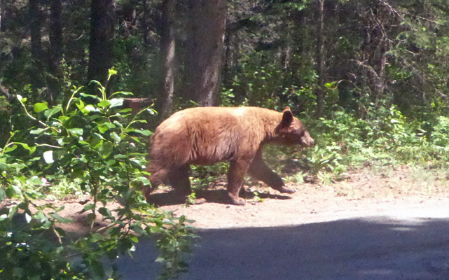
Two bears in two days strolling right by our campsite it pretty darned exciting.
It got up to about 83 that afternoon but it didn’t last long. The sun disappeared behind the trees on the hillside and things cooled down nicely. It got down to 46 in the early morning hours but had already warmed up to 53 at 8 am. We took the morning off; ran the generator and hung out.
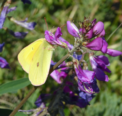
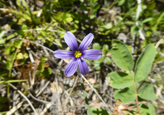
At about noon we headed out towards the town of Jasper. We stopped again at the Jasper House turn out and I went out to try to get a decent photo of the blue-eyed grass I’d seen the day before. But first I had to stop and take a photo of this butterfly feeding on what I think is Common Vetch.
I found some Blue-eyed Grass (Sisyrinchium montanum) in bloom not too far along the trail and this time my camera deigned to focus on it (the macro for flower close ups doesn’t always recognize blue or white flowers in bright sunlight).
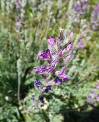
I also spotted a new lavender colored member of the what I think is an astragalus.
Then we went on into town and found the library. It’s a much smaller town than Banff—fewer restaurants and shops and LOTS fewer cars. There were lots of RVs parked on the streets and in the special parking along the railroad tracks but there were lots of open parking spots everywhere too. We found a place to park right next to the library and went in and used their WiFi. Then we went around the block to the Jasper Activity Center and paid $8.55 for the two of us to have showers. The women’s locker room had separate stalls and adjustable controls for temperature and while I had to wait a while to get hot water there was plenty. The men’s locker room had a gang shower that was controlled by motion detectors. Walter never got any hot water so he wasn’t very happy with the process.
Next we headed south out of town along the Icefields Parkway and had lunch in the parking lot for the Valley of 5 Lakes trailhead which had been completely full when we passed it at about the same time on Saturday but was only about 3/4 full on Monday.
There was sunshine (it was in the low 80’s) and we had a little haze but the mountain views were still wonderful.
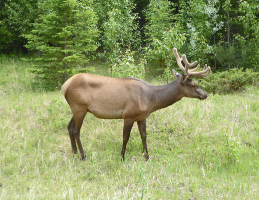
We came around a bend a there were cars pulled over with folks out with their cameras pointed at our side of the road. We slowed down and sure enough there was a bull elk on the verge. He even turned around and stopped eating for a moment so I could get a decent photo of him.
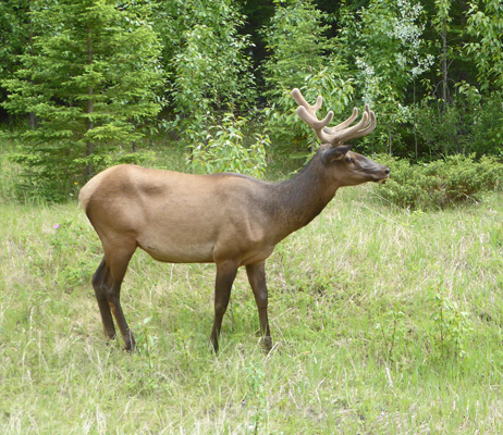
I’m not sure I’ve ever seen one up this close with velvet still on his antlers.
We continued on to Sunwapta Falls where we not only found a parking spot but it turned out to probably be the best spot in the lot. There are several hikes that start here so this is a low turnover lot which was nearly full.
We took the stroll out to the falls where there’s a bridge you can stand on to get a head-on look. And yes there are three trees that have fallen over the chasm.
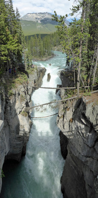
The water crashes under the bridge and into a rock cliff face and then turns the corner. It’s a wonderfully noisy waterfall.
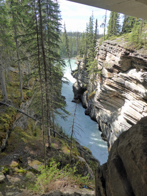
From here we turned back and drove north to the Athabasca Falls. This is a hugely popular stop along the parkway and they have a BIG parking lot which wasn’t full—hooray. We got another great parking spot and took the walk out to the viewpoint. I had to wait my turn to take a photo of the falls since there is really only a spot that is about 3 people wide where you can stand but hey at least it wasn’t so crowded I couldn’t get a turn.
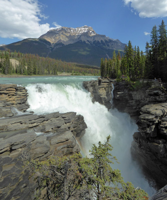
It’s not a very high waterfall but the volume of water crashing over it this time of year is enormous so it’s wonderfully noisy.
Walter found a bench while I walked over to the viewpoints on the other side of the falls which really didn’t give you a better view. On the bridge over the river you get a view of the whirlpool at the bottom of the falls that has formed a big round pothole in the narrow rock canyon at the bottom. And from another viewpoint you can see the water shooting out of the canyon and out into the wider plain from under a bridge.
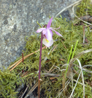
Along the trail I spotted a tiny little pink ladyslipper (Calypso bulbosa).
And this oddly elongated pair of bunchberries (Cornus canadensis).
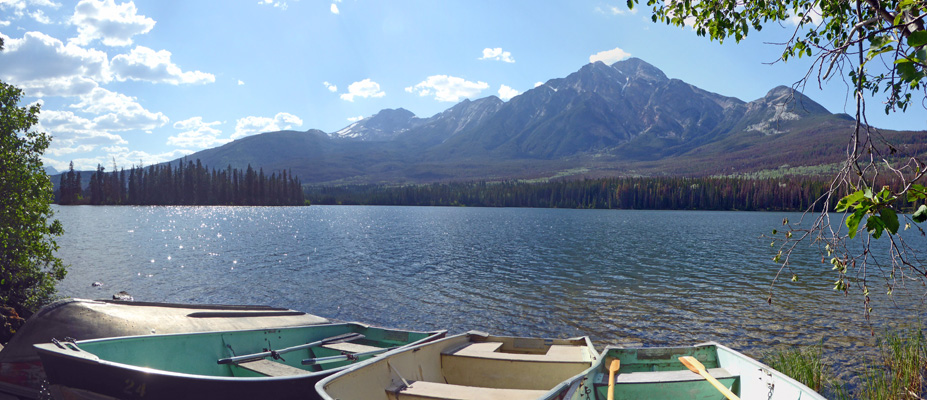
It was late afternoon by this point so we decided once we were back in town that we’d take the drive up onto the Pyramid Bench (a plateau above the town) and drive out to Pyramid Lake to search for wildlife. There were lots of folks just leaving a spot where we figure they probably had seen a bear but we saw no other critters except homo sapiens. There were folks out in kayaks and canoes and pedal boats near the lodge of Pyramid Lake so we kept driving to the end of the road. I got out and shot this photo into the sun.
On the way back to the campground Walter spotted a cow elk out across the river on his side of the road. There weren’t any bighorn sheep at the salt lick—there hadn’t been any goats along the Icefields Parkway either. We made it home by about 6:30. We were both a bit tired but happy.
We had two more full days at Jasper which I’ll cover in my next missive. We had great warm clear weather which was a real treat after the cold rainy weather we’d had in Banff.