While we were checking in Walter found the Craters of the Moon brochure we’d wanted to pick up at the Visitors Center so we were good for our planning. We set up camp and were happy to find that the internet worked fairly well (it got slow in the evening but worked pretty well most of the time we were there). The cable TV was minimal but better than nothing.
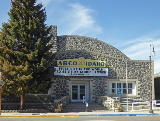
After lunch, we went out to see the sights in Arco, population 995. Back in the early 1950’s there was a lab here that worked to develop the nuclear reactors that powered the first nuclear submarines. As a result of that research, Arco became the first city in the world lit by atomic power.
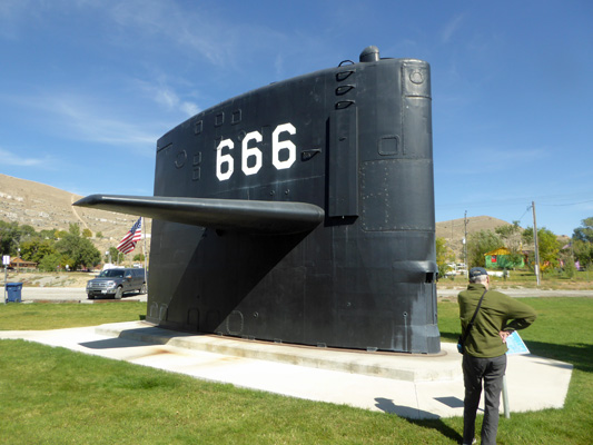
They also have a fun little Idaho Science Museum on the highway where you can visit the tail fin of the USS Hawkbill. It’s known as the Devil Ship since it’s also called SSN-666, known by some as the sign of the beast from Revelations. The Hawkbill was commissioned in 1971 and served the Navy until March 15, 2000 when it was decommissioned.
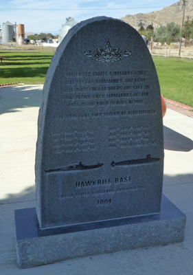
Because of the area’s involvement in the development of the nuclear subs, you’ve got all this cool stuff about them in the middle of the lava beds in Idaho! There’s a memorial to all the 65 submarines and more than 4,000 crew members lost since submarines became part of the Navy in 1900.
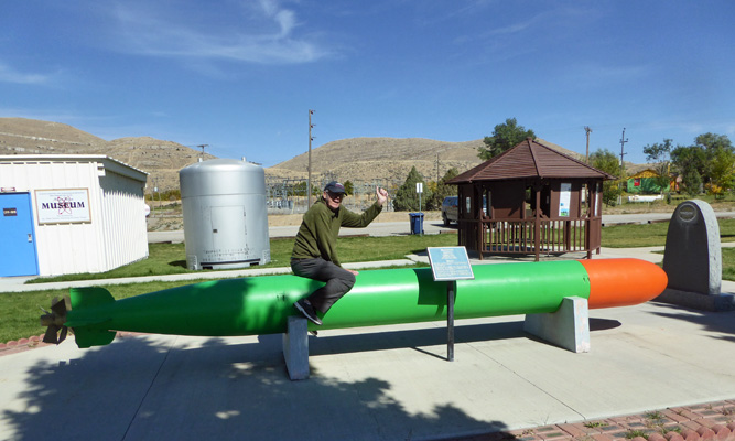
And they have a torpedo too. Of course Walter had to climb on board to take a ride.
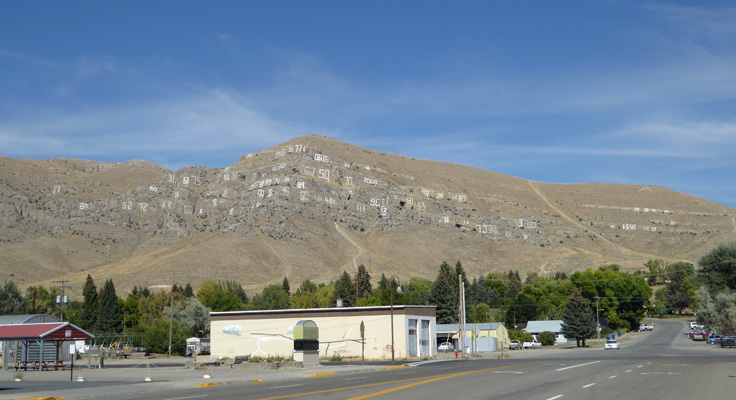
Up on the hillside behind the museum, the high school graduating classes have painted their class years going back into the 1920’s.
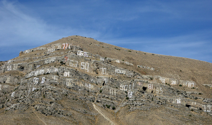
Here’s a close up of part of the hillside.
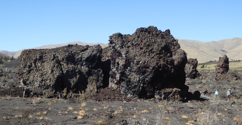
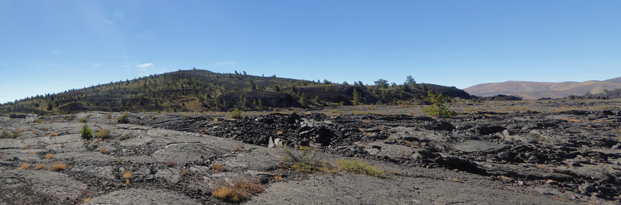
We had clear skies that night and the temperature got down to 29 degrees in the early hours of the morning. Brrr. We hung around home waiting for it warm up some and then set off back to Craters of the Moon to drive the 7-miles loop that takes you through a small portion of the 750,000-acre park. Most of the park has been designated wilderness and there are no roads and only 1 trail that lead out into it. But the 7-mile road gives you a nice taste of the range of features in the park.
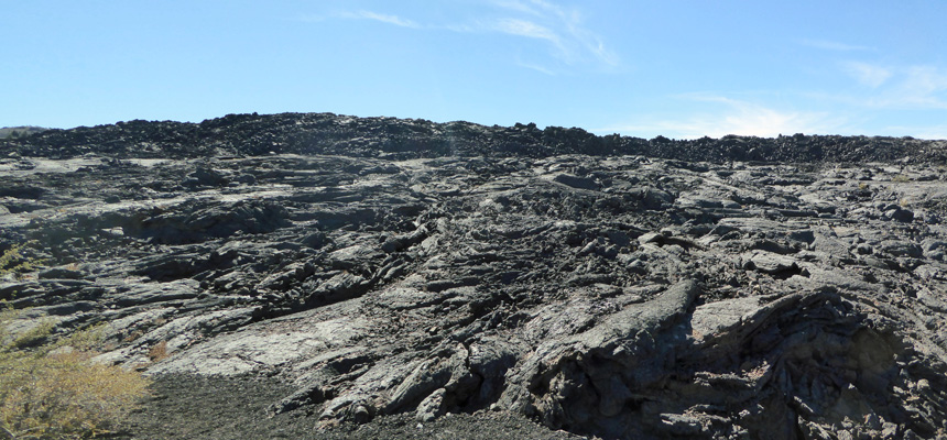
Our first stop was the North Crater Flow Trail. This short trail takes you across a section of the newest lava flow in the park from just 2,000 years ago.
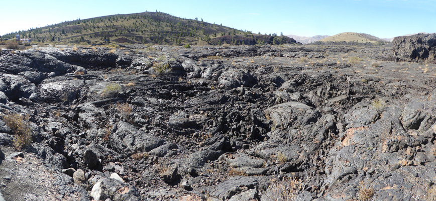
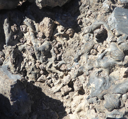
The lava flow was powerful enough to raft large sections of the crater out into the lava field.
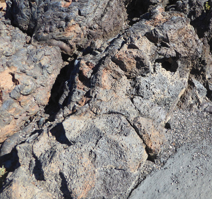
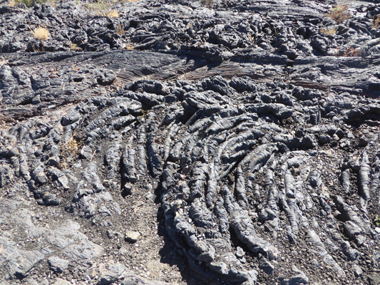
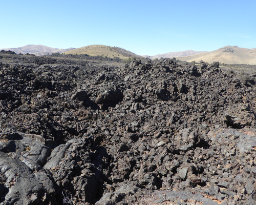
We’ve visited a lot of lava flows over the years in Oregon, California and Hawaii and they are always great fun. This trail had some nice examples of different kinds of basaltic rocks. Some that looked gooey or that it had just been splatted out.
And others full of holes like it had been very frothy to start with.
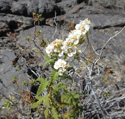
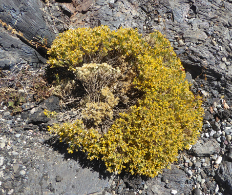
The temperatures were in the high 60’s—way cooler than the 100’s they have here in the summertime. And there were a few things in bloom, including this Fern Bush (Chamaebatiaria millefolium).
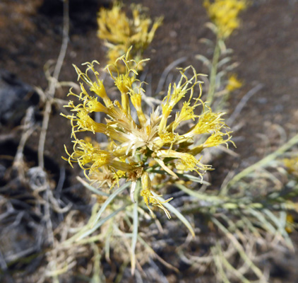
And this really small Dwarf Goldenbush (Ericameria nana).
There are some very nice pillars that are also thought to have been pieces of the crater that broke off and were rafted along on the lava flow.
As you walk along there are great examples of pahoehoe lava which occurs when lava is very fluid. This stuff has folded up like ribbon candy.
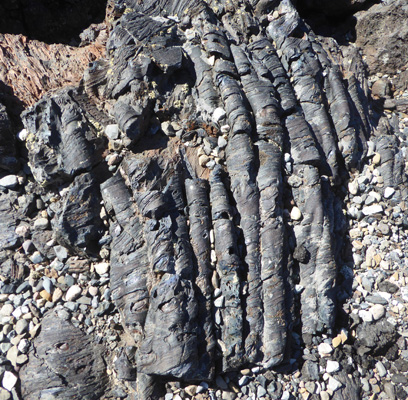
And this has swirled around and folded too.
This chunkier stuff is closer to being like ‘a’a lava which forms when the lava is thicker and more viscous.
This is usually a loop trail but one end of it was closed for renovation. Here’s the view from the ‘end’ of the trail looking toward North Crater. There’s a trail that winds up and around the North Crater—be sure to wear heavy boots. Lava will eat up your shoes in no time. This and the other craters here grew out of the Great Rift, a 52 mile long crack in the earth’s crust that has broken through to create cinder cones, splatter cones and huge lava beds for thousands of years.
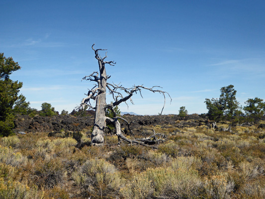
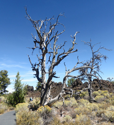
We drove on and then took the short spur road to the Devils Orchard Nature Trail. It wasn’t a terribly spectacular trail and the signs were about how much damage folks have done to the features of the park by simply walking on them (and what air pollution does to the lichens). But there were some very cool Limber Pine snags that made nice pictures.
And there was lots of Rubber Rabbitbush (Ericameria nauseosa) in bloom.
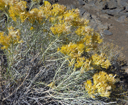
There was a lot of this in bloom along the highway too. It likes to grow in disturbed areas and seems to think that the fall is the best time to bloom. We saw tons of it in bloom in the Great Basin in Nevada in late September back in 2010. The flowers are kind of fun.
At the end of the trail (or perhaps the beginning since it was a loop) there was another great snag. It turns out some well meaning park managers had pruned the trees years ago trying to remove the witches broom and the pruning had accidently killed them—ah unintended consequences. Witches broom is a parasite but it doesn’t kill the trees. Pruning it out though left the trees open to diseases that did kill them.
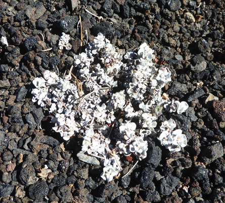
Having finished this trail we drove on to the one-way portion of the loop road and noticed all these little white plants growing on the cinder fields. They were nicely spaced out and if you didn’t look carefully you could think they were just lots of white rocks.
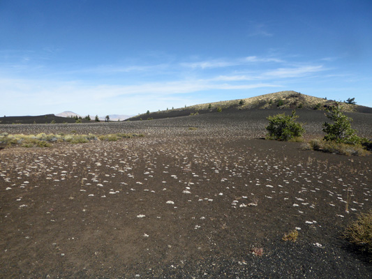
But no, they were Dwarf Buckwheat (Eriogonum ovalifolium). They bloom in the spring (late May to early June) and have orange flowers.
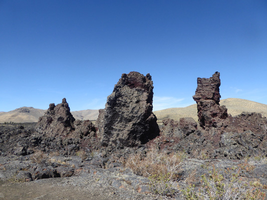
We skipped the hike up the Inferno Cone but I did get a nice shot of it from the parking area just past it.
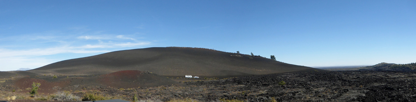
It’s what is called a cinder cone. Volcanic eruptions that include high gas content will create fine foamy cinders that accumulate around the vent and eventually build up to form a cone.
Towards the end of an eruption spatter cones appear when the vent ejects globs of tacky lava that adhere together. We stopped and visited the Snow Cone (an old spatter cone that is eroding due to too many folks visiting it) and got a nice view of the Spatter Cone (which you can climb up into) and another one just past it.
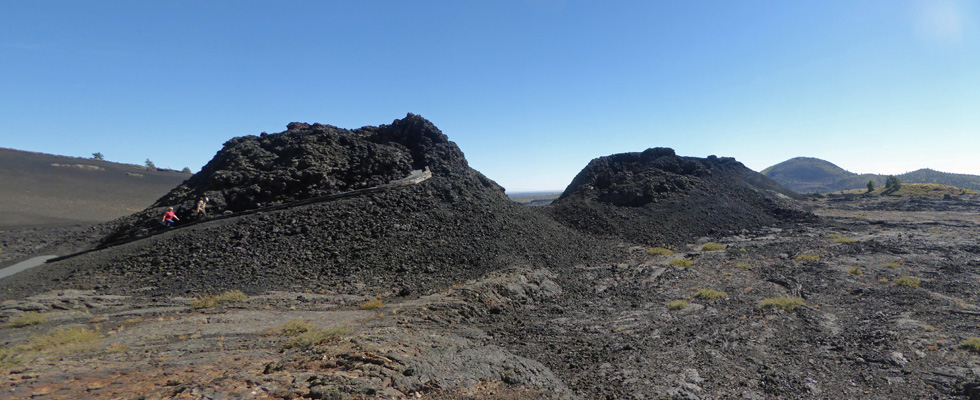
Facing the other way you can see the lava flow that the North Crater Trail goes across—the trail ends here at the spatter cones.
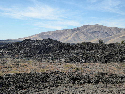
We drove on and along the way I stopped to get another shot of the lava beds with another cinder cone behind.
We took the spur road out towards the Tree Molds and Wilderness Trailheads and were glad we did. There is this wonderful area called the Lava Cascades where a lava lake had formed and then began to leak and lava flowed in a cascade down the hillside.
The picnic tables at the trailhead area and at the parking are for the caves area (lava tubes that have broken open which kids LOVE to explore) so we drove on and had our lunch back at the parking area for the Devils Orchard.
After lunch we went back to the Visitors Center after checking out the campground here which is nestled in among the lava flows. It was nearly full and we were happy to be camping in town where we could have power since it had been so cold at night. We watched the movie, watched lots of kids get sworn in as Junior Rangers (needless to say this is a real popular park for kids) and then watched yet another movie in the museum portion which was really good too.
It wasn’t as cold that night but it was still pretty cool when we broke camp the next morning, Saturday September 22nd, and drove east on Hwy 20/26 and then stayed on Hwy 20 to Idaho Falls and the Snake River RV Park. We had a reservation for 3 nights in a full hook up pull through. It hadn’t been a very long drive so we arrived pretty early and were lucky that our spot was open. Things were pretty empty in the pull through section (there are lots of folks here long term) but it all filled up by evening.
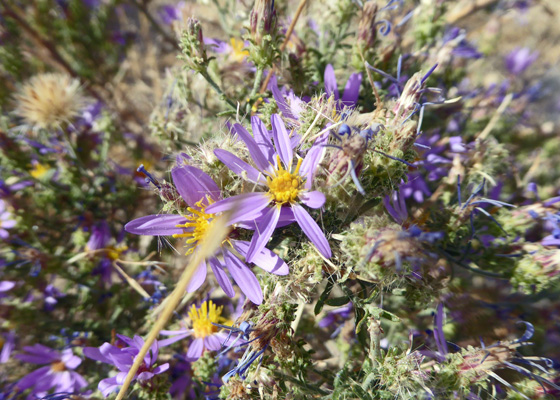
Along the way we stopped to change drivers and I took the photo of a small aster in bloom in the gravel along the verge. I think that it’s a Tundra Aster (Oreostemma alpigenum).
Their WiFi worked pretty well most of the time and Walter found plenty of TV over the air. He got to watch plenty of college football—including Stanford coming from behind to beat Oregon and then got to follow the Husky-ASU game on-line so he was pretty happy. It was in the mid-80’s for a while in the late afternoon but once the sun went down it cooled off pretty fast.
Sunday September 23rd it was cloudy and breezy. I did the laundry and then after lunch we drove south just a little ways to a parking lot along the Snake River to explore the Temple Loop of the Idaho Falls River Walk.
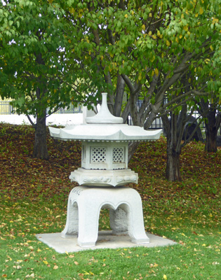
Our first stop was the Japanese Garden built to honor Idaho Falls’ Japanese sister city.
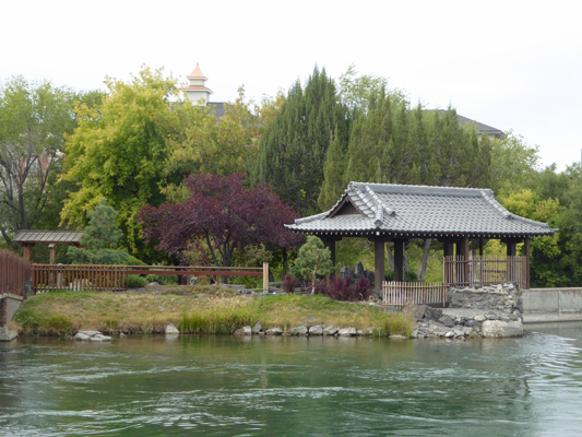
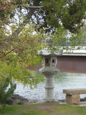
There’s a nice little bridge crossing the river to it and then you can wander the paths to view the stone lanterns.
And the little ponds with stepping stones.
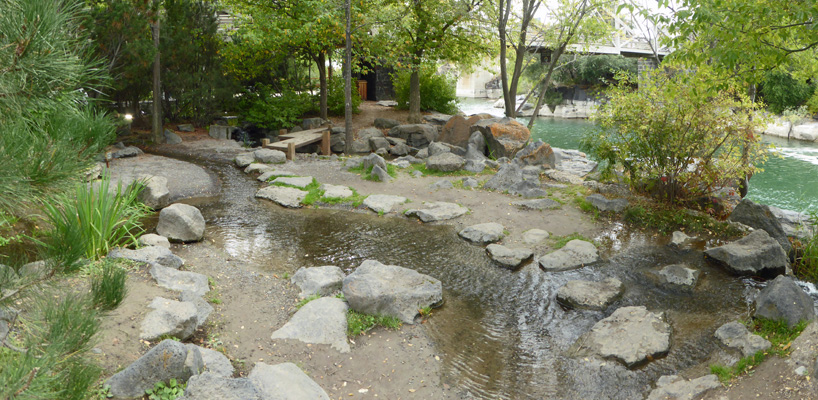
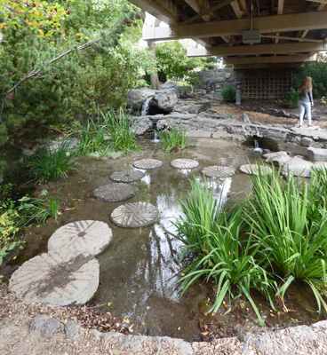
Under the highway bridge there was yet another pond with more stepping stones.
This was a lovely bit of quietude and beauty. We followed the next bridge over to the actual River Walk and past yet another stone lantern.
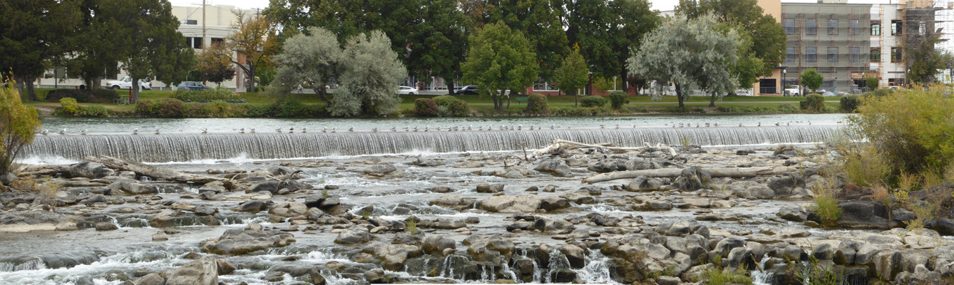
At this point you are in the heart of downtown Idaho Falls. There are hotels just across the street and Broadway, one of the main places to cross the river, is right there. Once we crossed Broadway we got our first view of Idaho Falls, a series of cascades created by a diversion dam built back in 1900 and then expanded in the early 1980’s. It feeds a series of 3 hydroelectric plants that generate nearly half of the electricity needed to power the city. The good news is that they did a nice job of it so the falls are pretty.
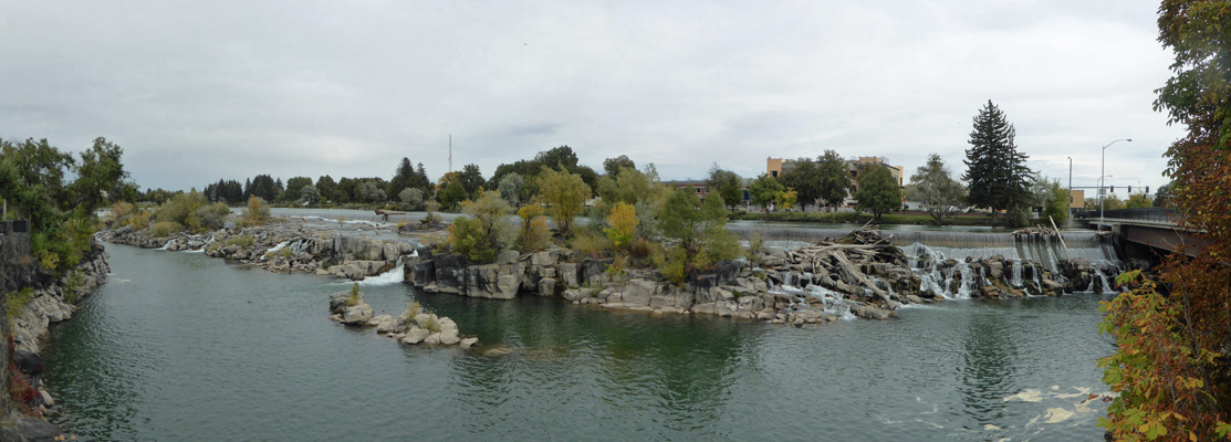
From this angle you can see the diversion dam as the water cascades over it. Don’t you just love the sea gulls waiting in a cue along the edge? I have no idea why they’re all pointed south.
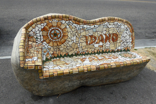
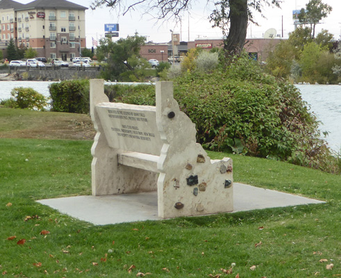
The diversion dam is several blocks long and there are falls all along it too. There is a greenbelt that runs all along both sides of the river along most of the 2.3 miles of the Temple Loop. And in much of it they have installed all sorts of fun artistic benches like this mosaic one in honor of Idaho Falls.
And this lovely metal fish.
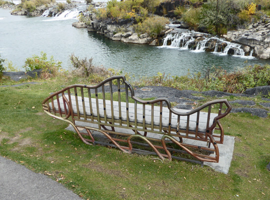
I don’t know the story behind this project but it sure brought a lot of fun stuff to the River Walk.
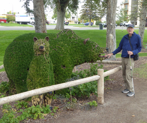
There are also a series of topiary statues. This is the only one that was actually green. Keeping moss alive through the hot Idaho dry summer must be a challenge. This bear had TEETH so Walter of course had to put his fingers in its mouth.
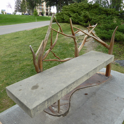
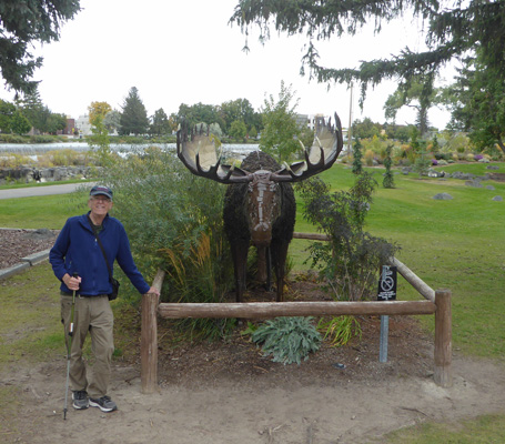
There were also life-sized metal sculptures like this moose.
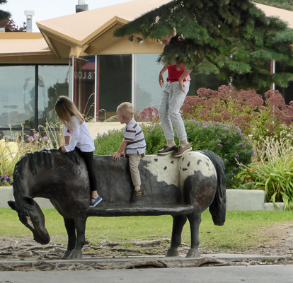
This family of kids thought this horse-bench was a perfect horse to ride. One of them even tried out being a trick rider by standing up.
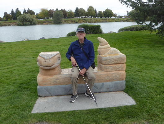
Walter, being an excellent bench tester, had to try out the rattlesnake bench.
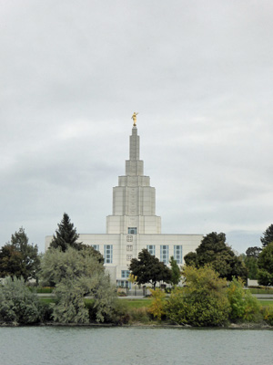
This portion of the River Walk is known as the Temple Loop because it gives you a view of the LDS Temple—the first one built in Idaho (finished in 1945).
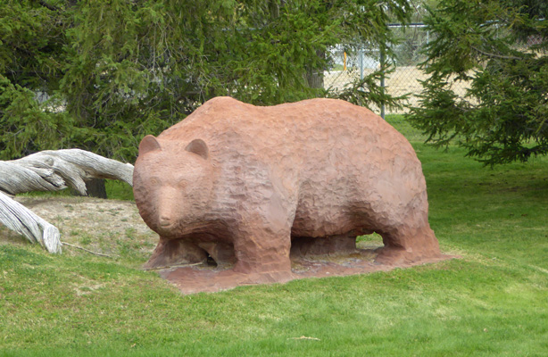
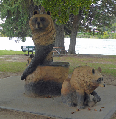
We continued along the loop, crossed the river again and came to another cluster of sculptures. This time a bear.
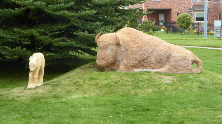
And a bison and calf.
Walter was tired by this point. We were both pretty tired at this point in the trip and it had been a full week what with the refrigerator repair and having to hitch up and move so many times. So he stayed sitting on a nice bench and I continued on the loop back to the truck and then drove back and picked him up. He was a little cold (it was in the mid 60’s and cloudy and breezy) but otherwise fine.
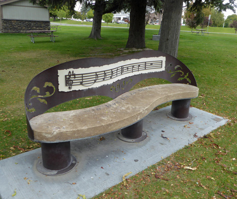
Along my way to the truck I passed this cool musical bench. The message on the bench is “To live for to love”.
And there was a wonderful set of bear benches!
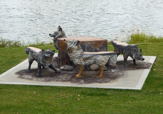
And there were wolf benches too.
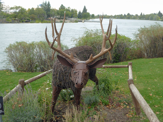
There was an elk topiary whose moss had died. I think he’s really stunning with the dried moss hanging down.
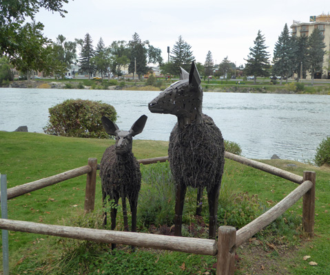
And there was a doe and her fawn.
Just before I reached the end, I found a bench using the shape of the state of Idaho—a perfect end-piece for a bench.
I made it back to Walter without a hitch and we headed home in time to see the Seahawks beat the Dallas Cowboys for their first win of the season.
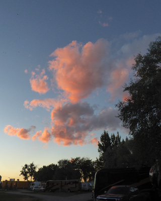
Monday September 24th, it was beautiful and sunny but cool (high 60’s) and we did grocery shopping and dinked around in the trailer working on a few minor repairs—there’s always something! That evening we had a little bit of pink in the clouds at sunset.