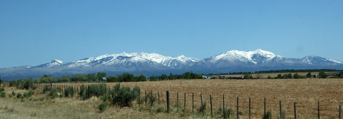
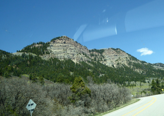
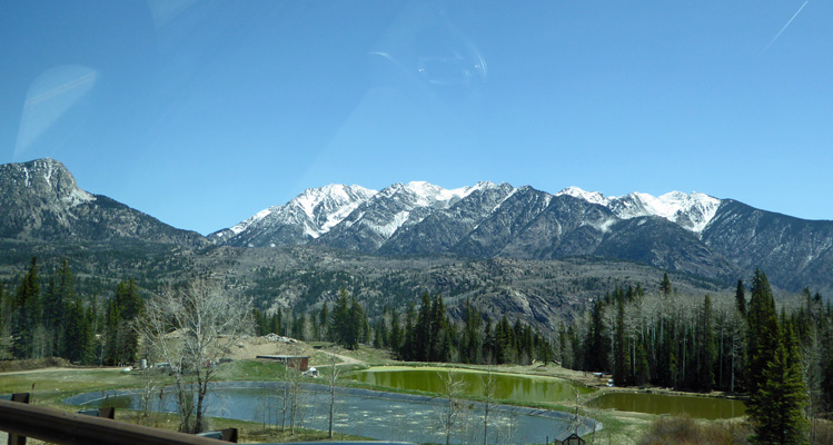
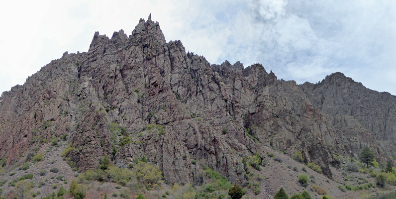
Hwy 140 hits Hwy 160 in Hesperus at the foot of these mountains and we turned east towards Durango. In Durango we turned north on Hwy 550 and began a steady climb up into the mountains. We passed great cliff walls.
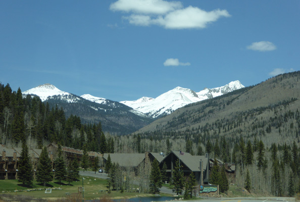
And Engineer Mountain in Purgatory where there’s a ski area.
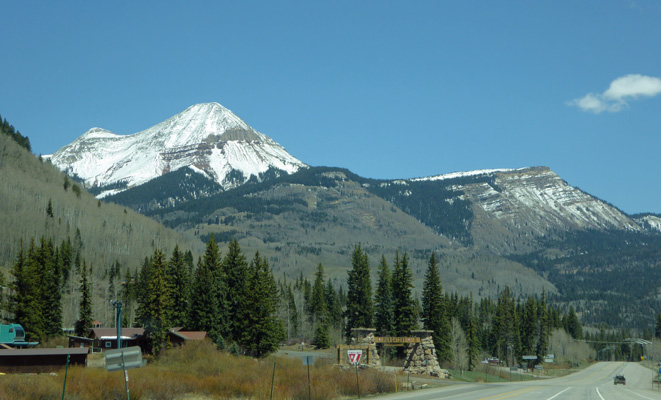
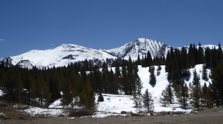
More and more snow-capped mountains appeared as we drove through the ski area.
Funny how the views are so great in places like that.
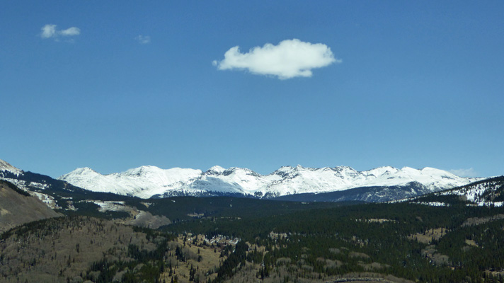
You have to go over 3 passes that are over 10,000 feet on this drive. Just before the first one we got new gorgeous mountains.
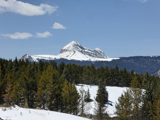
A sign even identified this one as Twin Peaks.

We stopped for a rest stop just before Coalbank Pass (which is 10,540 feet). It was a beautiful Saturday morning and there were tons of crazy bicyclists riding from Durango up over Coalbank Pass and on to Molas Divide which is 10,910 feet high. What little bike lane there was disappeared after Molas so we didn’t see more bikes after that—which was good since it’s a big avalanche and rock fall area. Here’s the view from the spot where we stopped looking south.
And looking east.
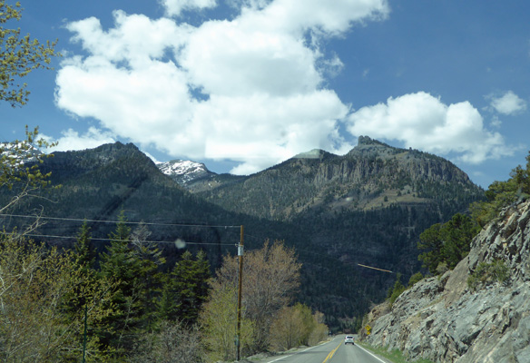
The roads were clear and dry but there was still lots of fresh snow on the ground.
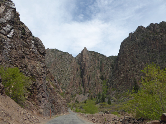
As you come over the last pass you enter a rocky canyon.
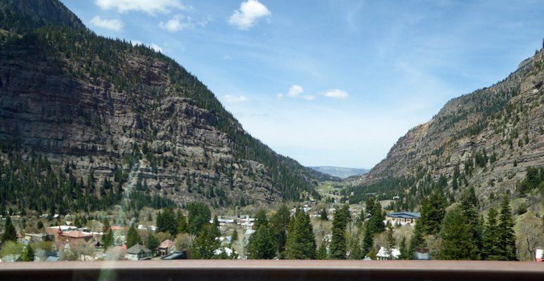
And reach the town of Ouray.
From here the high plateau opens up and you’re out of the mountains for a while. We continued on to the town of Montrose and then turned east on Hwy 50 which leads you to Black Canyon of the Gunnison National Park. Their campground has 3 loops with one of the loops having 22 electrical hook up sites. Reservations here don’t start until May 15th so we figured we’d be okay but we were still a bit concerned about arriving mid afternoon on a Saturday. No problem. We had several sites to pick from so we chose a side pull through site and settled in. They truck all the water into this park so there are no water hookup and no dump station (though they’re working on that). There’s a water bottle fill station though near the entry of the campground. With our Golden Access Pass (and the fact it was off season) our spot only cost us $10 a night. There’s no cell signal but hey, it’s a National Park.
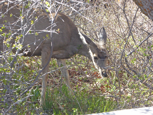
It was mostly sunny and the weather forecast was for mostly cloudy weather the next two days so we got it together after we set up to go have a look at the canyon in the sunshine. We spied a deer munching on the bushes in the campground as we set out.
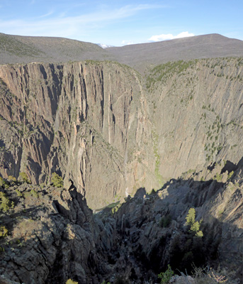
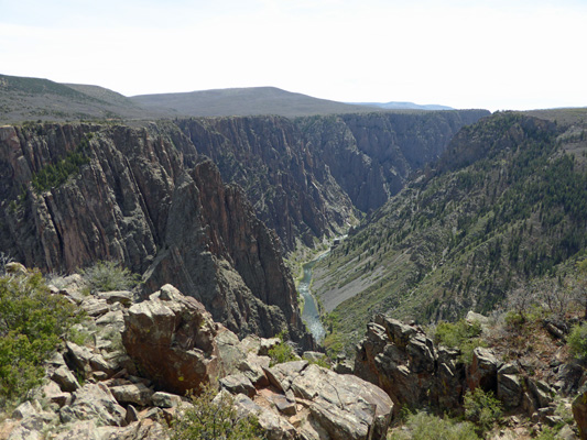
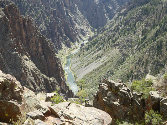
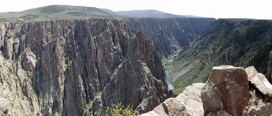
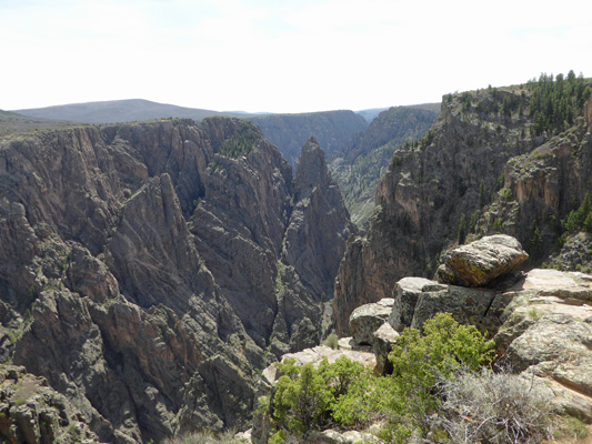
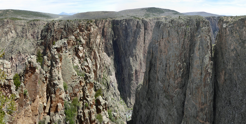
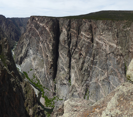
The first overlook on the park road is Tomichi Point this is looking east mostly.
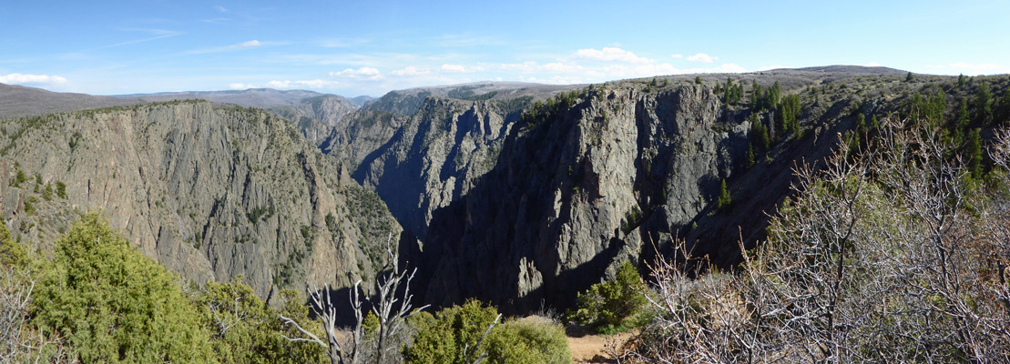
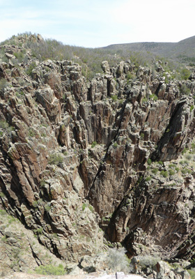
The canyon is named Black because so little sunlight reaches the bottom because the walls are so steep and the canyon is so deep. At its deepest point it is 2,772 feet deep. And at its narrowest point it is only 40 feet across down at the bottom.
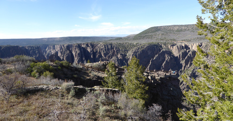
From the Visitor Center Parking Lot the North Rim is RIGHT there across the way.
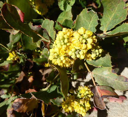
We took the short trail from the Visitor Center out to Gunnison Point. On the way I spied some tiny Oregon Grape (Mahonia repens) in bloom here and there.
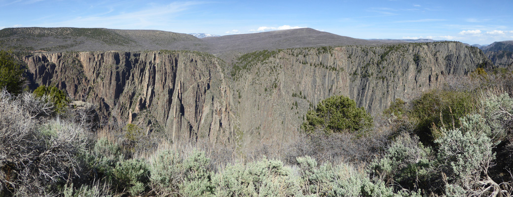
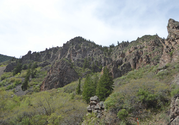
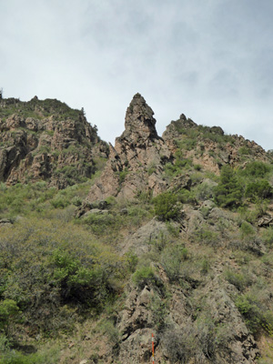
From the top of the trail you can see a series of pegmatite spires on the north rim. These were created by molten igneous rock that squeezed into fissures of the gneisses (black rock). The igneous rock is harder than the gneiss and so you end up with spires which are lighter than the rest of the black walls.
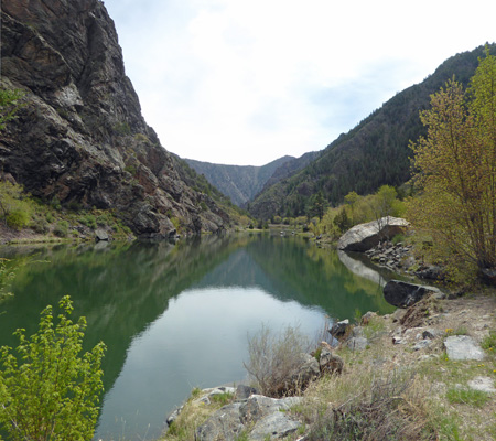
Out at the viewpoint you could look out and down and see a little bit of green water—the Gunnison River itself. It’s taken this river 2 million years to carve the canyon.
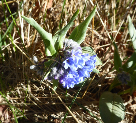
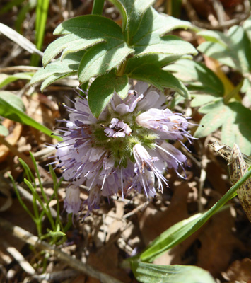
There were bluebells (Mertensia spp.) in bloom along the trail and in our campsite.
The south rim is over 8,000 feet so we took it easy climbing back up to the Visitors Center. It was good that we’d had a few days at 5,000 feet and then nearly 6,000 feet to help us acclimate to the change in altitude. Here’s a view of Gunnison Point from the back deck of the Visitors Center.
The next morning the campground emptied out fast—it was Sunday after all. And the deer were out in force as the campers left. While we sat at our dining room table one doe came to prune the shrub right outside the window.
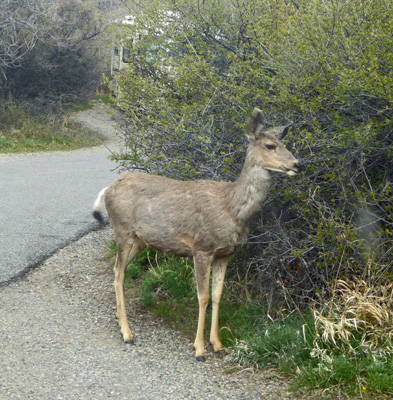
And shortly after she left, another arrived to work on the same bush.

When we came back later in the afternoon there were three deer bedded down in the campsite across from ours. But they meandered off before the folks who belonged in the spot came back.
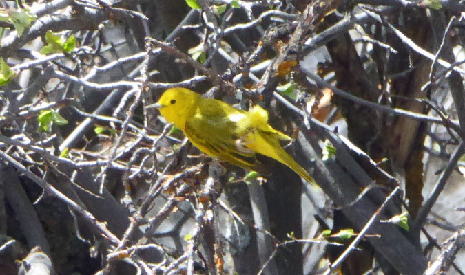
A number of goldfinches were singing their hearts out in the trees as we set out a while later.
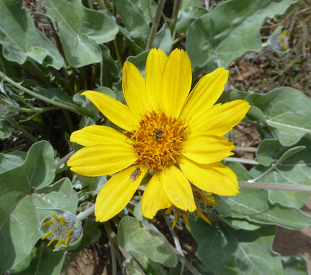
The South Rim Road leads from the campground area past the Visitors Center and then west for about 7 1/2 miles. Along the way there are a series of overlooks most of which require a bit of a hike to get to. We started out hiking out to Pulpit Rock. This trail is about 3,000 yds. and lead us past some lovely Arrowleaf Balsamroot (Balsamorhiza sagittata) something we usually see in Eastern Washington in the spring.
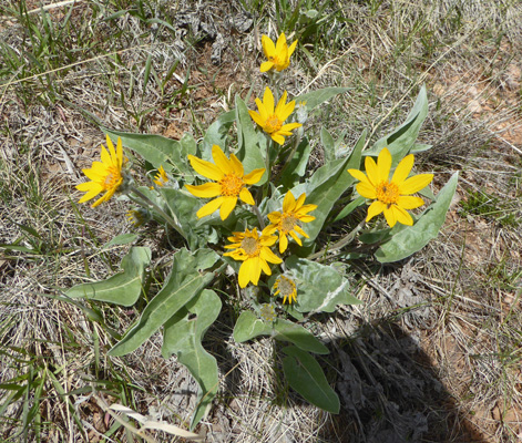
They’re such great happy flowers.
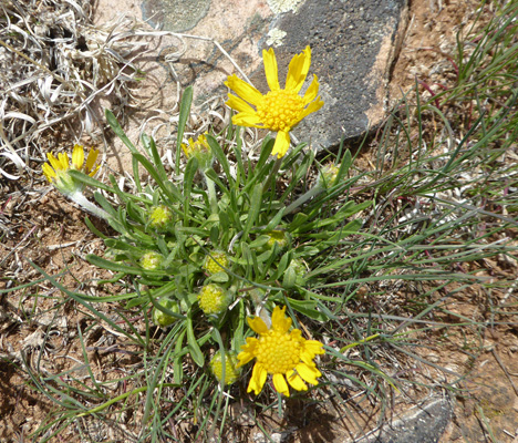
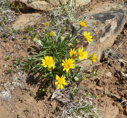
There was also little clumps of these lovely little daisies which turned out to be Ives’ Fournerved Daisy (Tetraneuris ivesiana)
Even before you get very far the view is great.
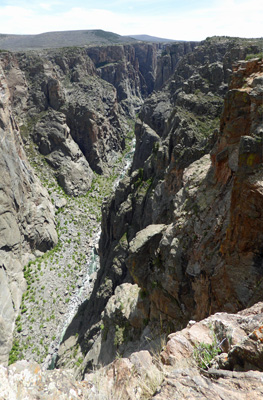
Here’s a close up of the river.
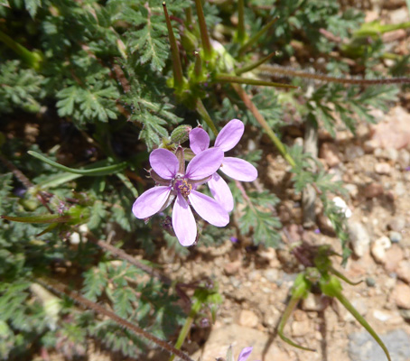
Along the way, I spied some Spring Beauty (Claytonia rosea) in bloom too.
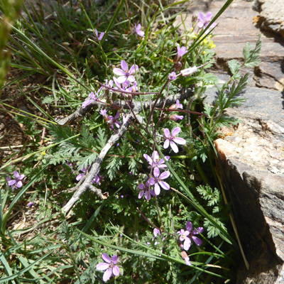
They’re not very big but they’re still lovely.
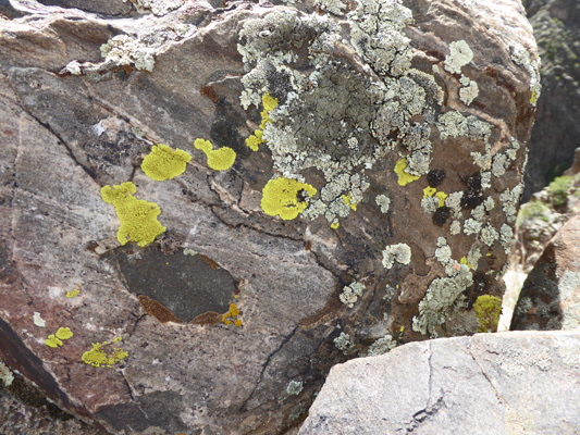
The lichen on the rocks out on the point were super.
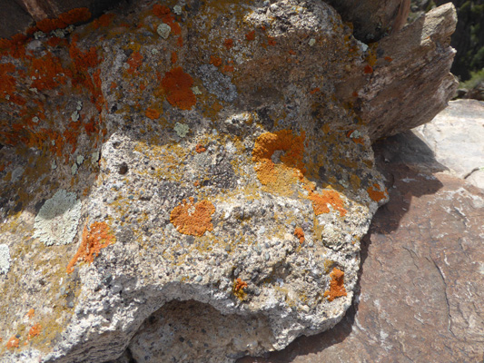
And came in yellow and green too.
Here’s the view from out on the point.
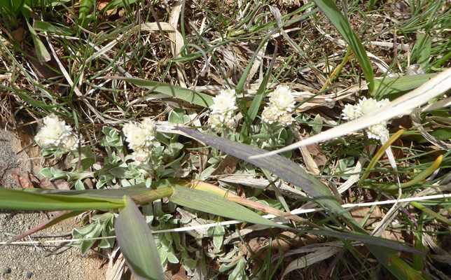
On the way back to the truck I spied some tiny pussy toes (Antennaria parvifolia) that reminded me of miniature pearly everlasting.
We drove on to the next view point which was Cross Fissures. Walter decided he needed to rest so I took the trail (another 3,500 yds) out. There was Dwarf Waterleaf (Hydrophyllum capitatum) growing right at the beginning of the trail.
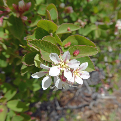
And tons of what I think were Serviceberries (Amelanchier alnifolia) in bloom along the way.
And a Death Camas (Toxicoscordion venenosum) too!
Out at the viewpoint you were faced with a deep cleft and then a rock face.
To the east you could see the canyon.
On the way back I spied these cute little yellow buttons.
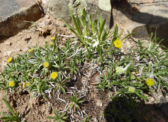
And these yellow daisies which just might be the Ive’s Fournevered Daisies again.
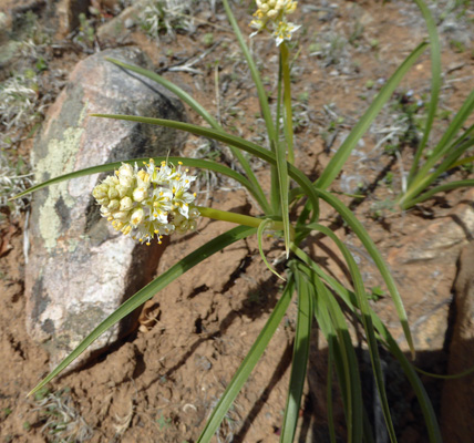
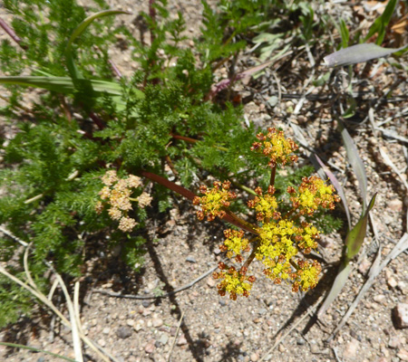
There was also quite a bit of Gray’s Biscuitroot (Lomatium grayi) in bloom too.
The next viewpoint was Rock Point and Walter made the trip with me this time. It made what I had seen at Cross Fissures make much more sense.
The Cross Fissures view point is on the top of the cleft on the far right. What you’re looking at there is a formation called Big Island. The river runs north and around it.
We skipped the next viewpoint since it was a long walk and it didn’t look like it was going to give us much of a different view.
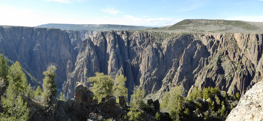
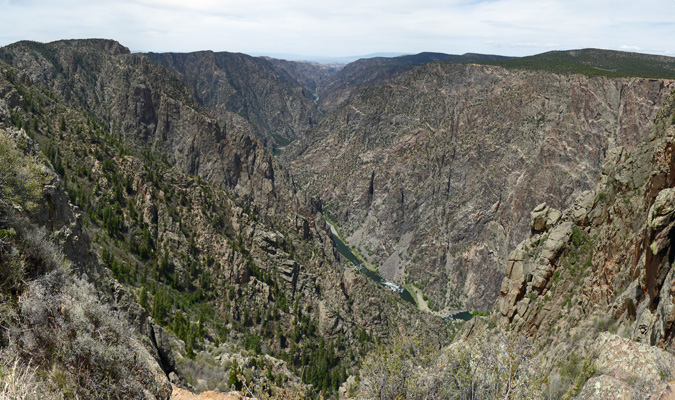
The next pair of viewpoints after that have one long parking area. We parked and hiked first to Chasm View—which is totally worth the walk and shouldn’t be missed. It’s straight down and you can see a long stretch of the river too. The run between Pulpit Point and Chasm View is the narrowest portion of the canyon at only 1/4 mile wide.
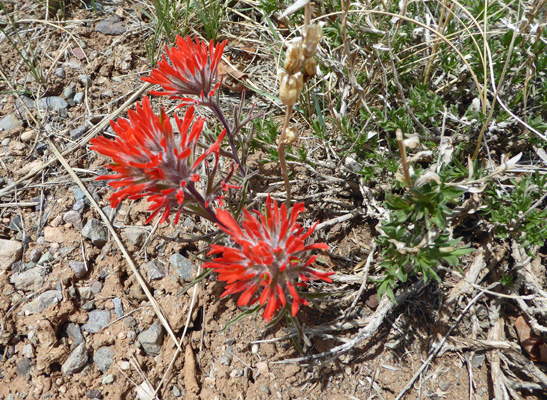
On the way to the Painted Wall, I saw a number of patches of my old friend Desert Paintbrush (Castilleja chromosa).
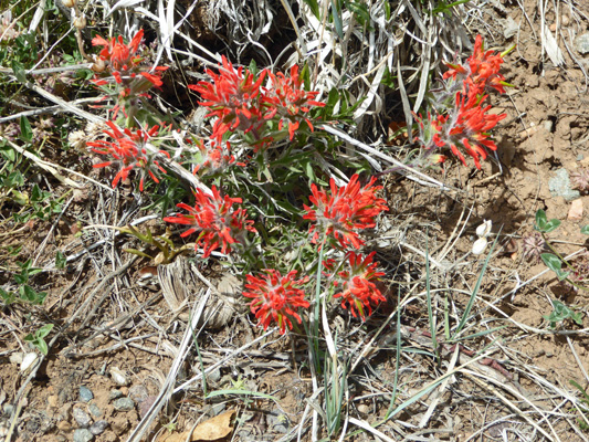
As far as I’m concerned no trip is complete without some form of Indian Paintbrush!
It’s a little walk out to the Painted Wall with a rocky scramble down to the viewpoint but it’s a great view.
Painted Wall (at 2300 feet) is the highest cliff in Colorado. The ‘paint’ on the wall is made up of rock intrusions a billion years old.
Sunset view is the last major viewpoint that is within easy walking distance of the road. It gives you a nice westward view of the canyon.
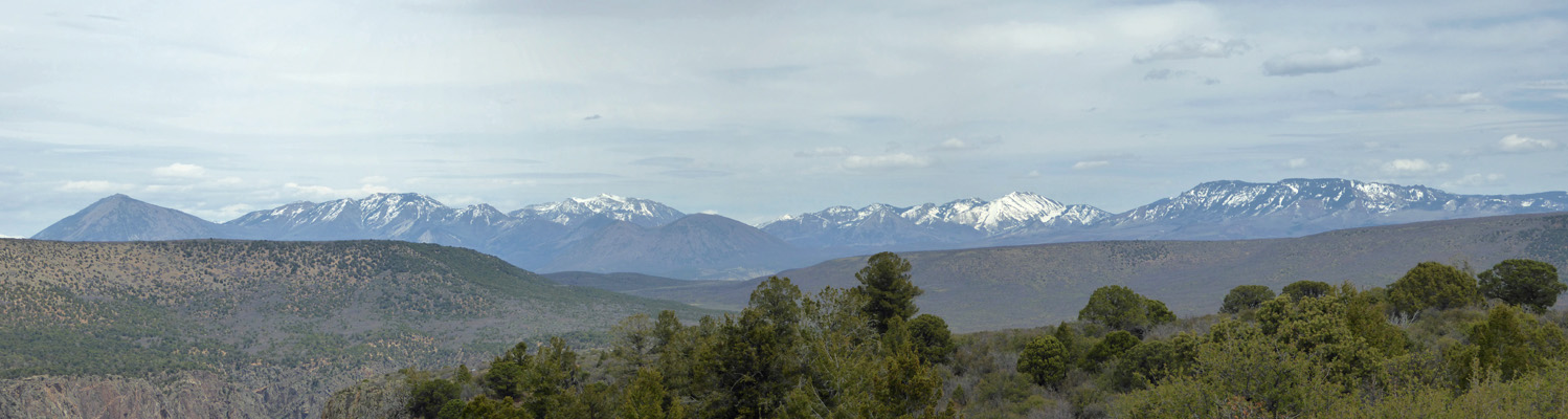
The road continues on to High Point (8,289 feet) where you can get a great view of the Rockies off to the northeast.
The Warner Point Trail starts here too. It’s a 1 1/2 mile round trip trail to yet another viewpoint. We’d hiked enough at this high altitude so we turned back and went to the Visitors Center and watched the movie (lots of great history of the exploration and development of the park) and then on home for lunch.
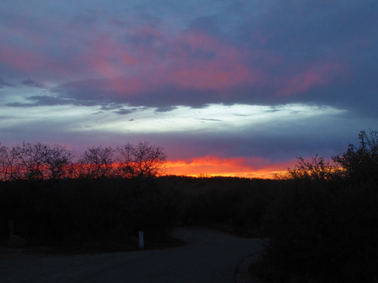
We’d had high clouds off and on all afternoon and they made for a nice sunset that evening. It started out gold.
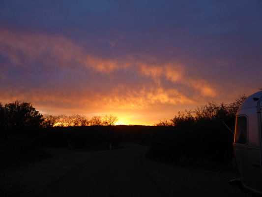
Then turned rosy.
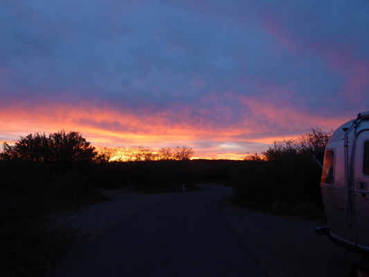
And lasted quite a long time.
Monday morning May 7th it was pretty nearly entirely cloudy but not cold. In fact it got up into the low 70’s in the afternoon (but it got so windy we had to close up our windows and vents).
We decided we’d take the East Portal Road down to the bottom of the canyon to see the sights. This road is only 5.5 miles long but a good portion of it is 16% grade since you’re descending over 2,000 feet in a fairly short distance.
It wasn’t a hard drive (in low gear) and it got us down to into the canyon for a whole different view on things. Instead of looking DOWN into the canyon now we were looking UP.
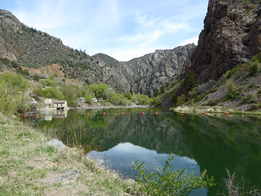
The river is mirror smooth here because of a series of dams that allow the Bureau of Reclamation to divert water through a 5.8 mile long tunnel (the longest irrigation water tunnel in the world when it was finished in 1909) out to the valley below for agriculture.
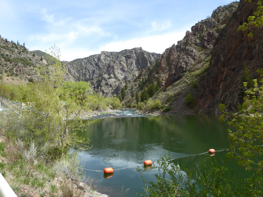
The tunnel is off to your left just before the beige building.
The pinnacles aren’t as big in this section of the canyon but they’re still fun.
And the mirror smooth river made for great reflection photos.
The road continues eastward to just before Crystal Dam where you turn around and can look down canyon again to see how steep the canyon walls really are.
Straight across the river it was a solid wall of rock.
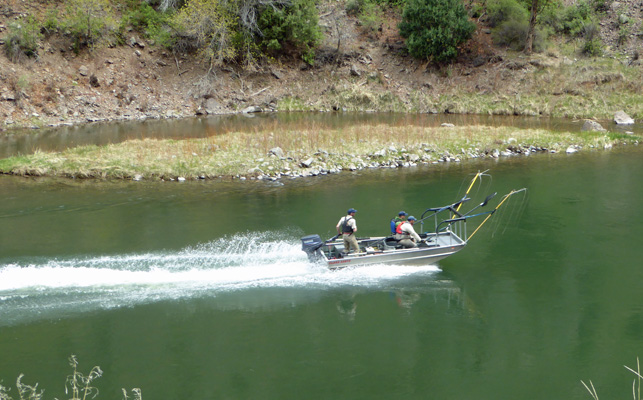
On our way back up canyon, a Park and Wildlife boat sped by with three rangers in it. It was rigged up with some strange contraptions on the front that we couldn’t figure out but since they had big nets too I guess they were out counting fish of some kind.
There’s a small campground down past the tunnel and diversion dam. You can’t take anything longer the 22 feet (including your tow vehicle) down the East Portal Road so it’s mostly a tent only campground but there were a few gravel spaces for car camping. There’s plenty of rocks to stand on to fish and we counted quite a few fisherman fishing for catch and release rainbow trout.

We drove on back up to the campground and on our way we noticed there were a couple of spots where you could see the town of Montrose off in the distance. Cell Service!!! So we drove back later in the afternoon to check our phones. We had one or two bars and while we could check voice mail and Gmail, my email wouldn’t come up. But hey, at least we knew that no one was trying to get ahold of us!
Walter had been having a scratchy throat and we both had been sneezing and had runny noses. I figured mine was allergies since it responded to stinging nettle but we were both happy to take the afternoon off and rest a bit.
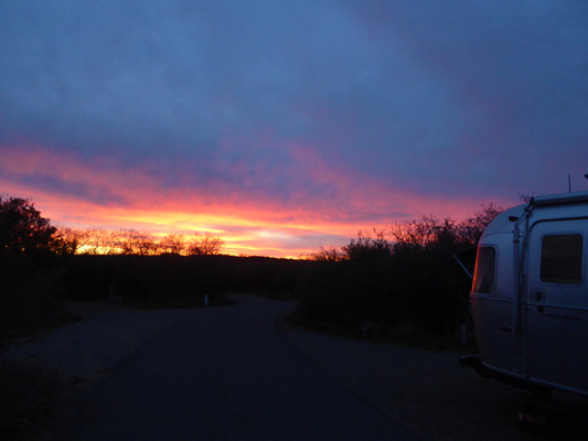
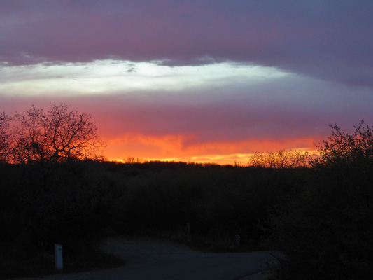
That evening we had another sunset. Not as spectacular as the one the evening before but hey sunsets are sunsets!
Here’s a bit of a closer shot which makes the fire at the horizon really pretty.
On Tuesday May 8th we headed east on Hwy 50 through the upper Canyon of the Gunnison and stopped in the town of Gunnison to do a little shopping. Then we continued on to Great Sand Dunes National Park.