
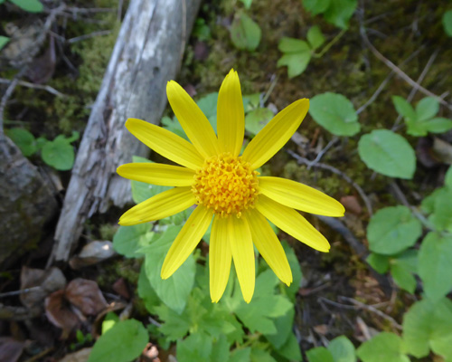
There was a big patch of Heartleaf Arnica (Arnica cordifolia).
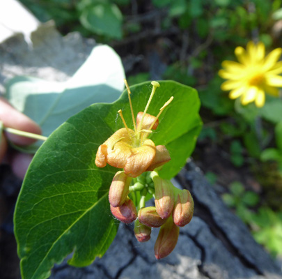
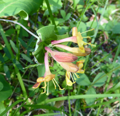
Some Orange Honeysuckle (Lonicera ciliosa) was just starting to bloom.
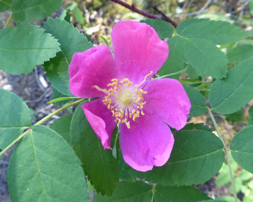
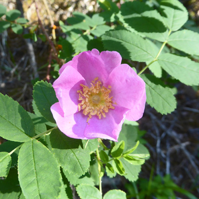
And there was lots of freshly blooming wild rose. They have 3 or 4 kinds of wild rose at Jasper and I can’t tell them apart.
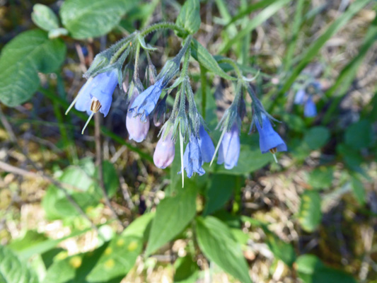
There had been Tall Bluebells (Mertensia paniculata) along the Source of the Springs trail on Sunday but the camera wouldn’t cooperate to focus on them then. But here they were in the campground and the camera cooperated too.
And lots of Starry Solomon’s Seal (Maianthemum stellatum) had burst into the bloom everywhere.
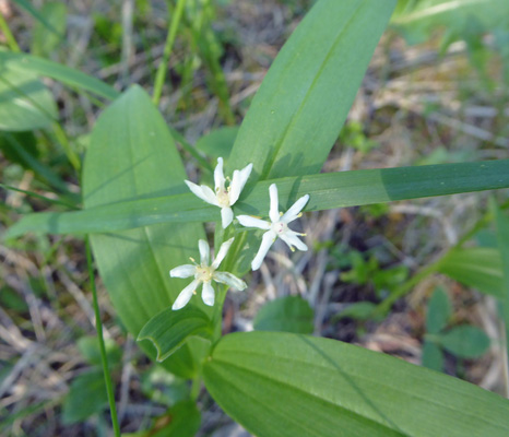
Out on the road in the campground loop I found some Bluntleaved Orchid (Platanthera obtusata).
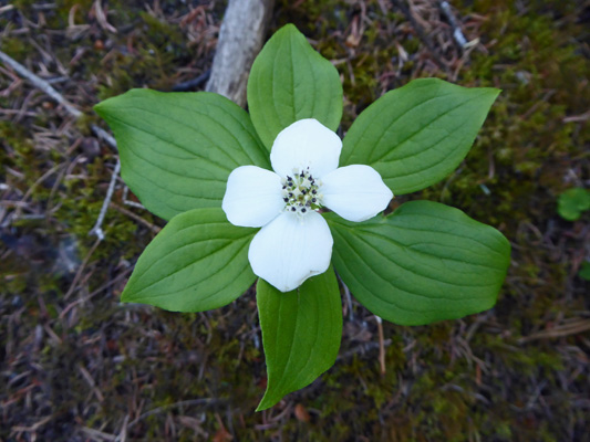
There were big patches of newly opened bunchberry (Cornus canadensis) too.
You know that a campground gets low use when you find so many flowers in bloom in it. The more people there are the fewer flowers I’ve found.
It was still in the 60’s when we headed out back towards the town of Jasper and then turned south on the Maligne Road (where they were busy repaving the bridge over the Athabasca River).
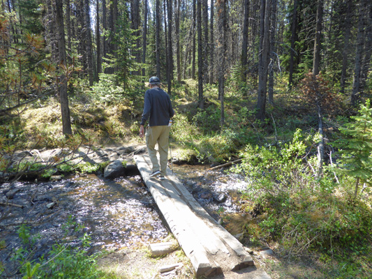
We turned off the main road onto an un-named side road and followed the signs to the 6th Bridge Parking Area—where surprise, surprise you can find the 6th bridge over the Maligne River. I’d read in one of our guidebooks that there was a little loop trail called the Flower Trail here and yet nowhere in any of the official materials did it call the loop anything but Trail 10a—a side trail of the Overlander Trail.
I was afraid that perhaps the flowers weren’t good here any more but we were willing to take the risk—and it paid off. We took the 6th bridge over the river—which was rushing by really really fast.
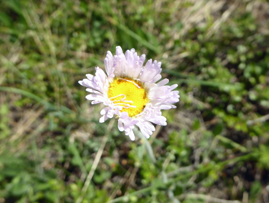
And then took the turn onto the trail right after the bridge. There was what I think was Tweedy's Fleabane (Erigeron tweedyi) in bloom in an open area.
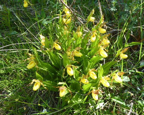
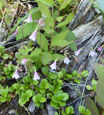
And as we entered a wetland we began to see Yellow Ladyslippers (Cypripedium parviflorum) which were smaller than those we’d seen on Sunday out on the Jasper House Trail.
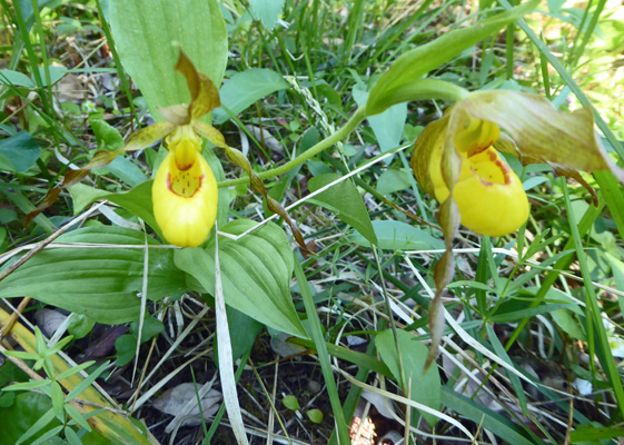
And the petals above the slipper (I’m sure there’s a technical term for them but I’ve forgotten it) were brownish colored too while those on Sunday were yellow. It turns out that the brownish color is the standard color for these flowers and that the ones on the Jasper House Trail are a special variety which is why they were bigger too. The regular ones still grow in clumps.
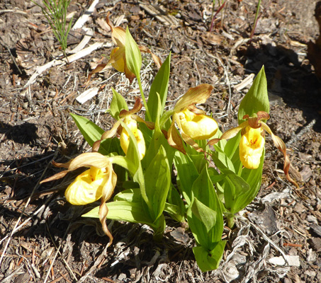
And some of the clumps were really big.
The Orange Honeysuckle (Lonicera ciliosa) was further along in the blooming process here than in the campground.
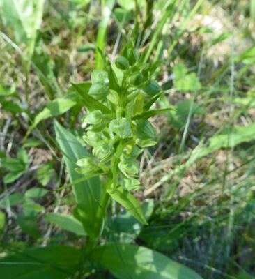
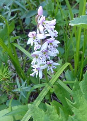
There were lots more Roundleaf Orchids (Galearis rotundifolia) here too.
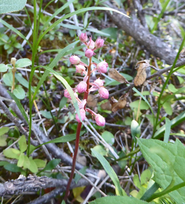
And some Pink Pyrola (Pyrola asarifolia) here and there.
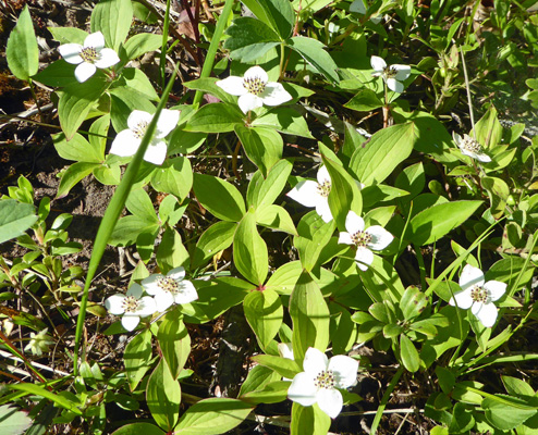
There were lots and lots of Bunchberries (Cornus canadensis). All is right with the world folks, Sara is back to taking bunchberry pictures!
And small patches of Twinflowers (Linnaea borealis) here and there.
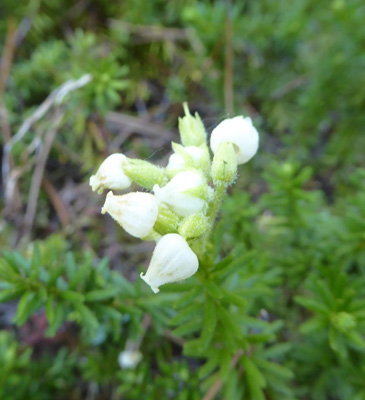
I think that these are White Globeflower (Trollius albiflorus) but there are so many different little white flowers that I’m not positive about it.
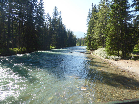
Right down next to the river I found some Bonneville Shooting Stars (Primula conjugens). I can’t explain it but these guys always make me very happy when I see them.
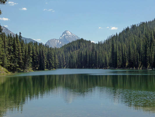
The trail takes you out to a little beach along the Athabasca River.
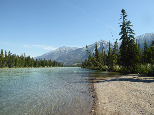
The water looked pretty blue in this direction but looking north it was green.
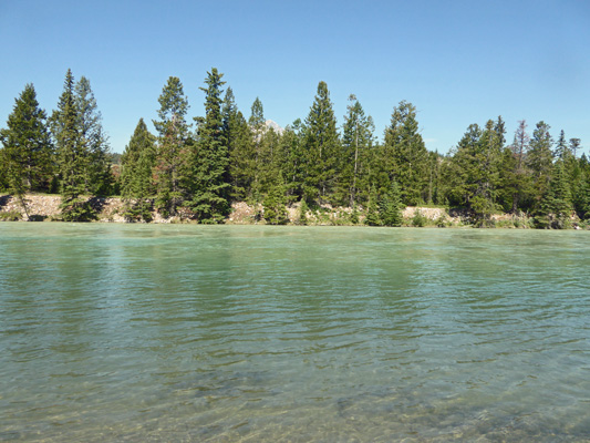
I love what the light does to the colors of the water here. A day later with all the heat we were having, the water was milk-glass green and nearly opaque.
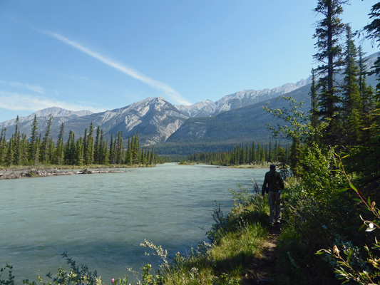
The trail continues on here but gets much narrower. There were lots of roots and rocks to watch for and the trail followed RIGHT at the edge of the river in places. But it was very pretty.
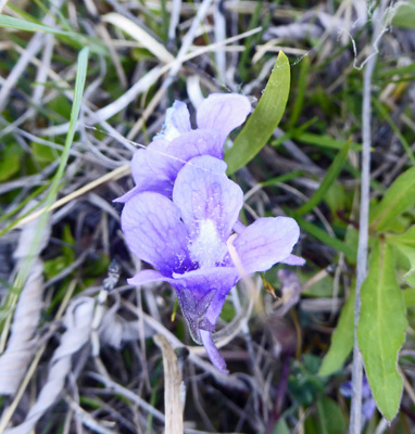
We found more Common Butterwort (Pinguicula vulgaris).
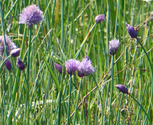
And there were Wild Chives (Allium schoenoprasum) growing in a marshy section.
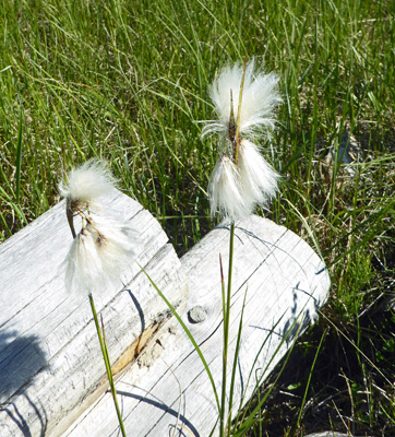
There was also some Tall Cottongrass (Eriophorum angustifolium) in bloom here. I don’t think I’ve seen any since we were in Alaska.
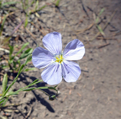
The trail loops back to connect with the Overlander Trail which is a wide jeep track. There wasn’t as much in bloom here and it was much drier so there were things like Lewis Flax (Linum lewisii).
Wild roses
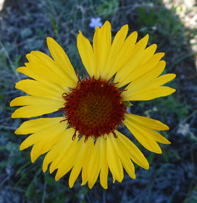
And Blanket Flower (Gaillardia aristata). There were a few blanket flowers in bloom along the road on Tuesday but by Wednesday afternoon there where TONS of them both along the Maligne Road and the highway.
It was pretty warm by the time we finished the loop, so we sat in the shade at a picnic table while we let the truck cool off with its doors open.
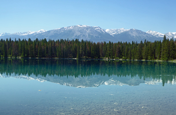
Then we drove back south a ways to visit Lake Annette where the water was mirror smooth.
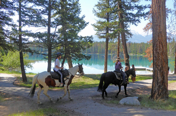
On my way back to the truck, three horses (with riders) came by on the trail—a guide with a cowboy hat and two greenhorns with helmets.
We drove to the end of the road around Lake Annette and I shot some more photos of the mountains and the gorgeous water.
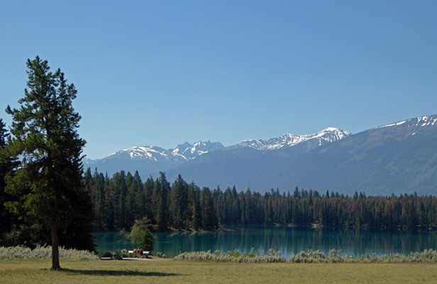
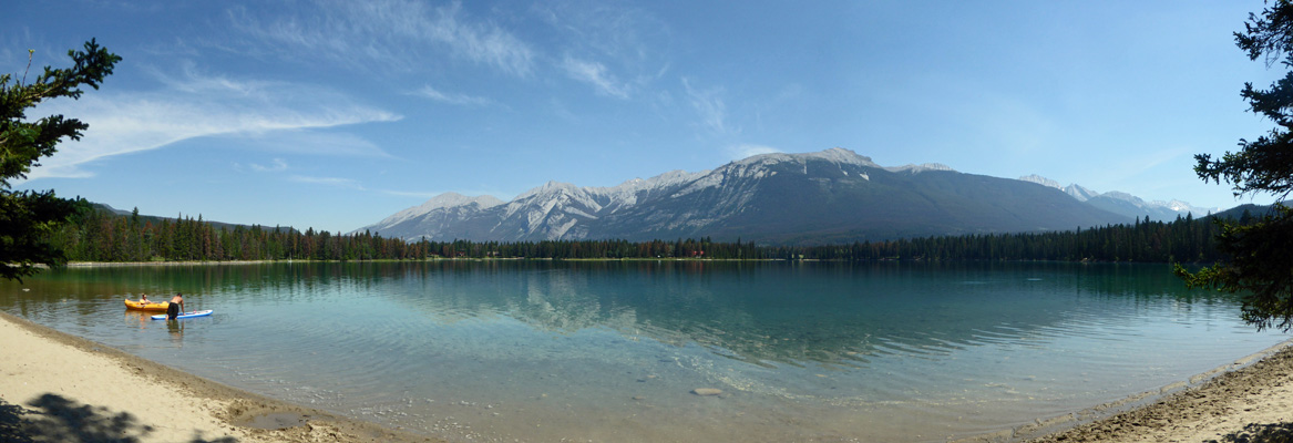
And then we visited Lake Edith (which is on the same road) where there was a group of teenagers just finishing up a bike ride sponsored by the park service. There’s a sandy beach here and folks were setting out with canoes, kayaks and stand up boards.
We drove out to the Fairmont Jasper Lodge too but the area was full of people and construction and there wasn’t an easy place to stop for a photo of Lake Beauvert. So we shrugged and we went back into Jasper town to the library because I’d discovered that while I had successfully picked up my email the day before none of my replies (or the missive I was trying to send) had been sent. I tried again and realized that they had some sort of filter/block on the upload from Windows Mail. But meanwhile I managed to identify most of the flowers we’d seen so it was a worthwhile trip.
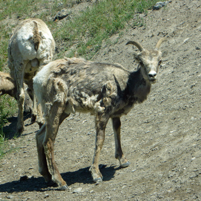
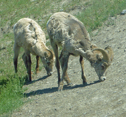
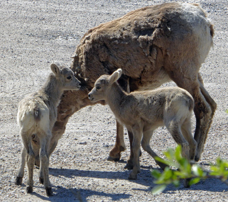
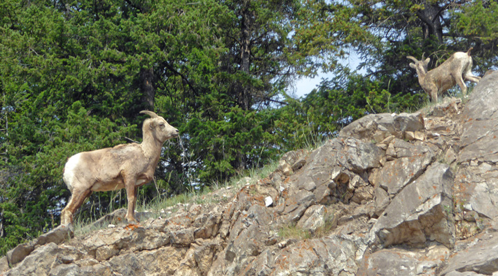
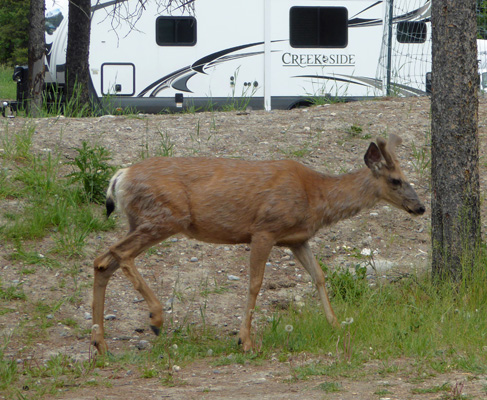
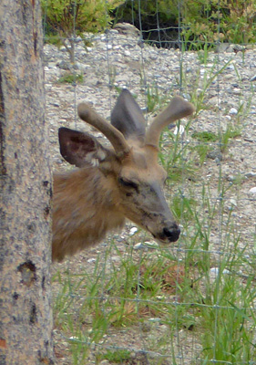
On the way back to the trailer (it was now in the low 80’s) we slowed down by the salt lick and were rewarded with 4 bighorn sheep.
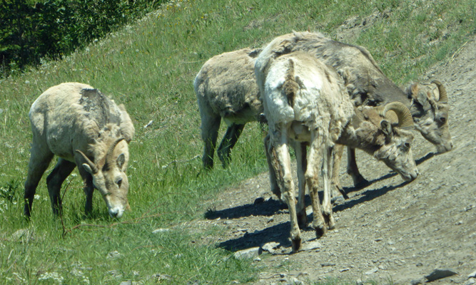
The females sure do look different than the males.
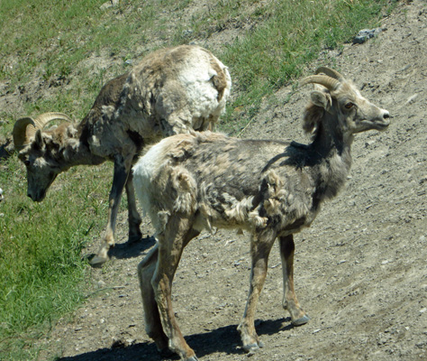
And boy is her face triangular straight on.
And we had at least one younger male in the group too.
It got hot that afternoon (88 degrees for a high) but it was really dry too and the trailer was in the shade most of the time so it wasn’t bad. By 10 pm it was back down to 70 degrees outside but we had a way to go yet cooling off the inside. The low for the night was 50 (way warmer than a few nights before but still a BIG daily swing).
It was sunny again on Wednesday June 20th. We ran the generator, packed a picnic lunch and headed back towards Jasper town and Maligne Road again, this time to explore Maligne Canyon and Maligne Lake.
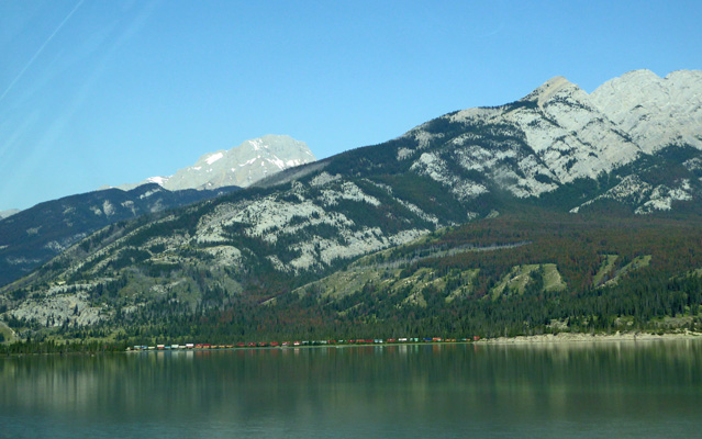
Along the way we saw a freight train making its way through the valley out across a lake.
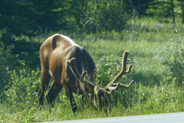
And we saw another bull elk along the highway. He was too intent on eating to raise his head for us.
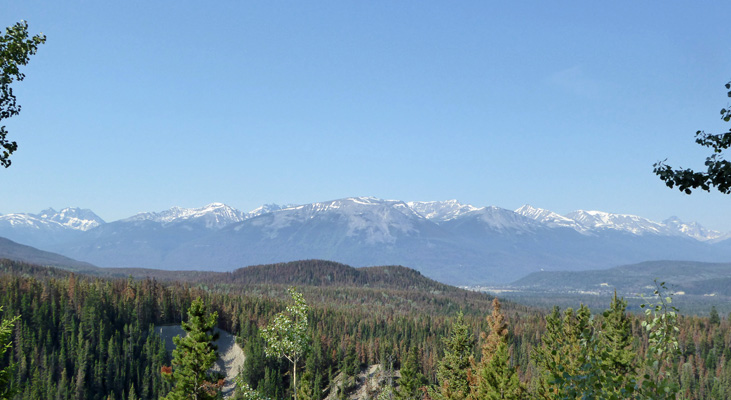
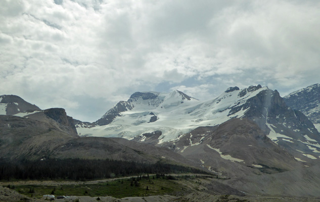
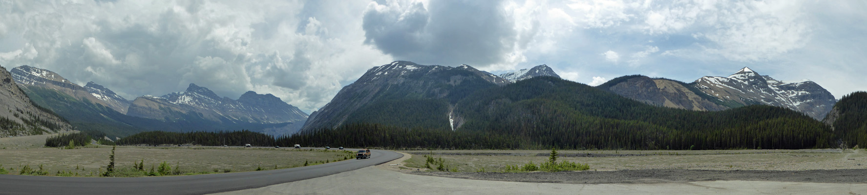
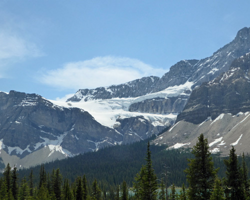
Once again we turned south on Maligne Road across the Athabasca River but this time we kept going up to the Maligne Overlook which gives you a view out across the valley. During the Ice Age the Athabasca Glacier (which is now over 120 km away) met the Maligne Glacier here in the valley.
That’s the town of Jasper down just right of center.
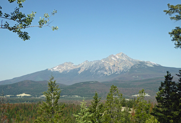
You get a nice view of Pyramid Mountain from here too. It looks really different from this angle.
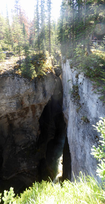
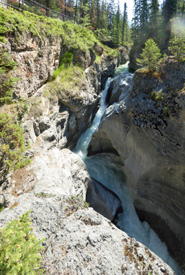
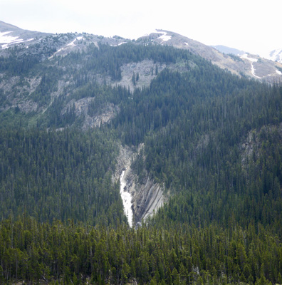
We drove a short distance to the turn off for Maligne Canyon and were lucky enough to get a parking spot since the lot was nearly full. Maligne Canyon is a big version of Marble Canyon (Kootenay National Park). It was carved by glacial action, glacial melt water dissolving the limestone walls and the work of the Maligne River. We took the trail from the parking area down to 2nd Bridge where the canyon is so narrow and deep you can’t see the river at all. But you can see how the glacial melt waters created marvelous high potholes that reach way up the canyon walls.
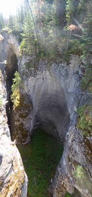
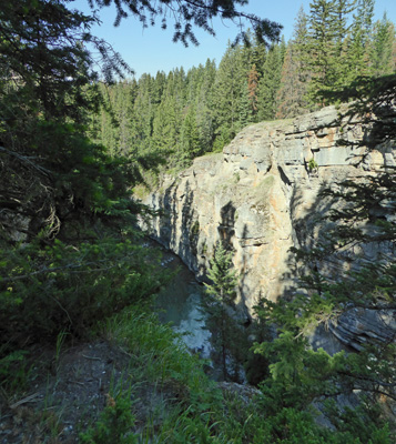
We crossed the bridge and Walter found a bench while I walked DOWN the trail towards 3rd Bridge (you can easily go as far as 4th Bridge from this parking lot but we had another hike planned). I went far enough to get a view of the river as the canyon widens.
And then turned back. I stopped to take this shot of a narrow spot in the canyon where the glacier dropped an erratic which got wedged between the narrow walls.
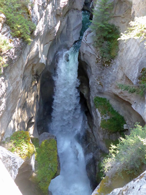
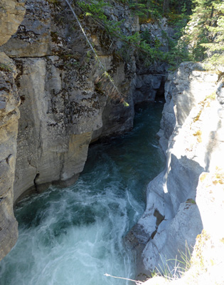
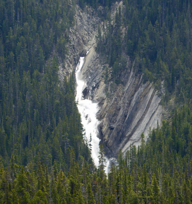
It was a steep climb back up so I sat with Walter to catch my breath and then the two of us took the trail up (not nearly as steep here) towards 1st Bridge and a great waterfall.
The trail continues to follow the canyon and you get views of more falls and cascades.
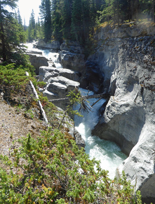
If you turn around here you get a shot of a big pothole that the churning water is carving out of the canyon.
You just kept getting more great views as you go.
I thought that the section of the trail between the top and 1st Bridge was the best part. The traffic flow takes you down to the 2nd Bridge first which then gives you great views of the waterfalls on the way back up.
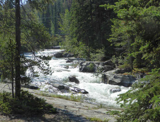
At the top the Maligne River crashes along merrily.
We hiked back to the car and continued up Maligne Road. There were cars pulled over near the entry of a picnic area parking lot and we slowed down and spotted a group of bighorn sheep including 3 lambs. I managed to get one shot with two of the cuties. The parking area must be salty because the moms were all apparently eating dirt and they were all still there when we came by several hours later.
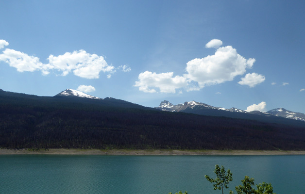
Next up we came to Medicine Lake. This is a very strange lake in that its level changes across the year like a reservoir. In the summer it’s high and in the winter it drops to just a stream. It took years for them to figure it out but it turns out that there are holes in the bottom of the lake such that the water drains out into the aquifer. The lake fills up when the water coming in is greater than the water draining out the bottom. In the winter when there’s no melt water the lake basically drains away.
You can see the reservoir-like bathtub ring where the high water mark is.
It looks like there was a big fire last year that swept through this area especially over on the right.
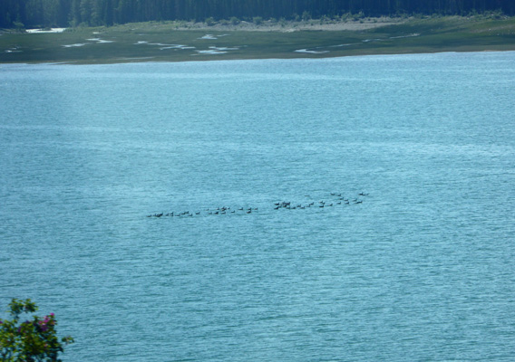
There was a raft of Canada Geese out in the lake. We’d seen very little waterfowl here so the geese were a pleasant surprise.
The road ends at Maligne Lake, a major tourist attraction in Jasper National Park. There’s a very popular boat ride and the parking lots for it were very full. Our plan was to park in the lot at the very end of the road and do the hike to Moose Lake (in hopes of seeing moose). That lot has a boat ramp and there were a bunch of boat trailers parked in it along with LOTS of cars. In fact, it was full. So we got to be the first vehicle to park out on the road (there were many more when we got back from our hike an hour later).
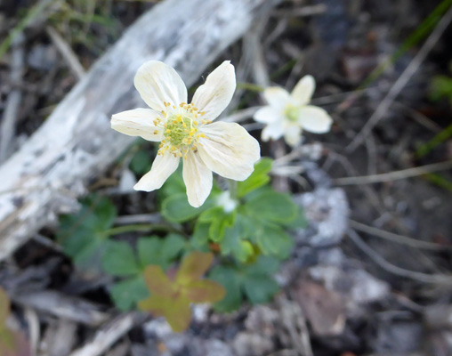
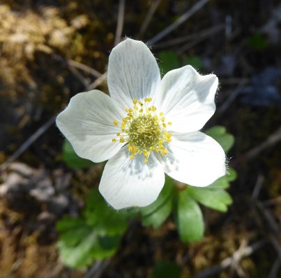
The trail to Moose Lake is a loop trail and we seem to have taken it in the reverse direction that most folks do. We went straight from the parking area up an old road until we reached the turn onto the Moose Lake Loop. Along the way I found some Smallflowered Anemone (Anemone parviflora) in bloom.
There was a little creek to cross and they provided a nice little bridge so we didn’t get our feet wet.
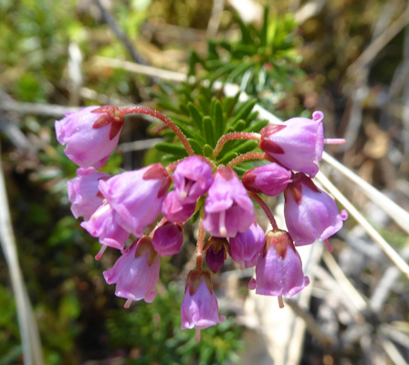
There weren’t many flowers but there were little bits of white heather that I think is Yellow Mountain-heath (Phyllodoce glanduliflora).
And some Pink Mountain-heather (Phyllodoce glanduliflora) too.
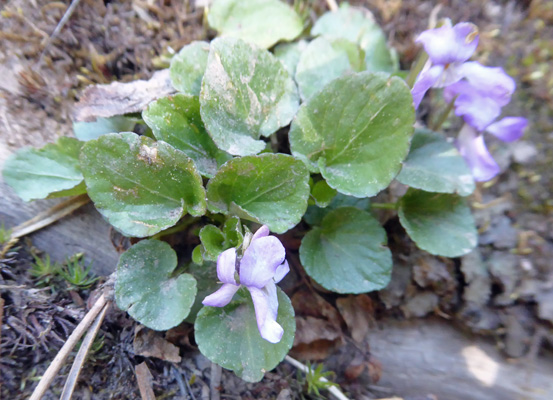
I also saw a whole 2 patches of these itty bitty little violets (Viola spp).
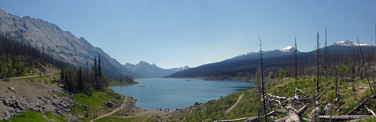
In time we made it to Moose Lake which is a pretty little lake with lots of mosquitos and no moose.
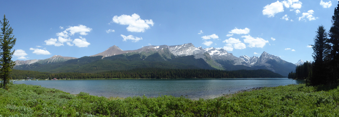
From here the trail was downhill all the way back to the shores of Lake Maligne where I got a nice panorama shot of the lake.
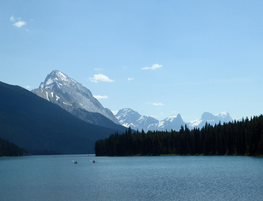
And further along the trail back towards the truck I got this close up shot of some kayakers on the lake with some cool mountains behind them.
There are several campgrounds on the lake that you can only get to via boat. It would be a fun expedition to do but I think a canoe is a better idea so that you have more room for all your camping gear. It was a little after noon and sure enough the wind was coming up on the lake which was going to make paddling more interesting for folks.
We happily made it back to the truck and headed back north on Maligne Road looking for a place for lunch. We’d seen a very nice picnic area on our way in but they don’t put signs up for people on the way back and we missed it. So we settled for a pull out along Medicine Lake with a view of the mountains and the Canada geese who were still rafted up together on the lake.
We went into Jasper town to top off our gas tank (and get gas for the generator) and got caught in a construction back up. But on the way back out of town we got to drive right through so it all equaled out.
The hot weather seemed to have brought a lot of glacial melt into the Athabasca River because it was a very light milky green now. And in places where other rivers joined it you could see a big difference in the color—blue from the new river water and milky green for the Athabasca.
I spied another bull elk along the road and got to be the first car to pull over to watch him. He was very intent on eating grass (just as the fellow in the morning was).
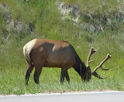
We decided that the grass along the road must be saltier (from road salt used in the winter) than regular meadow grass and that is why they graze so intently with the traffic zipping by.
It was 90 in Jasper town but it was only 86 when we got back to the trailer. However it heated up some as the afternoon wore on and we topped out at 90 both inside and out but only for a few minutes. Thunderheads came in along about dinner time and we had a few sprinkles and a lot of rumbling.
On Thursday June 21st (Happy Solstice), we packed up and headed back towards Jasper town on Hwy 16 and picked up Hwy 93 (The Icefields Parkway) south/east to Banff for two nights so we could do grocery shopping and laundry. While we were in Banff the first time, we’d made a reservation to camp once again at the Tunnel Mountain Village II campground since we had decided we wanted to enter British Columbia through Yoho National Park rather than farther north up by Jasper.
We’d had rain in the night but it had stopped when we broke camp. As we were approaching the bridge over the Athabasca to Maligne Road the traffic slowed down. No, it wasn’t construction this time. It was a pair of bighorn sheep up on the rise next to the road.
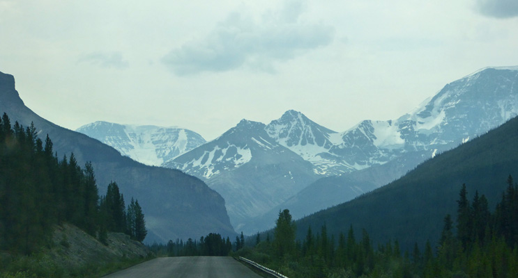
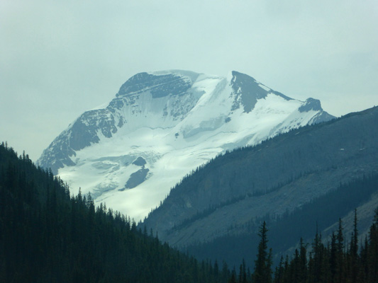
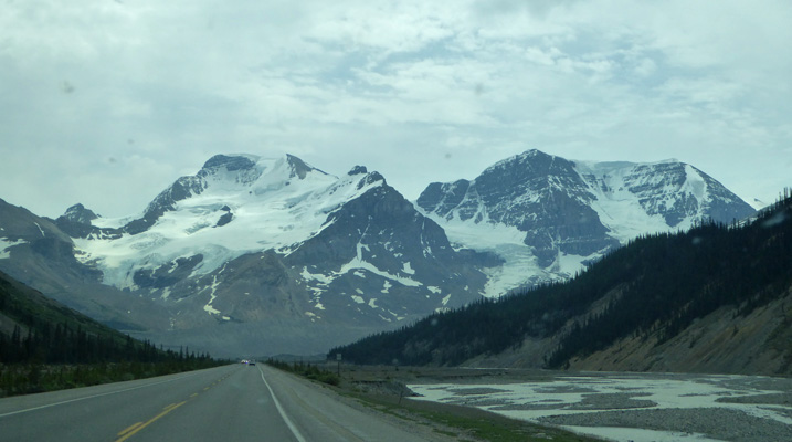
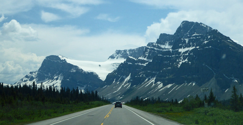
We made it through the construction around town and sat back to enjoy the drive south on the Icefields Parkway. The views are really different going south. There are glaciers nestled in the north-facing sides of the peaks that you don’t see when you’re coming north.
There were lots more of places where we could see glaciers peaking over the top of the mountains showing big piles of snow and ice.

And there was one after another of this big very visible glaciers.
If I were only going to drive the Icefields Parkway one way, I’d say you should start in Jasper because you wouldn’t want to miss things like this.
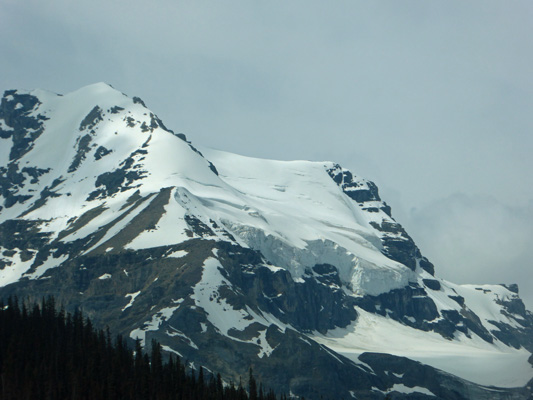
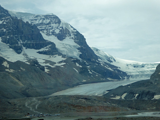
The Stutfield Glacier is huge and tumbles down the mountainside in more than one place.
It’s shocking to realize that you’ve driven this road and missed things like this huge expanse of ice. But heading north, unless you look in your rearview mirror you don’t see it.
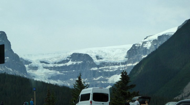
Even the Athabasca Glacier looks different coming in from the north. You can see more than just the toe.
South of the Icefields Interpretive Center I took this shot of part of the Columbia Icefield.
We stopped at the bottom of Wilcox Pass at a nice pull out to change drivers. And there was this very noisy waterfall right there at the end of the turn out.
In the moments when there weren’t cars rushing by you could hear it roar.
The view eastward from this pull out was a full 180 degrees of gorgeous—and yes the road takes a sharp hairpin turn here before heading up to the pass.
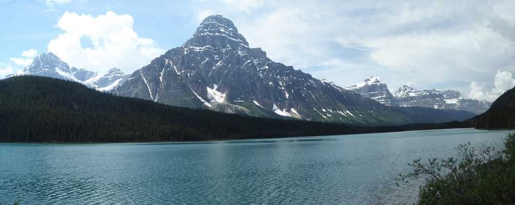
An hour later we were at Waterfowl Lake where I found a great parking spot so I could take photos of it, having missed the opportunity on the way north.
There was a couple in wet bathing suits sitting out on a rock but the rest of us didn’t think it was THAT warm since it had cooled way down with the rain the night before.
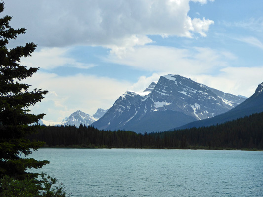
The view of the Crowfoot Glacier was really different too coming from the north.
We ended up having lunch in the Crowfoot Glacier turnout because the one at Bow Lake was full. Second best was still pretty swell.
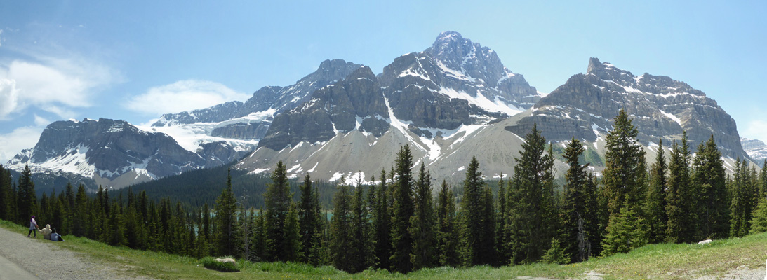
Not a bad view to eat you lunch by, no? Here’s a close up of the glacier.
We began to have showers off and on as we approached Lake Louise and there was hail all over the verge on the little pass just before Banff. It stopped long enough for us to dump our tanks and fill up our water tank and get set up.
While Walter was circling the campground to get the trailer turned around properly for the spot we were in he passed a young bull elk feeding on a rose bush. He sent me back to get a photo. The elk had moved on from the rose bush.
But I did manage to get a shot of his brand new antlers. They remind me a bit of training wheels. Walter called them kindergarten antlers. In any case, he’s not going to impress either the ladies or the other males this year.
The sun came out on the mountain to the north of us and we could see it nicely from our camp site.
Those black clouds brought thunder and lightening shortly thereafter and it rained off and on for several hours.
By morning we were having sunbreaks as we set out to drive to Canmore to do our grocery shopping. Having completed the scavenger hunt that is shopping on the road we got gas and came back to the trailer to put the groceries away. After lunch we went over to the Laundromat and did the laundry and used their WiFi to make reservations for our next two nights in Revelstoke, BC.
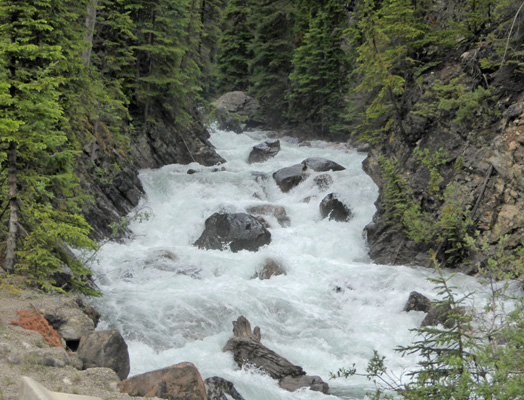
We had showers (while we took showers) but in the early evening it cleared off enough so folks were back out riding the bikes and walking the campground loop. It them poured much of the night and was still at it when we got up. But our luck held and it stopped just before it was time for us to break camp. It was mostly cloudy and you couldn’t see the tops of the mountains as we headed northwest on Hwy 1. We followed Hwy 1 through Yoho National Park, the town of Golden and then Glacier National Park and finally a portion of Revelstoke National Park. Along the way (during a flaggers stop in one of the many construction zones) I did manage to hop out and take a photo of Sherbrooke Creek as it crashed down to the highway.
We had a reservation at the Revelstoke Campground just off Hwy 1. The sun was just coming out and we happily set up in our electric only campsite after topping up our water tank. My weather station had gone on the blink so we can’t tell you the outdoor temperature but it was warm enough that we had the doors and windows open and the inside temperature was 77—nearly perfect.