
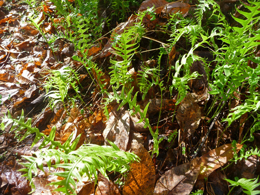
There were what appeared to be small sword ferns putting out new fronds all along the shady trail next to the river. This seemed strange to me since they usually put out new fronds in the spring up in Washington. Clearly the summer drought is over but it’s still not spring.
It turned out that the waterfall was more of a cascade than a true waterfall but hey, we’ll take what we can get.
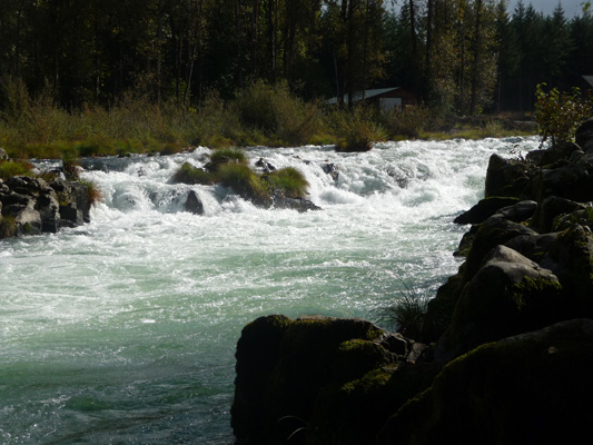
It would be quite the surprise if you were in a little aluminum fishing boat didn’t know it was there so I understand the warning signs.
We hung out the rest of the day enjoying having a decent internet signal and watching the clouds billow up but never provide any more rain.
On Sunday morning we motored southwest along the blue highways until we reached I-5 and then went south on I-5 to Roseburg. From there we went east on Highway 138 to Susan Creek Campground, a lovely BLM (Bureau of Land Management) campground along the North Umpqua River. We found a riverside campsite that was big enough for us and managed to get Genevieve parked on the nice level paved pad without a hitch. The brush along the river was so thick you couldn’t see the it but you could hear it. BLM campgrounds don’t tend to be as nice as Forest Service campgrounds but this one was an exception. It was very nicely developed, the campsites were nicely spaced and there were hot showers too (no water or power hook ups though). All for $14 a night ($7 with our Golden Access Pass).
Our next door neighbor was a vintage Airstream International from California. It’s amazing how many of these older Airstreams are still on the road. And wonders of wonders we had an internet signal here. Without the booster it was a little slow but with our signal booster it was great. That allowed us to do research on the next leg of our journey down near Medford.
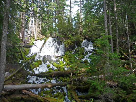
The next morning it was gorgeous and clear and we set out to visit Toketee Falls just up Highway 138 about 20 miles. The trailhead is a little ways off the highway but it’s well signed so we had no trouble finding it. The parking lot is next to this amazing old redwood staved flow pipe.
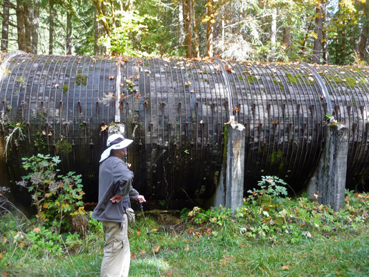
A great deal of the North Umpqua River flows through this on it’s way to a hydroelectric project. It had fine spray leaks all up and down it including on the top. It makes you wonder how many more years it will last. It was build in 1949 as part of the rural electrification project for the area.
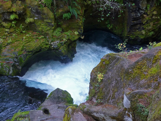
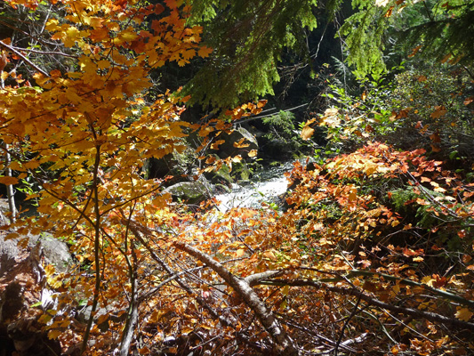
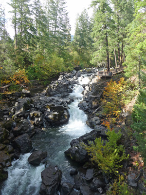
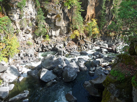
The trail leaves the parking lot parallel to the flow pipe and then wanders through some lovely old-growth forest. The trail wanders near the river just before it crashes down a narrow gorge. There was a lot of white water here and wonderful pot holes created by small rocks driven by the turbulence of the river boring down into the solid rock of the riverbed.
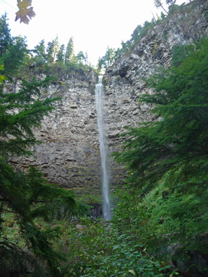
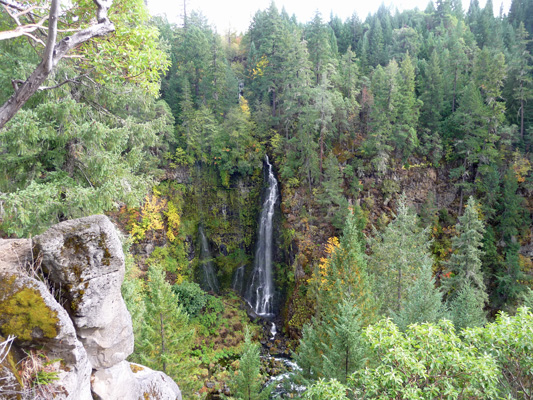
The trail leaves the river and begins what seems at first to be a steady climb up a series of stairs. But for every set of stairs that go up there’s another that goes down. In fact, the information sign at the beginning of the hike says that there are 97 steps up and 125 steps down on the way to the falls. At least they aren’t all at once! The alternating sets of steps go on for a while until you reach the last long stretch of down that leads you to a view of the falls as it exits the gorge.
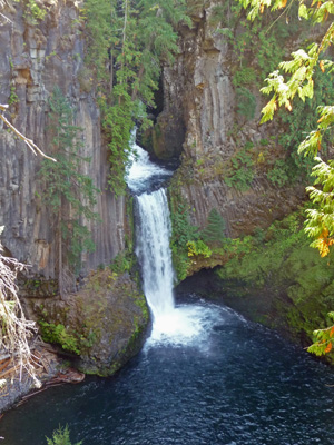
The viewing platform and the stairs are enclosed in chain link fence, a clear message that they’d rather not have folks clambering down the cliff side to get better camera views. But you could see footprints all over the place from folks who did it anyway. The falls actually have two small cascades just visible in the round hole before the big drop.
We rested here for a while and enjoyed the view.
And then we started back up the stairs.
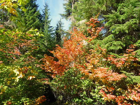
The sun filtering through the trees lit up the fall color near the river.
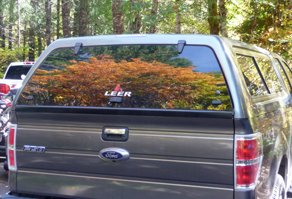
But best of all was what was waiting for us reflected in the back window of the canopy on the truck when we got back to the parking lot.
From Toketee was drove up Highway 138 another 2 miles or so to the trailhead for Watson Falls. It’s another nicely marked trailhead with a great parking lot. There were vine maples basking in the sun here that I couldn’t pass up.
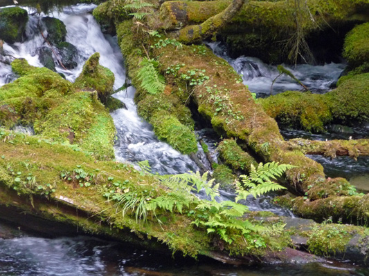
Watson Falls is 192 feet high and you can see the top of it from the parking lot of the trail head. We headed up yet another set of stairs (not very many this time), across the road and up a pretty steady incline following Watson Creek up the hill. Every once in a while, the trail would come right next to the creek and show you a bit of mossy fairyland.
The trail goes over a little bridge where you can catch an early view of the top 1/2 of the falls and then continues up the hill to a viewpoint at the pool at the bottom of the falls. There are a lot of vine maples and good-sized evergreens around the pool at the bottom of the falls and they make seeing the entire falls a bit of a challenge. But we finally found one spot where you could see it all.
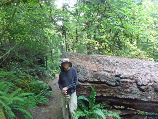
You can take the trail up to the top of the falls but neither of us was interested so we took the loop trail back down. This section is much steeper than the way we’d come up (nice of them to direct you to go the less steep way UP and take the steeper one DOWN). There were a number of downed old growth Doug Firs that they’d had to cut through to clear the trail.
The trail passes the creek again just before the road to give you a nice view of a cascade and then dumps you out on the road where the Big Leaf Maples gave us great splashes of yellow.
We ate our lunch sitting on a bench in the sun at the trailhead. Then we drove on to Whitehorse Falls (a place we’d read about on one of the info signs there at Watson Falls). This waterfall is in the Day Use Area of the Whitehorse Campground. No hiking required! They do provide a nice parking area and a great viewing platform though.
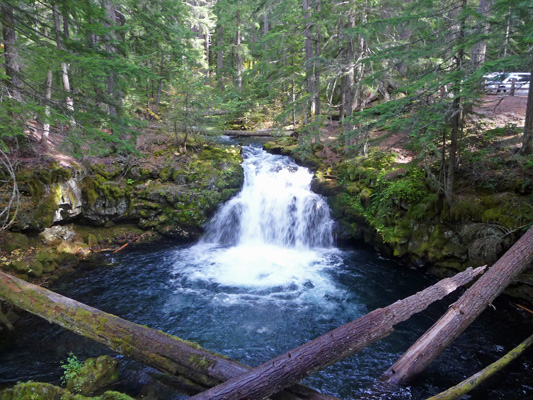
Last on the list was Clearwater Falls which is just a ways further up Highway 138. It’s in the Day Use Area for Clearwater Falls Campground. Again, no hiking required and they’ve built a nice viewing platform. The water in Clearwater River arises in springs about a mile upstream. The springs produce about 12 to 15 cubic feet of water per second all year round. The water is filtered through the layers of lava flow from Mt Bailey up by Diamond Lake (about 20 miles further east) and the filtering produces a remarkable level of purity and clarity in the water. This high quality water supports a very healthy fishery (salmon and steelhead).
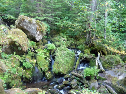
The mosses here are really lovely and the Forest Service even provided a nice information sign about them all.
From here we drove on back to Susan Creek Campground Day Use Area because we’d read there was yet another waterfall in the area up Susan Creek. We parked and with some difficulty found the trailhead across Highway 138. It turned out to be a two-mile round trip and we were both tired enough that we decided 4 waterfalls in a day was enough.
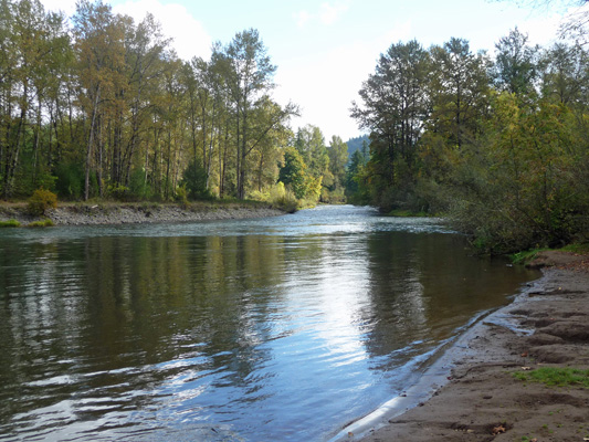
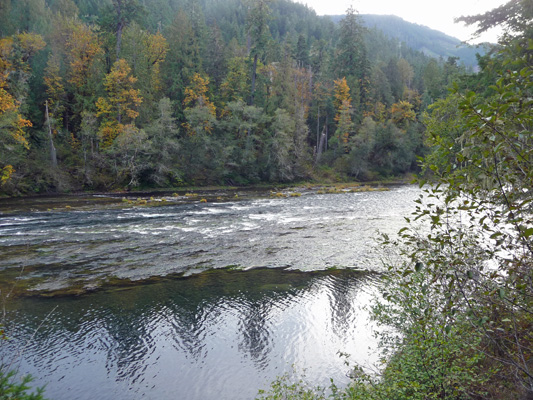
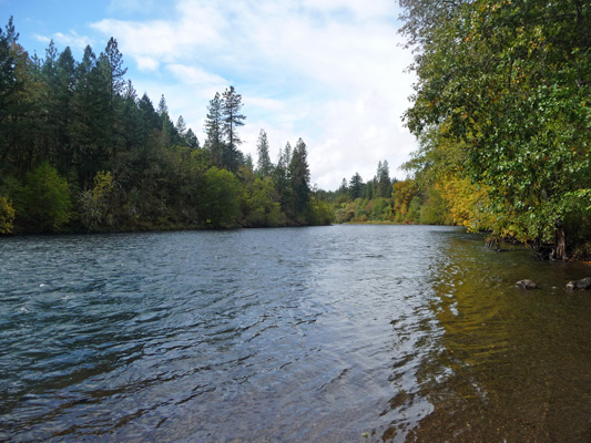
I did stop and take a picture of the North Umpqua as it went by the Day Use Picnic Area.
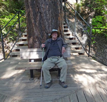
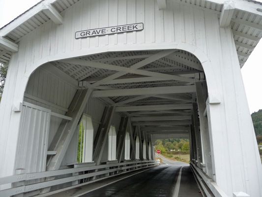
It rained in the night and was still raining pretty hard the next morning but let up by the time we got ready to go. We packed up and motored on back to I-5 and then down to Medford. Halfway there we stopped in the little town of Sunny Valley for gas and then motored over to the Grave Creek Covered Bridge (built in 1920). The sign that Walter is standing next to provided all sorts of great historical information about the settling of the area in the 1850’s, the local Indian Wars (1856) and the fact that this was an overland stage stop for the California Oregon Stage Line starting in 1860.
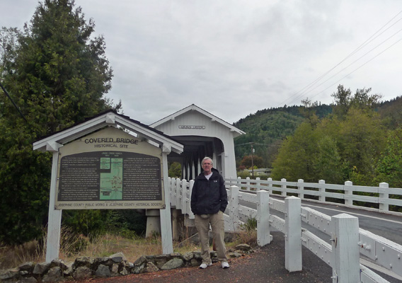
The bridge is only one-lane and was built as part of the Pacific Highway Project for the sum of $21,128.65.
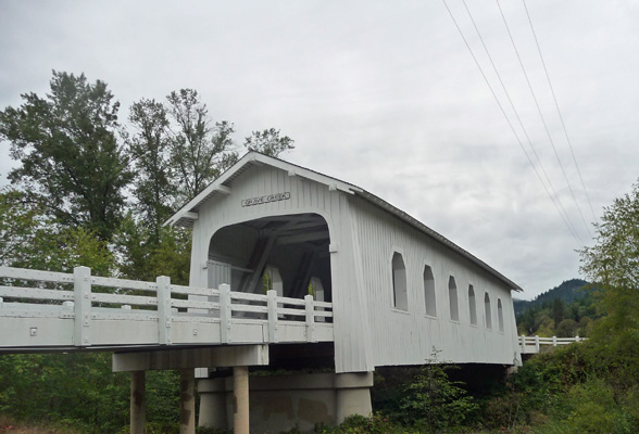
This is the last covered bridge remaining in Douglas County (though they don’t tell you how many there were to start with).
Carmine, the Garmin, helped us find the Safeway in Medford so we could do our grocery shopping for the next 10 days. Then we took Highway 62 east towards Crater Lake. About 50 miles west of Crater Lake, near Prospect, we found a nice lakeside (a view of a little square of blue) campsite at Joseph Stewart State Park on Lost Creek Lake. We had water and power (for only $18 a night) but no hot spot or cell phone signals. It was sunny and lovely when we got there.
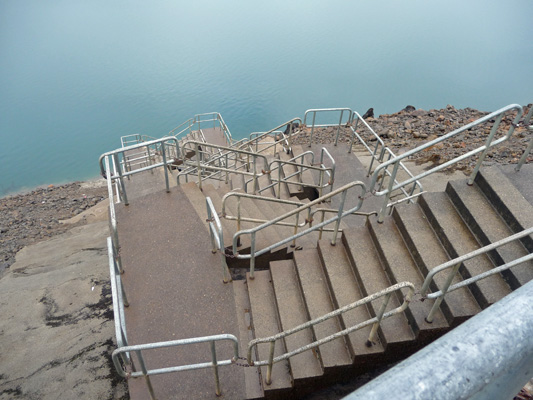
It started raining in the early evening and rained off and on all night and into the morning. It was pretty gloomy when we got up but by 11 am the sky started to lighten up. We drove over to the Day Use Area and found the designated photo op spot for the lake.
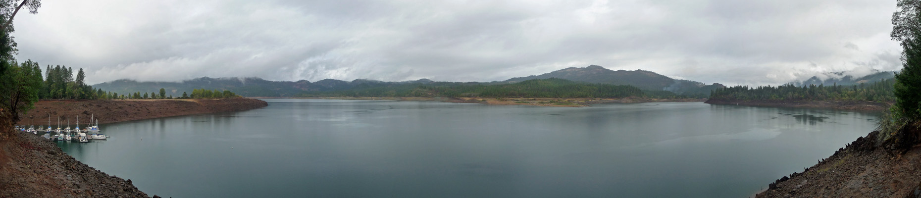
It’s autumn so the lake is down a ways for the year. But it appears to be a LONG way down from it’s high water mark up where the trees grow. Since they built these concrete stairs to go down to the waterline I suspect that the lake hasn’t been full for a very long time, though if the lake level went way up I guess the steps would survive okay under water.
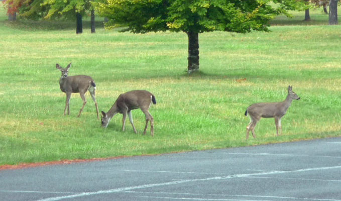
We drove over to the marina area and spied a family of deer out grazing on the lawn. There were four of them but I only managed to get 3 of them in my photo. It looked like a mom with a pair of twins from last year and a single fawn for this year.
We wanted to call a campground we were interested in over in Eastern Oregon so we drove a ways back towards Medford until we got a cell signal. Then we stopped at Elk Creek Park (a nice county park right along Hwy 62) to check things out. The Rogue flows right by the campsites so I suspect this is a popular place with fisherman. They have water and power hook ups too.
By this point we had nearly blue skies though it was still only in the low 50’s. So we decided to go back to the trailer, make a picnic lunch and go look for the waterfalls in and around the town of Prospect just 10 miles east up the road from Stewart State Park.
We found the Mill Creek Falls trailhead without much trouble. The turn off was well marked on the highway and we could see the parking lot easily once we got there. There was a BIG sign with a very confusing map of the waterfalls and trails in the area. We studied it and read the trail description we had and set out to find the trail which turned out to be an old dirt road. We followed it down the hill and turned in the direction of the sound of crashing water which was the right choice. In less than 1/2 mile we came to the overlook for Mill Creek Falls.
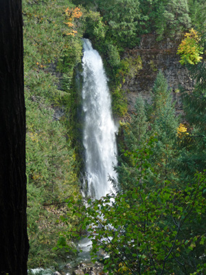
This is a very satisfactory 173 ft waterfall and we were glad we took the hike.
There was an old sign post near the viewpoint that told you the falls were 173 ft tall. They also said that Barr Falls were 242 ft tall. But what we didn’t realize was that the viewpoint for Barr Falls was just a little ways further along the trail (no signs indicating it and no arrows pointing the way). On the map at the trail head it looked like Barr Falls was way across the valley by the airport. WRONG. The falls are across the river just around the bend.
We hiked back up the hill (it’s pretty steep in places), got back in the truck and set out to look for the 3 other waterfalls: Barr, Prospect and Pearsoney Falls. We drove through the little town of Prospect looking for signs and didn’t find a one. We turned around and tried again. No luck. We stopped and read the directions for Prospect Falls and decided to take the loop out to the highway and try again. Sure enough, following the directions for driving west from Crater Lake we did manage to find the turnout just before the bridge just as you leave town. We parked in the turnout and crashed around in the bushes looking for the old road we were supposed to follow. We found it with some difficulty and followed it out to a point where you could see the falls.
It wasn’t a great view and we decided we could see it a whole lot better if we just walked out onto the bridge. So we headed back along the old dirt road and discovered where it hits the main drag (Mill Creek Road) just a few yards from the parking area—no need to crash around in the bushes just walk towards town a little ways until you come to the closed off end of the dirt road.
Then we walked out onto the narrow bridge (which has no place for pedestrians so be careful) where we got a great view of the falls. The wooden platform overlooking the falls is on private property.
And when we got to the other side of the bridge we could see a collection of huge boulders at the bottom of the gorge. These had been marked on the confusing map back at Mill Creek Falls. There’s supposed to be a trail down in there somewhere—for mountain goats maybe.
We then drove back through Prospect 2 or 3 more times looking for the trail head for Pearsoney Falls. No luck. We drove out to the Airport looking for Barr Falls. No luck. So we gave up and decided to have lunch. We drove back to the Mill Creek Falls trailhead and re-read the info we had on Barr Falls and realized that it was just a little further down the trail we had hiked earlier.
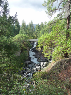
So after lunch we retraced our steps down to Mill Creek Falls and then went on another 100 yards or so and up some stone stairs to the view of Barr Creek Falls.
The falls have several drops above the big one. If you look carefully above the yellow patch of trees above the falls you can see another section of it. There are also several smaller sprays of falls to the left of the main falls.
Since Pearsoney falls was only a 12 ft. waterfall and it was getting late we decided to be satisfied with a 3 waterfall day and we headed back. It was just as well, because the clouds rolled in again and it started to rain lightly. [Note: we decided that Pearsoney Falls is probably reached on a trail from the parking lot across from the last couple of stores on the west side of Prospect that is marked as an Oregon State Park. It has some picnic tables and a vault toilet but no signs about the falls or the trail. Our state park literature calls it the Prospect Scenic Viewpoint.]
So in 3 days we managed to see 8 waterfalls, not too bad for folks wandering around without much of a clue as to where they are or where they’re going.