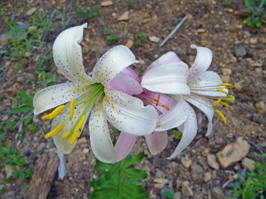
I turns out these are Washington lilies (Lilium washintonianum) which grow in Oregon and California but not Washington. They were named after Martha Washington rather than Washington state. I’d never seen them before since they are relatively uncommon and bloom in early to mid summer, a time we’ve never visited the Oregon Cascades before.
They come in white and in pink.
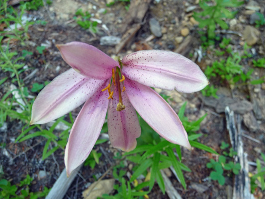
I saw quite a few of them along Hwy 26 as we drove east towards Madras—at least while we were still at a fairly high elevation.
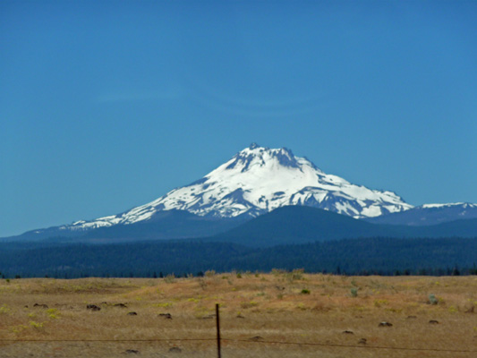
Once you come down into the lower elevations you can begin to see Mt. Jefferson.
The terrain changes rapidly from Lodgepole pines to junipers and sage. There was bitterbrush in bloom here.
It was in the 90’s and it wasn’t noon yet as we drove through this country to Madras on Hwy 97 and then a little south to Metolius where we got a campsite at a small RV Park for the night. Power, showers, WiFi!
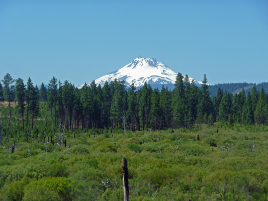
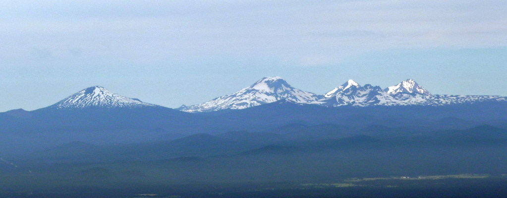
The next morning it was bright and sunny and in the 80’s by the time we broke camp. We drove south on Hwy 97 and I grabbed a couple of photos of the Three Sisters.
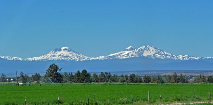
That’s a field of alfalfa in the foreground.
We stopped in Bend to ship our hotspot back to Straight Talk since we’d gotten the shipping label in our email that morning. If we’re lucky we might have a new one back in a week or so. In the meantime, we’ll be using WiFi in RV Parks and libraries as we used to before we got it.
We drove to just north of La Pine, OR and then turned east off of Hwy 97 to the main section of the Newberry National Volcanic Monument. It was 93 degrees when we turned off the highway and headed UP the road into the Newbery Caldera. By the time we arrived at Little Crater Campground on Paulina Lake in the caldera itself it was 78 degrees. Ahhh what a few thousand feet in elevation can do for you. (Bend is at about 4,000 feet while Paulina Lake is t 6,400 feet).
We got the second to the last campsite in the campground, a nice little side loop pull through with a bit of a water view. We’d read that this campground is often full by Thursday afternoon and that was true.
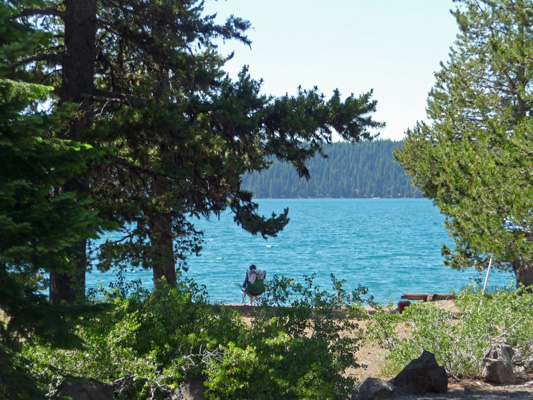
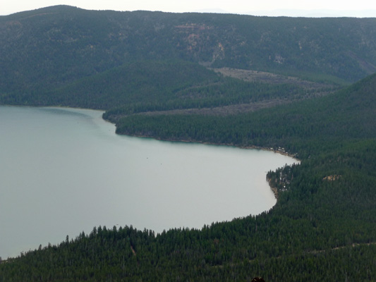
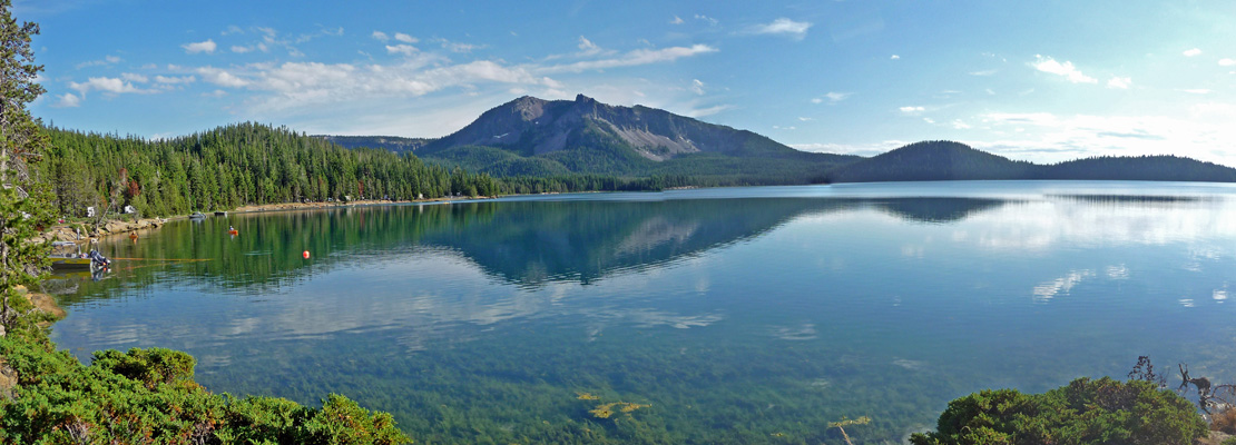
We opened up the windows to let the breeze cool the trailer off and sat in our camp chairs in the shade and admired the view. It was a beautiful afternoon with kids out on their bicycles and in their swim suits and folks out fishing on the lake. I went across the road from our site and visited with our neighbors and then took this shot of Paulina Lake.
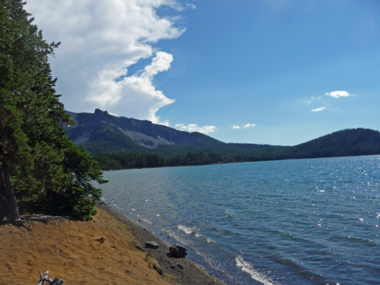
That’s the rim of the caldera on the left. There are still little patches of snow up there at 7,500 feet. Folks in this area consider this lake to be their own personal little Crater Lake. And geologically they’re the same—lakes formed in the empty centers of volcanoes. The difference here is that there is a small crater that developed in the middle of the caldera and divided the original big lake into two smaller lakes.
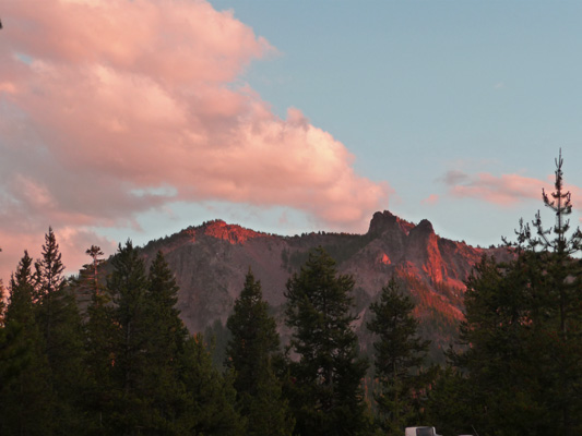
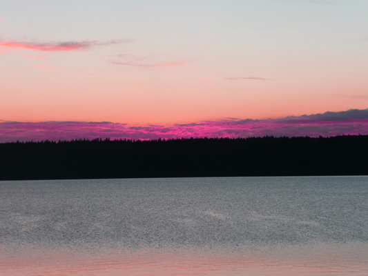
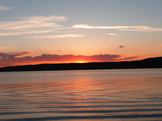
After dinner Mother Nature put on a little show for us, lighting up the clouds over the caldera rim to the south of us.
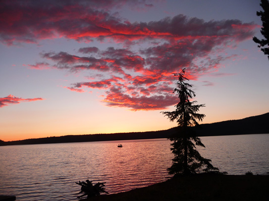
And turning the clouds over the lake orange.
It was still in the 70’s at 9:30 but the temperature dropped rapidly after dark and we were nice and cozy and comfortable in the night.
In the morning, the sun was still out when I went across to take this panorama shot of the lake while it was still smooth as glass.
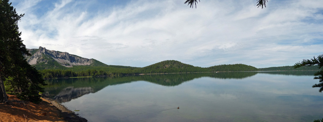
But you can see that there are high clouds coming in from the southwest.
By 10 AM the sun was gone and we were in clouds for the rest of the day. The temperature wandered down into the 60’s and I actually put on my fleece.
We decided to beat the tourists and the weather by going out in the morning for our outing for the day.
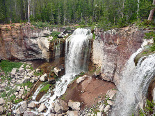
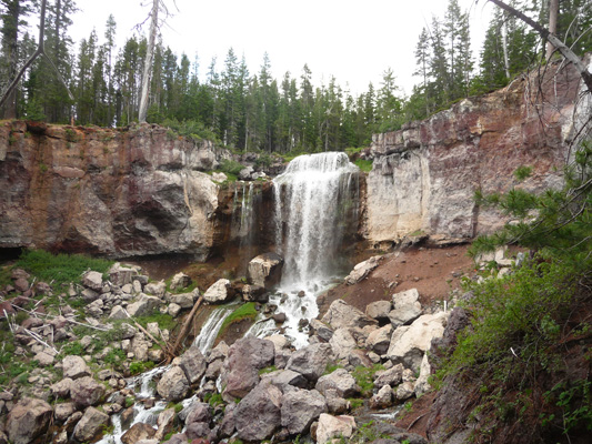
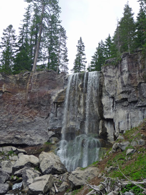
We drove back west along the lake to Paulina Falls, where Paulina Creek makes it’s exit from Paulina Lake in a rather spectacular way.
This was the view from the short trail that leads to the top of the falls. There were mosquitos and folks who had hiked from the Paulina Campground were complaining about them. Someone had warned me about them as we got out of the truck, so I’d gotten my can of Deet out and sprayed down before we started out and neither of us had any problems.
In addition to this viewpoint, there’s a 1/4 mile switchback trail down to the bottom of the falls. It was sandy and a little steep but we didn’t need hiking boots or our sticks for it. About 1/2 way down you get this view.
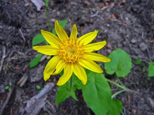
There was heart-leaved arnica (Arinca cordifolia) in bloom along the trail.
And when you get to the bottom you are rewarded with these lovely views from a platform in front of the falls.
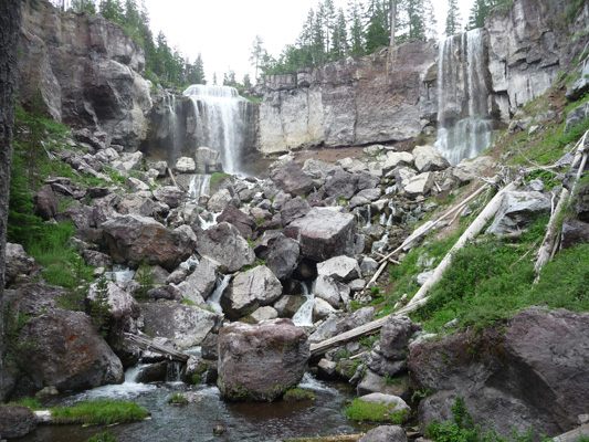
They think that the falls once were 200 ft. high. But at some point there was a big flood of water that carried huge boulders over the falls and dumped them at the bottom. Some of them are 20 feet high. The falls are now about 80 feet high.
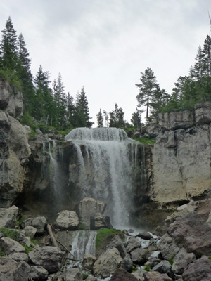
Here’s a close-up shot of the left side of the falls.
And here’s the smaller right side of the falls.
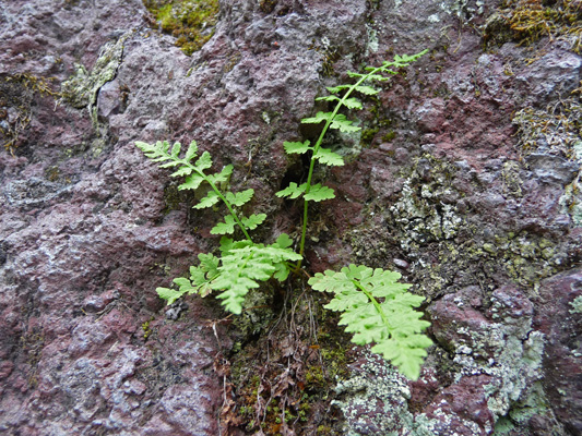
There were tiny little ferns growing in the cracks of some of the huge boulders watered by the spray from the falls.
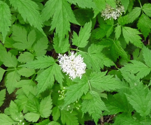
And there was a good sized patch of Pacific Waterleaf (Hydrophylllum tenuipes) growing in the shade at the base of the falls.
From here we took the one lane (two way) gravel road UP to the top of Paulina Peak. It was a washboard road and had almost no turn outs to pass traffic coming the other way. I was lucky only to meet one other vehicle on the way up. But it was worth the drive because you get this GREAT view of the area. It’s too bad we hadn’t gone the day before when it was clear but I suspect that the parking lot would have been totally full in the afternoon since it was close to capacity at noon when it was cloudy.
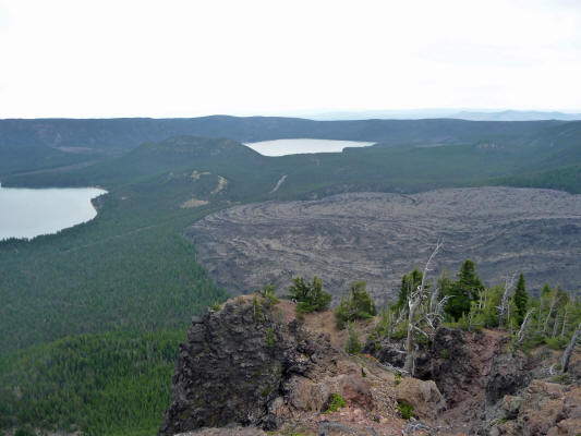
From here you can see most of Paulina Lake.
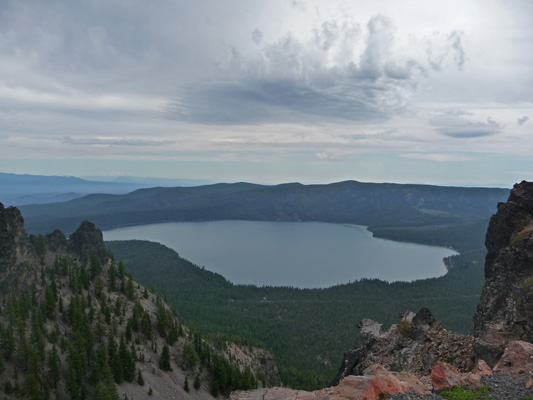
We’re camping down along the shoreline on the far right.
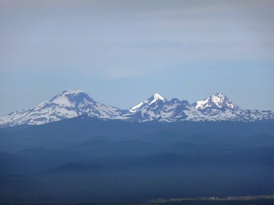
When you look west you can see Mt. Bachelor on the south end and the Three Sisters to the north (right).
Here’s a close-up of the Three Sisters. The sun was still shining on the peaks but the clouds were rapidly moving north. You could just make out Mt. Jefferson, Mt Hood and a very hazy Mt. Adams to the north. The guidebooks say that on a clear day you can see from California (Mt. Shasta) to Washington (Mt. Adams). But to the south it was grey and looked like it was raining, so we didn’t get to see Mt. Shasta.
To the east of Paulina Lake is East Lake and the Great Obsidian Flow. There’s a small crater between the two lakes. That’s what our campground is named for.
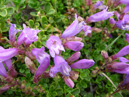
There were big swaths of Davidson’s Penstemon (Penstemon-davidsonii-var-davidsonii) in bloom.
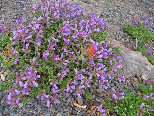
Here’s a close-up of the flowers.
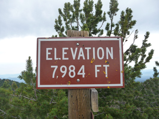
We took the little hike up to the high point of the Paulina Peak. Our campground is at 6,400 feet so we gained over 1,500 feet on the drive up.
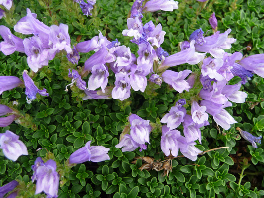
There was a patch of blue Davidson’s Penstemon at the top of the trail.
Along with a patch of Mountain navarretia (Navarretia divaricata) nearby. I discovered that there are tons of it in bloom in our campsite too.
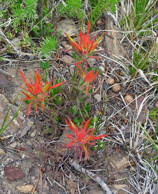
And of course there was paintbrush. No doubt this is some dry country variety. A while back, I gave up trying to tell them all apart and decided to just enjoy them.
We put the truck in four-wheel drive for the first time for the drive back down and that helped a lot with the washboard surface. We met some idiots who were driving a good sized UHaul truck up the road—even though it clearly says you shouldn’t take anything over 22 feet up it. Ah well, they backed down a ways and we got by and I got to grumble about idiots which is always a pleasure.
We drove on out to East Lake to have a look at the campgrounds there. The East Lake Campground is pretty small and it has a number of lakeside sites but not nearly the number that you find at Little Crater. It was full. Cinder Cone Campground is at the end of the road on the northeast corner of the lake. It had over 100 sites (half of them reservable). There are a few lakeside sites but most of them are just in loops in the woods. We’d been told by some locals that Little Crater was the best of the campgrounds because Paulina Campground is a little marshy and has lots of mosquitos and Little Crater has the best views. We had a few mosquitos at dusk at night but otherwise we were bug free. Almost all the sites in Little Crater have a lake view and we’re very happy to have found a spot in it.
We came back to the trailer in time to close up the windows and take down the awnings before the afternoon showers began. It was time for some down time. I downloaded and processed my photos while we ran the generator and then Walter had a nap while I wrote this. We’re beginning to get the hang of the full timing thing. We don’t push it—after all we have all the time in the world to see whatever is there. Traveling and dealing with the trailer is challenging enough, we don’t have to fill every day full to bursting too.
We’ve given ourselves 3 days to see the little-known treasure of Newberry Crater. We only picked it because it looked like the weather would be kind. We got much more than that and are thrilled. If you’re ever in the Bend/La Pine area, do take the time to not only see the Lava Lands portion of the park down near Bend but to take the drive up into Newberry Crater. It’s great place to camp. And it’s always cooler up here which is a blessing in the summer.
Late in the afternoon, after a small shower or two, the clouds cleared out and it was sunny and clear again. The lake was like glass when we went out for a walk along the road that winds through the campground. At the end of the road (where the trail continues on around the lake) I took this panorama shot looking south.
There were still clouds hovering along the Cascade crest at sunset and they lit up nicely.
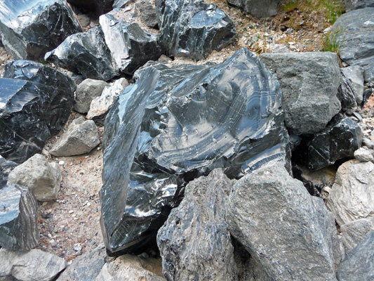
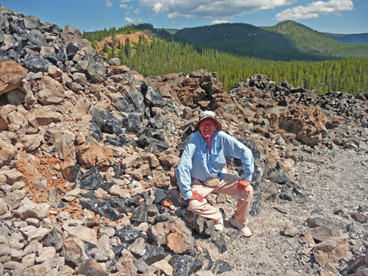
It was clear and sunny when we awoke on Saturday July 12th. We drove over to the trailhead for the Big Obsidian Flow and took the hike that winds up and through it. The trail starts as a paved path that leads to a steep set of stairs. At the top of the stairs was a collection of large obsidian boulders. I saw more obsidian and in larger clumps than anywhere I’ve ever been. A large portion of this lava flow is obsidian and the rest seems to be pumice.
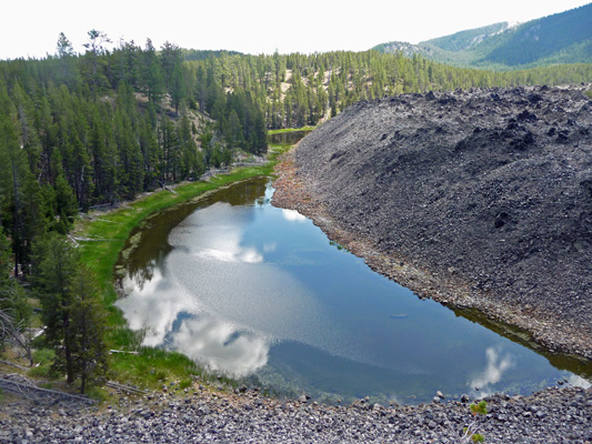
The trail takes you to a viewpoint over a small lake that has formed at the edge of the lava flow.
The the path gets rocks with lots of sharp pieces of obsidian. We came around a curve and you could see this great layer of shiny rock. I asked Walter to stand next to it to give you a sense of scale and he decided to sit down instead.
We crunched along on the trail as it wound up the hill until we came to another viewpoint with a bench and one lone tree.
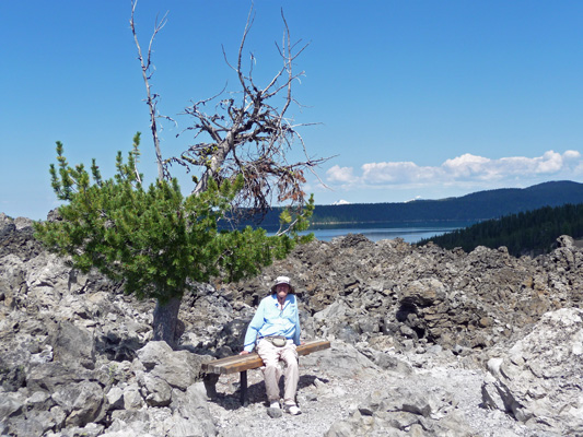
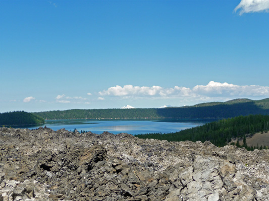
That’s Paulina Lake in the background.
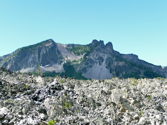
If you turn to the left you can get a great view of Paulina Peak—the viewpoint we drove to the day before—with the lava flow in the foreground.
We followed the trail to its highest point and were rewarded with this view of Paulina Lake. You can see a couple of mountains peaking over the edge of the caldera in the distance.
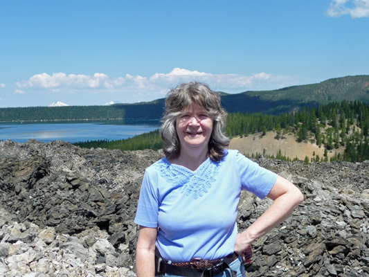
Walter took this shot of me as we jockeyed for a place to sit in amongst a group of geology students on a 3 week field trip from Indian University of Pennsylvania.
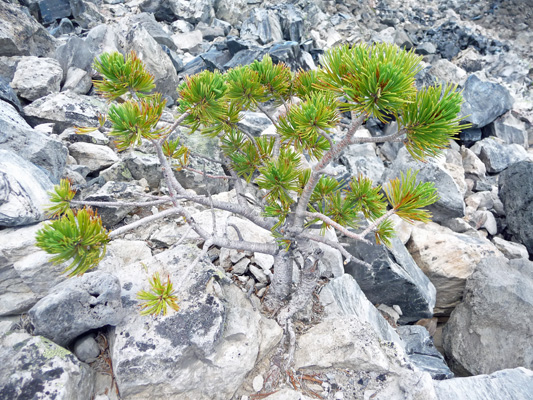
The trail makes a loop to the top and coming down the other side I spied this bonsai growing out of a boulder.
We had a great thunderstorm that afternoon with huge rain drops and a nice brisk wind. I washed the Airstream’s windows to get all the water spots off and while the rest of the trailer is a bit dusty we can at least see out!
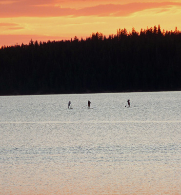
The thunderstorm left some clouds in the sky when it blew through and that made for a nice sunset.
While we were out watching it we saw an incredible number of fish jumping clear out of the water. Not just their heads but their whole bodies leaping out of the water. It was a great show. And then I heard voices out on the lake and realized there were paddle boarders out enjoying the last bit of light on the lake.