After checking the weather, we decided to motor on out to Sun Lakes north of Ephrata (and southwest of Coulee City) to camp at Sun Lakes Resort, next door to Sun Lakes State Park. In the past, we’ve camped at the state park but their rates have gone up so that it’s much cheaper to camp at the resort than the state park—at least in the off season. We got a nice pull through spot with full hook ups and an open grassy area next to us (and no neighbors because it’s now after Labor Day) for under $30 a night. A full hook up site over at the state park would have cost us $42. The resort is a concessionaire for the state park so we even got free admission to the park. This was NOT a difficult choice to make.
It was about 80 when we set up camp so we put out all the awnings and opened up the windows. As the afternoon wore on, the wind came up and got stronger and stronger. By 5:30 it was time to bring in the awnings so the trailer wouldn’t take off and fly away! It certainly was nice to spent the afternoon in shorts with the sun out after our days at Pleasant Valley wearing sweat pants and fleece and two pairs of socks!
The wind died down in the night but started up again in the morning. It was sunny with a few wispy clouds when we started out to explore the lakes of Sun Lakes. The state park encompasses not only Blue Lake which is where their picnic area and swimming beach are (and the resort’s too) but several more lakes out on wandering roads. We drove out toward Umatilla Rock and Perch Lake. Umatilla Rock is really a basalt mesa but hey it’s called a rock here. There were clouds coming in from the north but it was still sunny at this point.
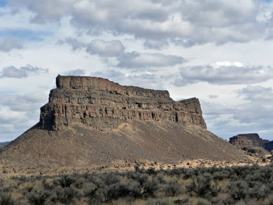
Here’s what the landscape around Umatilla Rock looks like. This is all part of what is known as the Lower Grand Coulee which was created during the last Ice Age when huge floods (400 to 600 ft .deep) came through and scoured out steep waterways.

You can hike to the base of Umatilla Rock from a trailhead where the pavement ends and a dirt road begins. We decided to take a pass on the hike in the wind and continued on the dirt road to Perch Lake.

All the lakes in this area are spring-fed. The water levels are down a bit since it’s near the end of the dry season.
The dirt road continues on to Dry Falls Lake. Dry Falls itself is a wonderful geological formation created by the huge ice age floods. In the old days just this section was known as Dry Falls. It’s over a mile wide here and about 900 feet tall.
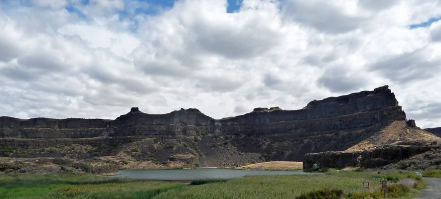
As geologists have studied the area they have come to the conclusion that Dry Falls is actually 3 1/2 miles across and extends all the way across the coulee. The chain of lakes down the center of Lower Grand Coulee were created as the big glacial floods came through. They are the bottoms of the falls. As the falls eroded away the coulee walls in the huge floods, they moved northward up the coulee leaving the pools behind.
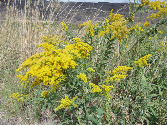
There was goldenrod in bloom at the edge of the wetland around the lake.
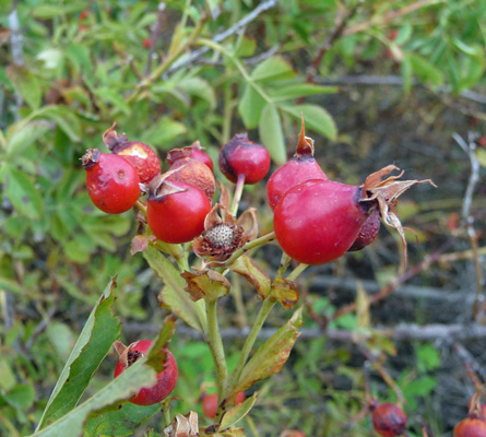
And brambles full of rose hips. We saw people picking rose hips down by Blue Lake and the day before down near Soap Lake. They’re not very big, about the size of the tip of my little finger.
We bumped our way back on the dirt road and then took the paved road out to Deep Lake.
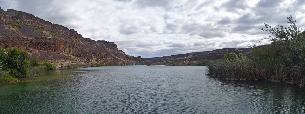
There was actually a family here with the kids going for a swim. The water was pretty cold so I bet they didn’t stay in long. It would be refreshing if it were hot but it was only about 72 at the time.
We walked along the edge of the lake for a little ways and then turned back. The state park’s website had said that the Visitor’s Center wasn’t open, but the bulletin board at the lake said that it was. So we motored on back past the resort and UP the hill to the Visitor’s Center which sits on the lip of the coulee. This is the view from the parking lot next to the Visitor’s Center. That’s Dry Falls Lake below—with a dried up section on the right. Dry Falls itself is that huge arc of canyon rim that runs from the left edge past the right edge of the photo.
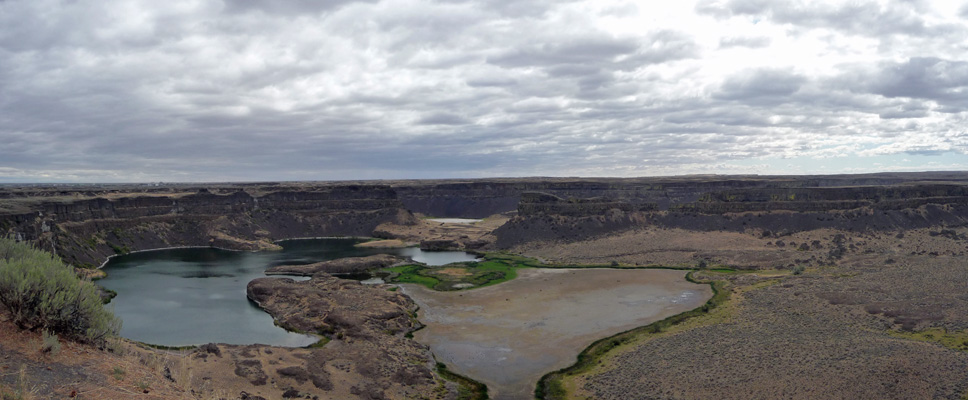
There’s a gazebo and a bit of rim edge that extends out into the coulee where you can take a pretty decent photo of things. Now stop and imagine 400 feet of water crashing over the tops of the falls and down into the coulee. No, I can’t imagine it either.

There are great information signs along the rim in the parking lot and we stopped and read them. The view of scientists as to what happened here has evolved a lot over the years and the signs are much better than they were say 20 years ago.
We spent a bit of time inside the Visitor’s Center reading the displays and watching a great 12 minute video put together by the state parks and Central Washington University’s Geology Department. CWU is in Ellensburg by the way.
By the time we were done there, a pretty good cloud deck had moved in. We didn’t have any rain but the wind kept gusting most of the afternoon. After about five the clouds cleared away and the sun came back out. We even had a little pink in the sky at sunset.
We awoke on Thursday September 4th to a picture perfect sun shiny day. We puttered around the trailer a bit in the morning (I even washed the trailer’s outside windows) and then got the bikes out for a ride. We rode down through Sun Lakes Resort and over to the boat launch area at Sun Lakes State Park next door. Tuesday and Wednesday it had been windy and the Blue Lake was all stirred up. But on Thursday there wasn’t a breath of wind and the lake was like glass.
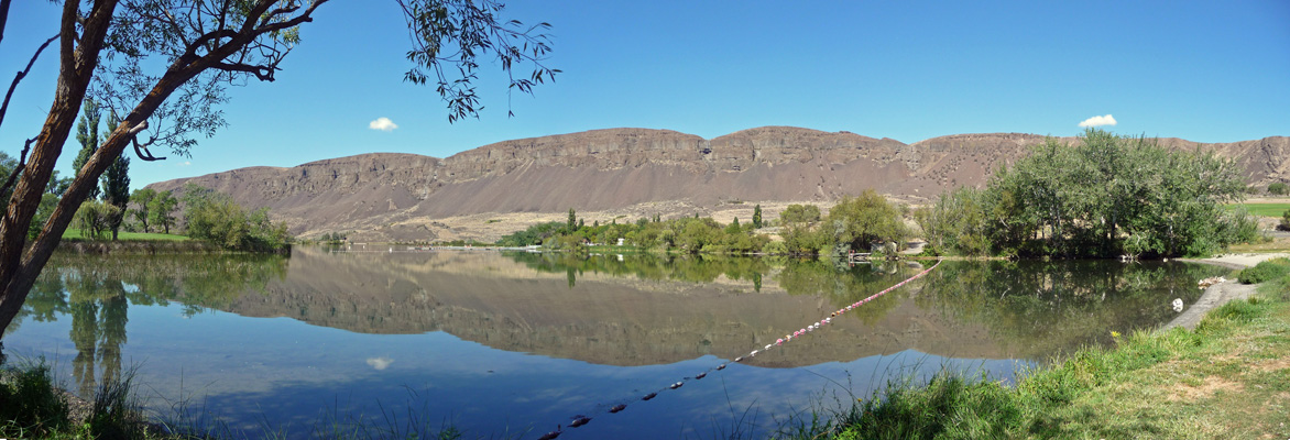
The parking lot here was gravel and when we went to ride back across it, Walter decided to go over the grass instead of the big chunks of gravel. I blithely rode across it with no difficulty but would pay for it later.
We road on down to the Day Use area and I noticed that it was harder work than it had been to pedal up hill. We stopped and watched a family playing at the beach and then turned to go on with our ride. We stopped to talk to a lady coming in and she pointed out that my rear tire seemed to be flat. And it was not simply a little slow leak either. It was FLAT.
So Walter rode back to the trailer and then drove back with the truck to get me and my bike. When we took a careful look at the tire you could see a slice in the rubber on the side of the tire—no doubt from the big chunks of gravel in the parking lot. Sigh. Of course it was the rear wheel, and on our fancy no-chain internal hub bikes changing that tire is a major deal which will wait until another day.
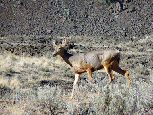
We had lunch and rested a while and then drove back out on the road to Deep Lake about 3/4s of the way. We saw a buck near the boat launch but he took off before I got my camera out. Walter had noticed a trailhead sign the day before for a short .6 mile hike that he wanted to try. It was called the Caribou Trail (no there aren’t any caribou in Eastern WA but what the hey it’s named after the Caribou Cattle Trail which went through here). The trail followed a gravel two track (part of the original cattle trail) gently up hill across the sagebrush-dotted desert. A doe wandered across the trail and then walked parallel to where we were standing so I got a photo of her. Shortly after, a faun came across the trail too. I guess that’s why the doe’s ribs are showing. The buck had looked fat and happy.
The trail continued to go up and turned to dirt and then turned the corner into the shade.
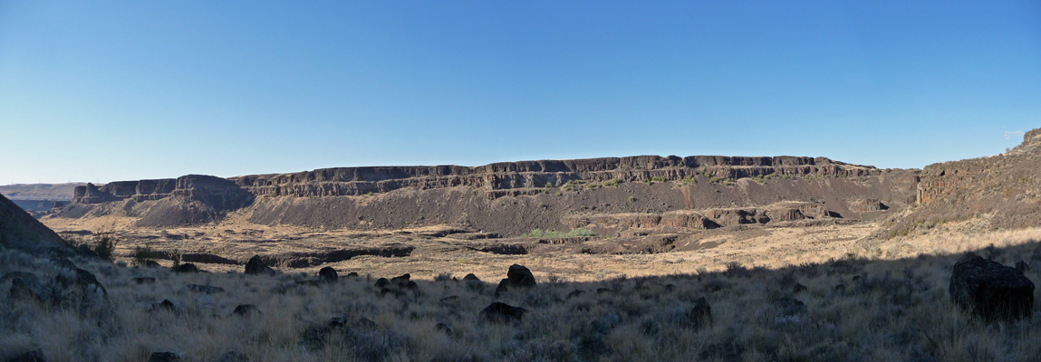
And of course then went STRAIGHT up hill. Walter decided he’d wait for me down at the bottom and I hiked up about 3/4 of the way to see if I could get a better shot of the potholes that dot the coulee floor here.
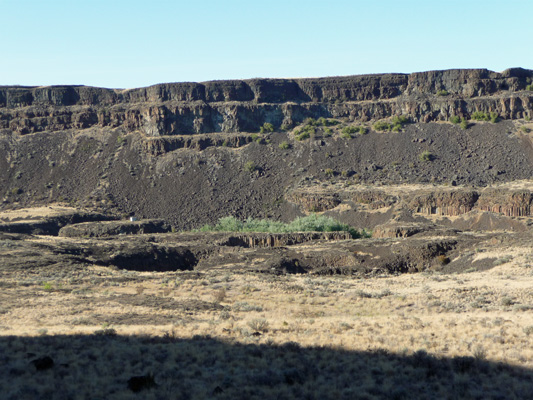
Geologists have decided that these very round 8 to 10 foot deep holes (sometimes as deep as 20 feet) were created by vortices of water during the big floods that carved the coolies. South of here there’s a state park called Potholes that is literally dotted with them. Many of them are 50 feet in diameter.
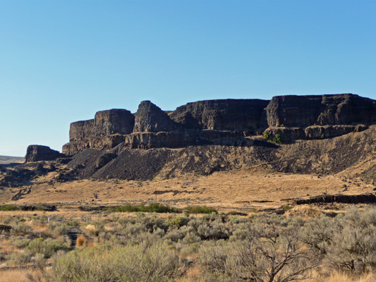
Does this mesa look like the ruins of an old fort, or what? But instead, it’s just layers of basalt eroded by wind and water.
On Friday September 5th it was another glorious sunny day. We packed up the trailer and motored south to Ephrata for a stop at the Ace Hardware Store. This was a wonderful small town hardware with everything imaginable and 3 roaming clerks to answer your questions and show you where everything was. We got everything on our list and then drove south and west through Ellensburg and up back into the Cascades to Lake Kachess to camp for two days.
Kachess is a favorite campground of ours. We’ve been coming here since 1999. We were here for a few days back in June and then they were short of campground hosts and our campground loop didn’t have one. This time, after setting up in the very same spot that we camped in last time (since the loop was empty except for the host) we went to register and the host came out to talk. He didn’t start working here until July 1. They had been through two managers while he was here (they’d lost one already the day we arrived in June) so clearly Thousand Trails hadn’t sorted out all their management problems yet. He’d been a trail host in the Everglades for 2 months this past winter and then did two months of campground hosting at Fort Stevens State Park on the Oregon Coast before coming here. He said he’d had a good time but that he was done hosting and looking forward to clearing out on Sunday when they close up his loop.
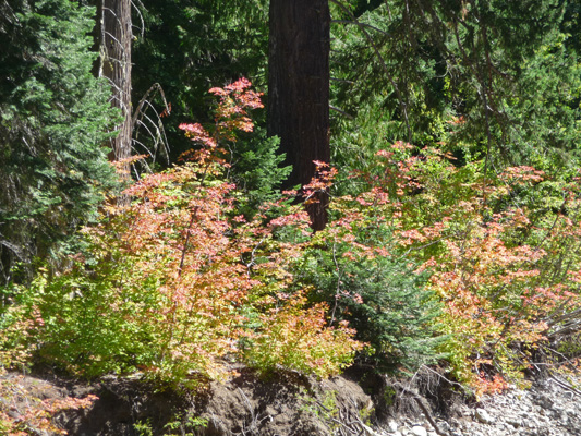
It was another glorious sunny day on Saturday September 6th. We’d had a cold night and the trailer was in the 50’s when we woke up so we ran the furnace. But it steadily warmed up as the day went on. The bridge to our favorite hike here was still out so we simply hiked down to the south end of the campground to have a view of the lake. On the way I spied these Vine Maples changing color. It won’t be long until it’s fall in the mountains.
The Day Use parking area was full on the south end of the lake and there were lots of folks out on the beach. The lake was down quite a ways from where it was when we were here in June but that is to be expected. Kachess provides irrigation water to the Yakima Valley. We hiked back to the trailer and dropped of our fleece since by this point we really didn’t need them. And then carried on along the trail through the Group Campground where we found people camping (in fact once we were out on the road we saw a sign that said it was a wedding). So we detoured around it and on out to the creek that marks the end of the north end Day Use Area.
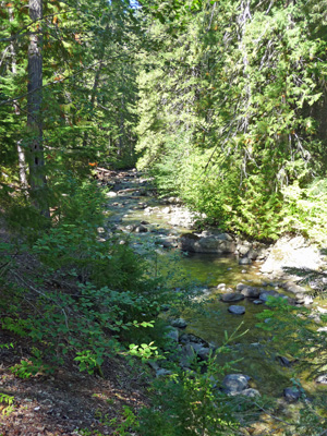
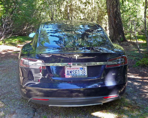
The water was way down here too but still not easily passible for us. So we wandered on out towards the beach. On our way through the Day Use parking area (which was full) I spied not only the usual Prius or two but a Tesla—the first I’d ever seen.
There were lots of folks out using water toys of all kinds.
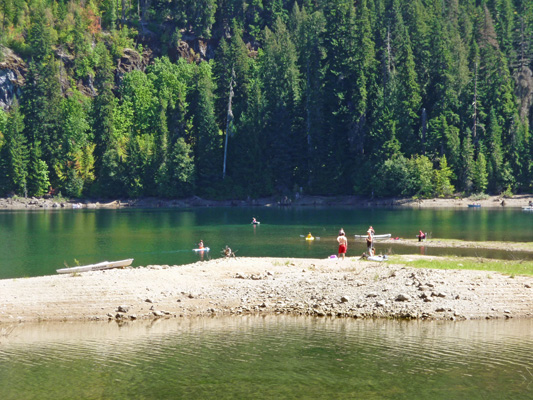
And the twenty somethings were gathered out on the rocks up lake trying to figure out how to jump off the rocks without getting killed (it’s easier when the lake is higher).
The view up lake to the north is still gorgeous with a bit of snow on the mountains.
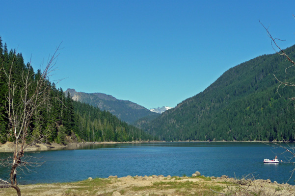
Here’s what it looked like back in June when the water was MUCH higher.
On Sunday September 7th we moved to Blue Sky RV Resort in Issaquah.
We’ll be staying there for a whole month so that Walter can have cataract surgery. He’ll have his right eye done on September 9th and his left eye done on September 30th. In between, there are follow up appointments and lots of errands and the like to do. But not much time for outings.
