
The road used to follow the Toutle all along it’s route out to Spirit Lake and thus is called the Spirit Lake Highway. But when Mt. St. Helens erupted in May of 1980, the Toutle was filled with the landslide (1300 ft of mountaintop plus a large portion of the north face) from the eruption plus the later pumice fall and that wiped out the road. When they rebuilt it, they routed it along the hilltops and up the ridges leaving the river valley to work through it’s load of debris and ash and pumice. As the road rises in elevation the views of the river make it look like one of the braided rivers up in Alaska that carry the rock and gravel deposited by the glaciers.
We stopped at the Loowit Viewpoint past Coldwater Lake for our first good look at the mountain. There was a bit of haze left over from the morning clouds and we were looking south into the sun so it didn’t make for the best photos but at least there weren’t clouds sitting on the mountaintop. Mt. St. Helens used to be a gorgeous conical mountain like Mt. Fuji. When she erupted she blew out her top and a good portion of her north face leaving her a hollowed shell of a mountain.
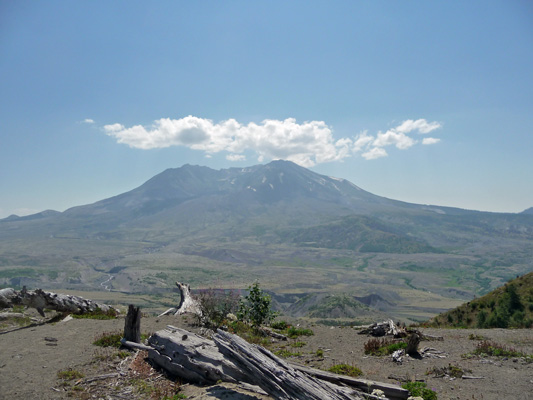
The dead trees in the foreground were killed during the eruption. The mountain blew up taking the top 1,300 feet of the mountain off and then proceeded to have further eruptions of pumice and ash. The initial blast killed everything within about 15 miles of the mountain on the north side.
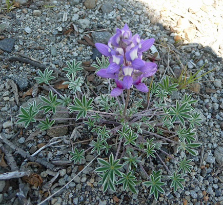
There were wild flowers growing in the pumice and ash at the viewpoint including this little dwarf lupine (Lupinus lepidus var. lobbii).
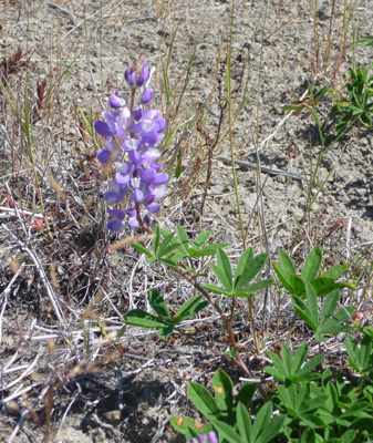
And quite a bit of subalpine lupine (Lupinus arcticus sbsp. subalpinus)
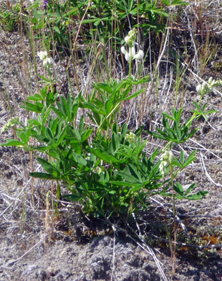
And Sickle-keeled lupine (Lupinus albicaulis)—a white lupine!
The lupine plays a big role in the revival of the landscape since it fixes nitrogen in the soil which then later feeds other plants the come along. Pumice and ash have no nitrogen and so they can’t support plant life until little nitrogen fixers like this come along.
There was also surprise surprise, Paintbrush!
We drove on up to the Johnston Ridge Observatory which acts as a visitor center at the end of the road. The large parking lot was about 1/3 full when we got there. There’s nothing like being a tourist on a weekday! We spent some time exploring the exhibits. There’s a wonderful relief map with LED lights and a narration that shows the way things flowed during the course of the eruption and there are some great video clips of geologists talking about the mountain. There’s a really nice patio out front with a great view of the mountain. Here you can see the Toutle River as it carves it’s way through the pumice plain. A great deal of the old mountain top is actually now down on this plain. So the joke is that if you want to hike the top of Mt. St. Helens go hike the area called The Hummocks where the top now rests.
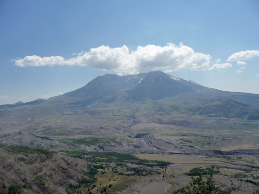
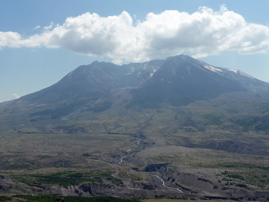
Here’s a closer shot of the mountain. You can see the size of the crater left by the eruption better here. And the depth of the debris, ash and pumice that the river is carving through.
We hiked down to the amphitheater area which is west of the visitor center and sticks out a ways further south. From here you could see Spirit Lake which is northeast of the mountain.
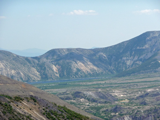
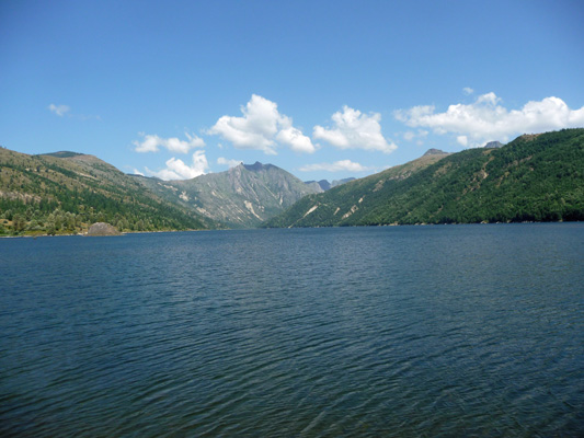
When we’d had our fill of the mountain we returned to the parking lot which was now about 1/2 full and drove down the mountain a ways to Coldwater Lake. This lake was formed as a result of the eruption. Coldwater Creek (or maybe it’s the Coldwater River) wound down a pretty little valley that had a narrow mouth at it’s west end. That narrow mouth got filled up with the landslide (the mountain top) at the beginning of the eruption and that formed dam to form the lake. The engineers worked to open up the debris field a bit so there wouldn’t be a catastrophic failure of the dam that would flood the Toutle again and that work resulted in a permanent new lake with a static rather than growing lake level.
We found an open picnic table for our lunch and then took the little paved walk along the lake’s edge to take some pictures. It’s really a very pretty lake.
It was a perfect 75 degrees here but when we got back to the trailer it was again 86 both inside and out. It made for a hot late afternoon and early evening but it did eventually cool off. No sunset through.
On Tuesday August 19th, we awoke to clear skies and a brisk breeze off the lake. We broke camp and drove back west to I-5 and then north to Hwy 12 and out to Randle. Then we went south a few miles on Forest Road 25 to Iron Creek Campground. This is a lovely campground in a stand of old growth forest. We visited it back in June when it was cold and rainy and rejected it as too dark. But on a sunny warm day it seemed perfect. It has nearly 100 campsites and most of them are big enough for the Airstream. We found a nice little side-pull-through and set up camp.
That’s when we discovered that the basil plant I had left in the kitchen sink had managed to hit the water handle on the kitchen sink when we hit a bump (we’d accidently left the water pump on) and our water tank was now empty and the grey water tank was full—and the basil plant was VERY well watered. Oops. We sat and talked about it and scoped things out and decided we’d be okay. We drained the grey water tank into a 2 gallon bucket (13 times) and watered the bushes around our campsite with it. The tank holds about 30 gallons but we only drained about 25 out of it. Then we filled our one-gallon water jugs from the campground spigot and emptied them into our fresh water tank. After a number of trips, we once again had enough water. I suspect it will be a good long time before either one of us forgets to turn off the water pump.
We had lunch and then went and visited with the campground hosts. They are old hands at the business and have really enjoyed working for Hoodoo Recreation managing this campground. They have a second host to back them up and to handle all the visitors on the weekends. There’s only one other campground in the district that has 2 hosts (because those folks have to haul water in and garbage out). These folks have water and sewer hook ups and power from a generator they run 6 hours a day for the water supply for the campground. They seem to think that’s more than sufficient. It would work for us.
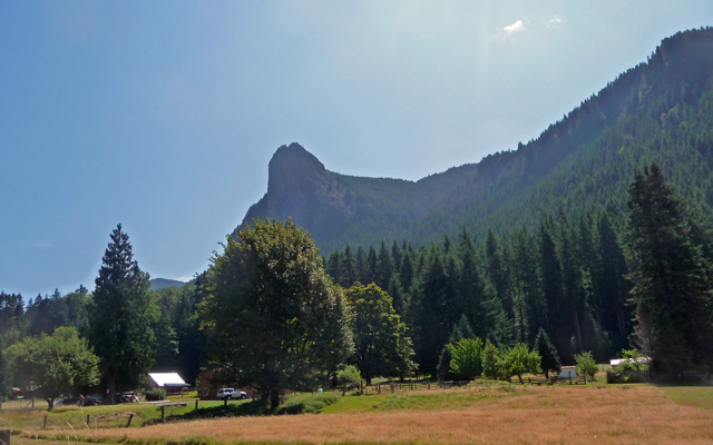
On Wednesday we awoke to clear skies and decided to pack a lunch and take a series of small hikes in the area. We drove from FR 25 to FR 23 via FR 75. It was a pretty drive on a decent paved road. We navigated our way by pointing ourselves towards Tower Rock Campground. Not long before we reached the campground we came out into a meadow area and there to the south we spied what must be Tower Rock.
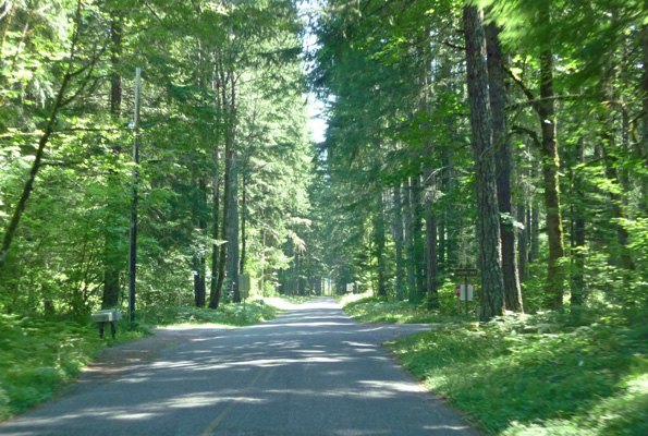
Past Tower Rock we drove through deep forest with lots of Big Leaf Maples which created a nice forest tunnel to drive through.
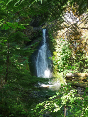
When we reached FR 23 we turned south looking for signs and sure enough we spied a trailhead sign for Camp Creek Falls with a small parking area across the road from it. We parked and took the trail into the woods. The trail wandered through the woods a short distance and then began to climb up a side hill. In maybe a 1/2 mile we reached Camp Creek Falls.
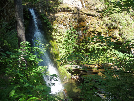
It’s a 30 foot waterfall with a nice wall of ferns on one side. While looking for a good spot to stand to take photos I noticed a little clump of mushrooms.
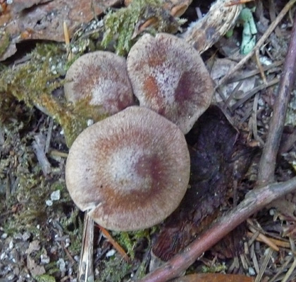
We saw mushroom buyers along the road both down by Peterson Prairie and along FR 25 so I guess I shouldn’t have been surprised to see these guys already.
I wandered around and finally found a place a ways down stream that gave a full view of the waterfall.
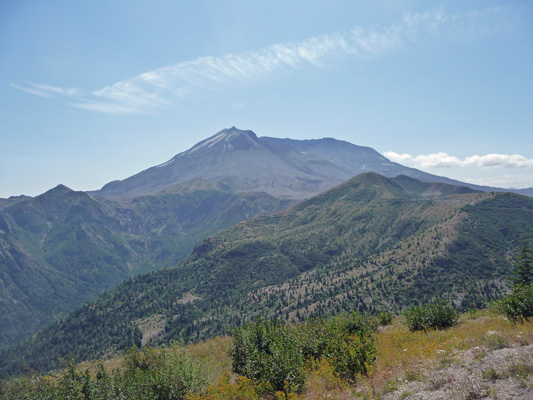
When we got back to the car, Walter announced that he thought we should bag the other little hikes and take the drive to Windy Ridge for a view of Mt. St. Helens from the northeast side. Windy Ridge is the closest you can get to the mountain by car these days and folks camp at Iron Creek Campground because it’s only 30 miles from Windy Ridge. So off we went, back along FR 75 and then south on FR 25 until the turn off for Windy Ridge. It’s a winding road with a number of view points and trailheads.
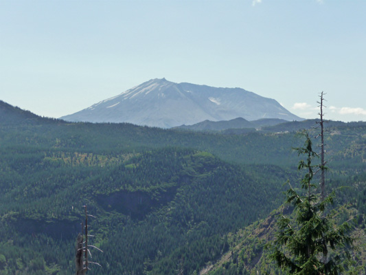
We stopped at a viewpoint where you could get an early view of the mountain. She looks very different from this side.
Then we stopped at great viewpoint where you can see Spirit Lake.
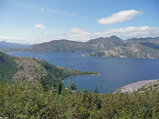
The landslide at the beginning of the 1980 eruption, landed right in Spirit Lake. That created a wall of water that went up the hillsides to the north and then washed thousands of trees back down into the lake. By the end of the first phases of the eruption Spirit Lake was 98 degrees and all the life in the lake had been killed. The landslide filled the lake with a lot of debris and plugged it’s outlet into the Toutle River. The level of the lake rose 200 ft so it is now bigger in circumference than before the eruption but much shallower. Engineers have created a tunnel through the debris field to give the lake an outlet and to prevent possible flooding downstream.
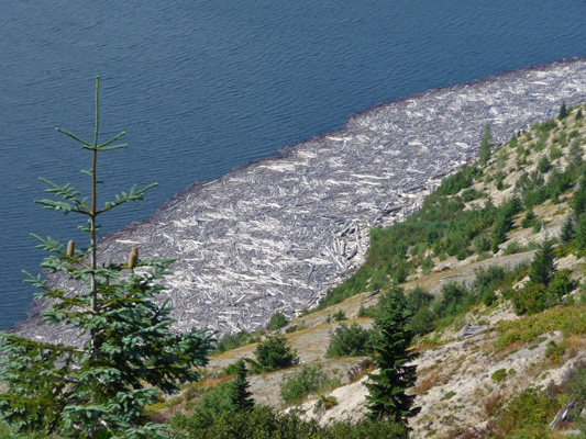
For years there’s been a hug log raft on Spirit Lake. You can see a little of it here. Slowly over the last few years it’s begun to sink.
We drove on and stopped at the Smith Creek Viewpoint for some great views of Mt. Adams to the east.
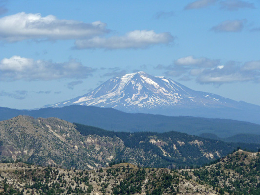
And Mt. St. Helens to the west.
We ate our lunch at Windy Ridge but took a pass on the hike up several hundred stairs for a better view of the mountain. There was a Ranger Talk starting right when we were done with lunch so we went over to the Amphitheater and listened. It was one of the best Ranger Talks I’ve heard in years. Lots info on the eruption and wonderful before and after photos of the mountain and Spirit Lake. Plus she had a scope focused on 3 elk sitting and chewing their cud on the mountainside.
We were both glad we’d taken the time (and gas) to go out to Windy Ridge.