
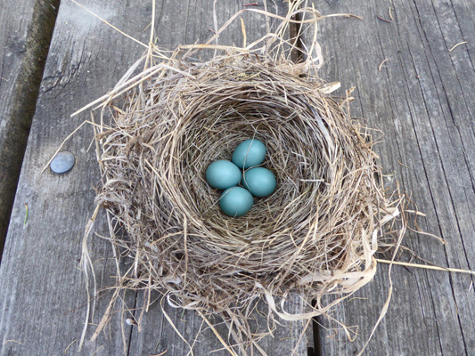
When I went to the office to pick up the keys for our cart there was a robin’s nest sitting on the picnic table. One of the staff had found it and the interpretive ranger was hoping to be able to preserve it for her collection of cool stuff she shares with kids at her interpretive programs. It’s way to cold for robins to be laying eggs so this must be left from sometime this summer. We do have a bunch of robins in the park still but I think they I migrating through at this point.
We only had 25 sites to clean (half of what we’d had the day before) and we’d cleaned half of them by 10:15 because so many of them had packed up and left as fast as they could. I dug ashes out of about 2/3 of the fire pits just so I could keep warm. By late morning it had warmed up into the upper fifties and by noon it made it up to 60. But there was a stiff breeze coming from the north so the end of the campground down by the lake was COLD.
When we drove into the C Loop in the morning there were three does and a buck lounging around in the grass near the construction site. They were still there a while later when I came back with my camera. The buck was still losing the velvet off of his antlers.
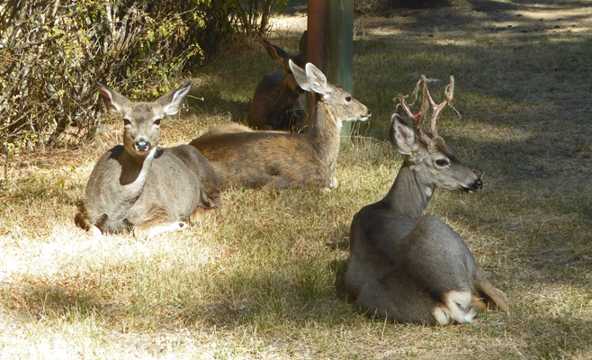
Later in the morning they were gone from here and we saw them sitting in the shade of the playground equipment between the C and E Loops. They are so tame they don’t even seem to mind kids playing around them.
We took a break at about 12:30 because we had 5 sites where no one was there—not a good sign for departing on time—and had lunch. A little after 1 we made one more round and found they had all vacated but one—which was just starting to get ready to go. We cleaned the others and then came back and sat in the sun and waited until they left at about 1:30. The site and the fire pit were clean!!! thus violating cosmic law #1 for camp hosts that the last site to vacate always leaves their fire going. But I’ll take a little rule breaking any old day.
Having put our cart away we packed up the computers and laundry and went into Joseph. Walter had a package to pick up at the post office and he went there while I got the laundry going and booted up my computer. And wonders of wonders there was a free open network from the motel across the street. We got on easily and the connection was good and fast. Hooray for free Wi-Fi! It’s still not real comfortable to work and balance your computer on your lap but it’s better than sitting in the car—so progress on the internet front has been made. Our hot spot also works in town so things are definitely looking up.
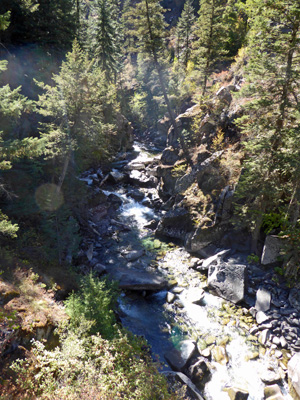
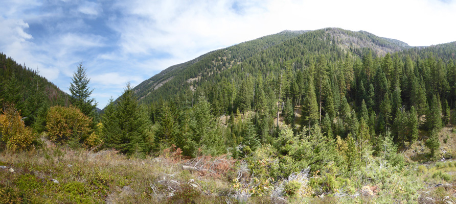
On Tuesday September 13th it was cold, clear and still. The lake was like glass so we stopped by on our end of the lake (the south end) to take a picture).
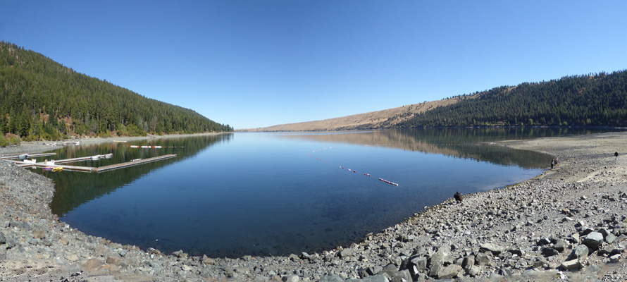
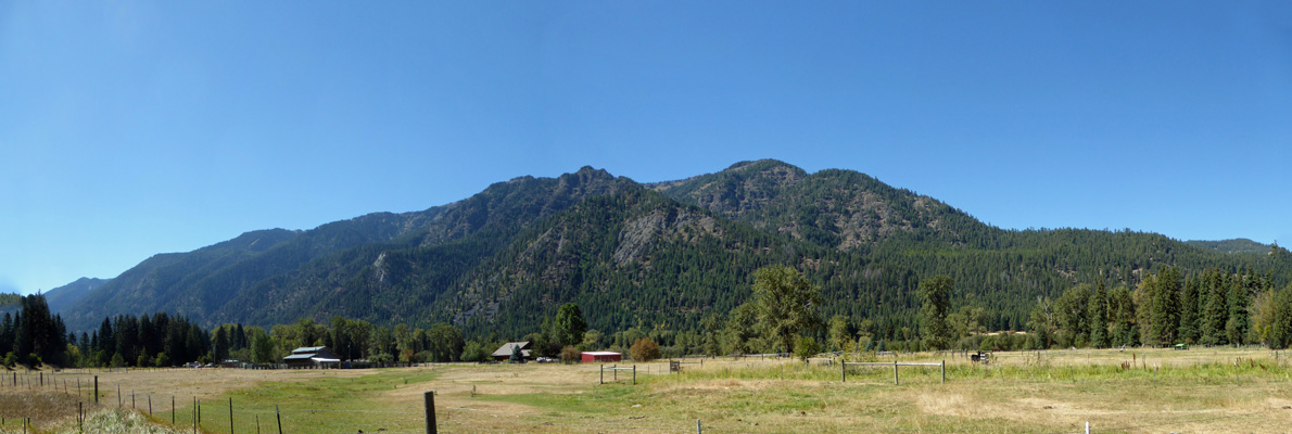
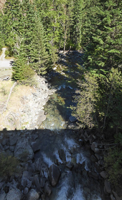
On our way to town we stopped at the Day Use Area on the north end of the lake too. I believe that the the large mountain on the right in the background is Chief Joseph Mt.

While I was at it I took a close up shot of Mt Howard on the left and Bonneville Mountain in the center.
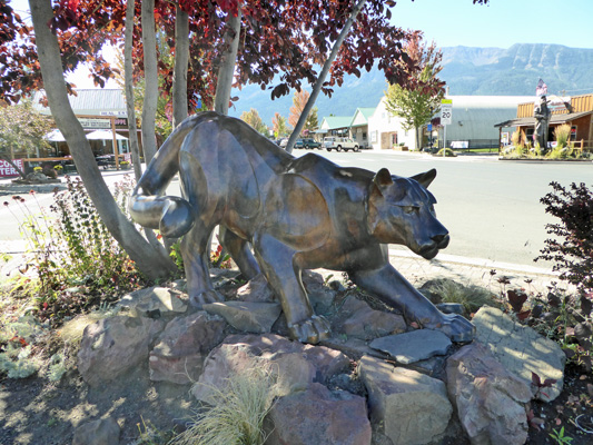
Since it was so gorgeous and sunny we decided to walk up and down the main drag of Joseph so I could photograph all the wonderful bronze statues that grace Main Street.
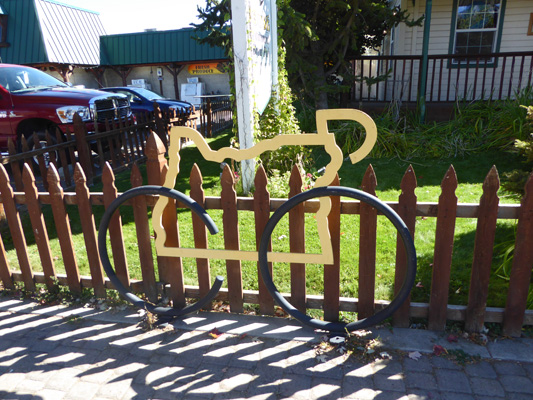
First off was an unusual bicycle with a map of Oregon as it’s body.
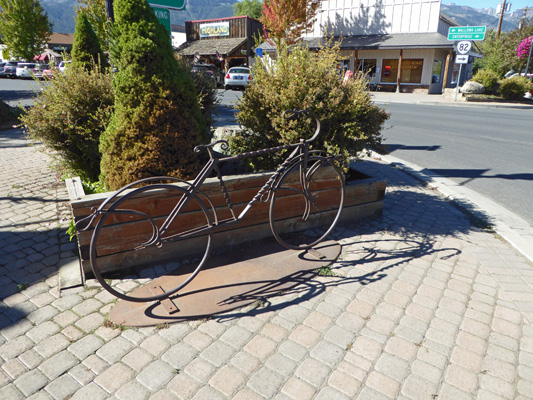
This more traditional looking bike shows up on several street corners in town.
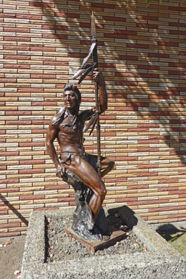
Then we moved into more traditional statues such as this one of Rolling Thunder and Springtime.
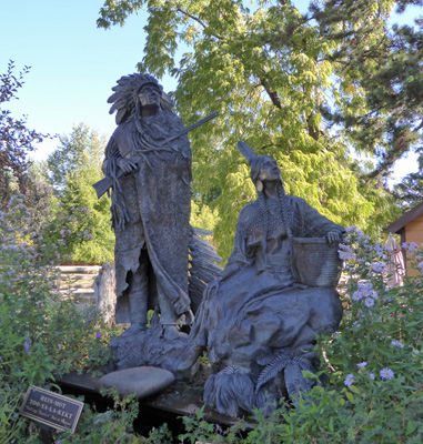
The detail on these statues was worth an extra shot or two. Here’s Rolling Thunder on his own.
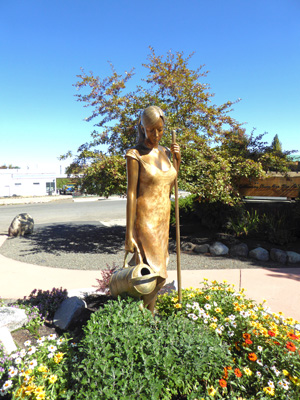
And Springtime on her own.
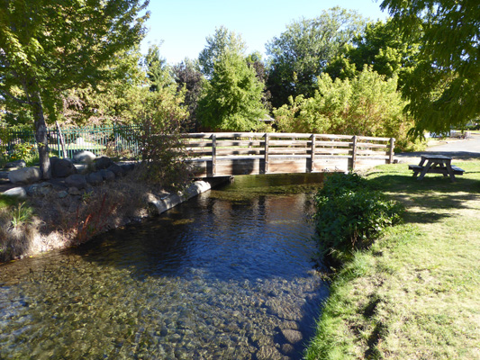
We walked a little further north and came to this nice little bridge over the Wallowa River. The river itself runs under the street so you don’t see it unless you’re on foot.
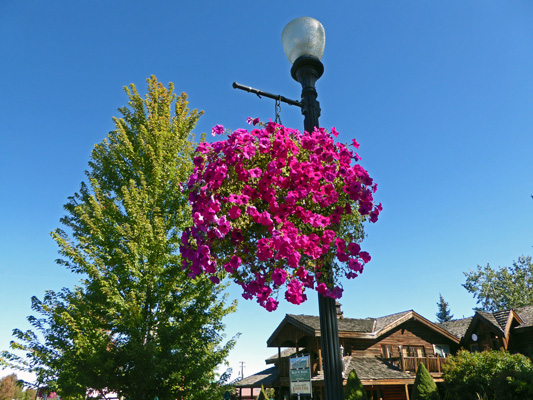
They had large baskets of petunias hanging from the light posts.
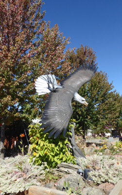
Having made our way to the north end of Main Street we crossed over to take a photo of the Spirit of Joseph.
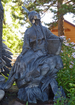
And then worked our way up the west side of the street to In Her Care.
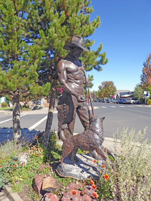
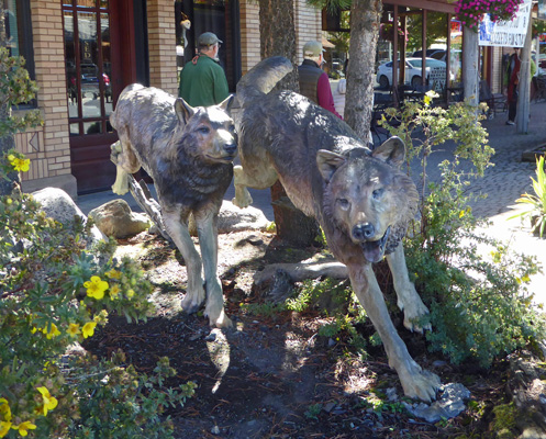
Then on to Tracking The Intruders in front of the local sporting goods store.
There is a very nice wolf/dog following behind the horse and rider but I couldn’t get them all into the same photo.
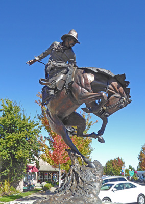
The Chief Joseph Days headquarters is just past here and they had a group of cowboys standing in the sun.
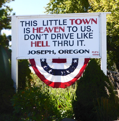
We both love this sign which is right in mid-town—the speed limit is 20 MPH at this point because it’s a school zone.
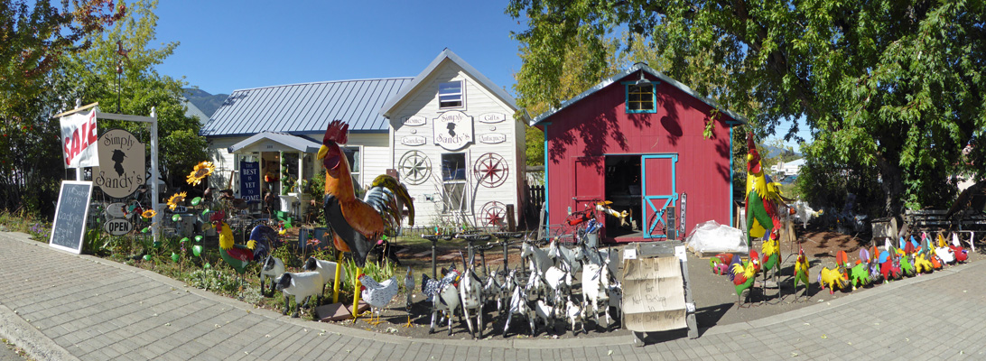
Next there is Simply Sandy’s where you can meet all your rooster needs plus flying pigs, and other interesting critters.
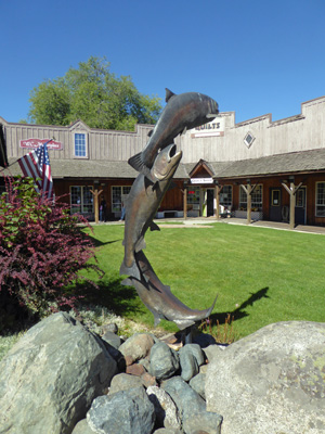
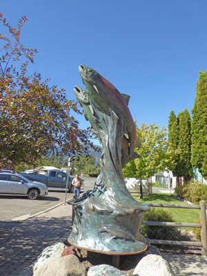
Things become more sophisticated again with this unnamed set of salmon (perhaps they are kokanee).
I took a photo of Attitude Adjustment the week before—it’s in front of the City Hall. But I took another set for good measure.
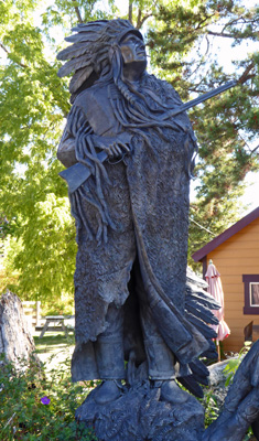
Chief Joseph is directly across the street.
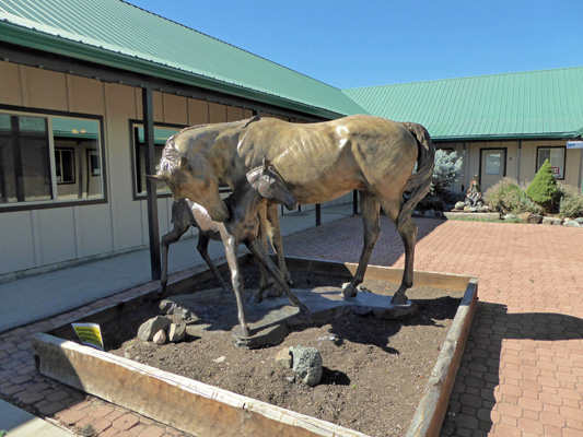
Further up the block you come to a scupture of a mare and foal called "Baby Steps".
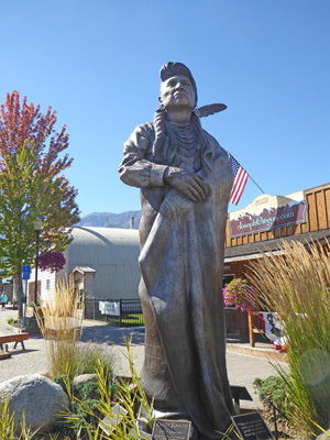
A little further still there is this a scupture of a Nez Perce warrior entitled "Sentinel" standing in front of the post office.
River Dance celebrates the kokanee again, this time on the corner in front of the Post Office.
And All Around Cowboy celebrates the Chief Joseph Rodeo.
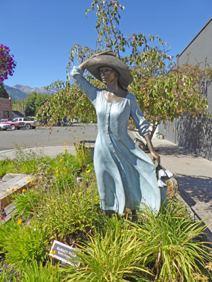
The last statue on the west side of the street is Garden Walk.
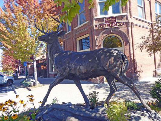
Across the street from here in front of one of the many galleries in town, you’ll find a white tailed deer.
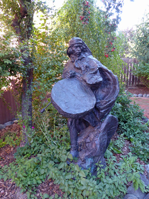
In the little courtyard next to the gallery I found this wonderful drummer.
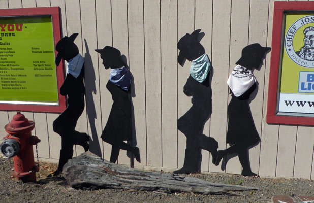
On the next street corner we found the Running Raiders. They don’t look bronze but they are.
And across the street from them is He Who Thinks He Is Invisible. You can see Chief Joseph diagonally across the street from here (on the right).
I’m really glad we took the time to do this walk when it was sunny and there weren’t tons of folks on the streets. It was a great fun to stop and appreciate each of the pieces of art and soak up downtown Joseph’s eclectic atmosphere.
Having finished our art walk we were now ready to take the drive we’d set out to do. We headed west on Hwy 82 to Enterprise and then drove another 10 miles to the little town of Lostine. Right where Hwy 82 makes a 90 degree turn towards the north we turned left onto Lostine River Road. The directions we were following told you to turn south at the Blue Banana.
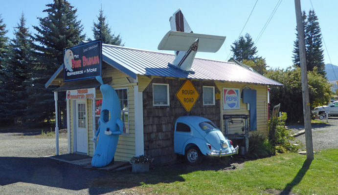
I don’t think anybody would miss it, do you? There’s more interesting stuff all over the back of the place too—and they sell Espresso and more!
The road takes you through agricultural land and gives you wonderful views of the mountains to the west.
The first 7 miles of the road is paved but it turns to gravel when you enter the Wallow Whitman National Forest. You can drive for 11 miles on this gravel road that on the whole was in pretty good shape (just a bit of washboard on the rises here and there).
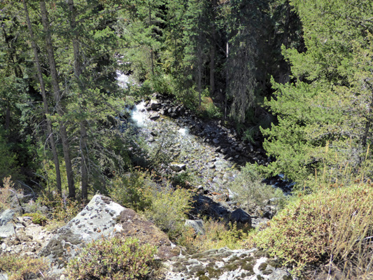
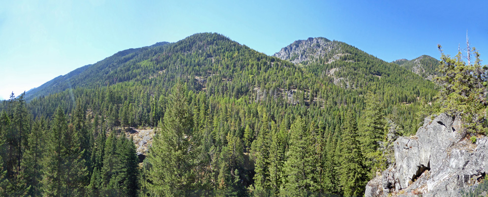
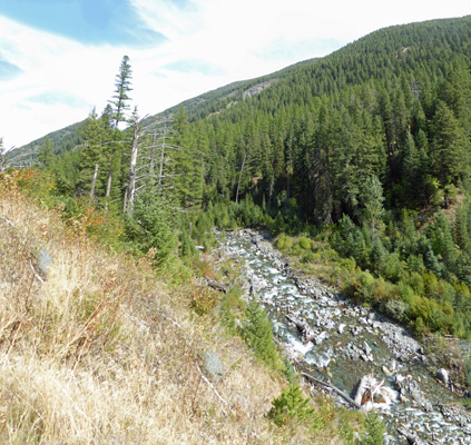
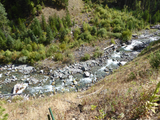
Our first stop was an overlook that had no name but did have an area information sign (and a map of the Lostine Corridor that we could take with us). We hiked out on the short trail to have a view of the Lostine River below.
And the mountains to the west.
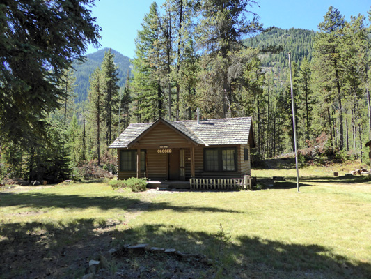
Just past here there are a couple of free campsites—with fire circles and picnic tables. Along this corridor they only allow dispersed camping at designated sites like this. There are also 6 campgrounds with bathrooms that charge a minimal fee (it appeared to be $5). Not far past the first of these campgrounds you come to the old Lostine Guard Station which is now used to house seasonal employees and volunteers.
There’s a picnic table and fire pit out back with a great view of the river.
The road becomes one lane with turn outs here and goes on from here past the Bowman/Francis Trailhead where there are trails that go straight up (switchbacks galore up to the Francis Lake on the east or Laverty Lakes to the west). The parking lot for the trailhead was full (maybe 10 to 12 cars) while the campground had maybe 2 cars in it.
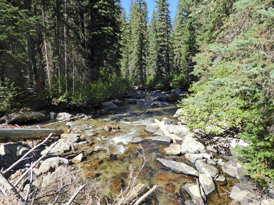
We stopped at the French Camp picnic area for lunch. The picnic tables were set well back from the river (so they don’t float away in the spring floods). I went out to the river to see what I could see.
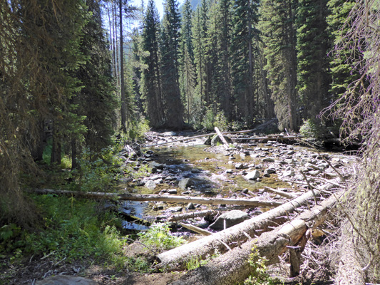
I threw caution to the wind and walked out on the left of those two logs out as far as I could go (until the branches on the log next to it got in the way). I shot photos up river that were straight into the sun and they didn’t come out well. But this shot down river was worth the tight rope walk out.
Our view from our picnic table included this portion of what is probably Marble Point. The whitish rock at the top is local marble—a sedimentary rock that has been metamorphosed to a soft marble. So no that’s not snow, it’s rock.
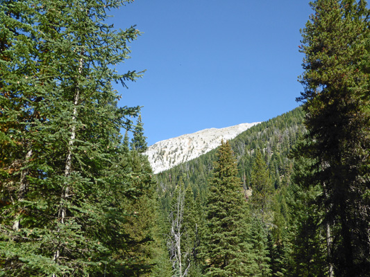
The geology of this area is quite interesting. The base rock is volcanic greenstone that is 230-270 million years old. On top of that is the soft marble which is 220 to 230 million years old. The higher reaches of some of the mountains are sandstone and shale that is 180 to 210 million years old. Then there are granites that are actually granodiorite and tonalite which intruded into the older layers 100-130 million years ago. These form the core of the Lakes Basin up in the Eagle Cap Wilderness. And then finally there are Columbia River Basalts which erupted from vents 14-16 million years ago. There’s a lot of it on the Hurricane Divide east of here.
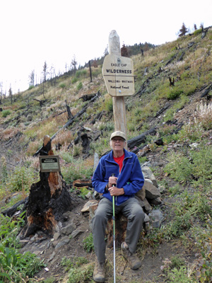
After lunch we drove on to the end of the road and the Two Pan Trailhead and Campground. It’s called Two Pan because in the old days shepherds left two pans hanging there for everyone’s use. The parking lot there was FULL as the trails here take you deep into the heart of the Eagle Cap Wilderness giving the shortest access to the Lakes Basin (a very popular area for backpackers).
We turned around here and didn’t bother to try to find any place to stop—not only was the parking lot full but there were folks parked along the side of the road too—over 20 cars.
On our way back I stopped to take photos at the Pole Bridge which is near the end of the Forest Service portion of the road. Here’s the view looking up river from the bridge.
And down.
There’s a picnic table over on the left near the tree line—that’s a picnic spot in the Pole Bridge Picnic Area—what a view!
On our way through Enterprise we stopped and did the grocery shopping—even though I’d forgotten my grocery list. And I managed to remember all but three non-vital things—not bad at all.
Wednesday September 14th, we awoke to high clouds and a temperature of about 42 (we gained about 2 degrees each morning as the week went on). The forecast said it might make it to 67 but we weren’t too sure about that with the clouds.
We headed into town and stopped in front of the laundromat to use the Wi-Fi network there and then stopped at the little grocery store in Joseph to pick up the things I’d forgotten the day before. It’s is by no means a major market but it has the basics.
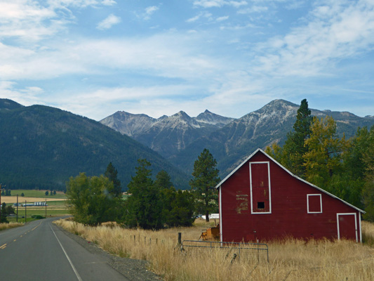
At the north end of town we turned west out past the rodeo grounds and the airport towards Hurricane Creek. On the way we had this great view of the mountains plus a nice red barn.
We turned south on Hurricane Creek Road which starts out as gravel and then becomes pavement when it hits the National Forest boundary (the opposite of what usually happens). After a fairly short drive we arrived at the Hurricane Creek Trailhead—which was nearly full with about 10 to 15 cars. We found a spot, put on our boots and both of us set out with our hiking sticks. This is a very popular trail both with backpackers and day hikers. You can hike 3 plus miles out to Slick Rock Creek to see Slick Rock Falls to make a nice 6 plus mile round trip hike. That’s a bit much for us (especially with the steady moderate grade that this trail takes) but who says you have to have a destination to enjoy hiking?
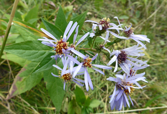
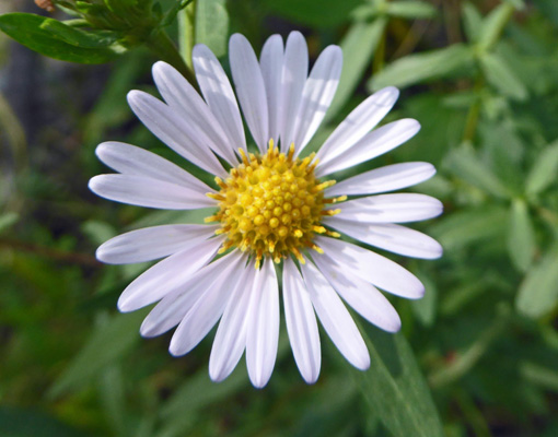
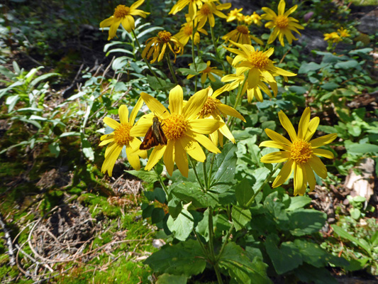
We headed up the trail and almost immediately I noticed a few Cascade Asters in bloom (Aster ledophyllus).
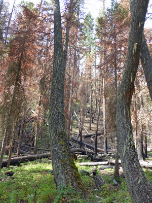
There was a 400 acre fire along this creek last year and we passed the edge of the burn not long after crossing Falls Creek (mostly a big rock fall with water gurgling through it.
There were masses of asters along the way—more flowers than I expected this time of year.
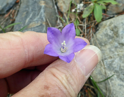
And here and there I spied a few Common Harebell (Campanula routndifolia).
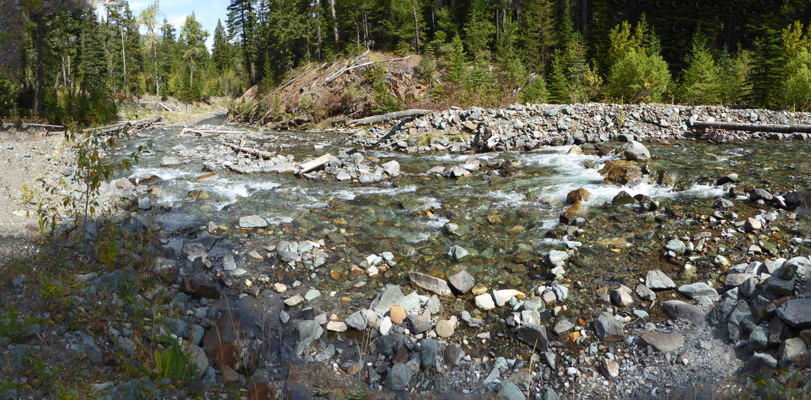
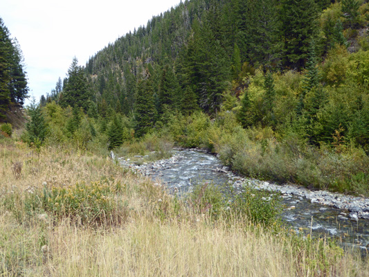
After a while we came to an open area where the trail meets the creek and I went out to the edge of the gravel bar to take a photo.
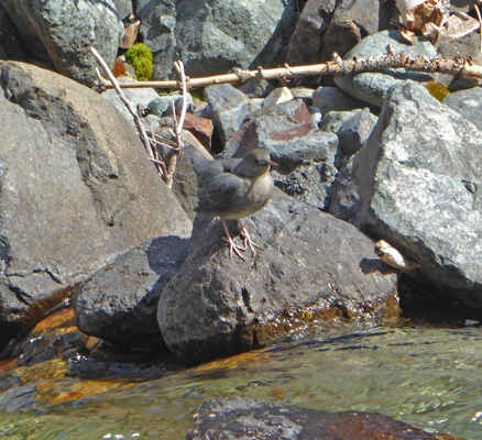
Across the creek there was a water bird perched on a rock. We have an old ongoing joke about any bird like this being water ouzel. However I think this is actually a juvenile American Dipper.
We hiked through a stand of trees that had been singed around their bases in the fire and the forest floor was full of Heartleaf Arnica (Arnica cordifolia) something we don’t usually see in the fall.
The trail climbed steadily with occasional steep grades thrown in to test us. Off and on it would open up with a view of Hurricane Creek down below.
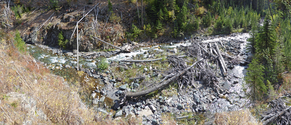
All those logs strewn about is a sign of high water flows in the spring. I imagine the creek really roars during snow melt.
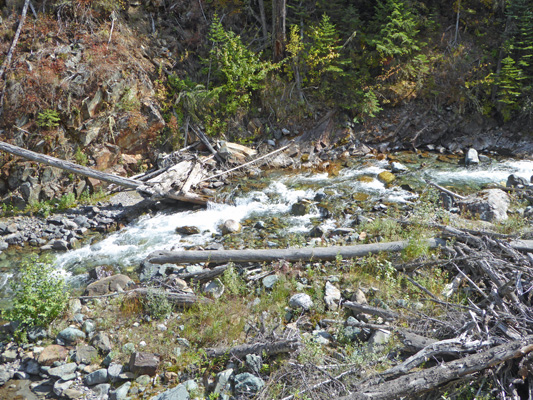
Here’s a close up of some of the white water below.
We’d hike along through the forest and across rock falls and then things would open up and I’d get all excited and take a bunch of photos of the creek again.
I tried a panorama shot of it winding its way through the canyon and it just wouldn’t sew together right so here’s another section.
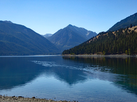
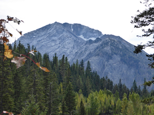
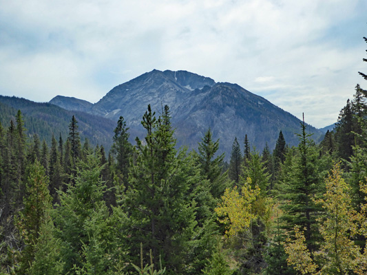
Eventually we began to get views of Sacajawea, the Wallowas highest peak at 9,838 feet. Here she is with Hurricane Creek winding it’s way away from her.
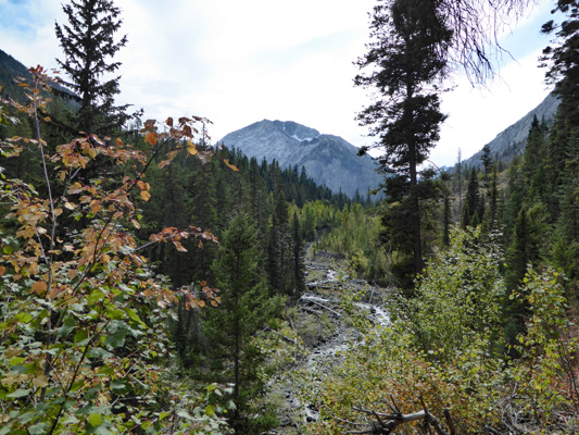
Notice that she still has snow along parts of her north face.
About a mile from the trailhead you enter the Eagle Cap Wilderness.
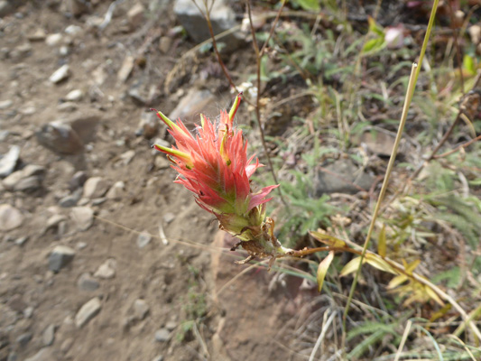
We hiked though an area that had burned very hot in the fire clearing most of the hillside but already the underbrush was coming back with lots of snowberry and ninebark. I even found little patches of our old friend Indian Paintbrush along through here.
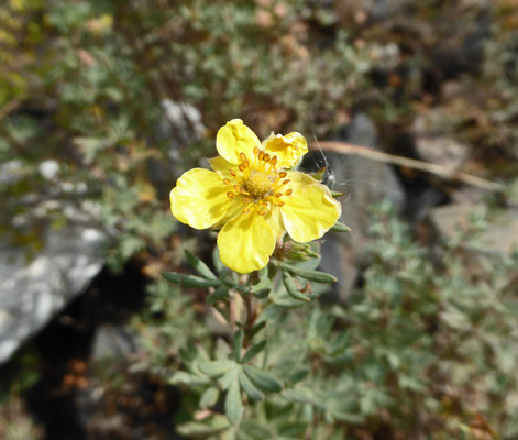
And some Shrubby Cinquefoil (Dasiphora floribunda) still in bloom too.
We made it up through yet another huge rocky draw and up onto a nice view point with yet another view of Sacajawea.
We sat and enjoyed the view and decided that since we’d hiked for nearly an hour it would be okay to turn back—especially since so much of the trail had been such a good aerobic workout.
I took this view looking back down canyon before we headed back.
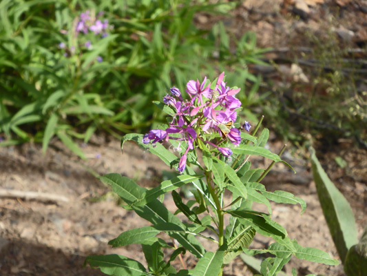
There had been lots of fireweed that had gone to seed along the way (part of it had burned the year before after all) but here and there some of it was still in bloom.
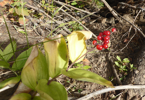
There were also a few patches of these bright red berries. I really don’t know what the plant is.
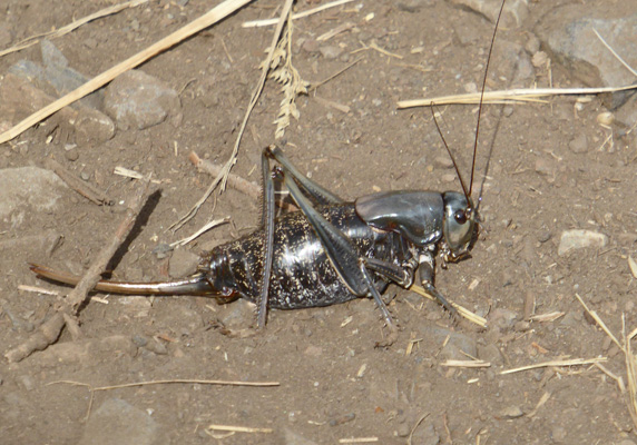
Then sitting in the middle of the trail we came cross a HUGE grasshopper. I love having a such a great zoom lens that I can get photos like this without disturbing the skittish creatures like this guy.
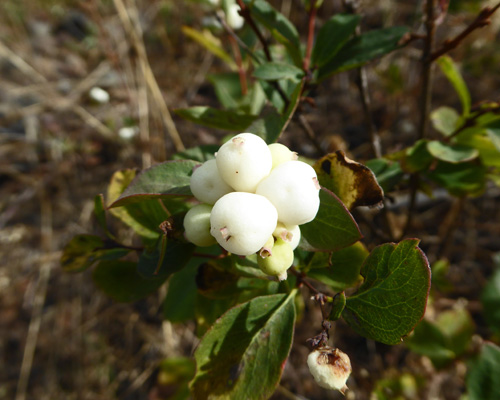
In the burn the snowberries had been tiny or still in bloom but in the unburned areas they were huge and plentiful.
On the way up we met a lot of folks both going up and coming down. Most were headed for Slick Rock Falls and some of the returning hikers gave great reviews of the the falls and their beauty. I’m happy to say that I finally outgrown the feelings I had when I was younger that somehow I should suck it up and try harder and should be able to make it to these far off destinations that were actually beyond my skill level. Now I’m simply grateful that we can both still get out on the trail and enjoy ourselves and see the great outdoors. We hike until it feels right to turn around. Sometimes I need to go around one more bend and make sure I’m not missing anything. But on uneven rocky steep trails like this one our old injuries tell us when it’s we turn back.
On the way back, I stopped and took more photos of the creek and of Sacajawea, laughing that I thought I might be taking the same pictures all over again. I was. In fact, some of them were taken from the exact same spots with the same leaves around the edges!
It was a great hike and if you can do 6 plus miles round trip do go all the way to Slick Rock Falls, I’m sure it’s worth it.
We drove back along the road until we found a turn off with a view of the creek and had our lunch.
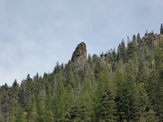
Up on the hillside there were outcroppings of what I assume were basalt. I had to a photo of this great finger sticking up out of the trees.
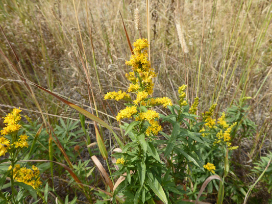
There was Canada Goldenrod (Solidago canadensis) in bloom along the roadside here too.
We made our way home to discover that it was 67 in Joseph and the trailer was nice and warm just from solar gain. Then we both had nice long well deserved naps!
Thursday September 15th, it was back to work for us. It was a balmy 44 degrees when we got up and warmed up quickly with completely clear skies. It was 46 when we started working at 8:30 and by 10:30 I’d shed one of my fleece and was down to my tee shirt by noon. In fact it made it up to 75 or so for a while in the middle of the afternoon. We only had 22 sites to clean and they had all vacated and we were done cleaning them by 12:30—whoo hoo. Once again, things were busy at the self registration station just as they had been the Thursday before. We hung out there and answered questions until 4 when the rangers opened the registration booth. The backlog of folks who wanted help from them took them nearly an hour to clear!
Friday September 16th, it was sunny and 48 when we got up and warmed steadily through the morning. By noon it was 74 degrees. Yippee! There were three couples on site cleaning duty and we only had 48 sites to do so we left the cleaning to the other 2 couples. Instead we dug out the fire pits in the sites that are currently closed because of the construction project. But first we spent about 45 minutes trying to track down a key for our golf cart since the interpretive ranger had accidently taken it home with her the night before. Once we had a key, we worked our way through the fire pits—some were clean because they had just been replaced but 18 of them were pretty full. We only had two buckets which meant we also spent a lot of time driving back and forth to the ash dump. But that was okay. We had plenty of time. It was a pretty day and the construction folks who had made a huge amount of noise the day before weren’t working at all. So we could easily get to all the sites without any danger of getting in their way. We were done with our project by noon and had the afternoon off to enjoy the sunshine.
Mid-afternoon we took the computers into town and checked our email and picked up a package at the Post Office. Then we found our way to the west side of the lake (it only took two tries since the street signs didn’t match our map) and drove past the houses and cottages that cling to the edge of the hillside along the lake. The road is gravel and steep in places. Neither of us would want to deal with it in the snow—and they get LOTS of it here in the winter.
Saturday September 17th, it was cloudy and 51 when we got up—what a difference 5 days can make. There were only 40 sites vacating and over half of them were in the A Loop. Our assignment consisted of the first 20 sites in A which included a party of 12 RVs (all the same brand) who had come together for a couple of nights and were now going home. They steadily departed across the morning and wonders of wonders all our sites had vacated before noon! We’d parked our cart and put it away by 12:05. What a treat. It felt like we’d won the lottery.
The sky was spitting rain as we finished up and by 1 the wind had come up. It actually made it up into the low 70’s with a few sun breaks. But on the whole it was a great afternoon to stay inside and read (and in the end defrost the refrigerator—this thing has to have both the freezer and the fins down in the refrigerator defrosted—but it only takes about an hour so it’s not too bad). By evening, the occasional spit of rain turned to the real thing and the campfires hissed out and folks sought refuge in their RV’s, trailers and tents. I always feel sorry for the tenters when the weather turns wet or cold or both. It rained most of the night but had pretty much stopped by the time we got up. Still it made for a wet morning for the folks in tents.
You can tell that we have truly moved into the off season now. There were only 48 sites vacating on Sunday morning in comparison to 102 last Sunday and 120 on Labor Day. We got half of our 25 sites done in the first hour but the rest of them took their time which was fine since it rained mid-morning for a good half hour and we retreated to the trailer until it stopped. By the time we were done at 1:30 we’d have a couple of sun breaks and there were big patches of blue appearing between the fast moving clouds.