
The weather never improved and we were content to spend the afternoon at home. Tuesday November 29th, it was mostly sunny as we packed up to leave and in the process I disturbed this little frog who was hanging out in the box around our water connection.
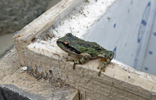
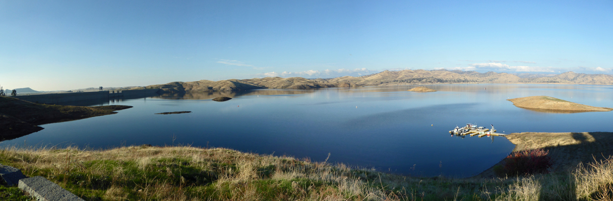
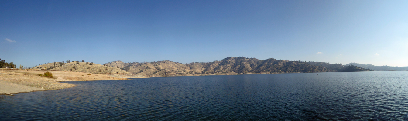
He stuck around long enough for me to take his photo and then hopped off into a puddle. We finished disconnecting and headed down the hills towards Fresno and Millerton Lake State Recreation Area. Many of the campgrounds on this lake are closed for the winter but they leave the full hook up campground open all year. It’s basically a parking lot with wide slots set up so you have room to park your vehicle next to your rig. We found a nice spot with a bit of a view of the lake and set up camp.
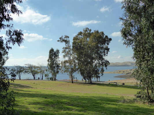
It hadn’t taken us long to get to Millerton Lake so it was early yet. I walked over to the edge of the campground (which juts out into the lake a bit) to get a view of the lake from the other direction.
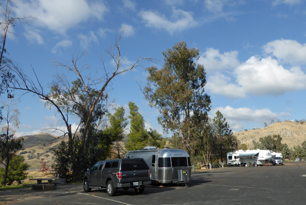
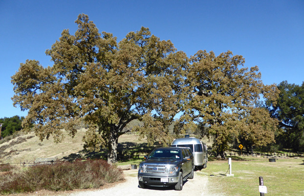
And just to nettle my old friend, Rian, who thinks I take too many photos of Genevieve Airstream, I took this photo of our campsite with the gorgeous eucalyptus in the background.
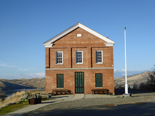
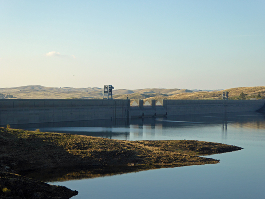
After lunch we took a drive to the far side of the lake—past the Friant dam and over to the reconstruction of the Millerton Courthouse. The town of Millerton was originally in the valley that became the reservoir. The brick courthouse was the first permanent courthouse in Fresno County—1866 to 1874. When the reservoir began to fill in 1941 the community disassembled the brick and stone building and rebuilt it again up on a knoll overlooking the new lake.
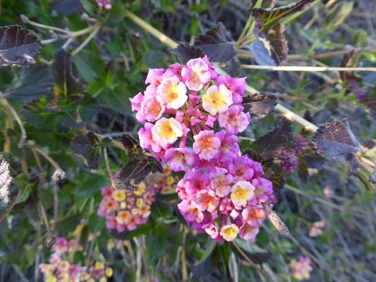
There’s supposed to be a museum inside that is open on the weekends in the summer months but we saw no sign of it since it was neither the weekend or the summer. There was verbena in bloom still near the parking lot.
From the far side of the Courthouse you get nice view of Friant Dam.
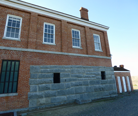
And when you walk around the Courthouse you can see that the lower story which is made of stone not brick, was the jail—complete with bars on the windows.
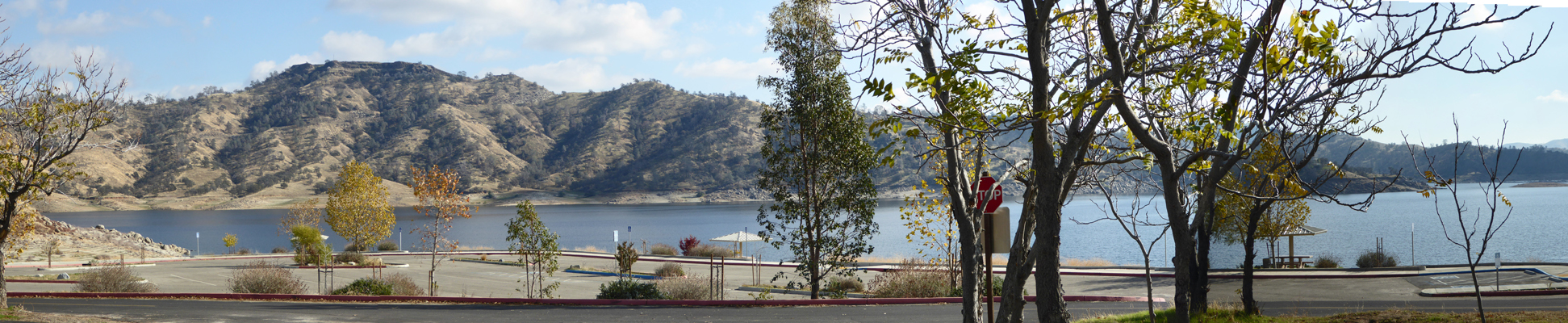
The view looking north from the dam on eastward is pretty spectacular.
There was a HUGE flock of ducks out on the water and lots and lots of Canada Geese along the edges of the lake—both in the water and out feeding on the grasses.
We were told that the lake is way higher than it has been the last few years. This is the end of the irrigation season so the lake should be down but there has been rain already so it has begun to recharge again. Always a good thing.
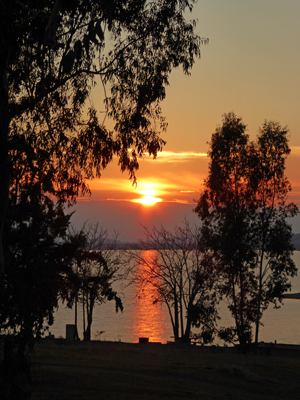
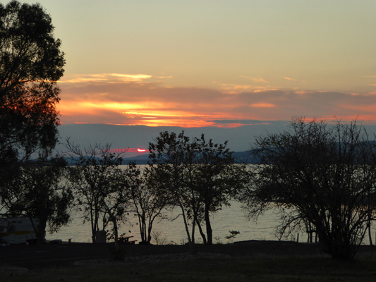
We drove on back to the campground and along about 4:30 I looked out to see the sun turning bright magenta and leaving a reflection in the lake as it set in the west.
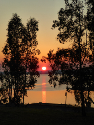
I kept walking out towards the Day Use area to get a clearer view and as I did the sun began to sink below the horizon.
It was sinking fast.
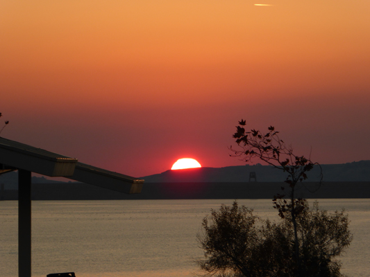
And I managed to get one last shot of the sky before it dropped from sight as I got to the open area at the Boat Launch.
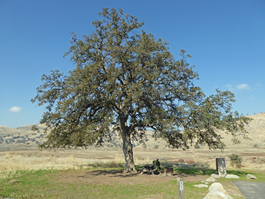
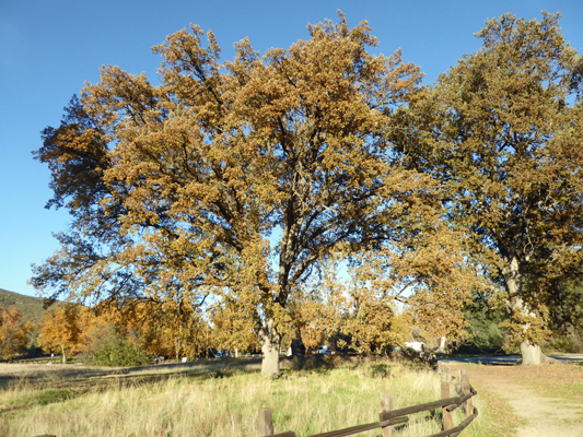
Wednesday November 30th, we simply took a walk around the Meadows area where the campground is. We walked the loop through the campsites and stopped to enjoy the view in a site with this huge Live Oak.
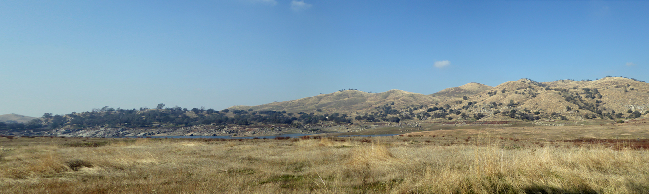
To the northwest you can see the hills marching off into the distance with a bit of an arm of the lake along with them.
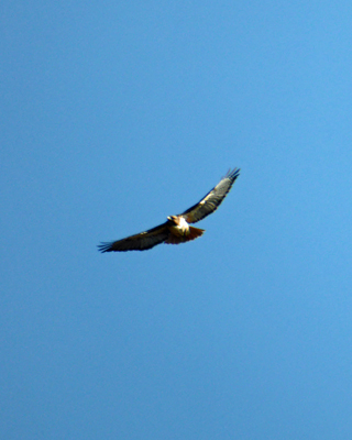
We looped on out along the lakeside and back through the lower dry camping sites and then headed out towards the hills. There were a pair of hawks playing the thermals. They never got close enough for me to get a decent photo of the two of them together but I did managed to get a bit of a shot of one on the wing.
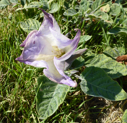
There was Jimsonweed (Datura wrightii) in bloom in the south facing campsites and picnic areas. These had the best purple tinge of those we saw.
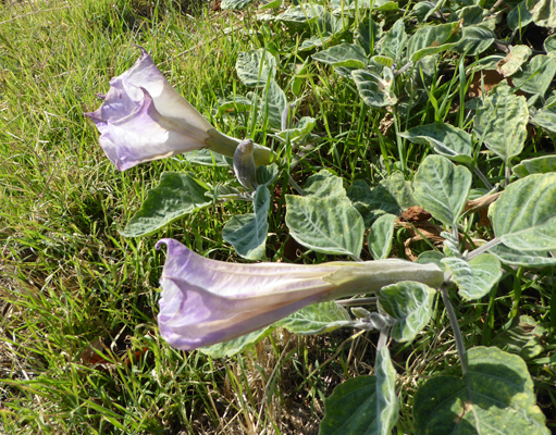
They don’t last long but they sure are pretty.
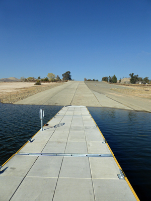
We’d been walking about an hour when we finished the loop back towards the trailer and Walter headed home while I went DOWN the boat ramp and out on the loading dock to see the lake from water level.
Then I got to walk back UP the long long boat ramp and up the hill to the trailer.
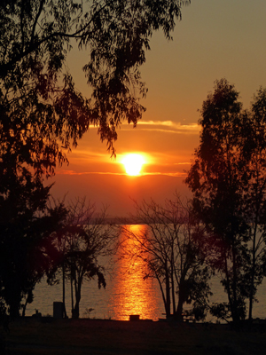
Along about 4:30 the sunset began once again. This time there was a cloud bank on the horizon and the sun was heading into it.
The colors changed a bit as it sank.
And the about 10 minutes later the sun peaked out from under the clouds right at the horizon in a magenta glow.
That evening we drove into Fresno and met our daughter, Leslie, and her husband, Al. for dinner at a great Indian restaurant. We had a wonderful dinner and a nice visit. They’ve only been in their new house down in Clovis (a southwest suburb of Fresno) for a week so they have lots more to do to get settled in.
Thursday December 1st it was foggy and in the low 40’s when we packed up to leave Millerton Lake. There was a bit of watery sunshine but it still felt pretty cold. We headed west through Madera and then over Pacheo Pass to Hollister and then turned south into the wine country south of the San Francisco Bay area. About 30 miles south of Hollister you come to Pinnacles National Park—a lovely place in the rolling hills where we visited back in March 2015.
We had a reservation for the weekend since this place is really popular with folks from the Bay Area on sunny weekends even in the winter months. We set up camp in our electrical hook up site—after double checking to make sure our water tank was topped off because the site didn’t have a water hook up. We had lunch and then walked over to the camp store/visitors center to check in. It was sunny and near 60 so it was a pleasant walk. We picked up a trail map while we were at it and then headed home again.
This campground is full of Blue Oaks and Live Oaks.
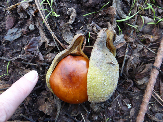
In fact, the ground in our site was covered in acorns.
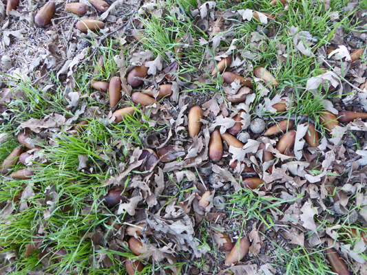
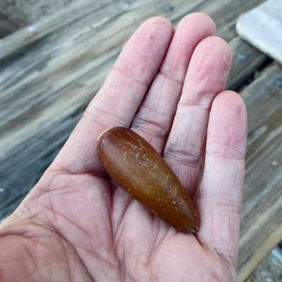
This are really large oblong acorn rather than the usual fat squat ones.
The trailer was parked in the sun so it was nice and warm but as the sun sank behind the hills things began to cool off fast. We settled in for a nap and when we woke up the trailer had dropped to 64 degrees. Things continued to cool off outside after sunset and by 8 pm it was 35 degrees outside and our heaters had managed to warm the inside up to 66. We were both so grateful to have electricity so we could be warm.
There’s no Verizon cell signal here so our hot spot didn’t work. This was a nice thing. It was good to have a break for the world for a few days. A news fast is a great thing when it’s been as crazy as it’s been of late.
We tried something different that night to maintain some warmth in the trailer. We have 2 small space heaters that we use to heat the place—one in the bedroom and one in the main living space. We left the one on in the main living space for the night, humming along all night and turned off the one in the bedroom. We usually go without heat at all but it looked like it was going to be COLD so why not try something different. The temperature dropped to 27 degrees in the early morning hours but our bedroom only dropped to 46—way better than the usual 5 to 10 degrees warmer than outside that it usually hits. The living room only got down to 51. Once the sun hit the trailer in the morning, things warmed up nicely with both heaters on by the time we got up for breakfast.
At about 11 am we set out to make our way to the Old Pinnacles Trail in the northern section of the park. I took this photo of or campsite with it’s huge oaks to give you a sense of what we can see out our back windows.
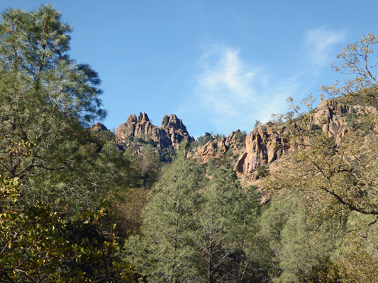
We stopped at the Peaks View so I could take a photo of the view.
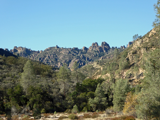
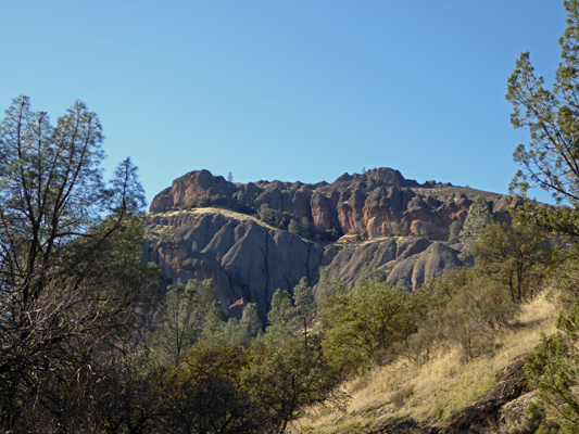
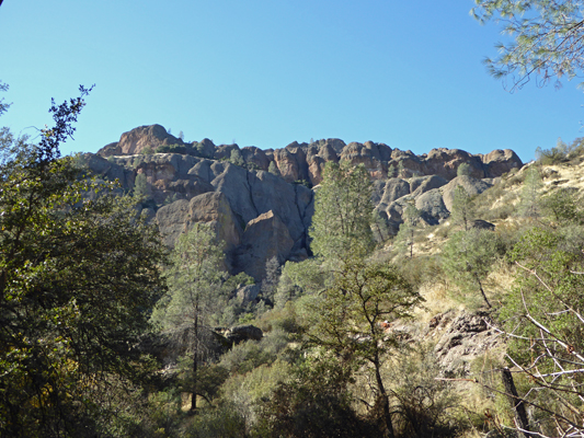
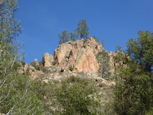
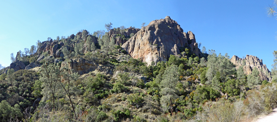
There’s a nice sign here explaining why in the world there are these fantastic features out in the rolling hills of Central California. They are volcanic formations that originally formed millions of years ago down in the mountainous area just north of Los Angeles. One portion of the formation is still down by LA. The rest has slowly traveled northward along the San Andreas Fault. In addition, two local faults played a role in raising the formations up over these hills so they could be exposed to erosion to shape the fantastic formations. Much of the rolling hills are made of the sedimentary layers from the erosion of the volcanic formations. Thus completes your geology lesson for the day.
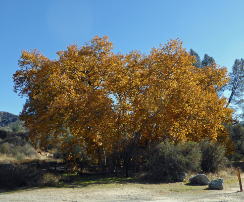
Across from this viewpoint there was a lovely sycamore tree still dressed in yellow fall color.
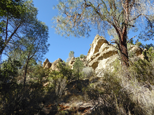
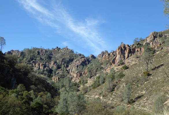
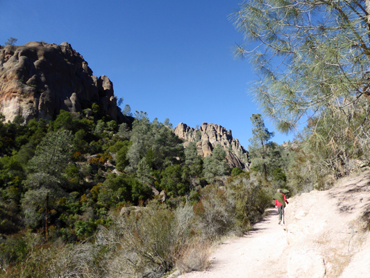
We took the north fork of the park road and ended up at the parking lot for the Old Pinnacles Trail. This is a fairly flat trail that winds along Chalone Creek out to the Balconies formations where you can explore the Balconies Cave or take the steep Balconies Cliffs Trail up into the higher formations.
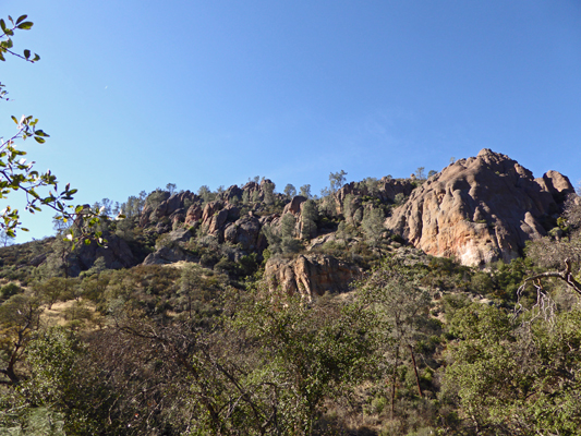
We put on our hiking boots and set out along the trail. There wasn’t any water in Chalone Creek but from time to time we’d get a view of some interesting formations sticking up out of the hills.
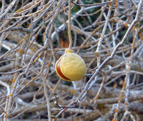
Along the way we began to see these odd seeds that looked like flattened horse chestnuts.
They were hard like horse chestnuts and eventually we saw that they came out of interesting seed pods.
And finally I got a view of them hanging, like Christmas ornaments, from a shrubby deciduous tree. It turned out that these are California Buckeyes. The seeds are very poisonous so don’t get it into your head that you want to eat them. But they were fun to kick as you walked along because their smooth surfaces helped them move a long way.
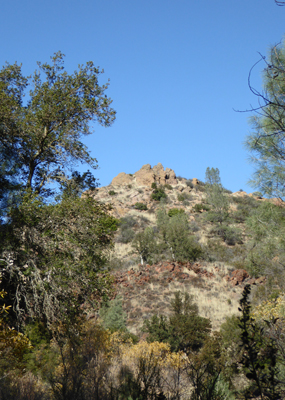
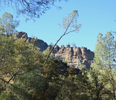
As you know by now, I love just about everything about our wonderful National Parks. That includes the interesting people we meet along the way. We stopped to talk to a young doctor (an oncologist) who was hiking the 9 plus mile loop from the west entrance of the park down through the Balconies and back up the High Peaks Trail. His goal for the day was to photograph a California Condor. I hope he found one! He spends most of his vacation time visiting National Parks—my kind of guy. After a very nice chat we went on and got yet another view of another strange bit of volcanic rock candy sticking up through the hills.
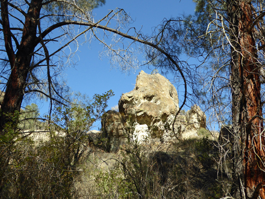
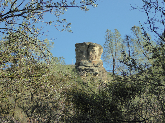
After about an hour, Walter decided he’d gone far enough but I wanted to get a view of the Balconies. So he found a rock in the sun and I continued on. I got another view of another bit of volcanic rock
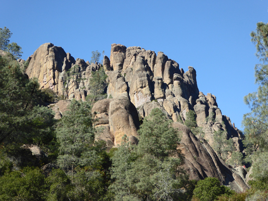
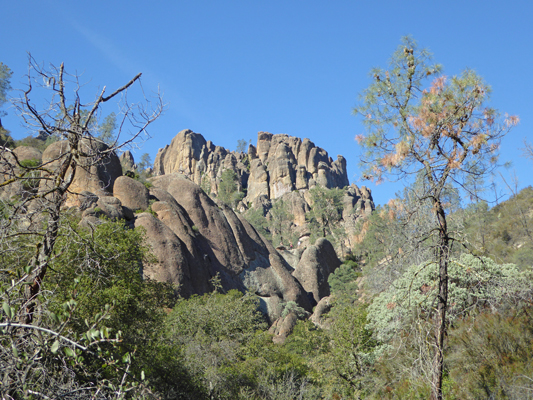
And then finally I began to get glimpses of parts of the Balconies Cliffs.
I wanted to see more of course so I kept on, getting a view of a piece here
And another piece there. All the while getting closer and closer to the formations themselves.
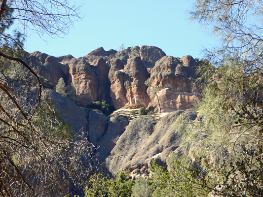
At last the trees opened up enough for me to pretty much see the whole formation.
For once, I didn’t just have to go around one more bend in the trail to see what else there was to see. Looking at the map when we got back I suspect I wasn’t too far from the turn off to the Balconies Cliffs Trail which is over 2 1/2 miles out from the parking lot.
I turned back and got a view of a cool volcanic plug sticking up on the south side of the trail.
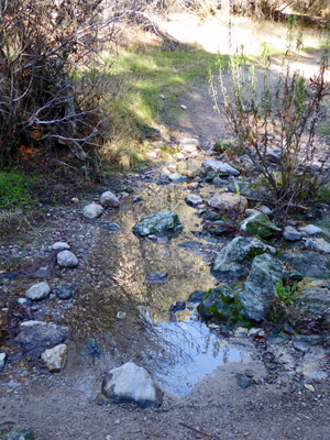
There were several little creek crossings (the West Fork of Chalone Creek I guess) and this one had a nice reflection of the hills in it.
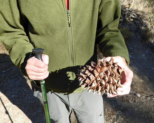
By the time I got back to Walter I’d been gone for about 20 minutes or so and he’d gotten restless and was back out on the trail looking around. He found one of the HUGE pinecones from a Gray Pine so I took a photo of it. They’re not as big as Sugar Pinecones but they’re big enough.
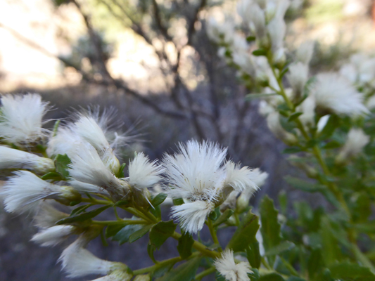
There were shrubs in bloom along the creek bed. At first I thought that these little white puffs were open seed heads but no, they’re fuzzy flowers. Fun, huh? This turns out to be Coyote Brush (Baccharis pilularis).
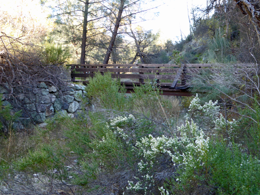
There’s a nice bridge across the dry creek and you can see more Coyote Brush in bloom.
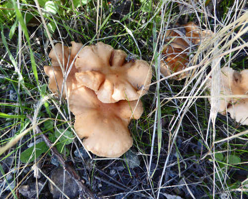
When we got back to the trailhead I noticed that there was a large ring of fungus around the base of a Manzanita bush.
We drove on back to the trailer and had lunch. Late in the afternoon Walter spotted a condor circling in the thermals over the high hills to the south. We stood and watched with the binoculars and in the end Walter stuck it out and saw 5 of them shortly before dusk. I got my camera out but even with the 20X zoom I couldn’t stay focused on them long enough to get a shot. They were a long long way away.
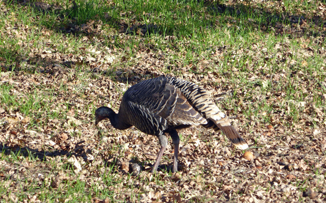
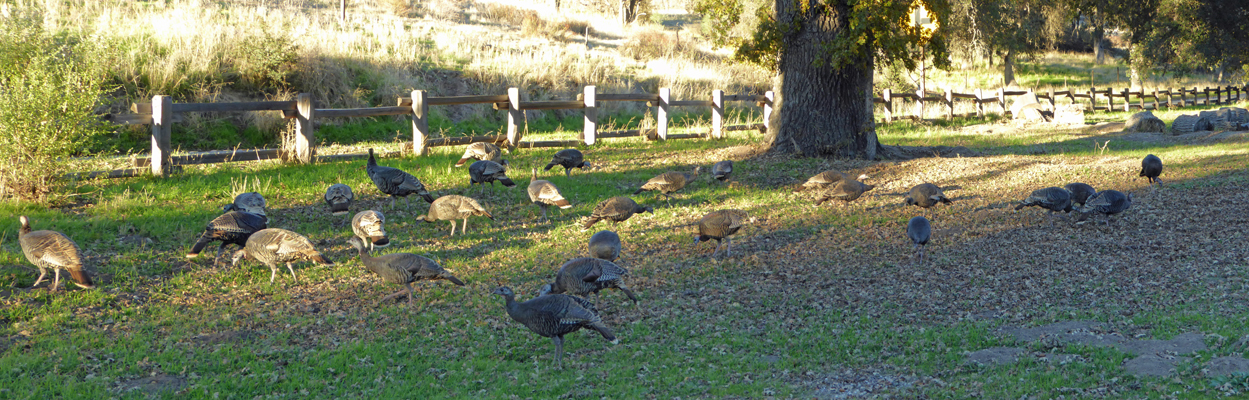
Saturday morning it was cold again (26 degrees) but it was also sunny and clear and warmed up fast. When we came out into our main living area we could see a HUGE flock of turkeys (26 to 28) right outside our dining room windows. This is part of the flock...
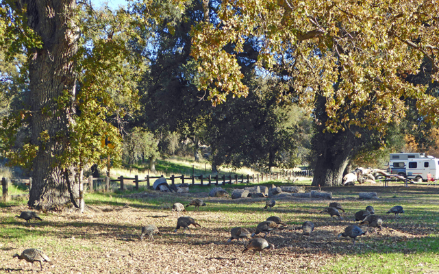
Most of them appeared to be juvenile birds. Our guess is that it was 2 or 3 moms and their broods.
At one point they heard something off to the right in the campground and they all looked up and played statues. By this point a few were still at it but the pecking was too good in among the leaves to stay on alert long.
On the weekends at Pinnacles they have a shuttle bus that you can take from the Visitors Center near the campground up to the Bear Gulch Day Use area. This is where the bulk of the trails in the park start and there really isn’t a lot of parking. We hiked over to the Visitors Center and climbed on the waiting bus and he closed his doors and started off. It turns out that until the parking lots are full he just sits and waits for anyone who wants a ride. Once the parking lots are full he just keeps driving round and round which means the bus leaves every 20 minutes.
We had decided to take the Condor Gulch Trail which heads UP towards the High Peaks Trail. There’s an overlook about a mile in and we figured we could do that and thus do 2 miles round trip. We haven’t done many steep trails this season so while we can put in the miles we aren’t in the kind of shape we were 2 winters ago and I’m afraid it showed on this one. We didn’t make it all the way to the Overlook but we got great views anyway.
Early in the hike you can see the High Peaks off in the distance.
With each turn of the trail the view changed and the trail just kept a steady grind upwards. Once or twice we were passed by folks jogging down the trail because it’s just steep enough that it’s a lot of work to walk rather than give in to gravity and jog.
We stopped to rest a bit and I got this shot of the rocks just up the hill from us. The colors are really wonderful.
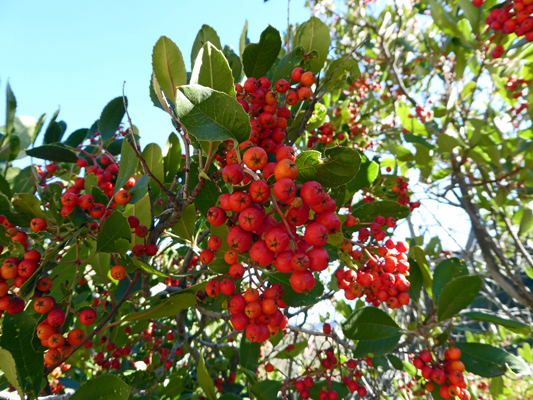
There was Toyon (Heteromeles arbutifolia) along the trail here, while you didn’t see it down in the valley.
The trail turns again and you get wide view of the High Peaks.
And a snatch of the the rest to the north.
We got warm enough that we had to take off our fleece but the views got even better.
I stopped to take this panorama shot.
When I caught up with Walter he was looking for a rock to sit on and was ready to quit. I waited a bit to make sure he was okay—he’d gotten overheated and didn’t feel particularly well. And I then hiked up around a couple of switchbacks to see how far it was to the Overlook.
There’s a bit of flat sot in amongst the lower set of rocks in the middle of the photo and there were people there so I figured that was the Overlook. It looked to be another 1/8 of a mile or so with another 100 foot gain. And the view was looking south into the sun. I decided I didn’t need to do it and hustled back to make sure Walter was doing okay. He was. In fact, he was pretty much recovered so we headed back DOWN which was way easier but still work because it was steep.
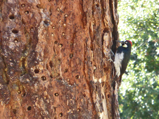
Just as we arrived at the trailhead we heard a woodpecker working on a dead tree next to the trail. With some patience I got a shot of him without his head buried in a hole.
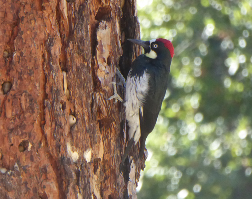
He’s an Acorn Woodpecker. And he gets his name from the fact that he digs holes in trees and buries acorns in the holes. You can see them on the left of this photo.
I stopped to talk for a moment to the ranger directing traffic in the parking lot (they only let folks up that way when he calls down to say he’s got an opening) and he pointed out a pair of California Condors circling up over the hills to the south.
The shuttle bus came just as we were ready to leave so we didn’t even have to wait. It was nearly full when it arrived while we’d been the only folks on it 2 hours earlier. And we were the only folks going back too. Clearly this is a park that folks from the Bay Area use as a day hiking spot on the weekends. Our driver said that it always busiest on Saturday especially if the weather was good. It was quieter on Sunday and of course on the weekdays it was real quiet since folks were at work.
We stopped by the Visitors Center to ask about the routes south from here and then wandered home for a nice relaxing afternoon. Walter managed to get some news on the truck radio and learned that the UW Huskies had won their play off game and are thus the PAC-12 champions. Yeah Team.
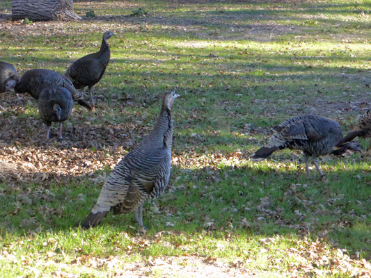
A little before 4 pm we started to see the condors start circling over the hillside again. It’s so lovely to get to see them multiple times in a visit. Just to add some variety to our avian entertainment the turkeys came back a little after 4. This time we took a careful count and it appeared that there were 28 of them.
The pecked around in the leaves and grass for awhile and then they all did that same ‘ALERT’ they had in the morning and started to head out across the road.
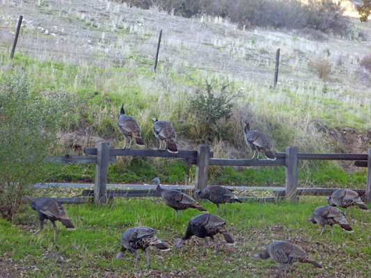
They got about half way across the road when a car drove up and they all rushed back to the fence. The car continued to wait so they all hustled across the road—the tail end Charleys taking flight to join the rest.
It wasn’t as cold that night as the previous nights—it only made it down to 31 in the early morning hours which meant that it warmed up faster in the morning. Our original reservation had us leaving on Sunday morning but we decided since our spot was open for the night that we might as well spend another day and just hang out. So we hiked over to the office and extended our stay a night, added some water to our water tank and sat in the sun watching the birds.
There are huge flocks (coveys) of California Quail that hang out in among the oaks in the campground area. They wander out onto the road looking for acorns that have been cracked by the passing cars and then run back to the campground every time a car comes. This provided endless entertainment since our spot was where they went out onto the road. I caught part of a covey pecking away in the grass as they worked their way towards the road.
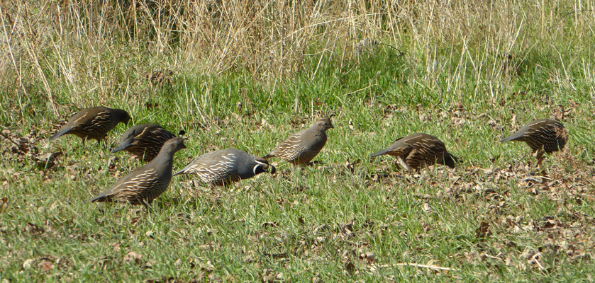
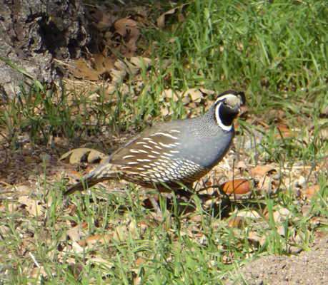
And I took TONS of photos of the males before I finally got a good shot of one—though his topknot doesn’t show well he’s other nearly perfect.
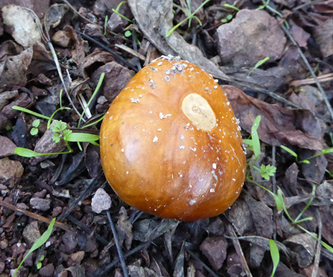
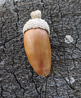
I had been puzzled that while we had tons of acorns none of them had the little caps that acorns always have. And we didn’t see caps up in the trees either. But while we were watching the quail Walter found some and I had to take a photo of this one since the cap makes the acorn look like it’s ready for winter—I’m sure the elves knit those hats don’t you think?
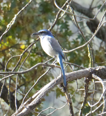
The nearly level Bench Trail leaves from the far end of the campground and winds its way through the oaks and chaparral for several miles. We decided we’d take a leisurely walk just to stretch a bit. First we walked through the empty tent camping area and the group camping area to find the trailhead. There were lots more quail and along the way I spotted a Scrub Jay resting on a branch.
We wandered along for about a half an hour and then headed back to sit in the sun some more and watch the quail. We could hear the turkeys off in the distance across the road but we didn’t see them again. The crows came and inspected the campsites that had been vacated that morning but otherwise it was a quiet afternoon. We both took naps and lolled around and read. In other words, we took a day off!
On Monday, December 5th, we headed south to Lopez Lake just outside of the town Arroyo Grande—south of San Luis Obispo. We’d hoped that there would be a cell signal there but no joy. So we’ll head into town to the library to check our email, send this and check the weather for the next week or so. We’re in full wander mode now so we’ll go where the weather sends us.