
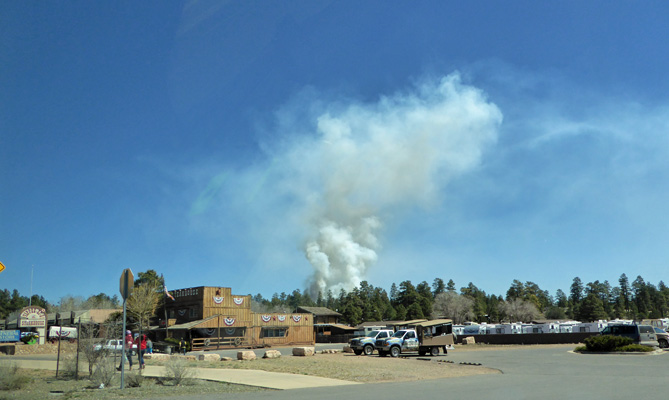
As we neared the Yipee Ei O Steakhouse I shot this photo of the smoke plume knowing then that there was no danger.
There were 6 kiosks open at the entry of the Grand Canyon to collect people’s entry fees and the lines were 6 deep but from what we heard later, this was WAY better than it had been in the previous few weeks when the lines were blocks long—Isn’t Spring Break wonderful?
We got checked in at the Grand Canyon Trailer Village and were assigned to a nice pull through spot a short walk from the free shuttle stop. There was a decent Verizon signal in this part of the park. The town of Tusyan is RIGHT outside of the park and there are no hills or mountains in the way so I suspect there’s a tower there. In any case we were happy to have a cell signal so our hot spot worked. Camping at the Trailer Village isn’t cheap ($44 a night for a full hook up) but it sure is convenient. We didn’t even bother to disconnect the truck from the trailer for our two-day stay because we knew we could ride the free shuttle system to everything we wanted to see and not have to fight to find a parking spot.
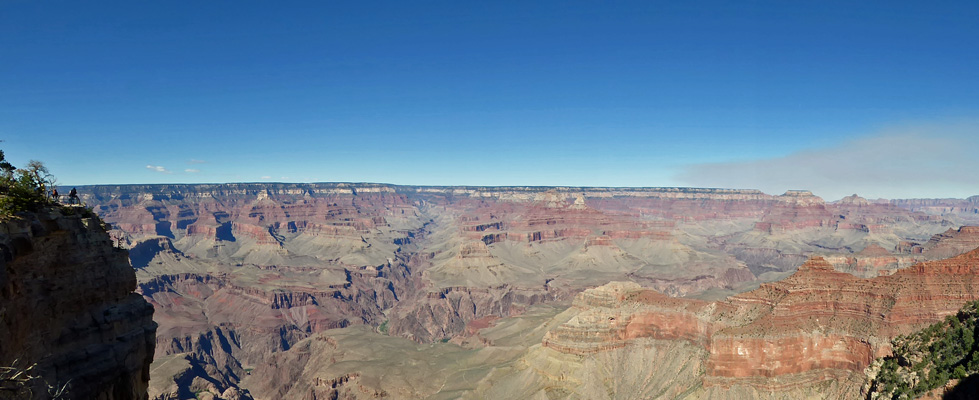
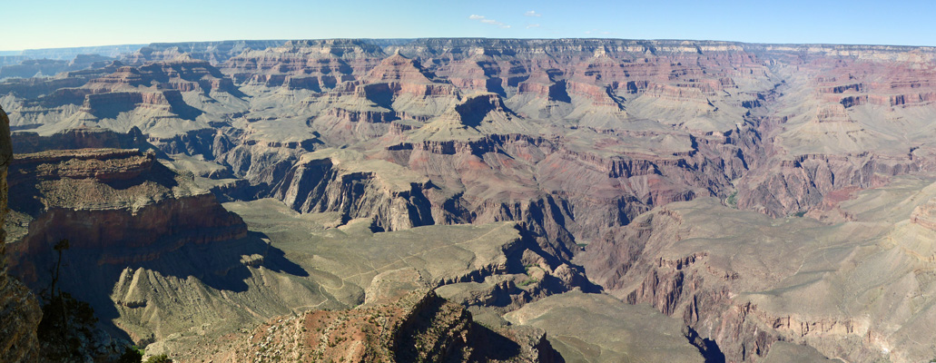
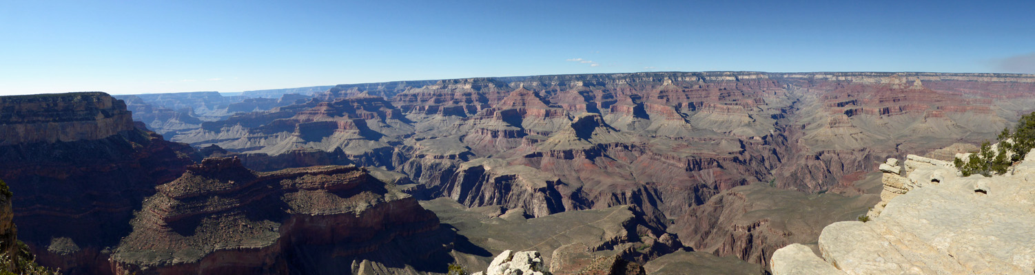
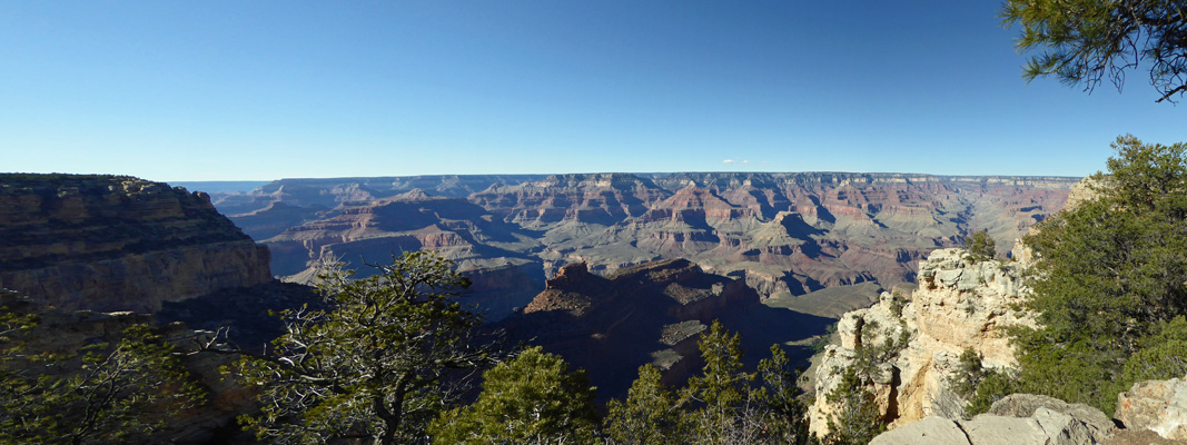
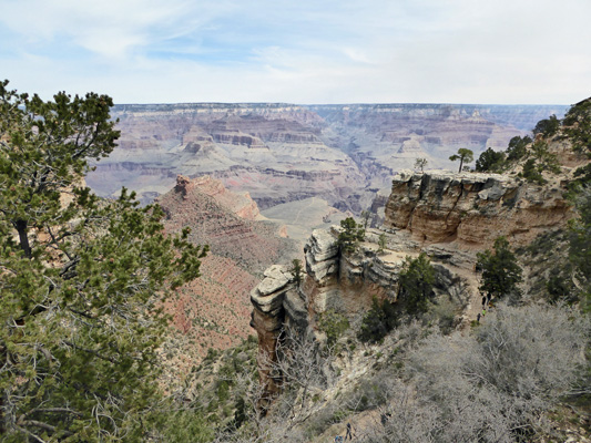
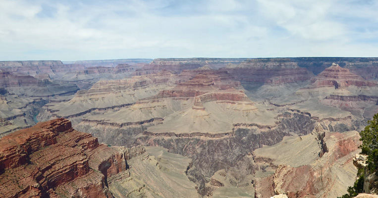
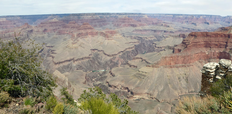
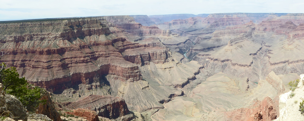
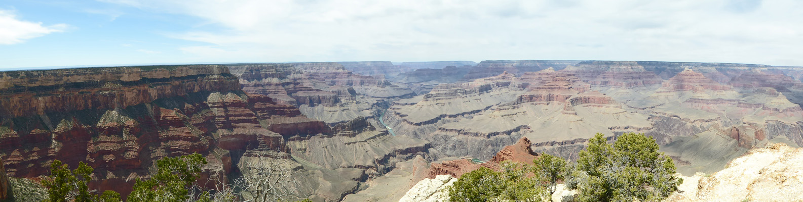
We had lunch and then headed out to catch a shuttle to the Visitors Center. The shuttles run every 10 to 15 minutes. It was near 2 pm when we caught a nearly full one at the Trailer Village stop and we were happy it wasn’t far to the Visitors Center. We hung around there exploring the exhibits waiting to watch the Park Service movie—it was a good one. And then we went out and waited for the Orange Line Shuttle to ride out to the Yavapia Point and Geology Museum stop and our first view of the Grand Canyon (at least on this trip). That little smear of gray on the right hand side of the photo is smoke from the controlled burn drifting across the eastern portion of the canyon.
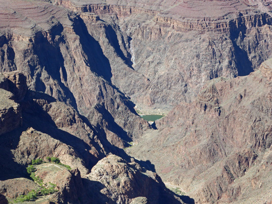
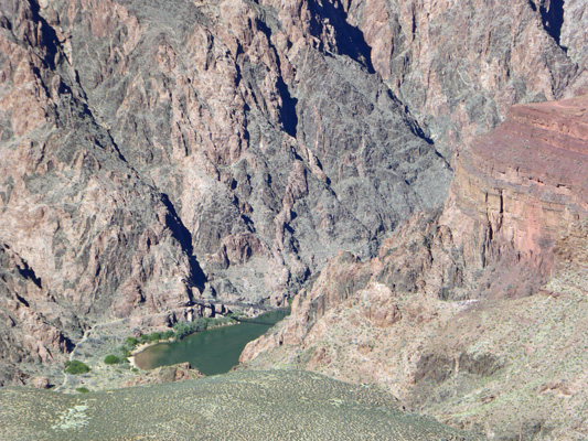
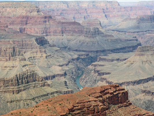
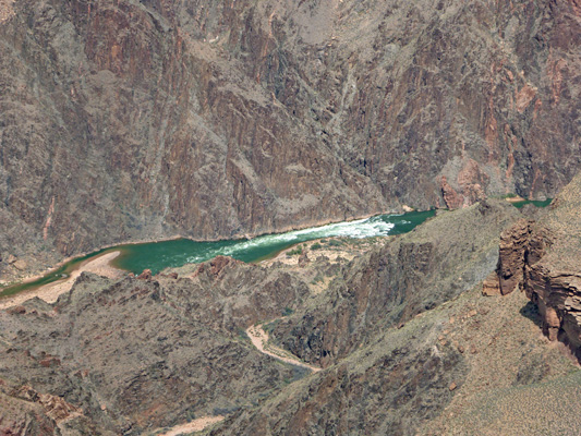
Down in the bottom we could actually see the Colorado River--note it’s GREEN rather than the usual brown. Much of the silt that the river used to carry now settles in the upper reaches of Lake Powell behind the Glen Canyon Dam up river. So unless there’s been heavy rain this side of Glen Canyon Dam, the river is green.
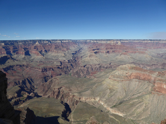
I was having fun playing with my new camera so I took a lot of photos at this first overlook.
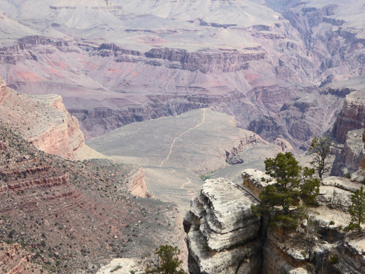
Way down in the bottom of the canyon you could see the suspension bridge that the hikers who come down the Kaibab Trail use to cross the Colorado on their way to Phantom Ranch.
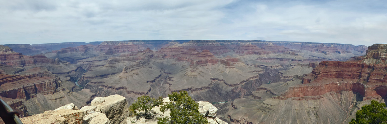
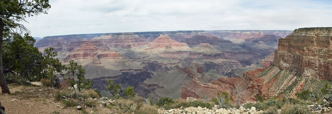
From here we set off heading west along the canyon rim, past the museum to yet another wonderful overlook.
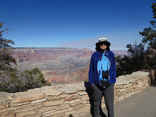
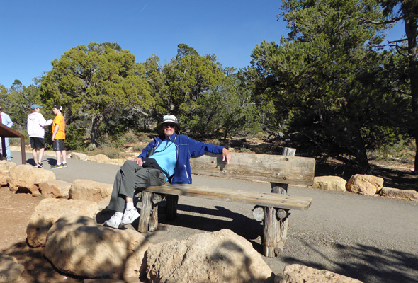
And here’s our proof that I didn’t just find some photos of the Grand Canyon on-line. Here’s Walter in front of the Canyon.
There were lovely purple flowers in bloom clinging to a rock. Newberry’s Milkvetch (Astragalus newberyi) perhaps?

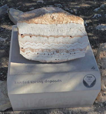
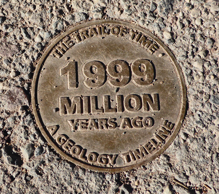
The Trail of Time begins not far from the Geology Museum. Here they have done a great job trying to help you wrap you mind around the age of the rock layers that can be found in the Canyon. They have placed brass rounds in the walkway with years marked on them. They start with having you find your age (funny how they’re already working up to 10 year intervals by the time you hit 60) and then quickly time telescopes so that a stride is a million years and then 10 million years!
Along the way they show you samples of the rocks in the layers corresponding to the time period you’re walking through. It starts with Banded spring deposits which you find at the top of the canyon.
And they take you through over 30 rock samples all the way to the bottom of the canyon where the rocks are 2 billion years old.
We walked along looking at the samples, reading the signs and enjoying the views.
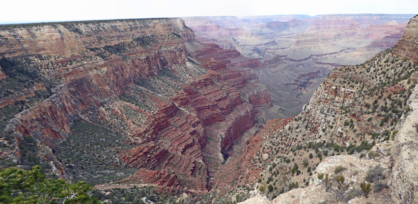
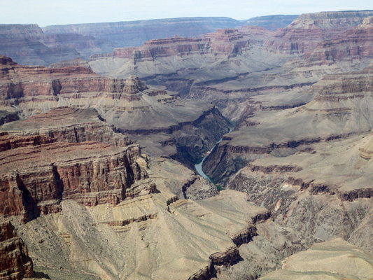
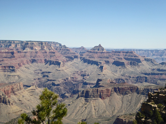
Below you can see the top 4 layers of the canyon pretty clearly. The top layer is known as the Kaibab Formation and is 270 million years old. The next layer is the Toroweap Formation and is 273 million years old. The 3rd layer down (the wide white band) is Coconino Sandstone and is 275 million years old. The 4th layer (the sloping darker layer) is the Hermit Formation and is 280 million years old. And that’s just the beginning. The canyon goes down through 2 billion years of geological record.
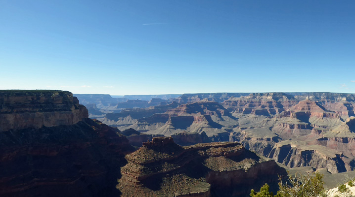
I have a fondness for these large rock ‘islands’ that sail along in the canyon.
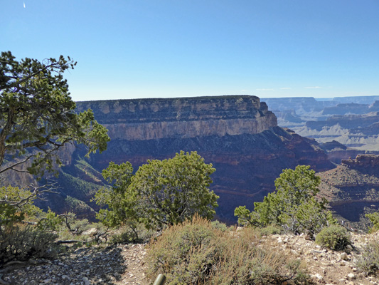
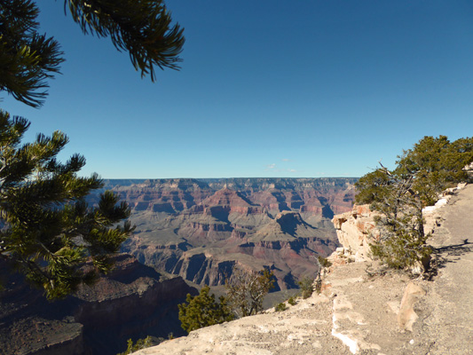
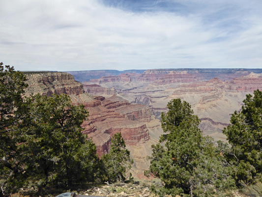
There are Utah junipers and a few Pinon Pines growing along the Rim. They provide peekaboo views now and then.
It’s 7000 feet in elevation here and even though the trail was mostly downhill, the benches were very welcome.
The view only changes a little as you walk along but it still fascinates because there are always new things to notice and the light keeps changing.
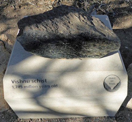
When you get to the end of the Trail of Time you see samples of some of the oldest rocks on earth. There’s Vishnu Schist which is 1 billion 745 million years old and can be found at lowest portions of the western reaches of the canyon.
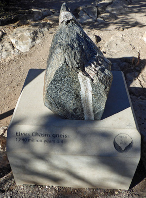
And Elves Chasm Gneiss which is 1 billion 840 million years old!
At the very end of the trail you come to the last marker—proof you’ve traveled nearly 2 billion years back in time.
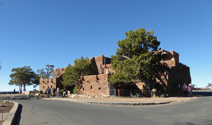
Once we were done with this trail, we needed to find the shuttle bus back to the Trailer Village so we made our way through the area known as The Village where the old historic El Tovar Hotel (along 3 other hotels) lords it over everything, including Hopi House which is perched on the rim.
We made our way down the hill at the El Tovar and found the Train Depot Shuttle stop. We got another FULL standing room only bus which thank goodness dropped a number of its passengers out at the top of Bright Angel Trail (and the Red Shuttle that goes out to Hermits Rest) so we actually got to sit down for part of the ride.
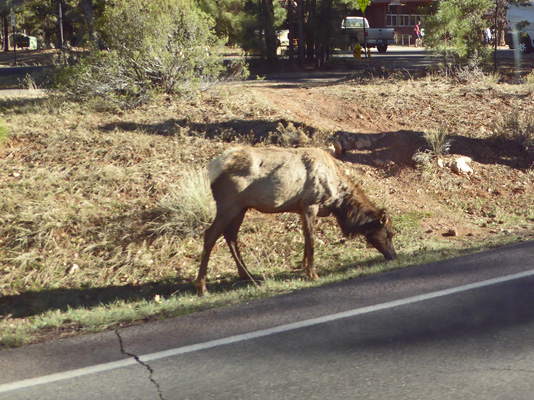
As we neared the Mather Campground area we saw a herd of about 12 elk wandering on both sides of the road. I took a lot of photos where I got more bus window reflection than elk but this one came out pretty well.
We made it back to the trailer a little after 5 pm and were happy that we’d opened the windows up before we left. It had been in the high 60’s and our little aluminum box heats up when you leave it in the sun!
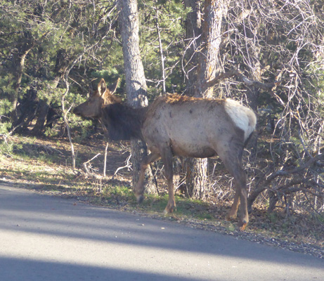
Just before 6 pm a lone elk cow came wandering right by our back trailer windows. There wasn’t time to get out the door so I took this photo through the dirty rear window. She moseyed on by and disappeared into the thicket at the edge of the campground.
Monday April 4th, it was partly cloudy and breezy when we started out and while the clouds never left us, it warmed up more than the day before—well over 70 degrees. We took the Blue Shuttle bus back through The Village and got in line for the Red Shuttle that goes out the road to Hermits Rest. The road that the shuttle follows is closed to private vehicles from March 15th to November 30 so unless you want to hike the 7 miles out and back (or ride your bike) the shuttle is the perfect solution.
There are 9 stops on the route and we didn’t figure out until we’d been on the bus for a while that there were stops you could only get off at on the way out (but not on the way back) so we missed a couple. Our first stop was Hopi Point.
You can see a trail heading off over the top of the mesa—I suspect it is the Bright Angel Trail (which goes down to the bottom of the canyon) but I don’t know for sure.
We skipped the next stop and got off at The Abyss where the canyon drops straight down 3,000 feet.
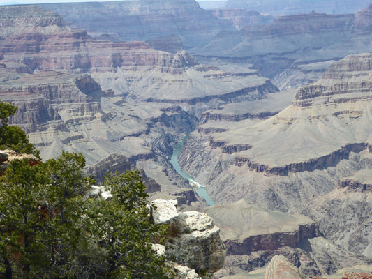
Here you can see the mighty Colorado as it carves its way through the canyon.
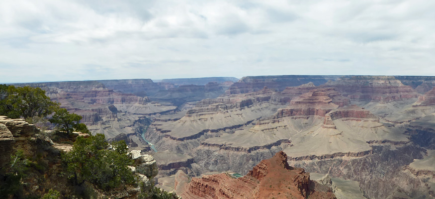
As you walk around the point you get a different view.
I got a close up the flowers that I’m pretty sure are Newberry’s Milkvetch (Astragalus newberryi).

And then we got back on the bus and went on to the end of the line to Hermits Rest.
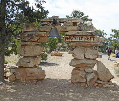
There’s a gift shop and small snack counter in this wonderful old building—built by the Sante Fe Railroad back in 1914. Hermits Rest was used by the Sante Fe Railroad to take their guests down into the canyon because Bright Angel Trail was a toll trail until about 1928. Once the toll was lifted (after Grand Canyon became a National Park) the Sante Fe RR gave up on Hermits Rest and took their guests to the main village area instead.
Back in the day, travelers left the train at the depot in The Village area and took an 8 mile buggy ride out to Hermits Rest. The adventurous ones then took a 7.5 mile mule ride DOWN the Hermits Trail to Hermits Camp for a meal and a night in the canyon.
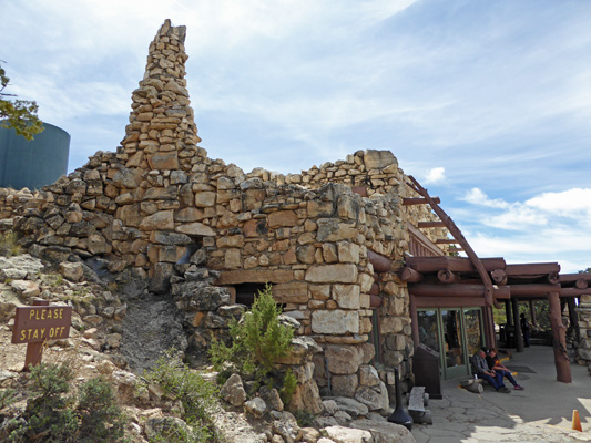
We had a quick snack sitting on the patio here with this great view.
Then we got back on the bus and headed eastward back towards the Village. First though we got off at Pima Point, one of the 3 places you can get off heading east.
Here you can see one of the BIG rapids in the Colorado called Granite Rapid. When the river is up and the wind blows the right direction you can hear this rapid all the way up on the Rim.
Here you can see Granite Rapid over on the far right and then a bend in the Colorado over on the left.
And here’s a close up of the Colorado making its way through the canyon.
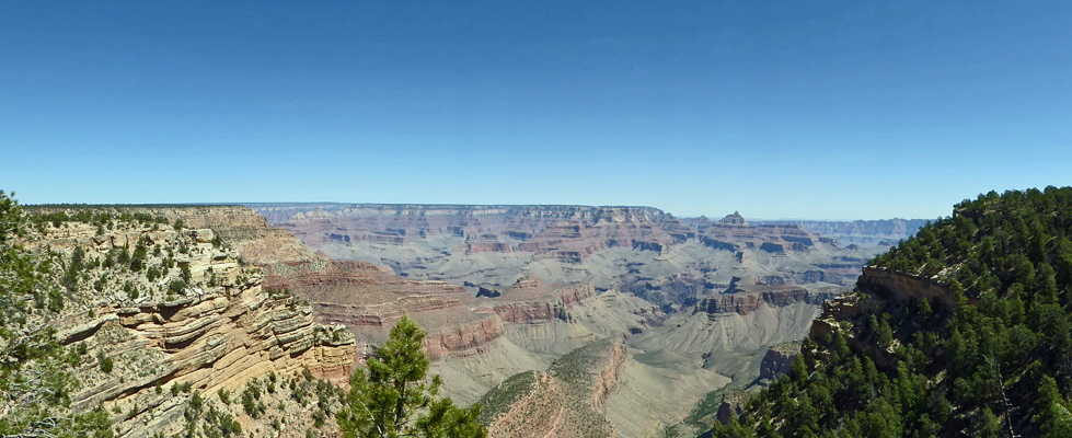
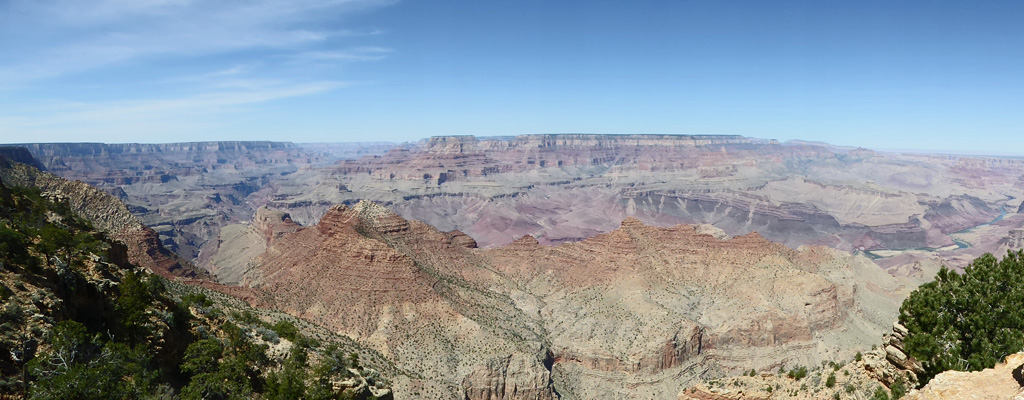
Capturing the vastness of any one of these viewpoints is a real challenge. I just shifted my view a bit and took another panorama and a whole new world opens up on the left.
We heard the bus coming and hustled over and got back on one more time heading east to Mojave Point.
Here you can see the Granite Rapid again but this time from a whole different angle.
The North Rim is 10 miles away off in the distance on your left.
I walked around the point here and got yet another view.
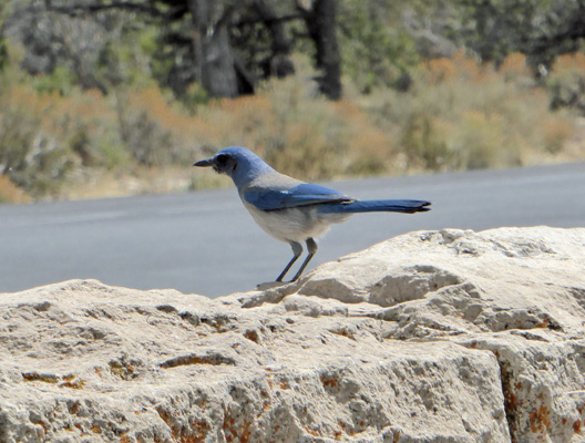
On the way back to the bus stop I saw this scrub jay and stalked him until he stayed still long enough for me to get a photo of him.
By this point we were ready for lunch, so we rode the shuttle back to the Village and then got on a totally packed bus back to the Trailer Village. Spring Break may have been over in Arizona but there were still a whole lot of folks from other states who were on Spring Break including a lot of folks from California. The park might not have been overflowing but it was pretty darned FULL as far as I was concerned.
I spent the afternoon processing photos (you do not want to know how many photos of that gorgeous canyon I had taken) and Walter spent some time on line getting the campground information for Glen Canyon National Recreation Area up by Page, AZ. After reading about the various campgrounds we decided to try the Lees Ferry Campground as a first choice.
The next morning we packed up and headed east along the Rim Road towards Cameron. I, of course, couldn’t pass by all those lovely overlooks so we stopped a ways out and I got this nice shot of the canyon.
The Rim Road covers only 30 miles of the canyon (from Hermits Rest to Desert View) but it gives you a nice sample of all that is there.
We completed the 22 mile drive from Trailer Village to Desert View and were thrilled to find that there were lots of parking spots in the RV and Bus parking lot. We gathered our stuff together and hiked out to the 1930’s Desert View Tower.
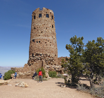
I remembered visiting this place on a cold November day on my first visit to Grand Canyon when I was 11 years old. My major memory being how bad the instant hot chocolate was and how very cold the wind was on the canyon’s edge.
The view here reaches out across the Painted Desert to the east (this is the west end of the same Painted Desert we saw when we were at Petrified Forest National Park back in March).
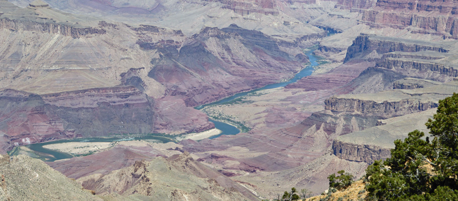
And gives you a great view of a pretty long stretch of the Colorado River.
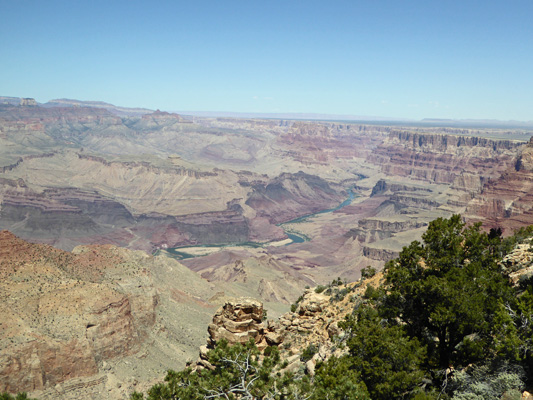
My new camera zooms in on things like this really well.
We decided to brave the crowds and actually go into the Desert Tower and I’m really glad we did. We took the stairs up to the first landing and there were wonderful paintings on the walls that I didn’t remember at all.
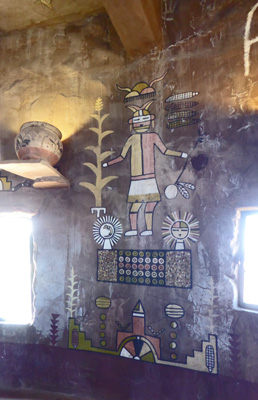
The place was crawling with people so it wasn’t an easy place to take pictures.
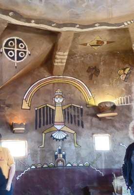
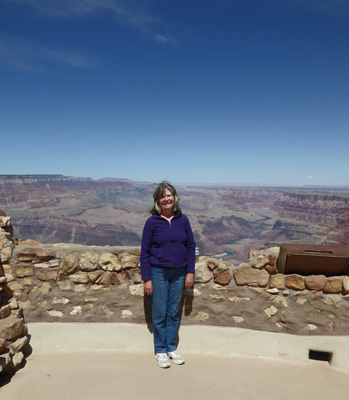
The stairs continue up to viewing windows on the next level and there are more paintings on the ceiling which the camera really didn’t do a good job on. We skipped climbing the rest of the stairs and went out onto the patio overlooking the canyon and Walter took my picture. It was windy and we had an hysterical time trying to get this shot taken without my hair blowing across my face—with other folks waiting their turn to pose in with this primo view—which that day looked a little bit like a diorama which the Grand Canyon is prone to do.
We left here at about 12:30 having spent two wonderful days on the South Rim. If you go, do give yourself a couple of days to really explore the canyon beyond the views at the heart of the village.