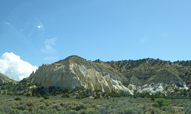
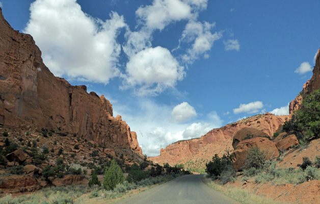
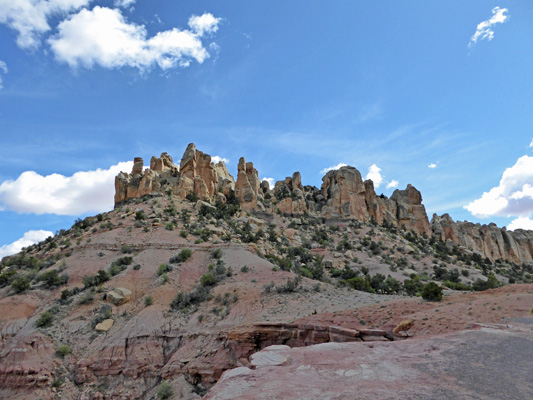
On the way we passed these cool fin-like formations along Hwy 12.
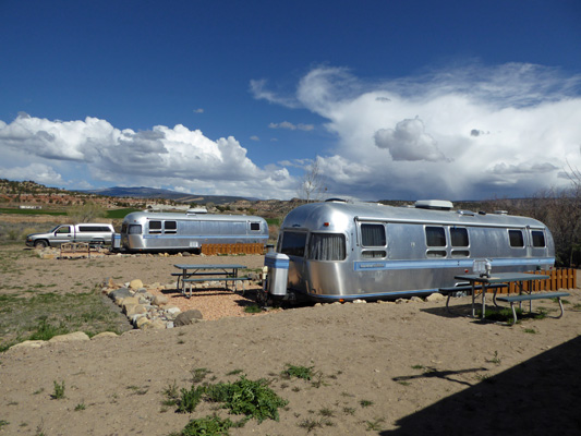
We stayed at the Shooting Star Resort and RV Park where they have a wonderful collection of old Airstreams that they offer as hotel rooms for the night. Genevieve was right at home surrounded by her older, bigger aunts and uncles—34 foot Airstream Excellas.
We parked backwards to the way the site was designed so that we could have this view out our back windows.
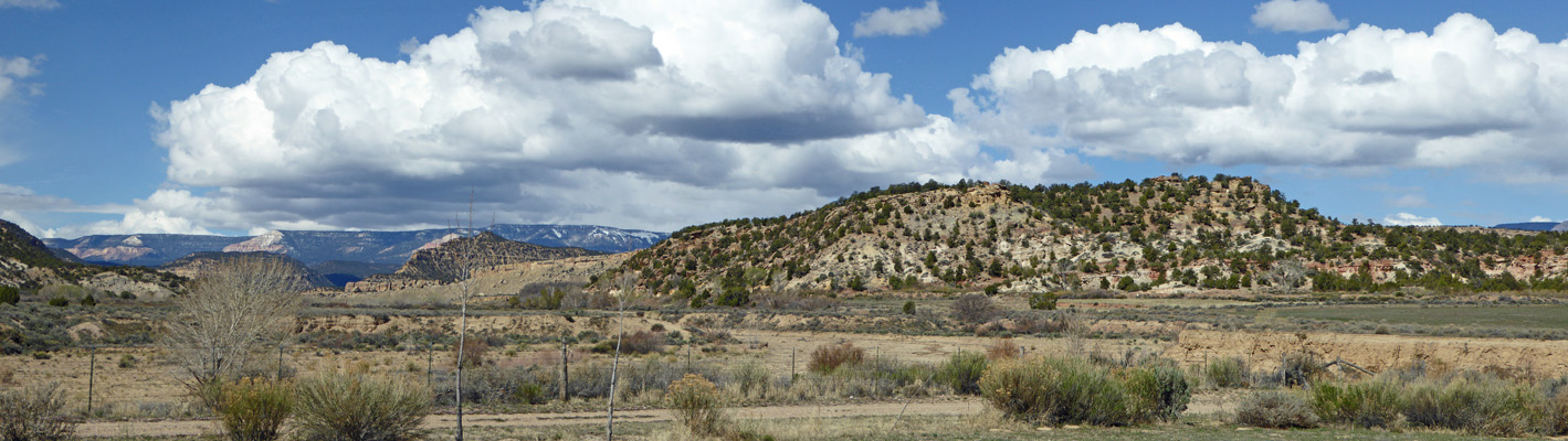
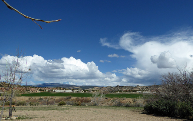
And this was the view off to the north. The green is an irrigated hay field.
This is a fun place to stay. Along with the Airstreams (decorated in camp 50’s styles inside) they have their own drive-in movie screen and will rent you a 60’s convertible (for $20 a night) to sit in to watch the movie. In the summer they show a movie (and sell candy and popcorn out of another old Airstream) every night.
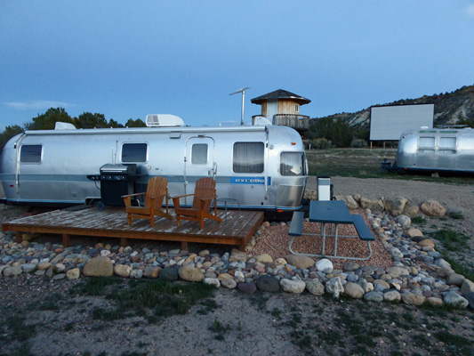
But of course it was early in the season yet so there was no movie which was fine with us. The cost for a full hookup site was $39.16 a night (tax included) and we considered it a good price for a place that was just plain fun. We had no hot spot signal there and our Verizon phone was on roaming but it’s always good to have a few days now and then without the internet.
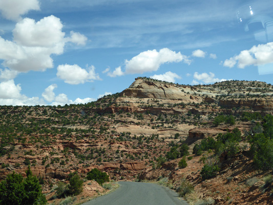
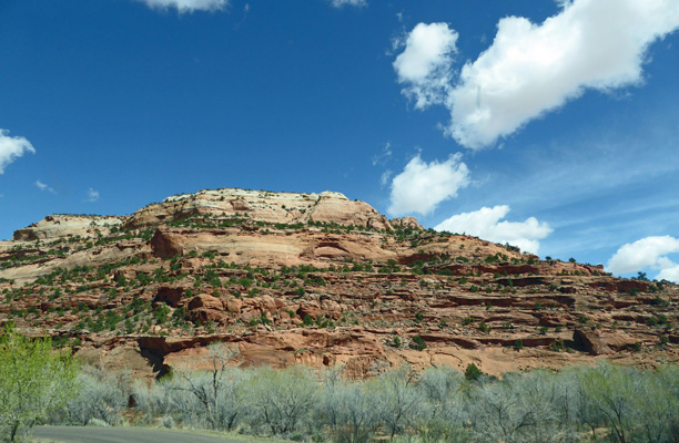
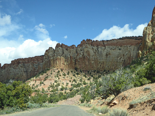
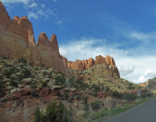
It was early when we arrived so once we were set up and had made a picnic lunch, we set out for a drive. Hwy 12 is considered a Scenic Hwy and heading east from Escalante it did not disappoint.
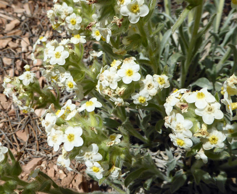
I saw these sweet little flowers in bloom along the side of the road at a pull out. I think that they are Tawny Catseye (Crytanthan fulvocanescens).
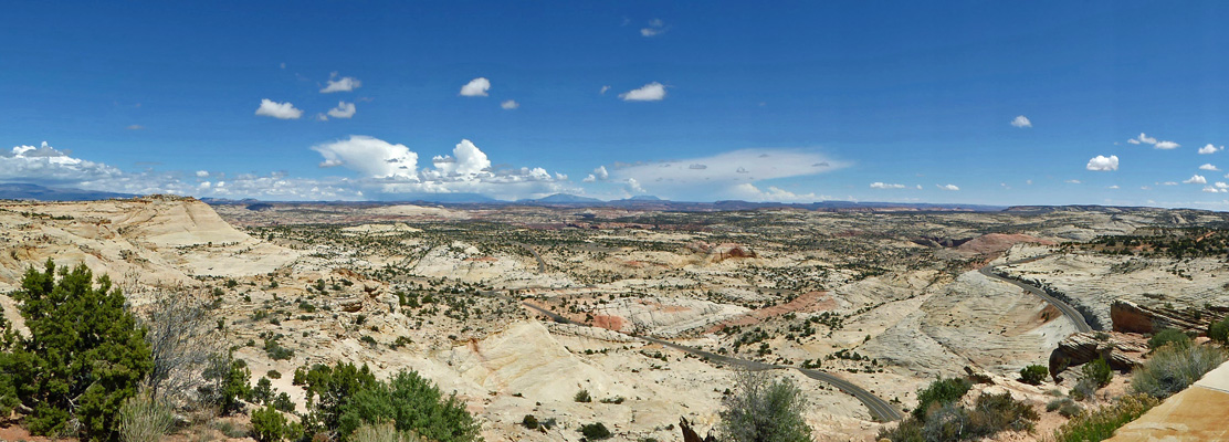
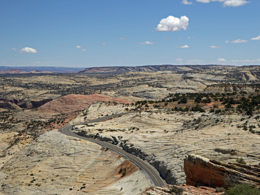
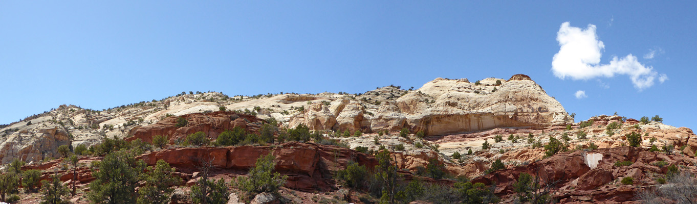
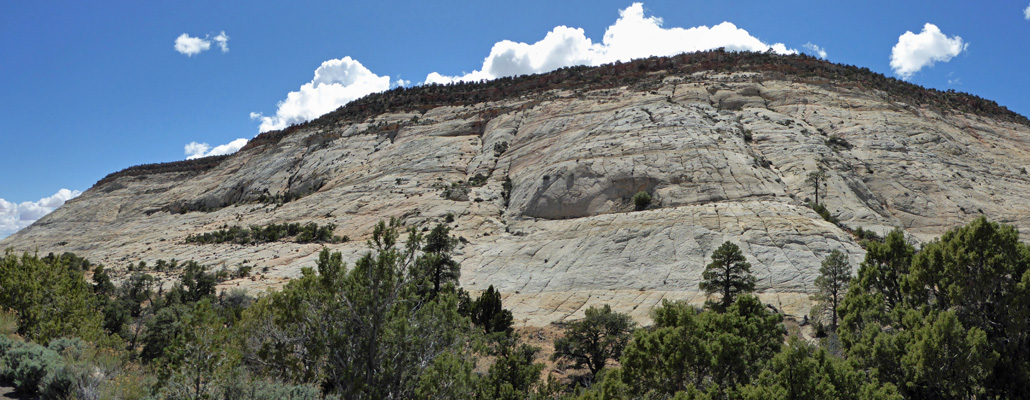
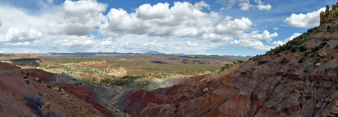
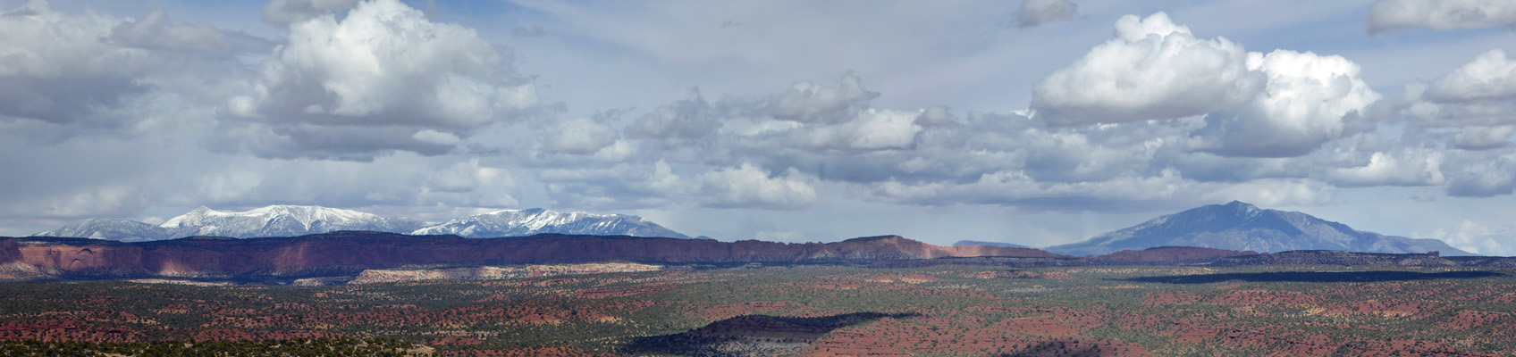
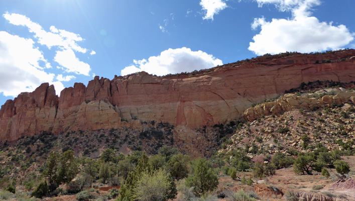
Head of the Rocks is an overlook you cannot miss. It’s huge and the pullout has lots of parking too. From here you can see all the way from the Aquarius Plateau to the north, (left) across the entire Escalante River Basin. In the background you can see the Henry Mountains, the Little Rocky Mountains (straight head), the La Salle Mountains (right of center) and the Circle Cliffs (off on the right). Navajo Mountain all the way at the Utah-Arizona Border was visible but it didn’t show up in the photo.
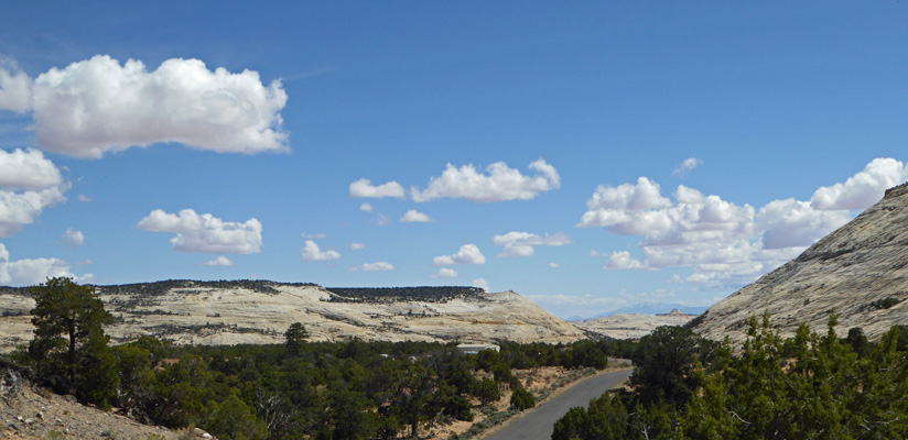
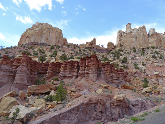
I walked a little ways to the left and shot this photo of the road as it winds down the hillside. This road wasn’t finished until 1940. Until then, the town of Boulder still got its mail by mule train in the winter months because the Hells Backbone Road that connected Escalante and Boulder wasn’t passible in the winter. It took 5 years and lots of dynamite to build the road across this rough country.
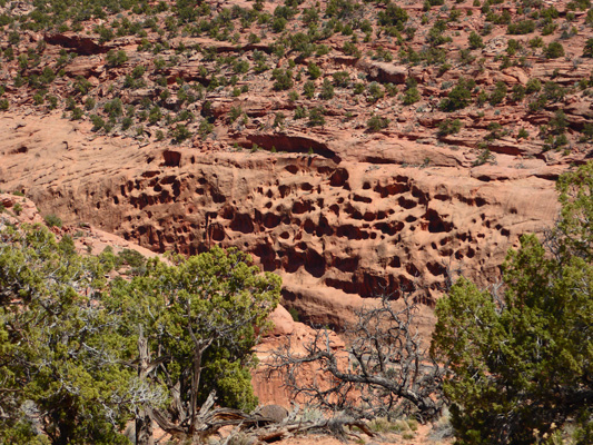
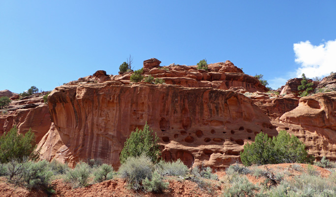
I took this close up shot of an arch in the making. The red sandstone is clearly much softer than the white layers.
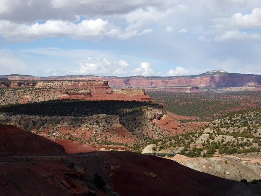
We wound our way down the road and came to Boynton Overlook not far from where the road crossed the Escalante River.
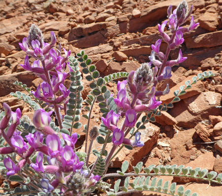
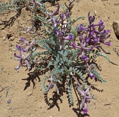
There were Wooly Locoweed (Astragalus mollissimus) in bloom across the road.
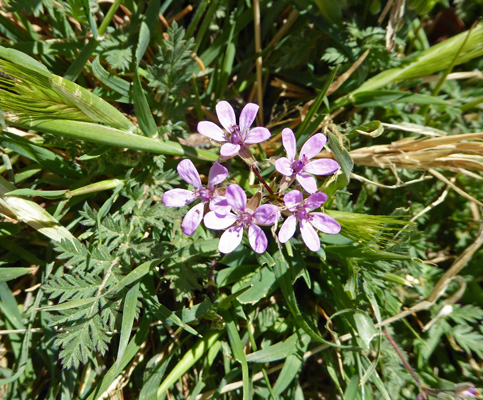
And here and there I saw some Storksbill (Erodium cicutarium).
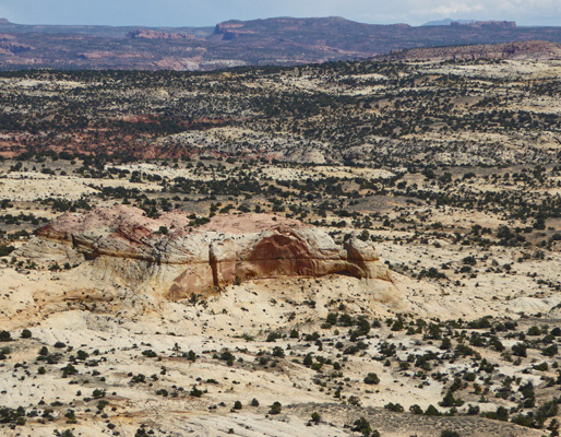
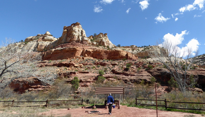
We went on past the Escalante River Trailhead and stopped at the Calf Creek Recreation Area for lunch. It’s a lovely area with great views to the north.
And to the south.
There is a 6-mile round trip trail to Lower Calf Creek Falls that starts here. It’s listed as moderately strenuous and that and the length of the hike, ruled it out for us.
After lunch (where it was warm in the sun but a little cool in the shade) we continued on to the town of Boulder where we turned southeast on the Burr Trail, a road that is paved for about 30 miles until it reaches the southern back country of Capitol Reef National Park where it turns to gravel and takes you all the Bullfrog at Lake Powell.
Early on we passed a large grey formation with strange checked rock. I stopped and took a photo of it.
And then we came around the curve and saw that there was an entire long formation of the stuff.
In fact we ended up driving through a big section with the same strange stuff on both sides of the road.
Just as I was beginning to wonder whether the entire drive would be through this strange stuff we began to descend a little and to see red rock.
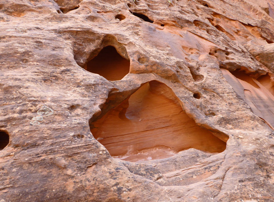
We pulled over so I could shoot some photos and noticed that down in the canyon below, there was an entire wall of Swiss Cheese.
As we came down the road towards the canyon we got a view of the tops of the hills on the south end of the canyon.
And then we drove past the Swiss Cheese wall itself.
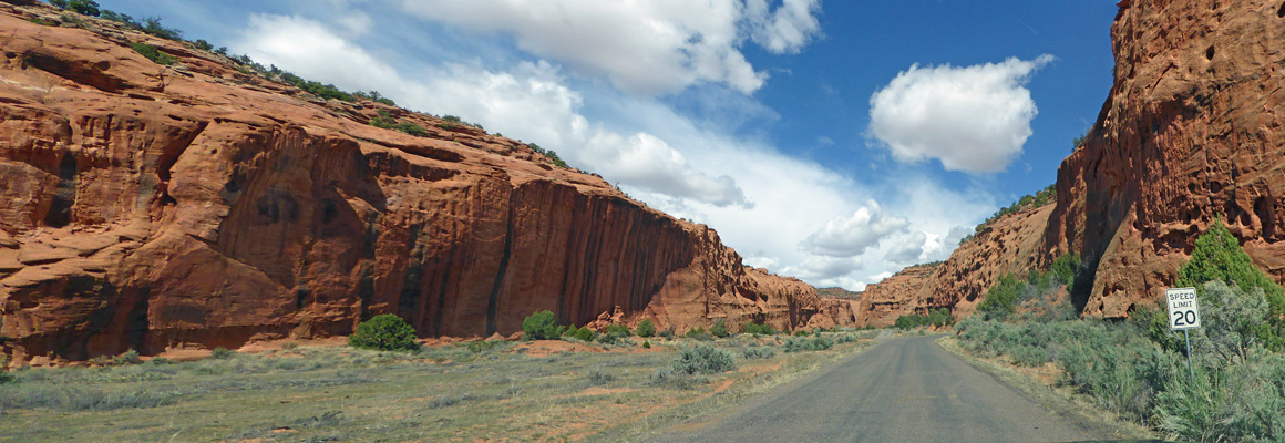
This marks the beginning of Long Canyon a wonderful 7-mile drive through all sorts of fantastic rocks. And yes, the speed limit is 20 MPH except where it’s 15 when things get more winding.
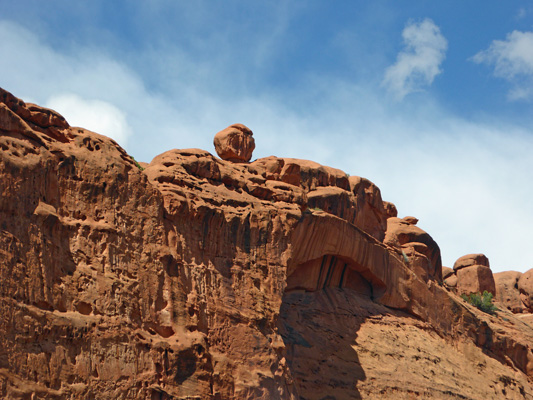
After we’d driven a ways down canyon we spied a balancing rock up on the top of the ridge. Clearly this isn’t earthquake country or it wouldn’t still be up there.
We drove on with the canyon walls rising around us.
As we got to the end of the canyon the red rock began to disappear and white rock began to appear.
I found these flat fins fascinating.
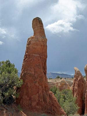
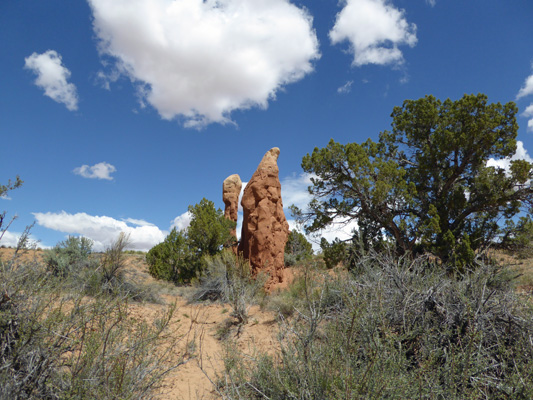
Just before the end of the canyon we came to these very deep red hoodoos. They each had a little cap of white rock to preserve them.
The road comes out of the canyon and a view across more of the Escalante unfolds before you with rocks that reminded me of the painted desert right below.
Off in the distance you could see the snow covered Henry Mountains and maybe Navaho Mountain over there on the right.
And back behind us you could see these lovely castle-like formations.
Off to the west there were more red cliffs.
We turned back here even though there was more pavement we could have driven. On the way back I stopped to take a photo of one of the hoodoos with it’s caprock in place—just like a little hat that might get blown off in the next big wind.
Here you can see the transition from red to yellow rock in the canyon wall.
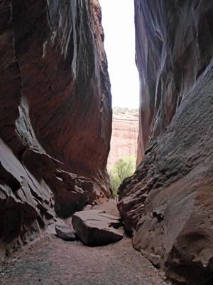
There’s a turn out for a small slot canyon on the way back out and we stopped and I took the little hike to see what I could see. It’s not very deep but it does have pretty high walls.
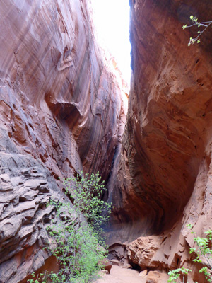
I kept going until I reached the very end of the slot.
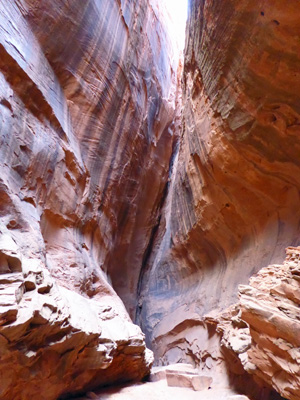
On the way back out I took a photo out the mouth of the canyon.
As I walked back out I noticed that there were Swiss Cheese holes in the canyon walls and thought that they looked really cool. I love the way the connect up deep inside the rock.
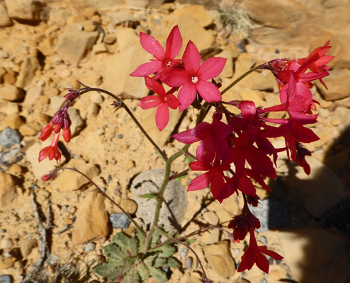
On our drive back I noticed some interesting red flowers in bloom along the side of the road and we stopped so I could get a picture. I’m pretty sure that it’s Scarlet Gilia (Ipomopsis aggregata).
The next morning it was sunny again and we set out to visit the Visitors Center in Escalante so we could get information on a hike for the day. The only hike that seemed to meet our requirements was a wander through the Devil’s Garden south of Escalante. This required that we drive for 13 miles on the Hole-in-the-Rock Scenic Backway, a gravel/washboard road that you can take 57 miles all the way to Colorado River. It was a bumpy ride but the 13 miles we drove was worth it.
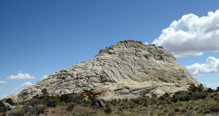
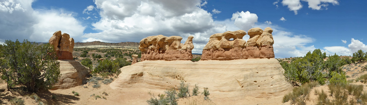
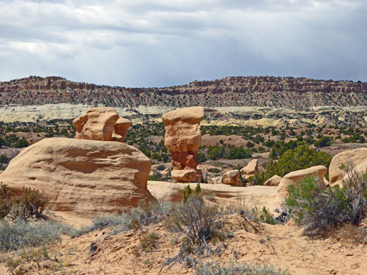
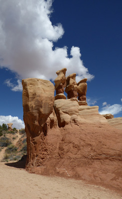
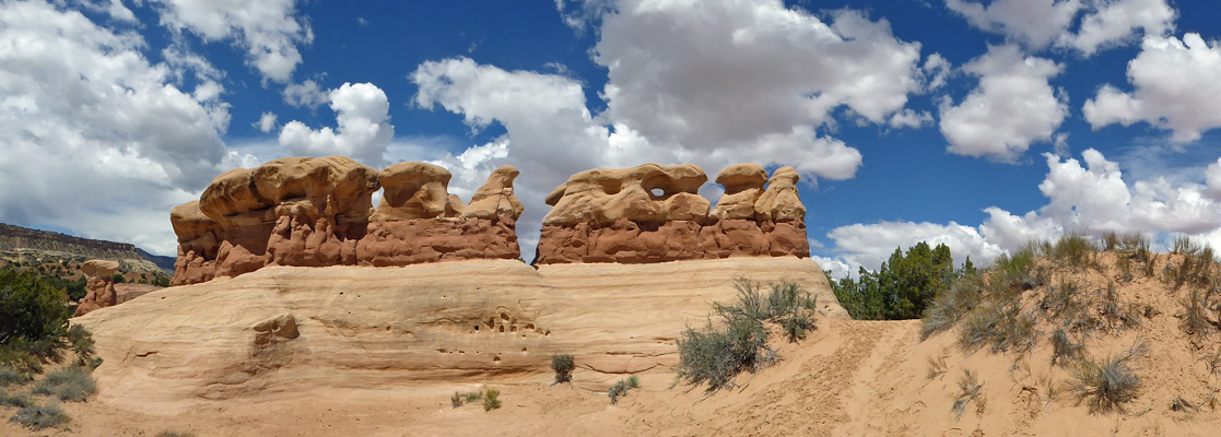
The first thing you see when you arrive at the trailhead is this fabulous formation. Actually this was taken from the far side of the formation so I could have the sun at my back but you get the drift—it’s a way cool place.
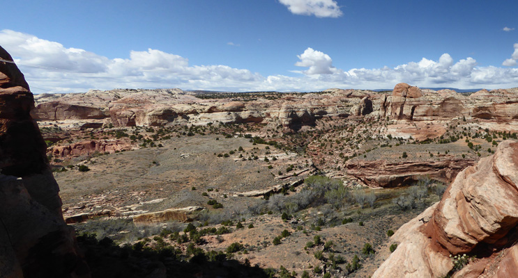
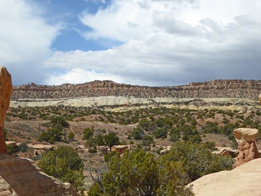
If you look across the wash from the Devil’s Garden you can see the Straight Cliffs, a formation that runs through a great deal of this part of the Escalante.
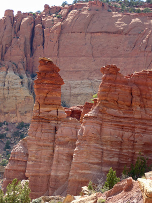
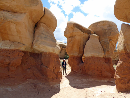
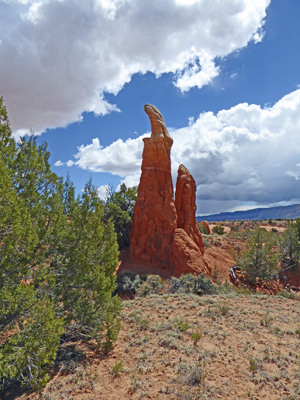
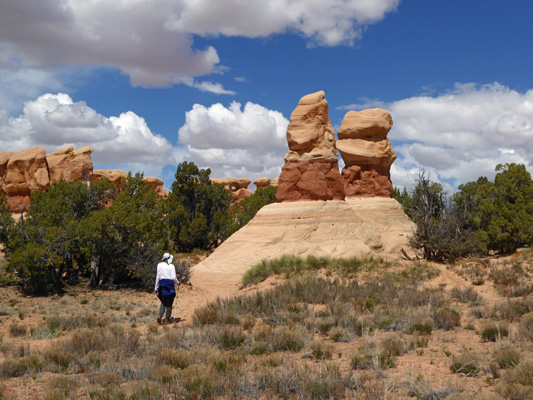
We followed one of the trails that wanders among the formations and came to this pair of really huge hoodoos. Walter walked as far up the rock as he felt comfortable.
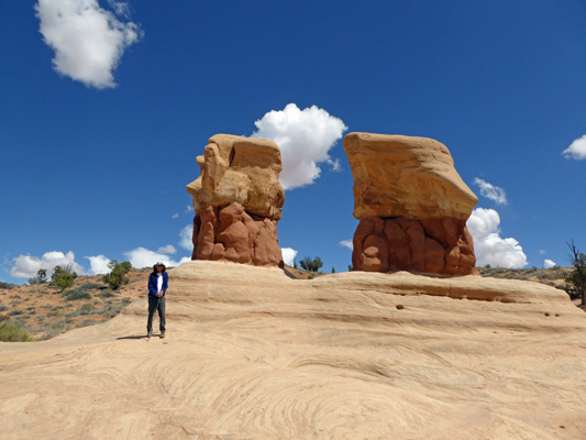
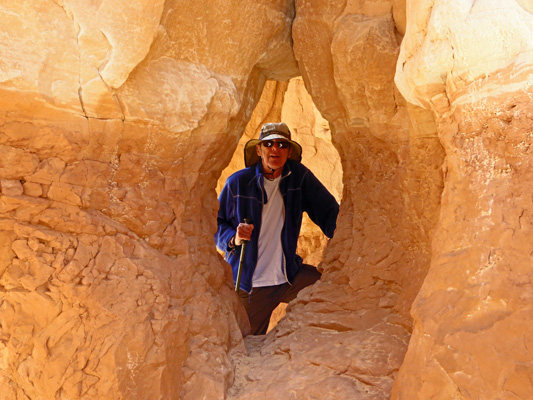
And then I got brave and scrambled up to the top. Getting back down again wasn’t easy and I almost ended up on my bum but I made it back down again okay.
The hoodoos here are pretty widely spaced but they come in all sorts of shapes.
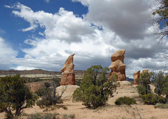
Further along there were a number of them clustered together.
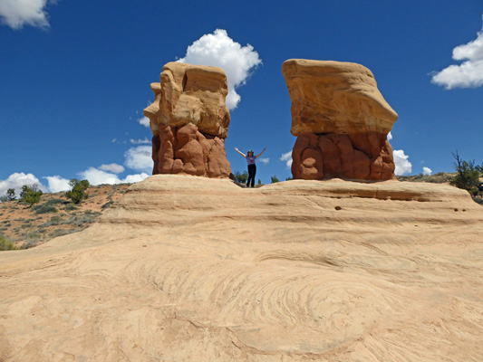
And the one just to the right of where Walter was standing had a window in it.
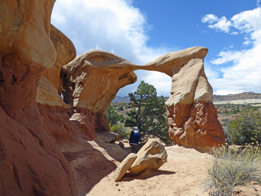
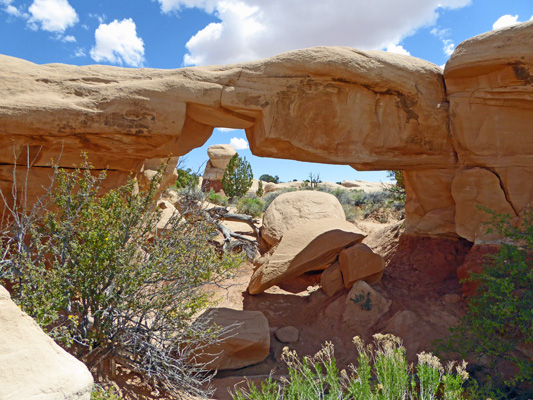
There are two Natural Arches in the garden and we kept hiking until we found them both.
This one is pretty delicate looking.
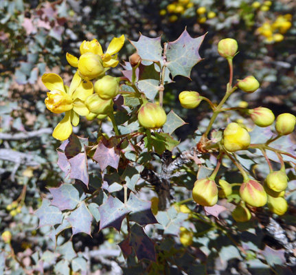
There was a Desert Holly (Mahonia fremontii) in bloom in among the rocks.
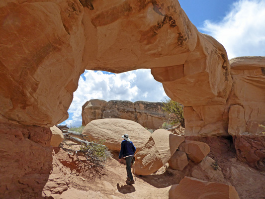
The second arch is much more substantial looking.
And I had fun taking photos of it from a number of angles.
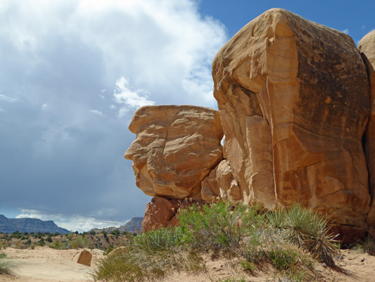
We carried on following trails through the formations and past this big rock that sure looks like a profile of a person to me. If someone has gone through a named all the formations we didn’t find a listing anywhere (thank goodness). I much prefer to find the surprises myself rather than try to figure out why someone else named something the way they did.
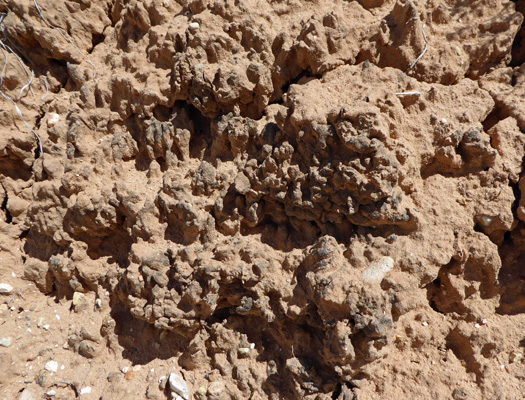
They make a big deal at the Visitors Center about the desert soil crust saying “Don’t Crush the Crust.” It’s a living complex of soil and cyanobacteria at this stage—which takes 1 to 3 years to form (and one crushing step to destroy).
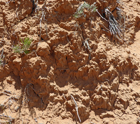
It can take up to 50 years for mature crust to form the complex of cyanobacteria, lichens, mosses, and fungi that add to the erosion-busting, water-absorbing, nutrient-building qualities of the crust. At that point is has a much darker and mottled look to it. I was pretty pleased to find this patch of mature crust along the wash later in our hike.
The formations kept coming so we kept hiking.
Near the end of the garden we came to this gem—a hoodoo with an apparent attitude.
We walked on past and I took a photo from the other side.
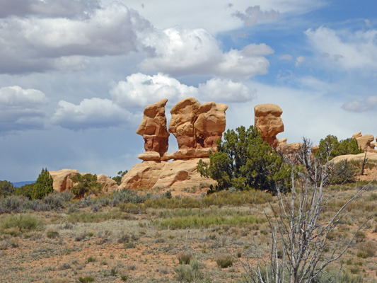
Looking back north from here we saw a grouping of 4 big boulders that once again looked like heads to us.
We hiked down to the wash and followed it back towards the trailhead. Along the way we saw a few more tall skinny hoodoos.
These guys look like statues on what remains of an old temple.
We made our way out of the wash and back up the hill past one more set of hoodoos.
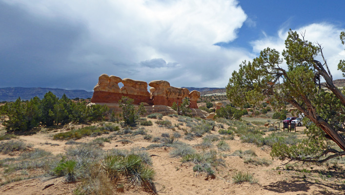
And to put a finishing touch on the visit I took one more shot of that first magnificent formation.
Exploring the whole Devil’s Garden only took us about 45 minutes and we enjoyed every minute of it.
For lunch we took our picnic up to one of the picnic tables on the other side of this formation. Here was our view for lunch. As you can see, that formation is RIGHT next to the parking lot.
There was some Wooly Locoweed (Astragalus mollissimus) in bloom right next to our table too.
After lunch, we bumped our way back up the 13 miles of gravel road. And then took the rest of the afternoon off.
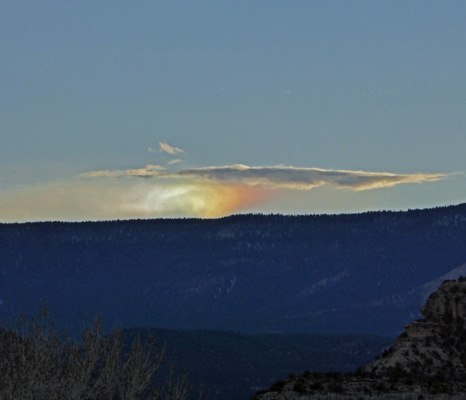
That night at sunset, a rainbow appeared on the horizon. I went out to try to photograph it and this is what I got.