
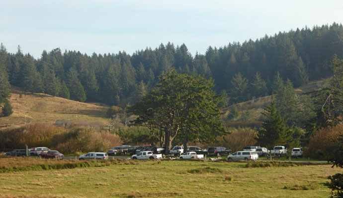
But come Monday morning, the number of vehicles was way down because we’d had rain most of the night on Sunday night. That stirs the river up and folks stop fishing when they realize that the fish can’t see their bait.
We had a sunbreak or two on Monday morning and managed to get the laundry done before it started to rain again in earnest. There were 3 of the lighthouse hosts doing laundry too and we exchanged information about past and future hosting experiences. They were all going to be spending the entire winter on the Oregon Coast—more power to them, I have no desire to spend the whole winter in the pouring rain!
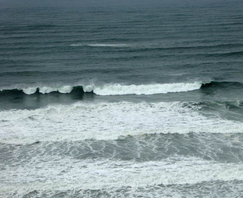
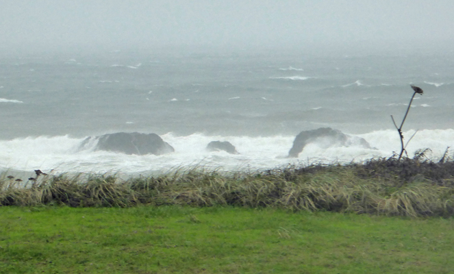
By lunch time it was raining but we decided we’d try watching the waves at the overlook near the Port of Port Orford again just for fun.
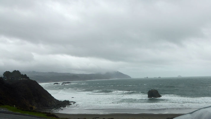
I snapped photos in the wind and rain—not really being able to see the screen because my glasses were getting rained on.
Suffice it to say we mostly had a rain-washed windshield and not much view.
We headed over to the library and settled in to enjoy the quiet there. Not long after we arrived the sky opened up and the wind began to howl. We had horizontal rain, howling wind and the whole library turned to the windows along Hwy 101 to watch. Everyone was amazed. It lasted maybe 10 minutes and let up. The locals were shaking their heads muttering about winter coming awfully early this year.
By the time we got back to the trailer at about 3 pm we were having sun breaks. And then at sunset, the entire sky (which was clouded over) turned orange—like orange cotton candy. It was the weirdest thing I’ve ever seen. A rain squall came through and the orange turned to gray and it was over. We had thunder and lightening and heavy rain off and on all evening and then in the night it turned to steady rain with wind so it sounded as if we were going through a car wash all night.
The rain ended in the early morning hours and we had watery sunshine most of the day on Tuesday October 25th. Walter had noticed that there was a parking area right near the eastern boundary of Cape Blanco State Park where we’d see cars parked and we discovered there appeared to be a trail there. So we made that our adventure for the morning.
We parked in the lot and went through the gate that keeps the cows and sheep from wandering onto the road.
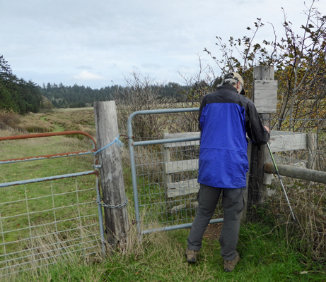
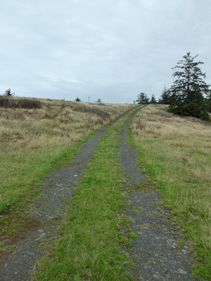
We were faced with what we thought were two choices. We could take a road up hill
Or we could take a partially flooded path out through the wetland/pasture area.
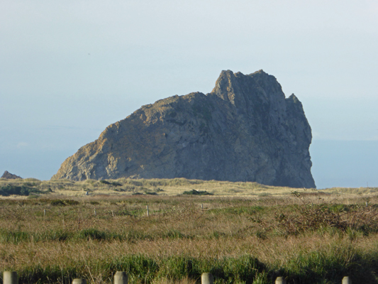
Since the path looked really wet, we opted to follow the road. It took us up a rise and gave us a great view across pastureland to Gull Rock over at the beach.
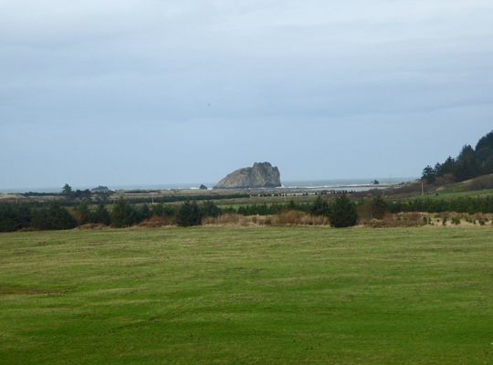
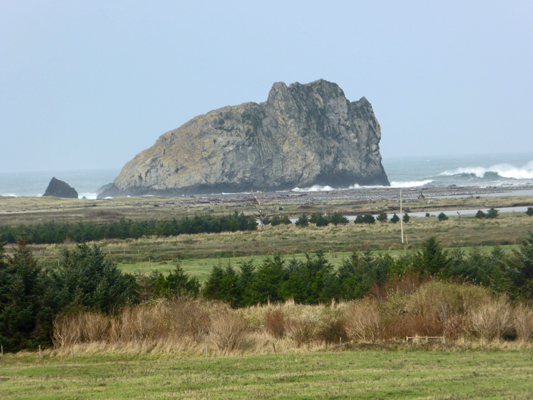
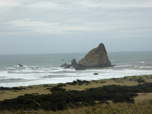
Gull Rock has lots of interesting faces and looks really different from different angles.
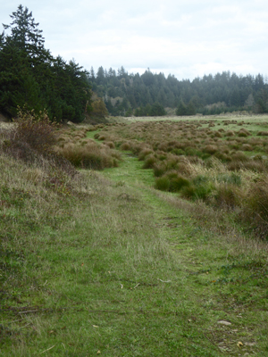
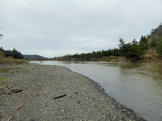
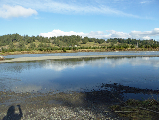
The road took us over and around a little hill and then down to more pasture. We studied the lay of the land and decided to head across the pasture to a gate that looked like it might lead to some trees and then the river. There were a lot of cow patties to dodge but it wasn’t wet and we made our way easily out to the river and a nice gravel beach. Here’s the view looking seaward.
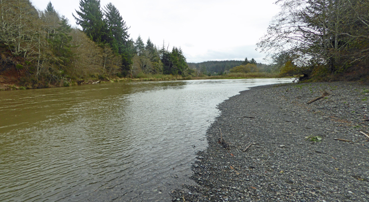
And here’s the view looking up river.
As you can see, the heavy rain had stirred things up so that the river was muddy again and so it was no surprise that there were no fisherman standing out on this bar trying to catch salmon. In fact, there had been nobody down at the boat launch that morning either.
I did spy one fellow down by the river though.
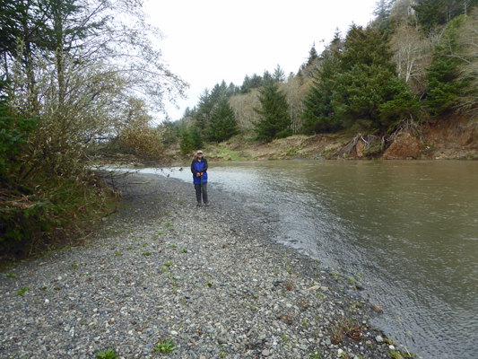
You know, I think you might recognize him—just maybe.
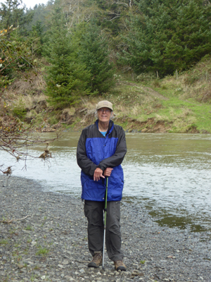
Well, at least no one will ever say that I didn’t take enough photos of Walter.
We stood looking at the river trying to decide if this might be where the ford was that the Hughes family used to cross the river. With the water levels so high and the current pretty strong it was hard to tell.
We headed back through the trees and at the gate I took this panorama shot of the area.
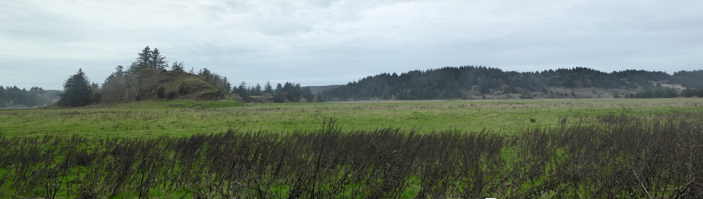
The road had taken us up over that little hill on the left and then we’d come across the pasture from the base of the hill. On the way back, we followed a trail that skirted the edge of the hill on the left hand side. And that brought us back to where we began. Only then did we realize that there had actually been a third option: to head straight head here across the grass to pick up the trail at the base of the hill on the right. It just didn’t look like a trail to either of us until we’d walked out on it.
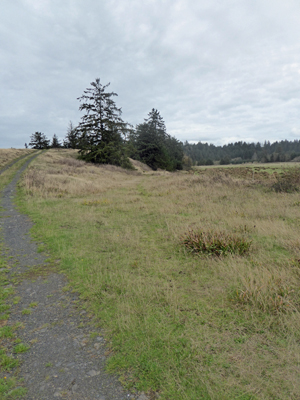
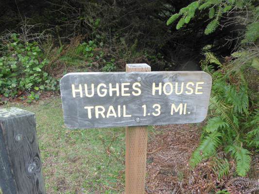
We went back to the trailer and had lunch and then Walter drove me up towards the campground so I could take the trail we’d seen a couple of weeks ago that said it went to Hughes House. We hadn’t been able to figure out where it came out on our end and since I needed a bit more exercise it seemed like a win win proposition.
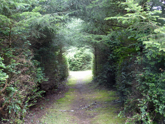
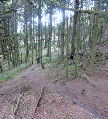
This trail starts just a little ways east from the viewpoint trail I had taken a couple of weeks before. And it heads through a tunnel in the trees just like that one did.
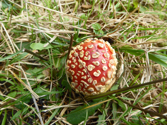
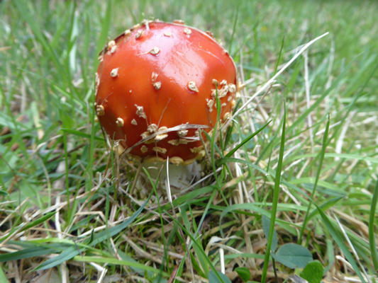
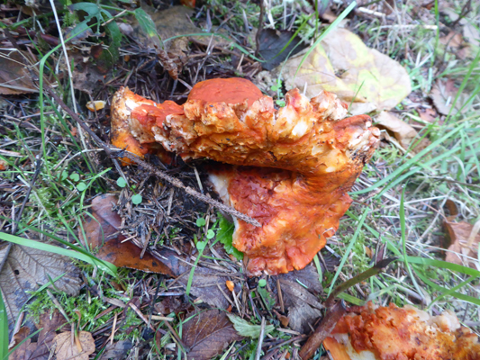
With all the rain we’ve had of late I wasn’t surprised to see mushrooms in the trail. I do so love these reds guys.
The viewpoint trail joins this trail just before you reach the viewpoint, so I took that short spur over to the viewpoint since I could hear the crash of the surf.
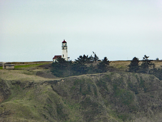
I took a close up shot of the lighthouse and managed (by pure luck) to catch it blinking at me.
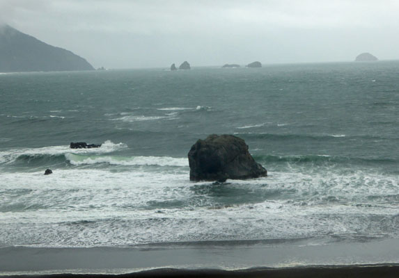
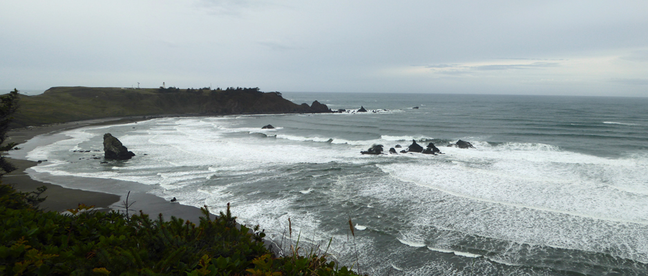
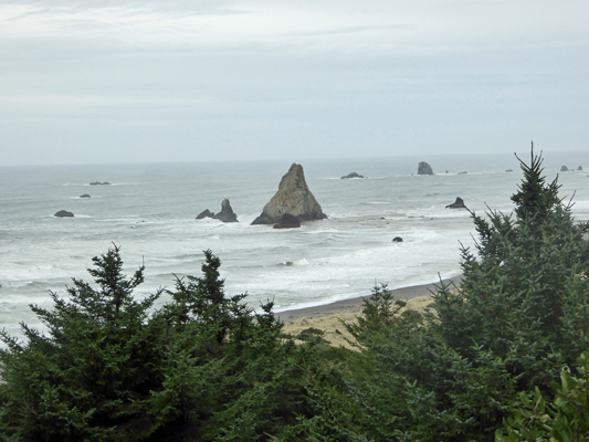
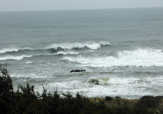
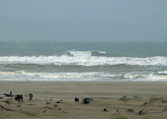
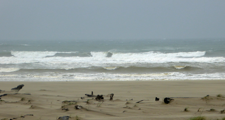
I had a great time taking photos of the surf crashing into the rocks.
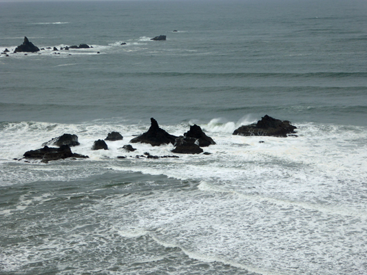
So much surf, and plenty of time!
There were even gulls circling above Gull Rock.
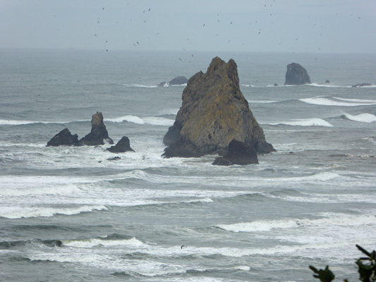
And more surf on more rocks.
Having gotten my surf and sea fix for the day, I rejoined the trail to find more fungus!
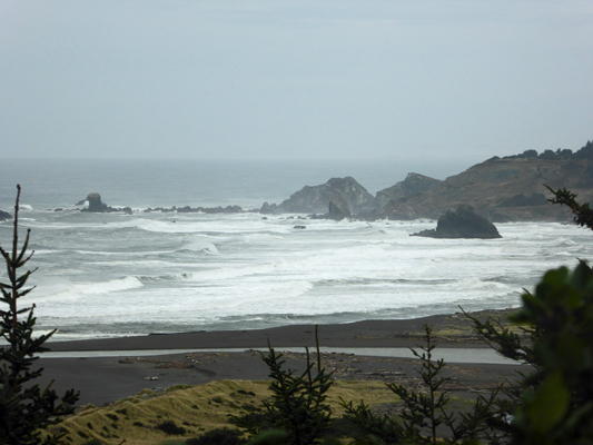
The trail follows a fence line eastward and then brings you close to the ocean again for another view northward.
As I said before, Gull Rock looks really different from different angles.
This viewpoint even gave me a bit of a different view of the curve of the beach on the north end.
Back in the woods I found some really strange fungus. It was bright orange and some critter had pulled it apart a bit. This thing was bigger than my hand.
Heading east again, the trail went DOWN the hill.
This was a ‘social trail’ but there were stairs too.
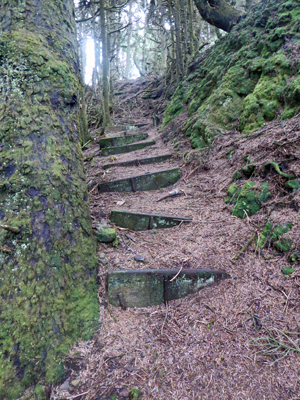
The trail came out at a gravel road. There was a signpost that said “Coastal Trail” but there was no arrow as which way you were supposed to go. How helpful! I followed the road down a ways and got a nice view of the beach.
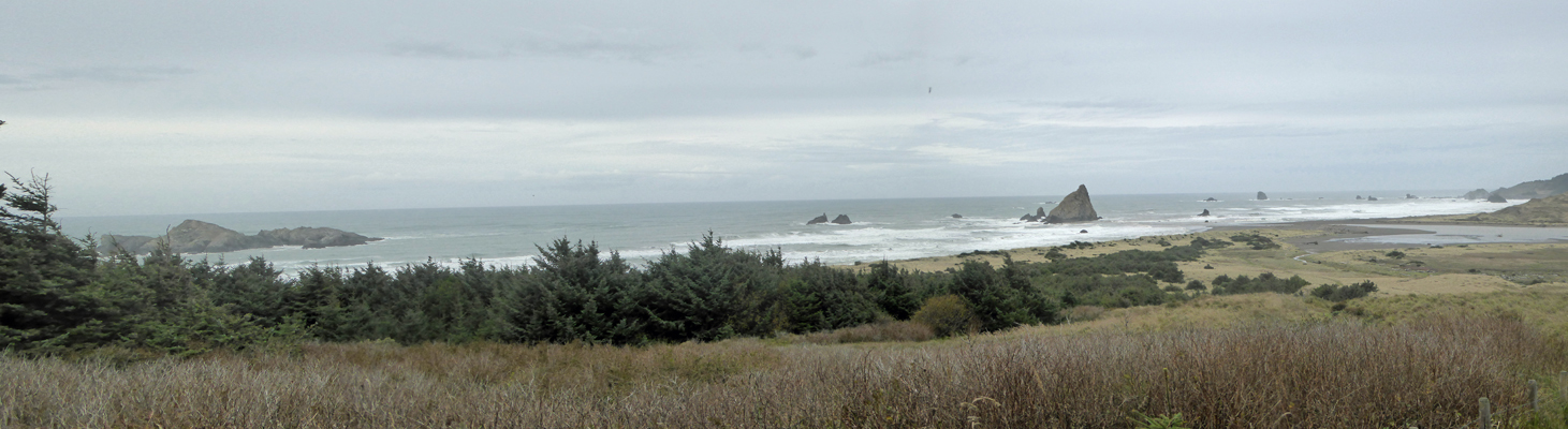
I went down a ways more trying to figure out where the trail was and in the process got a few nice surf photos too.
And one more great shot of Gull Rock from yet another angle.
From the looks of things, the ‘road’ went down towards the beach which was not the direction I wanted to go. But there appeared to be a rather muddy narrow trail that headed back DOWN the hill (through the sheep) that might get me back at least in the direction of Hughes House. So I tiptoed through the sheep who happily got out of my way, though the younger ones did turn back to look at me. And then I made my way down the hill. There were people down below on a trail (yippee) and they were surprised to see me appear up on the hill. I joined them, and we made our way across the muddy pastureland and back towards the boat launch.
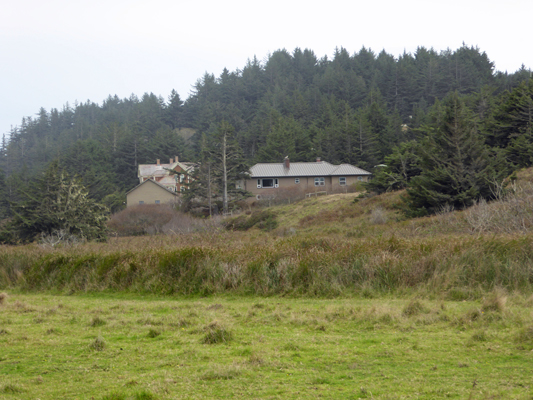
Along the way I took this photo of the manager’s house (with Hughes House behind it). It’s clear they have a very nice unobstructed view of the ocean from their living room windows.
I only picked up a bit of sheep poop on my boots but I didn’t get wet and we made it safely back to the parking area at the boat launch. The folks I’d met had followed the riverbank out to the ocean and had then seen a trail sign pointing back and were happy have someone along who had crashed around in the meadow before.
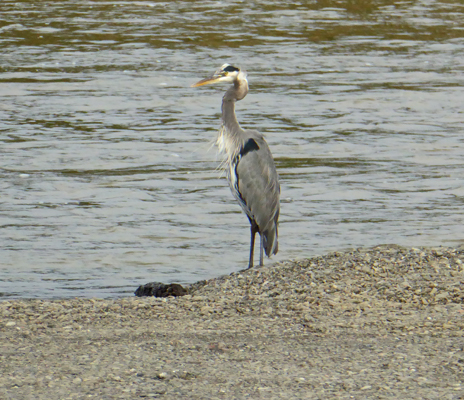
I spied a Great Blue Heron posing on the gravel bar at the boat launch.
And having captured him, I made my way back UP the hill to Hughes House and our trailer. Methinks the trailhead sign should say “Hughes House area” or “Sixes River” but hey, at least there was a sign! We’ve found that trail signage is not a major priority for the Oregon State Parks.
The next storm arrived at about 5:30 (as predicted) and we had steady rain all evening which turned to a downpour at about 10 and continued well into the night. It was still raining steadily when we got up but we decided we might as well head north to Bandon to see the 3 little State Parks there and do the grocery shopping while we were at it.
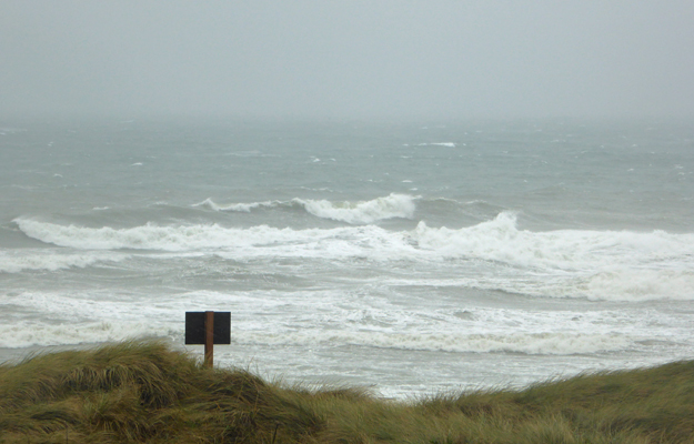
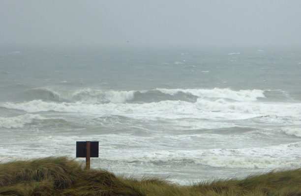
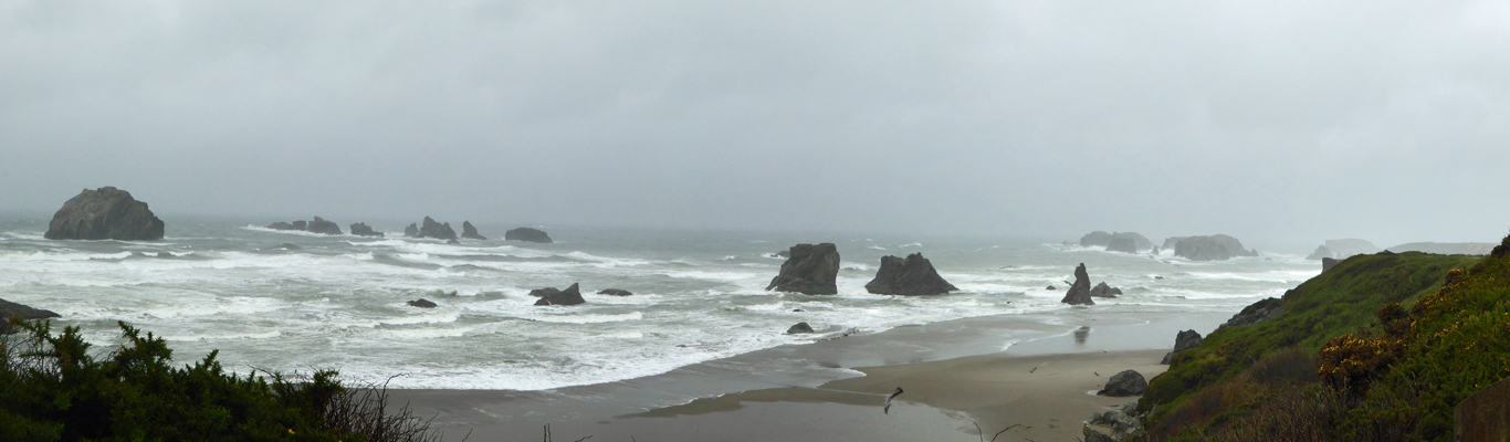
We headed north on Hwy 101 and then turned westward on Beach Loop Road just south of Bandon. Our first stop was China Creek State Park where the surf was crashing and the wind was howling. I got out of the car (since pictures weren’t possible through the rain-swept windshield) and took photos until my lens got wet.
I suspect this is a lovely beach to play on in the summer but in the wind we could see the sand drifting north along the beach.
This is snowy plover nesting area so you can’t walk on the dry sand south of here all the way to New River from March 15th to September 15th! There were warning signs for hikers that it was slow going here and that it was 11 miles to the next campsite so plan accordingly.
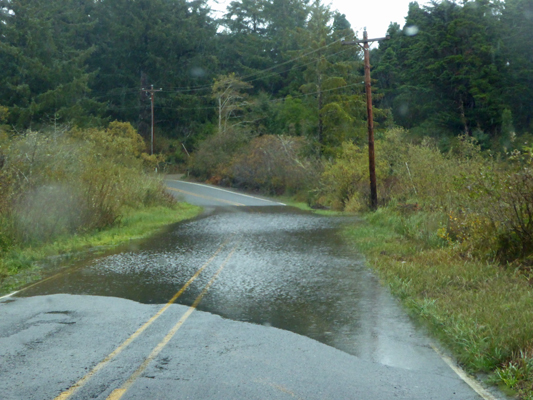
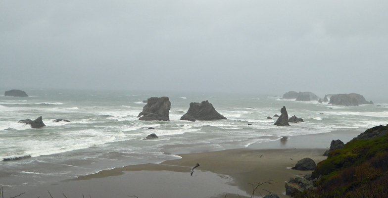
Having gotten sufficiently wet we continued northward toward Devil’s Kitchen State Park. But first we came to a flooded portion of the road. We could see the double yellow line throughout so we deemed it okay to drive through and we didn’t even raise that much of a rooster tail.
At Devil’s Kitchen the wind was even stronger than China Creek and there was still more lovely surf.
What can I say, I love taking photos of surf.
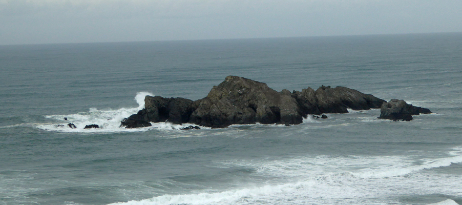
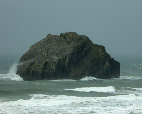
There was a walkway out to the south through some trees where it looked like there were lots of rocks (the Devil’s Kitchen no doubt) but it was so wet I wasn’t willing to do it—even with Walter egging me on. But I did get a sequence of shots of two large rocks and what the surf was doing around them.
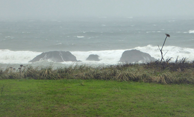
Now you see them. Now you don’t.
From here Beach Loop Road enters a very upscale neighborhood of motels with water views and large houses perched along the top of the dunes and the cliffs. Nestled in amongst these houses you’ll find Face Rock State Park.
It was raining really hard at this point and I turned so my back was to the wind (and rain) while I shot photos.
It really does look like a face rising out of the water off to the right doesn’t it?
There was a couple from Washington state out in the rain taking photos and they were laughing uproariously by the time they headed back to their car and so was I. The front of my pants were perfectly dry but the backs were WET. There is something wonderfully crazy about being out in the wind and the rain for no reason but to see the sights. What a wonderful experience.
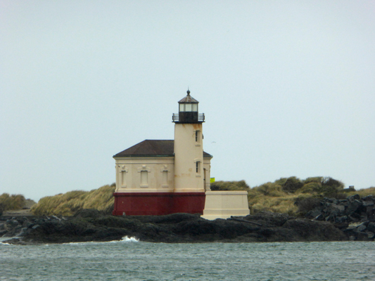
The road headed down towards town and just before it turned to enter Old Town Bandon we got a view of the Coquille River Lighthouse, complete with a flock of pelicans huddled on our side of the river.
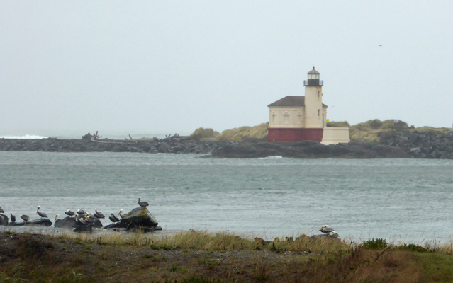
My glasses were now so wet I had no idea whether I was getting decent photos or not and I just kept shooting hoping for the best. Here’s a close up of the lighthouse.
We drove on through Old Town Bandon looking for a likely place for lunch. Nothing much appealed and since it was still pretty early we just went ahead and did our grocery shopping and bought lunch in the deli to take home. The Bandon grocery store is part of the same chain as the one in Port Orford but with half again (perhaps more) sq. footage. No scavenger hunt here—they had it all and it was easy to find. They also have a Rite Aid drugstore where we bought a few necessities.
It continued to pour all the way home and while the rain let up some as the evening wore on, it continued on and on and on. In the end it rained for just about 36 hours straight before it stopped in the early morning hours. Blub blub blub.
Thursday it was back to work at Hughes House. We had cloudy skies and a river that looked like it was close to flooding—much higher that it was after the big storm 2 weeks before. I checked on line and we’d had over 14 inches of rain so far this month—twice normal. We sat in the kitchen and read and waited. We had our first visitors at 1:15 and our total hit 6 for the day an hour later. That was it. We were open for 5 1/2 hours and only had visitors during a little over an hour of the time.
A steady light rain started again before we closed at 3:30. 56 degrees with light rain—a bit cooler than most days when it’s been 58 but not much. The rain didn’t last long and we actually had watery sunshine on Friday morning. What was that big yellow disc in the sky? The clouds burned off as the morning unfolded and we had true sunshine the rest of the day. We had 8 visitors—whoo hoo.
We buttoned up at Hughes House and took the truck down to the boat ramp area for the little walk. And what did we find but a stray sheep out on the road. She’d managed to get through the swing gate but couldn’t go back.
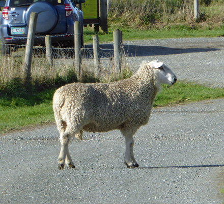
She was skittish enough so if you got very close she’d run away and start leaping into the air sort of like a deer but without as much elevation gain. We reported her to one of the ranger assistants and she said he’d call the owner to put her back in—last year they had cattle that got out—shades of Sugarloaf Campground in Idaho.
We walked out to the boat ramp and found it full of driftwood. The river had clearly been WAY up at high tide and left its mark.
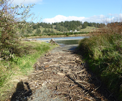
Do you want to back you boat trailer over all this stuff and then launch it out into this shallow water and get around the sand bar?
And of course I had to take one more photo of Gull Rock from yet another angle.
We ran into the head of the Cape Blanco Heritage Society on our walk and mentioned that we’d only had 6 visitors the day before and 8 on Friday. His reply was that the folks at the Life Saving Museum had had no visitors at all on Thursday. Boy does that make 6 sound wonderful!
It was a lovely afternoon to be out. It was in the mid sixties and there wasn’t any wind. A real treat when you’ve had as much rain as we’d had.
Saturday October 29th was another beautiful sunny day. In fact, it was so sunny that the living room of Hughes House actually got warm with all the sunlight streaming in and the sunroom was hot! We had 16 visitors which was still slow but oh so much better than Thursday’s 6. We knew another storm was heading our way because there was serious high surf on the beach all day and sure enough clouds began to scuttle in late in the afternoon and we had rain by evening. Ah well, the sun was very nice while it lasted. I’ve definitely reverted to my old NW weather attitude—treasure the sunshine when it comes.
Sunday October 30th was our last day giving tours at Hughes House. We had 8 visitors (the same as Friday) which did not speed the day along. It rained most of the day but in the mid afternoon we began to have sun breaks. There were fisherman down at the boat ramp in the morning but as the rain continued and the river started to get muddy again, they all left. We locked up the house a little before 3:30 and happily went home knowing that we wouldn’t have to spend another day twiddling our thumbs waiting for people.
Hughes House is a lovely house and we enjoyed giving tours. I just should have taken up knitting before we came since I’d have really gotten a lot done in all the empty hours we spent there.