
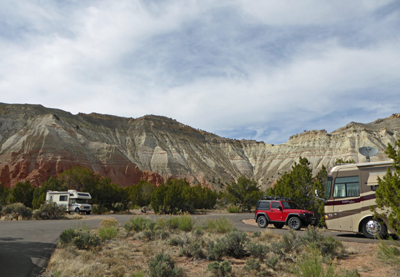
We had a great view from our back windows looking east.
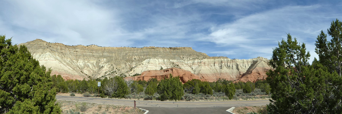
And a great view from our picnic table too.
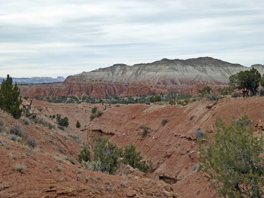
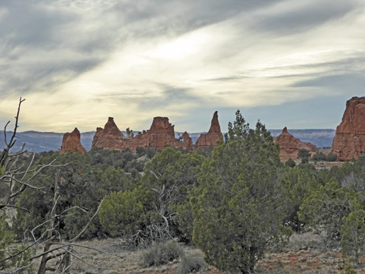
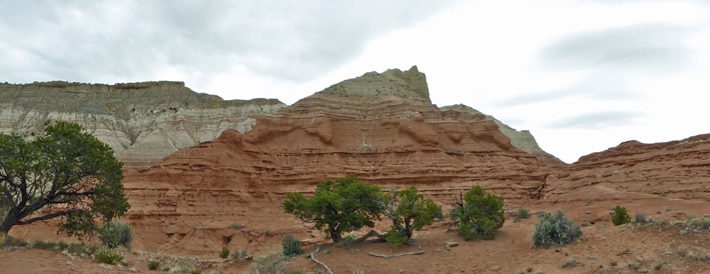
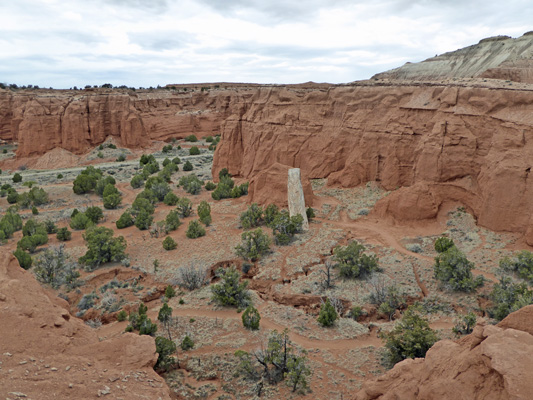
We set up camp and had lunch and then set out to explore the few roads in the park. Just down the road from the campground you can see some spires and one of the Sedimentary Pipes that the park is known for.
There are approximately 67 of these odd features in the park and the adjacent area. All the other features in the park are red sandstone but the Sedimentary Pipes are made of a harder white sedimentary rock. Geologists are unsure of the exact origin of the pipes but there are several theories as to how they came to be. One says that earthquakes may have forced coarse, water-saturated sediment to create pathways in underlying rock formations and that eventually the pathways became clogged with the coarse sediment and re-cemented to form columns of rock that was harder than the surrounding sandstone. Over time the surrounding sandstone was eroded away leaving the pipes.
A second theory says the pipes are remnants of ancient springs that became choked with sediment which became cemented into a rock that was harder than the surrounding sandstone. Then at a later time, the surrounding sandstone layers were worn away exposing the pipes.
A new theory proposes that the pipes were formed from water-saturated pockets buried under layers of other sediments over a period of several million years. Pressure from the overlying sediments forced the wet slurry upwards. The rising slurry scoured pathways through the underlying rock eventually cementing into hard rock. Erosion then stripped away the softer rock layers revealing the sedimentary pipes we see today.
However they came to be, they are amazing to see. They come in all sizes from just 6 feet to 170 feet tall
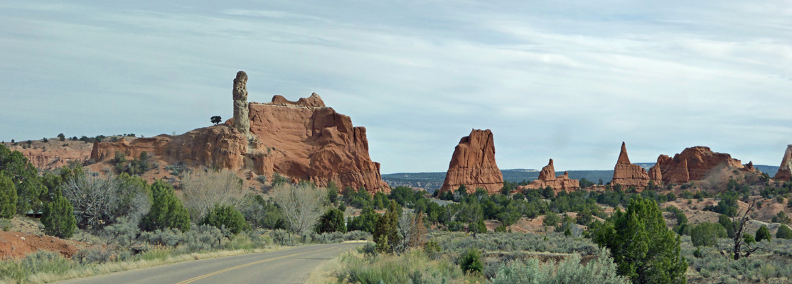
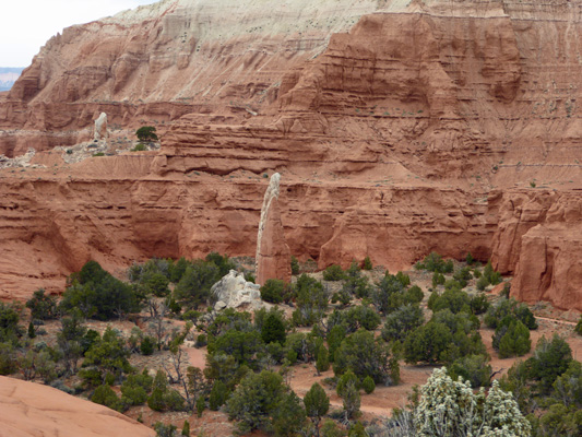
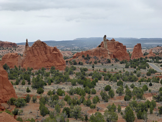
We followed the road to Chimney Rock out past the Bryce View Campground which has dry camping out in the wide open area called the Kodachrome Flats. The National Geographic Society had an expedition here in 1949 and asked the Kodak company for permission to name the area after their trademarked Kodachrome film. I can well imagine, now that they no longer make Kodachrome film that 50 years from now folks will be really puzzled by the name. But for now, I spent much of our two days there singing Paul Simon’s Kodachrome (Mama don’t take my Kodachrome awaaaaaay).
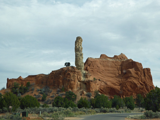
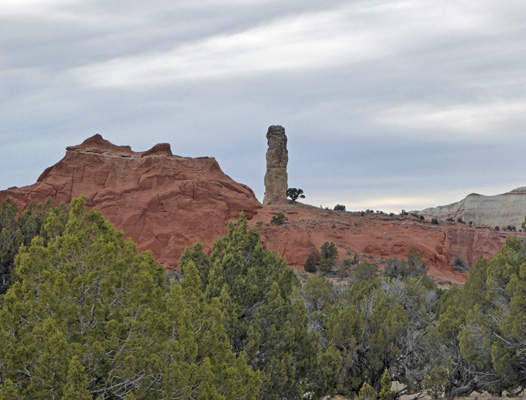
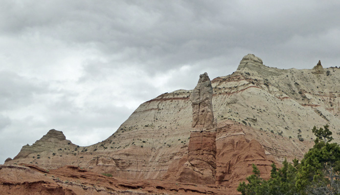
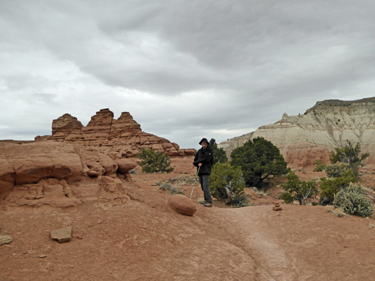
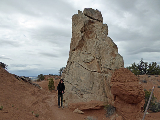
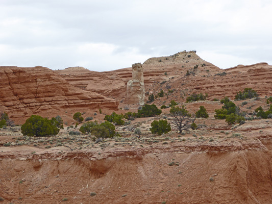
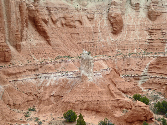
Chimney rock is a HUGE Sedimentary Pipe.
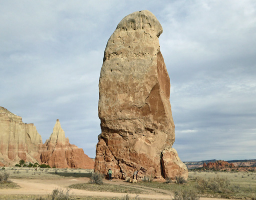
Yes, that’s Walter standing there at the base of that huge monolith.
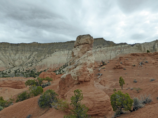
Behind it is a wonderful spire which is still standing because of that little piece of cap rock that hasn’t eroded away. Once it goes, the rest of the spire will erode away pretty quickly.
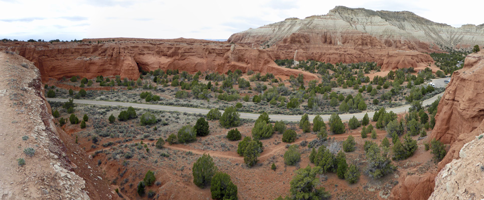
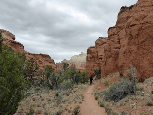
From here we drove out the road to the Shakespeare Arch/Sentinel Trail. This is a 1.7 mile loop trail that takes you out to the Shakespeare Arch and then on past the Sentinel and back to the trailhead. We decided we’d cheat and just go out the 1.2 miles to the arch and back since it was pretty late in the afternoon already.
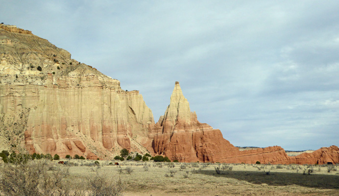
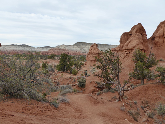
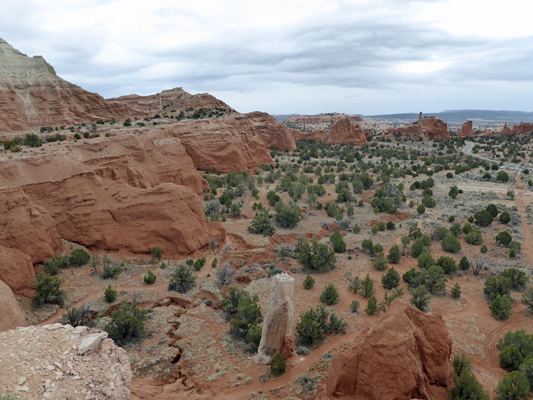
The trail takes you out to an open area where you can see across Kodachrome Flats all the way back to The Chimney.
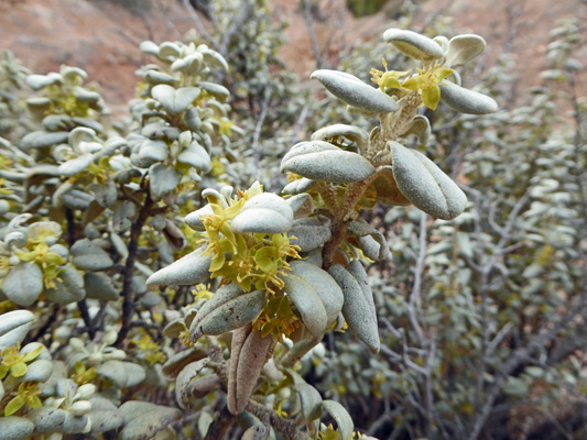
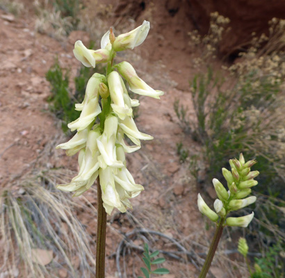
There was a lot of Buffalo Berry (Shepherdia rotundifolia) in bloom. It’s pretty weird looking stuff actually.
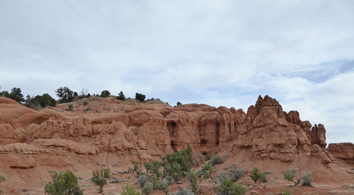
You also get a view of the nifty formations back towards the main area of the park.
The formations along this trail reminded me a great deal of sandcastles—you know the kind you made as a kid by dripping sandy slurry through your fists.
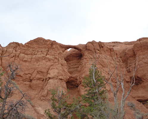
The trail has lots of ups and downs but eventually you get to a nicely designated spot to photograph Shakespeare’s Arch.
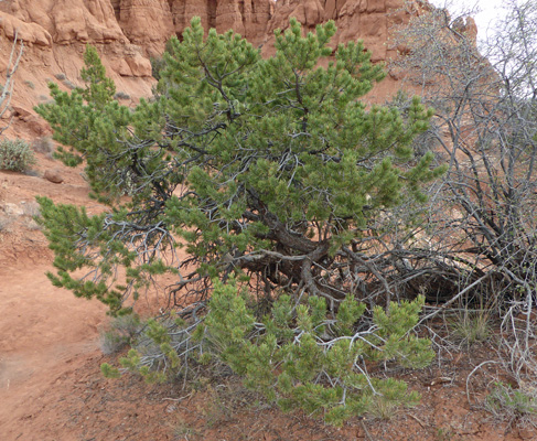
The trail takes you closer to the arch past a nice pinon pine.
And then right to the bottom of the arch.
Walter had waited for me a ways away and I turned back to catch a shot of him. You can see how the trail went up and down in steep little bumps—a bit like a motocross track.
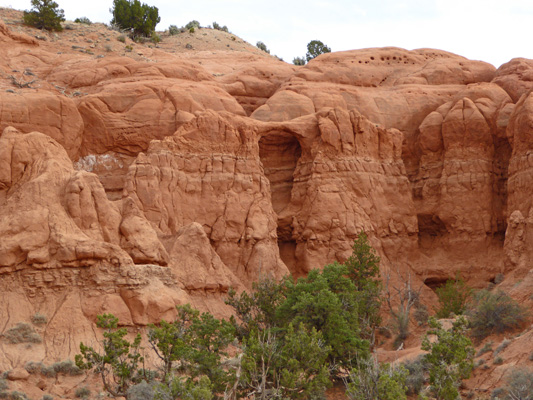
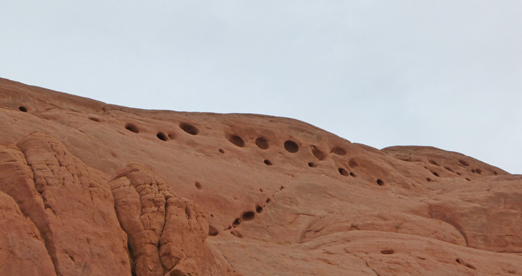
Up above to the right of the arch there was a row of nifty round holes. It’s things like this that get my mind going about ‘how did those come about?”
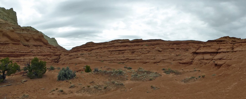
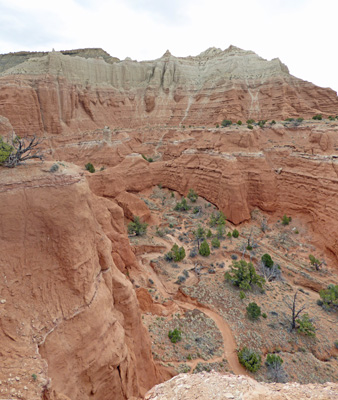
We made our way back to the truck and then retraced our route back towards the campground. On the way, we passed yet another Sedimentary Pipe.
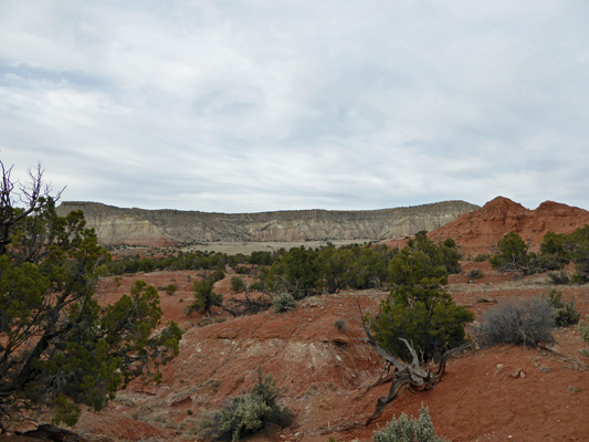
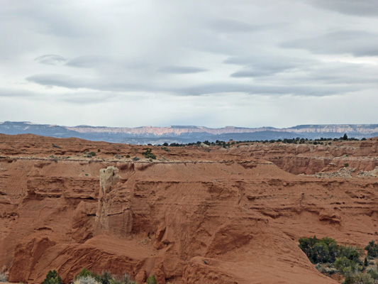
As you can see, clouds had come in and that made a new view of the spires to the west.
The weather forecast was for rain on Friday April 8th so we got out to do our hike for the day as early as we could. With morning light, I could easily capture the Sedimentary Pipe that you can see just south of the campground that I couldn’t photograph the day before in the late afternoon. We won’t say anything about these pipes being suggestive now will we...
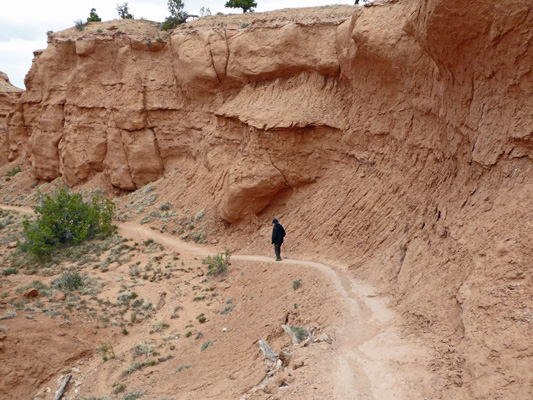
We headed across the road from the campground to the Angel’s Palace Trailhead—I do so love when we don’t have to drive to reach a trailhead.
The trail heads up a narrow canyon which got us out of the cold wind (aaaah). There was a pretty good-sized patch of Stinking Milkvetch (Astragalus praelongus) growing on the canyon floor. It didn’t smell bad to me so I don’t know why they call it stinking milkvetch.
The trail only has a 150 foot gain but it’s all in a short distance UP to the top of the mesa. We were glad that it was dry because it looked like it might get really sticky and slippery when it was wet. In any case we made it up okay and were treated to a great view to the north
and the west
and the south.
We were prepared for rain and while we only got a sprinkle or two we were both glad we had our jackets on because up on top it was WINDY and cold. Keeping your hat from flying away was a full time job.
When I finished taking photos in all directions I notice that there were folks coming UP the trail in the canyon. So I shot a photo to give you a sense of what we’d just come up.
The trail winds around in loop-d-loops all over the top of the mesa taking you right by this Sedimentary Pipe and its accompanying hoodoo.
This pipe looks totally different from the other side. It makes you wonder what forces made it look like it has a twist in it.
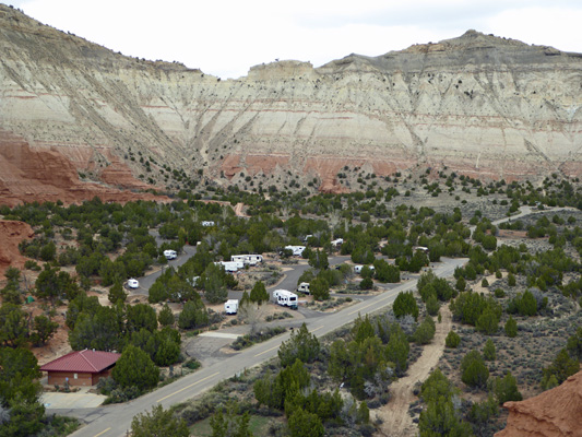
We followed the ridgeline and got a nice view of the campground below us. That’s Genevieve in the front row (4th from the bottom near the road).
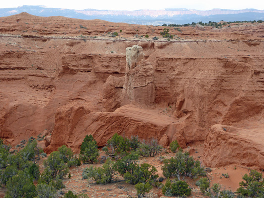
Here’s yet another Sedimentary Pipe, this one only partially revealed by erosion.
And if you look carefully, you can see the back side of Bryce Canyon in the distance
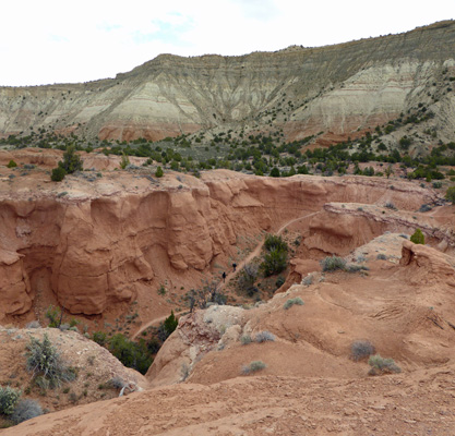
The trail takes you southward and gives you a view of the Grand Parade Trail down below and yet another Sedimentary Pipe.
There was an little photography trail out a narrow spine and I took it part of the way—but with the wind I wasn’t interested in being on anything that was only a foot wide and straight down on both sides. Still I got a decent shot of another pipe down below to the left side of the trail.
And a view of the road (and part of the trail) to the right side of the trail. You can see more of the Grand Parade Trail straight down and that there are several more pipes across the road along the Panorama Trail.
The trail continued to wind around and I continued to snap photos of pipes. This pipe I think is the same one I photographed from the super narrow trail (which is on the ridge behind the pipe).
And this is a different angle of one of the pipes I’d photographed the day before.
But this one is definitely a new one.
Here’s a different view of the Grand Parade Trail down below.
And yet another Sedimentary Pipe.
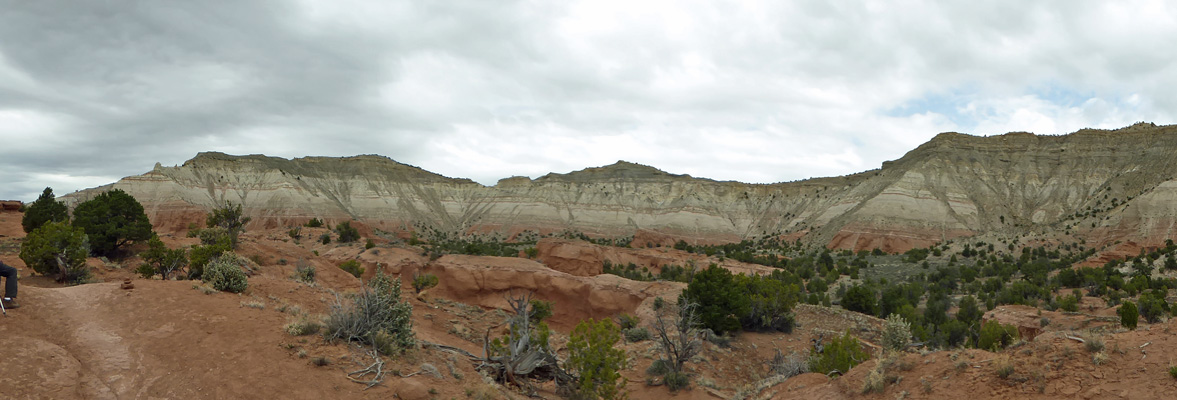
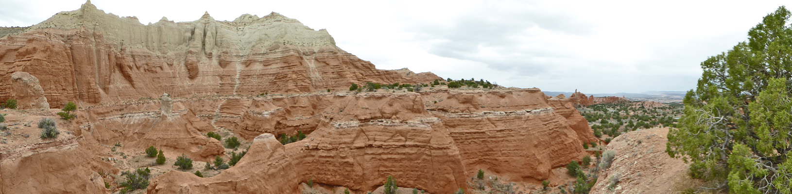
This was the furthest extent of the last loop-d-loop so when we went to turn back I took a panorama shot of the area. It’s really a pretty fantastic place.
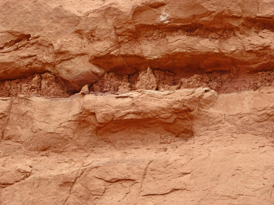
Heading back along the ridge we both noticed these weird little erosion patterns wedged between the rock layers.
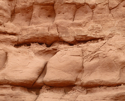
They really look like mini-cliff dwellings. Though when you get up close you can see they’re just strange erosion globs.
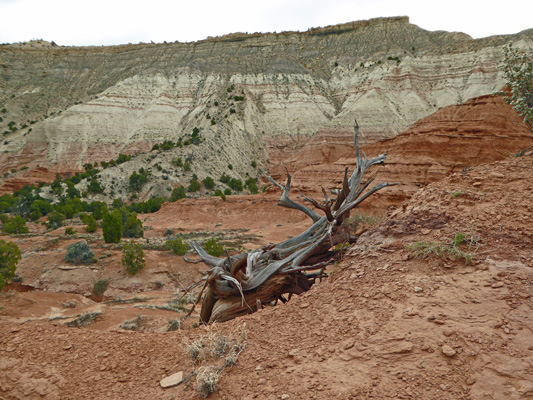
I couldn’t resist being a little artsy when I saw this wonderful old dead juniper.
It started to sprinkle as we started back down the canyon but it wasn’t anything serious yet.
It sure was nice to get back out of the wind and down into the narrow sheltered areas at the bottom.
Saturday morning April 9th, we headed back up Hwy 12 to the turn-off for Bryce Canyon. The forecast was for lows in the low 30’s for the next several days and highs only in the high 40’s so we were not interested in dry camping inside the park where it would be even colder since it is up at nearly 8,000 feet. So we got a spot at Ruby’s Inn and RV Park which is within a mile or so of the Bryce Canyon National Park entrance. It’s not cheap (nearly $50 a night with taxes) or particularly fancy but their WiFi worked and we had power. It was pouring rain when we arrived and we huddled inside until it stopped before setting up camp.