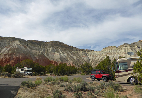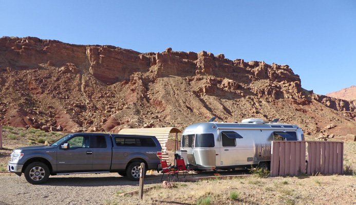
This is a National Park Service campground because it is within the Glen Canyon National Recreation Area. The campground is actually run by the park service rather than a concessionaire so the fees are very reasonable. It was $18 a night for either a nice back in or a pull through site. With our Golden Age Pass that meant that we only paid $9 a night—such a deal.
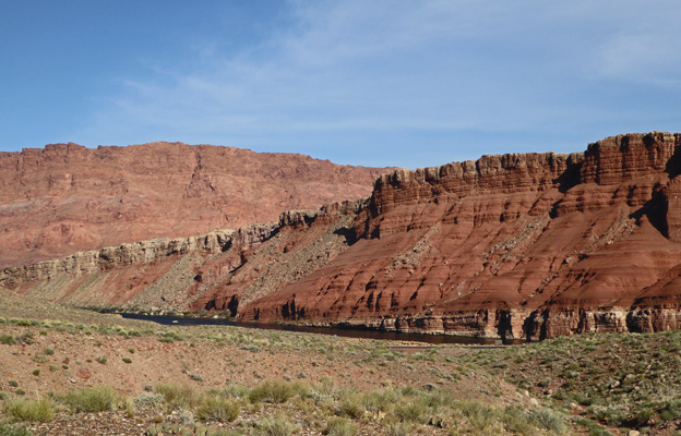
All that with a view of the river and more cliffs to the east and south too and plenty of sunshine to keep the solar panel charging up our batteries.
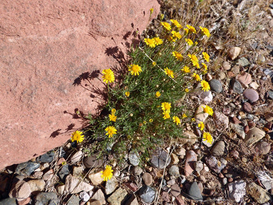
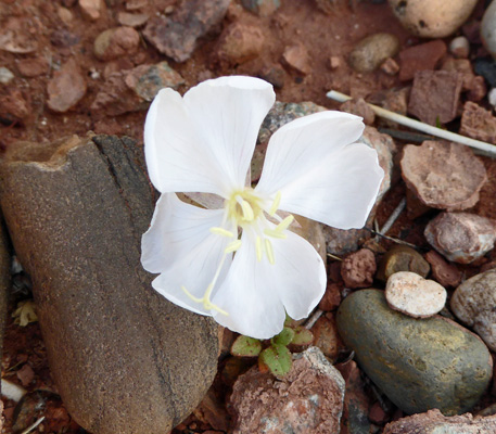
After we set up camp, I took the little hike down to the pay kiosk and found flowers in bloom on the way. I think that these are Stemless Hymenoxys (Tetraneuris acaulis).
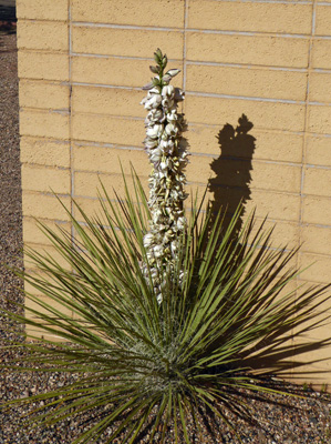
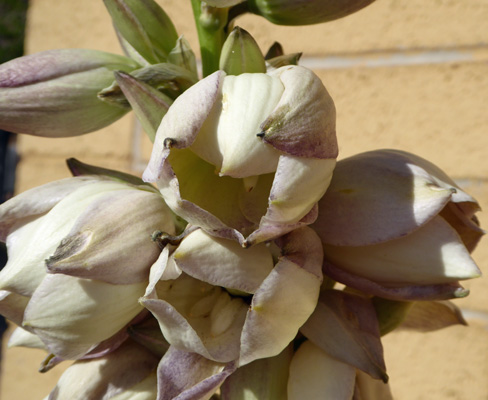
There was a big Navajo Yucca (Yucca baileyi) in bloom on the back wall of the rest room. I’d never seen one of these before. Most yuccas put up a tall stem before they begin to bloom. So seeing this one blooming all the way down to the base was a surprise.
Here’s a close up of the flowers.
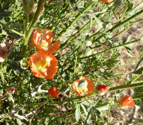
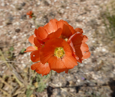
The Globemallow was just coming into bloom here.
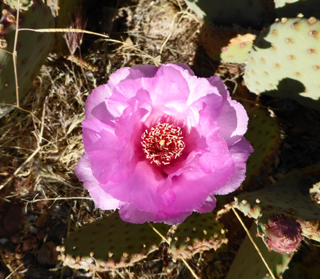
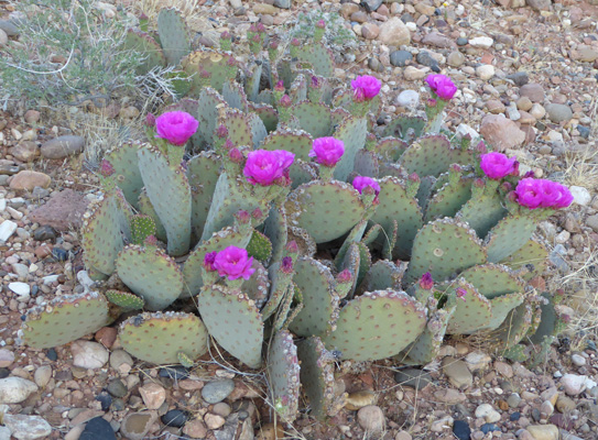
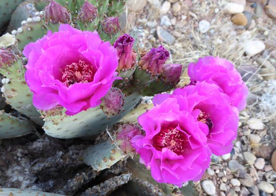
And the beavertail cactus were putting on a nice show.
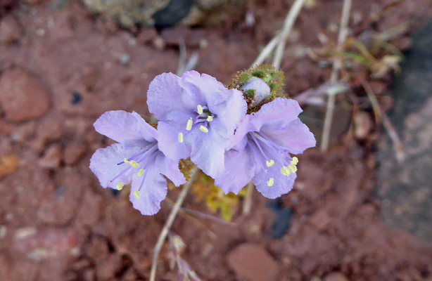
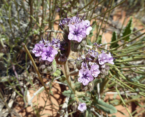
I saw this tiny patch of what I think is some sort of phacelia.
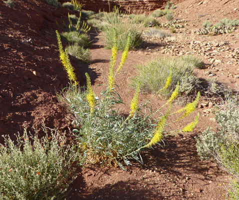
And out in the wash behind our campsite I found this Prince’s Plume (Stanleya pinnata) in full bloom.
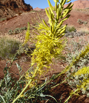
The flowers are pretty interesting up close.
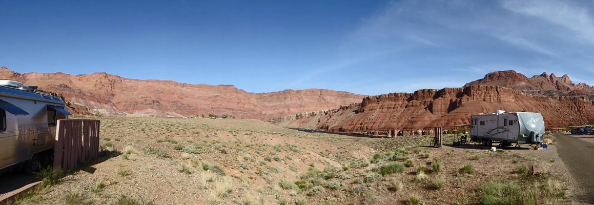
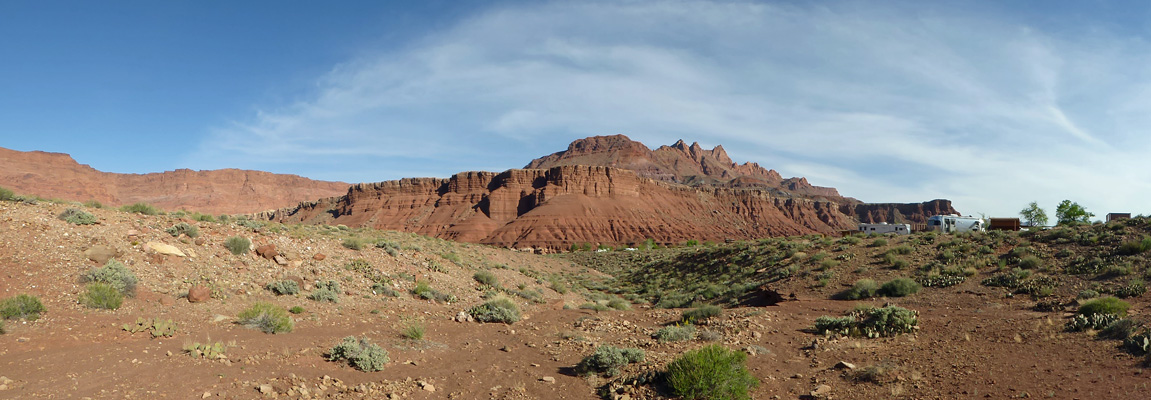
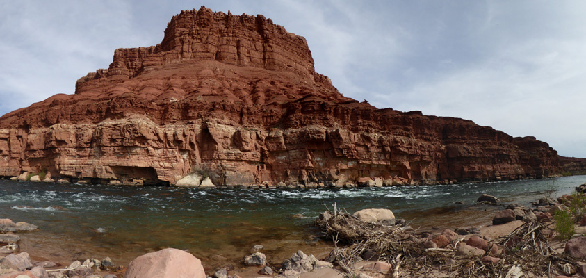
While I was down in the wash I took a panorama shot looking south.
And when I got back to the trailer I took a close up shot of the river view from our back window. In the morning the river was greenish blue. In the afternoon the red cliffs are reflected in the water so the river looks red.
Late in the afternoon the setting sun lit up the cliffs to the east.
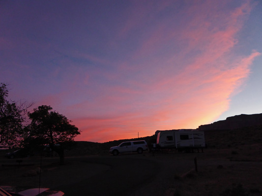
And we even got a little bit of a sunset.
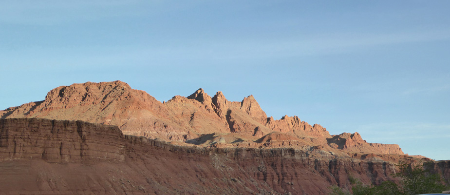
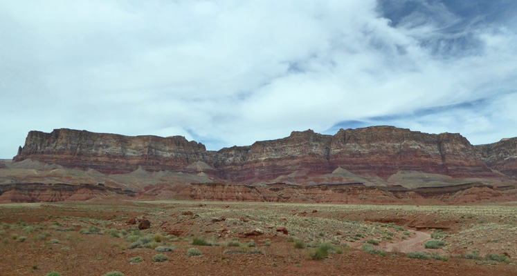
The next morning (Wednesday April 6th) before breakfast, I noticed that the light was really nice on the Vermillion Cliffs to the west. But there was a little hill obstructing my view so I set out to climb it.
On the way I came across a tiny little Desert Evening Primrose in bloom.
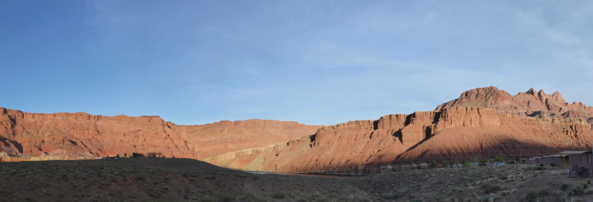
And from the top I got what I was after—a great view of the Vermillion Cliffs National Monument.
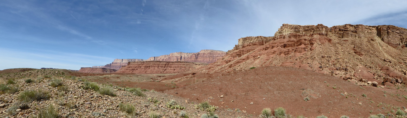
This part of northern Arizona is one big National Park. Glen Canyon National Recreation Area stretches from here many miles to the east; Vermillion Cliffs National Monument stretches into Utah to the northwest and Grand Canyon National Park follows the Colorado to the southwest until it meets Grand Canyon National Monument and then finally Lake Mead National Recreation Area. And all of it is gorgeous country.
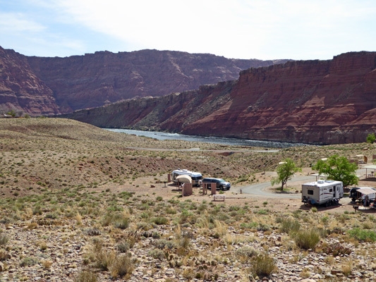
Before I started back down the hill I took a photo of the campground below. It’s a pretty amazing setting.
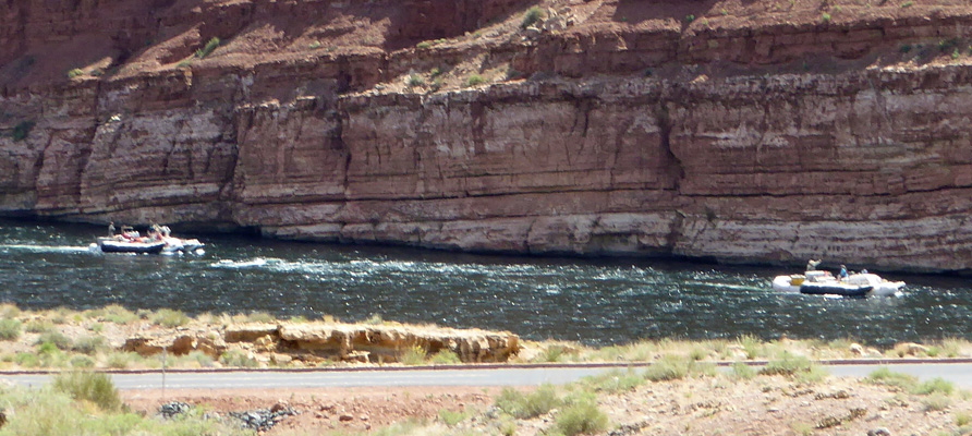
As we were packing our picnic lunch, we noticed that there were boats down on the river.
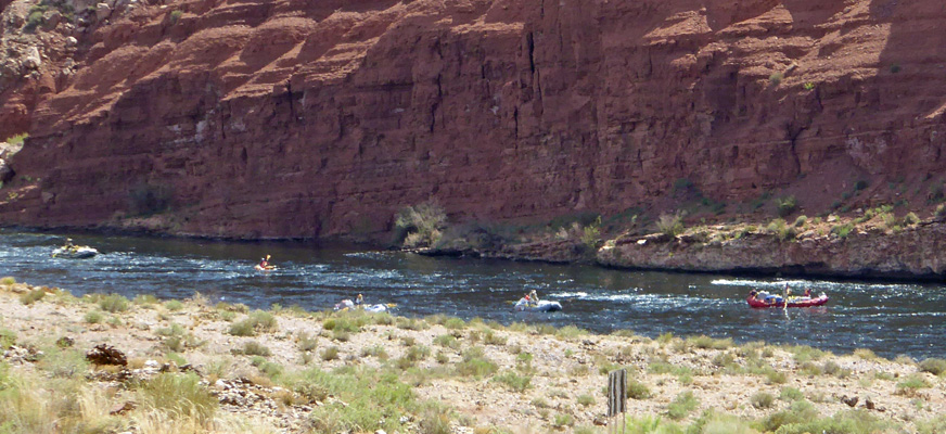
Lees Ferry turns out to be the launching point for all the rafting and kayaking trips down through the Grand Canyon. Here we had a supply raft (the big red one), 3 regular rafts and 2 kayaks setting out on the minimum 3 day journey down through the Grand Canyon.
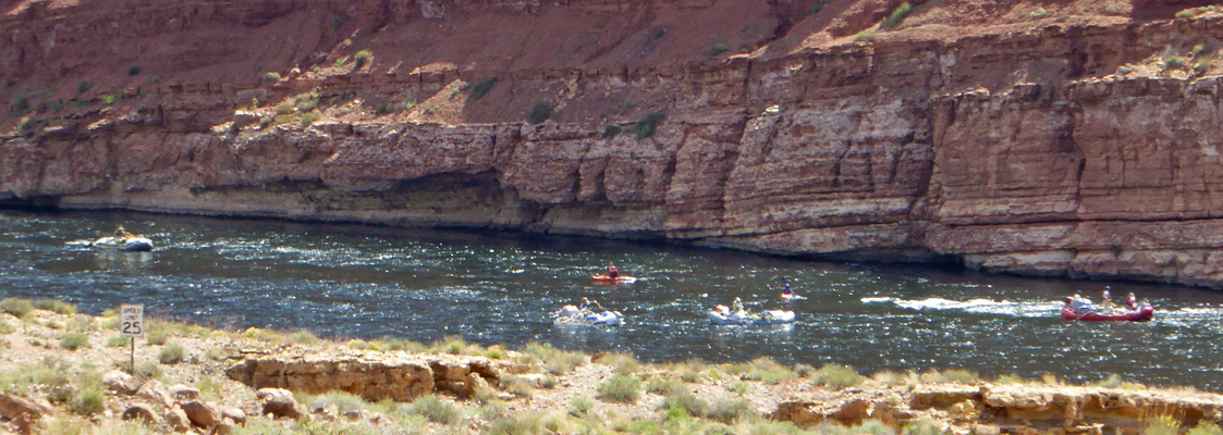
Just before we left another set of bigger rafts came past. The big gray pontoons help stabilize the bigger rafts for running the rapids.
The first stop on our outing for the day was down to the boat launch which is very near the original Lees Ferry. There was a crew getting ready to launch a supply raft for one of the commercial rafting trips. It takes a lot of food and gear to take care of a large group of people on the river for up to 18 days. Beyond this point there is not easy way into or out of the Grand Canyon for 200 miles—so please don’t forget your toothbrush.
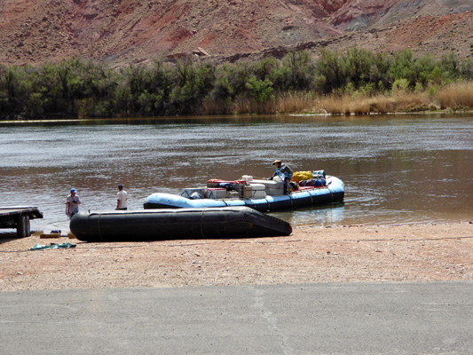
The park service limits the number of people who can go down the canyon each year. Private groups can wait up to 10 years for a permit. Close to 1000 trips—both private and commercial--with 22,000 people--go down the canyon each year between April and October and they ALL leave from here.
We had no idea when we picked Lees Ferry as a place to camp that this was where everyone started and we had no idea we would have this kind of entertainment either.
People take raft trips down the Colorado from Page to this point but they all have to get out of the river here.
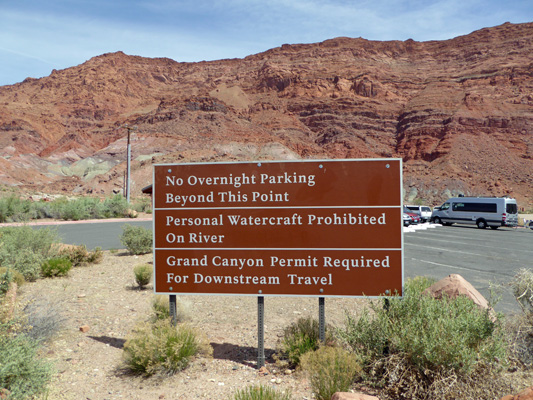
There’s a 14-day parking lot where people can leave their cars but many on commercial trips park elsewhere and take shuttle buses down to Lees Ferry so they don’t have to come all the way back here when they’re done.
From here you can hike to the historic Lees Ferry site just up river but we had other plans so we turned back towards Highway 89A. Along the road to Marble Canyon there are these really cool balancing rocks.
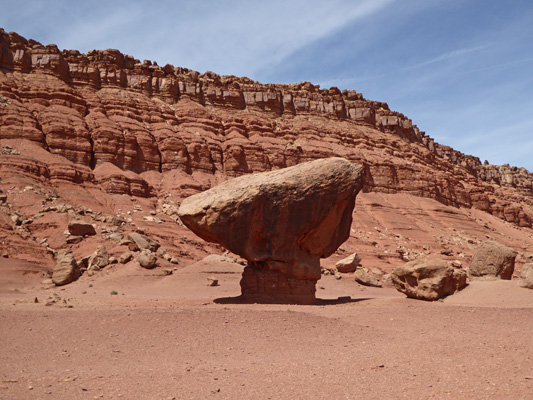
It turns out they are boulders that have fallen from the top of the ridge and then the surrounding sandstone they landed on has eroded away leaving them on a pedestal.
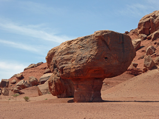
Eventually that will erode away too and the rock will fall again—just not as far this time.
A little ways further along the road you come to the trailhead for Cathedral Wash. You can go up wash into the Vermillion Cliffs National Monument. Or you can go down wash into Grand Canyon National Park (which is a narrow bit of land on each side of the river at this point).
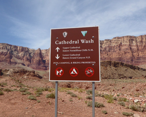
Up wash looks pretty amazing to me. But the trail description sounded like it would be a bit beyond our skill set with lots of scrambling over ledges and lots of very rocky ground.
Down wash wasn’t so challenging but it wasn’t as pretty either. Wandering around I found some more of that lovely purple stuff that I think is Hall's Milkvetch (Astragalus hallii) but might be Newberry's Milvetch (Astragalus newberryi).

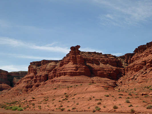
And Walter asked me to take a photo of these nifty hoodoos at the edge of the Cathedral area.
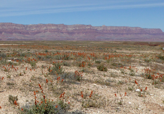
When we’d driven in the day before we’d noticed about 3 miles of orange flowers stretching along the road and off into the distance along Hwy 89A. This time we found a place to pull over and sure enough those orange flowers were Globemallow (Sphaeralcea ambigua).
I’ve never seen it putting on such a show before.
We followed Hwy 89A back to main Hwy 89 and then turned north to go UP the hill (to over 6,000 feet when we’d been down at about 3,400 at Lees Ferry) towards Page.
Just before you get to Page there’s a turn off to the west to Horseshoe Bend. We took it and found a parking spot in the lot even though there were folks parked out along the road leading in. We put on our boots and Walter got his hiking stick and we headed UP the hill towards the Colorado River.
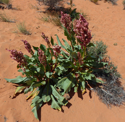
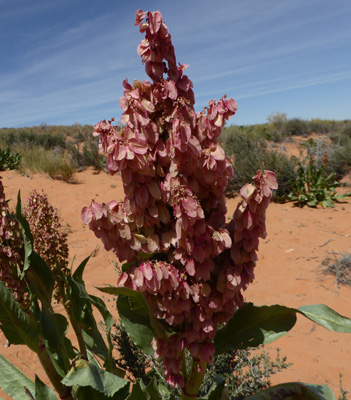
Along the way I stopped to photograph this wild dock also known as Wild Rhubarb (Rumex hymenosepalus).
Close up they’re really rather pretty.
And some notch-leaved phacelia (Phacelia crenulata) caught my eye too. It’s always nice to have a few flowers to have to stop and photograph when we’re hiking up hill.
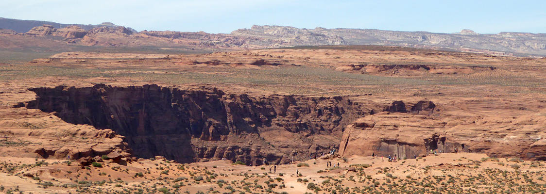
The trail hits a ridge and then you go DOWN towards an overlook that puts you 1,000 feet above the river as it makes a 270 degree bend around a mesa.

I took 20 shots to get this one near-perfect photo. To get the whole bend you have to stand on the edge of the canyon (which is 1,000 feet straight down) and there are no railings. The first spot I picked was right on center but even when I was at the very edge I couldn’t get all the water at the bottom of the photo in. So I scrambled back and up a ways and found another ledge and then took a series of shots from bottom to top to sew together to get this shot.
I have seen photos of Horseshoe Bend and figured it had to be out in the middle of nowhere. In fact, it is only a 3/4 mile hike from the highway. It’s sandy and steep in places but boy was it worth the trip. I might actually be willing to call myself a photographer now!
There were very nice benches along the steep trail and while they weren’t much use going down they were very welcome coming back up. And yes, the sand here really is that orange!
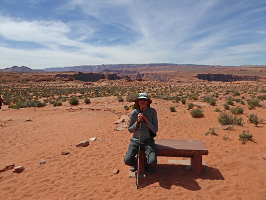
Here’s a shot of the rim from this bench. You can see all the people gathered along the edges trying to take photos—boy were there a lot of selfie sticks here.
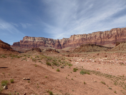
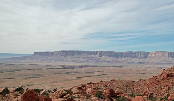
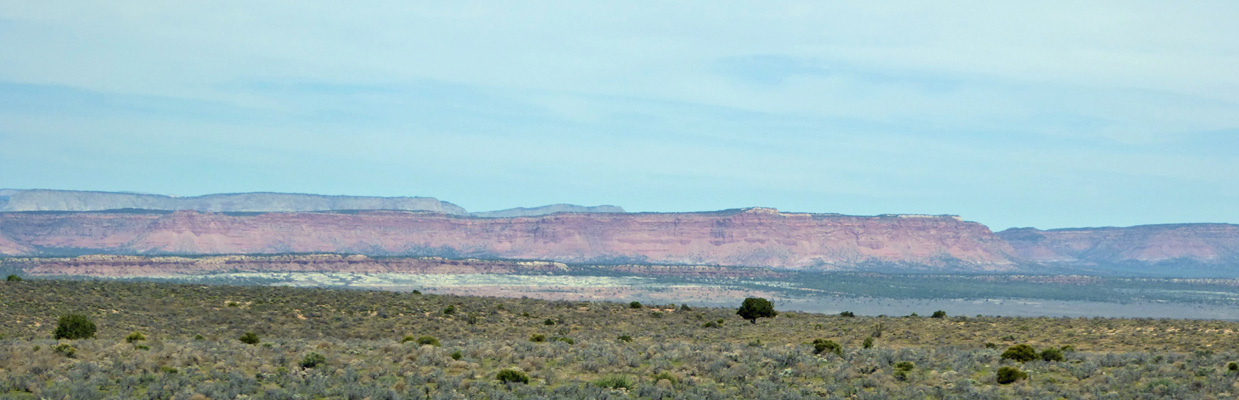
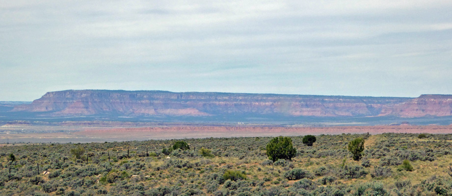
We went on into Page from here and got gas and stopped off at the Walmart across the street for a couple of things in the grocery section. And then we drove on back down the big grade towards Lees Ferry. We stopped at the overlook along the grade for our picnic lunch. Those are the Vermillion Cliffs off in the distance and the big gouge is the beginnings of the Grand Canyon.
After lunch we headed on back to Lees Ferry and drove along the River Road that connects the boat launch area to the day use area near the campground. I got out and played with taking photos of the river first looking east.
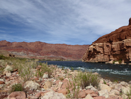
And then looking south.
That evening we had a group of rafters camping across from us who were taking off the next day at noon. They were excited and talking up a storm. And since it was nice out (it had been in the low 80’s) we went and sat out to enjoy the late afternoon light looking east.
I spied another beavertail cactus just loaded with blooms and had to scramble down into the wash to photograph it.
She really had lovely blooms.
Thursday April 7th, we packed up the trailer and headed west on Hwy 89A along the edge of the Vermillion Cliffs National Monument.
Once these cliffs end, you go UP into the mountains to nearly 8,000 feet, past the entry to the North Rim of the Grand Canyon (which doesn’t open until Mid May because of snow) and then you turn northward towards Freedonia.
And you begin to get views of the gorgeous formations that cover much of southern Utah.
I couldn’t resist the colorful rocks even if I had to shot the photos through the windshield.
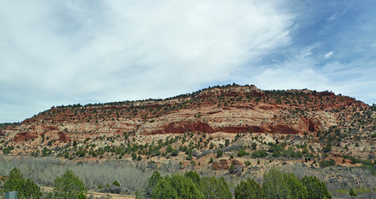
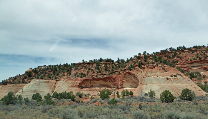
Eventually you head through the canyons and you get to see the rocks up close and personal.
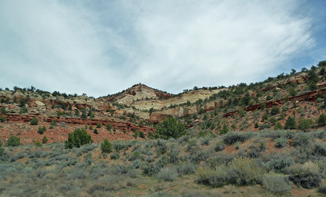
They come in all colors and shapes.
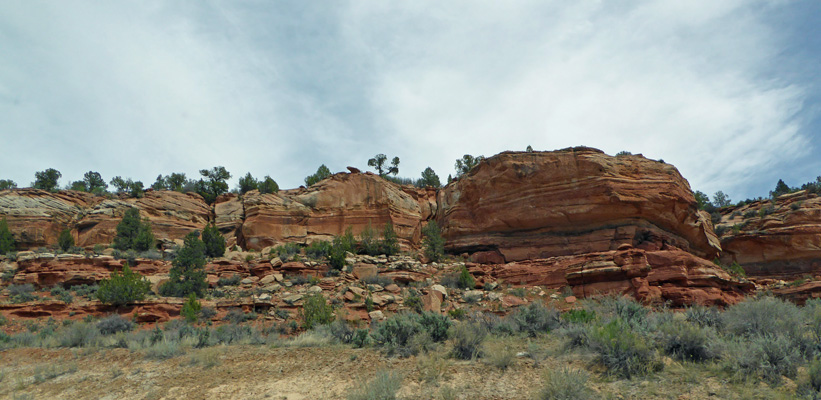
Orange gives way to pink.
And many have cool striations and ‘varnish’ which is caused by iron leaching down the face of the rocks.
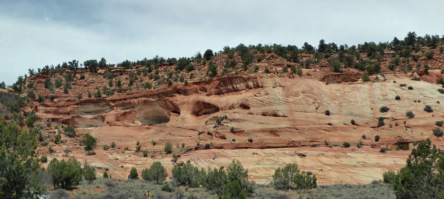
And of course there are cool caves too.
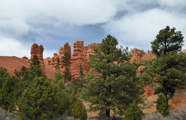
We passed by the turn off for Zion and followed the signs towards Bryce Canyon. Before you get to Bryce you go through a lovely area called Red Canyon. I turned off to let some traffic go by and grabbed this shot while I was at it.
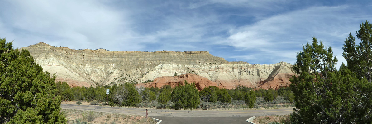
We drove on by the turn off to Bryce Canyon and headed further south along Scenic Highway 12 until we got to the turn off to Kodachrome Basin State Park. You drive 9 miles off the highway to reach the park and it’s worth it. We signed in and went to set up camp in our great full hook up pull through site.
Here’s the view out our back windows.
And here’s the view to the north from our picnic table.