
We’d thought that with the cold, folks might all leave pretty early. But the tenters instead availed themselves of the sunshine to get their tents and gear dry and others went off to the enjoy the sunshine that had been so rare earlier in the weekend.
By 12:30 we’d cleaned all but 6 sites but the folks in 5 of those sites weren’t even there—let alone packing up to leave. We took one more break and by just before 1 all but one had left. The last site was lollygagging so we gave up at 1:30 and had lunch and came back later to clean their site—which was good since they’d just left a little before 2.
We had enough sunshine for us to take our camp chairs out and sit in the sun for our breaks and it sure felt good to sit and soak up some rays. And we worked hard enough to earn a nap in the afternoon.
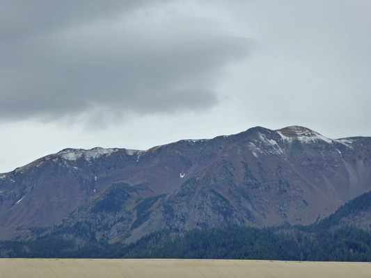
Tuesday, September 6th we had the day off. It was totally overcast and we had light rain off and on all day. It was a perfect day to dedicate to laundry, grocery shopping and errands. We packed up the laundry, the computers and the grocery list and headed into Joseph. One of the hosts had said that the Laundromat was on the east side of the street (maybe a side street) as you went into town. We drove up and down each side street and couldn’t find it anywhere. Finally we stopped at the City Hall and Walter went in to ask. While he was doing that I took this photo of snow on the upper reaches that had fallen on Sunday night (and still hadn’t melted yet two days later).
And of one of the 12 bronzes that are scattered up and down the main drag in town.
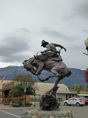
They do have a rodeo here mid-summer so this guy really does belong here.
The Laundromat turned out to be back on the south end of town on the east side of the main drag next to the car wash. It just doesn’t have a sign at all. The only way you can tell it’s a Laundromat is if you look in the windows and see the washers and dryers. We got a parking space right in front of it (score!) and got our clothes clean.
Then we headed west on Hwy 22 back to Enterprise to the Safeway grocery store. It’s not as big a Safeway as the one we always shopped in in Monroe, WA but it had everything we were looking for and it felt familiar—a real treat since so much of the time we’re shopping in strange new places that carry all sorts of things we didn’t know we needed but not things we’re looking for!
We foraged for lunch at the Safeway (their Deli is minimal so we probably won’t do that again) and then headed over to the Enterprise Library to use the Wi-Fi there. You have to pay $2 to get the password for the week (but we could share it between us) and they were having some problems so they had to reboot the router but it worked well after that. The place is an old Carnegie Library and it’s tiny. There was one wooden work table in the adult section and one very low round wooden table (with matching little chairs) in the kids section. The adult table was full of people so we sat at the kids table (where our knees didn’t fit under the table). We lasted long enough to read our email, check Facebook and deal with a couple of other things before we were both too stiff and uncomfortable to stand it any longer. All in all it was a very successful expedition and we were back at the trailer in time to loll around and read and take a nap the rest of the afternoon.
In the early evening, I got restless and went on over to the woodshed to visit with the hosts there. Some campers came by and said that there was a bear in a tree over in the A Loop! Just after that the rangers came by to say that they were telling everyone not to leave any food or trash out since there was a bear in the campground. Just as I was getting ready to go back to the trailer for my camera, Walter arrived with it saying that there was clearly something going on over in the A Loop because of all the folks with cameras.
So I went off and sure enough, there was an adolescent black bear about 15 to 20 feet up a tree. He/she had started down on the ground but when the excited campers started heading it’s way, it made a bear-line up the tree.
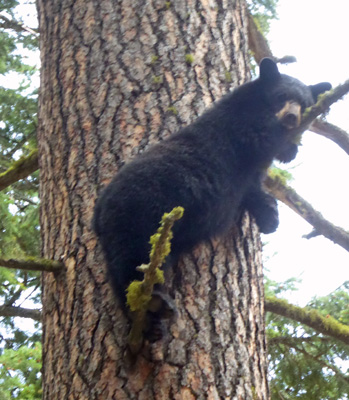
Sometimes it would stand on one foot and then the other. And then it changed position so I had to go around the tree and get another shot.
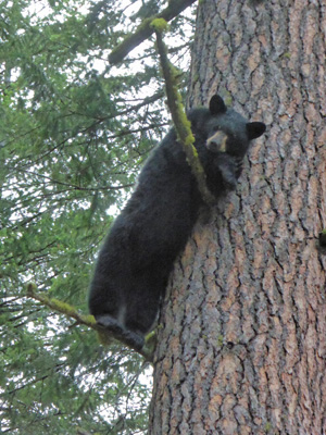
For those of you who might be concerned, these photos were taken with a telephoto lens. I wasn’t close to the bear’s tree at all. We were all keeping a goodly distance away. The kids wanted to know where his mother was. And I was pretty darned sure that this bear was too big to be hanging out with his mom and had been kicked out on it’s own. Black bears don’t get that big generally and while this bear might not be full grown she was not a cub.
Having handled the wildlife sighting for the day (we spy deer regularly but they tend to be pretty far way from our site or in town where we can’t stop to photograph them) we settled down for a nice visit with the wood hosts (who we work with cleaning sites on Thursday and Friday). Here at Wallowa Lake they sell wood by the cart—$5 for a good sized cart-full. And the hosts have to refill the carts when the campers return them after unloading their purchases.
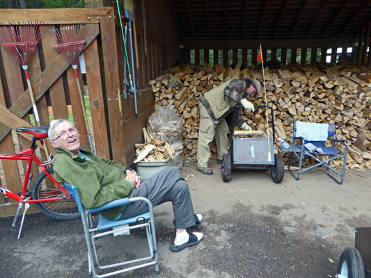
For a while it was real slow and then a pickup truck came and bought 4 carts-worth and a couple of other folks bought a cart each and presto the hosts had work to do. Otherwise they sit and read or visit with other hosts or campers. The hard part is that the temperature starts to drop into the low 50’s by 5:30 or so and it gets cold just sitting around. Long about 6:30 we were cold so we headed back to the trailer for dinner.
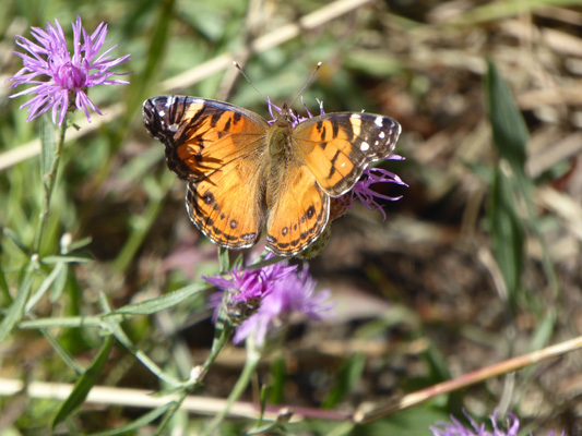
Wednesday September 7th, we slept in and Walter made waffles (Walter’s Wonderful Sweet Potato Waffles). The sky was blue, the sun was out and life was good. We waited a while until the temperature was well into the high 50’s and then headed out the road (just south of the campground) to the Wallowa Lake trailhead with trails leading into the Eagle Cap Wilderness. We found a place to park (which can be a challenge on the weekends but was no problem now that it was after Labor Day) and put on our boots and Walter got his stick. As we started out I noticed a bit of knapweed in bloom in the ditch and a wonderful orange butterfly feeding on it.
The area is a little confusing but the trailhead itself is on the east side of the road up a little rise to the left of the hydroelectric plant that sits at the end of the road (right at the boundary of the wilderness, of course). We filled out our free Wilderness Permit form and headed up the West Fork Wallowa River Trail towards the Chief Joseph Trail which peels off to the right in about .3 of a mile. The first mile or so of this trail is well maintained and very popular (especially on the weekends). It basically ends at BC Falls where there used to be a bridge to go across BC Creek. However, the bridge is no more and it’s not recommended that you cross the creek and so it appears that the trail ends. However, you can pick up the rest of the Chief Joseph Trail (which is no longer maintained) in Wallowa Lake State Park and follow the switchbacks UP the side of Chief Joseph Mountain. Mountain climbing was not on our list, so we took the trail starting at the trailhead and headed up towards the falls.
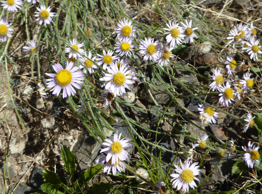
While we were still out in the sun (behind the hydro plant) I spied a patch of little tiny asters—each one smaller than my index fingernail.
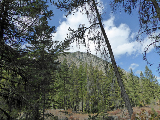
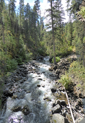
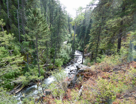
The trail turns west and heads out into the woods. Along the way you get glimpses of the West Fork of the Wallowa River and the surrounding mountains.
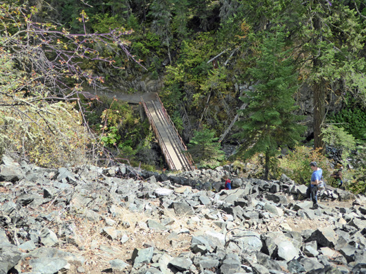
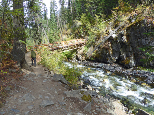
Then the West Fork Wallowa River Trail goes off to the left and UP the hill while the Chief Joseph Trail goes right to the north. After a while you come to this lovely bridge across the West Fork of the Wallowa.
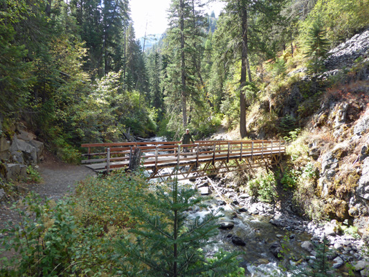
Notice the talus slop up in the upper right of the picture. We’ll be heading up that by means of a series of switchbacks after we cross the bridge. But who is that on the bridge? Could it be Walter?
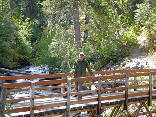
You know, I think it is.
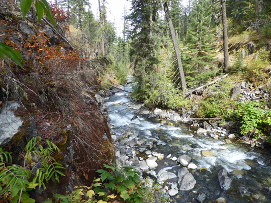
From the bridge itself you get a great view down river.
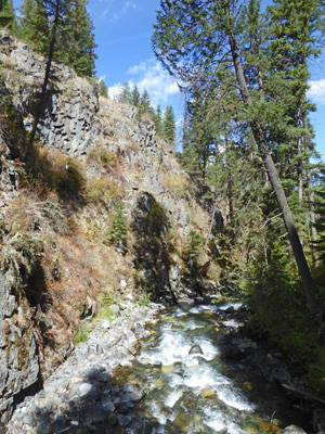
And up river.
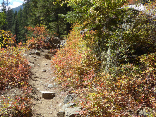
We followed the trail up the switchbacks and through a splendid patch of huckleberries that had turned color with the recent cold nights and sunny days.
Part way up the switchbacks you get a view of the bridge below.
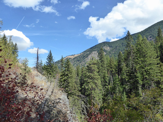
Once up this slope we headed northward again and got views now and then to the mountains across the valley.
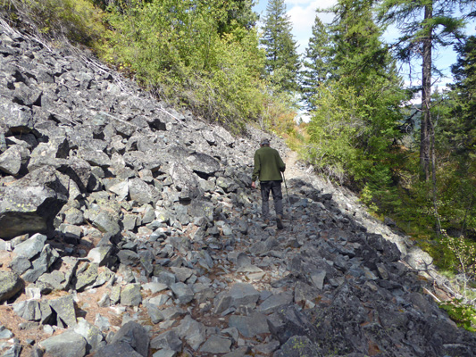
You then come to a series of 3 talus slopes that you have to cross. There are trails beaten into the loose rock so it’s pretty stable walking but there are lots of sharp rocks pointing up waiting to trip you, so you really have to pay attention. Later, Walter stated that he’d rather not have had to cross these. And since we both tripped more than once, I totally understand what he means.
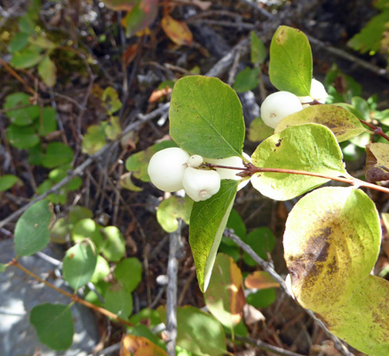
There were lots of large snow berries growing along the trail past the talus slopes.
And then we came to a nice open area that would have made a pretty good camp site though it didn’t look like it had ever been used for that. We found a log to sit on for a while and watched the gondolas of the Howard Mountain Tram head up to the top of the mountain across the valley. The tram was put in years ago for a ski resort that never happened. It now provides tourists with an expensive ride ($32 per person, $28 for seniors) to the top of Howard Mountain where you can see out across the valley and Wallowa Lake. I scrambled out onto a nearby point and took a picture of the lake. That ridge on the far side of the lake is a glacial moraine that helps form the lake.
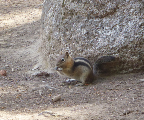
A little golden mantled ground squirrel came to beg and when we were not forthcoming he went across the way and posed for me instead.
We continued on just a little ways from here to BC Falls. The trail down to the bottom of the falls was really steep and slippery looking and Walter decided to take a pass. So I borrowed his hiking stick to help in my descent to get my photos.
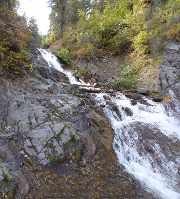
From the bottom, I carefully climbed up the rocks on the left (avoiding anything that was wet since it was all covered with slimy brown algae) to take another shot of the falls from higher up.
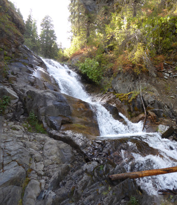
And then I took a shot of the cascade as BC creek makes its way down to Wallowa Lake.
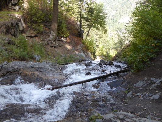
There is absolutely no evidence of any bridge left here and looking at the water rushing by and realizing that all the rocks are really really slippery you can understand why they don’t recommend trying to cross here. In fact, there were a father and son who arrived at the falls just as I was taking this photo and the father took one step onto a wet rock and down he went head first. He wasn’t hurt but it sure tells you how careful you need to be here.
Needless to say we turned around and made our way back down the trail from here. As always, it was way faster going down than coming up. It’s supposed to be 2.6 miles round trip and it took us nearly 2 1/2 hours (with a number of very enjoyable rest stops to enjoy the views) but only 45 minutes of that was going back down.
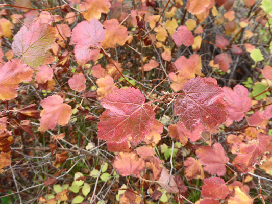
Along the way back, we passed several lovely patches of ninebark that had turned burgundy red.
And I got this nice shot of the West Fork of the Wallowa as we were coming down the switchbacks in the talus slope.
The approach to the bridge on this side is fairly pretty too.
And the view down the West Fork at this side of the bridge gives you a bit of view around the curve of the river that is nice.
This was a very satisfactory hike. We saw 3 or 4 sets of other hikers on it and many more heading up and down the West Fork Wallowa River Trail which takes you way up into the Eagle Cap Wilderness with it’s 9,000 foot peaks. But it most certainly wasn’t crowded.
Thursday September 8th, it was back to work again. The first order of the day was that we got to put up the flags. It was a little exciting at one point when I was struggling to get them untangled a bit and they started to come back down but in the end we were successful. It made me feel like a Boy Scout! There were 38 sites on our list for the day, so we split the list with our working partners and dilly dallied through the morning, digging out fire pits and answering questions of campers as we went. It was sunny and glorious again so we sat outside during our breaks (waiting for folks to pack up and leave) and in the process began to answer questions of the many folks who were struggling with the self registration station that is right next to our rig. Five of our last six sites for the day had re-upped (and we didn’t know it) and weren’t going anywhere so we ended up only cleaning about 12 sites—big deal.
After lunch, I made one more tour of the campground to see if any of our folks had left (they hadn’t) and put the cart away while Walter put our chairs out next to the self registration station where we happily manned it for the afternoon. At about 4:30, the ranger came and opened the registration booth and we headed in.
Answering questions and visiting with campers was great fun especially after our month at Harris Beach where we had little or no camper contact. This job is turning out to be lots of fun. It’s a nice mix of low key camper contact, a bit of physical work, no stress, good fellow hosts and great staff.
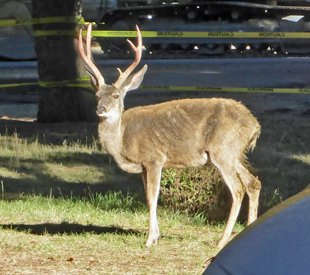
Friday morning while we were eating breakfast we looked out our windows to see a big 3 point buck heading through the woods parallel to the road. I got out the camera and walked along the road shooting photos. In the end, I got a winner as he posed in the sun behind a tent and in front of the caution tape for the construction site in the B Loop—you can’t see all his 3 points on each side but he really did have three full point in addition to the eye guards.
There were three couples on camp duty on Friday and only 42 sites to clean. So one couple went off to try to do some blowing in the Day Use Area and we got 21 sites to clean. It was cold to start (it had been down to 39 that morning) but it slowly warmed up. It really doesn’t feel as cold here as it did at Harris Beach where it was often foggy and misting with a bit of a breeze. Here it’s sunny and cold with no wind and so it’s been fine to be out working even when it’s well below 50. We worked our way through our list, taking breaks sitting out in the sun. There weren’t any where near as many folks struggling with the self registration center on Friday and so we only answered a few questions in the process.
We had a few slow folks again (and two sites that had re-upped without us knowing it) so we had lunch and then one more tour to pick up the folks who waited until 1 to leave. Once we were finished we both took a little nap and then headed into town to do a bit of work on the internet. But first I had to stop and try to photograph the kokanee that are starting to spawn in the Wallowa River here in the park. Kokanee are landlocked salmon who turn bright red when they leave the lake to come up stream to spawn.
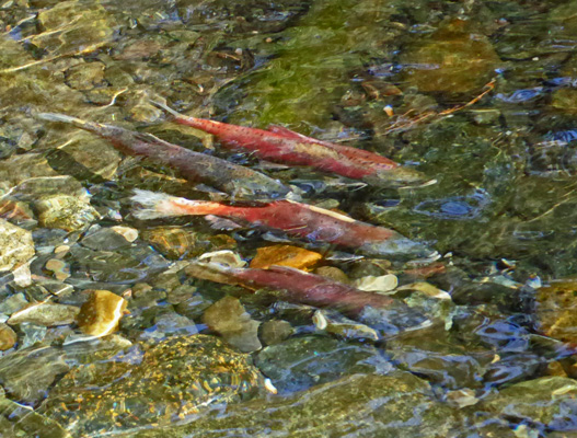
This guy was right on top of a big boulder which made it easier to get a decent shot of him.
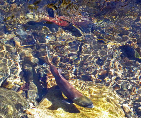
None of them were digging in the gravel ready to lay eggs but there were about 20 of then on the down river side of the bridge and another 5 or so on the other side of the bridge.
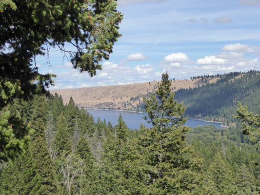
Then we drove on towards Joseph and stopped at the Day Use Area on the north end of the lake to get a shot of the lake and the Wallowas in the gorgeous sunshine. The Eagle Cap Wilderness encompasses most of the mountains south and west of the lake.
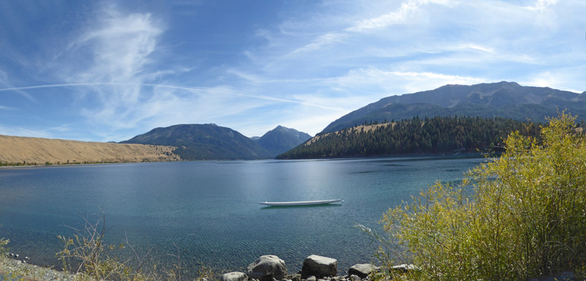
What looks like large embankments on the east and west side of the lake are actually lateral and terminal glacial moraines left by Ice Age Glaciers. During the Ice Age the Wallowas had 9 major glaciers each over ten miles long that carved the valleys here.
I believe that the big peak at the center of this photo is Bonneville Mountain.
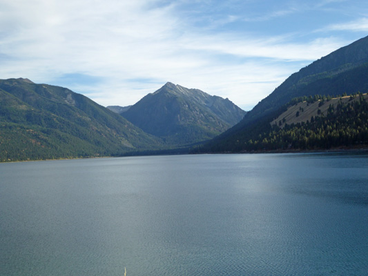
Chief Joseph Mountain rises to 9600 feet over on the right. The Wallowas contain 17 mountains over 9000 feet.
We headed back to Enterprise to go to the library only to discover that it’s not open on Friday (or Saturday or Sunday). But the internet signal was still available so we sat in the truck and did what we needed to do even though it’s not all that comfortable. Clearly internet access has continued to be a challenge but we seem to be coping okay.
During dinner that evening, a long awaited event finally happened: I lost my last baby tooth. Huh? Yes, indeed I have managed to hang on to one of my baby teeth for nearly 60 years longer that it was supposed to stay in my head. It finally started to get really loose this summer and the last few days was hanging by a thread. I’ve known it was going to happen and have an appointment with my dentist to deal with the new hole in my head come November but it’s still a little strange... Will the tooth fairy find me 60 years too late? It’s such a dinky little tooth I’m not sure it’s worth her trouble to make the trip.
Saturday September 10th was another beautiful sunny day. It was cold in the morning so we bundled up as usual. I even put on a turtleneck shirt for the first time in several years. There were 57 sites empting out so we even had 28 sites to clean—whoo hoo. And a lot of them left fairly early so we were down to just a five when we broke for lunch a little after noon. By mid morning I was stripping off my fleece and by 11 we stopped and I even took off my turtle neck and put on a tee shirt. After lunch, we both took off our long johns before we did our final rounds because we were hot. Once again, 3 sites had extended their stays so we really only had 25 sites to clean. By the time we put our cart away it was nearly 80 degrees! Summer. We sat in the sun for a while until we were actually hot and then moved to the shade. We took the rest of the afternoon off and I began the first little bit of planning for our big trip next year all the way to the Canadian Maritimes and back.
Sunday September 11th we had high clouds off to the east that eventually cleared off but our high for the day was only in the high 60’s. There were 102 sites vacating! And we only had 2 sets of hosts on so we each got 51 sites to clean—the most work we’ve done since before we left Harris Beach. Folks left in a steady stream so we worked until 11 before taking a break. Then we managed to get all but the last 4 sites done before about quarter to one. Those sites of course still had people in them. So we stopped and had lunch—this works really well for us since it takes care of us being tired and hungry and gives the folks who like to lollygag time to get out. Our last site emptied out just after 1:30 and of course the fire pit was a mess so it took time to clean—this is a cosmic law.
We came back and took a well earned nap and then had a restful afternoon and evening.