
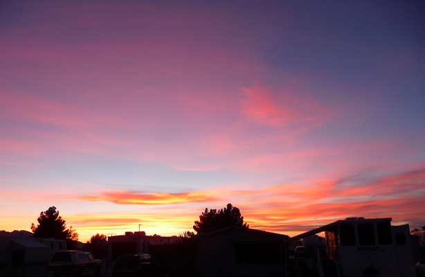
Followed by a really outstanding sunset to north
And to the west
Monday March 21st, we headed southeast, through the southern edge of Las Vegas and out to Callville Bay Campground in the Lake Mead National Recreation Area. We’d camped here in December 2014 when it was nearly empty and we were sure that it being Spring Break AND the week before Easter that it would be nearly full. Wrong! It was only about a quarter full when we arrived in the early afternoon. And from the looks of things it hadn’t been full over the weekend either. Most of the folks who came though over the next few days only stayed one night so even when it was 1/2 full it was only so for the night. Then they all moved on.
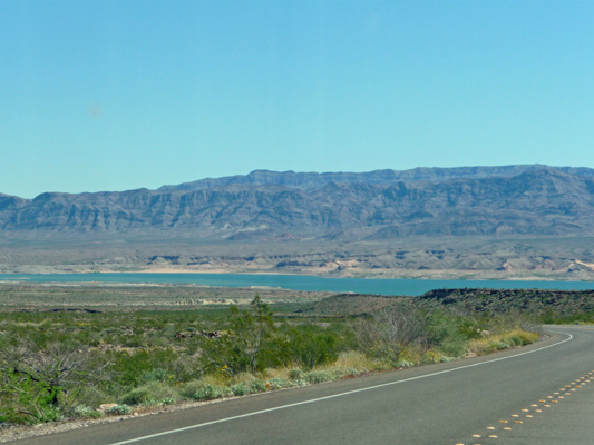
Lake Mead is way down (even though we learned that it had risen 50 feet since February) from it’s historic highs and many of the popular areas on the north shore of the lake aren’t even open any more because the lake has receded so much—it’s miles from the boat ramps and campgrounds to the water. While the boat ramp at Callville Bay is still open and functional clearly it’s not the popular place it once was, which is just fine with us. Of course, they’ve doubled the camping rates here since last we were there so that might have had an effect too. It now costs $20 a night to camp here without any hookups. Since it’s a federal facility our Senior Access Pass gets us a 50% discount so now it costs $10 a night rather than $5 but hey, that doesn’t break the bank.
We got a nice spot that was easy to back into and set up camp. It was warmer than we’d expected (even with partly cloudy skies) so we opened all the windows and let the wind blow through. Late in the afternoon we took a little stroll through a portion of the campground that was closed off (just as it was last time). There are two whole loops here that clearly they haven’t used for a long time. One even has a few spots with a view of the lake!
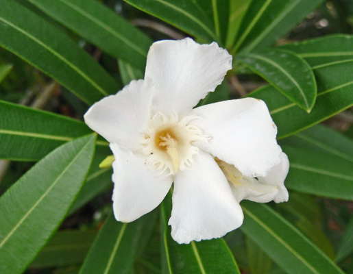
The Oleanders were in bloom. Most of them are white.
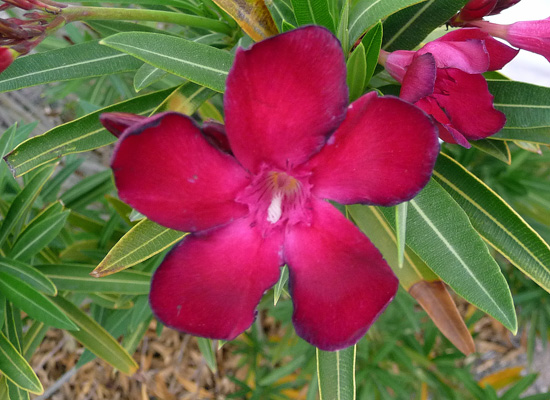
But here and there you can find a red one.
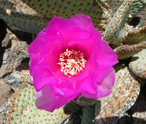
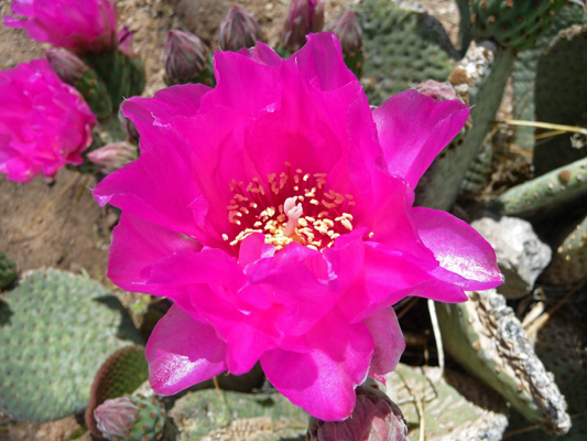
Or a fancy pink one
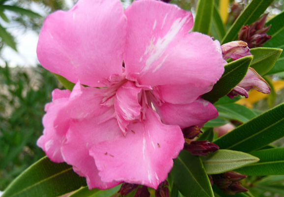
These hardy shrubs stand up to the drought and the heat of the desert remarkably well. They were blooming up a storm even in the campground loops where clearly the irrigation hasn’t worked in years.
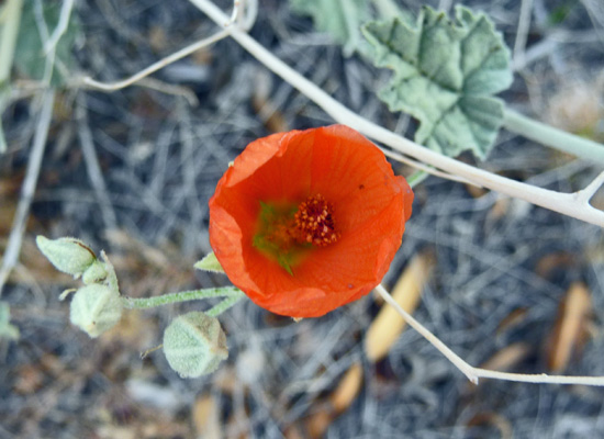
Here and there along the way there were Globe mallow (Sphaeralcea ambigua) in bloom.
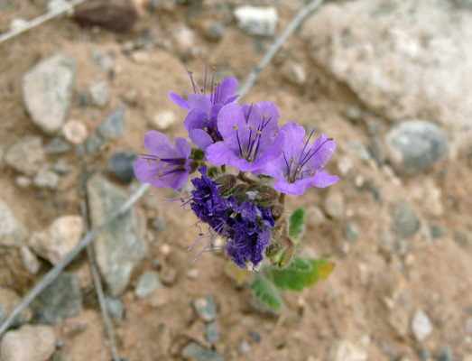
And a few phacelia (I’m not sure which one but it looks like Notch-leaf Phacelia (Phacelia-crenulata) to me).
The Brittlebush was gorgeous and full of blooms.
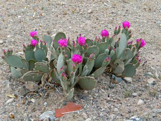
And the beavertail cactus up on the hillside opposite our campsite were full of blooms.
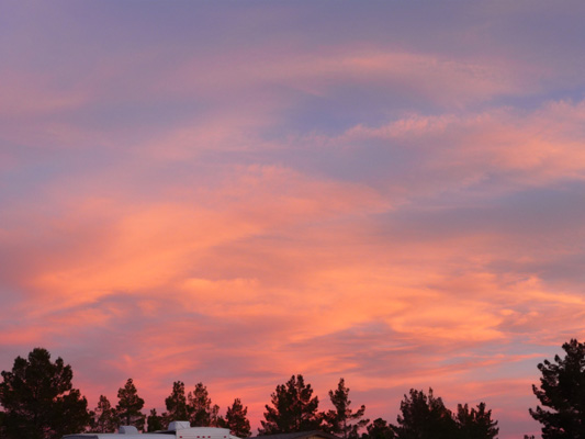
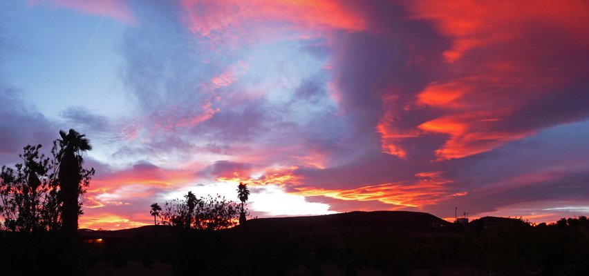
That evening we had just the right mix of clouds and dust in the air (it was getting windy) to make a fantastic sunset first to the south opposite our campsite.
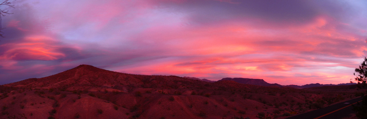
And then to the west.
The wind came up in the night and really blew hard rattling all of our vents and generally making for a noisy night of it. But it blew most of the clouds out (though we had a few more later in the day) and made for a much cooler day when we got up on Tuesday. We packed a lunch and headed south to find the White Owl Canyon hike that Walter had found on-line (we had decent cell signal here so our hot spot worked).
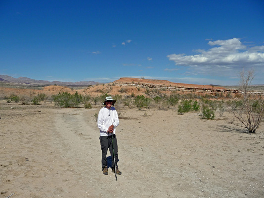
We drove back along Northshore Drive and then down Lakeshore Drive to the scenic overlooks along what used to be Las Vegas Bay and is now merely Las Vegas Wash. Following the instructions from on-line, we ended up at one of these overlooks and Walter got out to reconnoiter while I changed into my boots. There were no signs up indicating the trailhead but sure enough over on the north edge of the parking area there was a trail that went straight down the cliff down into the wash.
Walter grabbed his stick (silly me I didn’t take mine but I made it down okay) and off we went down a sandy steep trail. When we got to the bottom you could see a double track trail stretching off towards the north.
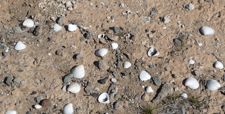
It was an easy trail to follow and not so sandy that it was a big workout on the calves. Clearly this had been lake bottom at some time because there were lots of shells in the sand.
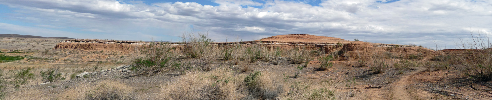
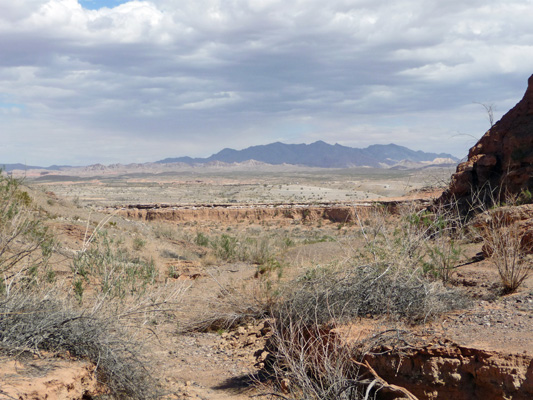
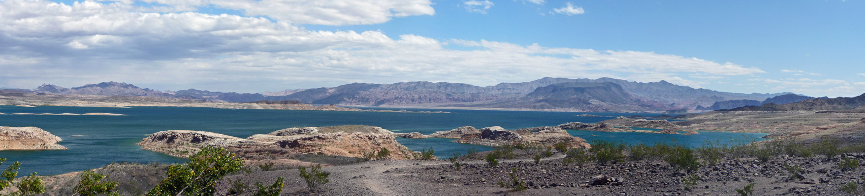
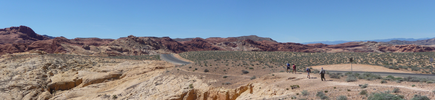
We went over hill and dale for a while until the trail started to turn up canyon. I took this panorama shot looking out at what used to be the Las Vegas Bay but which has returned again to desert.
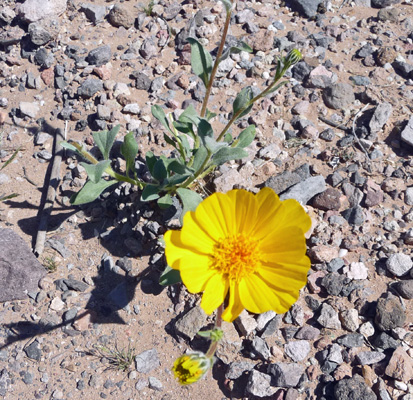
As we started up the canyon flowers stated to show up. There were a few Desert Gold (Geraea canescens), the same flower that had carpeted the floor of Death Valley.
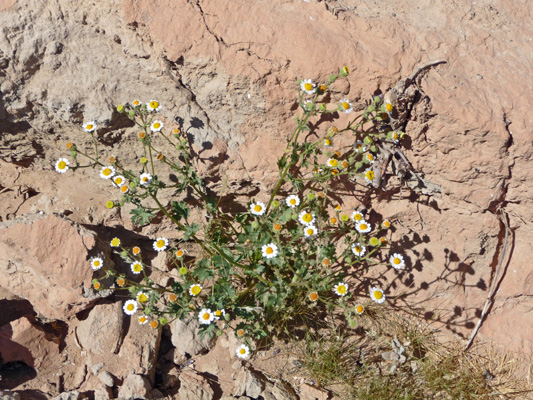
And here and there we saw some Rockdaisy (Perityle emoryi) which remind me a lot of chamomile.
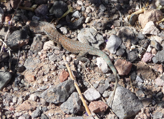
We saw a couple of Great Basin Whiptails and this one sat motionless for a long time pretending to not be there.
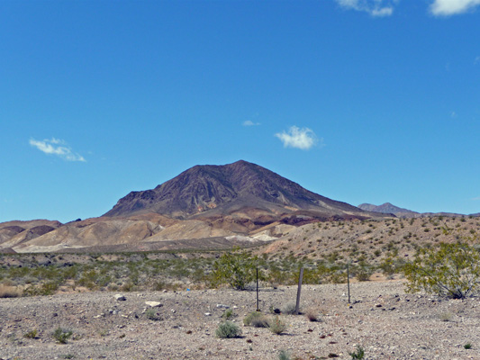
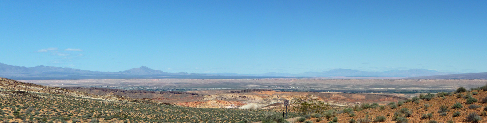
As the canyon narrowed I turned again to take another shot of the desert and the mountains in the distance.
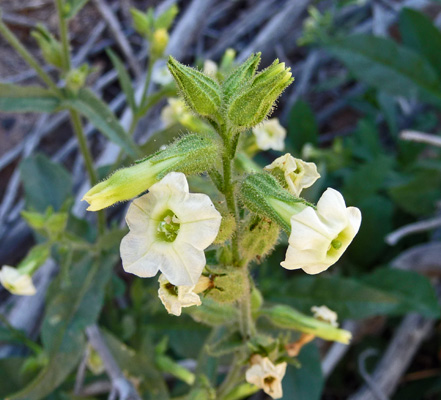
Along the canyon wall I spied some Desert Tobacco (Nicotiana obtusifolia).
And then wonders of wonders there were some really tall (over 3 feet) prickly bushes in bloom that sure looked like Rock Nettle (Eucnide urens) to me. Later when I talked to a ranger about this plant she described the stickers on the leaves as being like velcro. I suspect if you get them on your pant legs they hold on for dear life. When we were in Death Valley they were saying that the rock nettle was just coming into bloom in Titus Canyon and I decided not to drive all they way up there to try to find one little flower. So I was thrilled to find it here when I wasn’t looking for it.
In a few days this plant will be white with flowers since it was covered with buds. But I was thrilled with the 10 or so blooms I saw as we hiked.
The Cheesebush (Hymenoclea salsola) also known as Burro Bush was in bloom too.
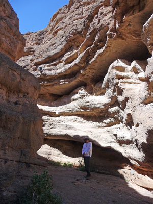
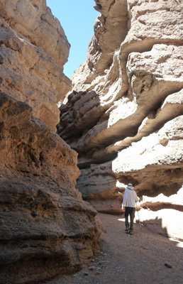
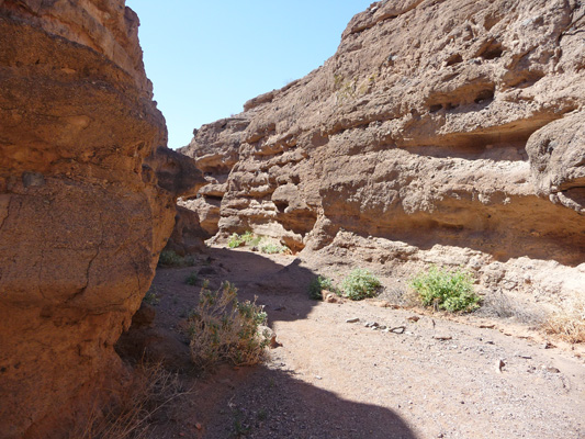
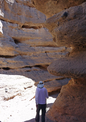
The canyon really starts to narrow after a bit.
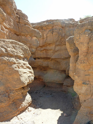
And eventually becomes a true slot canyon.
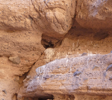
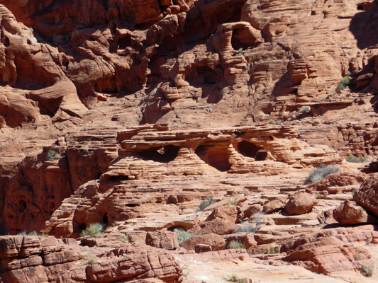
There are all sorts of little holes and nooks in the canyon walls where birds roost. The canyon gets its name from the owls who roost and nest here leaving white guano painting the wall under their roosts. We saw lots of these and stopped and looked for owl pellets (the little ‘hair balls’ that the owls regurgitate to get rid of indigestibles like bones and fur) but we didn’t find any.
The canyon walls towered over us for a while as we hiked steadily up hill.
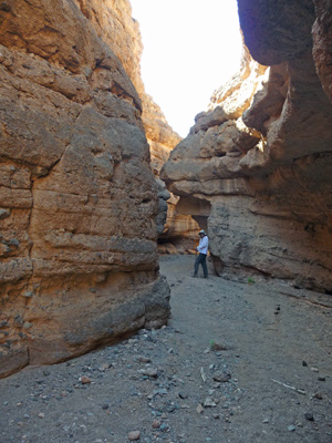
It never got super narrow but it was a very satisfactory slot canyon nevertheless.
After a while the canyon started to widen a bit.
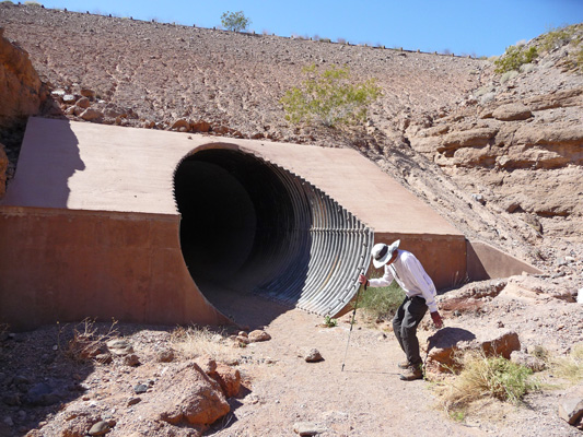
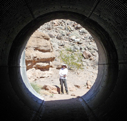
And we came to a culvert that goes under Lakeshore Drive. Walter of course found a nice place to sit here.
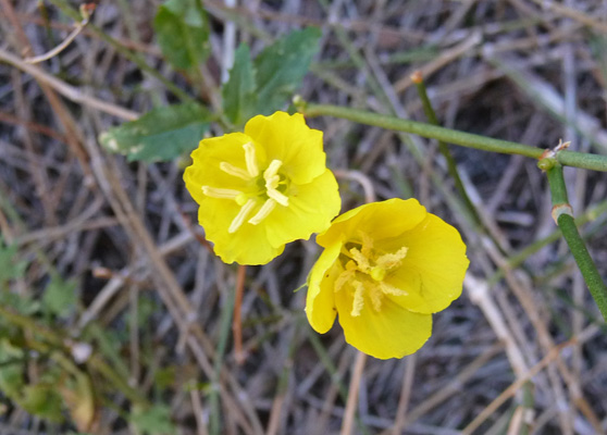
And I hiked up the culvert to see if the canyon got more interesting or not. What I found were Golden Evening Primroses (Camissonia brevipes).
And a somewhat wider canyon than before (with not very high sides).
I hiked back through the culvert and managed to get the camera to actually focus on Walter out there in the sunshine.
We decided we didn’t need to hike the little bit further (to yet another pair of culverts) and turned around here and headed back down the fun part of the slot.
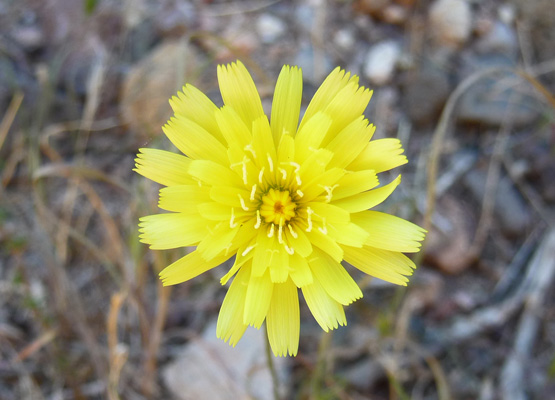
There were a few Desert Dandelions (Malacothrix glabrata) in bloom along the way.
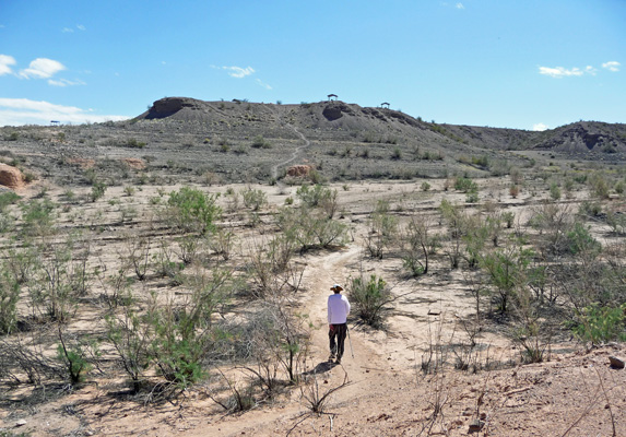
Hiking back went quickly since most of it was down hill. And when we came to the last wash crossing before the big UP I stopped to take a shot of the trail. Funny it doesn’t look as steep here as it is in person...We’re headed for those funny little picnic structures up at the top of the mesa.
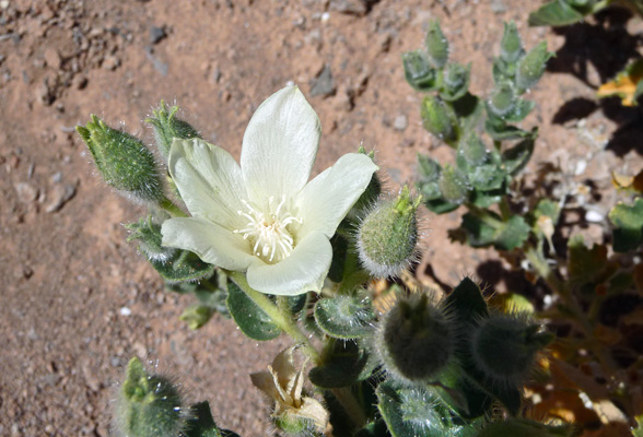
As we left the parking lot after our hike, I spied an accessible beavertail cactus in bloom, stopped the truck and ran across the road to take a photo. Isn’t she lovely?
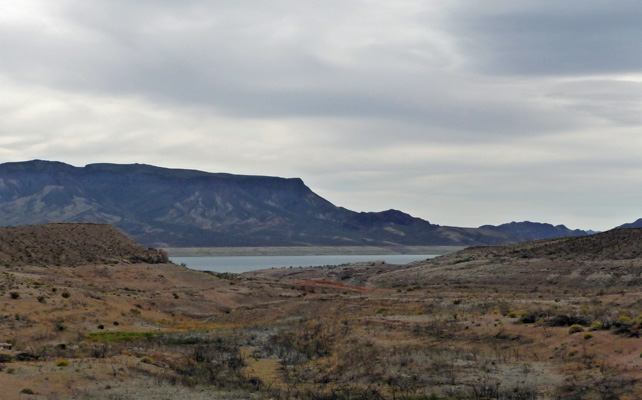
We drove south towards the Lake Mead National Recreation Area Visitors Center and stopped at the Sunrise Overlook where we could get a nice view of the lake.
In the distance you can see where the ‘bathtub ring’ ends and the black rocks begin. The lake is still many many feet down from its historical maximum.
At the Visitors Center we watched a very nice movie (the best one I’ve seen outside of one of the major National Parks) and I stopped to talk with the rangers about flower ID. They confirmed my Rock Nettle ID (I showed them shots on my camera and one of the rangers showed hers from her phone and we concurred that they were one and the same even though it had only been a week since she took hers and there weren’t any flowers yet).
They had a lovely double beavertail cactus in bloom in the garden outside their front door.
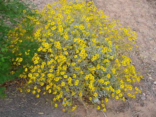
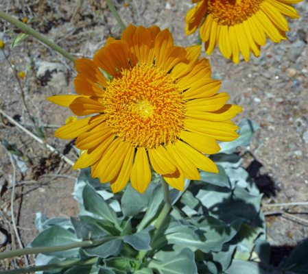
On the way back I noticed a lot of these big sunflower-like daisies along the road. They have big thick stems like a Gerber Daisy and a nice rosette of lovely silver green leaves. Of course I was driving so it took a while until I found a turn out where I could take a photo. Once I could get on-line later, I found out they were Silverleaf Sunrays (Enceliopsis argophylla) a very nice plant indeed.
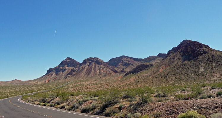
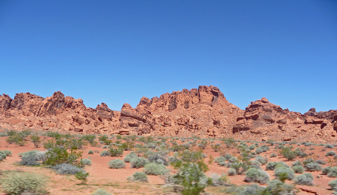
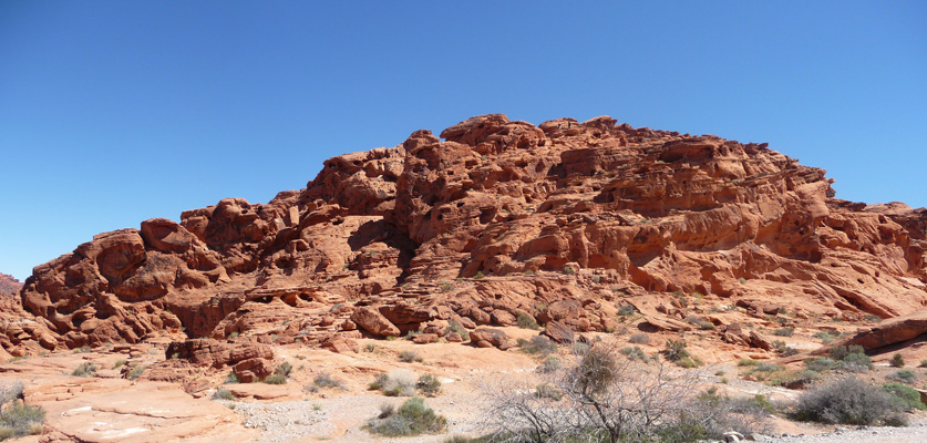
The mountains along the Northshore Road are pretty interesting looking so I stopped to get a shot of one of them too.
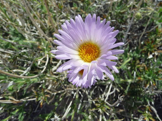
And just as we turned on to the road that goes down to Callville Bay I spied a large clump of Desert Aster (Xylorhiza tortifolia) and a place to park too!
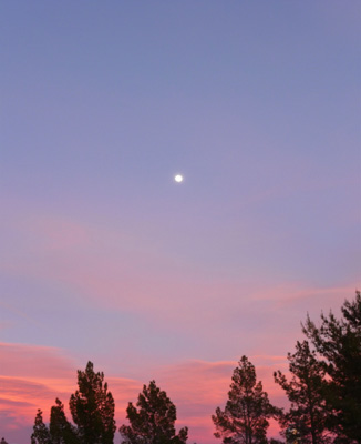
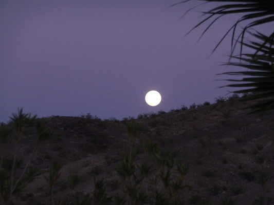
That night I caught the just shy of full moon (it was due to be full during the day the next day) as it rose over the hills.
Wednesday morning March 23rd, we decided we’d take a drive eastward along the Northshore Road out to the Valley of Fire State Park. It was sunny and clear as we headed out past the area they call Bowl of Fire.
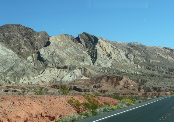
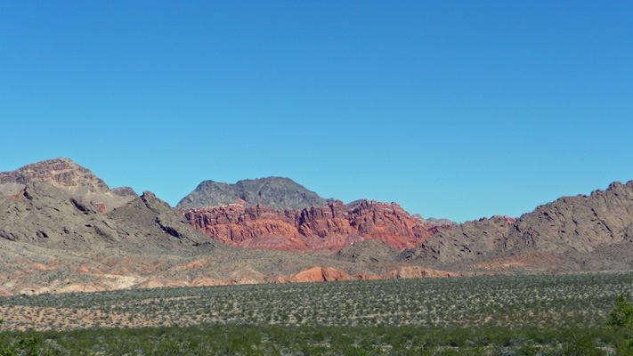
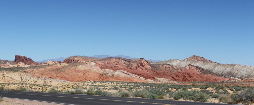
I love the contours of the hills and mountains through here with the red rock just starting to show along the roadside.
It’s not long before you can see the Bowl of Fire displaying its red beauty.
And to the south of the road you get interesting view of the Black Mountains.
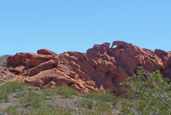
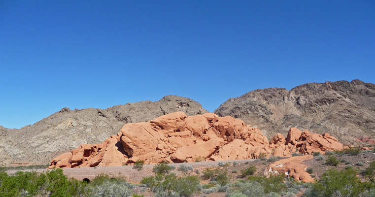
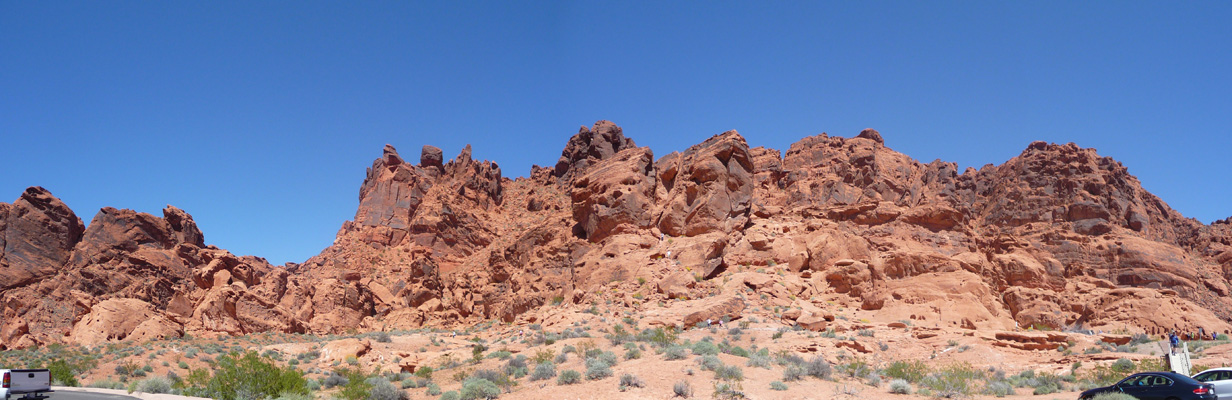
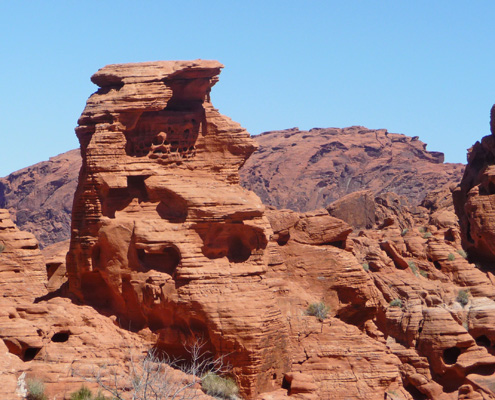
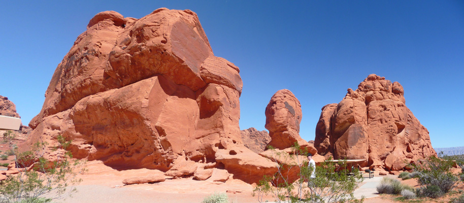
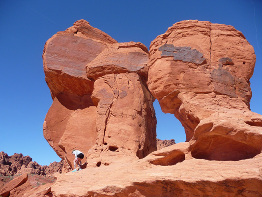
Not long after that you come to the area called Redstone which is full of cool red formations full of holes. Geologists say that they are petrified sand dunes. I just love the idea of petrified sand dunes!
We hiked here last time we were here but we just stopped for a few photos this time.
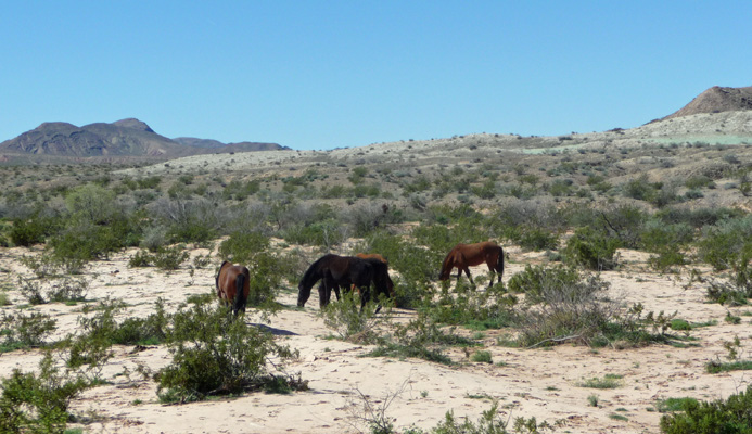
The road follows fairly closely to the boundary of the park just past here but we were still surprised to see horses grazing by the road. In fact, I got Walter to turn around so we could go back and take photos of them. They sure don’t look like wild horses to me. My guess is that they’d wandered off of some private land just to the north of here but who knows?
Not far from the turn off to go to Valley of Fire State Park we got a glimpse of the lake—this is the first view of the lake you get from Northshore Road these days—after nearly 40 miles of driving.
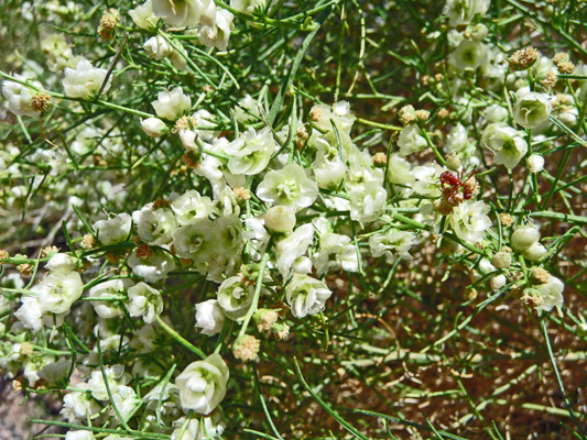
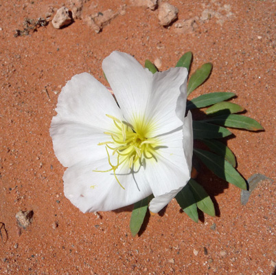
As we entered the Valley of Fire State Park, I spied some more of the little white flowers I’d seen the day before along Northshore out by Callville Bay (with no place to park to photograph them). Walter pulled over and I climbed out and wandered around taking photos. They turned out to be Dune Primrose (Oenothera deltoides).
We stopped and paid our entry fee in a VERY FULL parking lot (it’s the trailhead for a hike to Elephant Rock too but still...). We’d thought that it would be fun to camp here if it weren’t full. Ha! They had signs up about alternate places to camp 10 and 15 miles away. And when we asked at the Visitors Center later, I was told that the few spaces that open up each day are grabbed within minutes by people who come and wait. Needless to say, we discarded that idea. Maybe another time.
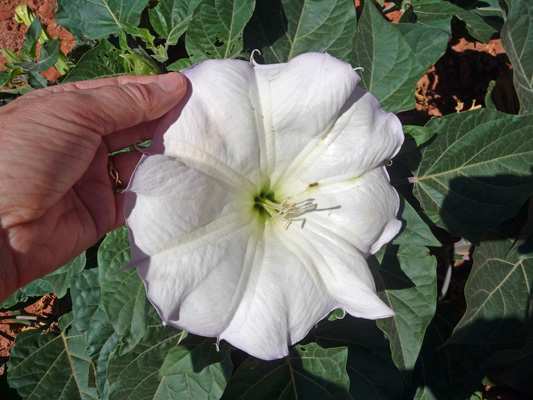
Along the road I spied this HUGE Jimsom Weed (Datura wrightii) plant in bloom. Yes, that flower is bigger than my hand.
We drove north through the park and the views from the car were worth capturing as we went.
We stopped at the Visitors Center where the parking lot was nearly full and the lower rocks were crawling with kids.
When were were here in December 2014 there were hardly any people but now it was Spring Break and this is a very popular with tourists from Las Vegas and locals too. We took the drive out White Domes Road and found the parking lot and the picnic lot across the road at Mouse’s Tank full (last time there were about 3 cars in them).
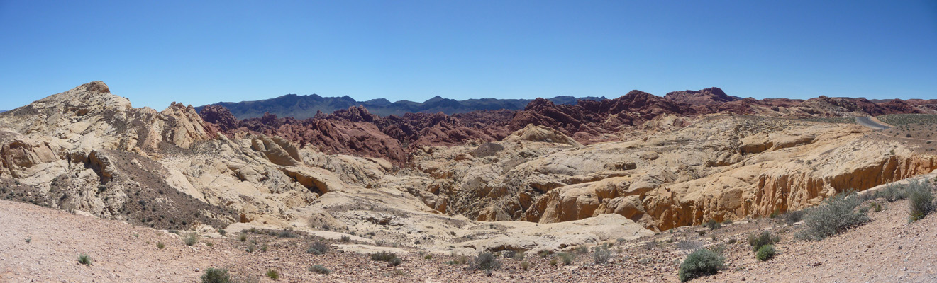
We stopped at Lot #1 (they may have named nearly every rock formation in the place but they didn’t use any imagination on naming the parking lots) and I got this shot looking out across the park. I think this is part of the formation they call the Fire Wave. You can hike out on it but of course that requires a parking place and all the lots at the trailheads were full and folks were parking along the road anyplace it was legal.
I’m so glad that the park was nearly empty for our first visit. And we’ll certainly keep in mind that December is a great time to visit if you want the park to yourself.
We drove out the spur road to Fire Canyon.
There were locals here disappointed that the parking lots were all full and looking for someplace to hike. The followed an unmarked but clearly established trail out into the canyon.
From the other side of the parking lot here you can look out across the valley and see parts of Las Vegas.
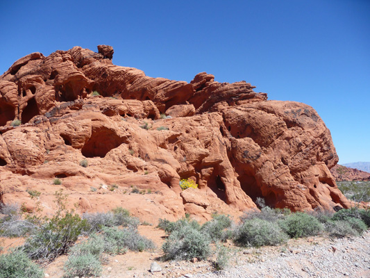
We decided we had time to drive the Scenic Loop Road out by the camping areas before we had lunch. The loop goes past a number of named formations before it hits a camping area where you can camp in amongst the rocks. We’d love to give this a try sometime but as I said before it was full. Past the campground the road turns to gravel but the rocks just get better.
There are ledges full of cool holes.
And holes with holes in them.
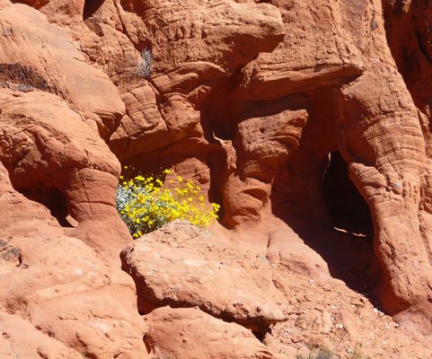
Towards the end of these formations I spied a brittlebush growing in amongst the rocks.
It was nestled up right in one of he holes.
These formations are so cool that I was surprised they weren’t swarming with kids crawling over and through them. But hey, they were all off hiking I guess.
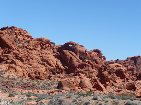
Towards the top of one of the formations we could see a mini-arch. I just love rocks that are made like Swiss cheese.
We headed on back the way we came and stopped for lunch at the picnic area at Seven Sisters—yes at those tables nestled in amongst the big rocks.
The Seven Sisters are these big hulking rocks—and guess what? There are 7 of them! And they’re really big and not real easy to climb on.
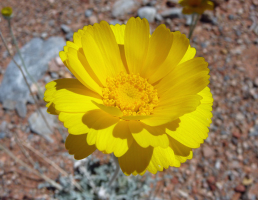
After lunch, we headed on out of the park and I stopped when I saw a new and different yellow flower in bloom. They were Desert Marigolds (Baileya multiradiata)—something we saw a lot of last spring in California.
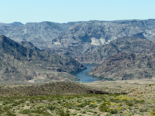
The next morning, Thursday March 24th, we packed up and headed southeast through the mountains and got a quick view of the Colorado River as it turned southward through the Black Canyon.
We drove on down to Golden Valley just outside of Kingman, Arizona to stay for a couple of nights at the Tradewinds RV Park. This park participates in both Passport American and Escapees Discount programs so we had two ways to save 50% on our camping there (of course they only apply one of them). We got a full hook up site within walking distance of the clubhouse (with a nice laundry) for just $18.50 a night (tax included).
That evening we had a pretty nice sunset too.

We had a low key day on Friday the 25th while I did laundry. They provided really nice fast Wi-Fi so we got caught up on our surfing and I got our website back up to date.
Then on Saturday March 26th, we broke camp in high winds (I had to battle to keep my feet as I stood out beyond the end of the trailer to make sure our tail lights worked) we headed further south to Congress, AZ just north of Wickenburg on the northwest side of Phoenix. We had mail waiting for us to pick up on Monday in Congress so we registered for 3 nights at the North Ranch Escapees Park just outside of the not very huge metropolis of Congress. We opted for a pull through site ($4 premium) and so paid $23 a night for our full hook up site. No free Wi-Fi here and our hot spot didn’t work well either. It worked for an hour or so one evening but otherwise didn’t give us an internet signal at all. Other folks were getting a 4G signal so we suspect the problem is that the 3G tower is overloaded and further away since it worked fine in town when we picked up the mail. One of these days we may have to upgrade as 4G takes over the landscape and more and more 3G towers get more and more overloaded.
The wind was still blowing but not as hard as it had up by Kingman and it died off before evening.