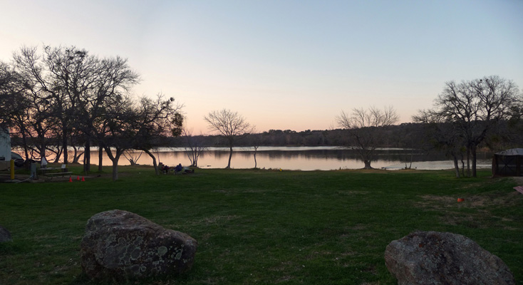
The campground was basically empty when we arrived and wouldn’t even begin to fill up until late Friday afternoon. There were tons of birds including a flock of over 40 robins who came through a couple of times. Our wildlife sighting for the day was this lone fawn crying for it’s mother.
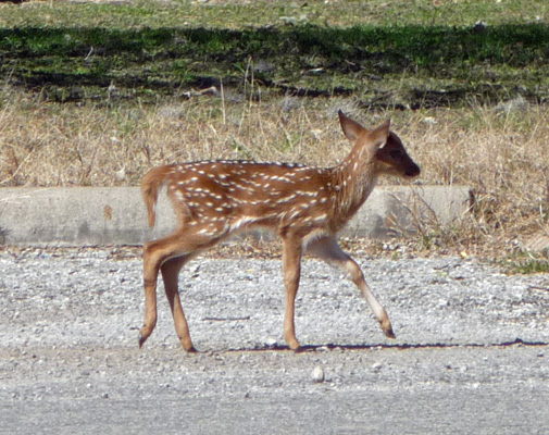
We never saw mom and that’s not a good sign. The park had been closed on Tuesday for a hunt to control non-native deer and we suspect mom got harvested. Sniff.
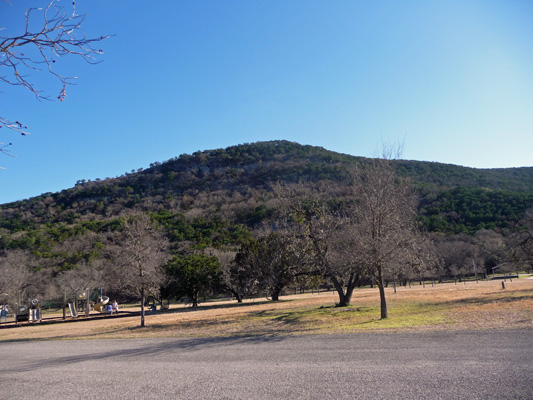
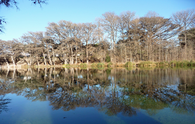
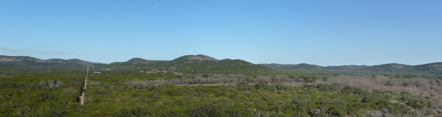
After lunch we took a drive to explore the park. There are over 350 campsites in the park but several of the loops were closed since it was so early in the season. This is the western edge of the Hill Country and there are actually hills in this park!
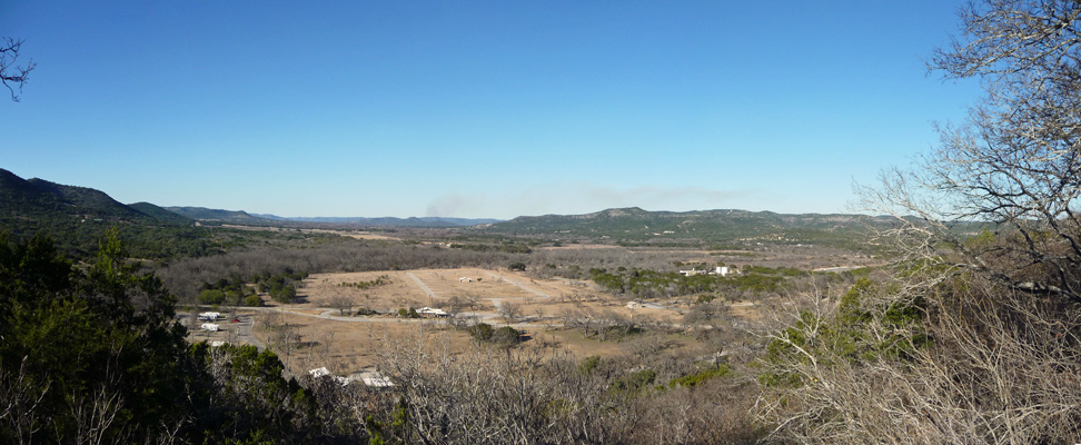
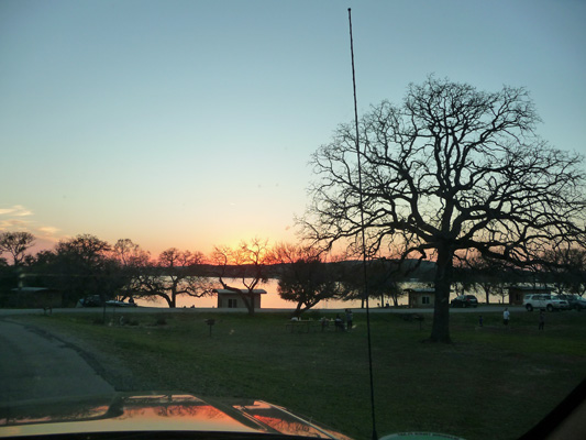
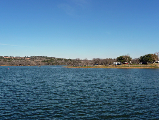
We took the old entry road (not realizing that it’s closed to motorized traffic—oops) and got a nice view from the overlook. This is a view looking northward across an open area of the park where there is a big overflow parking area. Most of the camping is in amongst mesquite and juniper trees.
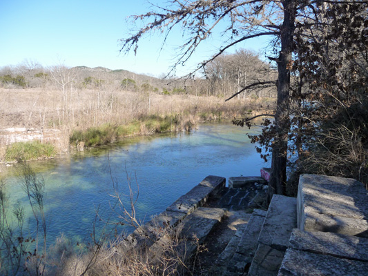
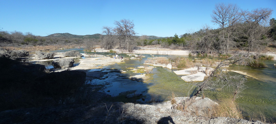
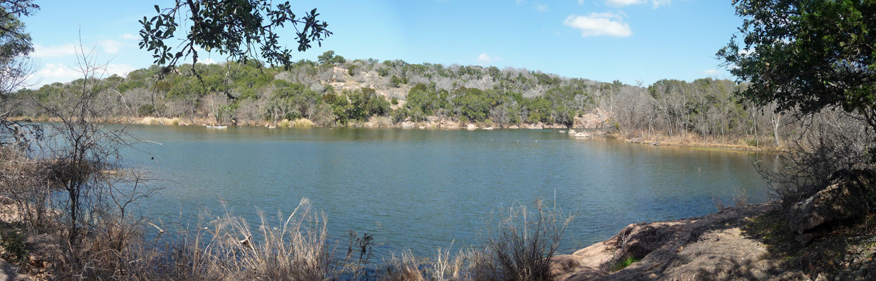
From here we continued on to the south end of the park and I got a view of the Rio Frio from the boathouse where they rent paddle boats.
This was our first river in Texas that was actually clear. All the other rivers and waterways and lakes have been muddy so this was a very pleasant surprise. It’s not very deep but it’s clear and very popular as a tubing river in the summer.
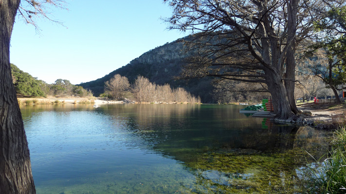
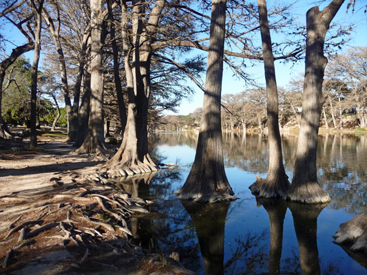
There were some bald cypress standing in the river too.
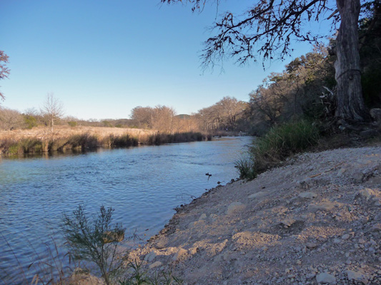
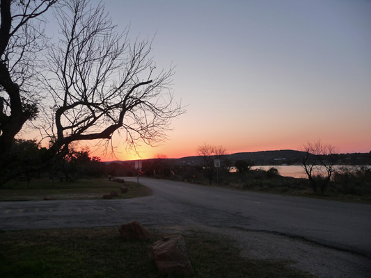
On the way back to our campground we stopped at the overlook for a view of the river and valley to the north.
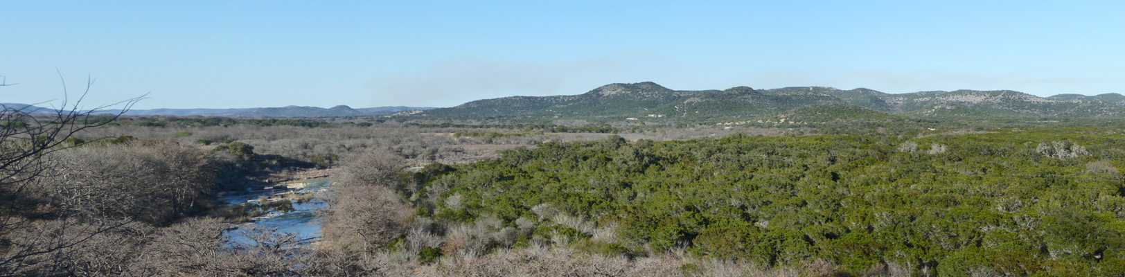
And the hills to the east (along with the power lines that march eastward).
Friday morning February 12th, it was 31 degrees at 7 am so we didn’t bother to get up and get moving. Our phones and hot spot didn’t work here (no Verizon and Sprint signal in the whole park but the folks with ATT had a signal). So we drove back out to the park entrance where we could use the park WiFi to check our email. Having done that we set out to take a hike up the Old Baldy Trail. By the time we got parked and ready to go at noon it was 78 degrees already.
We parked in some overflow parking in amongst the strange shelters that they rent here (and at several other parks we’ve visited).
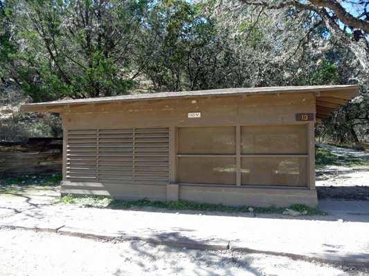
This one was open and I took a look inside. It consisted of one big room with a concrete floor and a concrete picnic table. They were a couple of power outlets inside and out and that was it.
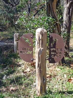
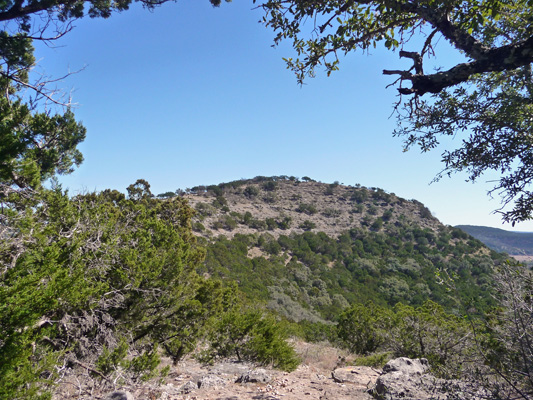
We headed up the Old Baldy Trail which takes you UP into the hills.
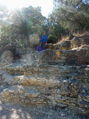
These hills are limestone and it’s pretty crumbly stuff.
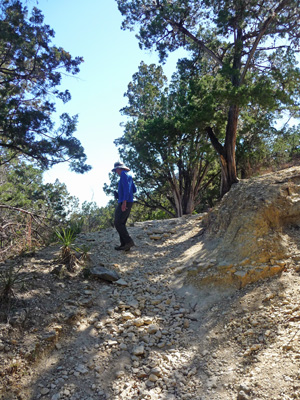
We had about a 250 ft gain in about a quarter of a mile.
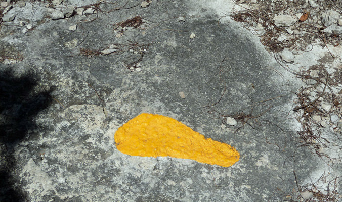
It’s pretty steep and takes you up some BIG steps and asked you to scramble over a lot of ledges. That yellow footprint is a trail indicator. You follow them UP the trail.
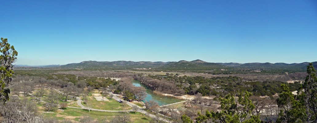
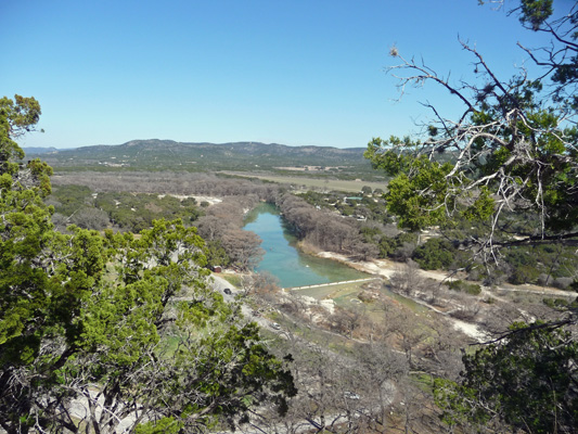
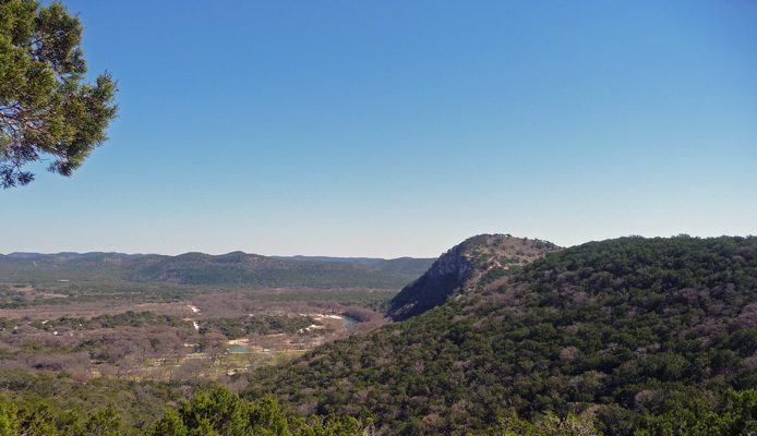
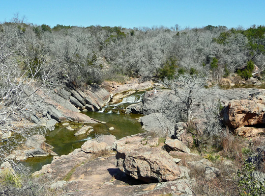
But your efforts are rewarded with a nice view of the river below. At the bottom of the photo is the little dam in the river that makes for the nice smooth area of the river by the boathouse.
We hit yet another big Up.
And yet another viewpoint.
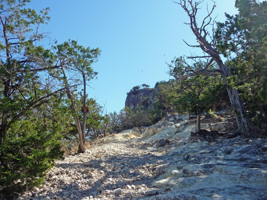
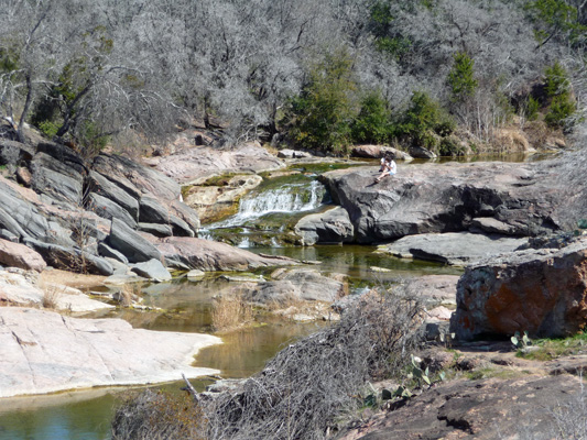
Not far from here we took the Foshee Trail up the ridge rather than taking the even steeper trail all the way to the top of Old Baldy. We were looking for a longer hike rather than just a short but monumental UP.
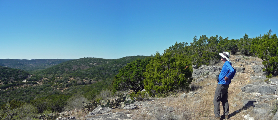
There was still a bit of up on the Foshee but it wasn’t anywhere near as steep. And we got a nice view of Old Baldy and the few folks who were up on top.
The trail follows the ridge and we got a nice view to the northwest.
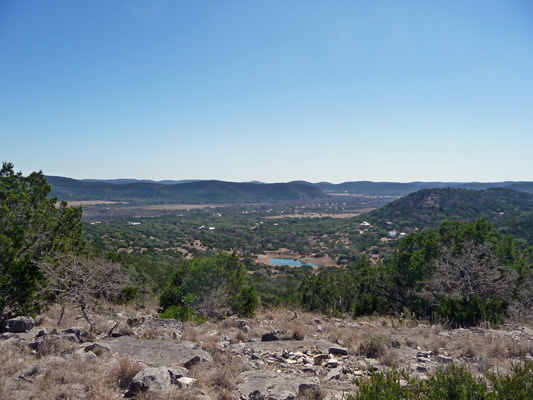
And a bit of the view to the south with a pond and a little bit of civilization.
It was hot in the sun (even the wind was warm coming out of the west) and we were grateful for a break in the climb.
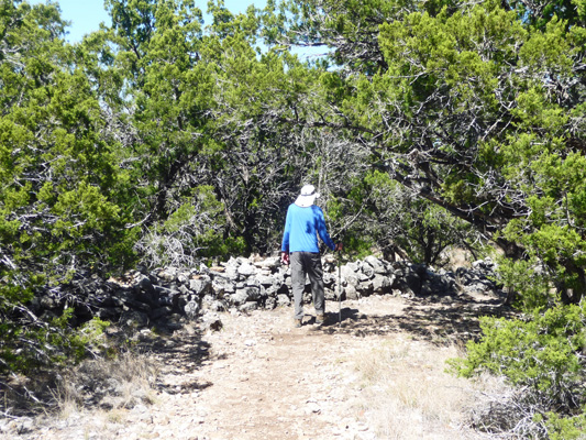
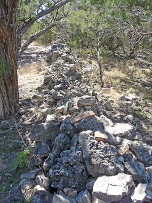
At the end of the ridge we came to part of a 3/4 mile long old stone fence.
Walter found a rock to sit on and we had a little break in the shade of the juniper trees.
Then we got to walk through the fence and I got a decent shot of it as it disappears off into the woods.
We took the Bird Trail DOWN the hill when the Foshee joined it. It was REALLY steep and so it was a lot of work going down—400 ft drop in .4 miles. But we did get another nice view of Old Baldy as we came down.
Figuring out where a trail goes on the way down is harder than on the way up so we were grateful that they’d put the yellow footprints here and there for us to follow in the down route too.
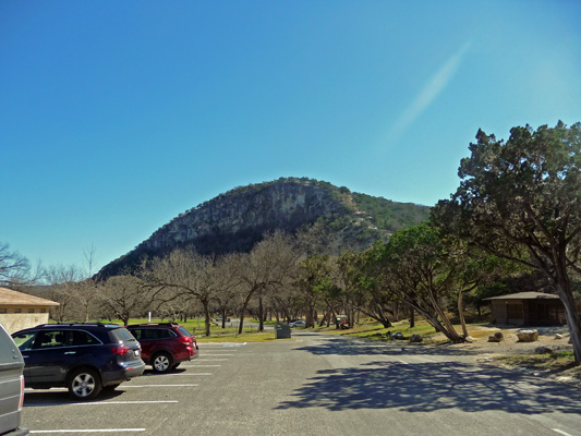
We were very happy to spy the truck as we hit the flats. And I took one more photo of Old Baldy from the parking lot.
It was 85 when we finished the hike at 2 pm. It sure felt good to go back to the trailer (where we’d left all the windows open) and rest.
Slowly as the afternoon wound on, the campground filled up. But it was surprisingly quiet on Friday night. It didn’t hurt that it cooled off quickly so folks didn’t want to sit out all night.
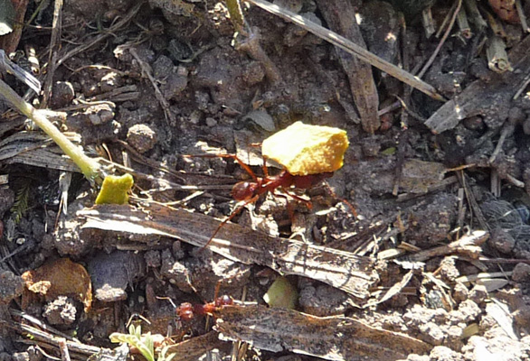
On Saturday morning February 13th, it wasn’t quite as cold—only 39 as a low for the morning, but it didn’t warm up as fast and we only had a high of 75 that day. Walter spied something strange out in the grass while we were getting ready for breakfast and discovered we had leafcutter ants in our grass.
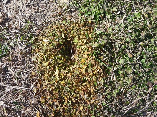
They had made a trail from the middle of the grassy area all the way over to a nearby mesquite tree and had trimmed all the leaves off of the mistletoe in the tree.
I got down on my haunches (which were a little sore from all that heavy duty up and down hiking the day before after 2 months of FLAT trails) and managed to get a photo of an ant carrying his leafy load.
Some people came by as we were examining the ants and we started to talk. We ended up spending a good deal of time giving them and their friends tours of the Airstream which is kind of a fun way to start the day.
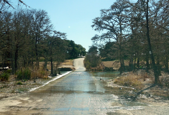
We drove up to the headquarters at the entrance to check our email again and then drove out of the park and down the nearest road on the other side of the river to explore a bit. There are a number of RV parks on the far side of the river but only one of them was open this early in the season. We drove to the end of the road where there was a splash to cross the Rio Frio. We decided we didn’t need to have our tires washed and turned around and drove back.
After lunch we decided we’d take a low key hike along the river. We missed the turn for the trail head on the north end so we drove down to the south end to start it there. We parked in the lot by the Pavilion and stopped to see what we could see. The Pavilion was built by the CCC in 1937 (after putting in the original entry road and building the keepers house in 1935-36.) Part of the Pavilion was a large patio which could be used for dancing. Once it was done, the CCC boys invited the local girls to a dance and they’ve been dancing here to the jukebox every summer night since.
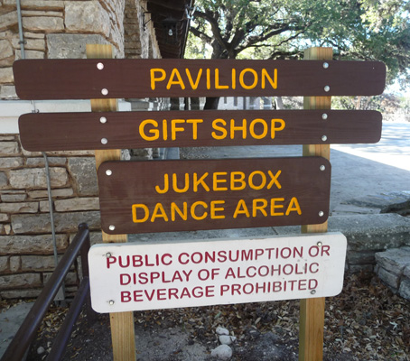
The Pavilion itself has the gift shop and restrooms and the speakers for the jukebox are mounted on the roof. We didn’t find the jukebox but I took a photo of the building and the dance floor.
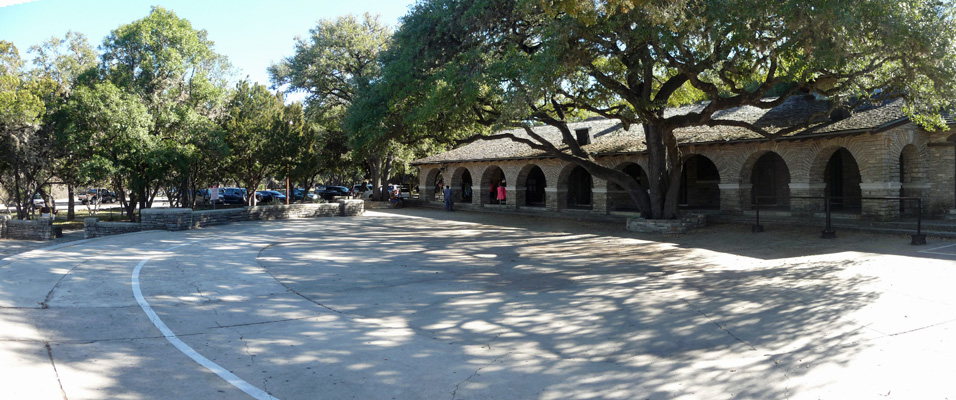
The white line marks the edge of the dance floor. People bring their chairs out and have to stay behind the white line. There were signs about not leaving unattended chairs overnight—I guess folks try to save their spaces.
We walked over to a small trail that took us out onto a old viewpoint in front of the dance floor.
Then we took the Madrone Walkway out until it joins the Blinn River Trail. I was in sandals and Walter hadn’t brought his hiking stick because we thought we were out for just a stroll. The trail down to the river was REALLY steep and crumbly and we decided that it would be better for us to drive back to the other end and hike it from there than to risk either of us falling.
So we walked back to the Pavilion and stopped to have a look at the Garner Grill which isn’t open until Spring Break.
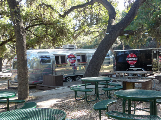
It’s a converted Airstream International Sovereign with deep fryers and grills and the like inside. Old Airstreams never die, they just go on to become catering trucks.
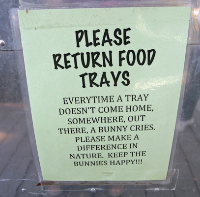
They had this great sign on the side about what happens when people don’t return their food trays. Keep the bunnies happy!
We drove on back to the River Crossing camping area and found the overflow parking area right next to the trailheads for the Blinn River and the Frio Canyon Trails.
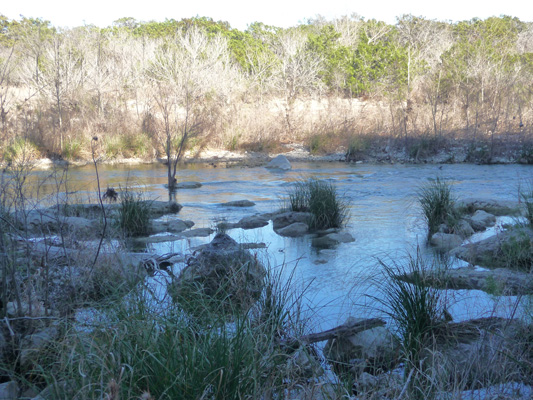
We followed the Blinn River Trail down to the river and I got a nice shot of the rocky area at the bend in the river.
There were people out on the rocks in the sun and kayaks being pulled up river because it had gotten too shallow to paddle.
We hiked along the river but this trail wasn’t in much better shape than the Old Baldy Trail had been. There were lots of broken branches here and there and lots of loose rock. We had to scramble over a few boulders and you had to be very careful about where you put your feet. I would have been much happier in tennis shoes rather than my hiking sandals.
We got some nice views of the river.
And as the shadows lengthened the rocky sections got kind of pretty.
The day before they had stocked the river with trout down by the dam. So there were lots of fishermen out--young and old, large and small. Most of them were avoiding the dam because it had been such a zoo down there in the morning. But that’s where people were catching fish. Further up river we didn’t find anyone who had had any luck but they all looked happy—as did the dogs who got to swim in the river.
Sunday February 14th, we woke to clouds and a little drizzle. This was our first cloudy day in some time so we weren’t pouting much. Our plan was to break camp, dump our tanks and then stop at the entry area to use the internet to check whether Blanco State Park over by Austin had any openings for the night. As we had experienced on Saturday morning, we couldn’t get on the reservation system using the WiFi. Ah well, it probably is some internal firewall that is working overtime. We decided we’d go ahead to Boerne and do our grocery shopping and hope that our hot spot worked when we got there.
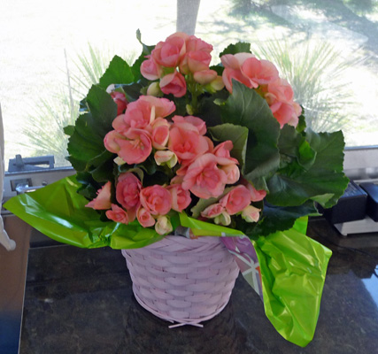
There was a very nice HEB in Boerne and we not only did our usual grocery shopping but got treats for Valentines Day too. Walter bought me flowers (as he always does).
We had lunch and checked the reservation system and sure enough, Blanco was still full up but Inks Lake which is a ways further north, had water and electric spots available for Sunday night. So that’s where we set out to go.
We drove northeast through Fredericksburg which was FULL of people strolling up and down the main street of this quaint German town. We checked on-line later and there was nothing special happening there. It’s just a favorite outing on a holiday weekend. The sun had begun to break out by the time we’d gotten to Boerne so it was a pretty day in Fredericksburg but boy were there a lot of people.
We drove further east to Inks Lake State Park just outside of the town of Burnet, Texas. We arrived after the office closed so we got to drive around the campground loops (there are in the neighborhood of 300 camping spots here) looking at the few spots that were available for the night. We picked our spot, set up camp and went back to the entrance and paid our money.
Sunset was just starting as we went to climb into the truck.
By the time we’d worked our way up the hill by the cement block cabins you could see the sun starting to sink into the hills across the lake.
And it was full on sunset by the time we got to the park entrance.
We went back to the trailer and I made Walter home-made spaghetti dinner—his favorite meal and something I’ve made on Valentine’s Day for him for more years than I can count—spaghetti, red wine and good sourdough bread—that’s the way to Walter’s heart for sure.
It only got down to 42 the next morning and warmed up pretty quickly. We got a notice on the truck that we needed to go pay for our spot so I went up to the office to find out what was what. They had our payment okay. It was just that they like to officially check everyone in! So we did that and paid for another night (they only let you pay for one night with self registration) so we could stay until Tuesday morning. The sites here are $24 a night for water and electric—they’re the second most popular park in the system.
Our hotspot and Walter’s new Verizon phone worked just fine here but our Sprint phones showed a signal but not enough to do anything with. We spent some time looking at site availability for the coming weekend and set out a plan for the next week that includes reservations for the weekend at Palo Duro Canyon State Park up by Amarillo. The forecast is for temperatures to continue to be unusually warm for this time of year including up in the panhandle so we’re going to grab it while the going is good since it could turn cold again up there at any time.
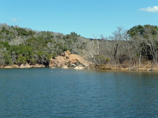
With our planning complete, we set out to take the hike out to Devil’s Waterhole and then on out the Valley Spring Creek Trail. We walked through the campground which was slowly emptying out--though not completely by any means.
At the end of the campground, there is a parking lot next to a picnic area where the Devil’s Waterhole Trail begins. In a short distance you arrive at the lake and a view of the Spring Creek Delta.
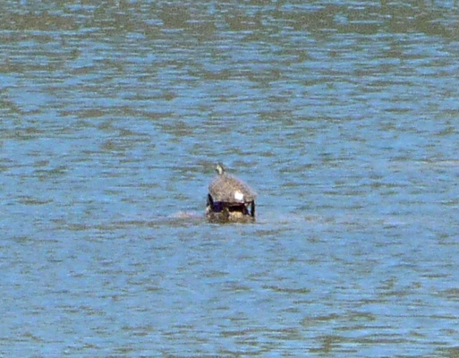
Walter decided he needed to go back to the trailer so I stayed here to watch the canoes and the water life. It was a lovely spot to sit and listen to the birds singing. I think that the spring migration may have begun simply because we saw so many song birds (robins, goldfinches, sparrows and warblers) both here and at Garner.
While I watched I realized that one of the grey wood projections in the lake wasn’t grey. In fact it appeared to be a turtle—probably a red-eared slider.
Once Walter returned we headed out the trail again and arrived at the Devil’s Waterhole—a favorite swimming area in the summer.
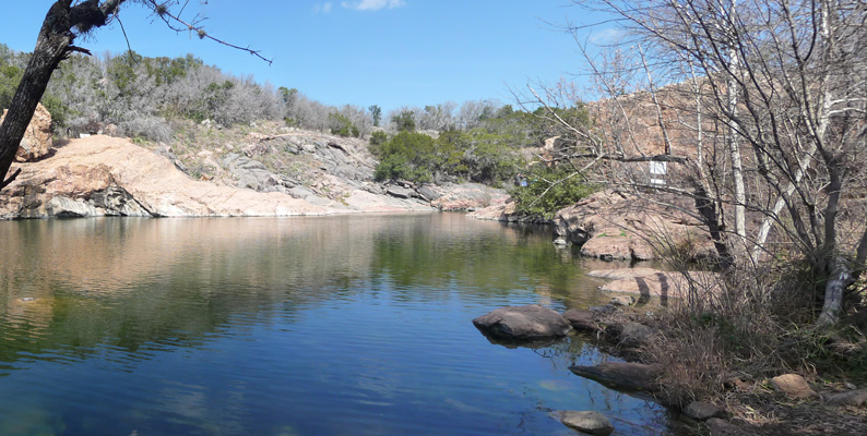
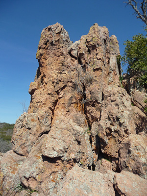
The rock in the park is mostly this lovely pink. That’s because instead of being the usual limestone that you find in most of the hill country, here there is Valley Spring gneiss—a metamorphic rock that is over a billion years old.
The Valley Spring Creek Trail heads up the hill from the Devil’s Waterhole, over a big shelf of gneiss (pronounced nice).
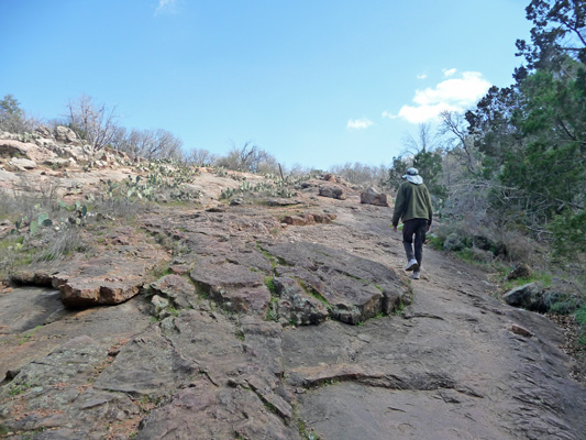
This was the only serious up on the trail and the footing was much better than on the limestone at Garner.
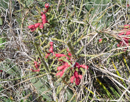
Here and there we saw examples of Tasajillo (Pencil Cactus). But this was the only one we saw with fruit on it. There were also lots of prickly pears along the trail—with and without fruit.
At the top o the trail we came out to a view of Valley Spring Creek Falls.
There was a couple sitting on the rocks overlooking the falls having their lunch. It’s not a real big waterfall but it’s the only one we’ve seen here in Texas.
We continued on past this nice little pillar of gneiss.
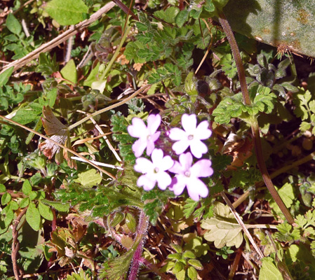
There is yet another trail that comes off of the Valley Spring Creek Trail and parallels the road but we decided we’d gone far enough and continued on to complete the loop on Valley Spring Creek Trail. We spied a few small purple flowers.
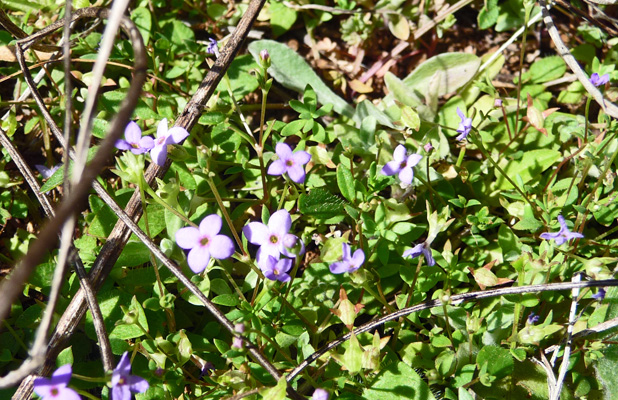
And some tiny tiny blue ones in amongst a great deal of blooming chickweed. The weeds like tickseed were blooming up a storm here.
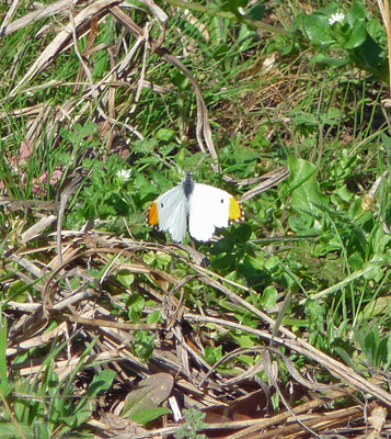
This part of the trail went through the woods and we saw a lot of black butterflies with orange markings and yellow ones too. When we were resting for a few minutes on a nice bench in the shade I spied a white one come to rest on some plants across the way. It turned out to have orange markings on the tips of the wings.
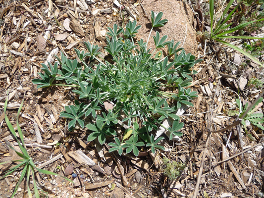
In the sunny sections of the woods I saw a lot of lupine in full leaf—they will be Texas Bluebonnets in another few weeks.
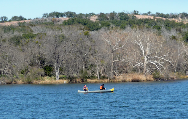
We finished the trail and then drove over to see the North Fishing Pier. There were lots of folks fishing and they said they had caught a few crappie. The pier is set up to attract sunfish too.
There were kids out in rented canoes.
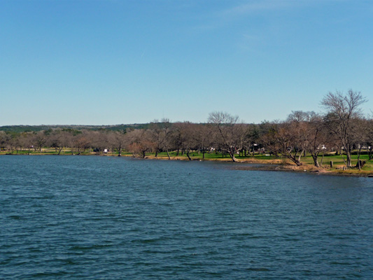
And the view back towards the campground was pretty.
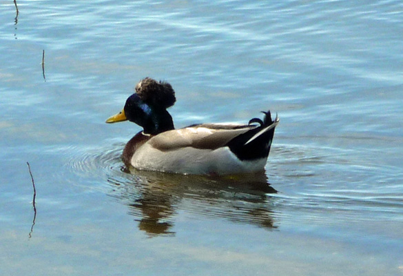
We also saw this odd mallard with a top knot. Earlier I’d seen one with a white top knot too.
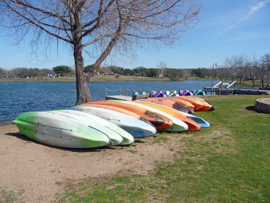
To finish our tour off we motored over to the boat launch/store area. Here they have canoes and kayaks for rent—and they were locked up as opposed to the ones we saw at Martin Dies State Park.
The view from here was pretty nice too.
We stopped in the store and talked with the staff there. They dug out their butterfly books and couldn’t come up with an ID of my white and yellow butterfly but we all had fun chatting about the state park system and the parks we’d visited.
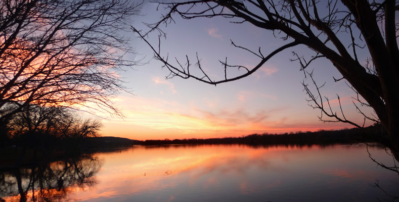
Mother Nature put on a nice show at sunset again. This time I got to go down to the shore to catch the color in the lake itself.