
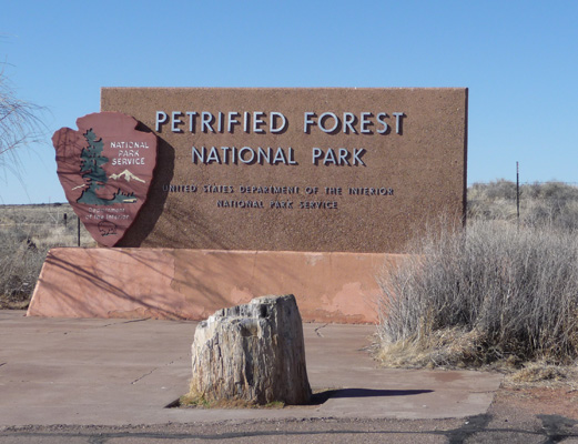
The park itself is 28 miles long from north to south. We started at the north end (at the I-40 entrance) where there is a really nice empty parking lot and this sign. We had had our lunch there the day before and as far as we could figure out the only function of the parking lot was to give folks a place to park while they photographed the sign! So we did our bit to help it maintain a function and took a picture of the sign too.
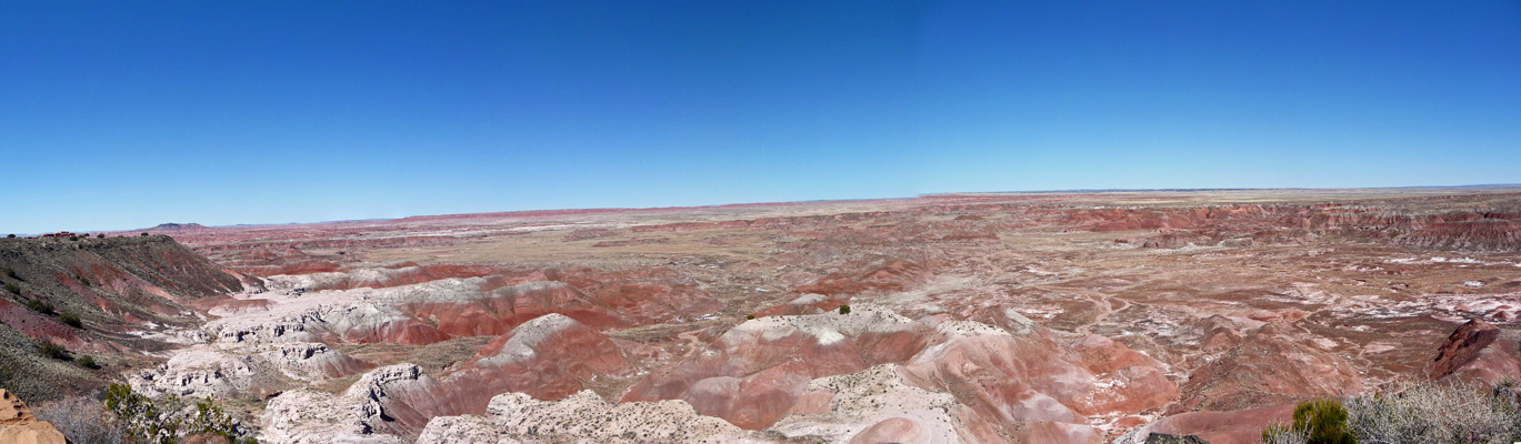
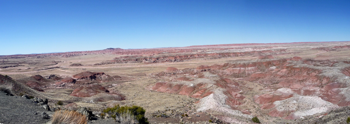
The Visitors Center is located just north of here and you can visit it (and the Painted Desert Diner and gift shop) without paying your money to enter the park—something we’d not seen before at a National Park. We stopped off and got the appropriate maps and literature and watched the movie which was a good one. And the headed north to Tiponi Point, the first overlook of the Painted Desert. The Painted Desert stretches from the Grand Canyon all the way across Arizona and a ways into New Mexico. But the overlooks here in Petrified Forest National Park provide the best views I’ve ever seen.
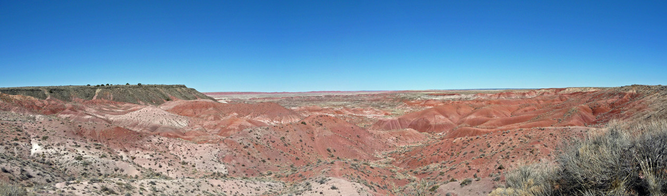
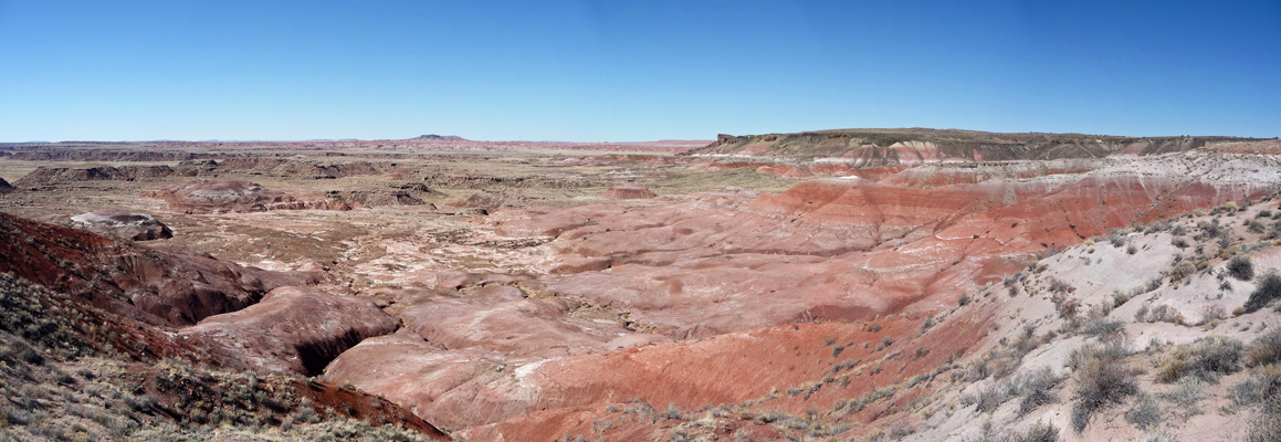
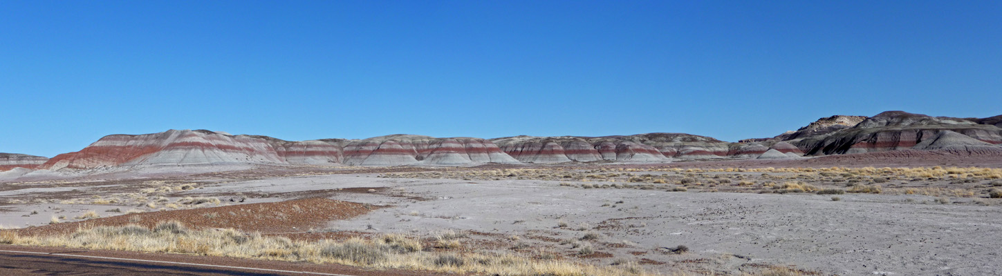
The colors in this section range from pale pinks and beiges to deep oranges and reds.
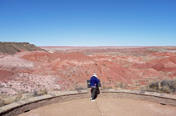
The road follows the rim of the canyon here and allows you to stop and get a different view of things every so often. This view is from an un-named overlook just a ways from Tiponi Point. But it gives you a very different sense of things. All the Painted Desert portion of the park has now been designated Wilderness so while you can hike here even the rangers can’t take vehicles or anything powered out there. In the old days there were road so there are remnants of bridges but the roads were all dirt and the desert has taken them all back.
We drove on to Tawa Point and talked for a little while to a ranger who was working on a new guided hike for the area. From Tawa Point you can see over on the left at the top of the canyon that there is a layer of basalt at the top that came from a volcanic vent just to the southwest.
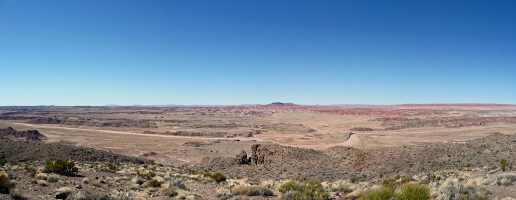
Since we were getting such nice view from the overlooks we decided we really didn’t need to hike the trail the takes you along the rim from Tawa Point over to Kachina Point and back. So we took the lazy man’s route and drove to Kachina Point where you get this view looking back towards Tawa Point.
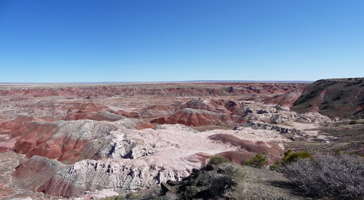
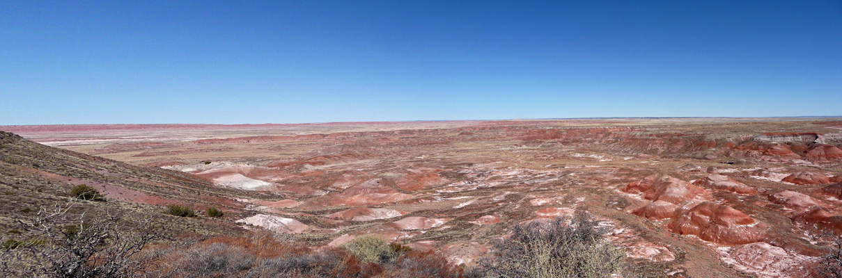
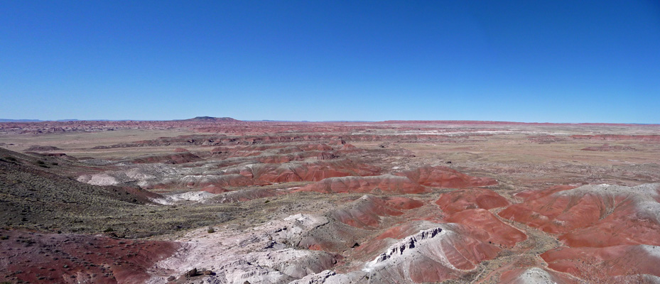
And this view looking southwest—where it all seems to go on forever.
The historic Painted Desert Inn is located at Kachina Point.
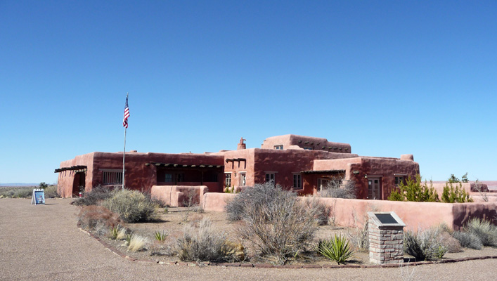
It was originally build of petrified wood in 1920 and then renovated by the CCC in 1937 to look like an adobe pueblo and then again in 1947-9 by the Fred Harvey Company to spiff up the inside some. It was saved from demolition in 1975 by the locals and is now a National Historic Landmark filled with wonderful work by the CCC and murals by the Hopi artist, Fred Kabotie, done during the 1947-9 renovation.
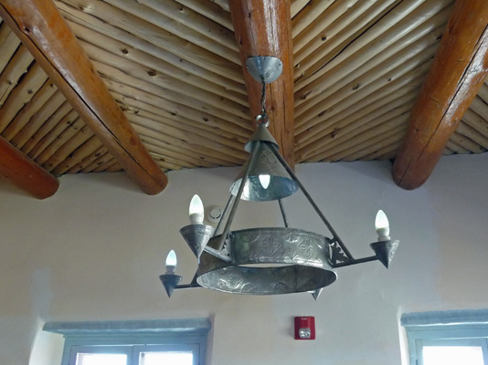
There are wonderful handmade tin light fixtures from the CCC era.
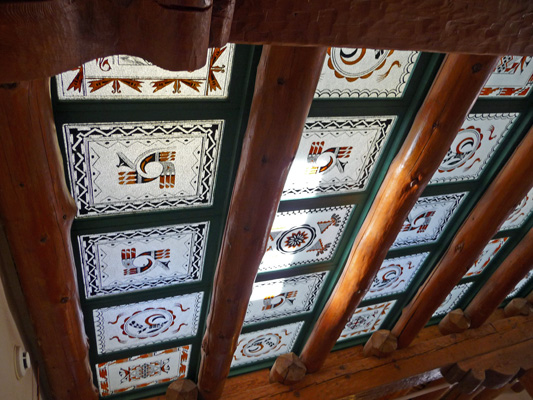
And the skylight over the staircase is another wonderful CCC piece done with local Indian motifs.
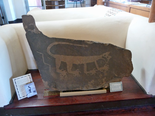
This mountain lion petroglyph was found by the park’s first permanent ranger-naturalist, Myrl Walker in 1934.
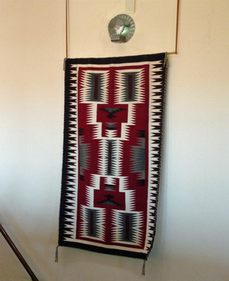
Here’s a lovely Indian blanket hanging in the stairwell plus another tin light fixture.
The Kabotie murals are really marvelous.
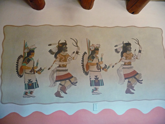
The adorn the walls of the dining room.
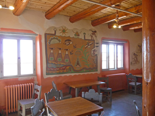
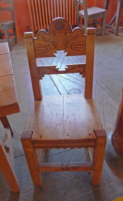
Where you can find original CCC furniture like this carved chair.
And more murals
We’ve seen a lot of CCC projects this winter and read a lot of signs about the CCC. And I’d say that the park service has done a very nice job of commemorating the hard work of the CCC here at the Desert Inn.
We drove on now heading southwest to Chinde Point where they found fossils of the Chindesaurus bryansmalli in 1984. When Gertie as she was called, was discovered they thought she was the most primitive dinosaur ever found. But in 2011 she was reclassified as a member of the T Rex family.
Because this is all wilderness all the paleontological work has to be done without the aid of vehicles which can be a big challenge when it comes time to bring specimens in.
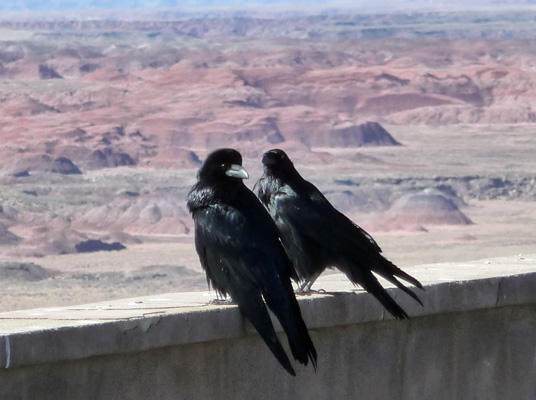
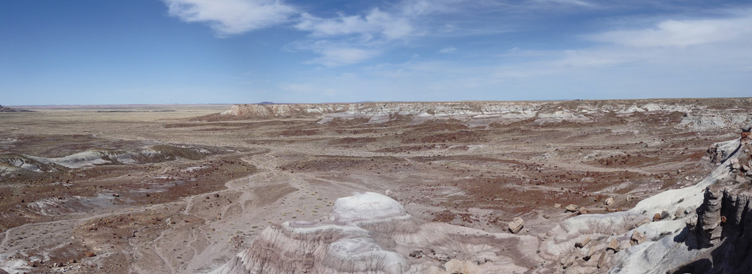
We drove south to Pintado Point where you can get a view of the Painted Desert that stretches from Chinde Mesa to the north the San Francisco Peaks a hundred miles away. It was clear enough for us to see the San Francisco Peaks but they didn’t show up in this photo.
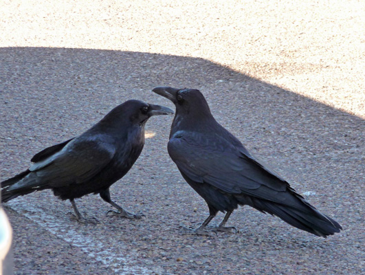
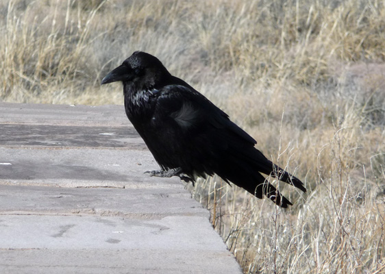
However, I had no trouble capturing this pair of ravens sitting on the wall with the painted desert behind them.
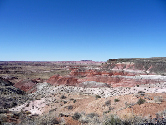
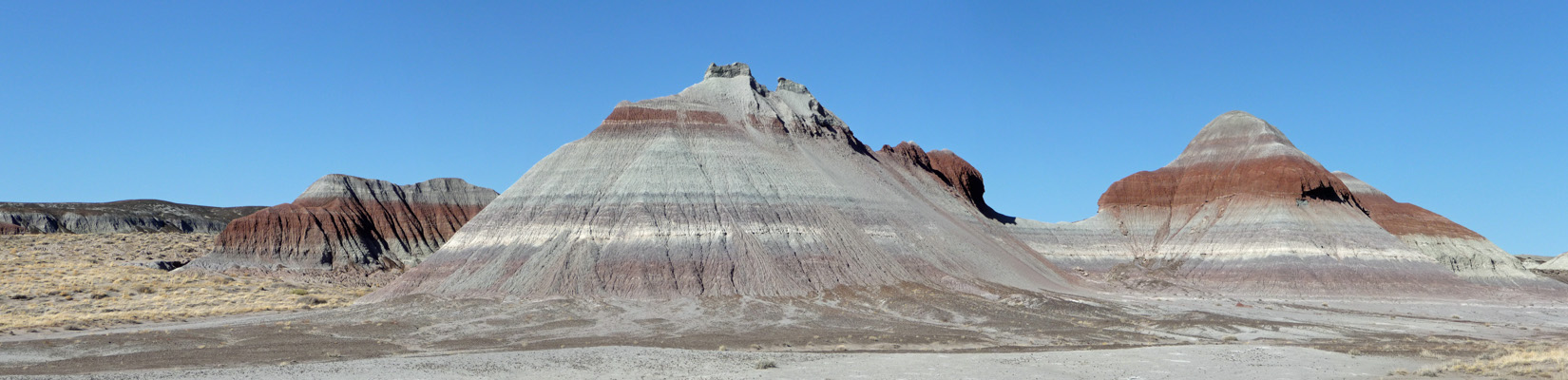
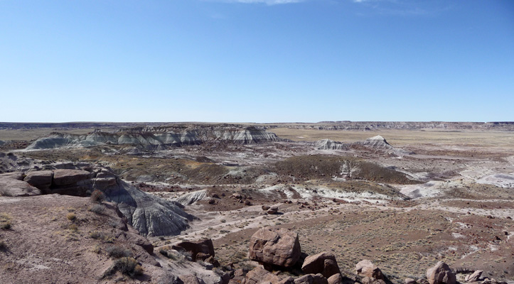
A ways further south you come to Nizhoni Point (Nizhoni means beautiful in Navaho) where the white layers give things a different look.
The last of the Painted Desert overlooks is Lacey Point, named for John Fletcher Lacey, an Iowa congressman, who was instrumental in the passage of the Antiquities Act which helped protect the fossils and ruins in the park.
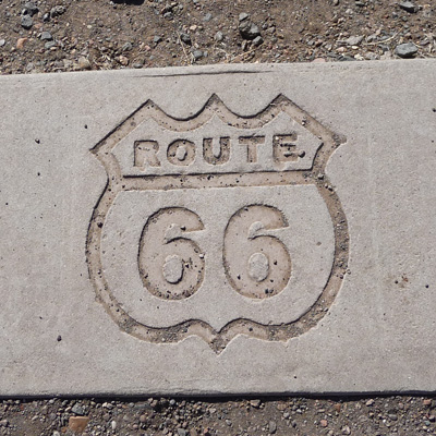
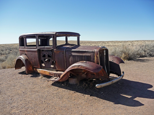
The original Route 66 ran through the park (as does the Sante Fe Railroad). In fact, Petrified Forest National Park is the only national park that with any portion of Route 66 within its borders. They have a nice display and overlook commemorating the historic highway that ran from LA to Chicago.
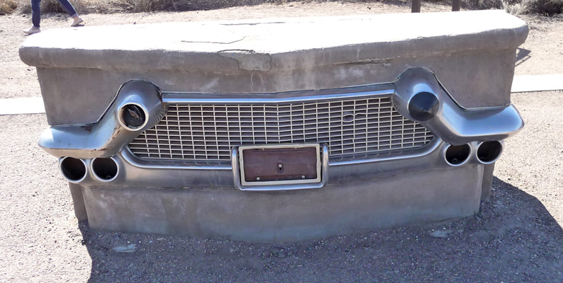
Including the old Route 66 logo
And a wonderful old rusty 1932 Studebaker sitting on the actual route—from a different angle you can see the old telephone poles running off into the distance.
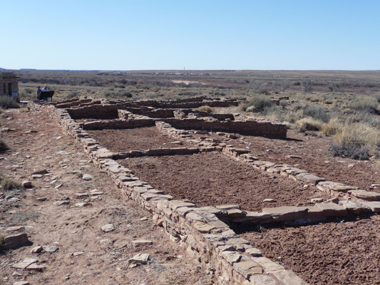
From here you cross over I-40 (which runs parallel to old Route 66 through much of Arizona and New Mexico) and on to Puerco Pueblo, the ruins of a ancestral Pueblo Indian village inhabited between 1250 and 1380 when there was plenty of water in Rio Puerco (now just a wash that occasionally fills with water).
We stopped to have lunch here and a pair of ravens stood guard while we ate.
When we were finished they inspected for crumbs—clearly a well trained cleaning crew.
We took the short hike through the portion of the pueblo that has been excavated. It passes what they believe is an old kiva.
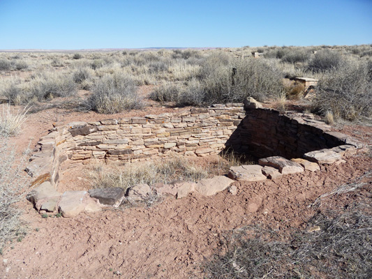
And the foundations of some of the 100 rooms that made up the pueblo.
The real treat here is that there are petroglyphs that you can see down on the canyon wall.
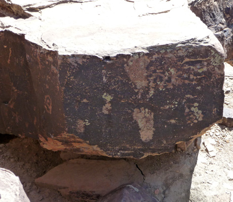
On the far left of this rock you can see a small spiral. It’s location is very important since on the summer solstice light shines down a cleft in the rock opposite creating a shaft of light that moves down the rock until it hits the spiral marking the morning of the solstice.
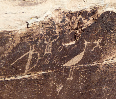
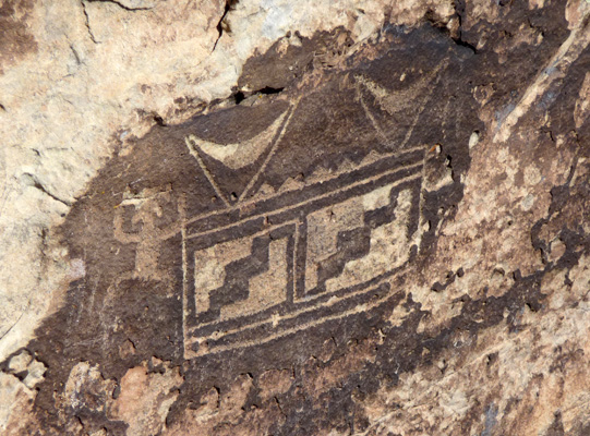
As you walk along the canyon rim you can see other nice petroglyphs.
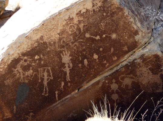
My favorite is this white-faced ibis with a frog in its beak.
Though these geometric patters are pretty outstanding too.
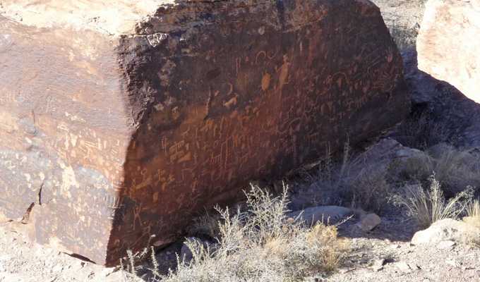
We drove south further to Newspaper Rock. Here there are a huge number of petroglyphs covering a rock down in the canyon. You need binoculars to see them and a good telephoto lens to photograph them. Early morning light might produce better results too since in the late afternoon the shadows were pretty deep.
The road continues southward through an area called The Teepees.
Across the road you get a wider view of them.
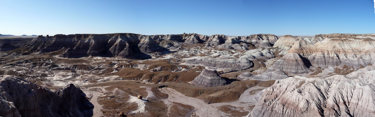
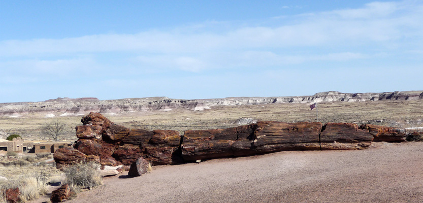
The final portion of our day was dedicated to the Blue Mesa Loop, a road that takes you through some wonderful blue formations with our first taste of petrified wood.
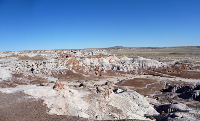
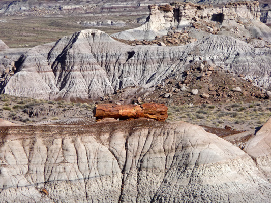
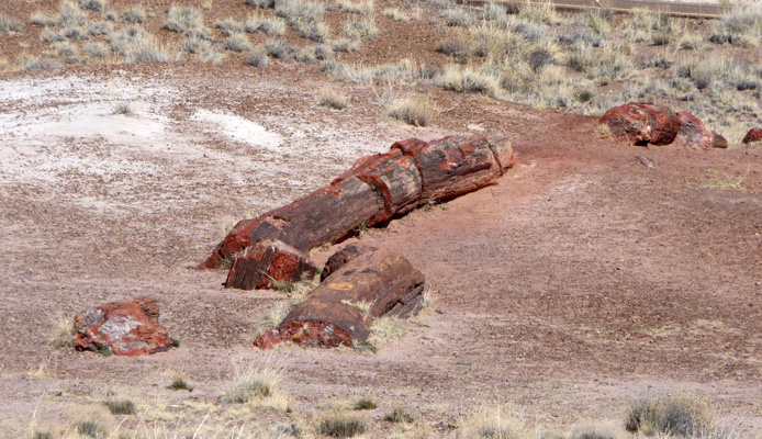
This area has some great perched logs which have been revealed as the mudstone they were encased in has eroded away.
We drove the loop and decided to skip the hike down into the Blue Forest since frankly we were both pretty tired from just climbing in and out of the truck so many times. The trail goes down a steep hill and then winds through the formations you can see below.
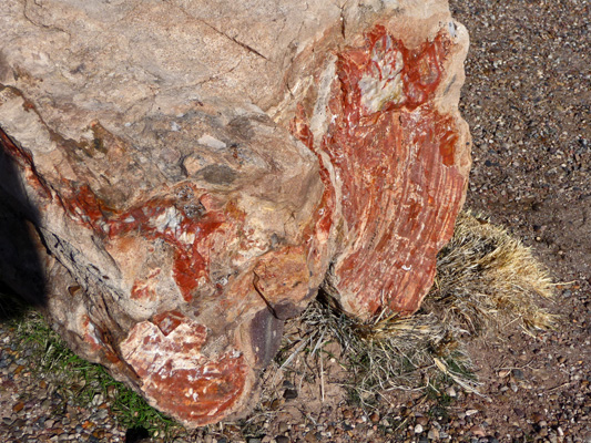
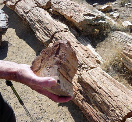
We stopped at one more viewpoint and I took this shot of my first up close and personal encounter with multi-colored petrified wood.
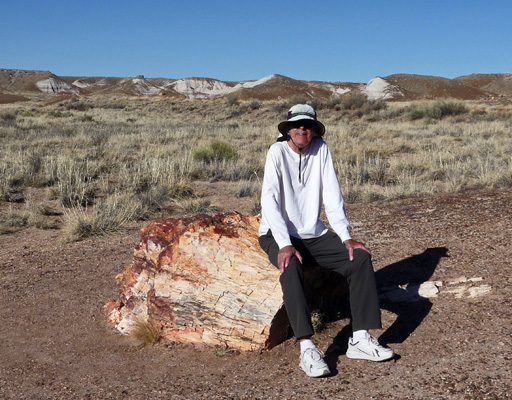
And Walter posed doing one of his favorite things—resting on a rock—in this case a petrified log.
We drove on south through the rest of the park, mapping out our visit for the next day and then home the back way to Holbrook. Needless to say, we slept soundly that night.
The next morning we made our lunch again and drove south on Highway 77 to the town of Snowflake to have our oil changed. The change oil light had come on the day before and Holbrook didn’t have anyplace that Walter would trust the truck to so we drove the 25 miles to the Jiffy Lube in Snowflake to do our duty. It set us back about an hour but hey, it’s important to take care of Francois since he provides us with so much good service—he’s got over 38,000 miles on his odometer and we haven’t had him 2 years yet.
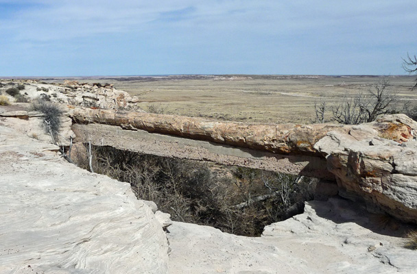
We drove back to Holbrook and then on down to the southern entrance of the Petrified Forest and up to the Agate Bridge overlook. Here there is a petrified log flash flood water has eroded away the underneath it to form a bridge. Back in the 1917 somebody decided they wanted to save the bridge from Mother Nature’s ways and supported it with a span of concrete. Eventually the concrete will wash out and the tree will fall.
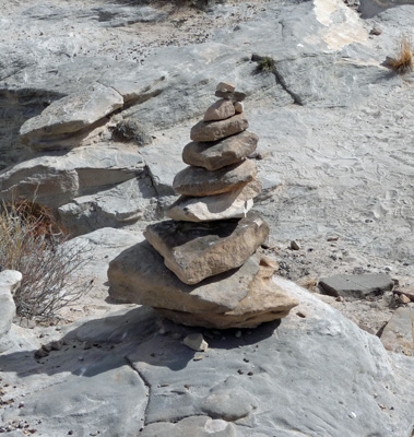
In the same area, people had built cairns here and there—our first in several months.
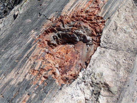
There was a sizable chip out of the side of the bridge on our end and Walter wanted me to take a photo of it. As you can see, it truly is solid agate.
Agate Bridge was as far north as we planned to go that day so we headed back southward towards Jasper Canyon (which used to be called First Canyon back in the days when people took the Santa Fe Railroad to the park and this was the first canyon of petrified wood they would encounter.)
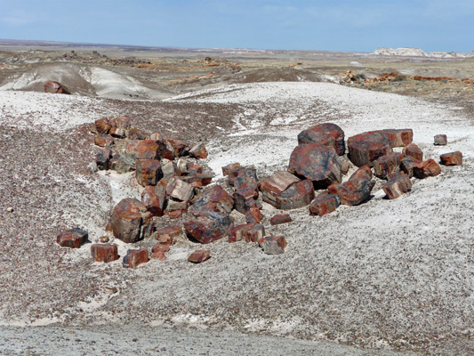
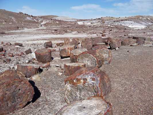
All those round black/brown boulders are actually chunks of petrified wood strewn across the canyon floor.
The view to the southwest give you a different flavor.
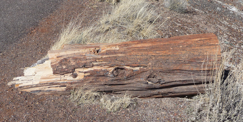
One of the things I found amazing was how there would be these huge logs of petrified wood just lying there next to the road. They break into rounds from the pressure of their own weight.
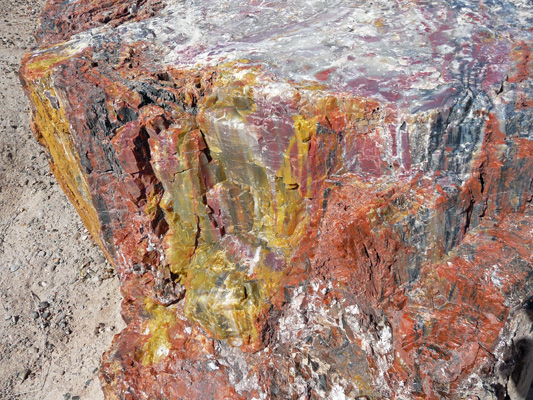
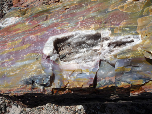
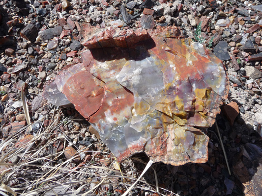
Next up, was the Crystal Forest which has a great paved trail through a collection of petrified logs and rounds. Right next to the parking area there were big rounds of extremely colorful petrified wood. The reds, oranges and mustards are due to iron compounds that infiltrated the wood tissue along with the silica which causes the petrification. The blue, purple and brown are due to manganese minerals. Personally I think they look like melted crayons.
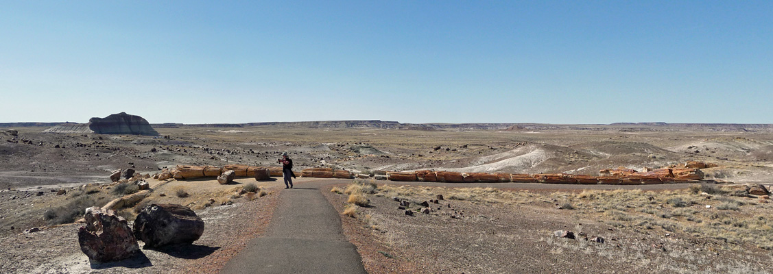
We took the 3/4 mile paved trail through the Crystal Forest. It’s full of lovely colored logs, complete with bark.
There are great heaps of petrified tree rounds.
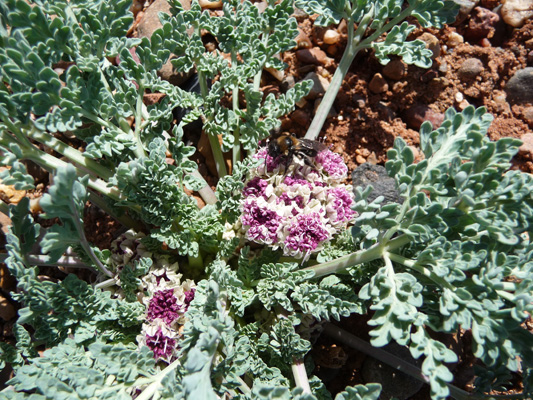
And we saw the first beginnings of wildflowers.
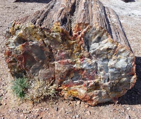
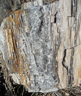
The petrified wood in this area is known for having quartz crystal embedded in it. And sure enough we found a bit here and there.
Only part of this tree has been uncovered by erosion. The rest will slowly appear as the mudstone and gravel erodes away.
The trail winds along giving you view of the surrounding painted desert and then comes to this huge long tree that stretches along a turn in the trail.
It clearly hadn’t been exposed to manganese or iron since there wasn’t much color in the stone. It still really looks like wood.
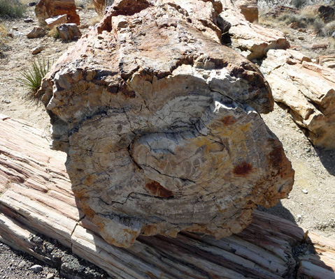
Here’s a shot of the end of one of the rounds—very different than the melted crayon look.
Further on we came upon yet another chunk that looks like it’s just a piece of downed wood—but it’s not, it’s solid stone.
I took lots of photos of pieces of wood with shiny bits until I found yet another piece with a cavity of quartz.
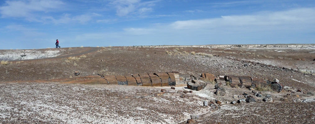
The quantity of petrified wood lying about in the Crystal Forest is truly amazing. And they have photos from 100 years ago that show that the wood hasn’t moved a bit in most cases—and very little of it has walked away with tourists—mostly because it is so dense so the big pieces just weigh too much.
This little piece of petrified wood particularly caught my fancy—I love the colors. So I took a photo of it so I could take it home with me—leave only footprints, take only memories/photographs.
We ate lunch here and sure enough another pair of ravens came to watch us and then patrol for crumbs once we were finished.
Near the south entrance of the park you will find the Rainbow Forest Museum. It has nice displays about the natural history of the place including some really cool fossils both of the dinosaurs they have found in the area and the plants.
The plant fossils have helped them recreate what the area was really like here 250 million years ago—when it was located at the equator as part Pangea, the single continent that broke apart to form our current land masses.
We took a hike on the Giant Logs trail but didn’t finish it because frankly it was rather disappointing in comparison to the Crystal Forest we had just done. I did that a photo of “Old Faithful”, a large petrified tree, that has been a favorite in the park since it first opened.
We really enjoyed the Petrified Forest and were very glad we’ve given ourselves two days to explore it.
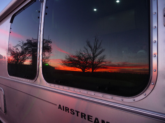
That evening we had a few high clouds which helped Mother Nature put on a nice sunset.
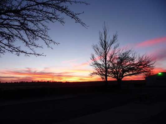
As I turned to go back to the trailer I realized that Genevieve had gotten into the act too and gotten herself painted with the sunset too.
Sunday morning, February 28th we packed up and drove south on Highway 77 back through Snowflake and on through the town of Show Lo (yes it used to be a poker town) and through the Salt River Canyon. The road is winding and goes Up and Down and lot. It was full of motorcyclists out for a Sunday drive—a sure sign a road has lots of good twisties. I pulled over at an overlook to let the cars behind me by and got out to take some photos of the Salt River Canyon.
This was taken facing into the sun so it’s a bit washed out version of the canyon itself—and way down there in the bottom there actually is water.
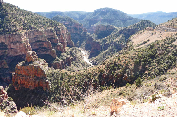
The road continues to twist and turn with 6 to 10% grades—great on a motorcycle or in a sports cars but a bit much pulling a 25 foot trailer. Let’s just put it this way, I’m not interesting in driving it again.
We spent 2 nights at the Apache Gold RV Resort just south of Globe, AZ. This was our first casino RV park and while it was adequate it was no big deal. It was a giant paved lot with nice hook ups on extra wide spots. But there were no picnic tables and not much of a view. It was just under $30 a night with our Good Sam discount and it gave us a place to camp while we picked up our mail at the Post Office on Monday and did laundry.
Our Texas driver licenses were in the packet of mail along with our new health insurance cards and a whole lot of other good stuff. It’s is now completely official, Texas is our domicile.
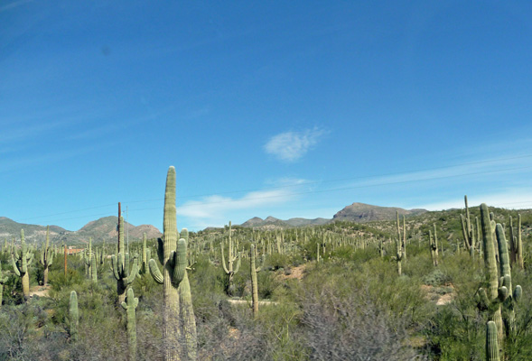
Tuesday March 1st, we headed towards Phoenix for a 3-day stay in Goodyear. However Highway 60 (which goes from Globe west towards Phoenix) was closed for blasting that morning so we had to take a 69-mile detour (instead of 25 miles on Highway 60) that took us through the Dripping Spring Mountains and a whole lot of copper mining. It was another road with some steep grades but it wasn’t quite as twisty as the road through Salt River Canyon. There were nice view of saguaros with the mountains in the background.
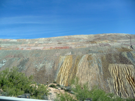
And we passed some amazingly huge long (as in miles long) piles of mining tailings.
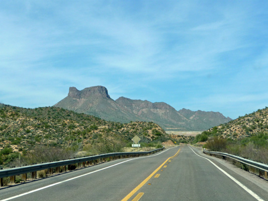
There were glimpses of some stunning views to the north too.
We re-joined Highway 60 at Superior and then headed towards Phoenix where the traffic was stop and go even though it was only 2 in the afternoon. We made our way to Estrella Mountain Regional Park where we’d miraculously gotten a campsite for 3 nights. Every other year we’ve visited they’ve been booked solid. We found out why when we got there—their hosts take up all their hook up sites and they have lots of them because these folks run the Nature Center and the Entry Kiosk along with the tent campground. They had a host associated with the horse corral leave and their spot was available for just 3 days before the next host arrived—presto we had snapped it up.
Spring Training started on March 1st and Phoenix was full to the gunnies with snow birds and baseball fans. We had dinner on Tuesday night March 1st with our daughter, Leslie, and her husband, Al at Osaka Japanese Steakhouse—with the full griddle show that includes fancy knife work and flying eggs and vegetables. It was fun and it was great to get to spend a little time with them before they took off to go to Las Vegas for the NASCAR race.