The camp host really nice and suggested that there were electrical hook ups at Ghost Ranch just up the road and lots of them at Heron Lake State Park about 30 miles farther north. I’d read that the RV camping at Ghost Ranch was best left to folks taking workshops or going on trail rides there and otherwise it was better to avoid them. So we drove north to Heron Lake.
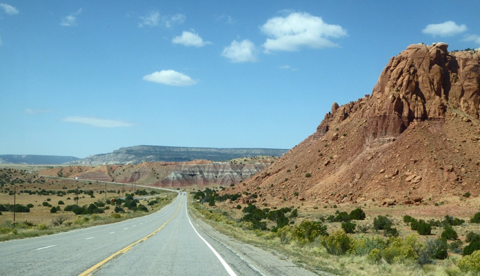
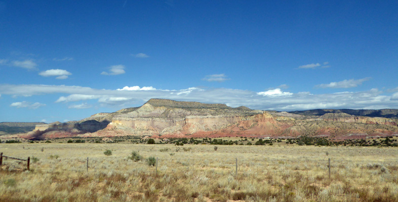
Abiquiu and Ghost Ranch are both places were the painter, Georgia O'Keefe, spent a great deal of time so this part of New Mexico is known as Georgia O’Keefe Country. It’s beautiful stark country as you drive north on Hwy 84.
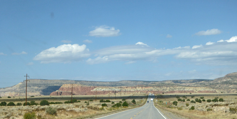
The layers of red and cream colored rock along with the clouds and the blue sky made for a beautiful picture.
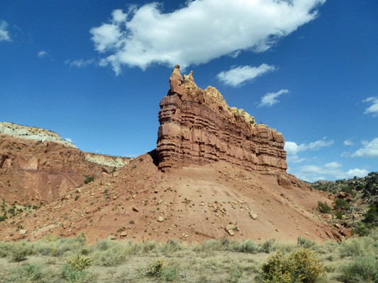
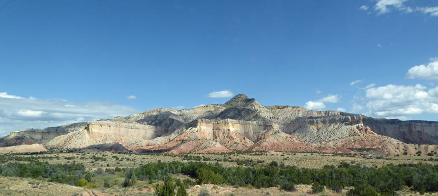
There are fins of red rock topped with harder white stone.
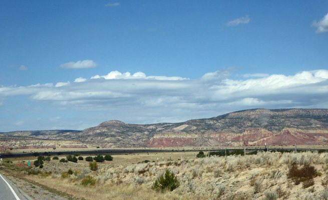
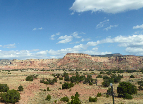
And red cliffs that lead you to hills of layered colors.
White hills rise off in the distance. In among them you’ll find the area Georgia called Plaza Blanca.
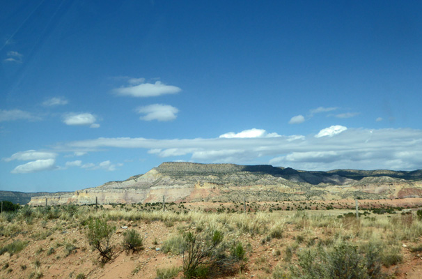
I love the pink and salmon of the hills and mesas of the southwest.
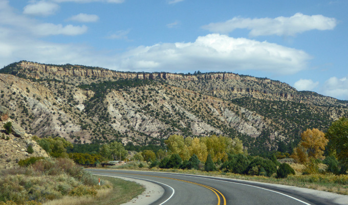
Here’s the turn off to Ghost Ranch.
And then we had more pink and salmon.
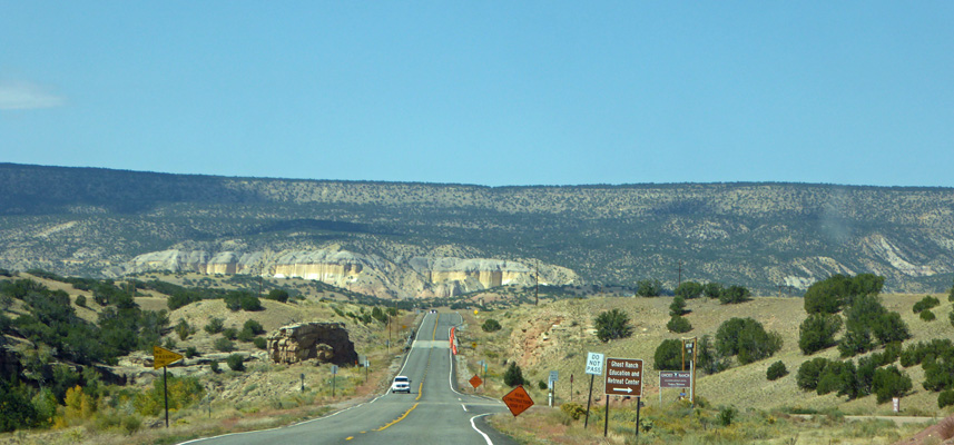
Here’s more of the interesting white rock that tops off the salmon and pink.
As we went north the terrain changed and we picked up junipers and cottonwoods.
We took Hwy 95 west out to the Visitor Center at Heron Lake State Park and found it closed. But there were maps available of the campgrounds and we did eventually find our way out to the section that had electrical and water hookups. We stopped in the dump station to deal with our tanks and managed to get the rear wheels of the trailer run up against a curb of broken up concrete that clearly many other folks had gotten stuck on. Rather than bumping over it (which is hard on the tires and the trailer) we disconnected the trailer, repositioned the truck, hooked the trailer back up and presto got out without a hitch. Whew.
The Blanco Campground was nearly empty and had a bunch of pull through sites with water and electricity. The only problem was that they were set up with the utilities on the the wrong side. So we turned around and came back into a site where it was also going to be easy to get out and around when we left. At last we set up camp and had lunch. And then had a well earned nap. The amazing thing we discovered was that we had a really good cell signal here even though it seemed we were out in the middle of nowhere. Some evenings it slowed down a bit but mostly it was great.
It was cold and clear that night and it got down to 11 degrees at 7 am Friday morning, which was why we were looking for electricity. We stayed in bed with our two electric space heaters running until it warmed up some. As far as I was concerned I just wanted to try to catch up on my sleep. I was pooped from getting up early and going strong all day while we were in Albuquerque. So we took it slow and dawdled.
It sunny so the trailer warmed up eventually and we went off for an drive to explore the lake. This is a reservoir that holds water that they bring down through the Colorado Rockies (literally through tunnels) and then feed as needed into the Chama River which runs down to the Rio Grande to help provide water to the dry valley areas where most of the population lives.
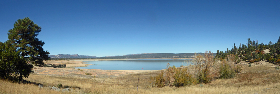
We stopped at the West Overlook to get a view of the lake.
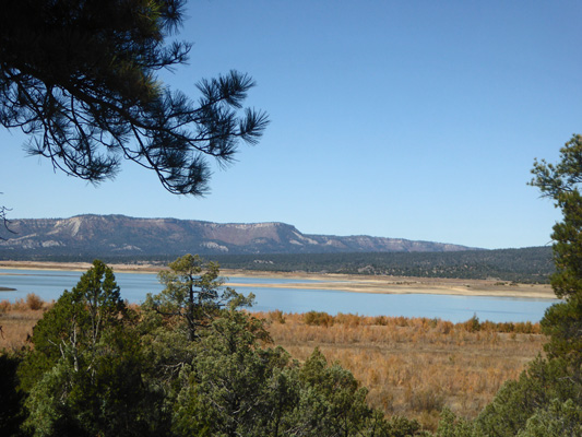
Then we stopped in a pull out just before the dam. There are lots of houses on the north side of the lake (no doubt they are why we had a decent cell signal) and this is clearly a lake they do boating on in the summer months.
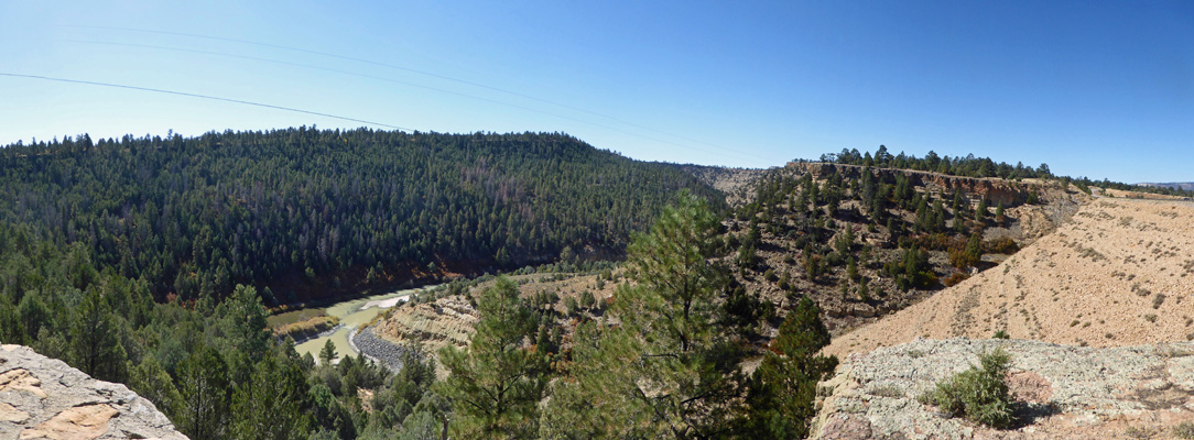
Across the road was a view point where you could see the earthen dam and down below the Chama River. You can see how the water coming out of the bottom of the reservoir has a lot of silt that it adds to the darker green river.
We drove to the boundary of the park and out to the northern end of El Vado Lake State Park which is just south of Heron Lake.
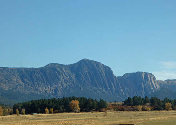
On our way back I had to slow down to take a photo of these amazing mountains in the distance.
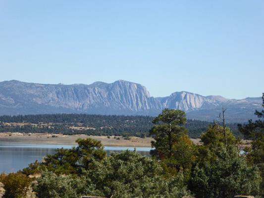
The tall one turns out to be Brazos Peak which is 11,286 feet in elevation.
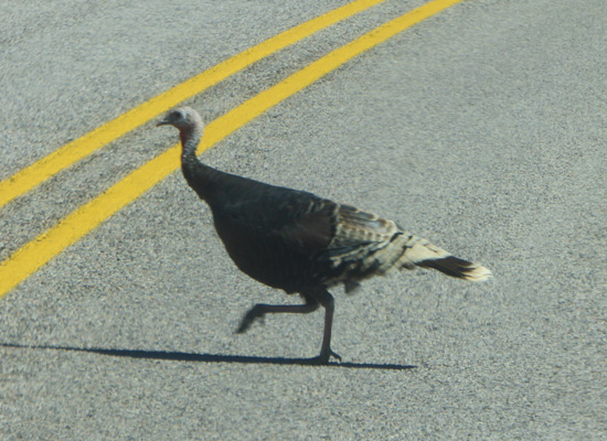
As we drove on, we spied a wild turkey crossing the road. And then we saw some of his friends (siblings probably) on the left side of the road. They scurried about and then the great explorer trotted back to join the rest.
It was cold again that night and we got down to 14 degrees by 7 am on Saturday morning. The amazing thing was that it was so dry there was no frost anywhere. The dew point according to our weather station was 4 degrees. Along about noon we decided we’d take the drive up to Chama up near the border with Colorado to get some gas—since it had the nearest gas station.
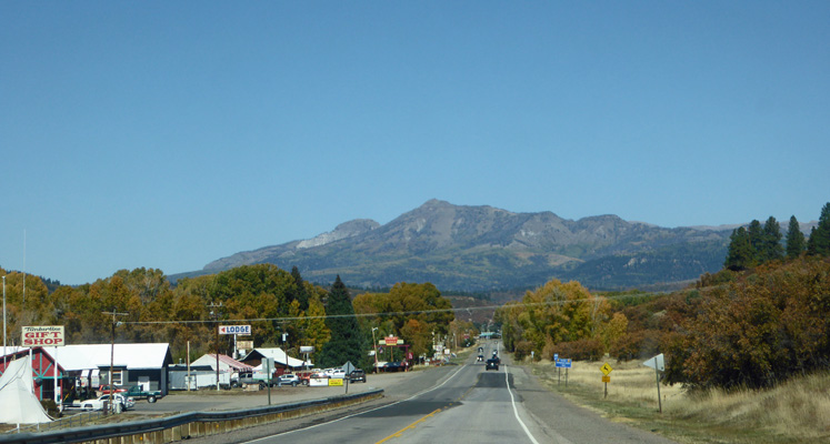
When we got back out to Hwy 84, we pulled over so I could get yet another shot of Brazos Peak.
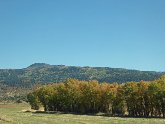
This is ranchland but here and there you see stands of cottonwoods that had lit up with fall color.
As we drove into Chama, you could see the Colorado Rockies off to the north—it’s only 5 miles to the Colorado border here.
Chama is home to the Cumbres and Toltec Scenic Railroad which runs up into Colorado to the town of Antonito. It’s an old narrow gauge train that is owned jointly by the two states. The parking lot at the station was pretty full but the train had already left when we drove through. We got our gas and then turned south and back to Heron Lake.
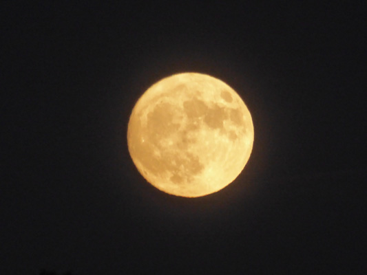
That evening the Hunters Full Moon rose over the trees out our dining room windows.
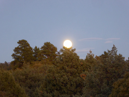
I couldn’t resist going out and taking a photo or 20.
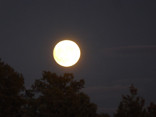
It was supposed to have an orange cast to it and that turned out to be true here in New Mexico.
It was downright balmy Saturday night and only got down to 20 degrees on Sunday morning.
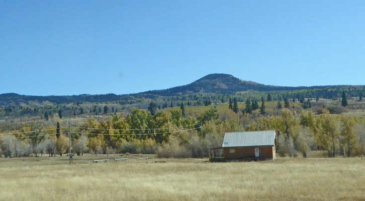
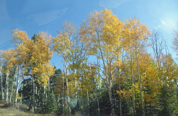
We took our time again and finally broke camp and headed out Hwy 95 to Hwy 84 where we turned south until we reached the turn off to Hwy 64 which takes you up over the mountains to the Rio Grande Valley. But first you had to go through the high mountain valleys where there was a touch of fall color.
And then up to over 9000 feet to where the aspens were mostly an interesting orangey yellow rather than their usual clear bright yellow.
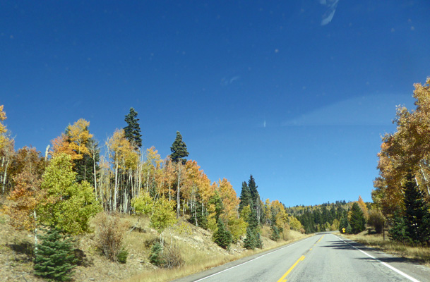
It may have just been that they were farther along since we did see some that were yellow.
When we reached the top of the pass you could see a long way off to the southwest.
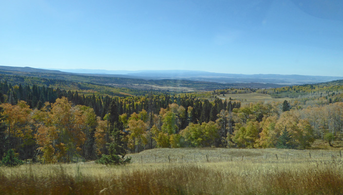
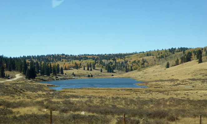
As we came down the other side of the mountains we passed Hopewell Lake, where we actually saw quite a few people along the lake’s edge.
We followed Hwy 64 right on into Taos, through old town (boy is it narrow through there when you’re pulling a big trailer) and on to Estes Es Rd. (which means This Is It Road) and the Taos Valley RV Park. We had a reservation for a full hook up pull through and we were happy to pull in and set up knowing we’d be staying put for 6 nights.
At this point we were half way through our 5 plus week exploration of New Mexico and didn’t mind at all to take the afternoon off. Their WiFi worked pretty well most of the time we were there and Walter got a few TV stations over the air including PBS (which can keep him fairly amused).
It was also warmer here both during the days (highs of 68 to 70) and at night (lows in the high 20’s) which was a nice break.