
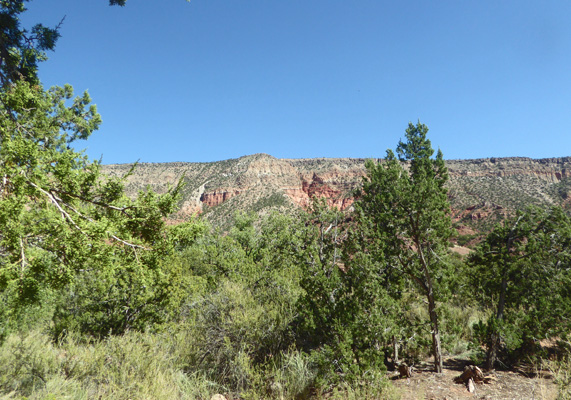
This is red rock country and we had a lovey view of the hillside to the northeast out our dining room windows.
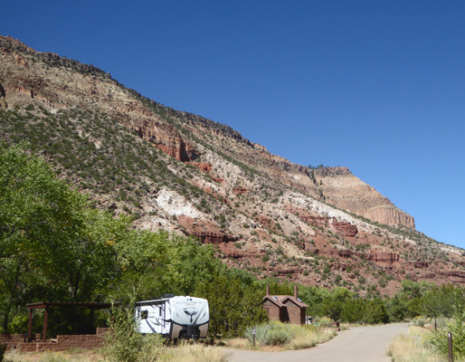
We took a stroll out to the entrance to pay our camping fee ($5 a night with our Golden Age Pass) and I shot this photo as we walked back.
It was in the mid 80’s so we put the awnings out and opened all the windows to enjoy the nice day.
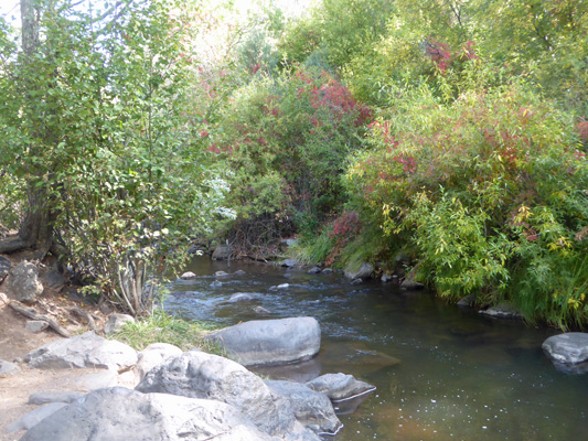
The cottonwood trees were just starting the have a bit of a yellow cast and the river (which is a bit more than a large creek) burbled nicely as I sat outside and enjoyed the view and the nice cool breeze.
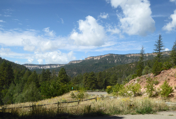
Tuesday morning, we set out to drive up Hwy 4 to explore the sights.
We drove through the little town of Jemez Springs which is very upscale, full of B and B’s, two hot spring spas and lots of galleries. It’s an easy get away for the folks in Albuquerque and there are some very nice houses both along the river and up on the ridge around town.
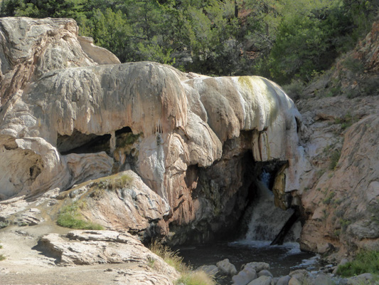
Just outside of town is Soda Dam—a hot spring on the river that has left a deposit of travertine that dams the river enough so there’s a popular semi-heated swimming hole there in the river.
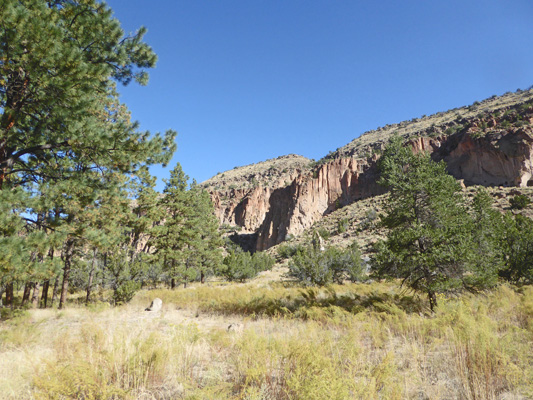
Our next stop was Battleship Rock which looms over the highway with its prow soaring into the sky.
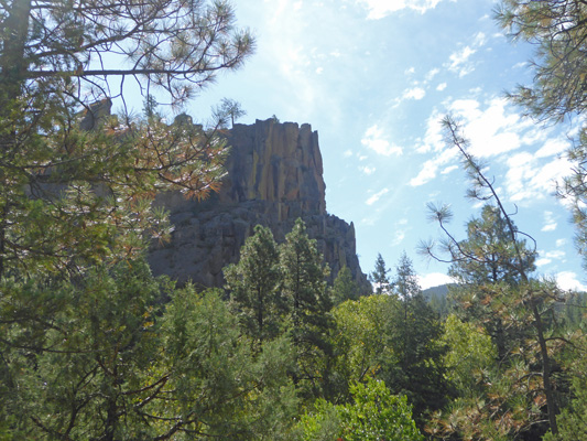
The view looking back down the highway was pretty nice here too.
I took the trail down the hill to the picnic area (we’d missed the turn off and so had parked at the trailhead parking up above) and got a nice shot of the river as it burbled through here. The Virginia Creeper that threaded though the trees here had started to turn bright red.
The highway wound its way farther up into the mountains and we took the turn off to Jemez Falls. The trailhead for the falls is out past the campground here so you just take the campground turn off and follow the signs. We were up above 8000 feet so Walter was happy to sit in the truck as I made the quick hike out to the falls.
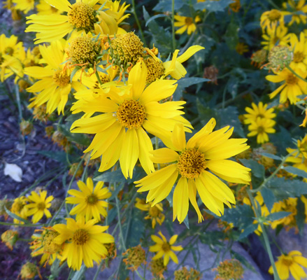
There were flowers here and there growing in the shade of big old Ponderosa pines.
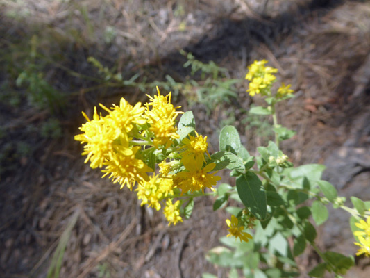
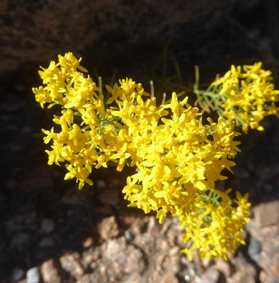
Wright’s Goldenrod (Solidago wrightii).
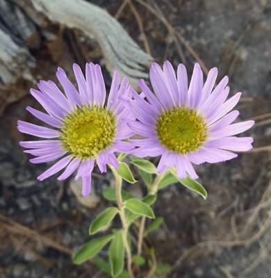
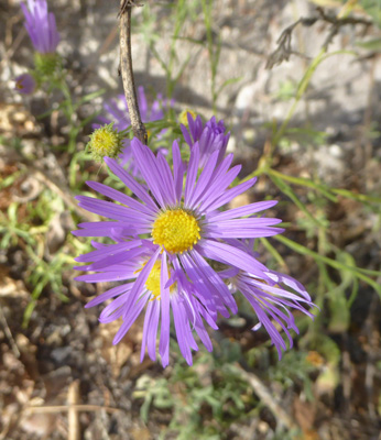
And Bigelow's Tansyaster (Dieteria bigelovii).
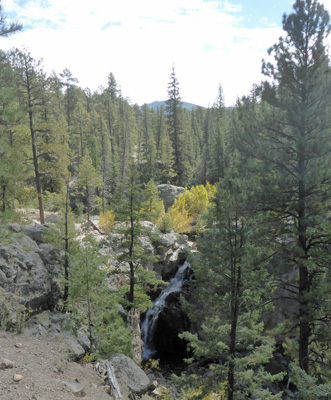
The trail hit some large rocks and scattered but I could hear the falls so I followed one of the trails until I could see the railing that keeps you from falling into the chasm and managed to find my way down to the view.
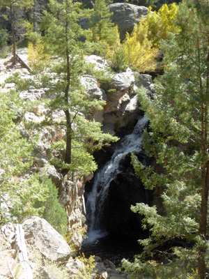
Here’s a closer shot of the falls themselves.
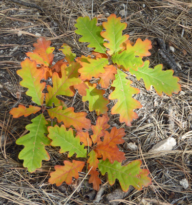
I made my way back to the trail proper and passed a Gambel oak seedling just starting to make some fall color.
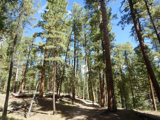
This was a very pleasant hike with temperatures in the high 60’s and wonderful stands of Ponderosa.
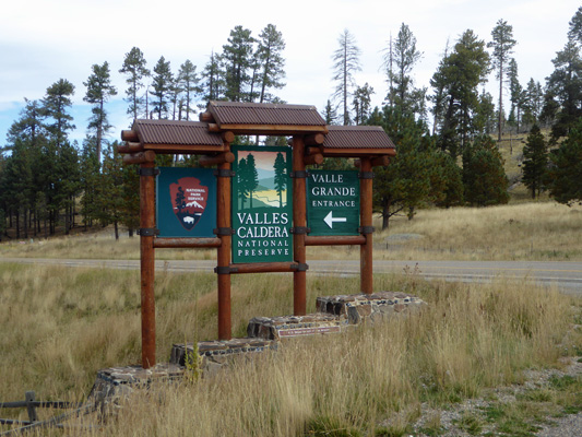
Hwy 4 tops the mountains at Valles Caldera National Preserve.
The caldera is the remains of a huge volcano that blew up 1.5 million years ago. The eruption was 300 times the size of the Mount St. Helens eruption in 1980. The ash and pumice from that eruption fell as far away as Kansas, Utah and Wyoming and buried the surrounding area in up to 1000 feet of ash.
It was a private ranch (which had passed through many hands over the years) until 2000 when the federal government purchased the land. It became part of the National Park Service in 2014. While the entry signs say that there is a $25 fee for entry, those fees have been suspended for the time being since the Park Service hasn’t had the money to put in anything but the most basic signage in the park.
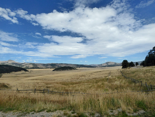
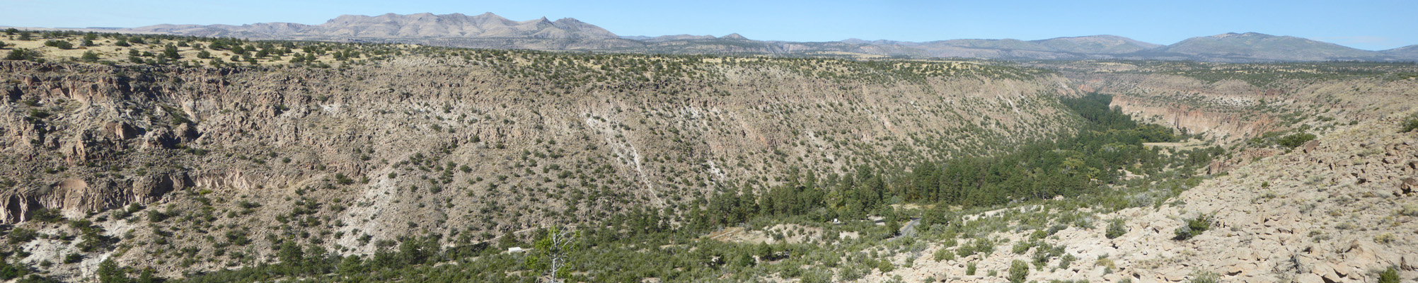
We drove the dirt road towards the Visitor Center and I shot a photo of Valle Grande (the main valley within the caldera). There are hills and cinder cones all over the caldera since it remained active even after it blew up several times.
We watched as a coyote trotted along through the grasslands.
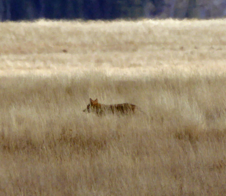
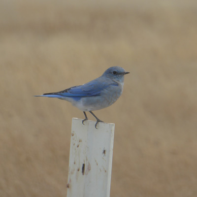
He eventually trotted across the road in front of us. There were also tons of Mountain Bluebirds sitting on the milepost signs along the edge of the road.
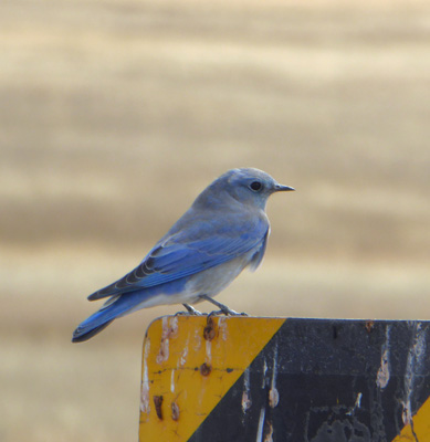
I’ve probably seen 5 or 10 of them in the years we’ve been traveling. I know I saw well over 100 in just the hour or so we were in this park.
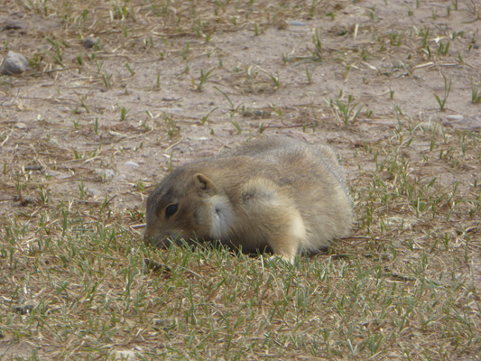
There were prairie dogs in the Visitor Center parking lot. This guy seemed to be filling his cheek pouches with grass, probably to line his nest for the winter.
We stopped at the Visitors Center (which is in a temporary building brought in back in 2006) and learned that we could drive the dirt roads in the park to see the old ranch buildings and look for wildlife.
They had a spotting scope on the porch trained at a large herd of elk out in the meadow. Even with my zoom lens they just looked like black dots. But with the scope I could see that there was at least one very large bull elk hanging out with his harem.
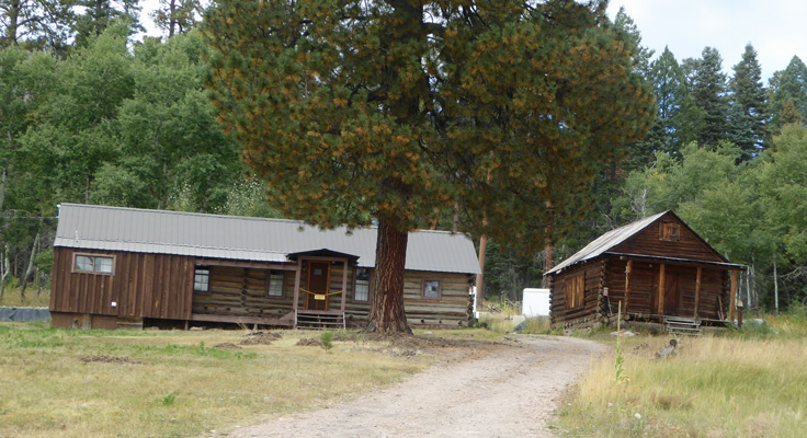
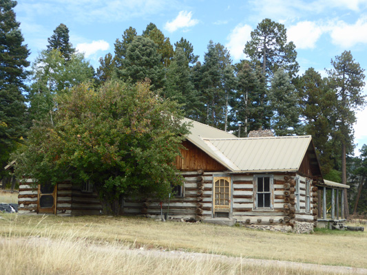
We got our pass to drive in the park (which you have to return to the Visitor Center when you’re done so they know you’ve left when they close up at the end of the day) and set out to drive part of the 35 miles of dirt road in the park. It leads you though the area where a cluster of ranch buildings of various ages are clustered.
There’s no signage so you have to guess from the map that they hand out which is which. I think that the building on the left is the Otero Cabin built in 1915 and next to it is the 1941 Commissary.
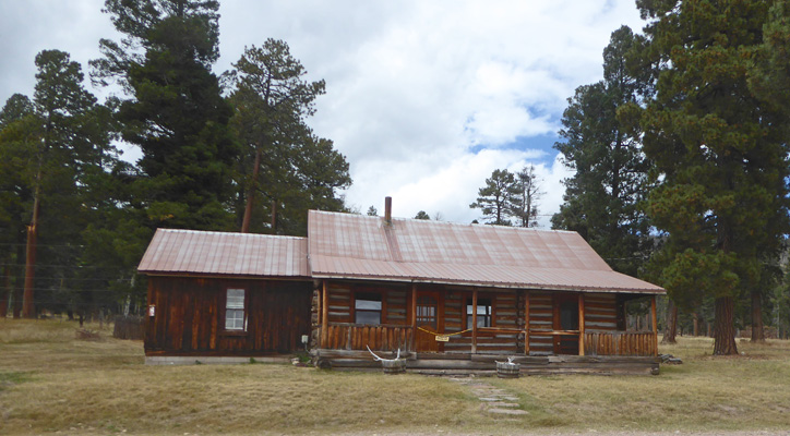
This is the Bond Cabin built in 1918.
And this is the Ranch Foreman’s Cabin built in 1918.
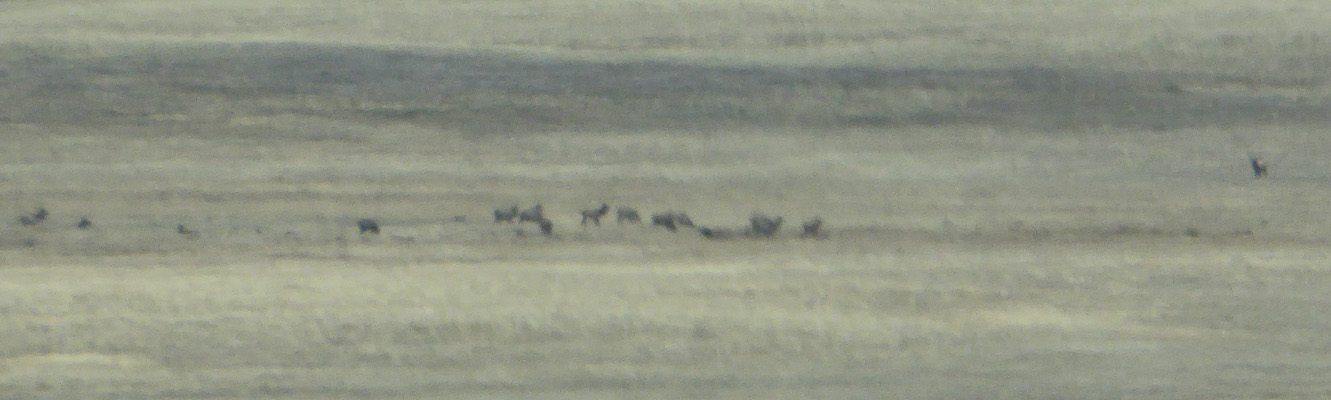
We drove on past lots of big old Ponderosas. The ranching here degraded the grasslands and wetlands and the park service is putting a lot of energy into restoring the balance in both. The elk seem to approve. We could spy the herd out in the middle of the valley again. Yes, I know it’s fuzzy—they were a long way away but at least you can see they were there.
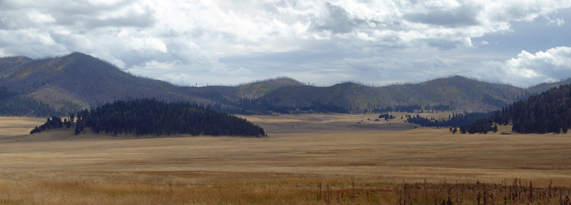
Eventually we’d had enough of bumping along on the dirt road so we turned back and I took a shot of the valley from the road. Here we were near to 9000 feet and fall color was beginning to tinge the grasses too.
The dead timber on the surrounding hills (mountains) are from two huge fires in 2011 and 2013 that burned 2/3 of the preserve. They have since introduced controlled burns in hopes of returning the area to it’s normal balance and thus thinning the remaining forest.
As we drove out of the park I took one more shot of one of the many mountain bluebirds who escorted us as we drove along.
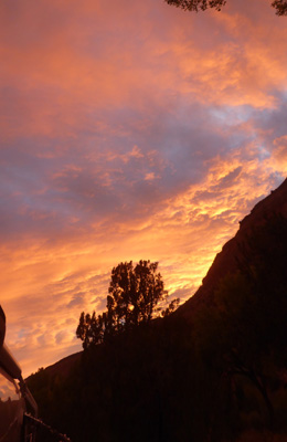
That evening as I began to cook dinner everything turned golden. Outside you could see the clouds had turned yellow/gold as the sun sank behind the hills.
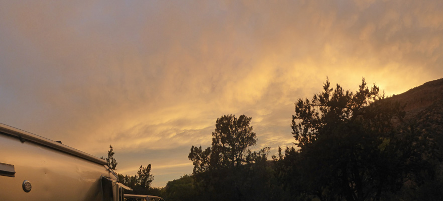
From gold we moved to orange/pink.
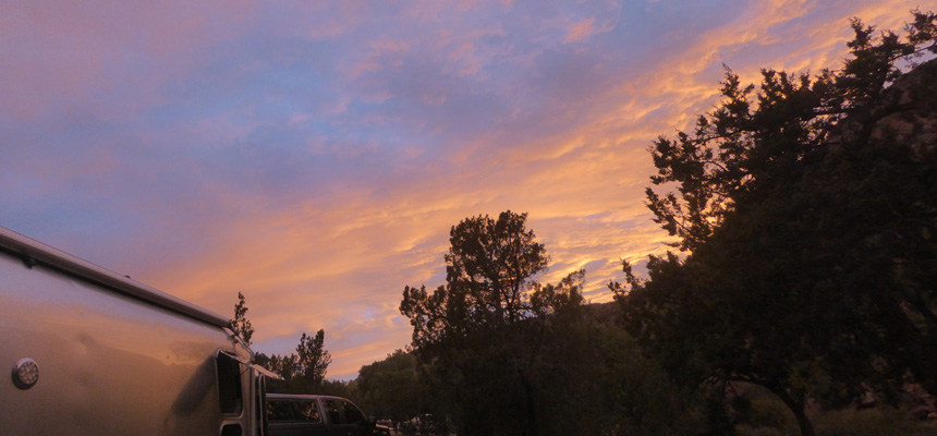
I took this panorama shot s o you could see the color reached above us too.
We’d had plenty of sunshine our two days at Vista Linda and the solar panel had kept our batteries nicely charged up. Wednesday morning October 2nd, we packed up and drove back up Hwy 4 over the crest and then down a series of hairpin switchback curves towards Los Alamos, NM and Bandelier National Monument. The last switchback was a real doozy but Walter managed to get us around it without a hitch and we motored on to the Juniper Family Campground at Bandelier National Monument.
They were doing a repaving project in the park (and had just finished repaving the campgrounds themselves) and all the cones everywhere made figuring out where to go a bit interesting when we arrived in the campground. But in the end we found a nice spot that wasn’t too hard to back into (though we had to park the truck at an angle to fit it off the road) and with lots of sun for the solar panel.
We set up camp and had lunch and then a little after 3 we went down into the canyon to the Visitors Center. They were restriping the Visitor Center parking lot so we had to park in the overflow but that wasn’t too much of an issue. There is very little parking down in the Frijoles Canyon and between 9 and 3 you have to take a shuttle bus either from the town of White Rock 8 miles away or from the campground.
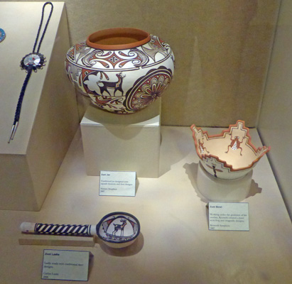
We watched the movie about the park and had a nice look at their museum which had a nice collection of pottery and other goodies.
And we decided that the best way to see the ruins here was to come back early the next morning when there were fewer people and it wasn’t so hot. It was only in the mid 70’s (we were at 6000 feet) but the sun was really hot. So we checked to make sure our plan would work (yes, we could come down with the truck before 9 and then leave anytime when we were finished) and went on back home.
There were Ponderosa pines in the campground and as the sun moved west they shaded the solar panel so we didn’t get as many hours of charging here as we had at Vista Linda but we were still doing okay.
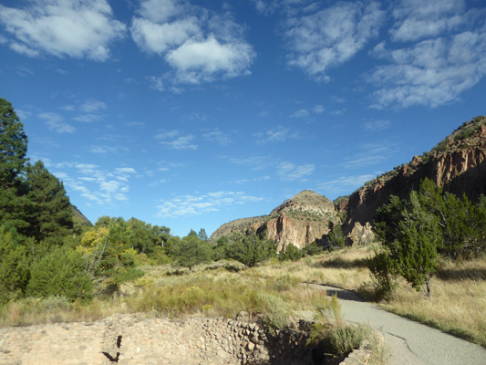
It was in the low 50’s when we got up at 7:30 the next morning so we bundled up a bit when we drove down into the canyon at 8:30. We got a parking spot right in front of the Visitor Center and set out on the Main Trail.
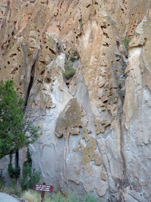
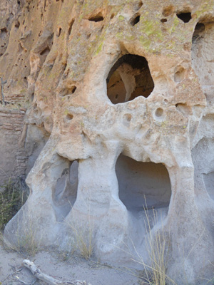
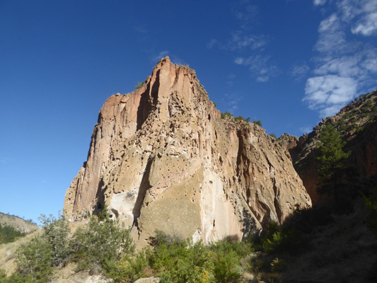
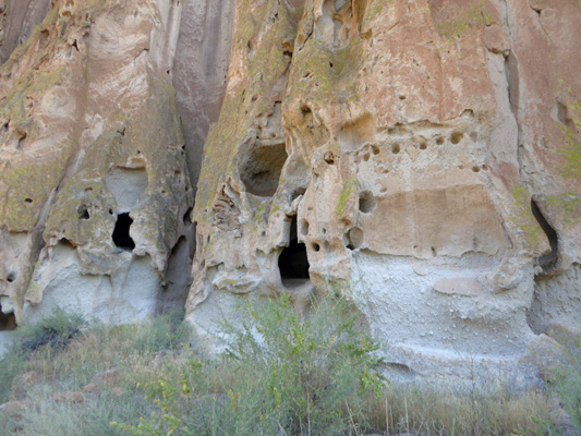
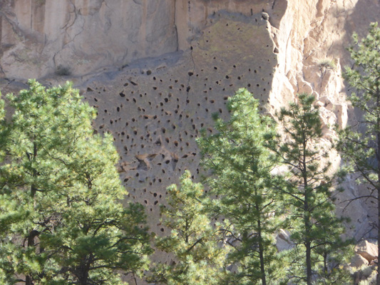
The valley is made of volcanic tuff, which is basically compressed volcanic ash mixed with pumice. It’s harder than pumice or ash but it erodes in interesting ways so that the walls of the canyon look like Swiss cheese.
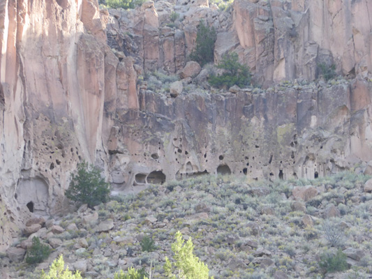
The Ancestral Pueblo people who made their homes here in the 1200’s used the caves as the basis of many of their homes, enlarging the caves and then adding stone or adobe rooms on the front.
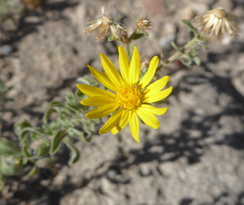
There were Fall Tansyaster (Dieteria asteroides) in bloom along the trail.
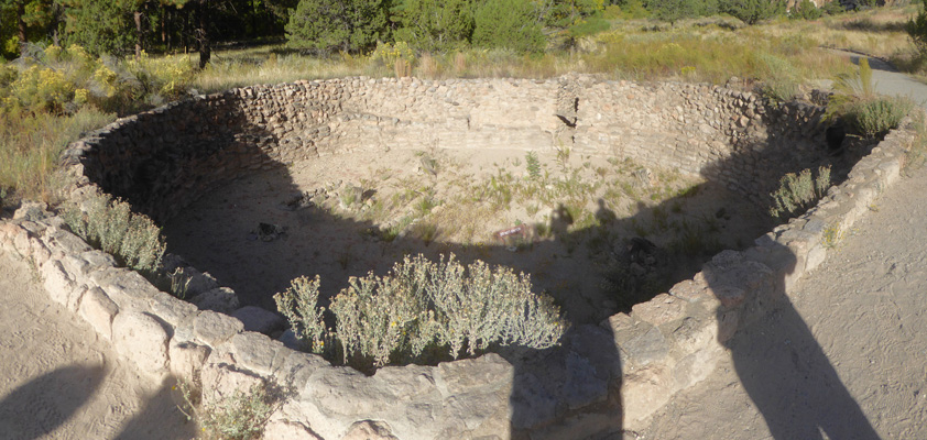
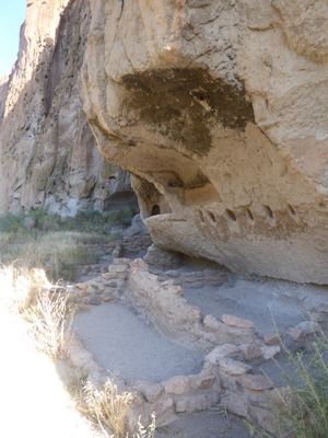
The Big Kiva (which is a restoration) is the first structure you come to along the trail.
The paved trail takes you up the valley where we were beginning to see the first of the clouds that would bring us heavy rain that night and into the early afternoon the next day.
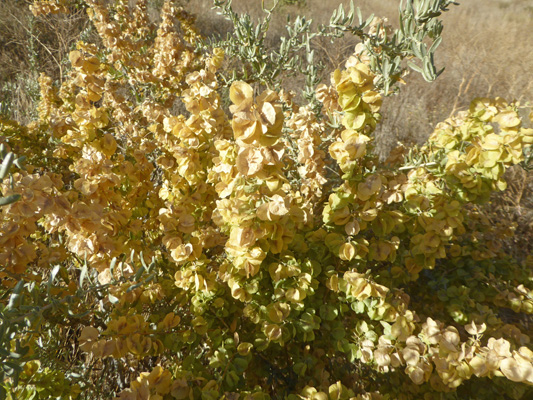
There was more Four-wing Saltbush (Atriplex canescens) here.
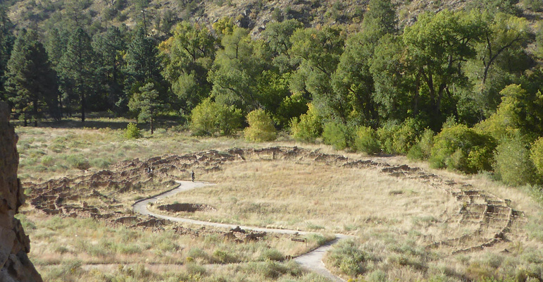
main ruins in the center of the canyon are the remains of the village of Tyuonyi (pronounced Qu-weh-nee).
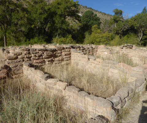
The small rooms are arranged in a big circle around a central plaza.
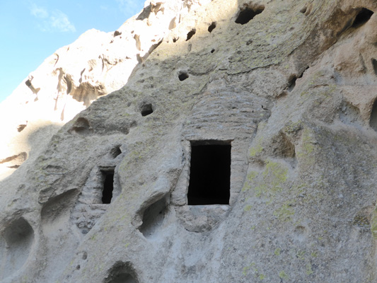
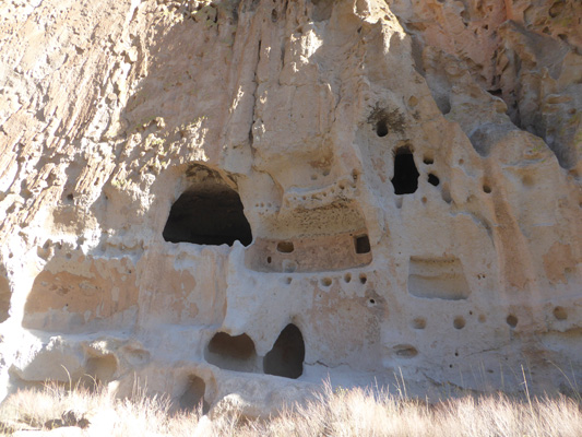
The trail takes a turn here and you go up the hillside to view a series of cliff houses that were built into the caves in the tuff. You get a nice up close and personal view of the tuff and how it erodes as you climb the trail.
They provide ladders up into several of the caves.
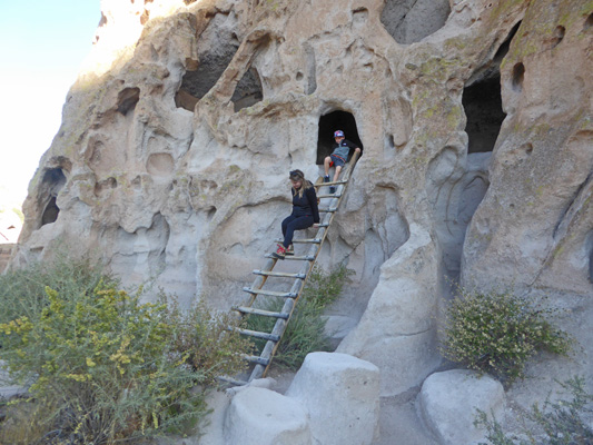
It has a fairly fanciful look to it because of the way the rock erodes. And the little boys in the group in front of me had wonderful time climbing the ladders and crawling around in the caves.
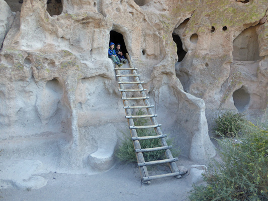
Can you imagine living in a place like this with all of these nooks and crannies?
In 1920, they built a reconstruction of what they thought the houses in front of the caves looked like. They know now that the entrances are probably wrong but hey, it’s here and you can see how the roofs worked.
From up on the hillside you an see down to the shape of the ruins of Tyuonyi.
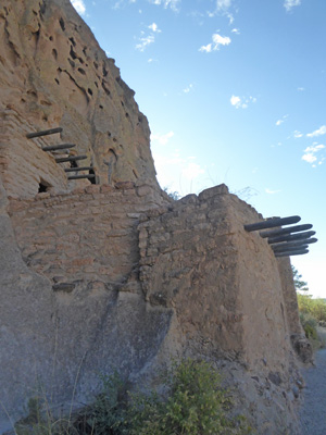
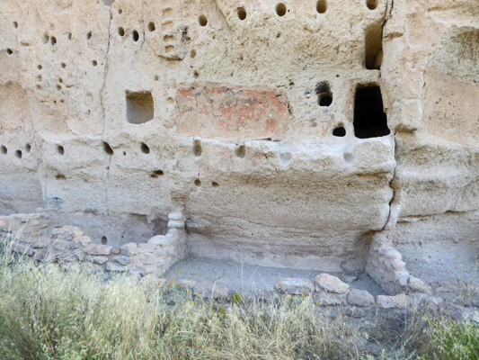
A few of the cliff dwellings have square doors created with bricks.
Every now and then there was a section of tuff that hadn’t been lived in because the holes aren’t big enough.
Here you can see how they carved holes in the rock to hold their roof posts for the room in front of the caves.
The trail guide said that they smoked the ceilings to harden the tuff. Here you can see that and the walls of the rooms that sat in front of the caves.
The trail goes back down the hillside and then continues on to an area they call the Long House.
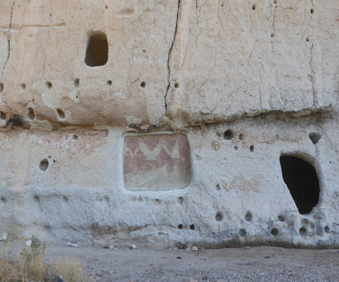
Here there are post holes in the tuff that indicate a very long single roof along with the foundations of the rooms that lay there.
There’s also a pictograph that had been covered with plaster.
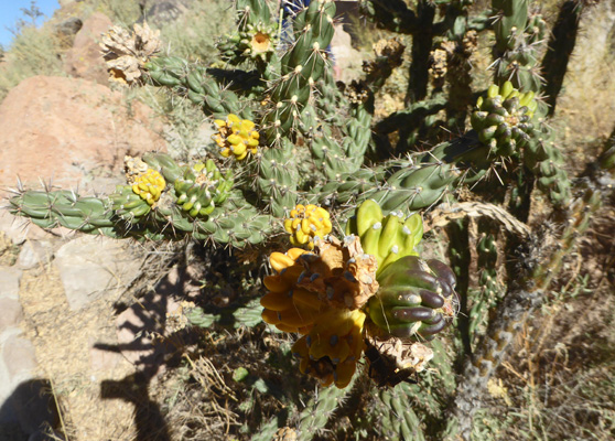
There were cane cholla along the way. This one still had yellow fruit on it.
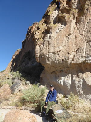
Walter tested a number of the nice benches along the trail and this one by the Long House passed with flying colors.
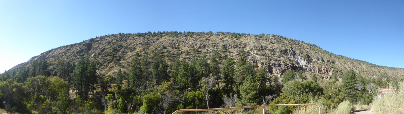
Before we headed back down into the valley I took a panorama shot of the hills across the way.
From here you can either go on for another 1/2 mile to the Alcove House where you get to climb four steep ladders up into a ruin or you can return along the Nature Trail to the Visitor Center. We took a pass on the ladders and turned back here.
The Frijoles River was dry as we followed it but there were nice signs telling you all about the flora and fauna of the area.
There were Ragleaf Bahia (Amauriopsis dissecta) in bloom in the inner courtyard of the Visitor Center.
Before we left the valley I took yet another shot of the Swiss Cheese tuff.
On the way back to the campground we stopped at the Bandelier Overlook where you get a view of the valley below and the mountains in the distance.
Along the trail to the overlook I spied some Broom Snakeweed (Gutierrezia sarothrae).
And some Hairy Goldenaster (Heterotheca villosa).
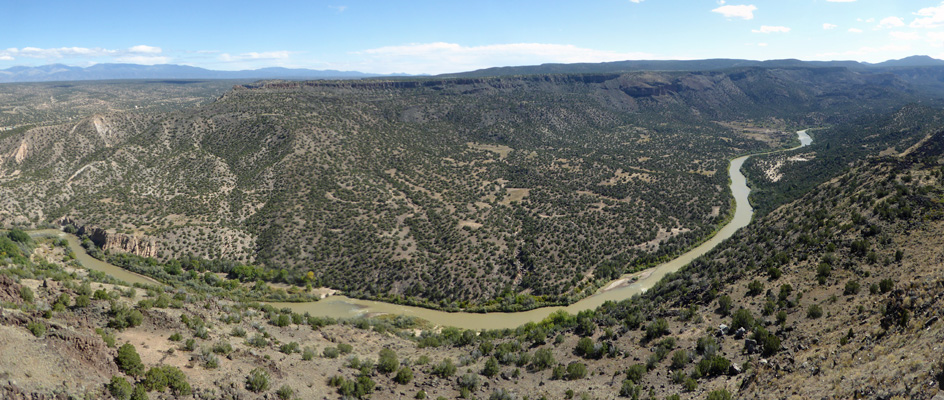
We had a quiet morning trying to keep the sun focused on the solar panel and then decided to go into the town of White Rock to do a little grocery shopping and to visit the White Rock Overlook which gives you a view northeast over the Rio Grande Valley with the Sange de Christo Mountains in the distance.
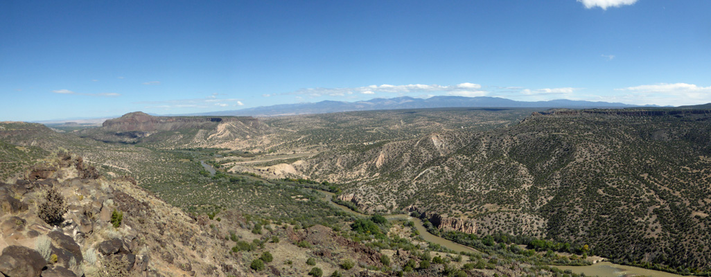
And southeast following the Rio Grande south.
It started to rain in the night with thunder and lightening and continued to rain steadily into the late morning.
We took a drive over to Los Alamos (an experience in and of itself because if you take a wrong turn you end up at a security gate for one of the many buildings associated with the Los Alamos National Laboratory) and visited the Bradbury Science Museum in town. It’s a nice little museum but it was FULL of people looking for something to do on a rainy day. We watched the two movies they have, one on the development and testing of the atomic bomb here and the other on what the Los Alamos Laboratory does today—both very good and informative.
Having stopped by their large Smiths (like a small Fred Meyer or a big Fry’s) to pick up a saucepan because one of ours lost its handle after 20 years of camping use, we came home and ran the generator since it had stopped raining but there wasn’t enough sunshine to help us charge the batteries.
Saturday morning October 5th, we broke camp and headed out of Bandelier on Hwy 4 which took us through White Rock and out to Hwy 50. This took us to Hwy 285 south where we skirted Santa Fe and picked up I-25 south. We continued on to Hwy 16 where we headed west to Cochiti Lake Recreation Area where we had a reservation for 2 nights for a campsite with water and electricity. We checked in and got ourselves all set up. Not only did we have electricity (oh so sweet) but there was a 5 bar 4G cell signal. Whoo Hoo. We had been lucky to get 2 bars at Bandelier and there had been no signal at Vista Linda so we were in fat city. Civilization for sure.