
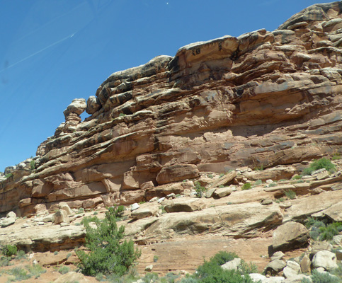
Along the way I spied a little bit of blue sky though an arch made of tumbled boulders, I think.
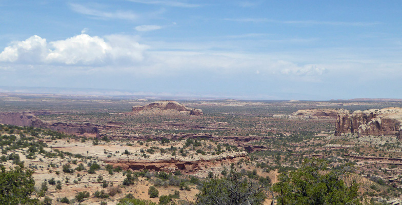
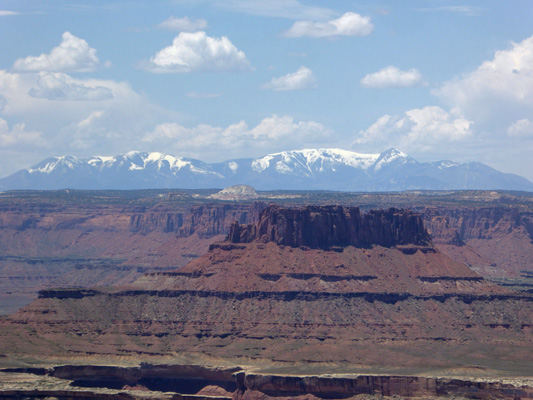
Next up was a turnout where you could see the Monitor and Merrimac Buttes. These two buttes were named after the warships the Monitor, a Union ironclad steamship, and the Merrimac (correctly spelled Merrimack), the hull of which was made into the Confederate Ship the Virginia. They fought a naval battle during the Civil War, which was the first battle between two ironclad ships.
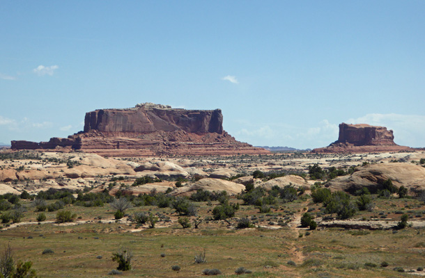
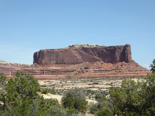
The Merrimac is the bigger of the two buttes.
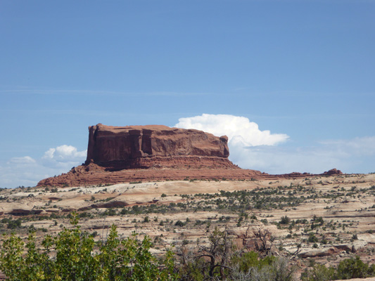
And the Monitor is the smaller one.
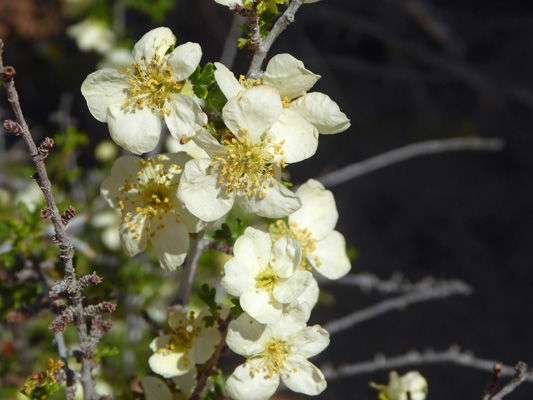
At the overlook there was Stansbury's Cliffrose (Purshia stansburyana) in bloom.
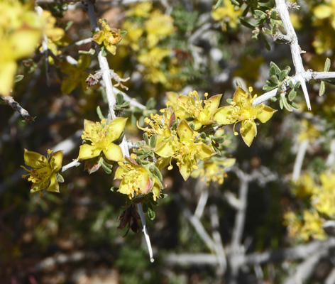
Plus Blackbrush (Coleogyne ramosissima)
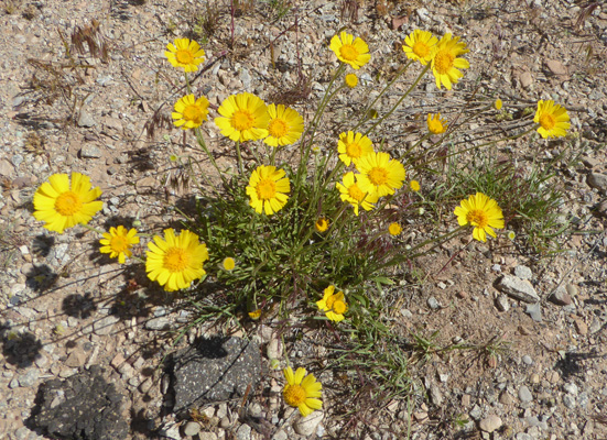
And Ives' Fournerved Daisy (Tetraneuris ivesiana) too.
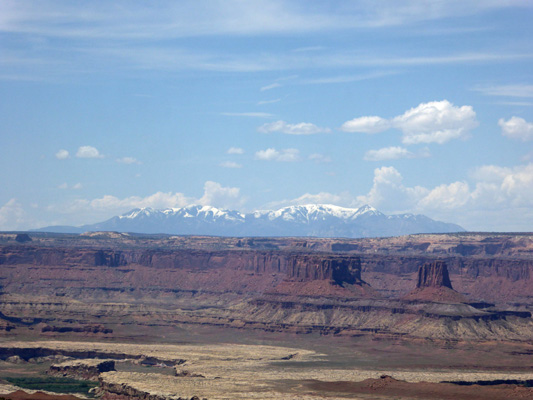
After 26 miles you pass the Visitor Center for Island in the Sky—where we didn’t stop since their parking area was full. Just past the Visitor Center is Shafer Canyon Overlook. That’s the Colorado River cutting through the canyon.
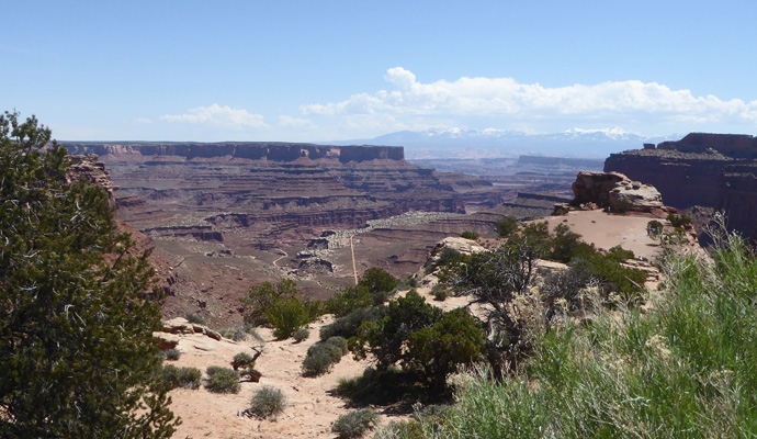
We got another lovely view of the La Sal Mountains from here.
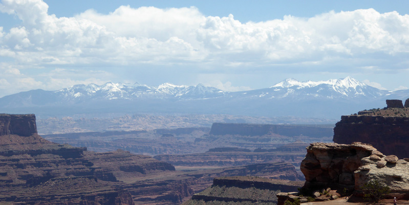
Across the way you can see the Shafer Trail Road which is an unpaved 4-wheel jeep road that descends into the canyon. We could see folks on what looked like mountain bikes but might have been trail motorcycles way down in the canyon.
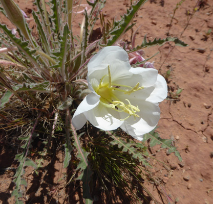
There were Tufted Evening Primroses (Oenothera cespitosa) in bloom in the parking area.
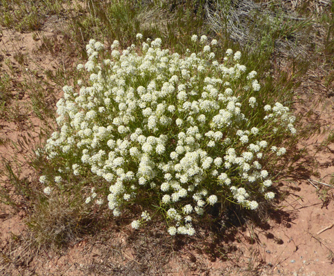
Along with Mountain Pepperweed (Lepidium montanum) and
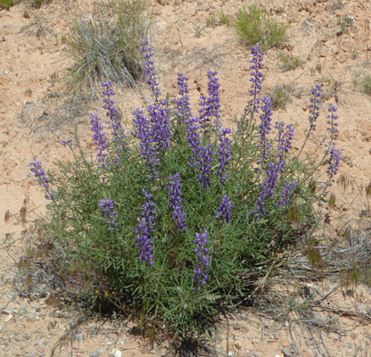
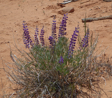
Lupine
We continued on past the Mesa Arch Trail parking area (which was full) and turned north on the park road towards Upheaval Dome. Along the way I spied some Whipple's Fishhook Cactus (Sclerocactus whipplei).
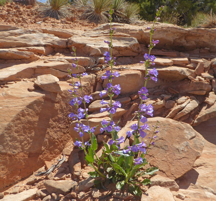
Some lovely penstemon growing out of a crack in the rocks.
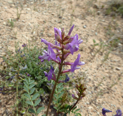
And Silvery Lupine (Lupinus argenteus) along the verge of the road.
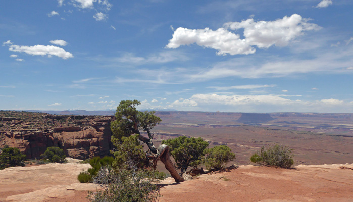
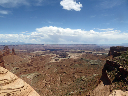
Along the way we stopped to catch a view looking west from the road.
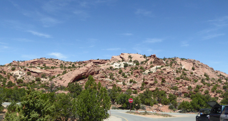
The parking lot at Upheaval Dome was close to full. There is a hike here that lots of folks were heading out on that starts with stairs and is considered Moderate even though it’s not real long. We took a pass but I did stop and take a photo of the area.
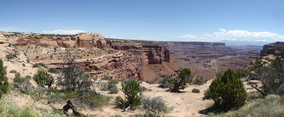
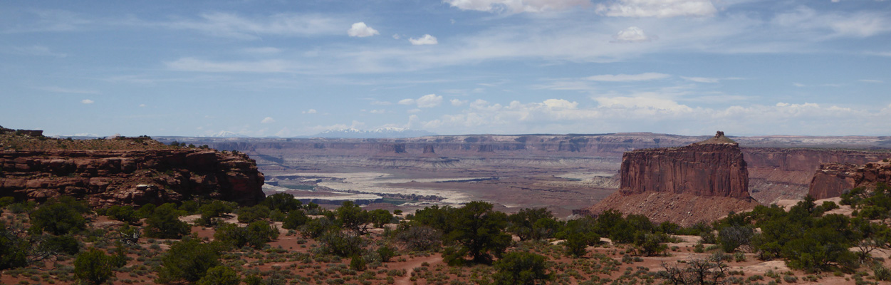
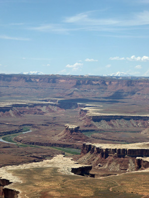
The road ends here so we turned back and retraced our route. Along the way we stopped at the Holman Springs Overlook where I got a shot to the west of what I think are the Henry Mountains where Mount Pennell rises to 11,407 feet.
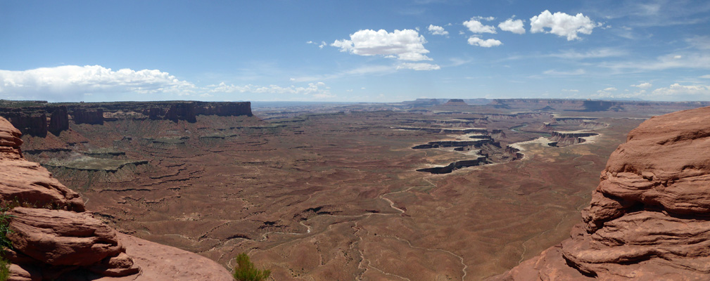
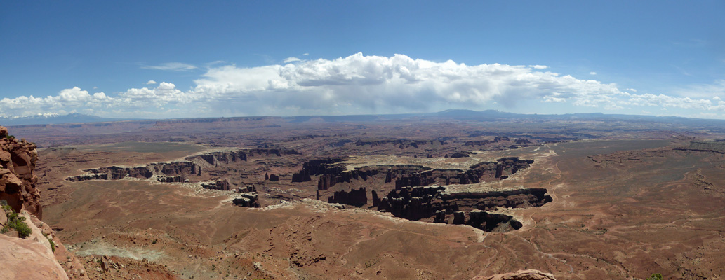
Here’s a panorama shot from the Holman Springs Overlook. That’s the Green River down below.
We drove on and took the turn off for the short road that takes you to the Green River Overlook.
Here’s a closer shot of the canyon that the Green River is cutting deeply into the plateau.
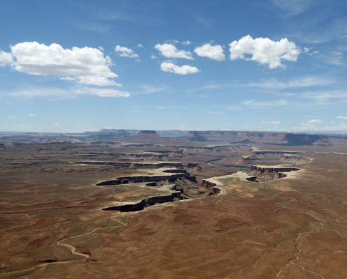
And when we zoom in a bit more you can actually see the Green River.
From the Green River Overlook we continued south to the Orange Cliffs viewpoint.
Off in the distance we caught sight of the Henry Mountains again.
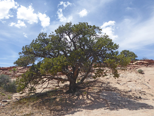
As I headed back to the truck I couldn’t resist taking a photo of this gnarled old juniper sitting on the edge of the canyon.
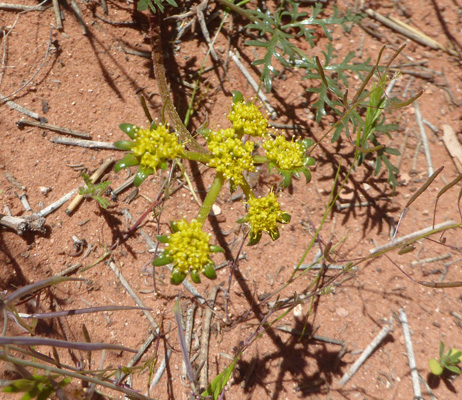
I also nearly tripped over a Parry's Biscuitroot (Lomatium parryi) on my way.
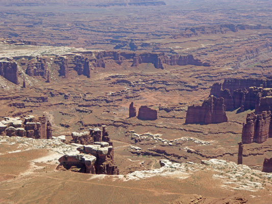
We had to drive around the Grand View Overlook parking area twice to find a parking space and when I found one it was waaaaaay out there. So I hiked back to the overlook which was worth the walk.
This is part of Meander Canyon just before the Colorado joins the Green River.
Down in the canyon there were needles and fins and you could see a portion of the White Rim Road which is a one-way jeep road that takes you from the Shafer Trail all around the Island in the Sky and out of the park north of Upheaval Dome.
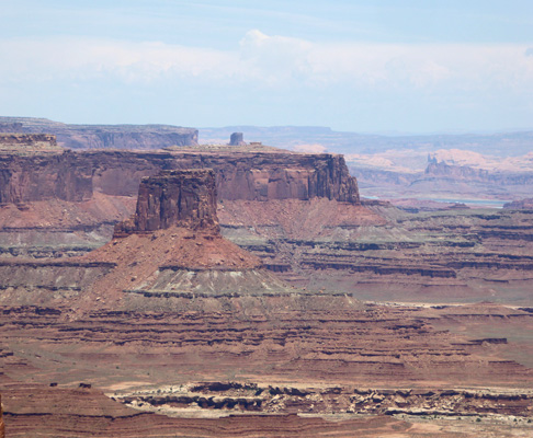
From here we began to retrace our route and stopped at Buck Canyon on the east side of the park road.
Here you can see the La Sal Mountains again.
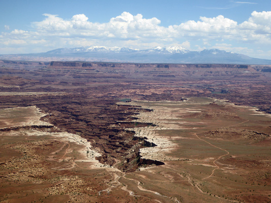
Off in the distance there were some fun buttes.
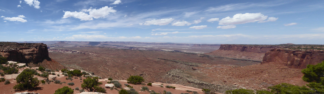
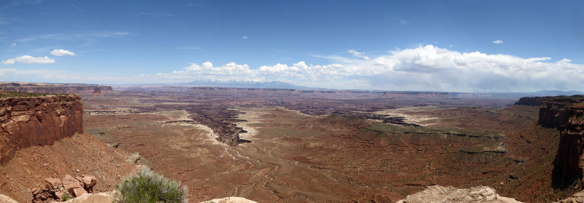
Here’s a panorama shot from the overlook.
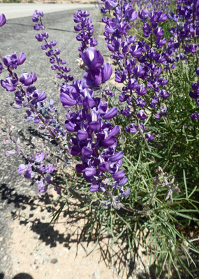
Along the road I slowed to take a shot of this nice lupine.
When we reached the Mesa Arch Trail parking area there were parking spots and I talked Walter into taking the 1/2 mile trail out and back to see the arch.
It’s a very popular hike and there were people all over the place taking pictures and climbing on the rocks.
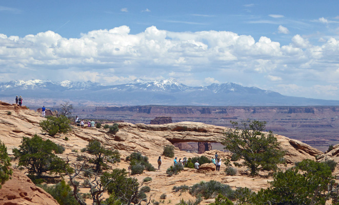
It’s a gorgeous view with the La Sal Mountains in the background. Folks come here for sunrise shots too. I wouldn’t want to take this trail in the dark but hey, I’m an old lady.
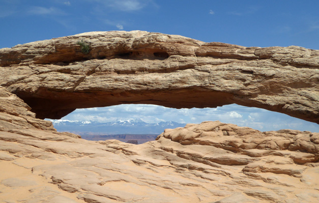
With some difficulty and a little patience I managed to get a shot of the arch without any people in it. The goal is to get the mountains through the hole in the arch, so please ohhh and ahhhh that I managed to do it.
This gives you a better view of the arch. I admit that I had to crop some people out of this one.
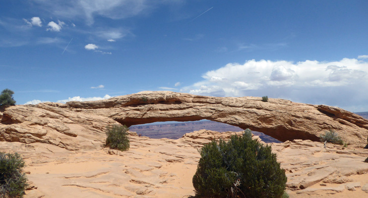
Shortly after taking this photo we had a dust devil come through and deposit a lot of sand and dust in everyone’s eyes.
Here’s a view down into the canyon on the right side of the arch.
We continued on the loop trail having to search for it from time to time.
This big old pinyon pine showed us the way at one point.
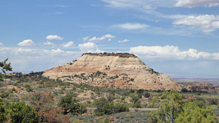
As we finished the loop, we got a nice view of Aztec Butte. There’s a 2-mile trail that you can take out to it is you want.
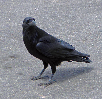
As we were leaving the parking lot, a big old raven landed right next to my side of the truck. So I did what any reasonable person would, I rolled down my window and took a picture.
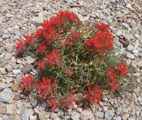
As we were driving out of the park I kept seeing these short bushy mounded paintbrush plants. Finally there was a turn out where I could stop and take some pictures. Later I learned that they are Rough Paintbrush (Castilleja scabrida).
I have now seen paintbrush is so many places that I think it might be time to take inventory of all the different kinds and locales. That’ll be a fun project to do when I’m caught up on my reports on this trip.
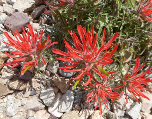
Here’s a close up of the flowers.
There were masses of this Wooly Milkvetch (Astragalus mollissimus) along the road out near the turnoff to Dead Horse Point State Park.
We were tired so we didn’t take the road out to Dead Horse Point which provides yet more view of the Colorado cutting through the plateau.
The next day we finished up our visit in Moab with an early morning trip to Arches National Park.