
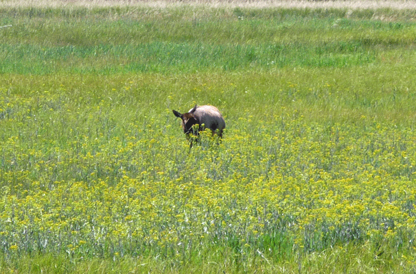
We motored straight on through town and made our way into the park itself. We hadn’t been in the park long when I spied a group of vehicles pulled over with people pointing into a meadow. I pulled over too and we took a look.
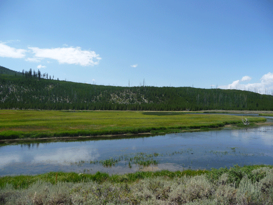
What? you can’t see the elk out there? How about here.
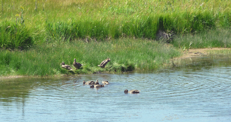
Plus there were some nice ducks in the river.
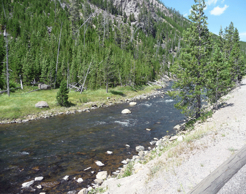
After we’d been driving a while we both realized that we were hungry and still a long way from Fishing Bridge. So we found a wide spot on the verge and pulled over along the Gibbon River.
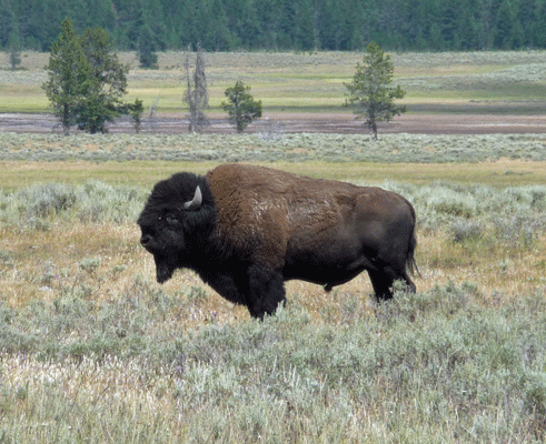
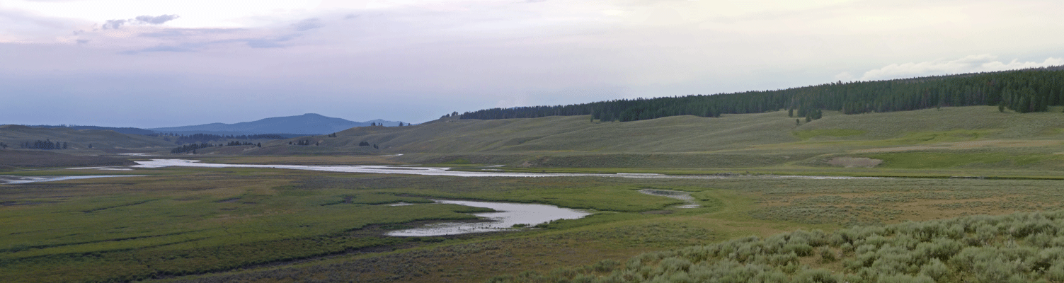
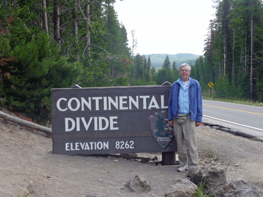
Nicely revived by lunch we drove on over the Continental Divide and then down into the Hayden Valley where we saw our first bison.
And then ended up in our first Bison-jam. At first we thought that the traffic was due to people slowing down to take photos of the herd on the west side of the road.
But then we realized that it was a little more complicated than that. The herd on the west side of the road was in the process of making its way to the east side of the road. And needless to say, Bison have the right of way on the roads in Yellowstone. There really is nothing quite so thrilling as having one of these big beasts cross in front of you.
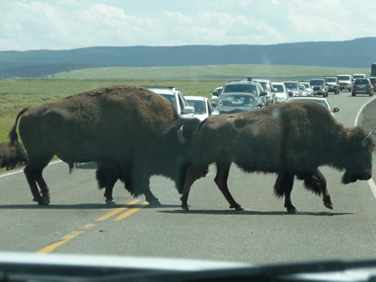
There was a ranger in a truck driving along beeping his high pitched horn trying to get the bison to move along—because sometimes they decide to stand in the middle of the road and chew their cud.
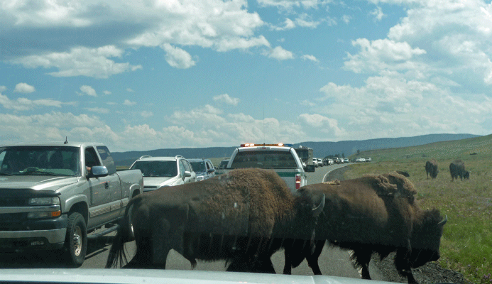
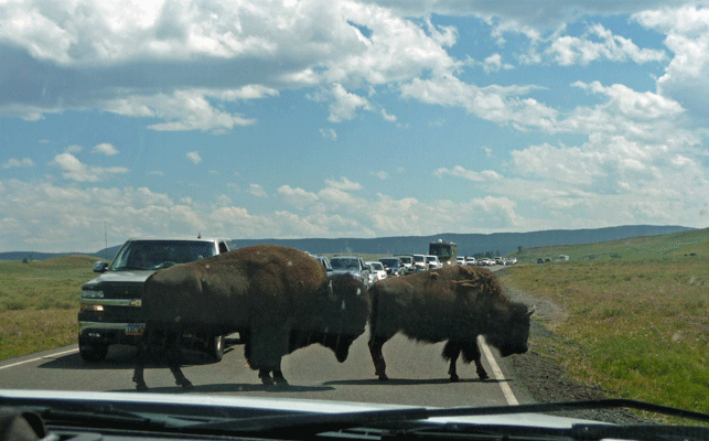
This was all well and good except that as you can see they just kept on coming right behind him.
We’d drive ahead a little then another pair or family would start across the road.
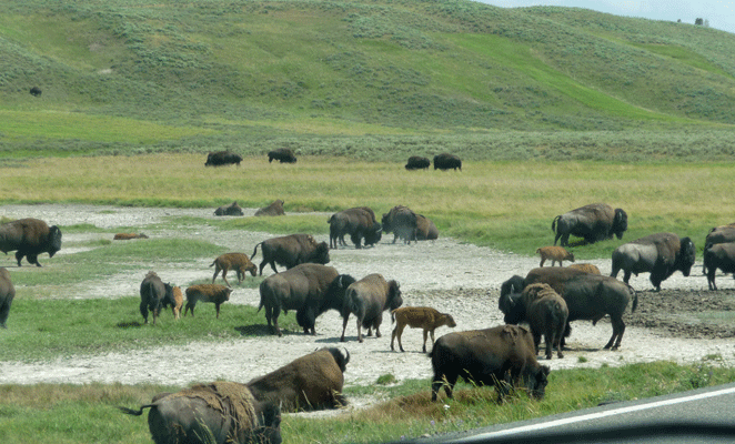
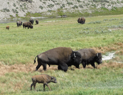
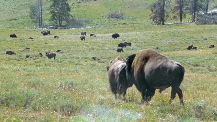
This is the time of year that the bison congregate in preparation for mating. The rest of the year the males are either solitary or spend time in small stag groups. But at this point, they are very interested in the females. They’ll walk up behind her, stick their noses up against her tail and take a big whiff. Then they’ll turn their heads to the side and flare their nostrils and breathe deeply—clearly checking her estrus state. Meanwhile she ignores him entirely and keeps on walking.
We finally made it through the Hayden Valley on down to Yellowstone Lake and our campground at Fishing Bridge by about 4 in the afternoon.
This campground is a hard-sided RV-only campground with electrical hookups. It’s not cheap (no Golden Age pass discount) but since we were staying for 6 nights, the electrical hookup was a really good thing. It’s a cheek by jowl affair—even denser than most private RV campgrounds but there are nice showers and a laundry and it’s in the park! All the other electrical hook-up sites are way outside the park so you have to drive an hour and half every day to get anywhere.
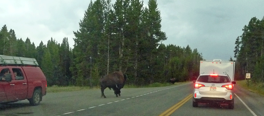
After dinner we went out critter watching again. We spied a herd of bison near the lake. And of course they decided they needed to cross the road.
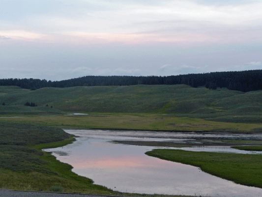
We drove on back up in the Hayden Valley and all the bison we had seen earlier in the day had disappeared up over the hills.
I got a nice shot of the early sunset reflected in the Yellowstone River though.
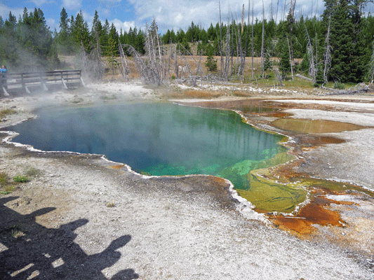
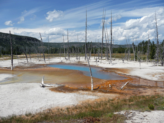
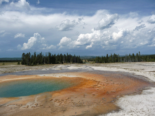
The next morning we got up bright and early and set out to explore the Southwest quadrant of the park. Yellowstone is a big place and while we had 5 days that still meant we had to make choices about what we’d see and do. So on our first full day we drove west along Yellowstone Lake to West Thumb, a geyser basin that is right next to the lake.
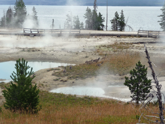
Yes, those are Canada Geese down there amongst the hot springs.
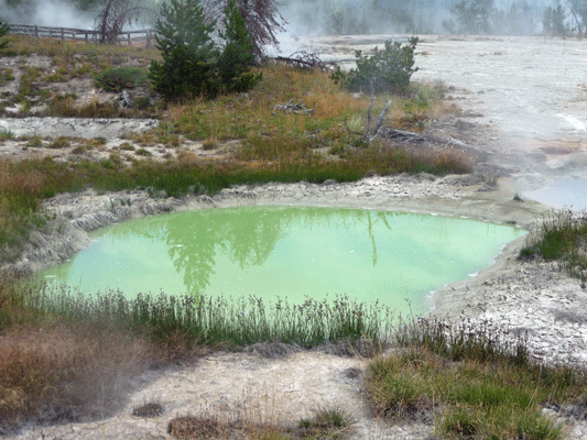
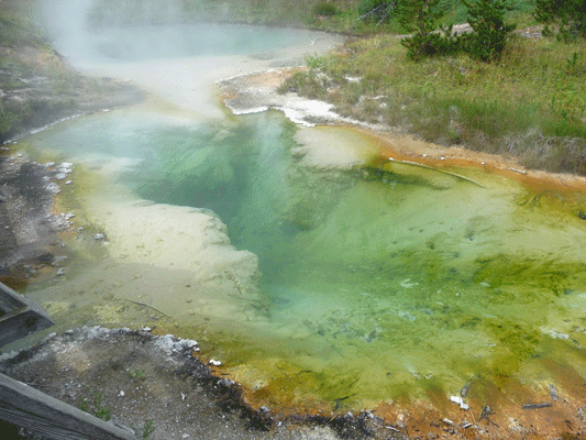
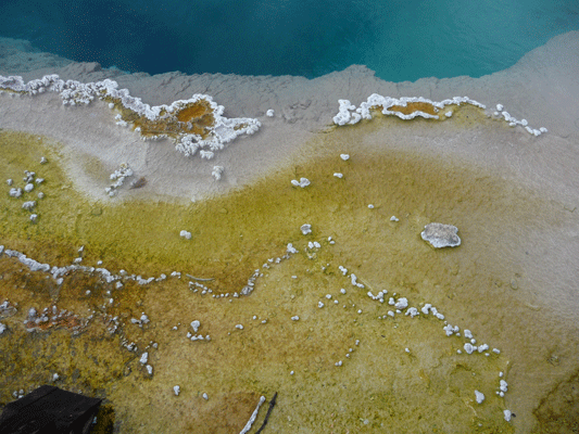
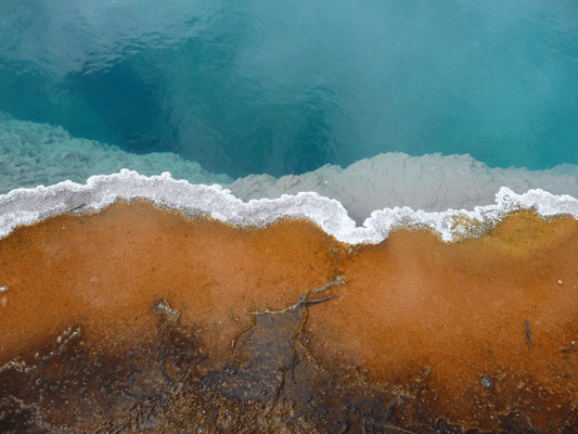
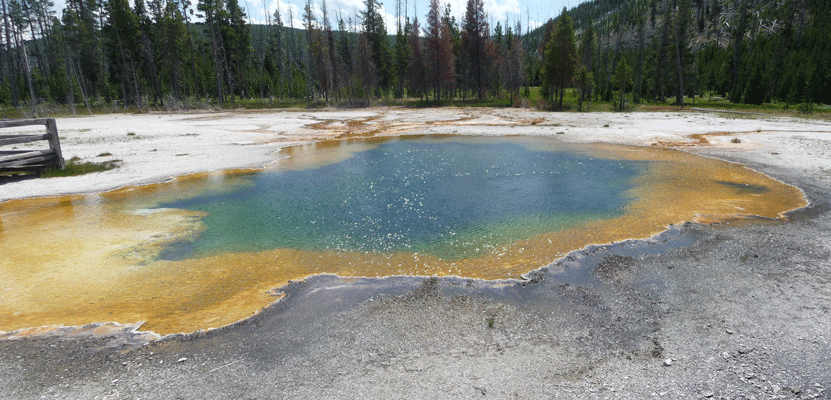
The hot springs here come in lots of different temperatures which means they come in lots of different colors.
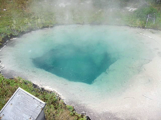
These are the Seismograph and Bluebell Pools.
 |
 |
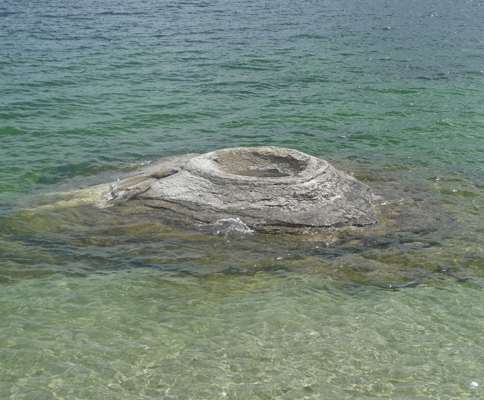
There are also hot springs and geysers that have formed out in the lake. This is the old Fishing Cone where back in the early days folks would cook the fish (the water is about 199 degrees F) that they caught in the lake. Needless to say, that’s not allowed any more.
Some of the pools bubble and boil.
And some have mats of algae in wonderful colors.
 |
 |
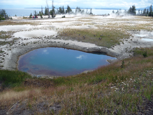
As we finished the loop we could see the geese had moved on to the edge of the Ephedra Spring.
When we’d arrived here the parking lot was about 1/2 full. By the time we’d hiked the boardwalk and gotten back to the truck the lot was full and there were buses disgorging large groups of tourists. We headed west and crossed the Continental Divide (twice). Yellowstone Lake is at 7,733 ft. elevation so going over several 8,000 plus foot passes was no big deal.
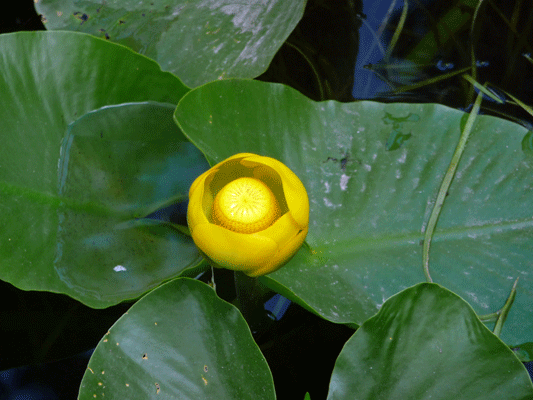
There is a little lake here called Isa Lake. It’s special because it straddles the Continental Divide. One end of it empties east and the water eventually ends up in the Gulf of Mexico and the other end empties west and eventually ends up in the Pacific. It also had yellow water lilies (Nuphar luteum) in bloom.
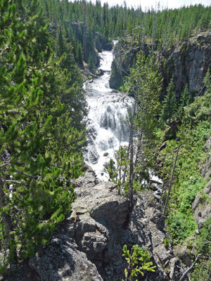
We drove on and stopped at the Kepler Cascade which is a nice waterfall right near the road.
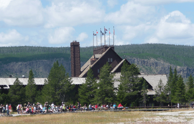
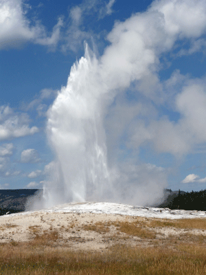
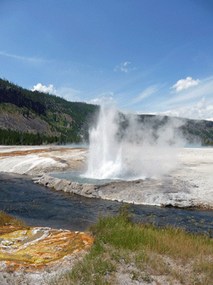
We finally arrived at Old Faithful in the Upper Geyser Basin at about noon. There are tons of parking lots here and I swear we got the last spot in the place. We hiked to the viewing area for Old Faithful which was filling up with people. This is a clue that it might erupt soon. Sure enough it was due to erupt in 20 to 30 minutes. We settled in on a bench to wait. We were on the east end of the viewing area so we had a view of the Old Faithful Hotel too.
By the time the geyser erupted people were gather 6 to 8 deep in the huge viewing area. It erupted for about 3 1/2 minutes which means I got lots of photos. Here’s the one that seems to be the best.
Once the eruption was over we made our way to the Visitor’s Center to get a map of the geyser basin and to see what other geyser might be about to erupt. There was nothing due to erupt for quite a while and it was well after 1 pm so we decided to hike back to the car and have lunch and leave the main portion of the Lower Geyser Basin for another day.
After lunch we drove over to the Black Sand Basin which is just a mile up the road. Amazingly there were several open parking spaces when we arrived!
The basin is named for the obsidian sand here but I admit I didn’t notice any. We made our way across Iron Spring Creek which is fed by the hot water from the springs here.
We saw an osprey swoop down and grab a fish and fly off, so clearly the water isn’t too hot for fish.
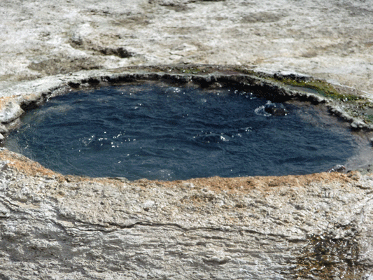
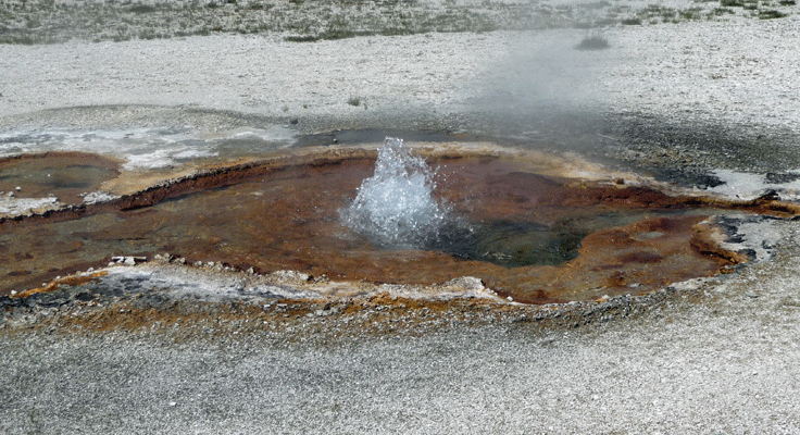
There was a nice little bubbler along the trail. I do so love things that bubble and splash and hiss and burp!
Sunset Pool gets it’s name from the colors along its edge.
Emerald Pool probably used to be greener but it’s warmed up so there’s less yellow algae growing in it so it’s more blue than green now .
The Cliff Geyser was erupting off and on the entire time we were here. It gets it’s name from the edge that has built up at its rim.
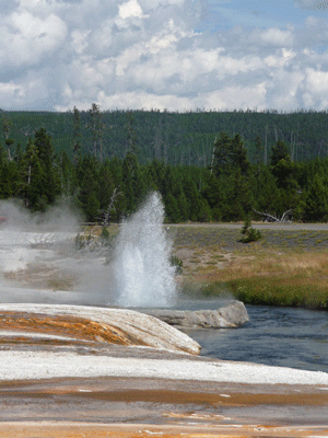
It erupts every few minutes so I get multiple chances to photograph it.
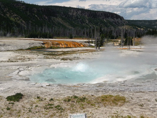
Spouter Geyser roiled but didn’t really spout for us.
The opalescent pool overflowed a few years ago and killed a stand of trees nearby. It amazing how dynamic these geothermal areas are.
From here we drove north in hopes of stopping at Biscuit Basin. But when we got there the parking lot was full and there was a long line to get in. So we drove on. It was mid afternoon by now and the traffic was heavy. All those folks who are coming to Yellowstone from outside the park have arrived along with all the rest of us who were trying to see as much as possible during the day. It was as bad as trying to find a parking space at the mall during the Christmas season.
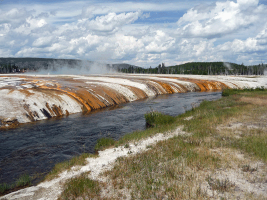
We were really lucky that when we got in line to go to the Midway Geyser basin that someone pulled out right in front of us as we worked our way into the lot, so we got a spot. There were buses galore here and TONS of people. We took the bridge over the Firehole River and up the hill to the Excelsior Geyser Crater. This geyser hasn’t erupted for a very long time but it puts out 4,000-4,500 gallons of 199 degree water per MINUTE! That’s a lot of hot water—streaming down the hill and into the river. It’s hard to photograph because its so steamy.

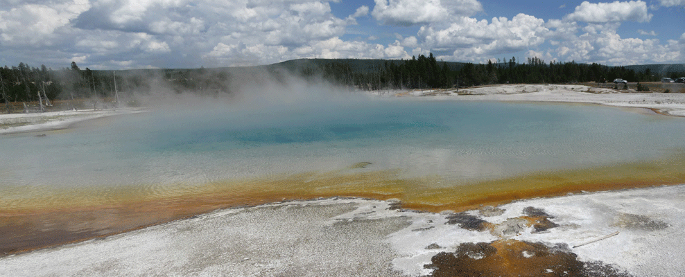
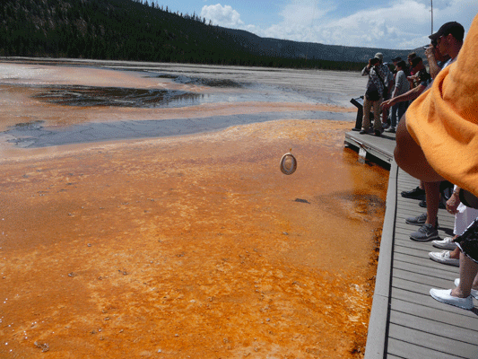
The real attraction here is the Grand Prismatic Spring which is the largest hot spring in the US (the 3rd largest in the world). The colors at the edges match those of a prism.
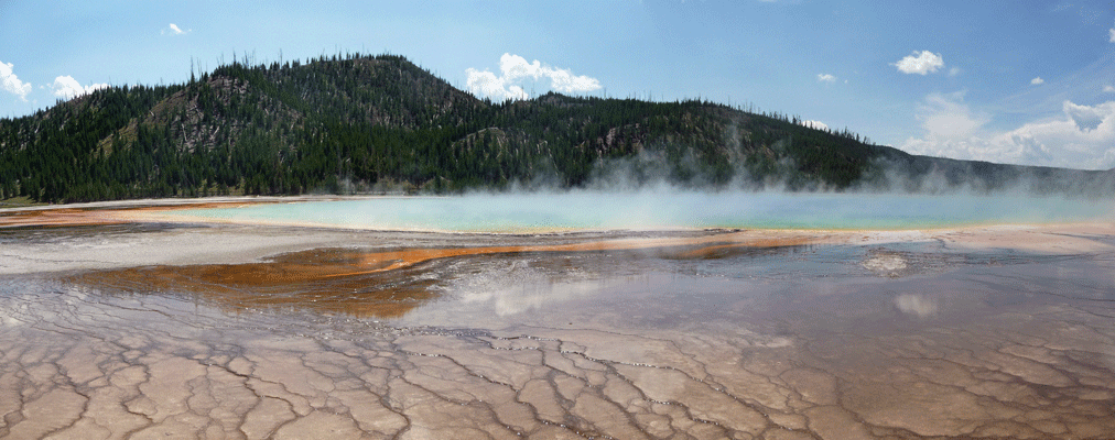
The best photos of this spring are taken from helicopters!
While were were here we spied a guy with a fishing pool retrieving a hat that had flown into the mud—it was really windy here and you had to keep a hold on your hat. His son had lost his hat so he had gone back to his car to get his rod to fish it out. Having done that, more people kept coming to him for his help.
The Turquoise pool was a lot easier to take photos of.
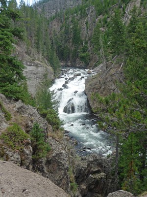
From here we drove north to take the Firehole Canyon Drive. It’s a short side road just south of Madison and I’d seen that there was a waterfall on it so I wanted to go.
There weren’t a lot of people driving this one-way road so I even got a parking space near the falls.
Just before the road ends we discovered why most people actually drive this road. There’s a swimming hole in the river that’s open to the public. The Firehole gets relatively warm because so many of the thermal features drain into it and this section of the river is pretty shallow. It was full of people wading around and there wasn’t a parking space to be had anywhere near it.
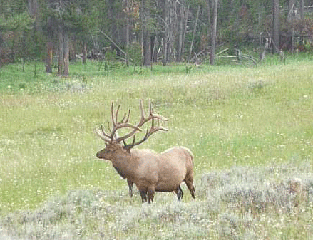
By now we’d reached Madison and it was shorter to drive back via Canyon and the Hayden Valley then to go back the way we came so we continued on to make a complete loop. As we passed Canyon we spied a pair of gorgeous bull elk. There was a ranger trying to get us all to keep driving but of course we all wanted to stop and take photos. So this was taken out the driver’s side window as I drove by.
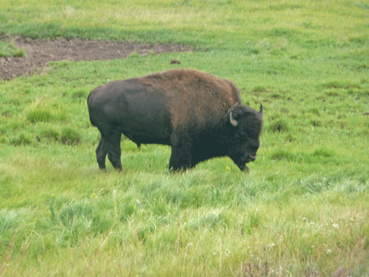
The bison were out again in the Hayden Valley though most of them were on the west side of the road. I got a nice shot of a big bull who was posing along the road. I just think they’re wonderful.
It was a full day and we were pooped!
In Part VI, we’ll drive out to the Lamar Valley in the Northeast section of the park for more wildlife viewing and a visit to Cooke City.