
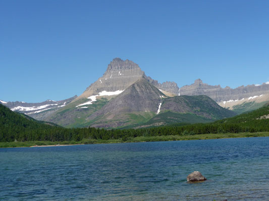
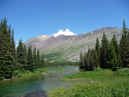
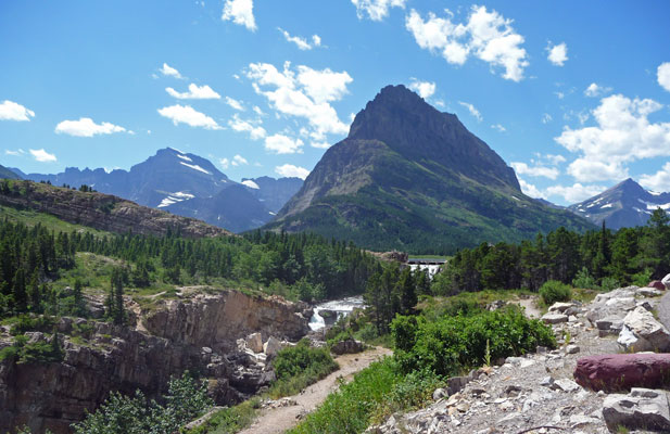
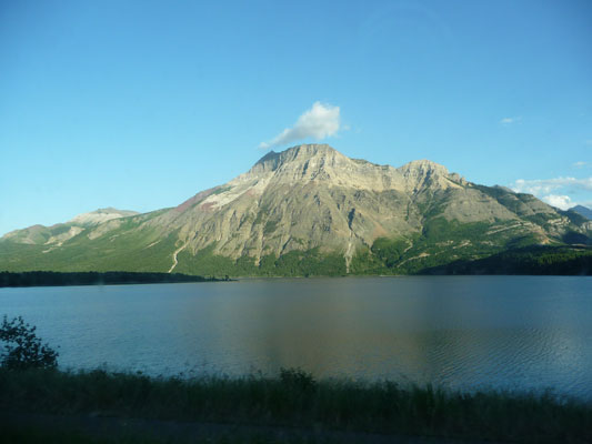
Our run of warm dry weather continued as we headed north on a daytrip to Many Glacier (the third of the entrances on the east side of the Park). You drive through Babb, Montana with its genuine supper club and then head west along Lake Sherburne. The view was so pretty we had to stop and take a picture.

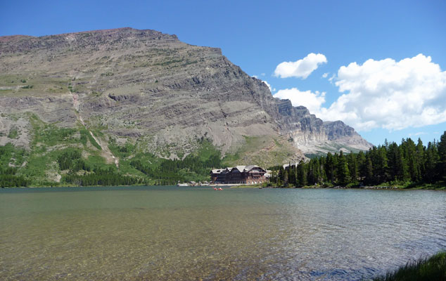
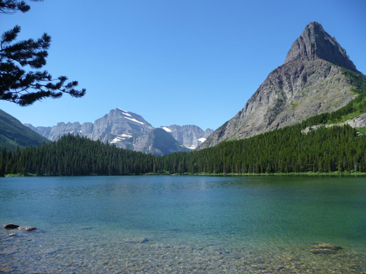
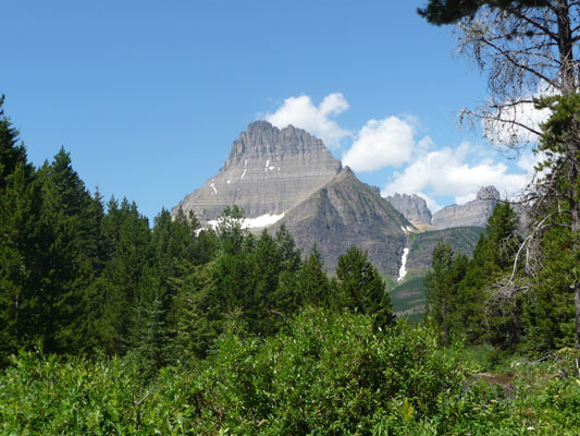
The Many Glacier area is on Swiftcurrent Lake. The road goes over Swiftcurrent Creek as it leaves the lake so you get a great view of the lake and the Many Glacier Hotel from the bridge.
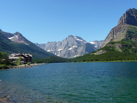
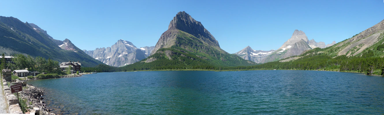
Back in the 1860’s there were 150 glaciers in this area. Now they’re down to 25 and they’re all shrinking fast. They expect all the glaciers in the park to be gone by 2030 or sooner. But the mountains around the lake are still stunning. Here’s a panorama shot of the view from the bridge.
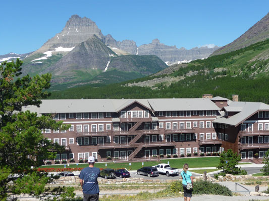
We cased the hotel area and then drove out to the area around the campground and the main trailheads for the area. It was just before 11 am and all the lots were full! So we drove back to the hotel because we’d seen some spaces in their parking lot. Luckily they hadn’t filled up while we were gadding about and we got a spot. The lot is up on a hill behind the hotel.
 |
 |
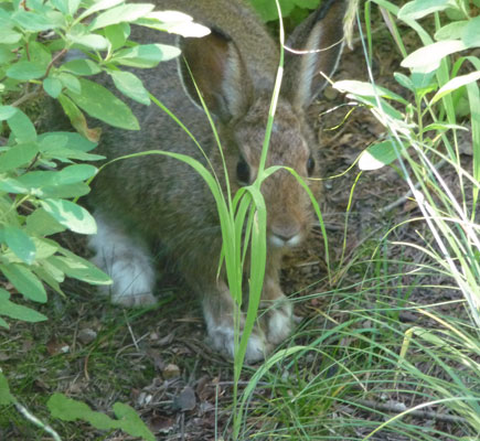
We came around a bend in the trail and there was a big rabbit sitting in the middle of the trail. We stood and watched him for a moment but someone came by from the other direction and scared him off. Or so we thought. When we walked on there he was hiding in the grass next to the trail. And he was no ordinary rabbit. From his HUGE paws we determined that he’s a snowshoe hare. In the winter he’ll be all white. I love that his feet stay white for the summer.
In a while the trees thinned out and you could walk out to the edge of the lake.
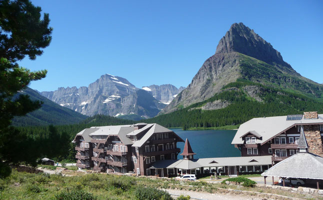
Here’s the view of the hotel with a very large slab of granite behind it. There were folks out in kayaks and canoes who started out at the dock in front of the hotel.
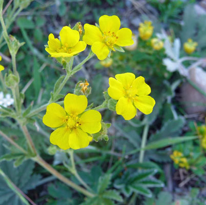
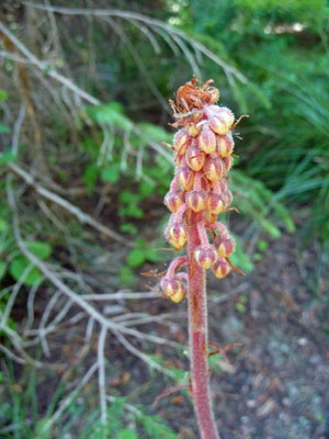
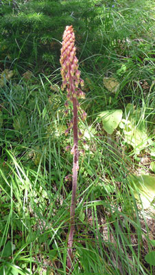
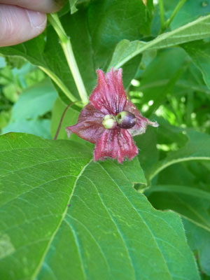
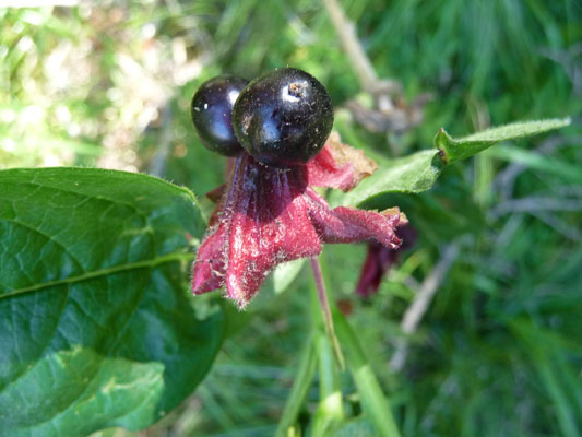
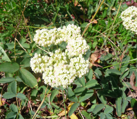
Once back on the trail I spied some Pinedrops (Pterospora-andromeda) which I think are really cool. Later on we saw one that was nearly 3 feet tall.
 |
 |
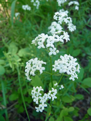
We saw a lot of this stuff and I had not a clue what the heck it was. My friend, Teresa, who's a wildlife biologist told me it was twinberry (Lonicera involucrata).
 |
 |
The trail crosses a bridge and gives you the option to go on out to Lake Josephine or continue on around Swiftcurrent Lake. There were people who had taken a boat across Swiftcurrent and were hiking on out to Lake Josephine where they would catch yet another boat out towards the Grinnell Glacier. We opted to continue on around Swiftcurrent.
Eventually the trail leaves the lake for a while and follows a creek that goes up to the campground. We saw some folks who were having a great time hiking in the creek. It was in the high 80’s so it was perfect weather for it. The mountains were still visible and the views still lovely.
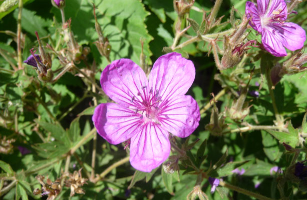
The trail goes through a trailhead parking lot that has a picnic ground in the middle of it. Most of the folks who hike out to the Grinnell Glacier park here which is why the lot was full. With a little bit of difficulty we found where the trail started up again across the parking lot. It lead through a very nice meadow full of flowers, like Sticky geranium (Geranium viscosissimum)
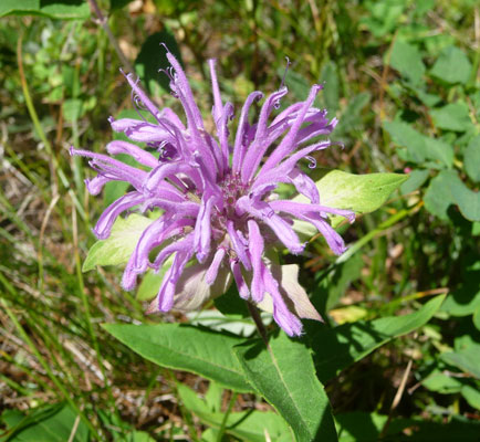
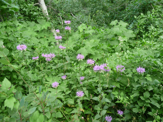
And tons of Bee balm (Monarda fistulosa).
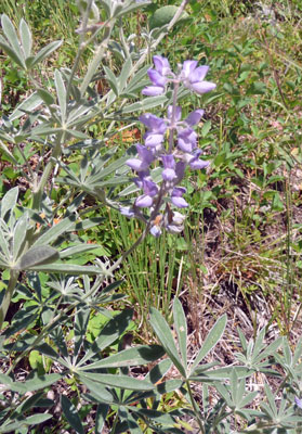
There was even some Silky Lupine (Lupinus sericeus) still in bloom.
The trail comes out on a sandy beach right where the road goes across the foot of the lake. There were people out sunbathing and kids making screeching attempts at getting into the obviously cold water. There was quite a bit of Sulphur Buckwheat (Eriogonum umbellatum) in bloom here.
The trail goes back in front of the hotel and we decided to walk through it on our way back to our car. It’s a pretty classic National Park lodge. I had to go downstairs and wander to the back of beyond to find the ladies room but it was a fun adventure. We decided to try and find a parking space back at the picnic ground and sure enough, there were a couple of spaces because the early morning hikers were beginning to come back. We had our lunch and then headed back homeward. I stopped to take a photo of the little waterfall formed by Swiftcurrent Creek as it leaves the lake.
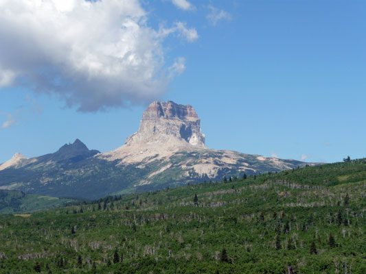
While I was taking this, Walter saw a grizzly bear up on the hillside. By the time I got back to the truck and figured out what he was pointing out, the bear had disappeared into the bushes. Ah well. The next morning (in bright sunshine again) we set out to drive north to Waterton Lakes National Park in Alberta just north of the Canadian border. Glacier and Waterton are contiguous so backpackers and kayakers and canoers can easily cross from one to the other and not even know it’s happened. All the rest of us in cars and buses have to drive up the Chief Mountain Highway and through the border crossing there. Chief Mountain is the sacred mountain of the Blackfeet Indians. It’s on the boundary between Glacier and the Blackfeet Indian Reservation. It’s a little over 9,000 feet tall and visible off and on during the drive along Chief Mountain Highway. At first it looks kind of narrow and weathered.
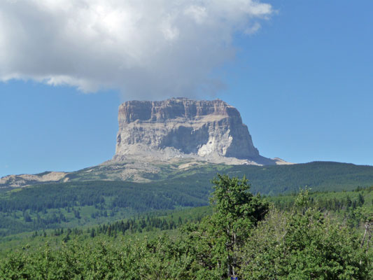
But as the highway winds to the north of it you get a very different view. And yes, there does appear to be a big chunk that has eroded out of the side of it.
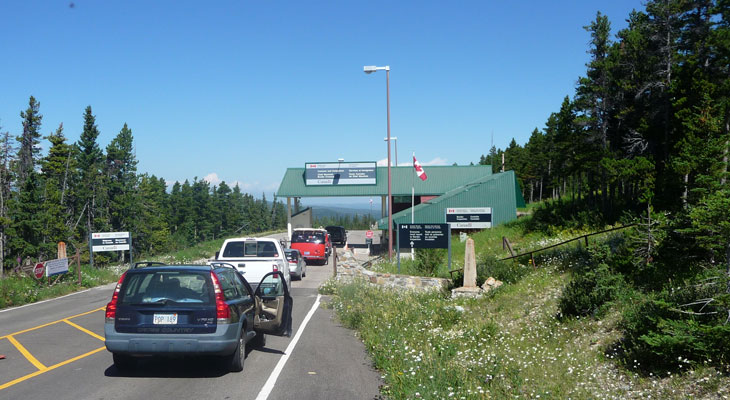
There was a bit of a wait at the border crossing.
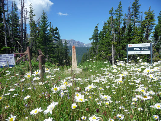
But I had fun when we were even with the border marker on the left. In the larger version of this photo you can see a straight line going off to the mountains that marks the cleared area that is the border.
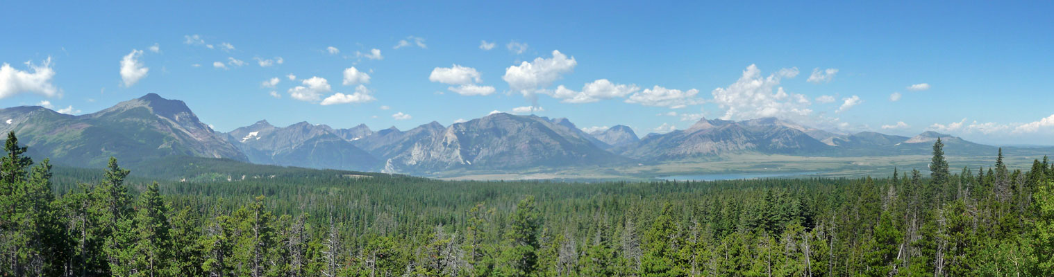
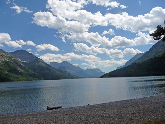
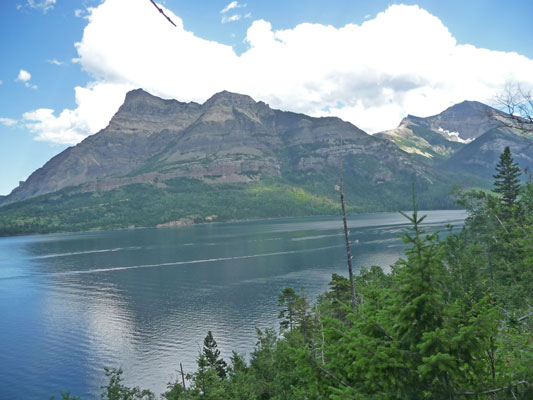
We stopped at a viewpoint overlooking the Waterton Valley and I took this panorama shot. That’s Lower Waterton Lake out in the distance. There are 3 lakes in a row as you enter the park with the clever names lower, middle and upper Waterton Lakes.
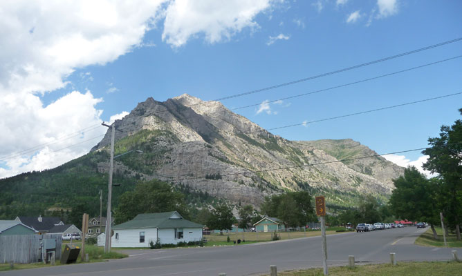
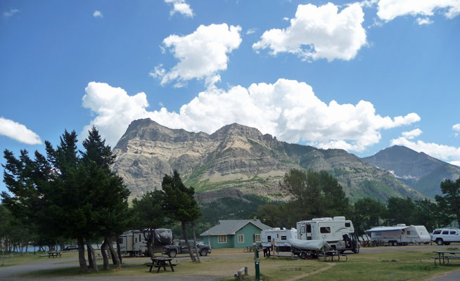
We had a reservation at the Townsite Campground. I didn’t really have a whole lot of info about Waterton when I was planning the trip and this was the only campground that you could get reservations for so I did that. When they say townsite, they mean it. The campground is basically on the edge of a town with houses, motels, pizza parlors, ice cream stores and bike rentals. Very strange. Here’s the view looking north from our campsite. And yes, that’s a house across the street from us.
The view south looks a little more like a campground.
We had lunch and then set out to take the hike to Berth Falls. But we really didn’t know where the trailhead was. So we walked along the lake on what turned out to be the bike/pedestrian path. There were a few people in wet suits playing in the water but mostly folks were sitting in the shade because it was hot and humid.
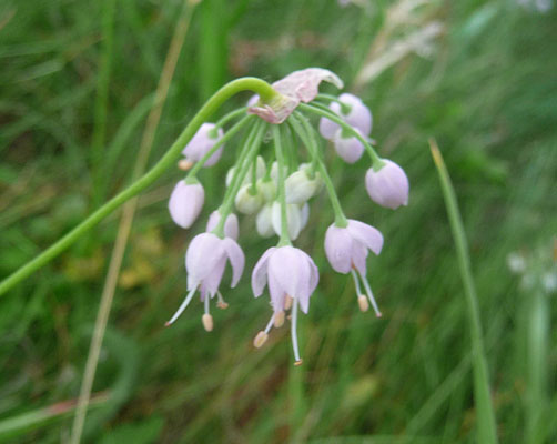
We wandered around and crashed through the bushes some and eventually found the trailhead. From our map (which clearly wasn’t all that great since we’d had such a hard time finding the trailhead) it seemed that we could take the trail up along the ridge and then back towards town. We were pretty tired already by the time we found the trailhead since it was so sticky and hot so we thought taking the shorter hike would be a great idea. We set off up the hill looking for the northward branch of the trail. We never found it. But we did find these lovely Nodding onions (Allium cernuum).
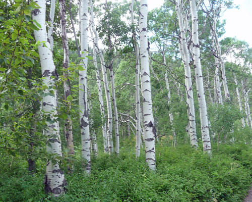
And there were great groves of aspens with lovely white trunks.
Big clumps of Bee Balm (Monarda fistulosa)
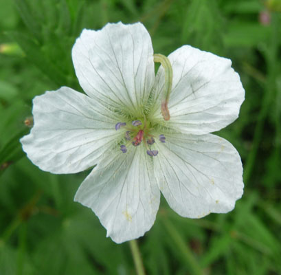
And some fun White geranium (Geranium richardsonii)—yes that is a little worm heading towards the center of the flower.
We hiked out until we got a nice view of the lake.
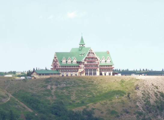
And then made our way back the way we came. At one point you could see the Prince of Wales Hotel up on the hill overlooking the lake. It’s a monster big elegant hotel like the one at Lake Louise further north in the Rockies.
We made it back to the trailhead just in time. A thunderstorm came through with great big drops falling just as we made our way back to the trailer. We snuggled in and took a nap enjoying the splat splat splat of the rain on the roof.
After dinner we took a drive out to see if we could see any wildlife. The storm had blown through and left lovely blue skies.
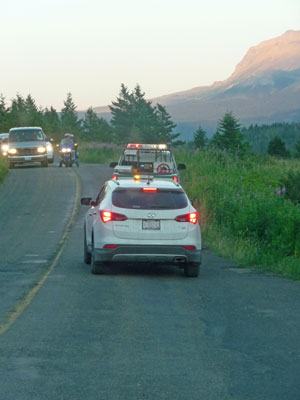
We drove out toward Red Rock Canyon because the only other road in the park was closed due to landslides. We wanted to see how big the parking lot was so we could decide whether to take the shuttle bus that only ran every 2 hours or just get up early to get a parking place. We drove through the Crandell Mountain campground and decided it would have been a much more enjoyable place for us to camp. It wasn’t nearly as full as the one in town and there were trees between the sites too. The park website said that during peak season this campground filled early but we were there in the early evening and there were lots of open spots. Ah well, that may have been due to the fact that half the park was inaccessible because of the closed road.
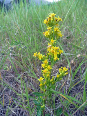
The parking lot at Red Rock was pretty good sized so we decided we’d be able to just get up early and drive out rather than take the bus. While we were there I spied a nice example of Northern Goldenrod (Solidago multiradiata),
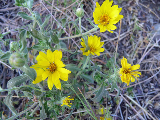
Some Golden Asters (Heterotheca villosa),
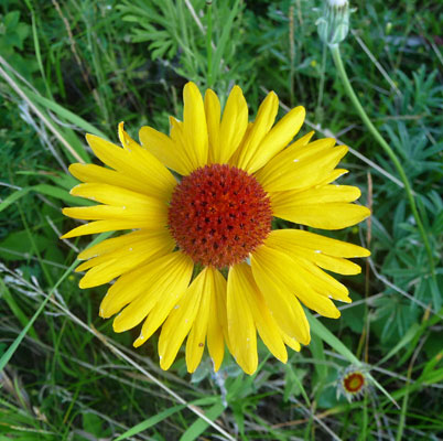
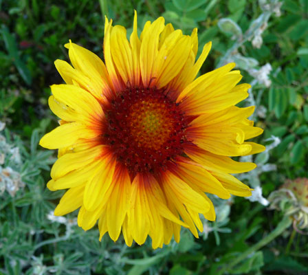
And some great examples of Blanket Flower (Gaillardia aristata). I just love the variety of coloring on these flowers.
 |
 |
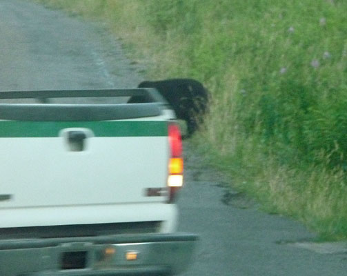
They then pulled both vehicles up close to him and sprayed a huge gout of what was probably bear spray at him. He moved off the road but not very far.
So then they fired rockets at him—fireworks that sounded like piccolo Pete’s. These are called screamers, we learned later. With this he finally took off. We both thought this was way overboard in reaction to such a little bear. We found out the next day that they had done this because he was displaying odd behavior—as in trying to chew on people’s tires. The idea here is to have the bears decide that people are highly unpleasant and should be avoided at all costs. I guess I understand but still...
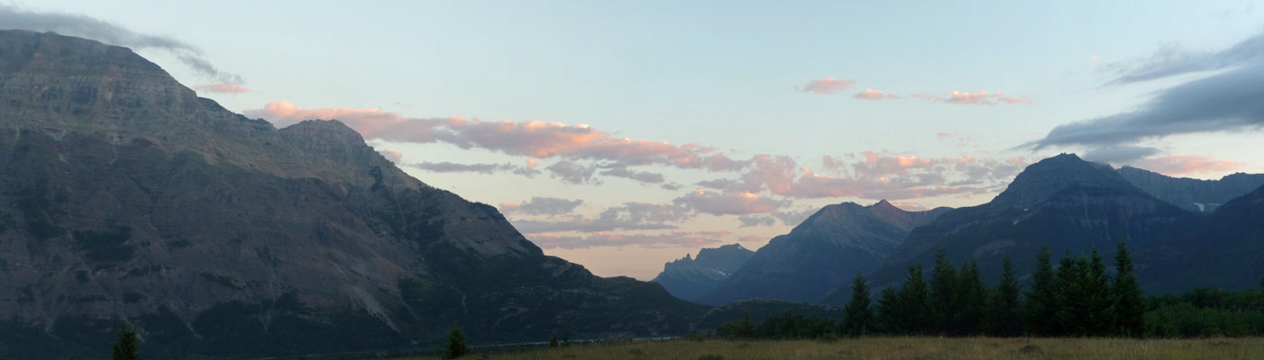
As we turned south towards the lakes Mother Nature painted the sky pink.
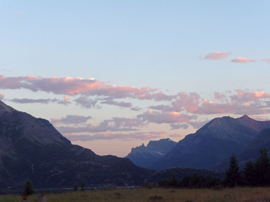
Here's a panorama shot of the sunset.
In Part IV, we’ll visit Red Rock Canyon, take the hike out to Blakiston Falls, visit the Waterton Bison Herd, go on a bike ride and then move on to Butte Montana.