
We had a leisurely morning and asked in the RV park office where the viewpoint for the LeConte Glacier might be. It turns out to be a little spur road off the 3 Lakes Drive—the only road on the island that we hadn’t driven yet. 3 Lakes come off the Forest Service Road we’d been on the day before. So we got to drive a little bit of that again and then follow the 3 Lakes Road up the hill through a tunnel of trees. There were lots of little streams that the road crossed and all of them were the color of very strong iced tea.
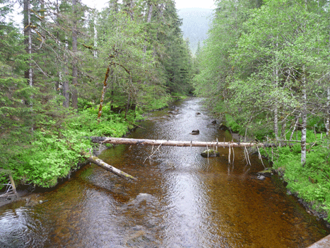
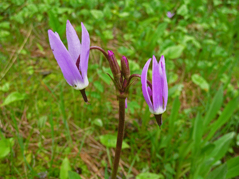
The water picks up tannins from the peat in the muskeg. Think of the color of the water that comes out of a potted plant when you water it and you’ve got the color of this creek just right! There were lots of flowers in the ditches and banks along the road including a wonderful big patch of Northern Shooting Stars (Dodecatheon frigidum).
As we neared the turnoff for the spur road to the viewpoint you could tell that the ‘road raper’ as we call the huge roadside mowers they use at home, had been working this section of the road. It was Sunday and we were surprised to find a guy actively working, chewing up the roadside plants as he went. In fact, he was trimming the spur road when we got there and we had to do a little dance with him to get by.
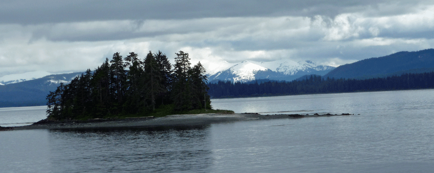
We drove up to the viewpoint and past a little (since that’s where the mower was) and turned around. Sure enough off in the distance there was LeConte Glacier. The white stuff on each side of the island in the middle of the photo is glacier.
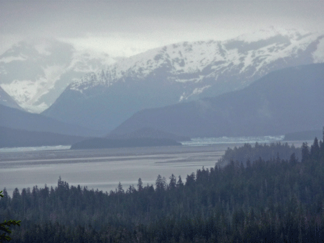
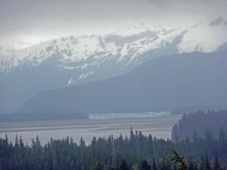
It was raining while I was taking the photos and so they're not as clear as I’d like but you can see it! As soon as we got out of the truck, mosquitos swarmed all over us. This was the first time in Petersburg we’d seen a mosquito. There hadn’t been any on the muskeg hike or in the campground which had tons of standing water. But up here in the mountains they were fierce. We hopped back into the car and drove on.
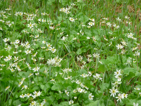
The 3 lakes that the road is named after are three small lakes that have boardwalk hikes connecting them. On a non-rainy day we would have put our head nets on and done the hike but we really didn’t have the heart for it in the rain with the mosquitos too. So we drove on. The reward for the rest of the drive was tons and tons of Northern Starflowers (Trientalis arctica) and other muskeg loving plants.
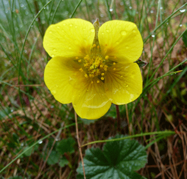
I saw a bunch of these little yellow flowers and got out to take a picture. It looked like solid ground but it wasn’t. My tennis shoe sunk so far that water ran over the top and into the air holes. Wet socks, yum! The flower is a Marsh Marigold (Caltha palustris).
We spent the rest of the day hanging out in the trailer reading and playing on the computer. The next morning we had to check in at the ferry dock at 10:45. I’d hope to run into town and buy lunch at Inga’s, a seafood restaurant recommended by a friend, but Inga’s didn’t open until 11 and it was too far to walk and get back in time to get on the ferry, so Inga’s cuisine had to go unsampled.
This ferry was much fuller than the last two we had taken. There’s only one ferry a week to Sitka from the south so everyone who wanted to go there this week was on it, including a girls softball team who had been in Petersburg for a tournament for the weekend and was now going home to Sitka.
Here's a map of the area. We'll be going up Frederick Sound to Kake and then over to Chatham Strait and up to the Peril Strait to Salisbury Sound and then down to Sitka Sound and the town of Sitka.
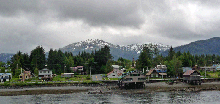
It’s a 13 hour trip which makes for a long day. It was cloudy and misting a bit when we left but I did get a nice photo of the northern portion of Petersburg as we sailed by. Most of the buildings on pilings are boat houses but the one in the middle of this photo is a house. We’d both admired it when we drove by it on Saturday.
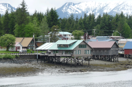
Here's a closeup that I took as we passed by.
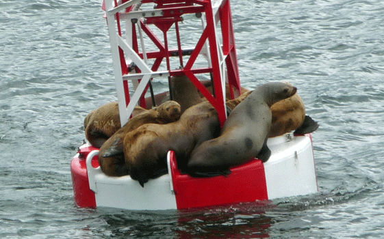
The ferry sails up Frederick Sound with the mainland on one side and Kupreanof Island on the other. There are buoys marking the way and we spied a group of Harbor Seals hanging out on one of them. It looks like there are at least 6 of them squashed onto this one buoy.
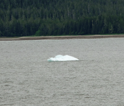
After we’d been sailing up the Frederick Sound for a while we spied a few ice bergs.
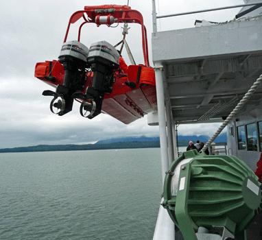
The captain announced that they were going to send a crew out to get a piece of one of the bergs. Even the crew thought he was joking to start with but no, that’s what they did. It made a great rescue drill for the crew actually. First the ferry slowed to an almost complete stop and they lowered the ferry’s lighter into the water with 2 crewmen on board.
While they motored off to the small ice berg, the ferry got under way. We were surprised at the one they picked because there was a bigger one nearby. But in time it made sense. The lighter got to the further one and the men hacked at the ice berg while we slowly gained on them. I’m not sure what they were using to hack at the ice, it looks like a golf club but I’m sure it’s some other tool.
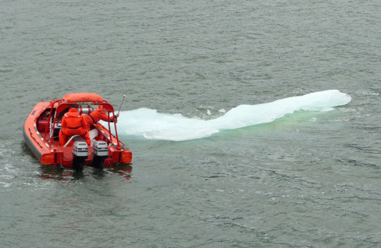
We passed them by and then slowed to a stop again while they caught up to us with their bounty of ice. They put it in a big steel pan on the deck so everyone could go out and touch it.
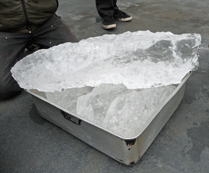
I’m sure part of the reason they did it was that we had the bunch of middle school kids (the softball team) on the boat and a whole bunch of other kids too. To top it all off, they announced that you could buy a drink in the bar with glacier ice in it.
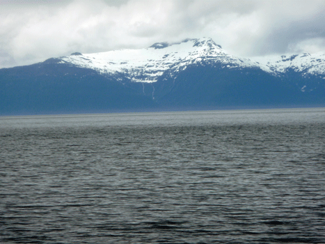
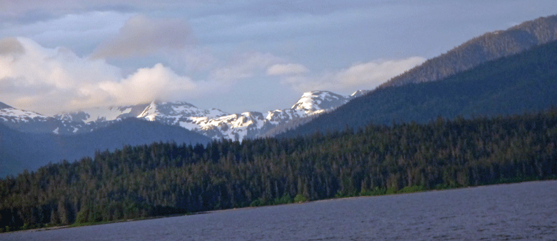
About 3 hours out we had this view of the mountains to the north on Admiralty Island.
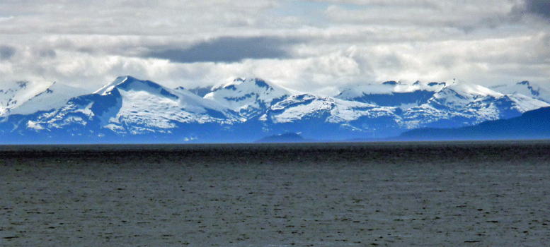
After about 3 1/2 hours things cleared up a bit and you could really see more of the mountains. I think that at this point what we were seeing were the mountains of Baranof Island (to the west) where Sitka is located, but I couldn’t swear to it.
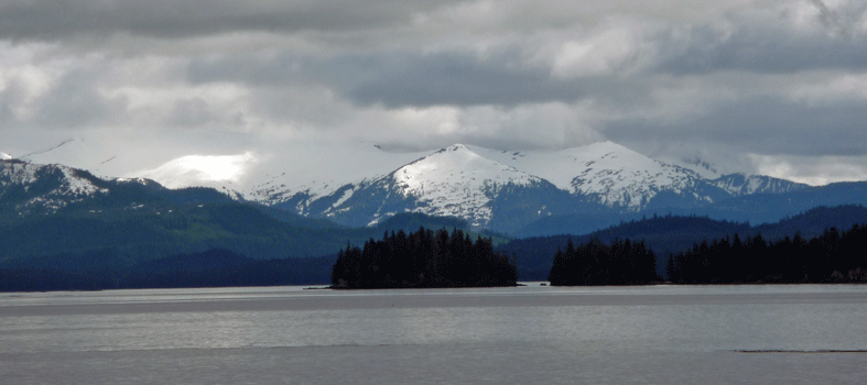
Not long after this we moved into the protected area at the northwest end of Kupreanof Island to stop at the Native village of Kake. It’s not a very big place but it’s in a gorgeous setting.
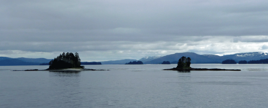
I have an extreme fondness for these little tree-topped islands. These even had little beaches and several of them seemed to have small cemeteries on them—at least we saw clusters of white crosses on them.
The mountains in the background are on Kuiu Island which is west of Kake which is on Kupreanof Island .
Our stop in Kake was less than 1/2 hour and the ferry dock is out of town so we really didn’t get to see Kake. They are supposed to have the world’s tallest totem pole and on our way back out of their bay we did see what we thought might be it. There was a couple on the ferry who seemed obsessed with this so we all got to learn about it.
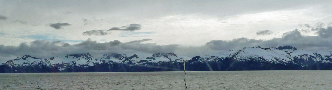
For the next several hours we sailed westward through Frederick Sound toward Baranof Island. The weather cleared a bit and the views of the mountains got better and better. Sitka is on the far side of these mountains facing out into the Pacific.
After we had turned north up the Chatham Strait, the sun came out and lit up one of the mountains on Admiralty Island.
We had momentary sightings of porpoises and spouts of what were probably whales but nothing definitive. It was just enough to keep things interesting. Then as dusk approached (at about 11:30) we began our journey through the Peril Straits between Baranof and Chichagof Islands. They navigate following buoys and there are times when it looks like they are going to sail right into the mountainside and then just at the last minute the turn. We sat and visited with a couple from Vermont and watched the ferry make it’s way slowly along as the light grew dimmer.
We arrived in Sitka at 1:15 am. We were lucky and were the 2nd vehicle off the ferry. We motored north a short distance and spent the night outside the gate of Starrigavan Recreation Area where we planned to camp the next day. Walter was up early the next morning and we were in our site and set up before 8 am. It was laundry and grocery day so we spent the day doing chores.
At the end of the day we stopped at the McDonalds across the street from the Laundromat to use their free Wi-Fi. This was the most upscale McDonalds I had ever seen, complete with a fireplace and art on the walls. And a view of the small boat harbor and Mt Edgecomb in the distance. A McDonalds with a view, who would of thunk it?
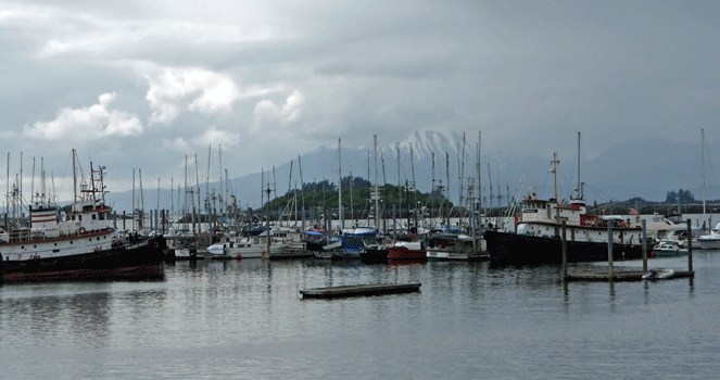
Mt Edgecumbe is a dormant volcano with a profile very similar to Mt. Fuji. I kept taking photos of it for days in hopes of getting a view when the top wasn’t in the clouds.
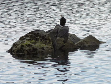
While I was out taking photos of the marina I saw a group of bald eagles hanging around the mouth of a nearby creek. Fish guts perhaps? In any case, I got a decent photo of this guy.
In Part IX we’ll take you with us as we explore Sitka and take a couple of hikes—one at the northern end of the road and one at the southern end of the road.