
Here's a map of the final leg of our journey. We'll drive from Hyder, AK (Point A) to Smithers, BC (Point B), then on to Prince George, BC (Point C) then to Lac La Hache, BC (Point D), then to Merritt, BC (Point E) and finally home to Monroe, WA (Point F). We did it in 5 days, slow and easy like all the rest of the trip.
View Larger Map
It had been raining all night and was raining pretty hard when we broke camp in Hyder. We made it through Canadian Customs without a hitch. This was our 8th trip through Customs on this trip and we have one more passage back into the US just before we get home. By that point, it should be a real breeze because we won’t have much food left.
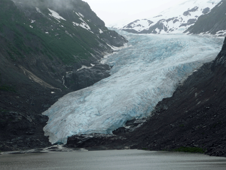
We decided to stop and get gas in Stewart and that was a good thing because there wasn’t another gas station for miles and miles after that. The Bear River was running very high and fast. I guess the warm day yesterday followed by yet another night of rain has really got the snow melting. The waterfalls down the canyon walls were gushing. Once again no photos because today not only were there no turn outs but there was fog so it didn’t seem safe at all to just to stop in the middle of the road so I could shoot a picture. We stopped and got a couple of more photos of Bear Glacier since one of the books said it was best to photograph it in morning light. God forbid I shouldn’t have all the right photos at this point.
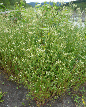
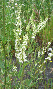
We stopped at a rest stop (one of the very few on the Cassair) and I had to take a photo of this strange weed that I'd never seen. It turned out to be Sweet Clover (Melilotus Officinalis) which I'd photographed in Denali but had forgotten.
 |
 |
A while later we saw a black bear cub walking across the highway. As I slowed down he took off at a run and disappeared into the bushes. I figure he was the last in line after mom and his sibling(s) and that’s why we didn’t see the rest of them. He was too little to be out on his own yet.
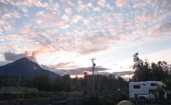
We spent the night that night at Glacier View RV Campground just 8 km west of Smithers, BC. If you stand in just the right spot at the right time of day you can see a glacier up on the mountain. The sun was in my eyes so I decided to wait to take a photo of it the next morning when the exposure would be better. Bad idea, by morning the clouds had engulfed the mountains and you couldn't see the glacier any more. Oh no! I've missed a glacier photo!
We did have a nice sunset that night though.
While the mountains were shrouded in clouds it was otherwise a nice day when we got up the next morning. We stopped in Smithers and got gas and did some grocery shopping and then hit the road. We'd driven from Prince George to Smithers coming up so this was a complete repeat for us.
The drive was uneventful. No wildlife sightings. No problems. I had a bit of a problem figuring out how the distance markers worked in relation to the Milepost but after a while figured it out. The Yellowhead Highway which we were on, gives you the distance from the ‘beginning’ in the direction you’re going. So when you’re going East (as we were today) they’re telling you how far you are from Prince Rupert. When you’re going West, they’re telling you how far you are from some place way to the east of Prince George. Each highway we’ve been on has worked a little differently in terms of mileage markers.
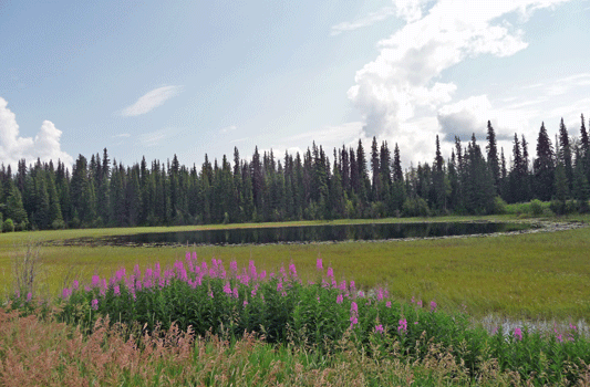
In any case, we found a nice turn out to have lunch that had a little pond and a marsh. Walter turned the trailer around so we could look out into the marsh while we ate—much better than watching the highway.
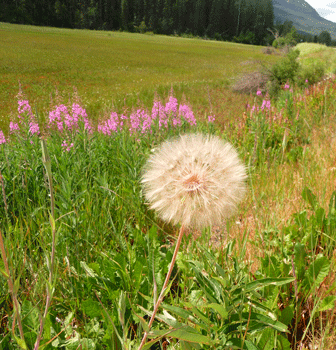
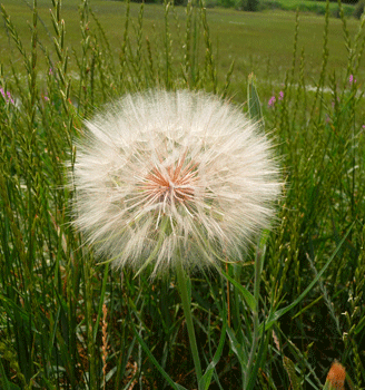
There were salsify seed heads at the rest stop. They are the biggest ‘dandelion puffs’ you’ll ever see. I remember the first time I saw one back in Western Massachusetts. I was so excited I picked it and took it to show Walter at his office. The seed heads hold together better than dandelions do but they do eventually let go and go poof.
 |
 |
By the time we arrived in Prince George we were both tired and punchy. We camped at Blue Cedars RV Park on the western edge of Prince George. It's funny how tired 5 hours of driving can make you when you've been on the road for nearly 2 months.
There were sun breaks the next morning when we woke up but the sky was mostly cloudy. We’d had a little bit of a sunset the night before and once it again it actually got dark. This will be a novelty for us for quite some time after many weeks of twilight all night.
We drove south out of Prince George on Highway 97 and finally bid farewell to the last of the taiga as we entered lush central BC. The traffic on Highway 97 was much heavier than we’ve had the last few weeks. Lots of trucks and lots of cars and RVs going both directions. It was summer after all and there seemed to be lots of folks out on vacation at this point.
Early on in the day we saw a fox cross the road. He was a brownish one like the one we saw yesterday. In the afternoon while I was driving we saw something we’re not sure what it was. There were two of them along the right hand verge. One had been hit by a car or truck and the other started to come out into the road in front of me. I swerved a little and avoided him/her but I’m not sure it survived the semi that was behind me. The live one was as big as a porcupine and had short legs like that. It was light brown and variegated. It had a pointed nose which rules out the porcupine. In the end we decided that they might have been badgers (though that would be highly unusual).
It started to rain heavily and then pour so hard I couldn’t see the road just before we reached Lac La Hache Provincial Campground where we planned to spend the night. We arrived safely though and found a spot to camp without a problem. We just left the full setup process until the rain let up.
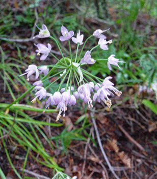
After an afternoon nap the rain finally stopped entirely and the sun came out so we took a turn around part of the campground. The sites that are next to the highway have a great view of the lake—you just have to be deaf to enjoy them because of the highway noise. There was a little trail through the grass out to the view and I saw some pink Nodding Onion (Allium cernuum) in bloom along with some little short asters. I have these alliums growing at home but they're much darker pink there.
The trees here are almost all Doug Firs. That wasn’t true last night but the trees in the rest stop where we switched drivers in the morning were all Dougs too. And so the transition to normal NW floral continues.
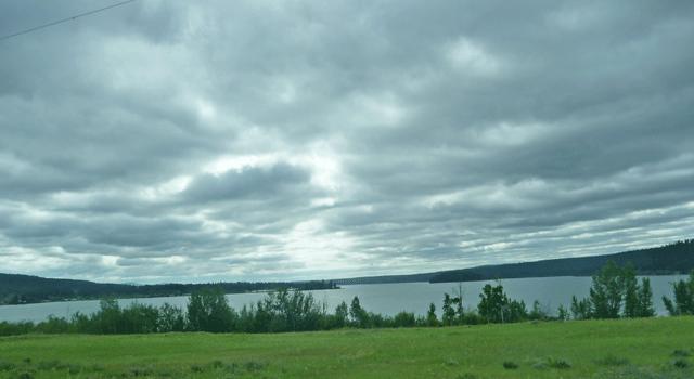
There were sun breaks when we first got up the next morning and big patches of blue. But by the time we’d had breakfast and broken camp there were only wisps of blue left and the sun had gone into hiding. We got some nice views of Lac La Hache as we drove into town and I snapped a quick picture as we drove by.
At one point in the morning a deer came bounding along from the right hand side of the car, bounced over the cattle fence and beat it across the road so quickly that by the time we came even to where it had crossed, it was out of sight. That was the wildlife sighting for the day.
We took Highway 97 east towards Kamloops and the terrain changed to something looking an awfully lot like the area near Alta Lake in eastern Washington. Instead of the Columbia we had the North Thompson flowing along. The farms had center-pivot irrigation and were growing hay and then alfalfa.
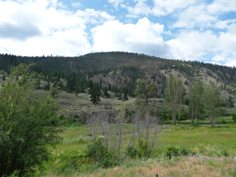
We stopped at a rest stop and I took this photo of the sage brush covered hills.
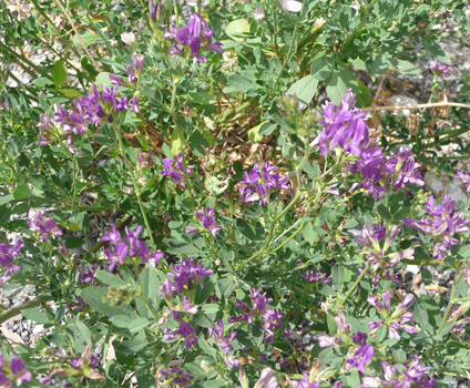
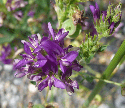
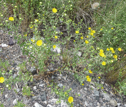
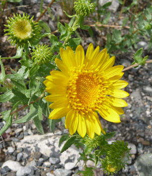
There were these mysterious flowers in bloom that I didn't discover until we got home were Alfalfa (Medicago sativa) in bloom. I've never seen it any bigger than maybe a foot tall. This stuff grows to over 3 feet tall when it blooms but when they grow it for hay they keep it cut fairly short so it never blooms.
 |
 |
 |
 |
After the turn off south of Highway 5 just west of Kamloops, the terrain changed back to mountains with pines. I personally prefer it and the temperature dropped back down into the 60’s.
We spent the night in Merritt, BC, the country music center of British Columbia. There are murals of Country Western singers on many of the buildings and they have a huge Mountain Country Music Festival each year here.
It was over 80 degrees when we arrived at the city RV park that we selected using Carmine the Garmin. There was some strange earth moving operation (a composting operation perhaps) behind the trees next door and a noisy trailer park behind us. It wasn't peaceful but it had WiFi and water and power and the temperature made it feel like summer for a change.
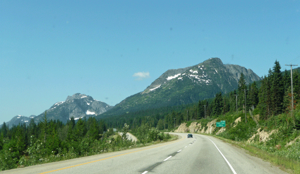
We hit the road the next morning a little after 9. It was sunny but a little hazy with thunderheads along the mountain tops. We took Hwy 5 south to Hwy 1. It winds up through the mountains and over a pass that is 2,000 meters –that’s over 6,000 feet. There was still a bit of snow on some of the peaks and I took one last photo just to show there are pretty mountains in BC too.
We stopped and switched drivers in a Sears parking lot at the turn off from Hwy 1 to Abbotsford, BC and the border crossing into the US at Sumas, WA. I took a moment to eat the last of the cherries I’d bought in Smithers since I didn’t think they’d let me take them back into WA.
The signs said the wait at the border crossing would be 10 minutes but it was closer to 20. In any case it was the longest wait at a crossing for the whole trip. This was our 9th crossing for the trip and once again we had no problems since all we had were bananas, carrots and lettuce. We had a nice border guard who welcomed us home.
We wound our way through the countryside back to I-5. Traffic was nearly stop and go northbound as we approached Everett but it all moved along fine in our direction. I was grateful that we didn’t have to take I-405 down through Bellevue after 2 months of having nearly no traffic to deal with. We were home by a little after three.
We unloaded the trailer and put all the food away and then went and parked the trailer in its spot at the back gate. When we came back I went to the bathroom and had the strange experience when I flushed of having water pouring out of the junction between the tank and the body of the toilet and down on the floor. I turned the water off in a hurry and was mystified as to how this could have happened.
Then a while later Walter used the other toilet and it did it too—though not with as much force. It appears that the seal between the tank and the body of the toilet (I didn’t even know there was one) had dried out over the 2 months we were gone. Given that the toilets are over 30 years old and one needed to be replaced anyway, we decided to replace them both. Of all the things that could have gone wrong while we were gone, this was not what we expected. It’s minor in comparison to many other dire things that could have happened so we are okay with it.
I took the final reading on the odometer for the trip. We drove 6,474.2 miles. Add to it the ferry distances and you’ve got nearly 7,500 miles. Whew. And I took 4,293 photos!
We hope you enjoyed riding along with us on our trip of a lifetime.