
Here's a map of our journey for the next couple of days. We'll drive from Watson Lake, Yukon (Point A) to Iskut, BC (Point B) and then on to Hyder, Alaska (Point C).
View Larger Map
We drove a little ways west on the Alaska Highway and then turned south on the Cassiar Highway. Very soon after we passed out of the Yukon for the last time and into British Columbia.
The first hour of the Cassiar Highway was really uneven and bumpy. It didn’t have pot holes or frost heaves, it was just bumpy. It was also pretty narrow and didn’t have any lines at all—no double yellow, no dotted yellow, no verge markers, nothing. There were also no turn outs or rest stops for that first hour either. I was beginning to wonder how far either of us would be able to tolerate bumping along in one day when the road widened some and the surface evened out. Whew.
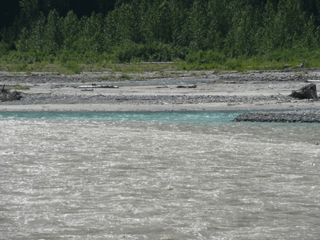
The other thing that made the first hour hard was the rain and the fact that we drove through a HUGE burn—probably 50 miles worth. The first section probably burned last year or the year before because there were no grasses, only fireweed, but lots of it.
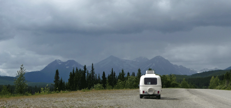
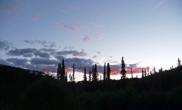
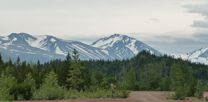
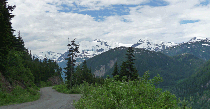
Once the road evened out and the burn was over, things were lush and lovely. We still had squalls of rain showers but it wasn’t very bad. We switched drivers after 2 hours and about then we moved from the Yukon Plateau to the beginning of the Cassiar Mountains and things got very pretty.
I took this photo when we stopped to switch drivers in a wide pull out.
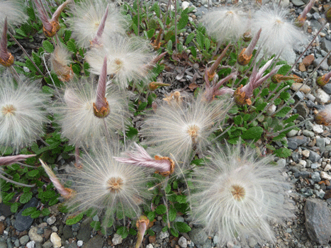
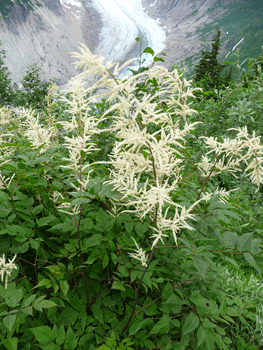
There were tons of these little seed pods all over the ground here. Since there weren't any flowers left I have no idea what they were but they sure are fun looking.
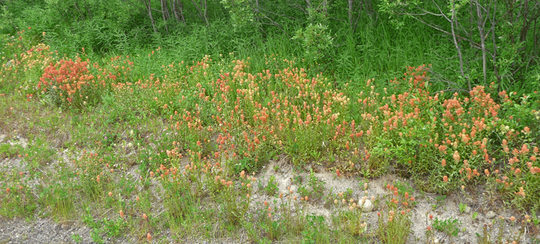
As we drove along there were huge patches of orange, yellow and peach Indian Paintbrush (Castilleja sp.). I’ve been doing research on it but can’t tell you which species of Indian Paintbrush it is, so just enjoy the pictures with me, okay?
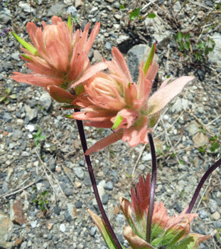
Here's a close up of it.
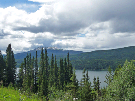
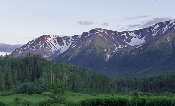
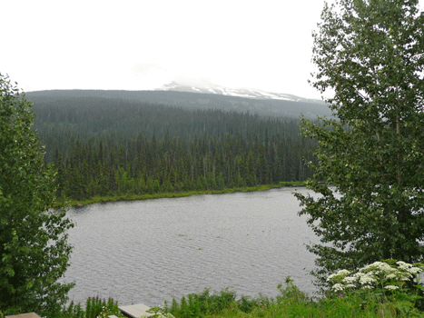
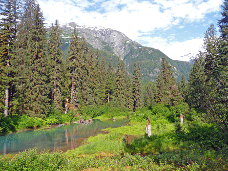
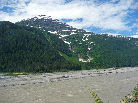
The scenery through the Cassiar Mountains is gorgeous. There are big lakes and lovely streams running through a very lush countryside with snow-capped mountains as the backdrop.
Here's one of the lovely lakes in the afternoon when the clouds began to break up.
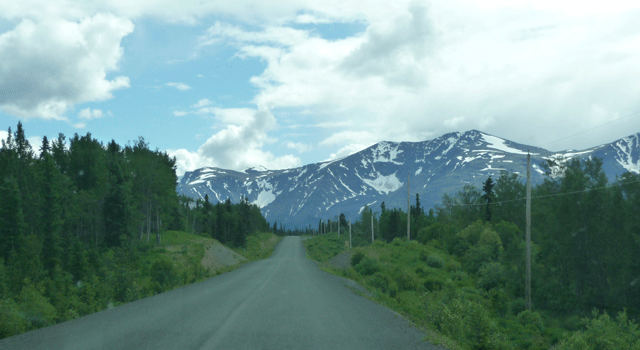
The views of the mountains got better the further south we went but as you can see, we still didn't have any lines on the road.
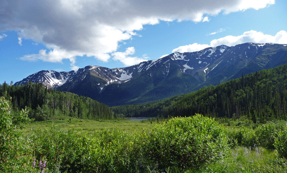
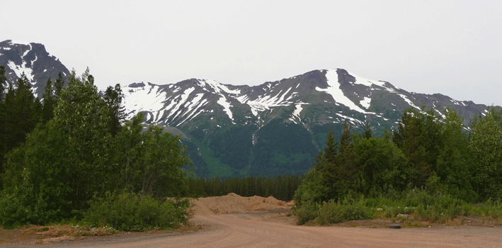
We got to Mountain Shadow RV Park just north of Iskut, BC at about 3:45. We were the first rig in but there were 5 more big trailers (3 fifth wheels) that came in right after us. We got the pick of the litter in a site with a gorgeous view of the mountains with the lake in front of it.
Here's the view from out site.
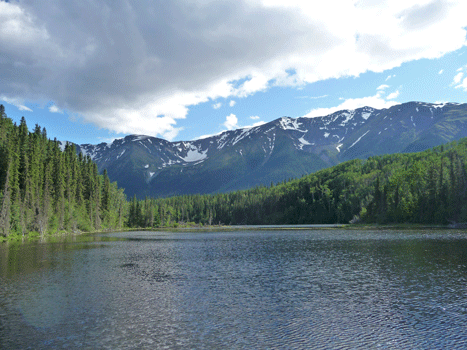
We spotted a moose down at the lake that was too far away to make a decent photo. So off we went on the trail down to the lake. Of course, the moose was gone by the time we got down there but it was a nice walk. Here's the view from the end of the dock on the lake.
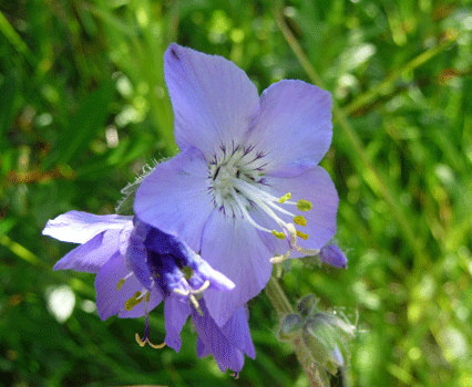
I stopped and took photos of the flowers in the meadow on our way back up to the trailer.
 |
 |
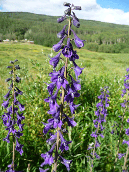
| Tall Larkspur (Delphinium glaucum) |
Skullcap Speedwell (Veronica scutellata) |
 |
 |
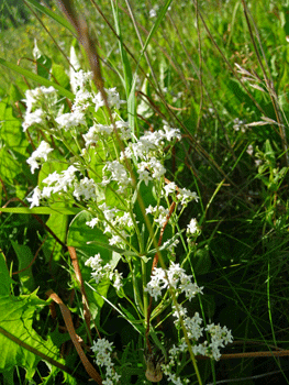
| Northern Bedstraw (Galium boreale) |
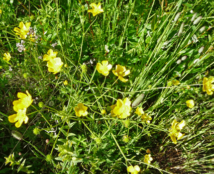
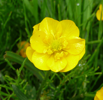
Norwegian Cinquefoil (Potentilla norvegica) |
And tinted the mountains to the south pink.
We set out south on the Cassiar the next morning even though Carmine the Garmin didn't want us to go that way. She had it in her head that we should turn around and drive back to Watson Lake and to the end of the Alaska Highway at Dawson Creek and THEN on over to Hyder. Her route would take 30 hours while ignoring her only took us about 5.
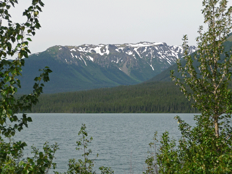
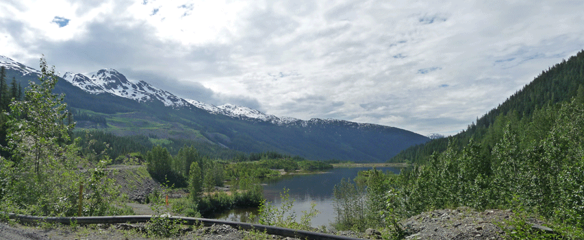
We stopped in beautiful downtown Iskut (a gas station and a store and a school) and got gas and then stopped for a view of Lake Kluachon (the same lake we could see a little bit of from Mountain View RV Park last night).
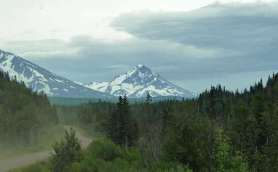
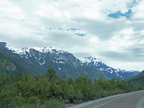
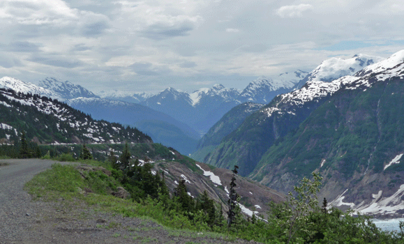
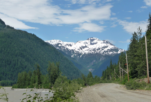
The mountains were beautiful all along the highway today.
A little while later a dotted white line appeared in the middle of the road! And then verge lines appeared too. Civilization here we come. Or not. A few more kilometers and we hit signs of a big construction project up ahead. And then we came to a halt while we waited for a pilot car.
I got out and took photos while we waited. This was the view to the east.
This is the view looking west from the highway, including the entrance to a HUGE sand and gravel pile that they were using in the chip sealing project we were about to drive through.
The flag person had a dog (the first we'd seen with a pet) and the dog loved to chase the ravens across and over the piles. That was more entertainment than we usually get waiting in construction zones.
It turned out we followed the pilot car for 12 klicks. That was the good news since it kept everyone at 25 mph which kept the dust down big time. Here's a view shot through the windshield with the dust cloud out in front of us.
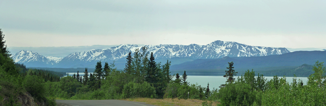
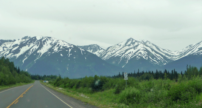
Eventually the dust settled and the road became true highway with a double yellow line down the middle and white lines on the verges and beautiful mountain views all around.
There was more construction later on in the form of clearing along the roadside for a new power line but that didn't slow us down that much. We stopped for lunch at Mehan Lake which looked like it should be prime moose territory but we didn't see any moose.
Along the way today we saw a fox (jumping on it's prey and carrying it across the road) and a grizzly who high-tailed it back into the bushes after having been out on the verge for a few moments.
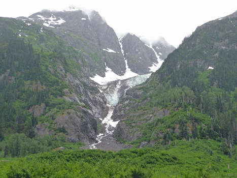
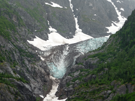
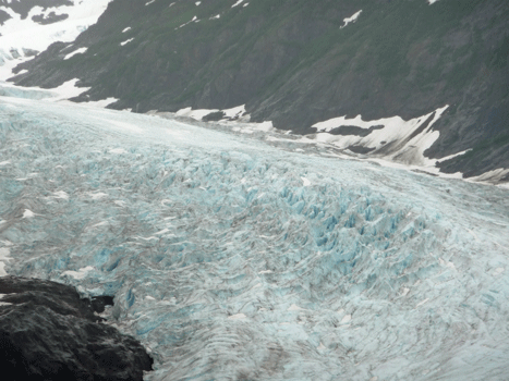
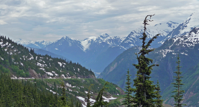
We drove westward on The Glacier Highway (Highway 37A) off the Cassiar headed to Stewart and Hyder. There was more construction and this was good news. It meant I had a moment to take these photos of a hanging glacier south of the highway.
 |
 |
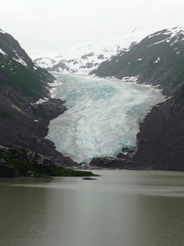
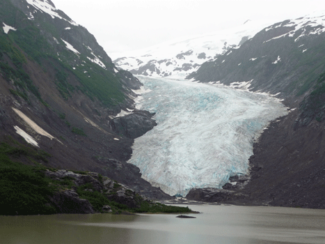
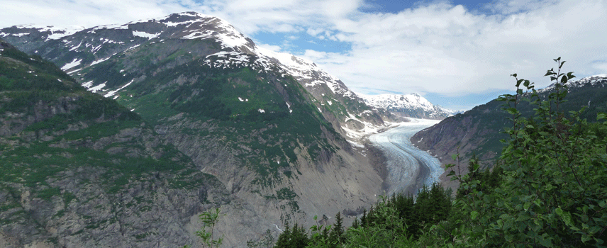
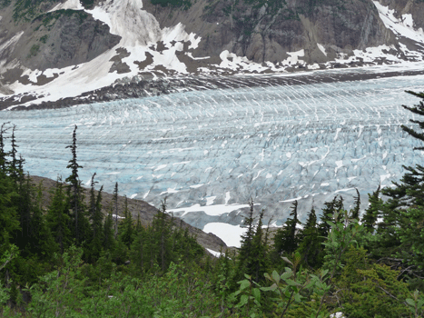
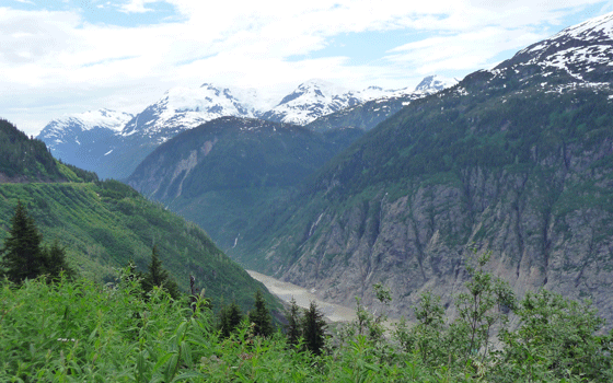
Not long before you reach the town of Stewart you come to Bear Glacier which used to be RIGHT next to the road. It's retreated as most glaciers have and now there's a lake between the road and its toe.
 |
 |
 |
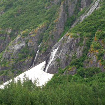
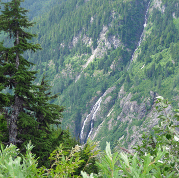
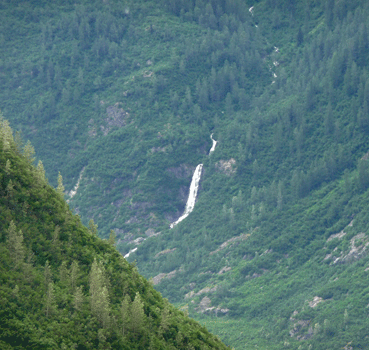
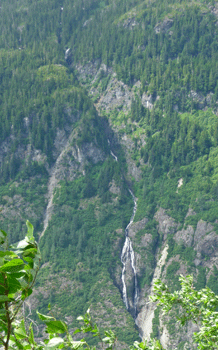
There's a set of waterfalls just to the east of the glacier that were cascading down into the bottom of an avalanche chute.
There weren't any signs identifying the glacier but I'm pretty sure from the Milepost and from photos on the internet that this really is Bear Glacier.
Stewart and Hyder are right next to each other. However Stewart is in BC and Hyder is in Alaska! In fact Hyder is all alone by itself in a little bit of Alaska with the Misty Fiords National Monument and no other access to Alaska. Stewart is a good sized town with gas stations, grocery stores and a port. Hyder has a dirt road leading through a group of old abandoned buildings (road under construction of course) and a couple of hotels, a general store, a couple of places to eat and Camp Run-A-Muk RV park where we stayed. Camp Run-A-Muk is right on the main drag and we were serenaded by huge graders and gravel trucks for most of the two days that we were there.
Why go to Hyder besides the drive along the Glacier Highway? Two wonderful reasons: the Fish Creek viewing area where bears come to fish in late July and August and the drive out to Salmon Glacier.
We awoke the next morning to a gift from the gods! Sunshine with the mountains visible. We had been told not to bother driving out to Salmon Glacier if you couldn't see the mountains but the weather gods smiled on us and gave us clear skies even though they weren't in the forecast.
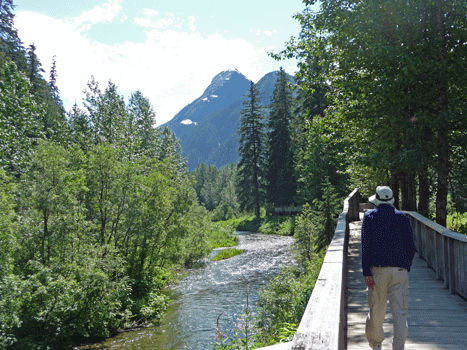
We decided to make a picnic lunch since we were going to Fish Creek and then up to Salmon Glacier. It’s only 3 miles out to Fish Creek but it’s another 25 miles out to Salmon Glacier on a dirt road. We figured we’d make a day of it. The views on the way to Fish Creek are lovely even if the road isn't.
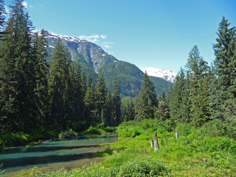
When we got to Fish Creek, we were told that a mama bear and 2 cubs had just been in the creek. Mom had caught a fish and had retreated to the bushes to eat. The supposition was that since she’d caught something she’d be back. So out we went to watch and wait.
It’s a gorgeous setting. There’s the crystal clear creek with a small pond behind it with the mountains framing it.
We waited a while and talked to some of the folks who were waiting and watching. We saw a few fish but no bears so after a while we gave up and started the drive out to Salmon Glacier.
The road was very bumpy and they were working on clearing the verges with heavy equipment. Past that we met a few very large semi’s taking equipment up the road to the mines that are at various points along the road. The road exists to serve the mines not to take tourists out to the glacier so we need to be grateful to those mines and the trucks. Anyway they made driving that much more interesting when the road was only about 1 ½ lanes wide. Periodically there were views of the mountains and the Salmon River along the way.
We’d noticed that the river seemed to be really high. It had rained yesterday but we didn’t think it had rained that hard. We came to a wide spot in the road and a Forest Service guy told us that the ice dam holding Salmon Lake in place had broken last night (it does this every year in mid-July) and the river was way up. There was the potential for the river to flood the road and for us to not get back. Walter was ready to turn around. Then another guy who had been camping out past the glacier came up. He said not to worry. It wasn’t that far of a drive, the river wasn’t that high yet and it was worth the risk. After some hemming and hawing we decided to give it a go and we were NOT sorry.
Here's the first view of the glacier from the road.
The deep valley that the glacier has carved over the years makes for a perfect place for waterfalls.
The road got narrower and narrower but meanwhile the view in the rear view mirror got pretty spectacular.
There was goat's beard (Aruncus dioicus) growing along the side of the road. It was the first we'd seen since we were in Palmer Alaska weeks and many miles ago.
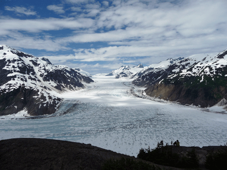
Soon the glacier was filling up the entire valley down below.
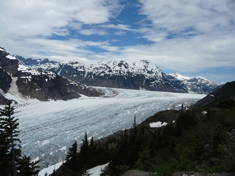
Salmon Glacier is really interesting because it turns a corner as it flows down out of the mountains.
The snow had melted off the surface of the glacier and you could see how blue the ice was.
The view in the rearview mirror changed and got that much more beautiful as we gained elevation.
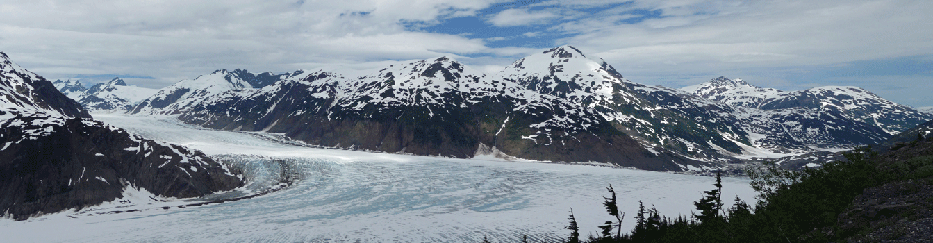
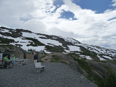
Here's a panorama shot of the glacier from a turn out near the final viewpoint.
The final viewpoint provides parking, picnic tables, bathrooms and an amazing view.
Turning around from here you can see that the snow hadn't melted off of the mountain meadows yet. The guidebooks talk about wildflowers here but clearly not yet.
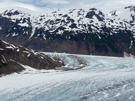
It took some work but here's a full panorama shot of the glacier from the viewpoint.
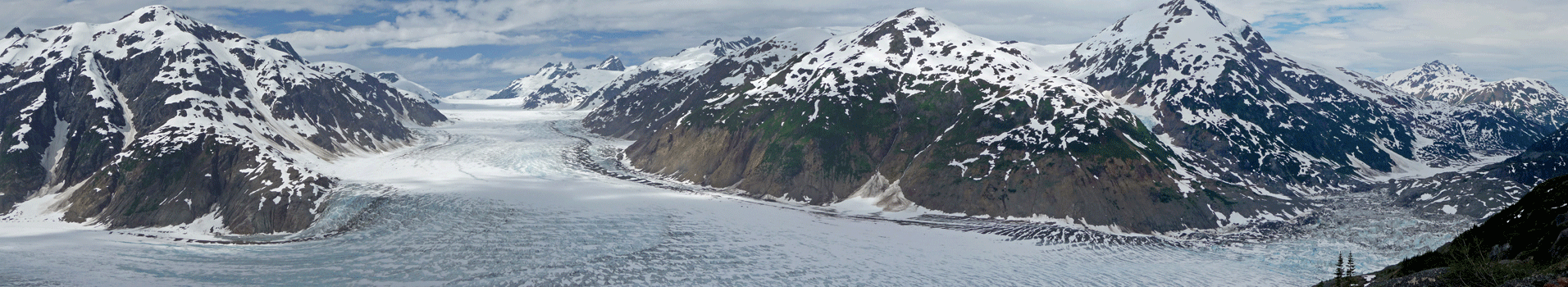
The odd blue chunky area on the far right is where Salmon Lake was before the ice damn broke the night before. If someone hadn't pointed it out we'd never have guessed that it had been a lake.
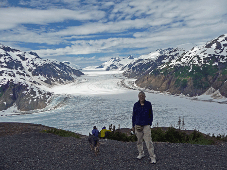
Here's Walter in front of the glacier.
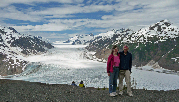
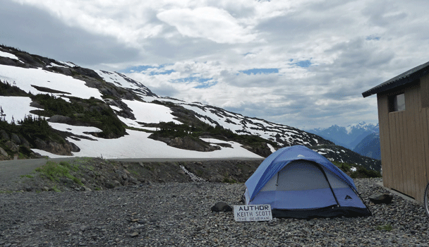
I was setting up the camera on a picnic table to take a photo of the both of us when a fellow came up and offered to take it for us. We agreed and he turned out to be Keith Scott, The Bear Man. He has DVD’s, post cards and a book he sells. We ended up buying his newest book called Coastal Bears which he autographed for us. He’s wonderful eccentric from New Brunswick who has traveled all over to watch and photograph bears. He spends June, July and August here and hikes the glacier (including under it) and then photographs the bears in August. He’s a happy man doing what his heart desires.
Here's Keith's tent (where he's not supposed to camp but he does sometimes).
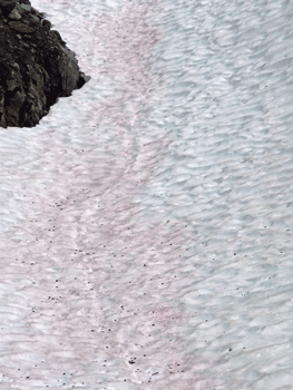
On our way back down I noticed that some of the snow seemed to be pink. I slowed down and sure enough, this whole section had pink algae growing on it.
We stopped for lunch in a turn out and had the gorgeous view of the valley looking west.
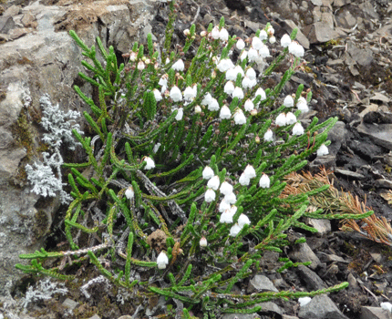
There was white heather (Cassiope mertensiana) in bloom along the verge.
And there was a huge waterfall across the valley.
From this viewpoint a little further down, you can see the river down below. It's dirty brown now from the water draining from Salmon Lake.
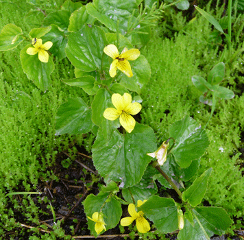
There were stream violets (Viola glabella) blooming in the ditch here.
Along with slender potentilla (Potentilla gracilis)
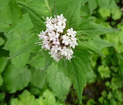
And there was Sitka Valerian (Valeriana sitchensis) too.
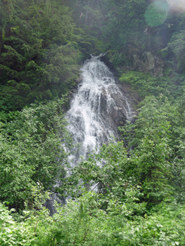
As we drove on I spied yet another very big waterfall.
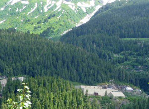
We stopped and took a gander at the Premier Gold Mine site. This gold mine was started in 1910 and by 1918 it was considered one of the richest mineral deposits in BC. It started as an open pit mine and then became an underground mine.
There was one last waterfall right next to the road as we came down into the flats again.
When we got back down to the Salmon River you could see where the water from the lake was joining clear water from other tributaries of the river.
Here's a view across the river to the mountains on the other side.
And here's the view back up the road and the river.
We stopped at Fish Creek again hoping to see bears. Here's Walter walking along the boardwalk above the creek.
The light was coming from another angle so of course I had to get one more shot of the pretty little pond and meadow.
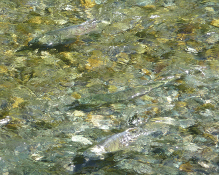
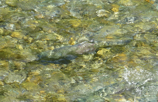
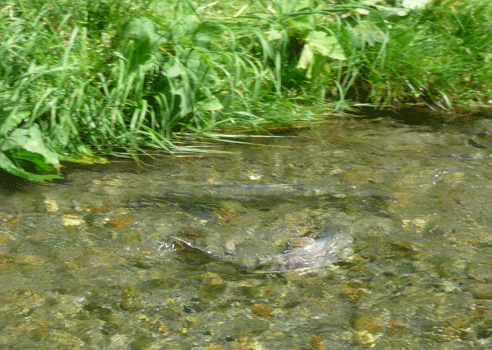
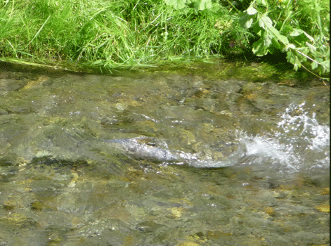
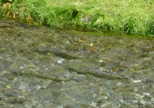
There weren't any bears but there were fish running in pretty good numbers. They were spawning. You could watch the females use their tails to create the hole to lay their eggs in and you could see the males nudge her on the back and chase her some.
 |
 |
 |
 |
 |
There was a juvenile eagle who came in hopes of catching a fish but no bears. We watched for quite a while and then went on back to the trailer to have showers and a break. We returned after dinner and watched until 8:30 pm but no bears put in an appearance.
We were grateful for such a beautiful day because that night it began to rain in earnest. It wouldn't have been any fun standing around in the rain watching for bears that didn't show up.
In Part XXVII we'll complete our drive homeward through BC to Monroe, WA.