
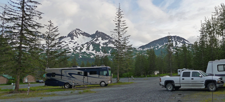
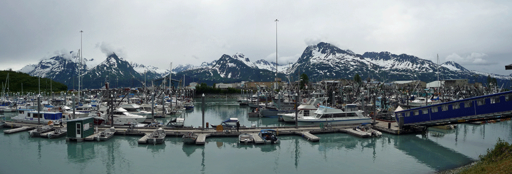
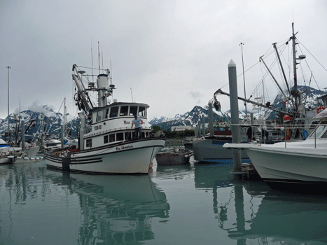
We spent the morning doing important things like laundry and discovered that the fishing fleet was in because they'd called a 30 hour pause in the salmon fishing season. The laudromat was full of fishermen trying get it things clean before they went out again.
We had lunch and then took a walk along the waterfront.
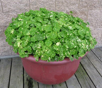
There was a pot of the Alaska variety of Nasturtiums by the waterfront so I had to take a photo of it. I grown them in pots at home because of their variegated foliage. Notice, it's early July and there aren't any flowers yet.
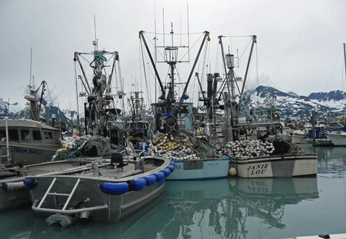
The seiners filled the berths of the marina. These are working boats in port during the pause in the salmon season.
While we were walking along a pretty good sized boat came in and maneuvered it's way into one of the few remaining berths. We both would have bet money he wouldn't fit but he made it in first try. He just whipped right into his spot.
We also got to watch the amazingly fast work of some men cleaning and filleting fish that people who had been out fishing had brought in. A sharp knife and a great deal of skill can make fast work of a big fish!
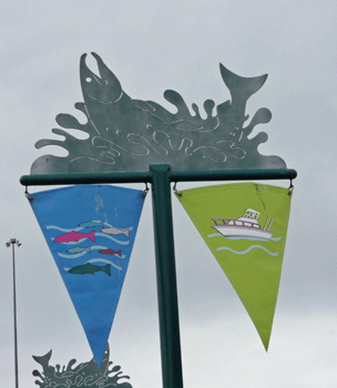
The boardwalk looking over the Harbor had these nice banners. I love the splashing metal salmon!
After our walk, we took a drive to Mineral Creek Road which is supposed to go 5 ½ miles out of town to a nice hike. During the winter they have cross country ski trails and snowmobile routes here. In the summer they don’t take care of the road and it was one big pot hole. We drove 1 ½ miles until we came to place where a bridge was out.
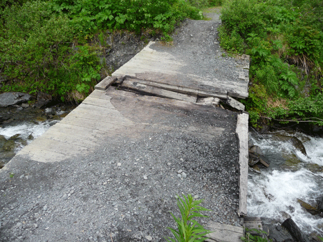
If you are brave and crazy and have 4 wheel drive you can drive down a steep incline and then through a deep fast creek.
Yes, that's the road, really it is.
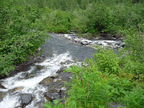
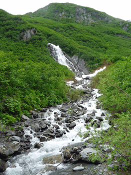
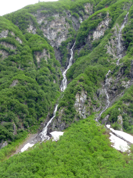
The mosquitos were pretty fierce when we first got out so we put on our jackets and head nets and headed out. There was a very nice waterfall cascading down the hillside.
 |
 |
 |
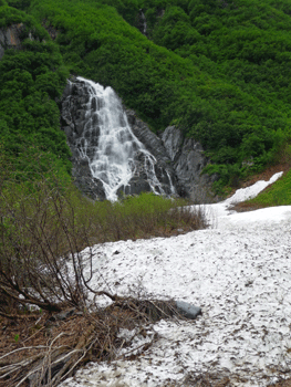
We kept walking and were rewarded with yet another waterfall.
Notice the snow. Valdez is one of those places that gets TONS of snow every winter and this past winter was a record one just as it was in Seward.
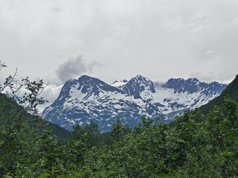
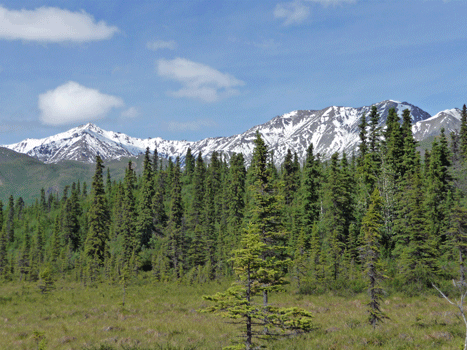
The road wound on northward and we got a nice view of the Chugach range to the north.
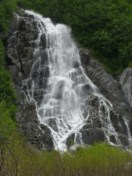
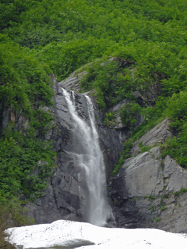
And across the creek to the east there was yet another waterfall.
We turned back after this and actually met a 4 wheeler full of young men who had driven through the creek at the washed out bridge. They didn't go far because we saw them again before we reached our truck.
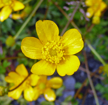
There were some nice Western Buttercup (Ranunculus occidentalis) in bloom along the trail.
On our way back to the RV Park we stopped at the Old Valdez town site. The 1964 earthquake basically destroyed Valdez. The epicenter was only 45 miles away. Many buildings were destroyed and in the end it was determined that the land underneath the town was unstable and they condemned the whole town. 62 of the buildings were moved to the new town site and the rest were removed.
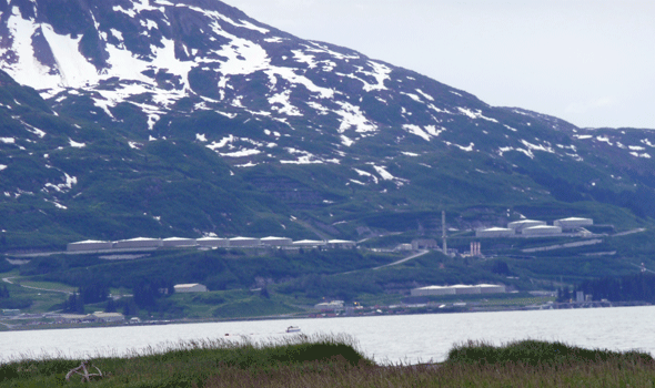
When you visit the old town site you can still see some of the streets. But the most important thing is a great view of the oil terminal at the end of the Alaska Pipeline across the bay.
It rained all night that night and the campground was full of puddles. We didn't have one right outside our door for a change but there was one right under the tongue of the trailer and another one at the dump station. I did a lot of wading that morning--without getting my feet wet for a change.
Here's a map of where we'll be going over the next two days. We'll go from Valdez (Point A) to Chitina (Point B) and then on to Glennallen for the night (Point C). The next day we'll drive back down to the Wrangell St. Elias National Park Visitors Center (Point D) and then on to Slana (Point E) where we'll be camping. In the afternoon we'll drive out the Nabesna Road (Point F).
View Larger Map
As we left town it was 47 degrees and raining. It sure felt a lot like January in Seattle to us. And funny thing, as we went over Thompson Pass (elevation 2,678 feet) it was 35 degrees and there was slush hitting the windshield. You could see the snow line on the surrounding mountains and it was clearly sticking at about 3,000 feet. And yes, it was July!
Our original plan had been to drive out the McCarthy Road into Wrangell-St. Elias National Park and visit the old Kennecott copper mine. But the McCarthy Road is a 60-mile long dirt road that can be really awful to drive when it's wet. It takes 3 hours to drive when it's dry and we talked to someone who drove back from Kennecott on it this day who said it took the 5 hours! Needless to say we've never regretted deciding NOT to drive the road.
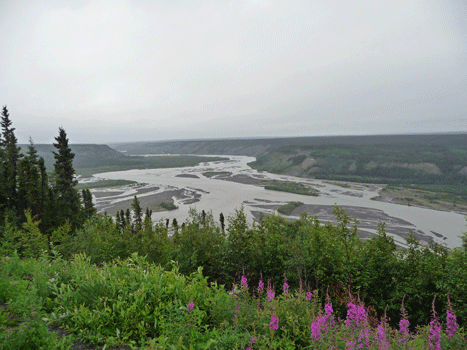
But we did decide to drive out to Chitina which is where the pavement ends. We stopped at a viewpoint overlooking the Copper River.
It was raining and cold when we got to Chitina. We stopped at the Ranger's Station and watched a very nice movie about the Kennecott Mine and discovered that they were closing the mine's big mill building for the rest of the summer to do stabilization work--starting that day. So we wouldn't have been able to tour it if we did drive out.
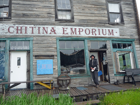
On our way back to the car I spied the Chitina Emporium and had Walter pose in front of it.
I loved this row of dusty old bottles lined up in the window.
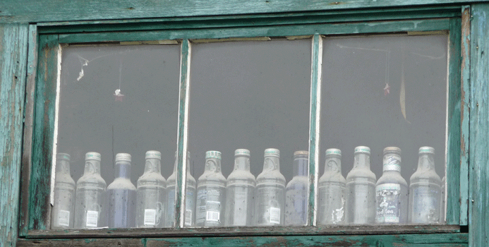
They look like they've been there forever, right? When you zoom in on them, you discover they're Arizona Ice Tea bottles! Not ancient history at all. It's just dusty when it's not raining in Chitina.
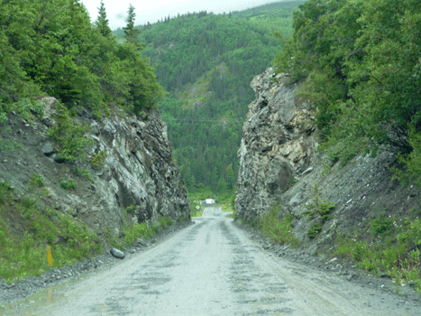
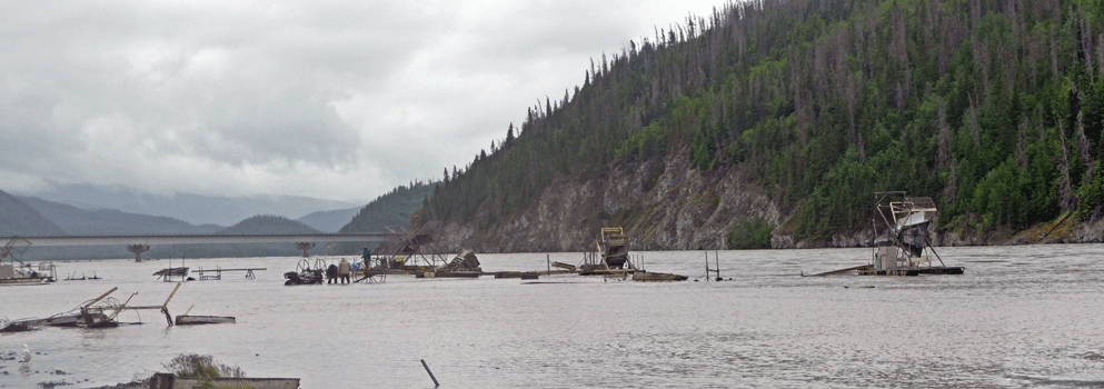
The ranger convinced us to drive the first little section of the McCarthy road across the Copper River on a fancy new bridge so we could see the natives using fishing wheels to catch salmon.
The road starts out by going through this one-lane cut.
Then it goes over a cool bridge and there's a campground on the north side of the road where we could go out onto the beach. Just past the campground turnoff is a steep hill and it was pure mud and full of ruts from trucks going up it. We took one look at it and said, we would never consider taking Rosita up that!
The beach was another story. It was gravel and we easily found a place to park and then walk to view the fish wheels.
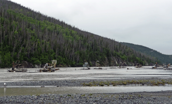
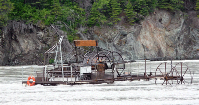
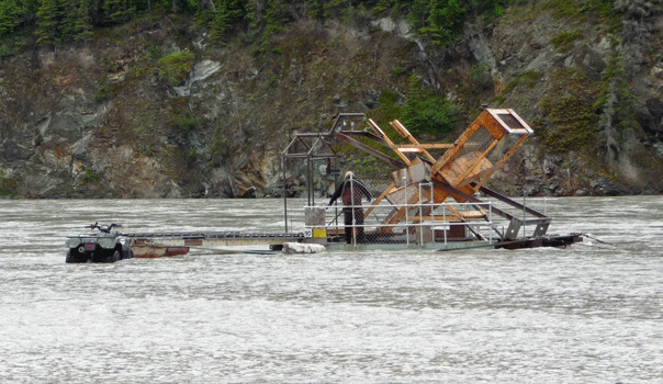
These are not spiffy new fish wheels like the Department of Fish and Game one we saw on the Chilkat River outside of Haines. These are homemade fish wheels.
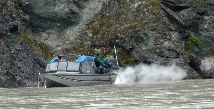
While we were standing there, a fellow climbed onto his 4-wheeler and drove out into the river to one of the fish wheels.
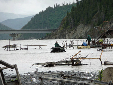
Clearly this is the favored form of transport out to the fish wheels. Here's another one parked next to a different fish wheel.
The whole area had a sort of make-shift feel to it--with lots of piles of junk added in for good measure. In this panorama shot you can also see the spiffy bridge that crosses the Copper River.
Then to add to the fun a fishing boat came by with two guys using dip nets over the side. It must take a lot of strength to fish this way--scooping up fish with a net over the side of a fast moving boat.
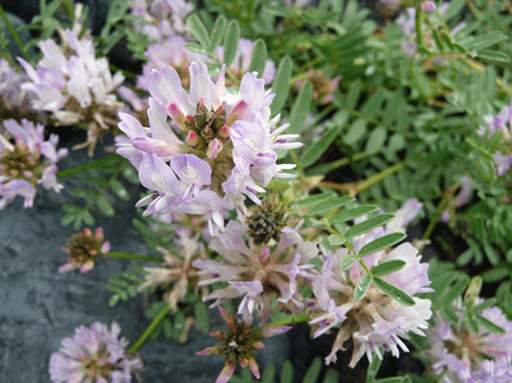
This Oxytropis nigrescens was growing in the sand on the beach.
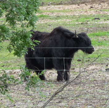
As we were driving back along the Edgerton Highway from Chitina out towards the Richardson Highway, I spotted these very strange hairy cattle. And then I saw a sign. They weren't cattle; they were Tibetan Yaks!
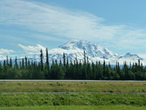
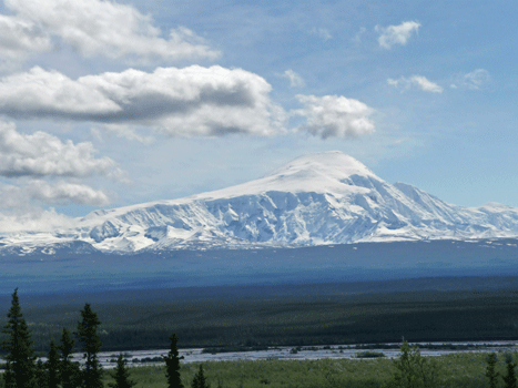
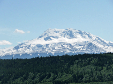
We spent the night at an RV campground in Glennallen. And wonders of wonders we awoke to SUN! After such a cold raw day the day before this was really a blessing. We drove back south 10 miles on the Richardson Highway to visit the Wrangell-St. Elias Visitor's Center which had been closed when we went by the night before. Today Mount Drum was out in its full glory!
We explored the Visitor's Center and watched the wonderful movie. Have I mentioned that I love National Park movies? From here we drove north on the Richardson Highway to the Tok Cutoff Road towards the little town of Slana. We stopped at the view point we'd visited on Sunday to take more photos of the mountains.
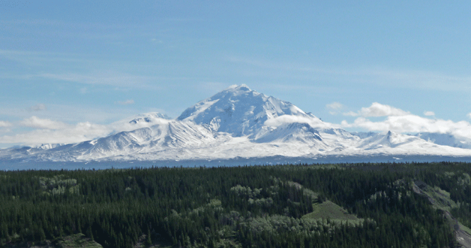
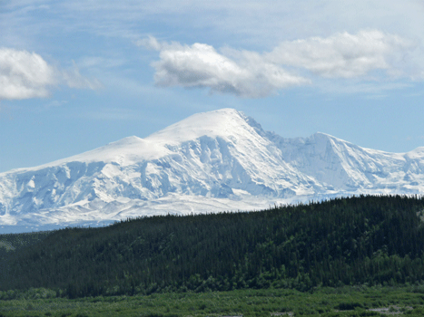
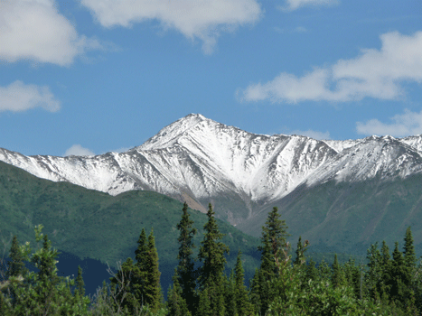
Here's Mount Drum from the viewpoint.
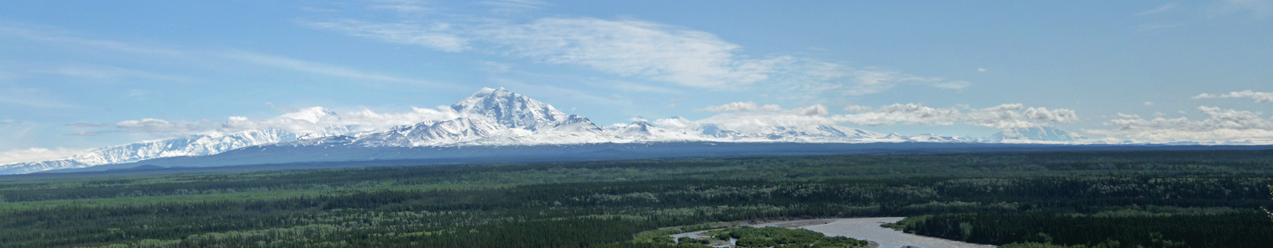
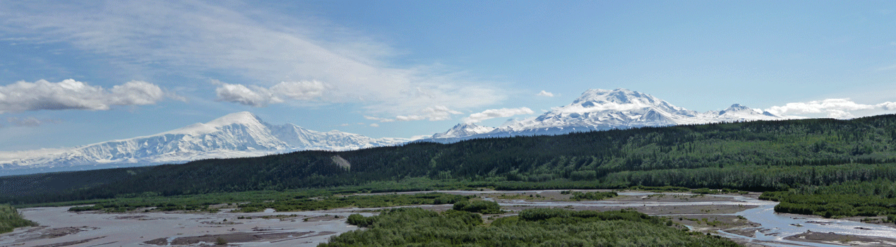
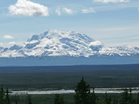
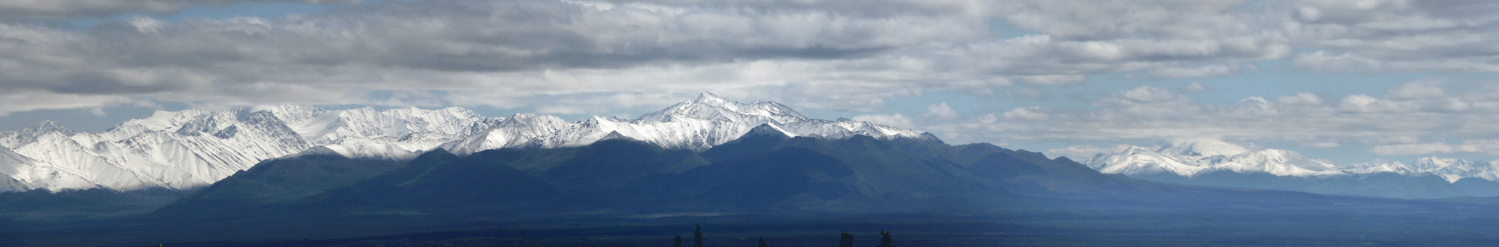
Mount Sanford (on the left) and Mount Wrangell (on the right) were still hiding some in the clouds as you can tell from this panorama shot.
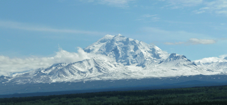
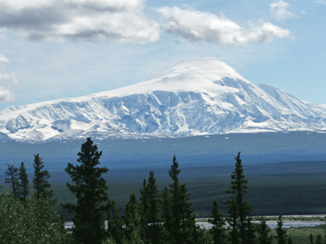
We drove on north stopping now and then so I could record the great views. Here's Mount Drum again from further north.
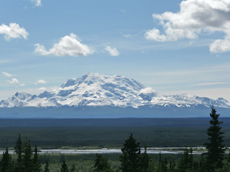
We took the turnoff to the Tok Cutoff and finally Mount Sanford came out of the clouds.
From the Visitor Center and Glennallen, it looks like Mt Drum is taller than Mt Sanford. But when you get north of them both you can see that in fact Mt Sanford is much taller. Drum is only 12,010 ft. while Sanford is 16,237 ft.
 |
|
|
By this point you're looking at the north face of Mount Drum so it looks really different.
 |
 |
 |
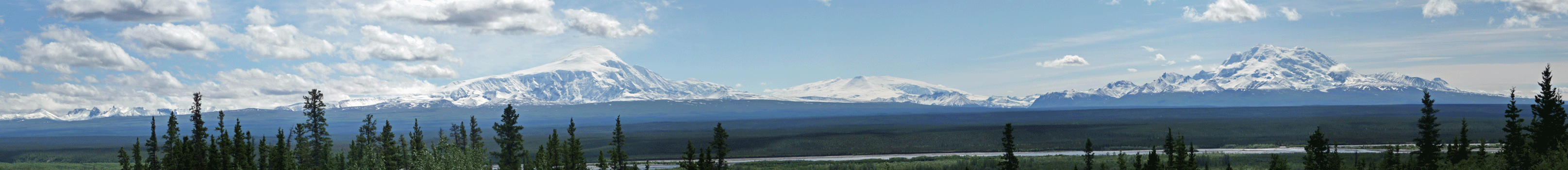
Here's another panorama shot of the two of them together. Can you tell I was excited to have a clear day? By this point you can really tell the Mt Sanford is taller than Mt Drum.
We got into Slana at about 1:30 pm. We pulled into the HartDRanch just as the owner of the place was coming home from her job as the postmistress. She's a pretty remarkable lady. She is 71 years old and living there alone. She had built the log cabin post office herself when she got the contract to be the postmistress years ago and her husband had been in the hospital.
We had lunch and then took the Nabesna Road east into Wrangell-St. Elias Park. There are only 2 roads into Wrangell-St. Elias National Park: The McCarthy Road and the Nabesna Road. The Nabesna Road doesn't go anywhere in particular but there's very little traffic on it and the views are nice.
We had picked up a CD at the Visitors Center that narrates the drive so we listened to it as we drove. The road is paved for the first 11 miles and then it becomes dirt. We did a lot of puddle dodging because it had rained heavily the day before.
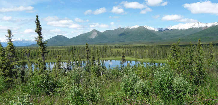
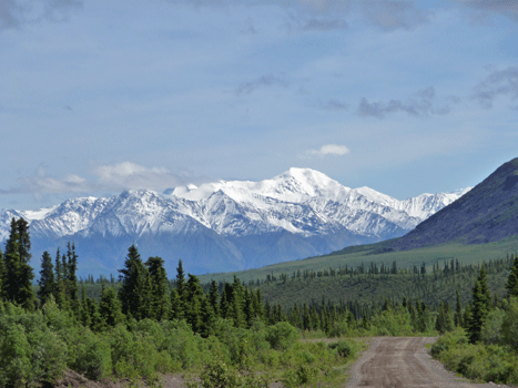
We stopped at all the viewpoints and I got this nice shot of the Wrangell Mountains to the south.
The Mentasta Mountains to the north were closer and not so tall.
This kettle pond made for a nice shot of the Mentastas too.
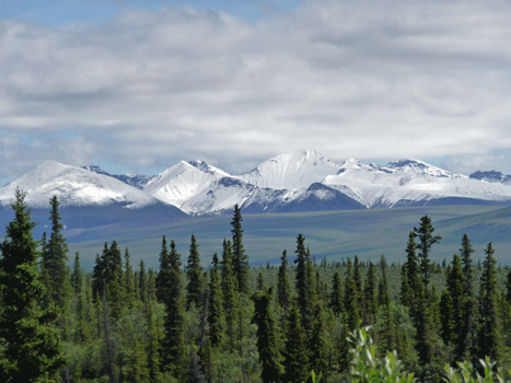
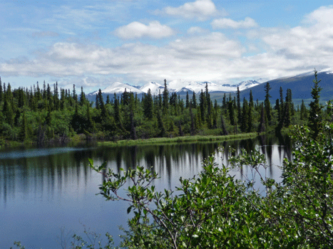
We caught more views of the Wrangell Mountains at Rock Lake. You certainly can tell it had snowed the day before.
Rock Lake wasn't big but it was pretty.
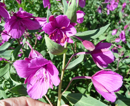
The dwarf fireweed (Epilobium latifolium) was in bloom. I love the intensity of the color.
Here you can see the Wrangell Mountains and the Nabesna Road itself.
The road goes 42 miles but there are three creek crossings that can make going the whole way a bit of a challenge. The first creek was dry and we just had to drive through a big gravel wash. But the second one was running pretty good.
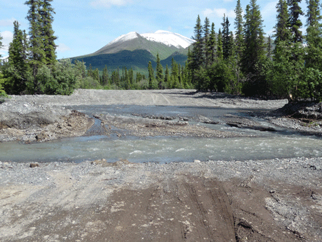
We have a policy that we don't drive through anything we can't see of the bottom of. No bottom visible here so we turned around and rattled our way back.
I grabbed one more photo of the Mentasta Mountains on the way back.
In Part XXIV we'll drive back into the Yukon and to Skagway Alaska.