
Here's a map of our journey for the next three days. We'll go from Homer (Point A) to Williwaw Campground (Point B) the first day and then to Hatcher Pass (Point C) and on to Mendeltna (Point D) for the night the second day. Then on the third day we'll make our way from Mendeltna down to Valdez (Point E).
View Larger Map
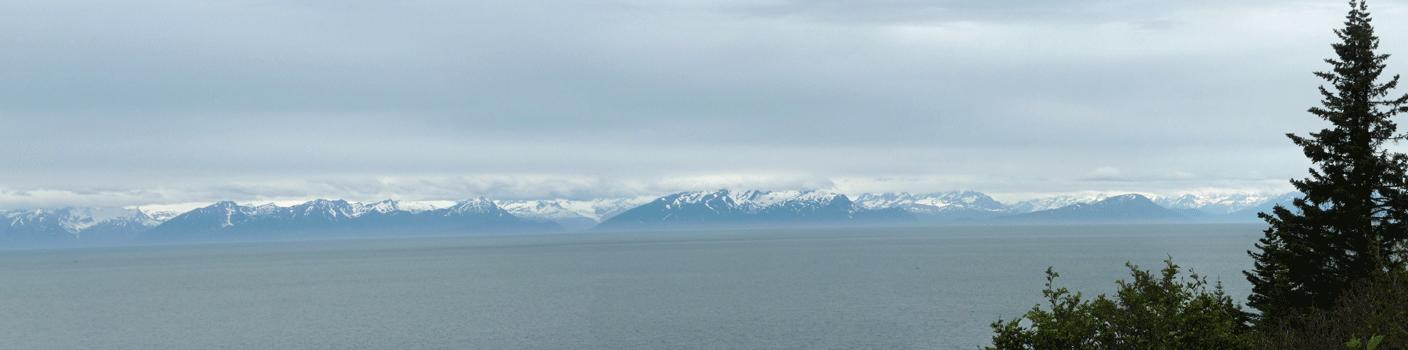
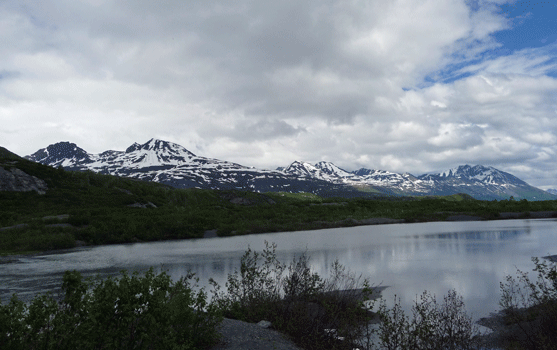
We worked our back along the Cook Inlet and today it was clear enough that you could get at least a partial view of the Katmai Range to the north. The Katmais include Mt. Redoubt which is a very active volcano. But I have no idea which one of these it is.
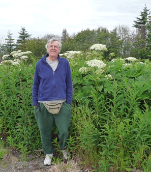
We stopped at a view point that had lots of really tall cow parsnip and I got Walter to pose in front of it so you can tell how HUGE it is. He's 6 feet tall.
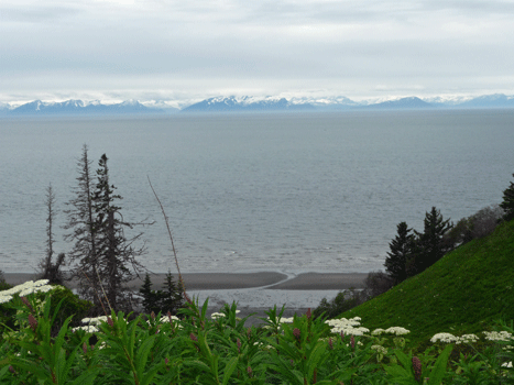
Here's another glimpse of the mountains across the way. You can see part of the sandy beach down below. There were folks who found a path and were exploring down there. There's a beach in this area called Clam Gulch where needless to say, the clamming is good.
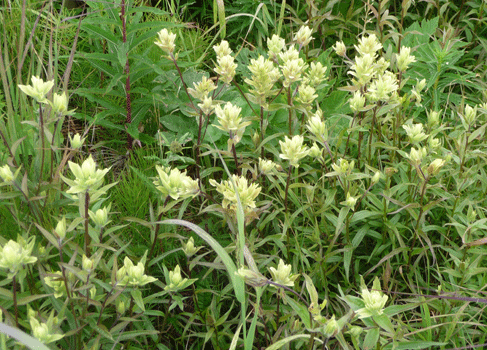
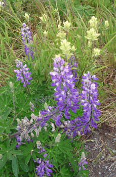
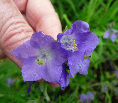
There was also lots of pale paintbrush (Castilleja caudata) in bloom here.
It made a very pretty picture mixed in with the Arctic Lupine (Lupinus arcticus).
The weather was mostly cloudy and misting the rest of the drive. We were backtracking so we'd seen it all before. It was Friday and there were an incredible number of cars coming out into the Kenai now that the sockeye salmon had begun to run. Most of the cars we saw had fishing gear including dip nets on the tops of their vehicles.
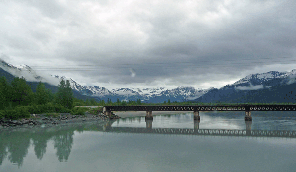
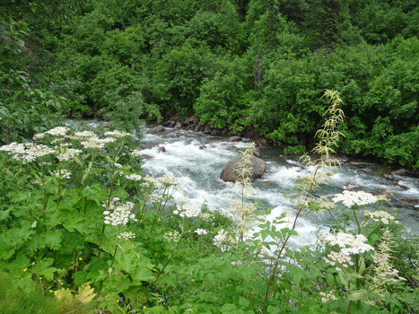
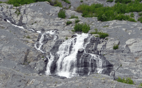
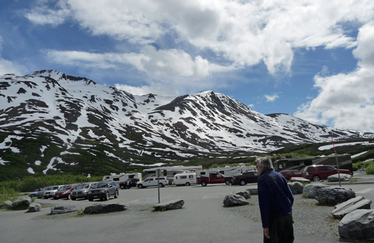
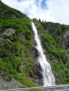
We motored on about 180 miles and ended up at Williwaw Campground, a National Forest Campground, just east of Portage on the highway to Whittier. There's a nice waterfall that's visible from the campground so we went out during a brief sunbreak to see it.
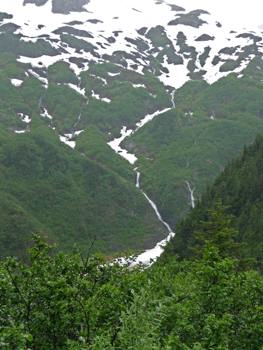
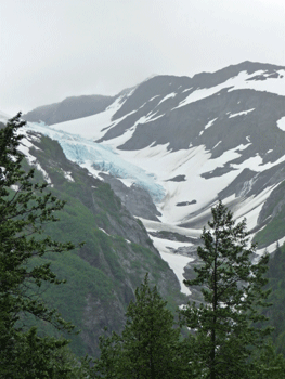
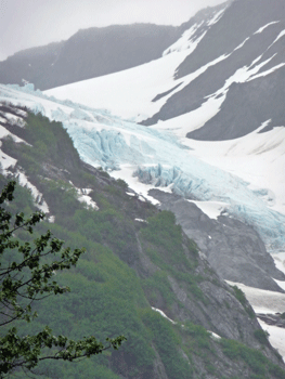
You can also see Middle Glacier from the trails leading north of the campground.
 |
 |
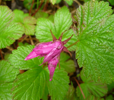
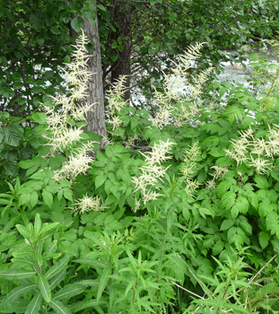
There were lots of ponds and mosquitos. But there were flowers too.
 |
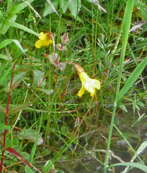 |
| Nagoon Berry (Rubus arcticus) | Yellow Monkey Flower (Mimulus guttatus) |
 |
 |
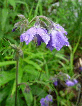
| Tall Jacob's Ladder (Polemonium acutiflorum) |
Tall Jacob's Ladder (Polemonium acutiflorum) |
 |
|
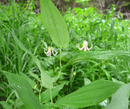
| Clasping Twisted Stalk (Streptopus amplexifolius) |
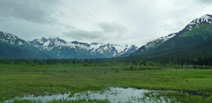
We got another view of Middle Glacier from across the valley before we spotted a very large pile of fresh bear skat that made us decide it was time to turn back.
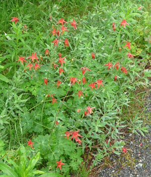
On the way back I spotted a nice patch of Western Columbine (Aquilegia formosa).
 |
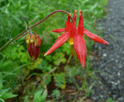 |
| Western Columbine (Aquilegia formosa) |
The next day we set out in a drizzle (it had rained hard the night before) and made our way along Turnagain Arm on the way back towards Anchorage.
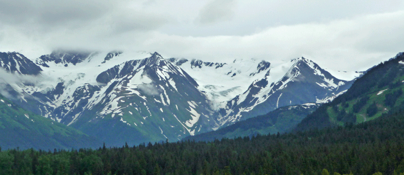
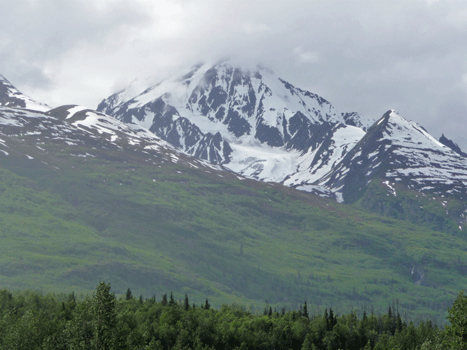
The mountains would disappear into the clouds and then peek out again.
I don't know the name of this glacier but it's still pretty.
We spotted a couple of Dahl sheep rams along the Seward Highway just outside of Anchorage. The traffic was heavy and there weren't any spots big enough for the trailer so I didn't get any pictures. But I could see their big arched horns even with the naked eye.
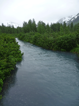
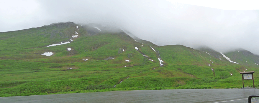
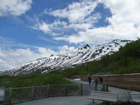
After doing our grocery shopping at a Fred Meyer in Eagle River we made our way to Hatcher Pass and the Independence Mine State Park. A steep winding road leads up to the pass but at least it's paved! Past the pass it turns to gravel. I stopped at a turnout to take a picture of pretty Little Sustina River.
This is the only place I saw Goat's Beard (Aruncus dioicus) on the whole trip.
It was cloudy and raining pretty hard at the top of the pass. But that didn't keep a bunch of locals from doing a road race (as in running in shorts and t-shirts) and others from setting out with backpacks on the trails.
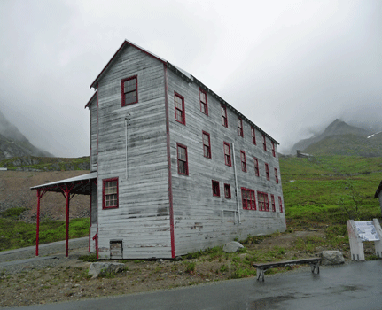
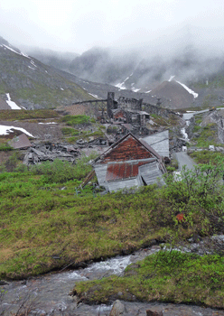
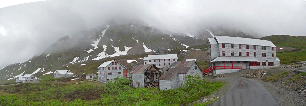
The Independence Mine produced 150,000 ounces of gold between 1936 and 1943. Since the mine and it's buildings aren't all that old, the State has been able to stabilize at least some of the buildings on the site. This is one of the dormitories where the miners lived that has been renovated and preserved.
Other parts aren't in as good a shape.
Here's a panorama shot of the restored and stabilized section of the mine.
The mine was up the face of the mountain and there were rail cars that took the men up into the mine. We hiked around in the lower section here. It was cold (as in the temperature was 47) and wet so we didn't make the hike further up the trails amongst the falling down buildings.
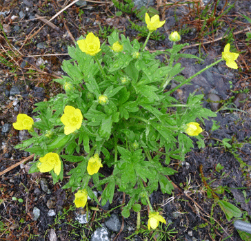
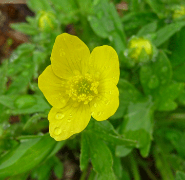
There was a bit of Eschscholtz buttercup (Ranunculus eschscholtzii) in bloom along the trail.
 |
 |
| Eschscholtz buttercup (Ranunculus eschscholtzii) |
Eschscholtz buttercup (Ranunculus eschscholtzii) |
We had lunch here and then motored on along the Glenn Highway. Here's a great example of the Alaskan kids' form of tagging.
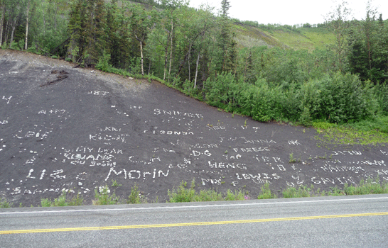
They take white rocks and arrange them on the dark gravel to make their names and messages. We saw this sort of thing along most of the highways in Alaska where the cuts were dark rock or soil.
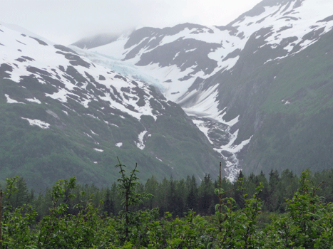
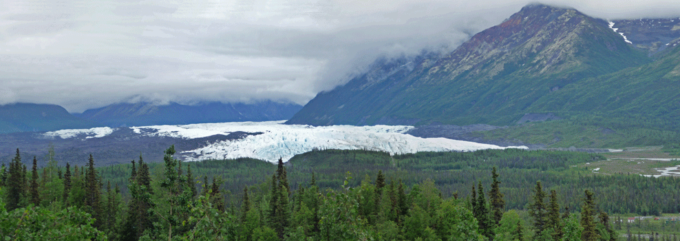
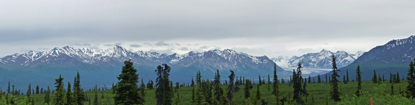
Several hours out on the Glenn Highway we began to get views of the Matanuska Glacier.
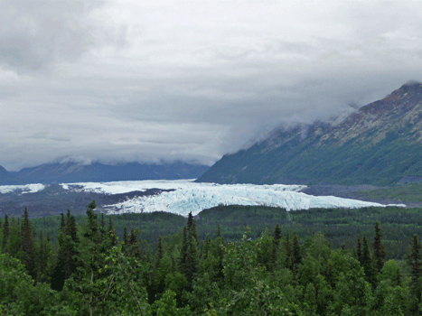
As we got closer there was a really nice viewpoint where you could get good close-up shots.
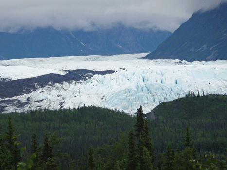
It's an interesting glacier because it is still filling a valley rather than pouring down a mountainside as most of the others we saw do.
There are supposed to be great mountain views along the Glenn Highway but the clouds were pretty low and it rained most of the time. But late in the afternoon after we'd gone over Tahneta Pass and Eureka Summit the clouds lifted a bit.
I believe that this glacier is the Nelchina Glacier but I could be wrong.
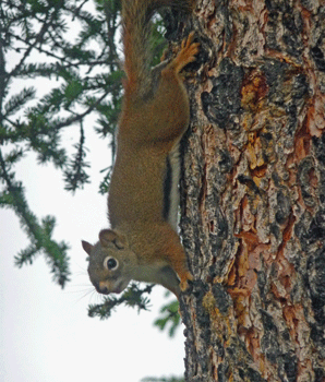
We camped for the night at an RV campground that was behind an old roadhouse. They had a bar and restaurant and cabins and they sold fuel. There were a few folks in the cabins but we were the only people in the very large sprawling RV campground. We did have a little company though. Besides ferocious mosquitos, this red squirrel came down a tree and looked right into our trailer window.
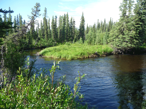
The next morning we awoke to mostly sunny skies and for some reason the mosquitos had disappeared. I guess there was a bit of a breeze that we hadn't had the day before. In any case, it allowed me to go out and take pictures of Mendeltna creek which was only a little ways from the trailer.
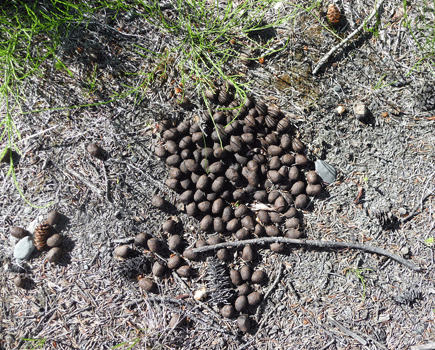
There was a large pile of what we decided must be moose skat since it was so much bigger than the deer skat we're used to seeing.
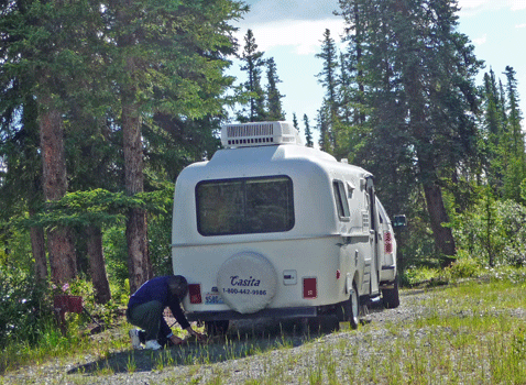
Here's Walter getting the trailer ready to roll. Note that he has his mosquito head net on because we'd gotten eaten alive setting things up the night before.
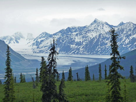
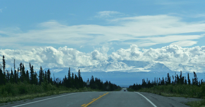
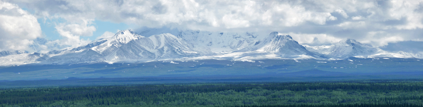
It wasn't long as we drove east on the Glenn Highway before we began to get glimpses of the Wrangell Mountains to the east. Notice the way the highway ripples. Those are frost heaves and make for a roller coaster ride as you drive along.

Mt Drum which is 12,011 feet in elevation is in Wrangell St. Elias National Park. The clouds kept moving around so you get a different sense of it in this photo than the more above.
We turned south on the Richardson Highway and stopped at a viewpoint overlooking the Copper River and the Wrangell Mountains.
Here's a closeup of Mount Drum with a bit of Mount Sanford sticking out of the clouds.
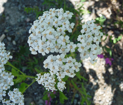
There was yarrow (Achillea millefolium) in bloom at the viewpoint.
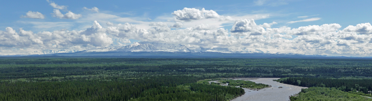
A little further on I got a nice shot of the Wrangells next with Willow Lake in the foreground. I believe that's Mt Wrangell in the middle of the photo.
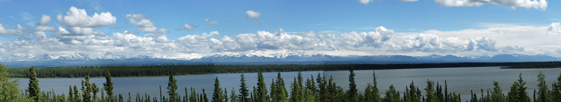
To the south you could see the Chugach Mountains.
We drove on through an area that had wonderful waterfalls coming down the mountain sides and no place to stop. But there was at least a turnout where I grabbed a photo of Mount Billy Mitchell.
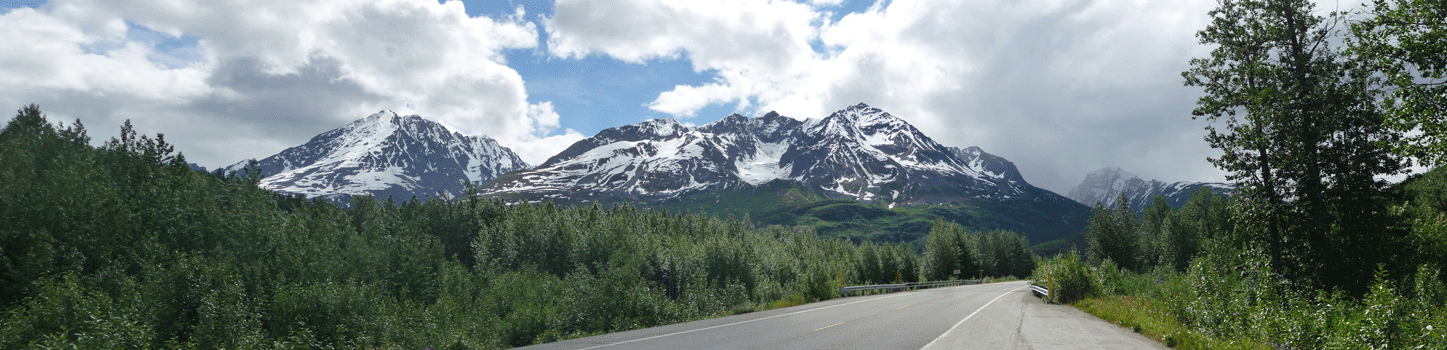
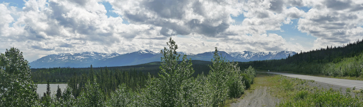
We drove through the Chugach range with the clouds clinging on the mountain tops.
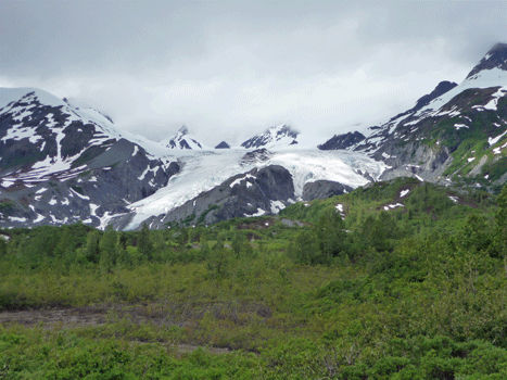
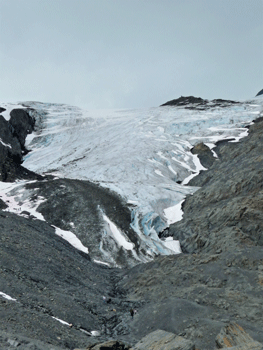
And then we began to see glimpses of the Worthington Glacier.
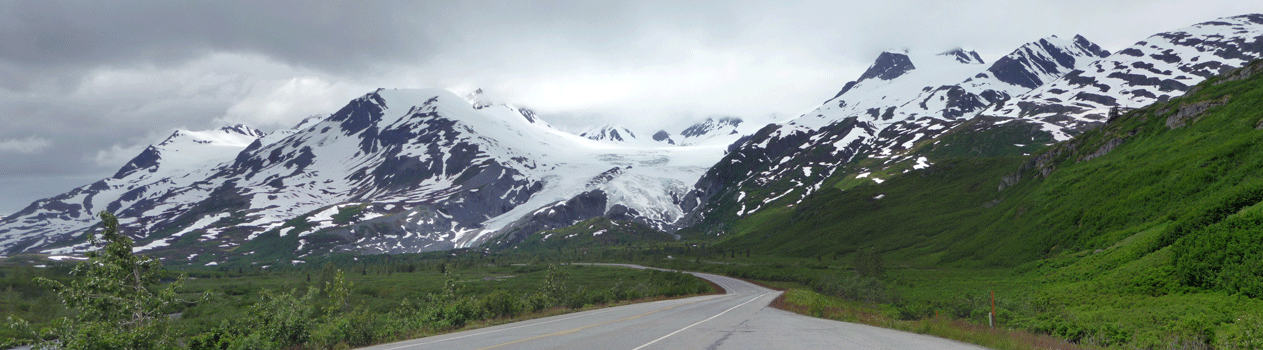
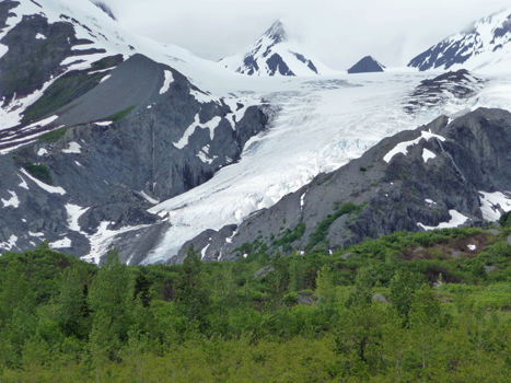
As you get closer it gets bigger!
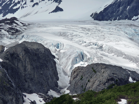
And then the road curves around and you see it from a whole other angle.
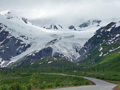
Here's a close-up of the left hand tongue.
There's a state recreation site with a great place to get closer views of the glacier.
 |
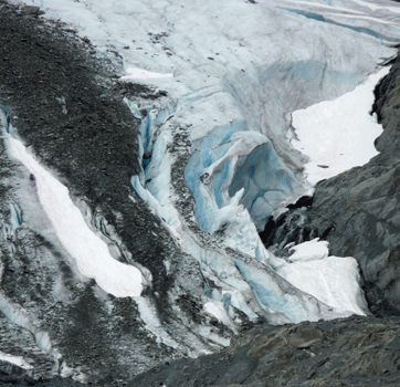 |
And here's a close-up shot where if you look carefully on the left hand side you'll see people who have hiked up to the glacier and are getting ready to go out onto it. It was a relatively warm day and a Sunday to boot, so there were all sorts of crazy folks taking people without proper footwear out onto the glacier.
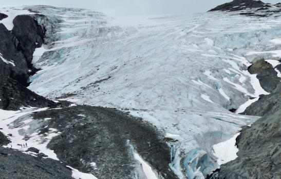
There was a nice waterfall to the right of the glacier where melt water was coming down over the rocks.
Here's the view looking back up the path (east) and across to more of the Chugach Range.
And this is the view looking north.
There was even a gorgeous view from the parking lot! Yes, that's Walter walking along and you can see Fernando and Rosita straight ahead in the middle of the photo.
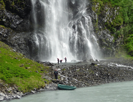
We had lunch here and then motored on through Keystone Canyon to Bridal Veil falls.
There were river rafters beached at the base of the falls.
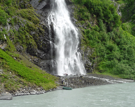
And while we were watching them, they all went and stood under the falls! This turns out to be one of those 'rites of passage' that goes with running the Lowe River outside of Valdez.
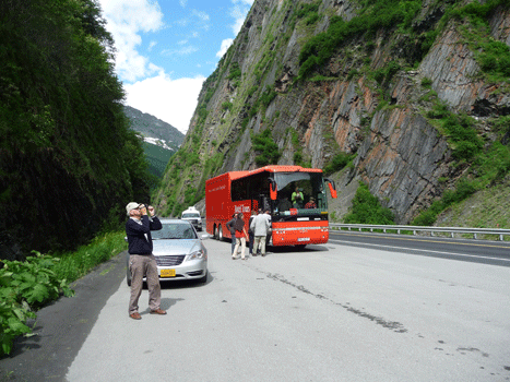
This wacky Rotel drove up while we were there. It's a combination bus and hotel. You ride in the front and then have a berth in the back to sleep in at night. It's run by a German company. We saw them in the Yukon on our way up and then again here.
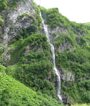
There was a second smaller falls right next to Bridal Veil.
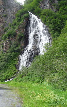
And then around the next curve there was Horsetail falls.
We drove on another ten miles to our campground just outside of Valdez where we had showers and WiFi!
In Part XXIII we'll explore Valdez and then visit Wrangell St. Elias National Park.