
September had been very wet in the Seattle area and so it was no surprise that it was rainy when we left home. Our goal for the first day was to reach Central Ferry State Park out in the middle of nowhere in far eastern Washington. The park is on the Snake River and was built by the Corps of Engineers like so many of the other parks in Eastern Washington on the Snake and Columbia Rivers. It's amazing to me how similar the terrain and the park layouts are in all of these parks. If you didn't know better you might think you were at Maryhill Park on the Columbia outside of Goldendale with the wide river and the high basalt cliffs to the south. Turns out that we learned during this trip that the basalt layer is 1,000 feet deep in Washington and northern Oregon so it's not surprising every river cuts through it and looks pretty much the same.
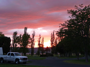
The park was nearly empty with only one RV per campground loop. We invaded somebody's personal loop and found a nice site by the river and settled in for the night. The clearing weather brought us a very nice sunset!
The next morning we headed east to Clarkston/Lewiston on the Washington/Idaho border and then south on Hwy 129, a wonderful scenic highway that winds through the canyons created by the Snake and the Grande Ronde Rivers. I'm sure it's a wonderful road to drive in a sports car or on a motorcycle but it was a little winding for us towing a trailer! Having done it once, I doubt we'll go this way again.
Once we entered Oregon we began driving along the rim of a canyon that you couldn't see down into. Finally, not far from the town of Enterprise (and Joseph) there was a scenic turnout with a view of what turned out to be Joseph Canyon.
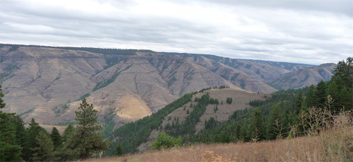
The bottom of the canyon was the historical wintering grounds of the Chief Joseph Band of the Nez Perce Indians. In the summer they'd come up to the high plateau but in the winter the moved down into the canyon to get out of the weather. They couldn't understand why in the world the White Men who settled here insisted on spending the winter up on top in the harsh wind and snow! The settlers assumed the Nez Perce were nomads when in fact they moved each year in an orderly fashion between the canyon and the plateau.
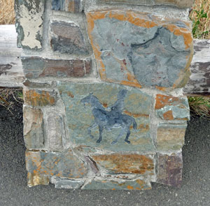
The viewpoint had lots of informative signs and really neat stonework.
From here were drove on to Wallowa State Park which is just south of the town of Joseph. It was cloudy and cold (55 degrees) when we arrived--not exactly the boating weather we'd hoped for. Clearly we'd missed boating season since all the docks and boats had been hauled out of the water for the winter.
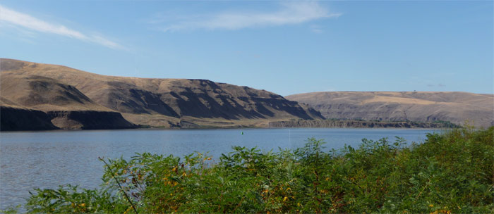
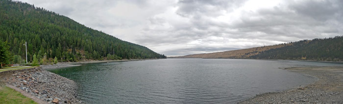
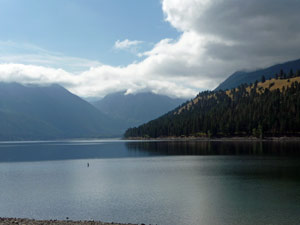
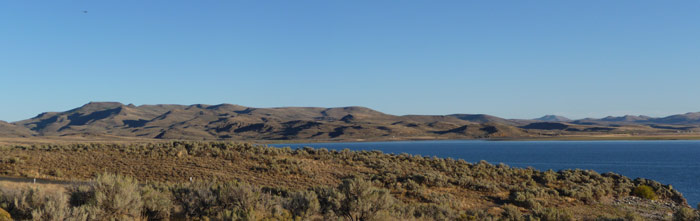
We took a walk in the afternoon through the campground and out along the lake. This is a panorama shot I took from the south end of the lake. To the east (right) the terrain is dry and the hills are brown grass. To the west (left) the mountains rise quickly into the Eagle Cap Wilderness and they are covered with Ponderosa Pines, Lodgepole Pines and Douglas Fir. The town of Joseph is straight ahead in the center of the photo in the dry rolling hills.
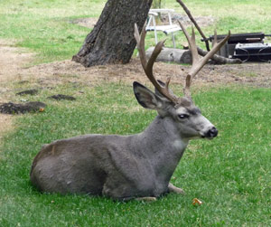
As we came back into the campground, Walter spotted a large buck nestled in the grass chewing his cud! I took a whole series of photos of him as we got closer and closer to him. He could have cared less that we were there at all. Clearly he was totally used to people.
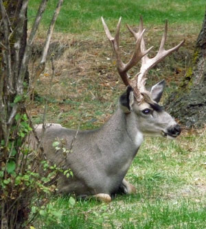
We went around the next bend in the campground and there was another one just as placid as can be, chewing his cud. Isn't he pretty? Clearly all that lovely green grass and the no hunting policy in the park makes for a nice safe home for these guys.
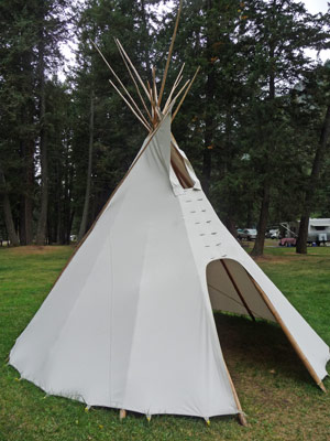
Someone from the Nez Perce tribe had put up this really nice tepee in the campground and clearly they'd been having presentations there at least on the weekends. Nobody was around on the Tuesday that we were there so we gave ourselves a tour.
The next day it was still cloudy in the campground but by the time we got to Joseph the sun was out. I took this photo of the lake looking south from Joseph with the state park in the distance. It's a beautiful area and I suspect at some point we'll try to go there in early September to do some hiking and kayaking.
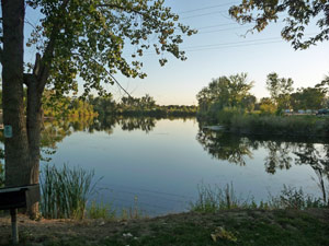
Wednesday was a traveling day and we made our way back to I-84 and on to the Boise area. We camped in Caldwell which is a little town just west of Boise. There's a decent RV park there with electricity, showers, WiFi and a nice little pond.
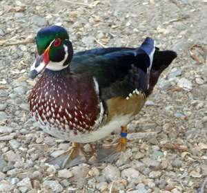
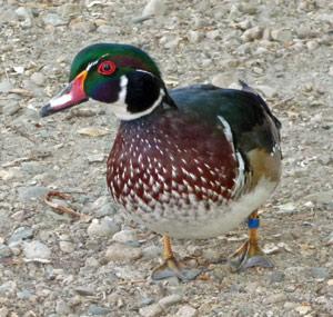
The next morning this Harlequin duck arrived at our door. Clearly he knew that trailers had people with food in them! He kept close the whole time we were getting ready to depart and I'm sure he was really disappointed when we didn't make free with any goodies. How'd you like to be stared down by the beady red eye?
From Caldwell we drove west to Mountain Home, Idaho and then south on Highway 51. The terrain is like most of Eastern Washington and Oregon: golden rolling hills and sage brush. It may not technically be part of the scablands but it sure looks like it! The highway winds its way south and eventually enters the Duck Valley near the border with Nevada. Just south of the border is the Wildhorse Reservoir, which provides irrigation for the Duck Valley Indian Reservation in both Idaho and Nevada. Along the way we saw several herds of antelope! Yes, this the true "home home on the range where the deer and the antelope play"! I'd never seen antelope before so I was really excited.
The Wildhorse Reservoir has a great state park in addition to a whole bunch of Bureau of Indian Affairs and BLM campgrounds along it's shores. We chose to camp in the state park because it was nicely laid out and actually had a few trees!
As we were setting up camp we saw a herd of antelope along the shoreline not far from the trailer. The bounded away and we didn't see them again so no photos of them. Someday!
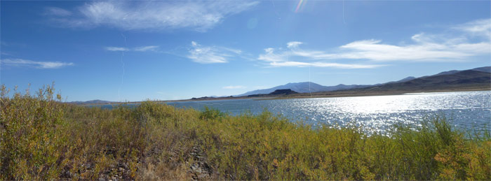
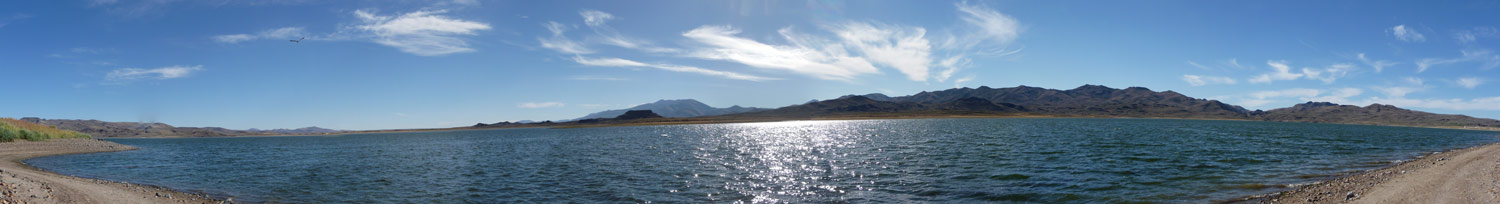
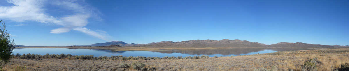
After lunch we took a little hike down to the shoreline. We stopped about halfway down the ridge and I shot this panorama shot. It was a gorgeous day in the low 70's.
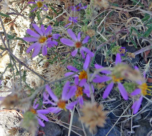
We found lots of antelope tracks along the beach but no antelope. Here and there I saw little clumps of asters in bloom, a little scraggly but flowers never the less.
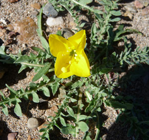
Even better there were these fun yellow poppies I'd never seen before.
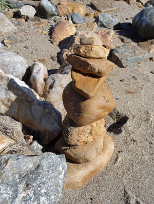
And there were lots of nice rocks that invited you to make rock piles--8 rocks high ain't too bad!
Here's a panorama shot from the beach. It's a big lake and there was no one out on it at all but ducks and white pelicans who were too far out to photograph.
On the way back to the trailer we encountered several prairie grouse who did a great job of startling me as they took off in a whir of feathers. Turns out they are a threatened species everywhere else in Nevada but are present in good numbers along the reservoir.
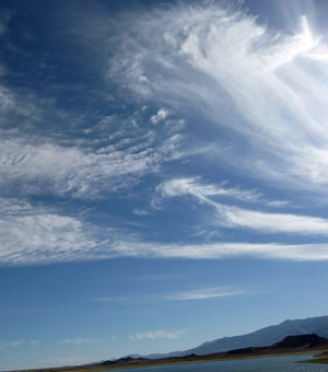
In the late afternoon the wind came up some and the clouds made some great patterns in the sky. Mare's Tails, they're called!
And the light painted the hills with wonderful shadows too.
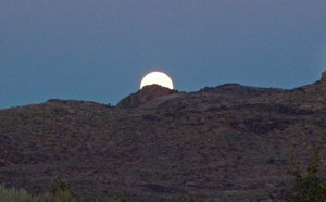
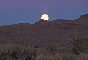
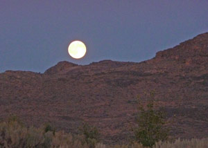
And then the full moon came up as I was starting to cook dinner. I had to drop everything, grab the camera and shot pictures as it came up over the hills.
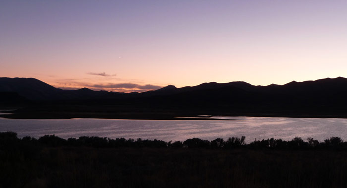
While I was out taking photos of the moonrise I turned and saw we were getting a good sunset too. Photo heaven!
It was cold that night--down to 29.5 degrees before the sun warmed things up in the morning. We didn't have an electrical hookup so we snuggled up close for the night and then turned on the gas furnace in the morning. It's amazing how fast it can warm up the Casita!
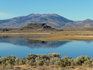
When we went to break camp I noticed that there was no wind and lake was still as glass. You know me and reflection photos! I just couldn't NOT take a few.
I really liked this place. The campsites were widely spaced. The few neighbors we had were very quiet so we felt as if we had the place to ourselves. There was wildlife to watch and these wonderful views. As we left in the morning we stopped to use the dump station and had a nice chat with the ranger who has lived here full time for 9 years! He said it was busy in the summer and again in the winter for ice fisherman! It's one of the coldest places in Nevada and the lake freezes solid. I can imagine that wind blowing off the lake at -20 degrees. Brrrrrr. If we go back it will NOT be in the winter.
That day we drove south and east through Nevada to Great Basin National Park which is on the border of Nevada and Utah. It was Friday and the campgrounds were full! We ended up on the highway in an RV park behind a motel/restaurant/bar where the bar was in Nevada (with casino) and the motel and gas station were in Utah!
In Part II we'll take you on a tour of Lehman Caves in Great Basin National Park. It'll be warm outside but wear your coat because the caves are 50 degrees!