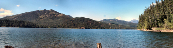
For reasons beyond us the lake had more water in it than ever before. We've camped here in early June and there hasn't been as much water as there was this year. We did the hike that leads from the north end of the campground up along the lake edge and enjoyed the quiet and the views.
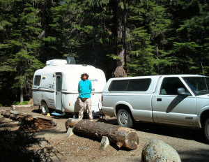
The next day we set off on an adventure. Every year we seem to take at least one hike that takes longer to get to than the hike itself. Last year, it was Bird Creek Meadows down by Mt. Adams. This year it was Tucquala Meadows. To get there you drive I-90 to Cle Elum and drive towards Roslyn. From Cle Elum, you drive 19 miles on Hwy 903 to the north end of Cle Elum Lake. Then you drive 12.5 miles are a very pot-holed gravel/dirt road. It's a pretty drive but the road is pretty narrow and very dusty--except of course when you drive through the concrete paved creek where they've opted not to put a bridge in.
There's no real trail at Tucquala Meadows, you just wander around in the meadow and look at the flowers. When we stopped for our first look we realized the meadow was closer to being a swamp and it would be very wet going.
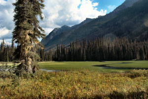
The meadows are slowly being created as Tucquala Lake fills in with silt and you can see the meandering streams that run through the marsh grass.
Farther away from the lake the meadow is less marshy but still wet.
Since it was pretty late for flowers we decided to drive on to the end of the road and take the hike to Hyas Lake rather than get our feet wet in the meadow. After driving 13 miles of bad road mid-week we expected to find an empty trailhead parking lot. Wrong! There were cars everywhere. It turns out that this trailhead provides some of the easiest access to the Alpine Lake Wilderness available.
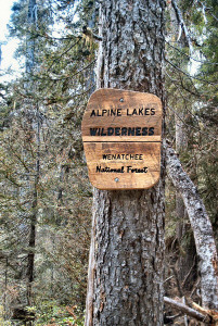
In fact, you cross into the boundary of the wilderness only about 100 yards up the trail. The Pacific Crest Trail used to pass through here before they re-routed it farther north and there are a number a great trails leading to alpine lakes and high mountain passes that start here.
We took the trail north out of the parking lot after packing our lunch into our day packs.
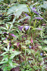
There were flowers growing in the tall meadow grasses along the trail.
This is wild delphinium.
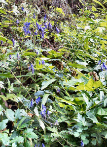
Here you can see blue bells along with the wonderful purple foliage of aging plants.
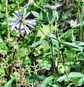
And of course there were asters.
But best of all there was an ant highway with huge ant mounds.
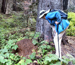
The surface of these mounds was constantly moving as hordes of ants carried all sorts of goodies into the mounds.
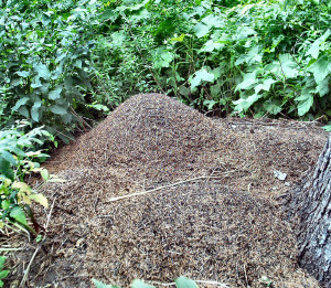
These mounds have been here for years. Our trail guide which was written in 1994 (our is a 1998 printing) tells you to watch for the highway on the trail and sure enough there it was along with at least three big hills.
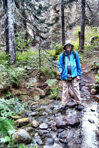
The trail itself is a gentle one with very little elevation gain. There are lots of creek crossings--I lost count at 18. Some an easy hop and others requiring a bit of rock hopping but nothing serious.
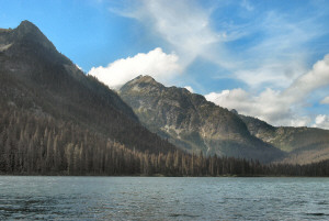
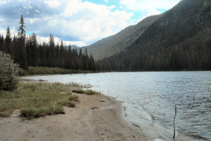
The reward at the end of this little 2 mile hike was Hyas Lake.
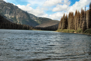
We walked along the edge of the lake taking photos and enjoying the views.
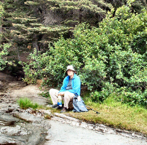
And then found the perfect set of rocks to sit on--with a view of the lake--for our lunch. I can't think of anything much better than eating your lunch sitting on a rock at an alpine lake. The believe it or not there weren't any mosquitoes!
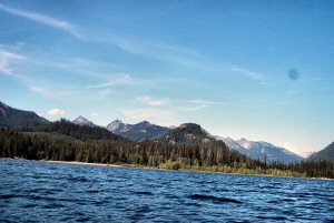
The view south was a little bright but I still couldn't resist grabbing one more photo before we headed back down the trail to the car.
We managed to get back to the trailhead without falling into any of the creeks and were packing up to head back to Kachess when a backpacker came careening into the parking lot. He looked exhausted and said that the hike back had taken way longer than he'd expected from past the Deception Pass area and now he had to drive all the way back to Seattle. He was not a happy camper.
We ate his dust when he roared around us on the dirt road. We weren't in a hurry, after all we were only driving back to Kachess!
The next day the campground began to fill up. People start coming in on Thursday morning and by Friday noon the place was full--even the campground hosts were surprised. Someone nabbed our spot before we'd even back out of it!
We took the Kayak out around noon on Thursday before the afternoon wind came up. We packed our lunch in a little cooler and pushed off to explore the coves and inlets of the southern part of the lake--called Big Kachess since in years when the water levels are very low the lake divides into two sections though we've never seen it that low.
It was a pretty day and warmer than it had been. Perfect for being out on the water. I took this from the boat out on the water.
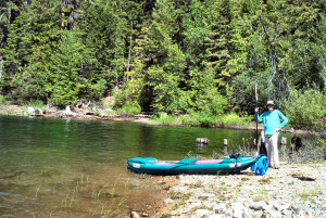
We found a little inlet with a sandy beach and pulled our boat out. Here's Walter with the boat and his paddle.
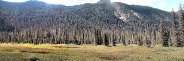
Here's a panorama shot from our picnic perch.