The mountains were out all the way down to California. We stopped to change drivers at Mt. Shasta and I took this shot of the mountain and it's nearby cinder cone, Black Butte on the right.

When we got about half-way down I-5 from Mt. Shasta to Redding shrubs and small trees with purple/pink flowers started to appear. The rest area was full of them and I took lots of pictures because I wasn't sure what they were.
We continued to see them around Redding and then again along Hwy 49 outside of Fresno and Yosemite. After a while I realized they were Redbuds--maybe it was all those campgrounds and picnic areas named Redbud...
I think of them as small trees but in Northern California they're more like large shrubs. This one was in a rest area on I-5 south of Shasta.
Imagine the road lined with these for miles and miles. It was gorgeous!
We drove for 4 days and finally reached Fresno where we met our daughter, Leslie, and her husband, Al for dinner. We camped at Millerton Lake State Park where the hills were green and the wildflowers were in full bloom. Here's the view from our campsite. You can just see the blush of orange from the flowers along the road.
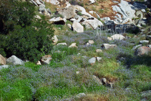
There was a little creek/ravine along the road in the park and it was FULL of baby blue eyes. I climbed down into it to take pictures.

From Millerton we drove north along Hwy 49 to Mariposa and then along the Merced River to El Portal just outside of Yosemite.
The redbuds were in bloom and there were California Poppies in huge swaths on the hillsides. If you look carefully you can see the purple cast from the redbuds along the river.
We had a sunny warm day for our drive up to Yosemite to see all the waterfalls that had been dry last October.
Cascades Falls is along the Merced before you enter the Valley itself.
Bridal Veil Falls wasn't dry in October but there was so little water it didn't show up in the photos.
In April, there was so much water that all my pictures from the base have water spots from the mist getting on the lens!
This was taken from a ways away in the parking lot where the 1/2 mile trail to base of the falls begins.
Yosemite Falls had been completely dry in October. Now, the shuttle bus driver said she thought it was at peak.
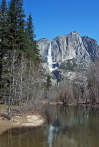
This was taken from across the valley. The upper falls are huge. The lower falls are the little white streak on the lower left corner.
Here are the falls from the trailhead. You can actually see a little bit of the middle falls just above the top of the lower falls.
Are the lower falls looking any bigger to you here?
How about now?
The mist got my hair wet when the breeze changed direction.
Along the trail on the way back from the falls, the creek was full of what appeared to be snow while the ground around it was snow-free.
This stuff is called "frazil" and it forms when the water in the falls becomes super-cooled in the process of falling and it freezes into frozen foam. The whole length of the creek was full of this stuff-- one section looked like an open snowy field.
And in case you didn't get enough of it, here's the falls reflected in the Merced River from the bridge at Swinging Bridge picnic area where we had lunch.

Upon hearing that Mirror Lake actually had water in it, we took the hike out to see it. In the fall, it had been a bed of dry sand and we'd heard that many years it doesn't get water in it at all. But this year, there'd been enough snow that there was actually plenty of water in it! There was a tiny breeze so no true mirror effect here.
Here's the view of Yosemite Valley from Tunnel View.
That's Bridal Veil Falls on the right.
We spent another night in El Portal and then drove south to Mojave for a couple of nights.
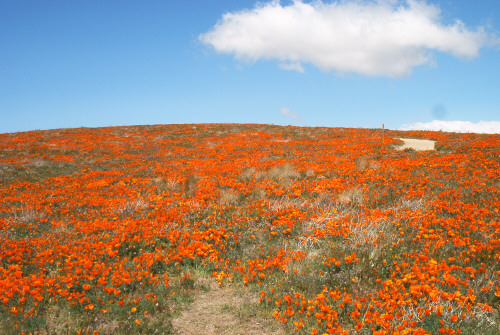
The poppies were in bloom at the Lancaster Poppy Reserve.

There was some lupine--that's the purple stuff in the foreground below. In the distance you can see a swath of yellow. This is called fields of gold.
There were patches of it along the road like this.
The Poppy Reserve is about 50 acres and it was all in bloom. The whole area leading up to the reserve was in bloom too and the hills looked like someone had gone after them with yellow and orange air brushes.
Once again I took TONS of photos and felt as if I were in heaven. We might have spent hours hiking here but it was REAL windy and even though it was over 60 it was COLD.
After taking just a few more pictures we went into the town of Lancaster to find the library and use the WiFi. It was a HUGE very nice library and seeing the rest of Lancaster, we got to reassure ourselves that we'd not missed anything by having not visited before.
For lunch we went north of Mojave to Red Rock Canyon State Park. This is a real gem of a place with rock formations that are a cross between Bryce Canyon and Death Valley.
These were just plain cool!
This is a panorama shot to give you an idea of the scope of them.
And here's Walter--that little green-shirted figure at the base.
We both thought that the upper eroded white formations looked like rows of statues in a temple.
In Part II we'll go to Joshua Tree National Park.
